BASIN PROGRAM CPRA - Coastal Protection ...
←
→
Page content transcription
If your browser does not render page correctly, please read the page content below
AND RESTO
                     ON               R
                   TI

                                      AT
           EC

                                         I
        TAL PROT

                                          ON
                                           AUTHOR
         AS
                    CPRA

                                          ITY
            CO

                                                    BASIN
                                                    PROGRAM

 Atchafalaya Basin Program
Fiscal Year 2021 Annual Plan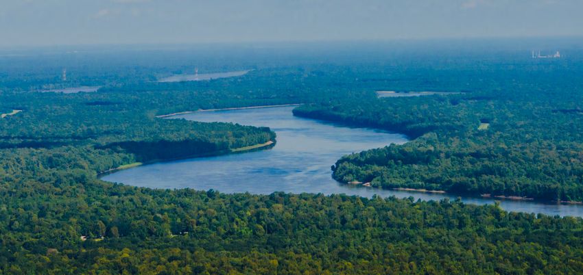
AND RESTO
                                                                                                                                                                                                                                             ON               R
                                                                                                                                                                                                                                           TI

                                                                                                                                                                                                                                                              AT
                                                                                                                                                                                                                                   EC

                                                                                                                                                                                                                                                                 I
                                                                                                                                                                                                                                TAL PROT

                                                                                                                                                                                                                                                                  ON
                                                                                                                                                                                                                                                                   AUTHOR
                        BASIN

                                                                                                                                                                                                                                 AS
                                                                                                                                                                                                                                            CPRA

                                                                                                                                                                                                                                                                  ITY
                                                                                                                                                                                                                                    CO
                        PROGRAM

    Program History                                                                                                      Technical Advisory Group
    The Atchafalaya Basin Program was put in place to develop, implement, and manage a comprehensive state                The Atchafalaya Basin Program Technical Advisory Group is in place to review, evaluate, and approve water
    master plan for the Atchafalaya Basin Floodway System, Louisiana Project. This master plan directs the efforts of     quality or water management projects for inclusion into the Basin Annual Plan. Membership is as follows. Each of
    the state as local sponsor for the US Army Corps of Engineers Floodway project and provides the mechanisms            the entities below has one member unless otherwise noted:

    to match federal dollars used in the mitigation of that system. Although the Program has focused on the               Executive Director, Coastal Protection and Restoration Authority (Chair)
    components of the Atchafalaya State Master Plan approved in 1999, activities have also expanded to address the        Louisiana Department of Environmental Equality
    needs of both the resources and resource users of the Atchafalaya Basin.                                              Louisiana Department of Agriculture and Forestry
                                                                                                                          Louisiana Department of Natural Resources
    Previously, the Program was housed within the Louisiana Department of Natural Resources and that agency was
                                                                                                                          Louisiana Department of Wildlife and Fisheries
    charged as lead for the implementation of the Atchafalaya State Master Plan. On July 1, 2018 the Program and
                                                                                                                          Louisiana Department of Culture, Recreation, and Tourism
    associated authorities were transferred to CPRA through Act 570 of the 2018 Regular Session. With that transfer
                                                                                                                          Louisiana Department of Health
    the CPRA will continue to provide an annual plan for the Atchafalaya Basin Program that will be made part of the
                                                                                                                          Louisiana State Land Office
    overall CPRA Annual Plan.
                                                                                                                          Atchafalaya Basin Levee Board*
    Although the structure of the Program has undergone revision in statute the CPRA is committed to continue the         Police Jury Association of Louisiana East of Atchafalaya*
    important work benefitting the Basin while tying this Program into the state’s larger coastal efforts. This Annual    Police Jury Association of Louisiana West of Atchafalaya*
    Plan also includes descriptions of currently planned and future projects as well as an overview of the Advisory       United States Geological Survey
    groups and other oversight. More information can be found on the CPRA website coastal.la.gov/atchafalaya-             United States Fish and Wildlife Service
    basin-program/. We thank all involved with the management and preservation of the Basin and are excited to            United States Army Corps of Engineers
    have this Program incorporated into the state’s Coastal Program.                                                      Louisiana State University School of Renewable Natural Resources

                                                                                                                          * denotes memberships that have specific requirement for selection and appointment as set forth in Act 570 of
                                                                                                                          the Louisiana Legislature Regular Session 2018.
    Coastal Protection and Restoration Authority Board Positions
    Governor’s Executive Assistant for Coastal Activities (Chair)
    Secretary, Louisiana Department of Natural Resources
    Secretary, Louisiana Department of Transportation and Development
    Secretary, Louisiana Department of Wildlife and Fisheries
    Secretary, Louisiana Department of Environmental Quality
    Secretary, Louisiana Department of Economic Development
    Commissioner, Louisiana Department of Agriculture and Forestry
    Commissioner, Louisiana Division of Administration
    Chair, Governor’s Advisory Commission on Coastal Protection, Restoration and Conservation
    Director, Governor’s Office of Homeland Security and Emergency Preparedness
    Commissioner, Louisiana Department of Insurance
    Designee of Senate President (Ex-officio)
    Designee of Speaker of the House (Ex-officio)
    Designee of Lieutenant Governor
    Eight appointees from the following 7 hydrologic basins:
    Representative of the Pontchartrain Basin
    Representative of the Breton Sound / Mississippi Delta Basin(s)
    Representative of the Barataria Basin
    Representative of the Terrebonne Basin
    Representative of the Atchafalaya Basin
    Representative of the Mermentau / Teche / Vermilion Basin
    Representative of the Calcasieu / Sabine Basin
1                                                                                                                                                                                                                                                         2
AND RESTO
ON R
TI
AT
EC
I
TAL PROT
ON
AUTHOR
BASIN
AS
CPRA
ITY
CO
PROGRAM
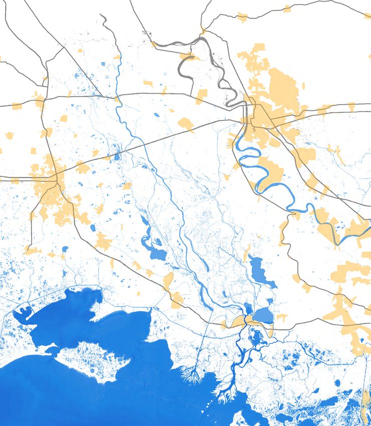
FY 2021 Project List East Grand Lake Upper Region
Only one new project was nominated for FY 2021, which was the Henderson Lake WMU Spoil Bank Gapping This project was initially approved in the FY 2010 ABP Annual Plan process as “Development of a Complete
Program. This list will remain the priority water management projects for the Program unless updated by the TAG and Specific Plan to Address Water Quality and Sedimentation in East Grand Lake/Flat Lake/Upper Belle River
or CPRA. The plan also identifies projects related to improvement of public access, outreach, and recreational Management Units Through Modification of Water & Sediment Inputs.” The project was intended as a first step
projects that will enhance the public’s opportunities to enjoy the natural resources of the Basin towards realigning water flow patterns and strategically redirecting sediment in the East Grand Lake (EGL) project
area, and the Upper Region was chosen as a starting point.
Water Quality / Water Management Projects Public Access, Outreach, and Recreational Projects
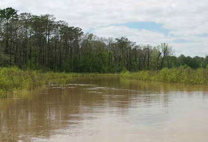
The EGL Upper Region encompasses the area south of Bayou Sorrel to Old River and east of Grand Lake to the Gulf
Henderson Lake WMU Spoil Bank Gapping Project Cajun Coast Welcome Center Trail Intracoastal Waterway. It covers an estimated 72,143 acres. This area has only a few flow restrictions preventing
water from entering and circulating throughout a large portion of the area, and the highly channelized flow
Flat Lake Study Sandy Cove Boat Launch
of water through the School Board Canal (Unnamed Canal), Indigo Bayou, Salt Mine Bayou, Williams Canal,
Murphy Lake Depth Restoration Atchafalaya Basin Geotrail Bayou Pigeon, and the Coon Trap creates a sediment delivery network that carries sediment deep into the area,
promoting further restriction of flow and isolation of small areas. Hydrologic restoration of the area requires
Buffalo Cove Water Management Project BSA Swamp Base Camp
modifying this network of channelized water inputs. Ownership of the area is a mix of public and private land, so
East Grand Lake Upper Region completing landscape-scale hydrologic restoration requires cooperation among landowners. In 2015 The Nature
Conservancy (TNC) acquired specific tracts needed to provide critical water inputs, and the project is now moving
forward through a partnership between ABP and TNC. In December 2015, DNR and TNC signed a Memorandum of
Water Quality / Water Management Projects Understanding to formalize this partnership.
Status Report
Henderson Lake WMU Spoil Bank Gapping Program A robust monitoring program has been initiated by TNC. This monitoring program includes a combination of
continuously recording instrumentation and discrete monitoring stations to determine the change in water
The Henderson Lake Water Management Unit Spoil Bank Gapping Program will address restricted water flows flow patterns resulting from restoration. The program will also track the corresponding effects on water
north of Henderson Lake. The restricted flows contribute to water quality issues in the swamps, the lake, and also quality, habitat, forest health, biodiversity, and carbon and nutrient sequestration during flood and drainage
inhibit flood flows south to the lower basin. The program will help to reestablish more natural North/South water events. Design and permitting for phase 1 of project construction is underway and includes a suite of elements
flows present in the basin. Due to the importance of improving water quality and hydrologic regime, the ABP TAG designed to restore healthy flow patterns in the EGL Upper Region. As the project progresses, there will be ample
identified this project as a top priority in the FY 2021 Annual Plan process. opportunities for public input at TAG and CPRA public meetings, which are held throughout the year.
Status Report Additionally, the CPRA holds public meetings annually to receive input on the CPRA Annual Plan which includes
This project is not currently funded. the Basin Plan.
u Sorrel
Bayo
Bayo
Gu
lf In
u Ca
trac
nn
o
on
ast
al W
ate
rwa
l
a Cana
Florid
y
Tract 1 Tract 2
Proposed project features
Current funding for this project was reallocated from projects that were unable to proceed including Cocodrie
Existing spoil bank conditions within Henderson Lake. Existing canal conditions within Henderson Lake.
Swamp and Pigeon Bay. A portion of the funding received in 2017 will also be allocated to this project.
3 4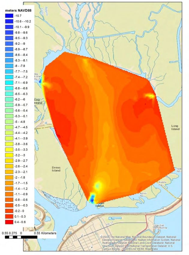
AND RESTO
ON R
TI
AT
EC
I
TAL PROT
ON
AUTHOR
BASIN
AS
CPRA
ITY
CO
PROGRAM
Murphy Lake Depth Restoration Flat Lake Study
Sediment has closed off access to Murphy Lake in the East Grand Lake WMU in low water conditions, causing water Sedimentation is causing loss of access and aquatic habitat in Flat Lake and is detrimental to the overall health
circulation and water quality problems. The project would involve dredging sediment accretion from the entrance of the ecosystem. Sediment accumulation in Flat Lake exacerbates drainage issues and stagnation of interior
of Murphy Lake to improve access and water flow into the lake. swamp habitat throughout the Upper Belle River WMU. This study is an evaluation of the lake and its ecosystem
to support the design of a restoration project to rehabilitate habitat, improve biological conditions, and re-
Status Report establish access for the benefit of public use.
This project is not currently funded.
The “Overview and Planning Process of the East Grand Lake Water Quality Improvement and Sediment
Buffalo Cove Water Management Project Management Plan” (2010) clearly identified the Flat Lake area as an important component of the drainage of
the East Grand Lake and Upper Belle River WMUs. The study concluded that the hydrodynamic influence of Flat
The Buffalo Cove Water Management Project is a project of the U.S. Army Corps of Engineers (USACE). It was Lake should be quantified as part of the planning process and suggested that decisions regarding the future
designed to improve water circulation and sediment management in the Buffalo Cove Water Management Unit management of the waterways in and around Flat Lake will have a significant influence on the hydrology and
in an effort to enhance fish and wildlife resources. The project includes the improvement of interior circulation ecology of the Western and Upper regions. Because of its proximity to Coastal Master Plan projects designed to
within the swamp; the removal of barriers to north-south flow; the input of oxygenated, low temperature river build wetlands in Terrebonne
water; and the prevention or management of sediment input into the interior swamps. Parish, Flat Lake was chosen as
a location for a demonstration
The project location is the lower Basin in Iberia, St. Martin and St. Mary Parishes. USACE began construction on project for utilizing Atchafalaya
Buffalo Cove in 2004, and the project was estimated to benefit more than 7,500 acres initially and 53,000 to 58,000 Basin sediments as a borrow
acres eventually. source. This study will include
analysis of lakebed sediments
Initially constructed Buffalo Cove elements
and will provide that and
included Bayou Eugene and elements 1, 6, 7,
other information to assess
8, 9-1, and 9-2. Some of these elements were
the feasibility of this area as a
impacted by unprecedented high water during
component of the Coastal Plan.
the Mississippi River Flood of 2011 and were no
longer functioning as designed. The following Status Report
elements were repaired as of February 2013: 6, A portion of funding received
7, 9-1, 9-2, and elements within Bayou Eugene in 2017 will be allocated to this
(E1, E2, and E3). In 2016, the USACE began project.
construction on elements 3, 12, 14, and 16 to
further improve interior flows, and with the
completion of those elements in June 2016, the
project was considered substantially complete.
This Buffalo Cove WMU element at Bayou
Status Report Eugene was repaired after the flood of 2011
Element 10 (Logjam), which was a late addition to the project design, still remains to be constructed. Element
10 was designed to improve a historic flow corridor of approximately 2.9 miles in the south/central Buffalo Cove
WMU. It includes construction of cuts in hydrologic impoundments, which have been caused by the spoil banks
of two oil and gas canals and one impoundment caused by sedimentation along a ridge. This project element was
added to improve hydrologic connection between Buffalo Cove Lake, the Ice Box, and areas further downstream
to the Atchafalaya River. In order to construct the proposed cuts, an existing access channel (Bayou Bieber) will
be partially improved from Poncho Chute and a 100 foot portion of the access channel will be backfilled to
preexisting conditions in order to maintain the existing channel capacity. The Atchafalaya Basin Program has set
aside a portion of the funding received in 2017 funding to provide the State’s 25% cost-share for Element 10.
Once Buffalo Cove WMU is completed, the State of Louisiana will have a cost share of 25% of ongoing operation
and maintenance funding for this project.
Bathymetry of Flat Lake.
5 6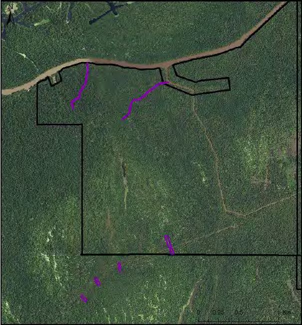
AND RESTO
ON R
TI
AT
EC
I
TAL PROT
ON
AUTHOR
BASIN
AS
CPRA
ITY
CO
PROGRAM
Public Access, Outreach, and Recreational Projects Map of FY 2021 Project Locations
Cajun Coast Welcome Center Trail
This project will include construction of boardwalk behind the Cajun Coast Welcome Center in St. Mary Parish to Water Mangement Units
provide a trail through the scenic cypress-tupelo swamp. It will also include informational signage to explain flood 1 Lake Henderson
protection and its relation to the floodway. 2 Alabama Bayou
3 Werner
Sandy Cove Boat Launch
4 Lost Lake
5 Cow Island
6 Cocodrie Swamp
Upgrades to the Sandy Cove boat launch were proposed in the State Master Plan. Improvements to the existing 7 Beau Bayou
8 Pigeon Bay
launch are proposed. Improvements to the parking area, lighting, restrooms and a fishing area, as well as other 9 Buffalo Cove
improvements. 10 Flat Lake
11 Upper Belle River
Atchafalaya Basin GeoTrail
12 Six Mile Lake
Baton Rouge
1 2
The Atchafalaya Basin GeoTrail is a series of 24 geocaches that have been placed in and around the Atchafalaya
Basin. Launched in 2017 each site highlights how water has influenced the region.
3
Link: http://coastal.la.gov/atchafalaya-basin-program/recreational-opportunities/ Henderson Lake WMU Spoil Bank Gapping Project
BSA Swamp Base Camp
4
5
BSA Swamp Base Camp Lafayette 6 8
The camp would promote public access to the swamp habitat of the Atchafalaya Basin through use of its BSA 7
Swamp Base Camp at Henderson, St. Martin Parish, Louisiana. The camp would provide access to State agencies East Grand Lake Upper Region
10
and public educational institutions for research and educational outreach programs. In addition promote access for 9 Murphy Lake Depth Restoration
children with special needs by making the activities more easily accessible to persons with disabilities, including but
Buffalo Cove Water Management Project
not limited to the purchase and/or construction of parking areas, boat launches, piers, docks bulkheads and other
11
facilities designed to provide accessibility for citizens with disabilities and special needs.
Sandy Cove Boat Launch
Link: https://www.bsaswampbase.org/
12 Flat Lake Study
Cajun Coast Welcome Center Trail
Morgan City
7 8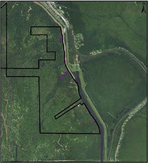
AND RESTO
                                                                                                                                            ON               R
                                                                                                                                          TI

                                                                                                                                                             AT
                                                                                                                                  EC

                                                                                                                                                                I
                                                                                                                               TAL PROT

                                                                                                                                                                 ON
                                                                                                                                                                  AUTHOR
BASIN

                                                                                                                                AS
                                                                                                                                           CPRA

                                                                                                                                                                 ITY
                                                                                                                                    CO
PROGRAM

          With the passage of Act 8 of the First Extraordinary Session of 2005 (Act 8), the Louisiana Legislature mandated
          the integration of hurricane protection activities (e.g., levee construction) and coastal restoration activities (e.g.,
          river diversions or marsh creation). Act 8 also created the Coastal Protection and Restoration Authority Board
          (CPRA Board) and tasked it with oversight of these activities. The Office of Coastal Protection and Restoration
          (OCPR) was designated as the implementation arm of the CPRA Board. To avoid confusion, the 2012 Louisiana
          Legislature changed the name of the state agency from OCPR to the Coastal Protection and Restoration
          Authority (CPRA).

          The CPRA Board, with the assistance of CPRA, is required by Act 523 of the 2009 Regular Legislative Session,
          amended by Act 604, to produce an Annual Plan that inventories projects, presents implementation schedules
          for these projects, and identifies funding schedules and budgets. This Atchafalaya Basin Program Fiscal Year
          2020 Annual Plan provides an update on the state’s efforts to protect and restore its coast and describes the
          short-term and long-term results that citizens can expect to see as the state progresses toward a sustainable
          coast.

          Act 570 of the 2018 Regular Session, enacting La. R.S. 49:214.8.1, et seq., transferred the responsibilities of the
          Atchafalaya Basin Research and Promotion Board and the Atchafalaya Basin Program from the Department of
          Natural Resources to the Coastal Protection and Restoration Authority. The Atchafalaya Basin Program (R.S.
          49:214.8.1 et seq.) is placed within the Coastal Protection and Restoration Authority, which shall perform and
          exercise the powers, duties, functions, and responsibilities of the Program as provided by law. The annual basin
          plan shall be included in the Annual Plan: Integrated Ecosystem Restoration and Hurricane Protection in Coastal
          Louisiana produced each year by the Coastal Protection and Restoration Authority.

                                     Atchafalaya Basin Program Fiscal Year 2021 Annual Plan:
                        Integrated Ecosystem Restoration and Hurricane Protection in Coastal Louisiana.
                                     Submitted to the Senate Natural Resources Committee;
             House Natural Resources and Environment Committee Senate; Transportation, Highways and Public Works
                            Committee House; Transportation, Highways and Public Works Committee;
                                by The Coastal Protection and Restoration Authority of Louisiana.
                                      In accordance with R.S. 49:214.5.3 and R.S. 49:214.6.1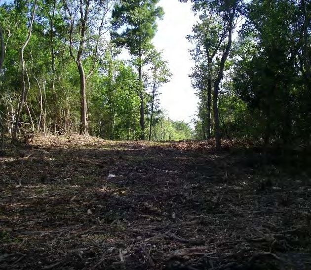
BASIN
                       PROGRAM

Connect With Us!
               SCRIB
          UB
      S

                   E

  @LouisianaCPRA
  www.coastal.la.gov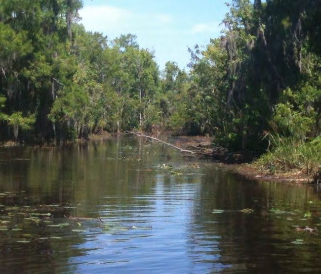
You can also read