Bay and Creeks Plan Redlands Coast - Redland City Council
←
→
Page content transcription
If your browser does not render page correctly, please read the page content below
Redlands Coast
Bay and Creeks Plan
2021–2031
Contents
1.0       FOREWORD                                                                                                            2
2.0       REDLANDS COAST CREEKS AND MORETON BAY                                                                               4
3.0       WHY WE NEED A PLAN                                                                                                  6

    3.1   STRATEGIC FIT                                                                                                       7
    3.1.1		Regional                                                                                                           7
    3.1.2		Redland City Council                                                                                               7
4.0       OVERVIEW OF THE BAY AND CREEKS                                                                                      8

    4.1   VALUES OF OUR BAY AND CREEKS                                                                                      10
    4.1.1		Environmental Values                                                                                             11
    4.1.2		Economic Values                                                                                                  12
    4.1.3		 Social Values                                                                                                   12
    4.2 HISTORICAL AND CURRENT LAND USE IN REDLANDS COAST                                                                   12
5.0       CURRENT CONDITION                                                                                                 13
    5.1.1 What we know                                                                                                      15
6.0       CHALLENGES                                                                                                        16
    6.1 IMPACTS FROM POPULATION GROWTH AND LAND USE CHANGE                                                                  19
    6.2 CLIMATE CHANGE                                                                                                      21
7.0       FOCUS ON RECENT ACTIVITY                                                                                          22
8.0       VISION AND GOALS FOR THE BAY AND CREEKS                                                                           24
9.0       ACTION PLAN                                                                                                       26
10.0 REFERENCES                                                                                                             28
11.0      APPENDIX 1 – RELEVANT LEGISLATION                                                                                 30
12.0      APPENDIX 2 – 2019-2020 BAY AND CREEK ACTIVITY HIGHLIGHTS                                                          31
13.0      APPENDIX 3 – MANAGEMENT PLANS AND ASSOCIATED DOCUMENTS                                                            32

List of figures
Figure 1: Environmental Plans.                                                                                                7
Figure 2: Redlands Coast Catchments.                                                                                          9
Figure 3: Bay and Creek Values.                                                                                             10
Figure 4: Healthy Land and Water overall waterway condition scores over time from Annual Report Cards.                      15
Figure 5: Challenges –climate change and population growth and land use                                                     17
Figure 6: Simple conceptual model of areas of Moreton Bay including pressures.                                              20
Figure 7: Examples of key Redland City Council programs that contribute to protecting and enhancing the value of
          Redlands Coast waterways and Moreton Bay.                                                                         23
Figure 8: Goals.                                                                                                            25

2                                                                                                                  Redlands Coast
1.0 Foreword
    Redland City Council manages significant natural, built, cultural and
    social assets involving land and waterways that flow to Moreton
    Bay. Moreton Bay contributes $7.56 billion to the South East
    Queensland economy each year, including directly benefiting the
    local economy of Redland City. Maintaining the ecological health
    of our local waterways and the bay is therefore coupled, and vital
    for building resilience to manage current and future challenges,
    including population growth and climate change.
    Council has invested significantly in assessing and improving the
    condition of our waterways and the bay, with initiatives such as the
    waterways monitoring and assessment programs, implementing
    actions to reduce sediment loads from construction sites and
    through the commitment to plant one million native plants by
    2026. The development and implementation of Redlands Coast Bay
    and Creeks Plan reflects an ongoing commitment to sustainable
    stewardship of our waterways and the bay.
    The Redlands Coast Bay and Creeks Plan provides strategic intent for
    protecting, maintaining and enhancing the health of our waterways
    and the bay. The Plan guides and prioritises management actions
    and Council’s operational activities for ensuring ongoing resilience
    of our waterways and the bay over the next ten years.
    Redlands Coast Bay and Creeks Plan is a non-statutory document
    and supersedes the Total Water Cycle Management Plan 2013.
    The specific operational management actions are presented in
    the supplementary Action Plan, and have been developed to be
    practical, realistic, targeted and achievable.
    The Redlands Coast Bay and Creeks Plan and supplementary Action
    Plan align with and operationalises Council’s implementation of
    the Lower Brisbane-Redlands Coast Bay and Creeks Plan that Council
    endorsed in 2018.

Bay and Creeks Plan 2021–2031                                               3
2.0 Redlands Coast Creeks and
    Moreton Bay

4                               Redlands Coast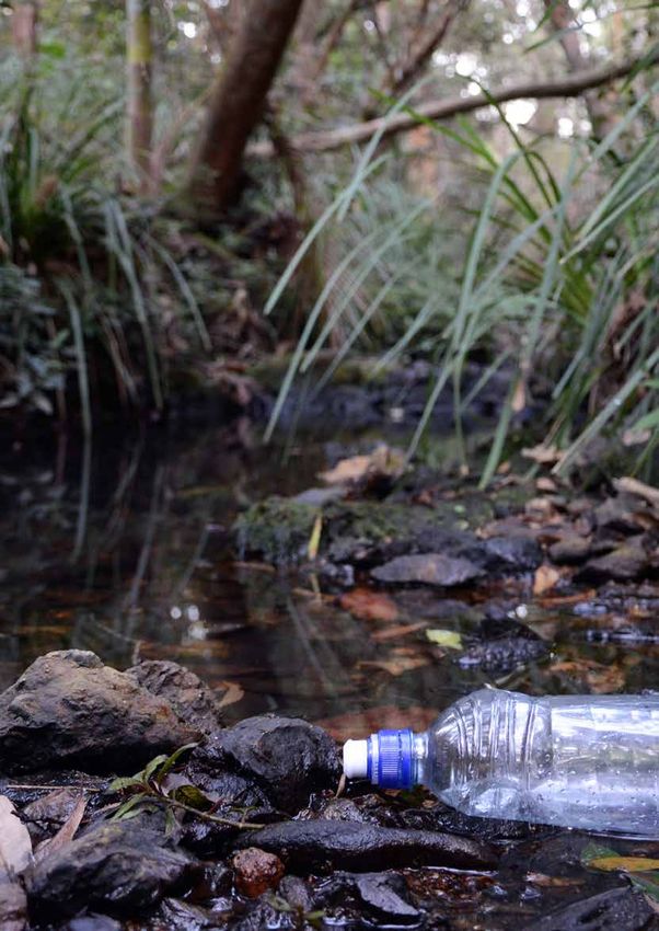
Management of Moreton Bay and Redlands Coast’s creeks            Groundwater is within the scope of the Plan, particularly to
extends to areas that Redland City Council (Council) has         the extent that it interacts with surface waters and Moreton
custodianship of, or has direct influence on. This includes      Bay. Land that discharges to Moreton Bay is also recognised
public land and private land, which may be regulated via         because rainfall runoff from this land flows to the bay and
development approvals or other legislation. Council has the      can therefore influence the health of the bay.
opportunity to influence individuals, businesses and other
                                                                 Management of our waterways and Moreton Bay will be
organisations using a range of legislative and non-legislative
                                                                 achieved through collaboration and partnerships established
measures. Education and engagement activities can be used
                                                                 between Council, traditional owners, community members,
to support stakeholders alignment to the strategic direction
                                                                 various levels of government and other stakeholders.
presented in Redlands Coast Bay and Creeks Plan (the Plan).
For the purposes of this Plan, ‘waterways’ includes all waters
and waterways in Redland City, including creeks, estuaries,
wetlands, lakes, dams, artificial water bodies, stormwater
infrastructure, foreshores, coasts and river and Moreton Bay.
Moreton Bay area is identified according to the Moreton Bay
Marine Park Zoning Plan.

 Credit K McNeale

Bay and Creeks Plan 2021–2031                                                                                                   5
3.0 Why We Need a Plan

6                        Redlands Coast
The liveability of Redlands Coast and the sustainability of         The associated Risk Treatment Plan sets out the high-priority
communities within its catchments are strongly influenced           actions recommended for the Lower Brisbane-Redlands
by the health of our waterways and Moreton Bay.                     Coastal Catchment. This focuses on actions that mitigate
                                                                    high risks and have a high likelihood of success.
However, existing and emerging challenges from land use
change, population growth and a changing climate, likely
mean that the ‘business-as-usual’ approach to managing              3.1.2 Redland City Council
our bay and creeks may not protect the lifestyles we value,
                                                                    The Natural Environment Policy outlines Council’s
the economy that provides our prosperity or the healthy
                                                                    commitment to protect, enhance and restore the health
environment that contributes to our quality of life.
                                                                    and viability of Redland Coast’s natural aquatic values and
The management of the waterways and bay is complex.                 environments for their inherent value and the benefit, use
Therefore, there is need for a plan with a clear vision to          and lifestyle of current and future generations.
identify priorities, set a clear future direction and drive
                                                                    Redland City Corporate Plan 2021-2026 establishes a
coordinated and targeted actions. This Plan presents a vision
                                                                    commitment to promoting:
for the creeks and bay to ensure Council’s and community
actions leave a positive legacy for the future Redlands Coast.      Our environment enhances our identity, lifestyle, wellbeing,
                                                                    economy and cultural values. Opportunities to be immersed in
3.1 Strategic Fit                                                   our naturally wonderful environment are harnessed, and drive
                                                                    our commitment to protect and enhance our natural assets.
There are a number of international, Commonwealth and
state legislation relevant to the management of waterways           This Redlands Coast Bay and Creeks Plan and the associated
and Moreton Bay. Refer to Appendix 1.                               Action Plan supports this position by outlining a coordinated
                                                                    set of actions to protect and restore the resilience of the
                                                                    creeks and Moreton Bay. (Figure 1)
3.1.1 Regional
                                                                    The Plan aligns and supports other Council strategies and
Lower Brisbane-Redlands Coastal Catchment                           plans that have direct influence on our waterways such
Action Plan (CAP)                                                   as the Coastal Adaption Strategy (CAS), Coastal Hazard
                                                                    Adaption Strategy 2021 (CHAS), Redland City Council Wildlife
In October 2018, Council endorsed the Lower Brisbane-               Connections Plan 2018, Redlands Coast Biosecurity Plan 2018
Redlands Coastal Catchment Action Plan. The CAP was                 and Redland City Council Conservation Land Management
developed by the Council of Mayors’ Resilient Rivers                Strategy 2010. Furthermore, this Plan seeks to align with
Initiative, which included consultation with officers from          other Council strategies and plans such as Redland City
Brisbane and Redland City Councils.                                 Council Open Space Strategy 2026, Redlands Coast Rural
The actions identified in the CAP contribute to achieving the       Enterprises Industry Sector Plan 2019, Redland City Council
goals of the Resilient Rivers Regional Strategy (2015–2025).        Strategic Asset Management Plan 2019, Assets and Service
The goals of the Strategy are:                                      Management Plans and Redland Water and Waste NetServ
                                                                    Plans.
 1. Keep soil on our land and out of our waterways.
 2. Help protect our region’s water security.
 3. Improve the climate resilience of our region.
 4. Promote partnerships with strong leadership to deliver a
    coordinated approach to catchment management in SEQ.

                                                      Corporate Plan

          Wildlife               Koala Conservation
      Connections Plan                Strategy                   Biosecurity Plan              Bay and Creeks Plan

Figure 1. Environmental Plans

Bay and Creeks Plan 2021–2031                                                                                                      7
4.0 Overview of the Bay and Creeks

8                               Redlands Coast
The Redland City Local Government Area (Redlands Coast) groundwater dependent ecosystems, including complex
covers approximately 537 km2 of land, 335 km of coastline networks of sedge dominated wetlands. Waterways on
and foreshore, and 525 km2 of waterways across 22 Coochiemudlo Island and the Southern Moreton Bay Islands
catchments. Our waterways and their discharge volumes comprise of intermittent, undefined drainage lines that
and catchment areas are relatively small in size compared generally flow to wetlands, foreshore areas to the bay.
to many waterways in the nearby Brisbane and Logan-Albert
There are no large rivers within Redlands Coast, although the
River Catchments (Figure 1).
lower Logan River forms a small part of the City’s southern
Nineteen of the mainland catchments flow directly to boundary.
Moreton Bay and the other three catchments (California
Moreton Bay is bounded on its eastern side by the large sand
Creek, Native Dog Creek and Serpentine Creek) flow
islands of Minjerribah and Moreton (Mulgumpin), and the
indirectly to Moreton Bay via the lower reach of the Logan
mainland coast on the western side. Large rivers (Brisbane,
River. Redlands Coast waterways have a range of flowing
Logan and Pine) discharge to the bay from a combined
and non-flowing habitats, and are fringed by diverse riparian
catchment of approximately 22,000 km². Moreton Bay is
ecosystems that provide habitat for terrestrial flora and
approximately 110 km long from north to south, of which
fauna. The larger waterways on the mainland have their
Redlands Coast accounts for around 38 km. Moreton Bay is
headwaters in the Mount Cotton hills (230 metres above sea
35 km at its widest east to west.
level).
Moreton Bay was declared a Marine Park in 1993 and is
North Stradbroke Island (Minjerribah) has many freshwater
recognised internationally as a Ramsar Site.
lakes (dune, perched and window lakes) and significant
Brisbane
City Council
Wellington
Point
Catchment
Tarradarrapin
Creek Hilliards
Catchment Creek
Catchment
Lower Tingalpa and Coolnwynpin
Cleveland Creek Catchment
Lower Tingalpa Catchment
and Coolnwynpin North Stradbroke Island Tarradarrapin Creek Catchment
Creek Catchment Catchment
Wellington Point Catchment
Thornlands Coochiemudlo Hilliards Creek Catchment
Catchment Island Catchment
Cleveland Catchment
Upper Tingalpa Thornlands Catchment
Creek Macleay
Catchment Eprapah Creek Island
Catchment Catchment Upper Tingalpa Creek Catchment
Moogurra- Perulpa Island
Catchment
pum Creek Eprapah Creek Catchment
Catchment
Lamb Island
Catchment Moogurrapum Creek Catchment
Native Dog Weinam Creek
Catchment Karragarra Island
California Creek Catchment Weinam Creek Catchment
Creek Catchment Torquay Creek
Catchment Catchment Torquay Creek Catchment
Serpentine California Creek Catchment
Creek
Logan City
Catchment
Council Southern Native Dog Creek Catchment
Redland
Bay Russell Serpentine Creek Catchment
Catchment Island
Catchment
Southern Redland Bay Catchment
Coochiemudlo Island Catchment
Gold Coast
City Council Macleay Island Catchment
Perulpa Island Catchment
Lamb Island Catchment
Karragarra Island Catchment
Russell Island Catchment
North Stradbroke Island Catchment
Figure 2: Redlands Coast Catchments
Bay and Creeks Plan 2021–2031 9
4.1 Values of our Bay and Creeks
Our waterways and the bay have important environmental,
economic and social values, and these values underpin the lifestyle
of residents of the Redlands Coast. These can include:
Environmental
Carbon sequestration Water quality and quantity
Ecosystem services Endangered threatened and
Biodiversity vulnerable species
Intrinsic value Ecosystem richness
Flora and fauna Healthy bay and creeks
Ecosystems complexity Nutrient cycling
Natural resources Carbon cycling
Healthy habitat Buffering capacity
Corridors Connectivity
Social
Relaxation Opportunities for school-based
Lifestyle education
Recreation Cultural learning
Amenity Traditions
Sport and fitness Places of meeting
Holiday destination Artefacts
aesthetic value Indigenous history and cultural
Support community resilience heritage
Environmental learning Human health benefits
Economic
Commercial fishing Eco-tourism
Water supply Drainage / stormwater
Industry Flood mitigation
Transportation Green assets
Tourism Drinking water supply
Recreation Infrastructure
Business Capacity for drought
Aquaculture
Figure 3: Examples of Bay and Creek Values
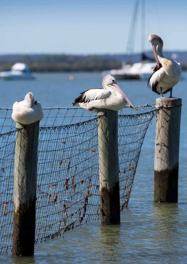
10 Redlands Coast4.1.1 Environmental Values Bay Ramsar Site. The Moreton Bay Ramsar site regularly
supports about 40,000 waterbirds and over 250 species
Our waterways and the bay support significant biodiversity of birds, including at least 34 migratory shorebird species
resources, and provide a range of ecosystem services. listed under the China and Japan Migratory Bird Agreements.
Aquatic biodiversity resources are supported by a variety of The Moreton Bay Ramsar site takes in large portions of the
aquatic habitats, including coral reefs, wetlands (including bay, Minjerribah, Southern Moreton Bay Islands and the
seagrass, mangroves, and saltmarsh), riparian habitats, mainland.
instream habitat, beach wrack, mud flats, sandy beaches Many of the 82 threatened species and 77 migratory species
and rocky shores. Redlands Coast has wetlands of national that listed as matters of National Environmental Significance
and international significance. These include the wetlands of under the Commonwealth Environment Protection and
Moreton Bay, Carbrook Wetland Aggregation and Minjerribah. Biodiversity Conservation Act 1999 that are found in the
A special feature of Minjerribah are the perched wetlands, Redlands Coast rely on the health of our waterways and bay.
which are considered rare globally.
Ecosystem services provided by our waterways and the Bay
The wetlands, creeks and estuaries of Redland Coast provide include fisheries resources, nutrient cycling, carbon storage
habitat for many significant and threatened species, such and shoreline protection. These ecosystem services directly
as the wallum froglet, water mouse, loggerhead turtle benefit our community’s livelihoods through food security,
and Oxleyan pygmy perch. Ornate rainbowfish is a locally protecting water quality, including drinking water quality,
significant species that is known to have different colour protecting shorelines from coastal erosion and mitigating the
morphs in different creek systems of the Redlands Coast. impacts of climate change. Marine ecosystems are described
Moreton Bay provides habitat for more than 1,000 species of as blue carbon ecosystems, as they provide a natural way of
marine wildlife including fish, sea turtles, humpback whales, reducing the impact of greenhouse gases on our atmosphere,
dolphins, waterbirds, and several threatened species, such through carbon sequestration.
as grey nurse sharks and dugongs. It contains one of the
most extensive intertidal areas of seagrass, mangroves
and saltmarsh communities along the eastern coast of Carbon sequestration is the process of
Australia. Many of the significant wetland areas of Redlands capturing and storing atmospheric carbon
Coast are recognised internationally within the Moreton dioxide.
Credit Jaleyna Ferrer
Bay and Creeks Plan 2021–2031 114.1.2 Economic Values traditional custodians and their intrinsic connection to the
lands and sea, along with their rich culture and heritage that
In addition to the indirect economic benefits our waterways dates back thousands of years. Indigenous people cultural
and the bay provide via ecosystem services, our aquatic activities include culturing oysters, mullet fishing and
assets also provide a range of direct economic benefits. hunting dugong. These activities have occurred for centuries
Tourism is one of the key industry sectors of Redlands Coast prior to European settlement and continue today.
and a key focus area for growth. Each year millions of visitors Early Europeans developed horticulture, cropping and
are attracted to the environmentally significant Moreton Bay, grazing on the productive red soils, and logged woodland
Minjerribah and Southern Moreton Bay Islands. Moreton Bay areas. Commercial fisheries have operated in Moreton Bay
receives more domestic tourists each year than the Great since European settlement, and historical exploitation
Barrier Reef. of some fisheries resulted in significant declines in the
Moreton Bay is one of the most intensely used coastal populations of whales, turtles and dugongs.
systems in Australia and supports some of Queensland’s Over the past 70 years, there has been significant
most productive fisheries, providing a renewable resource population growth in South East Queensland, including in
for Indigenous, commercial, recreational and charter sectors. the Redlands Coast. Substantial re-development of most
Moreton Bay contributes around $7.56 billion to the South of the catchments of Redlands Coast has resulted in rapid
EastQueensland economy each year. urbanisation converting former agricultural lands and
bushland to residential areas. This is particularly evident in
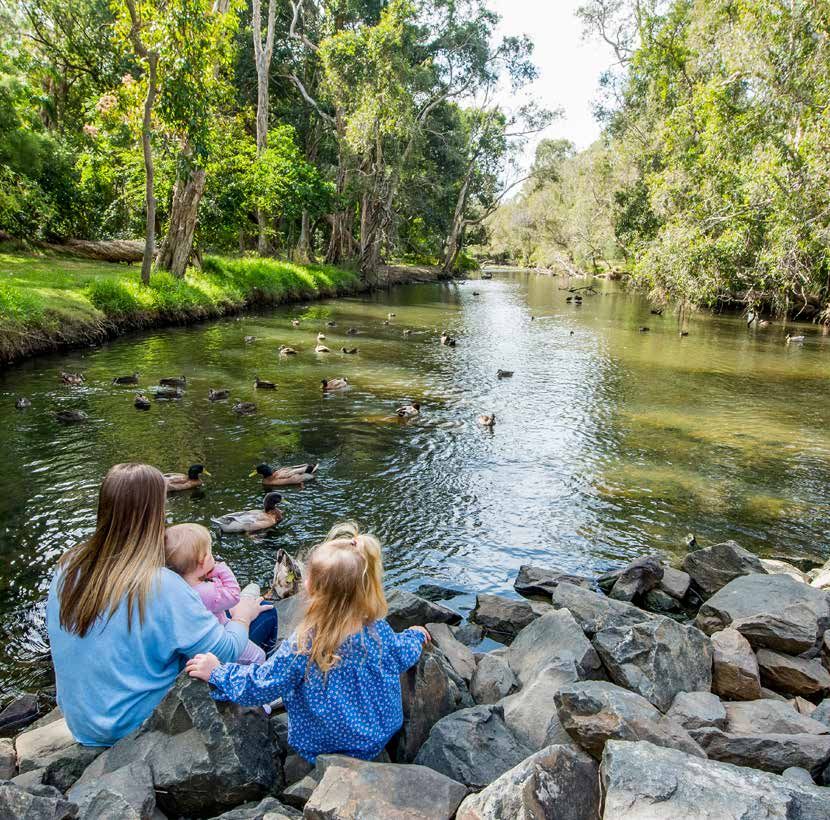
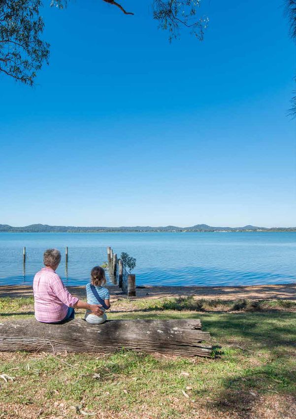
4.1.3 Social Values coastal areas, which are now heavily modified. Additionally,
urban development has shortened and straightened some
Redlands Coast residents value the recreation opportunities waterways (e.g. Ross Creek), and canal estates have been
provided by their local waterways, with high numbers of developed in the estuaries and inshore waters of some
people indicating that waterways are a place of rest and coastal catchments.
relaxation (70%) or places for social interaction with friends
On the mainland, the south-western portion of the city is
and family (64%). ‘Engaging in recreational activities in,
dominated by rural land uses, while the northern half and
or alongside, a local waterway at least once a month’ was
eastern coastal fringe are predominately urban. The range
reported by 60% of the residents surveyed. The 2020 Annual
of rural land uses include horticulture, grazing and irrigated
Healthy Land and Water Report Card indicated that 66% of
cropping, with most of the area’s poultry farms located in the
Redlands Coast residents surveyed were satisfied with the
southern catchments. Quarrying and mining occurs in the
recreational and aesthetic values of their local waterways.
headwaters of Tingalpa, Wallaby, Hilliards and Moogurrapum
creeks.
4.2 Historical and Current Land
Use in Redlands Coast Land uses of Coochiemudlo and the Southern Moreton Bay
Islands (SMBI) - Macleay (Jencoomercha), Lamb (Ngudooroo),
The Quandamooka People are the traditional custodians Karragarra (Karragarra) and Russell (Canaipa) Islands, mostly
of much of Redlands Coast. Council also extends its comprises urban development amongst bushland reserves.
acknowledgement of traditional custodians to the Danggan North Stradbroke Island (Minjerribah) has three townships,
Balun (Five Rivers) People who are currently in the process with the vast majority of island comprising areas of national
of Native Title determination for areas that include parts parks and protected areas.
of Redlands Coast. Council recognises and respects the
12 Redlands Coast5.0 Current Condition Bay and Creeks Plan 2021–2031 13
The condition of our waterways is monitored by Healthy         ▶ The health of Moreton Bay is good overall, water
Land and Water at a regional catchment level, and at a finer     quality is excellent and the extent of wetland habitats is
scale by Council over the last 10 years.                         excellent. The western and central bay have had notable
                                                                 improvement in ecological condition since 2015 (Figure 4).
The annual waterways report cards for Redlands Coast have
indicated that:                                                The results of Council’s waterway monitoring program
                                                               indicates that there is considerable variability in water
▶ The health of freshwater waterways has declined over         quality results across the catchments over time (i.e. high
  time and is now generally poor, with the extent of           spatiotemporal variability), however many of the creeks
  freshwater wetlands in the Redlands Coast catchment          within Redlands Coast are consistently nutrient rich, with
  also classified as poor. The monitoring data indicates       total phosphorus, total nitrogen and ammonia levels typically
  that waterway health is subject to seasonal fluctuations     exceeding the Queensland Water Quality Guidelines. High
  (C to C+, depending on the time of year), and that loads     levels of nutrients can result in excessive algal growth,
  of sediment and nutrients have increased over time,          which in turn can block sunlight to aquatic plants, reducing
  although these may be linked with periods of higher          photosynthesis and respiration which then may cause
  rainfall. Overall, freshwater fish communities have          decreased concentrations of dissolved oxygen in the
  declined, macroinvertebrates have remained stable and        waterway. Low dissolved oxygen may then negatively impact
  ecological process have increased slightly, although         fish and other aquatic wildlife. The impact pathways of land
  slight improvements in water quality and fish community      use development on water quality and habitat conditions are
  health were recorded at sites on Eprapah Creek. The          complex.
  extent of streambank vegetation along creeks of Redlands
  Coast is good, and wetlands are stable. Currently 86% of
  streambanks in Redland City are vegetated.
▶ The water quality of estuarine reaches is fair, and the
  extent of wetland habitat (mangroves and saltmarshes)
  in the estuaries is excellent. These excellent condition
  estuarine habitats in the Redlands Coast are critical for
  maintaining the productive recreational and commercial
  fisheries the Redland’s community relies on.

 Credit Neil McGregor

14                                                                                                               Redlands Coast
Condition
100
90
80
Condition
70
Eastern Bay
60
Southern Bay
50 Central Bay
40 Western Bay
Mainland Catchment
30
2015 2016 2017 2018 2019 2020
Years
Figure 4. Healthy Land and Water overall waterway condition scores over time from Annual Report Cards.
5.1.1 What we know ▶ Council is responsible for multiple ecological, social and
infrastructure assets that both influence and are influenced
Council understands that: by the health of our bay and creeks, including:
▶ Protecting existing riparian vegetation and wetlands from ▷ Green assets such as waterways (creeks), waterbodies,
clearing and weed infestation is a key environmental wetlands, foreshore and low lying land along the coast
management priority
▷ Council land, especially bushland reserves, adjacent to
▶ Best practice erosion and sediment control at construction the bay and waterways that helps maintain water quality
sites is effective in controlling sediment transported to and aquatic habitat condition, and provide core habitat
waterways, but there are opportunities for continuing and habitat corridors for a wide range of terrestrial
to improve compliance with best practice across all fauna species.
construction sites
▷ Council structures that are on, within or adjacent to
▶ Water sensitive urban design (WSUD) is effective in waterways and the bay
improving water quality and flow patterns in urban
▷ Stormwater assets such as sediment basins, bioretention
waterways, and increased adoption of WSUD in existing
basins, end of pipe structures, gross pollutant traps,
and new urban areas will benefit the health of waterways
erosion sediment control pits and culverts
▶ Aging stormwater assets are a challenge to manage and
▷ Wastewater treatment infrastructure and network
maintain, with some end of pipe structures contributing to
scouring of waterways and causing creek bank instability
▶ Waterbodies in Council ownership are a challenge to
manage with some requiring significant retrofitting, and Objectives of WSUD
many are without active management and maintenance
schedules 1. Protect natural systems
▶ Filling gaps in riparian corridors is a cost effective solution 2. Integrate stormwater treatment into the
for improving waterways health landscape
▶ Our freshwater creeks have locally important populations 3. Protect water quality
of native fish species, however pest fish are an issue in 4. Reduce run-off and peak flows
most waterways
5. Add value while minimising
▶ Native fish species diversity and migration improve when
development costs
barriers are removed, as evidenced by the success of the
recent fishway installation on Hilliards Creek, however
there are other known barriers across the city requiring
fish passage solutions to improve the viability of our local
freshwater fishes
Bay and Creeks Plan 2021–2031 156.0 Challenges 16 Redlands Coast
Population Growth
                Climate Change
                                                                             and Land Use

                                      Sea level rise
                                more frequent sea-level                    Pollution
            Weather             extremes                           plastic litter
                                increased coastal hazard           emerging toxicants e.g.               Education
  reduced rainfall              risk                               PFAS, microplastics
  increased storm intensity     limited capacity for                                              lack of awareness
                                                                   wastewater                     and education of our
  overall changes to            natural and made assets
                                to respond to sea level            contamination                  community
  rainfall patterns
                                rises                              quality of urban runoff        poor land management
  extreme weather
                                                                   increase in nutrients          practices
  increased heat waves
                                                                                                  excess water and water
  more droughts
                                                                                                  energy (erosion)
  more days over 400C
                                                                                                  increased peak discharge
  higher maximum                                                          Environmental
                                       Hydrology                                                  domestic animals (cats
  temperatures
                                                                    vegetation clearing           and dogs)
  more wildfires                altered flow regimes
                                                                    Erosion and sediment          impacts of natural
  higher peak windspeeds        changes to connectivity                                           disaster
                                                                    control construction site
  warmer sea                    within creeks                                                     unsewered properties
                                                                    modified hydrology and
                                increasing marine                   morphology
                                influence on creeks
                                                                    fluvial episodic erosion
                                changes to creek flushing
                                                                    aquatic pest (fish)
                                times
          Chemical                                                  terrestrial pests (pigs and
                                changes to stratification
                                                                    foxes)
elevated CO2                    within water column
                                                                    eutrophication
water deoxygenation             increased erosion
                                                                    invasive weeds aquatic               Economic
acidification of ocean          sediment redistribution
                                                                    and terrestrial
increased harmful                                                                                 fishing pressure
                                                                    reduction waterway
blooms, such as
                                                                    buffers                       stormwater treatment
cynanobacteria blooms
                                                                    reduced environmental         assets maintenanace
increased coral bleaching
                                                                    flows                         construction impacts
events
                                     Environment                    sediment                      from development
change in rate of
biochemical processes                                               toxic cyanobacteria           urban lighting
                                change in food web
                                dynamics                            blooms                        management of assets
                                changes in sex ratios of            loss of riparian              stormwater treatment
                                some fauna                          vegetation                    assets not functioning to
                                                                    fauna passage                 their intent
                                changes to species
                                assemblages within                  obstruction                   extraction industry
                                ecosystems                                                        farm dams
                                change in habitat                                                 fragmentation of habitat
                                distribution                                                      constrained creeks
                                                                                                  poor water quality
Figure 5: Challenges –climate change and population growth and land use
Bay and Creeks Plan 2021–2031                                                                                         17
The State of the Environment Report identifies climate change, changing land use, habitat fragmentation, habitat degradation, and invasive species as key pressures on Australia’s environment. As a result, many Australian species and habitats are in decline, and it is thought that the rate of decline may accelerate if no intervention is made in the near future. Monitoring data indicates that freshwater fish in the Redlands Coast are declining, and some freshwater fish species in Redlands Coast have limited distributions at the local scale, with some found in only a few creek systems. Thus, these species are particularly susceptible to further impacts to waterway health at the local scale. Some of the main challenges to waterway health in the Redland Coast include waterway barriers, cleared and developed riparian zones, point source discharges, non-point source pollution and sediment from modified catchments, invasive species and altered flow regimes due to highly urbanised catchments. Increased nutrient and sediment loads have implications for the health of Moreton Bay, especially with respect to potential for algal and toxic cyanobacteria (blue- green algae) blooms. Declining health of waterways and the bay also has implications for human health (e.g. quality of drinking water supplies, exposure to cyanobacteria blooms), lifestyle (e.g. recreation, liveability) and economic activities that rely on the health of our waterways and the bay (e.g. tourism, fisheries, aquaculture). For the purpose of this Plan challenges have been placed into two broad categories: ▶ Impacts from population growth and land use change, and ▶ Climate change. 18 Redlands Coast
6.1 Impacts from Population                                      velocity flows. In Redlands Coast, upper catchment areas
                                                                 typically have lower proportion of urban development, and
Growth and Land Use Change                                       higher proportion of native vegetation cover, than lower
                                                                 catchment areas.
The Australian Bureau of Statistics estimated resident
population for Redland City at the end of June 2020 was          Channelisation (i.e. straightening, shortening and often
160,331 persons. This is projected to increase to 192,431        concrete-lining) of waterways is an additional impact on
by 2041 (Queensland Treasury 2018 – Medium series                urban waterways, resulting in modified hydrology and
Projections). To accommodate the projected population            significantly impacted habitat. Direct modification to flows
growth an additional 17, 200 new dwellings are estimated to      and habitat has also occurred with the infilling of wetlands,
be required within the City between 2016 and 2041.               mangroves and saltmarsh habitats, particularly across lower
                                                                 Tingalpa, Coolnwynpin and Eprapah creeks. Canal estates
Construction in urban areas contributes significant volumes
                                                                 have been constructed in some areas, such as Raby Bay,
of sediment to the waterways. Less than 1% of land area
                                                                 Sovereign Waters and Aquatic Paradise. However, mangroves
across South East Queensland is under construction at any
                                                                 are retained along many shorelines and in estuarine reaches
given time, however construction sites contribute 40% of
                                                                 of most waterways, including Tingalpa, Coolnwynpin and
the sediment load that enters Moreton Bay. The ‘business
                                                                 Eprapah creeks. Instream dams and weirs for water storage
as usual’ approach could see sediment loads increase by
                                                                 further modify flows in some waterways and create barriers
60% to 100% over the next 20 years. This translates to an
                                                                 to fish migration, with road crossings of waterways also
estimated 50,000 dump trucks (or 500, 000 tonnes) of
                                                                 having the potential to impact fish migration when crossings
sediment entering South East Queensland waterways each
                                                                 do not incorporate design features that enable fish passage.
year. The impacts of sediment directly, in addition to the
                                                                 There are some 281 fauna barriers on Redlands Coast
numerous pollutants attached to sediment (e.g. nitrogen,
                                                                 waterways on the mainland, which gives about 4.2 potential
phosphorus and heavy metals), mean that sediment is one of
                                                                 in-stream barriers per km2 of Redlands Coast mainland. A
the most significant threats to waterway health in South East
                                                                 review of fauna barriers identified that Redlands Coast has
Queensland.
                                                                 five of the top 50 barriers to fish passage across greater
Various other pollutants associated with urban areas that        Brisbane.
significantly impact the waterways include, but are not
limited to:

▶ nutrients, from sources such as wastewater and
  stormwater (wastewater treatment plants, septic tanks,
  fertilizer and animal wastes)
▶ synthetic chemicals (such as pesticides, herbicides,
  fungicides, pharmaceuticals, PFAS)
▶ heavy metals (lead, mercury, cadmium etc.)
▶ other persistent organic pollutants (petroleum
  hydrocarbons from road runoff and other sources etc.)
▶ microbiological pollutants (faecal pathogens)
▶ plastics, including microplastics
▶ a wide range of other hazardous substances (for example
  industrial products and solvents), and
▶ general litter.
Urban development significantly increases the amount of
impervious land surface (e.g. roads, roofs, driveways, car
parks) in developed catchments, which reduces the amount
of rainfall that infiltrates soil throughout the catchment,
and instead creates large volumes of stormwater runoff
that create ‘flashy’ flows in waterways during storm events
(i.e. short duration, high velocity flows). In contrast, where
rainfall can infiltrate soil, water seeps more slowly to
waterways as subsurface flows, creating longer duration and
lower velocity flows in waterways. Thus, urban development
significantly modifies the hydrology of urban waterways.
Furthermore, the high velocity of flashy flows in urban
catchments means that they cause increased rates of erosion
                                                                  Credit Ruth Venner
and can transport more sediment than more natural lower

Bay and Creeks Plan 2021–2031                                                                                                19
Clearing of riparian vegetation changes light and thermal Simple
compete with,Conceptual Model
prey directly on juveniles and impact water
regimes of instream environments, which can facilitate quality and habitat quality, thereby exacerbating land use
excessive algal growth in the presence of high nutrient impacts on waterway health.
concentrations. Riparian vegetation contributes important
Impacts in rural environments include point and diffuse
components of instream aquatic habitats (e.g. leaves, fruits
Waterloo Bay pollution and sediment sources, cleared riparian vegetation,
and branches, that contribute to food webs and habitat
stock access to waterways, instream weirs and farm dams
diversity),Looking
and buffers
north sediment and diffuse pollution
from Wellington
Point (centre, foreground) through the catchment. Stock access to waterways cause
sources; thus, cleared riparian
and Tingalpa Creek vegetation impacts instream
trampling of banks and aquatic habitat, which can lead to
food webs(left,
andforeground)
habitats, and ensures higher rates of transfer
to the Port of decreases bank and bed stability and erosion. Farm dams
of sediment and pollutants to waterways compared to those
Brisbane intercept stormwater runoff that has the ultimate effect of
with vegetated riparian zones.
reducing the overall volume of water available for stream
Urban waterways with modified hydrology, modified channel
structure, high pollution and sediment loads and cleared
Simple Conceptual Model
flow; thus, farm dams can influence stream hydrology
(especially when there are a large number of farm dams
riparian vegetation enable pest fish (e.g. eastern Gambusia in a catchment). It is estimated that there are some 1400
and Tilapia) to establish large populations. Pest fish can artificial dams in Redlands Coast.
Waterloo Bay
Looking north from Wellington
Point (centre, foreground)
and Tingalpa Creek
(left, Sediment
foreground)
and nutrient inputs Flushing occurs from tidal There is a steep water Seagrass beds remain in
tofrom
theBrisbane
Port of River, Tingalpa exchange through quality gradient from shallow areas of
Brisbane Creek, and numerous North and South shore to Bay western shore. Corals
creeks and Passages occur on fringing
stormwater drains islands
Waterloo Bay Eastern Moreton Bay
Waterloo Bay extends from Wellington Point up to the The conceptual model shows Myora on North Stradbroke
Port of Brisbane which is situated at the Brisbane River Island looking North towards Moreton Island and Eastern
mouth. Tingalpa Creek empties into Waterloo Bay which Moreton Bay. Eastern Moreton Bay is considered to be in
is considered to be in moderate health: good health:
Although water clarity is better here than elsewhere in The water is clear, blue and clean.
western Moreton Bay, the turbidity is still quite high Abundant dugong, turtles, fish, and other marine
and the water has a greenish tinge from phytoplankton creatures feed on the extensive seagrass pastures;
Sediment
blooms.and nutrient inputs Flushing occurs from tidal There is a steep water Seagrass beds remain in
from Brisbane River, Tingalpa exchange through mangroves andfrom
quality gradient other vegetation on North
shallow Stradbroke,
areas of
The water becomes
Creek, rapidly clearer
and numerous to the
North and east
Southand there Moreton and Crab Islands are healthy
shore to Bay and
western plentiful.
shore. Corals
creeks and
are still some corals and seagrassesPassages
to be found, mainly occur on fringing
stormwater drains islands
in the eastern section of Waterloo Bay.
Waterloo Bay Eastern Moreton Bay
Eastern
Waterloo Bay extends from Wellington Point up to the The conceptual model shows Myora on North Stradbroke
Moreton Bay
Port of Brisbane which is situated at the Brisbane River Island looking North towards Moreton Island and Eastern
Looking from Myora
mouth. Tingalpa
(North Stradbroke Creek empties into Waterloo Bay which Moreton Bay. Eastern Moreton Bay is considered to be in
is considered
Island) north toto be in moderate health: good health:
Moreton Island
Although water clarity is better here than elsewhere in The water is clear, blue and clean.
across Eastern
western
Moreton BayMoreton Bay, the turbidity is still quite high Abundant dugong, turtles, fish, and other marine
and the water has a greenish tinge from phytoplankton creatures feed on the extensive seagrass pastures;
blooms. mangroves and other vegetation on North Stradbroke,
The water becomes rapidly clearer to the east and there Moreton and Crab Islands are healthy and plentiful.
are still some corals and seagrasses to be found, mainly
in the eastern section of Waterloo Bay.
Eastern
Moreton Bay
Looking from Myora
(North Stradbroke
Island)Tidal flushing
north to Eastern Moreton Amity and Moreton Populations of Lyngbya blooms Lyngbya deters
through
Moreton Island Bay has clear, Banks support dugongs and turtles blanket large dugong
the North blue and clean extensive and fish feed on the areas of grazing
across Eastern
and South water seagrass beds seagrass seagrass beds
Moreton Bay
Passages beds
Figure 6: Simple conceptual model of areas of Moreton Bay including pressures.
Source: Healthy Waterways (2014) Moreton Bay Simple Conceptual Model. Brisbane: Healthy Land and Water.
20 Redlands Coast6.2 Climate Change coasts and in waterways. A range of water quality and
ecological changes are likely to occur under new thermal and
Climate change is caused by increased concentrations hydrological regimes, and impacts pathways will likely be
of greenhouse gases in the atmosphere, primarily from complex, such as cascading impacts along food chains.
anthropogenic activities such as burning fossil fuels,
deforestation, and farming. Australia faces significant
environmental, economic and social impacts from climate In 2030, Brisbane’s climate will be more
change, and is one of the largest producers of carbon dioxide
like the climate of Bundaberg
emissions relative to the rest of the world, with roughly four
times the world average for emissions per capita.
Climate change predictions indicate that the severity and Migration (i.e. spatial movement) to one of the dominant
frequency of extreme events may increase. South East strategies that ecosystems and species can be resilient and
Queensland has experienced some such extreme weather adapt to climate change. For example, fish may need to
events, including heatwaves, droughts, floods, bushfires and migrate across latitude or elevation, and coastal habitats
severe storms (Figure 6, Appendix 3). In recent history, South may need to migrate inland. Key strategies for resilience to
East Queensland has experienced: the Millennium Drought climate change by our key aquatic assets include maintain
(1995–2009), destructive cyclonic events (Yasi 2011, Oswald buffers around low lying coastal areas and minimising
2013, Ita 2014, ex-tropical cyclone Debbie 2017), and cumulative impacts to waterways (e.g. riparian vegetation
significant bush fires (Minjerribah 2014, 2018 and Russell to improve instream thermal regulation; remove waterway
Island 2017). barriers to enable fauna movement).
Climate change is one of the most important factors linked With timely and effective planning and interventions, climate
to current declines in global biodiversity. The impact of risks can be better managed for increased resilience to
climate change on aquatic systems are likely to be complex climate change impacts by Redland Coast’s waterways and
and relate to changes in thermal and hydrological regimes, Moreton Bay.
with changing rainfall patterns influencing stream hydrology
and rising mean sea level influencing the hydrology along
Bay and Creeks Plan 2021–2031 217.0 Focus on Recent Activity 22 Redlands Coast
Council is committed to protecting, maintaining and                            While Council has invested significant resources in on ground
restoring the ecological health and values of the creeks and                   activities to improve water quality and aquatic ecosystem
bay. This is evident in the various activities and programs                    health, significant opportunities still exist for Redlands Coast
Council undertakes (Figure 6, Appendix 2).                                     to protect and enhance the resilience of the waterways.

   PRIVATE LAND
                                                                Erosion and sediment Community education programs
                     Environmental
                                                                control program      • Discovery Centre and workshops at
                     partnership                                Educates and regulates            IndigiScapes
                     programs                                   compliance on construction      • School holiday program
                                                                sites.                          • Education programs in schools and childcare
   Voluntary programs with private                                                                centres.
   landholders to manage their properties
   for improved environmental outcomes.             Investigate water                           • Regular social media posts and newsletters.
   The Waterway Extension Program                   pollution incidents                         Development assessment teams
   provides support and incentives to               Investigates, educates and                  Assesses development against City Plan,
   landholders in priority catchments.              regulates pollution incidents.              including Healthy Waters Code

   MONITORING PROGRAMS
                         Waterways health                   Regular                                           Water recreation
                         monitoring programs                aquatic habitat                                   management program
                         Monitoring occurs across           assessments                                       Monitoring at priority location.
                         Redlands Coast.                    Surveys occur every
                         Environmental relevant
                                                            three to four years of                            Harmful blooms
                         activities and licences
                                                            aquatic habitat, including
                         monitoring
                                                            native fish, pest fish
                                                                                                              program
   Monitoring of the operations                             and water bugs (aquatic
                                                                                                              Actively monitor and respond to
   of infrastructure, such as                                                                                 concerns at priority locations.
                                                            macroinvertebrates).
   wastewater network.

   PUBLIC LAND
                                                                            Community                                 Waterweed
                                                                            Bushcare                                  management
                                                                            program                                   Actively control aquatic
                                                                                                                      weeds at priority
                                                               Over 38 Bushcare groups supported by                   locations.
   Environmental Management System                             Council working throughout Redlands
   Enables Council activities to reduce environmental          Coast to restore areas.                                Riparian weed
   impact                                                      Creek Crew program is a group focused                  management
   Ensures Council activities meet statutory and               on waterways that monitors water                       Actively control riparian
   corporate goals                                             quality, fish assessments and creek side               weeds at priority
   Adopts the principles of ISO14001                           restoration.                                           locations.

   One million native plants                                                Conservation and
   program                                                                  land management
   Working to plant one million native plants                               program
   in Redlands Coast by 2026 as part of our                                 Council manages numerous
   commitment to a healthy, natural environment.                            parks and conservation areas.     Road cleaning program
                                                                                                              Active program, cleaning roads
                                Stormwater and wastewater                     Waste and Wastewater            removing pollutants.
                                asset management program                      Management           Road sealing program
                                Manages greater than $2.5 million worth of Waste transfer stations            Active program, sealing priority
                                stormwater quality improvement devices. Wastewater treatment plants           dirt roads across the city.
   Provide support to multiple community groups who facilitate activities.

Figure 7. Examples of key Redland City Council programs that contribute to protecting and enhancing the value of Redlands
Coast waterways and Moreton Bay. Refer to Appendix 2 for 2019/20 highlights.

Bay and Creeks Plan 2021–2031                                                                                                                     23
8.0 Vision and Goals for the
Bay and Creeks
24 Redlands CoastAs the Redlands Coast population grows and experiences is needed to protect the environment and sustain
a changing climate our creeks and Moreton Bay are likely environmental values and ecosystem services that our creek
to come under increasing pressure. Proactive management and the Bay provides to the community.
Vision
Working together to protect and enhance the resilience of the creeks and Moreton
Bay for a sustainable future.
Resilience is the ability of the environment to withstand or recover from a shock or disturbance.
Goals
Four goals have been identified to achieve the vision of protecting and enhancing resilience of the creeks and Moreton Bay.
Decisions Based on Protect Creek and Bay Restore Degraded Community Making a
Science Assets Systems Difference
Strengthen science-based Minimise harm to the creeks Restore resilience of Increase community
knowledge of the effects and bay from pollution, by the creeks and the Bay stewardship and connection
of climate change and prioritising the quality of by improving habitats, to the bay and creeks,
population growth on the urban runoff, management biodiversity, connectivity through education and
health and resilience of of stormwater and natural and natural flows through partnerships.
the waterways to ensure assets, and protecting corrective remediation works
management actions meet existing instream, wetland including actively eroding
current and future needs. and creek bank vegetated areas.
ecosystems.
Decisions based
on science
Protect creek Restore degraded
and bay assets systems
Community making
a difference
Figure 8: Goals
Bay and Creeks Plan 2021–2031 259.0 Action Plan 26 Redlands Coast
The supporting Redlands Coast Bay and Creeks Action Plan
                                lists the key actions and performance measures under the
                                key goals:

                                ▶ Decisions based on Science
                                ▶ Protect Creeks and Bay Assets
                                ▶ Restore Degraded Systems
                                ▶ Community Making a Difference
                                The Plan and supplementary Action Plan align with and
                                operationalises Council’s implementation of the Lower
                                Brisbane-Redlands Coastal Catchment Action Plan (CAP) that
                                Council endorsed in 2018.
                                Where conflict exists between proposed management
                                actions, the cost benefit of the of proposed volume reduction
                                of a pollutant by the proposed action (where known or easily
                                calculated) and the significance of the receiving environment
                                should be used to decide between actions. When considering
                                between the potential pollutant types, the impact of that
                                pollutant type should also be considered.
                                Refer to the supporting Redlands Coasts Bay and Creeks
                                Action Plan 2021–2026 for the detailed prioritised actions.

                                Monitoring of Action Plan Implementation
                                The implementation of the actions in the plan will be
                                reviewed annually. The review will assess the success of
                                each action based on the ‘Performance Measures’ listed in
                                the Bay and Creek Action Plan. Information from each of the
                                Council areas and external partners will be collated for the
                                annual review.
                                If available, updated mapping and other environmental data
                                sets will be used to monitor changes to the values, attributes
                                and threats of the creek and Moreton Bay.
                                Funding of the priority actions is critical for their success
                                and the performance of this plan. Delivery of the action plan
                                will be funded through a combination of business as usual,
                                general revenue, environment separate charge, reserve funds
                                and resources obtained through external funding sources
                                such as Resilient Rivers Initiative, and City Deals initiatives
                                under the Smart Cities Plan.

Bay and Creeks Plan 2021–2031                                                                 27
10.0 References
Accad, A., Li, J., Dowling, R., & Guymer, G. P. (2016). Healthy Land and Water. (2016). Notes from the Workshop
Mangrove and Associated Communities of Moreton Bay, Titled ‘Erosion and Sediment Control in the Building Sector:
Queensland, Australia: Change in Extent 1955-1997-2012. A Workshop to Identify Key Issues and Solutions in SEQ’.
Brisbane: Queensland Herbarium, Department of Science, Erosion and Sediment Control Community of Practice (Building
Information Technology and Innovation. Sector).
Australian Government Australian Bureau of Statistics. Healthy Land and Water. (2018). Sustainable Pollutant Loads
(2020). Regional Population Growth, Australia, 2018-19. for Target Setting. Brisbane: Healthy Land and Water Ltd.
Canberra: Commonwealth of Australia.
Healthy Land and Water. (2019, April 2019). Experts warn
Australian Government Bureau of Meteorology. (2020). community apathy could kill Moreton Bay. Retrieved February
State of the Climate 2020. CSIRO. Australian Government. 12, 2020, from Healthy Land and Water News Room: https://
Retrieved from http://www.bom.gov.au/state-of-the-climate/ hlw.org.au/newsroom/experts-warn-community-apathy-
documents/State-of-the-Climate-2020.pdf could-kill-moreton-bay/
Australian Government Department of Environment and Healthy Land and Water. (2021, January). Erosion and
Energy. (2019). Environment Protection and Biodiversity Sediment Control. Retrieved from Healthy Land and Water
Conservation Act Protected Matters Report - Redland City. Website: https://hlw.org.au/project/erosion-and-sediment-
Commonwealth of Australia. control-esc/
Australian Government Department of Environment and Healthy Land and Water Ltd. (2018). Sustainable Pollutant
Energy. (2019). EPBC Act Protected Matters Report - LGA Loads for Target Setting EHP Target Loads Modelling. Brisbane:
Redland City, Qld. Brisbane: Commonwealth of Australia. Healthy Land and Water Ltd.
Brown, R., Rogers, B., & Werbeloff, L. (2016). Moving Toward Healthy Land and Water. (Various year). SEQ Erosion and
Water Sensitive Cities: A Guidance Manual for Strategists and Sediment Control and Urban Stormwater Community of
Policy Makers. Melbourne, Australia: Cooperative Research Practice, Workshop Outcomes.
Centre for Water Sensitive Cities Pty Ltd.
Healthy Land and Waters. (Various Years). South East
Council of Mayors. (2019). Council of Mayors – South East Queensland Report Card. Brisbane: Healthy Land and Waters.
Queensland Annual Report 2017/18. Brisbane: Council of
Jackson, W. J., Argent, R. M., Bax, N. J., Bui, E., Clark, G. F.,
Mayors South East Queensland.
Coleman, S., . . . Wienecke, B. (2016). Overview: Pressures. In
CSIRO. (2006). Water Sensitive Urban Design. In Urban Australia State of the Environment 2016. Canberra: Australian
Stormwater: Best Practice Environmental Management Government Department of the Environment and Energy.
Guidelines. CSIRO Publishing.
Jenkins, G., Wheatley, M., & Poore, A. (1996). Spatial
Dudgeon, D., Arthington, A. H., Gessner, O., Kawabata, Variation in Recruitment, Growth and Feeding of Post-
Z., Knowler, D. J., Lévêque, C., . . . Sullivan, C. A. (2006). Settlement King George Whiting, Sillaginodes punctata,
Freshwater Biodiversity: Importance, Threats, Status and Associated with Seagrass Beds of Port Phillip Bay, Australia.
Conservation Challenges. Biological Reviews, 81(2), 163-182. Canadian Journal of Fisheries and Aquatic Sciences, 53, 96-
105.
Fischer, M., Burns, D., Bolzenius, J., Costello, C., & Low Choy,
D. (2019). Quandamooka Country: The role of science and Knight, J. (2018). Review of Saltmarsh Rehabilitation Projects.
knowledge in Traditional. In I. R. Tibbetts, P. C. Rothlisberg, Prepared for the Saltmarsh for Life Committee, Healthy Land
D. T. Neil, T. A. Homburg, D. T. Brewer, & A. H. Arthington and Water, Report Accepted 2018.
(Eds.), Moreton Bay Quandamooka & Catchment: Past, present,
Limnologic. (2012). Identification, Characterisation and
and future.
Prioritisation of Articial Waterbodies on Council Land (Redland
Fonseca, M. S. (1996). The Role of Seagrass in Nearshore City Council). Redland City.
Sedimentary Processes: A Review. In Estuarine Shores:
Hydrological, Geomorphological and Ecological Interactions.
Macreadie, P. I., Anton, A., & Duate, C. M. (2019). The future
Boston: Blackwell Science.
of Blue Carbon science. Nature Communications, 10 (3998).
Grill, G., Lehner, B., Thieme, M., Geenen, B., Tickner, D.,
McGrath, C. (2018). Synopsis of the Queensland Environmental
Antonelli, F., . . . Olden, J. D. (2019). Mapping the World’s
Legal System. (6th Edition). Brisbane: Environmenatl Law
Free-Flowing Rivers. Nature, 569, 215-221.
Australia.
Healthy Land and Water - Water by Design . (2013).
Meyer, J. (2018, December 20). Land and Water Media Release
Benchmarking Erosion and Sediment Control Performance in
- Experts Warn Community Apathy Could Kill Moreton Bay.
South East Queensland. Brisbane: Healthy Land and Water.
Retrieved from https://HLW.org.au/newsroom/ experts-warn-
community-apathy-could-kill-moreton-bay
28 Redlands CoastMoore, M., McCann, J., & Power, T. (2018). Greater Brisbane Saunders, M. I., Leon, J., Phinn, S. R., Callaghan, D. P.,
Fish Barrier Prioritisation. Brisbane: Catchment Solutions Pty O’Brien, K. R., Roelfsema, C. M., . . . Mumby, P. J. (2013).
Ltd. Coastal Retreat and Improved Water Quality Mitigate Losses
of Seagrass from Sea Level Rise. GLobal Change Biology,
Queensland Government. (2017). Pathways to a climate -
19(8), 2569-2583.
Queensland Climate Adaption Strategy 2017-230. Department
of Environment and Heritage Protection. Thurstan, R., Fraser, K., Brewer, D., Buckley, S., Dinesen, Z.,
Skewes, T., . . . Pollock, B. (2019). Fishers and Fisheries of
Queensland Government - Queensland Treasury. (2018).
Moreton Bay. In I. R. Tibbetts, P. C. Rothlisberg, D. T. Neil,
Medium Series Projection. Queensland Government
T. A. Homburg, D. T. Brewer, & A. H. Arthington, Moreton
Statistician’s Office.
Bay Quandamooka & Catchment: Past, Present, and Future.
Queensland Government. (2016). Walking the Landscape – Brisbane, Australia: The Moreton Bay Foundation.
Redlands Catchment Map Journal. Brisbane: Department of
Tibbetts, I. R., Rothlisberg, P. C., Neil, D. T., Homburg, T. A.,
Environment and Science, Queensland.
Brewer, D. T., & Arthington, A. H. (Eds.). (2019). Moreton Bay
Queensland Government. (2018). South East Queensland Quandamooka & Catchments. Brisbane: The Moreton Bay
Economic Foundations Paper. Brisbane: Queensland Foundation Limited.
Government.
Tickner, D., Opperman, J., Abell, R., Acreman, M., Arthington,
Queensland Government. (2021). The Long Paddock. A. H., Bunn, S. E., . . . Young, L. (2020). Bending the Curve of
Retrieved from Queensland Future Climate Dashboard: Global Freshwater Biodiversity Loss: An Emergency Recovery
https://longpaddock.qld.gov.au/qld-future-climate/ Plan. BioScience, 70(4), 330-342.
dashboard/#responseTab1
Waycott, M., McMahon, K., Mellors, J., Calladine, A., & Kleine,
Queensland Government Department of Environment and D. (2004). A Guide to Tropical Seagrasses of the Indo-West
Heritage Protection. (2016). Draft Climate Change in the Pacific. Townsville: James Cook University.
South East Queensland Region. Brisbane: Department of
Zeigler, S., & Benner, R. (1999). Nutrient Cycling in the Water
Environment and Heritage Protection.
Column of a Subtropical Seagrass Meadow. Marine Ecological
Queensland Government Department of Environment and Progress Series, 188, 51-62.
Science Queensland. (2019). Information Sheet - Ramsar Site
631. Moreton Bay - Australia. Queensland Government.
Queensland Government Department of Environment and
Science Queensland (2019). Marine Park Moreton Bay Zoning
Plan. The State of Queensland.
Queensland Government Department of Infrastructure,
Local Government and Planning. (2017). Shaping South East
Queensland. Brisbane: Department of Infrastructure, Local
Government and Planning.
Redland City Council. (2014). Redland City Economic
Development Framework 2014 - 2041. Redland City.
Redland City Council. (Various year). Redlands Coast Annual
Waterway. Redland City: Redland City Council.
Resilient Rivers Initiative. (2018). Lower Brisbane-Redlands
Coastal Catchment Action Plan 2018 - 2021. Brisbane: Council
of Mayors South East Queensland.
Resilient Rivers Initiative. (2018). Lower Brisbane-Redlands
Coastal Catchment Action Plan 2018 - 2021. Brisbane: Council
of Mayors South East Queensland.
Ross, H., Jones, N., Witt, K., Pinner, B., Shaw, S., Rissik,
D., & Udy, J. (2019). Values towards Moreton Bay and
catchments. In I. R. Tibbetts, P. C. Rothlisberg, D. T. Neil, T.
A. Homburg, D. T. Brewer, & A. H. Arthington (Eds.), Moreton
Bay Quandamooka & Catchment: Past, present, and future. The
Moreton Bay Foundation.
Sasakia, T., Furukawab, T., Iwasakic, Y., Seto, M., & Morib, A.
S. (2015). Perspectives for Ecosystem Management Based
on Ecosystem Resilience and Ecological Thresholds Against
Multiple and Stochastic Disturbance. Ecological Indicators,
57, pp. 395-408.
Bay and Creeks Plan 2021–2031 29You can also read