BRISBANE'S FLOODSMART FUTURE UPDATE 2021 - CATCHMENT FLOODPLAIN MANAGEMENT PLANNING - Brisbane City ...
←
→
Page content transcription
If your browser does not render page correctly, please read the page content below
BRISBANE’S FLOODSMART
FUTURE UPDATE 2021
CATCHMENT FLOODPLAIN
MANAGEMENT PLANNING
2 |    BRISBANE’S FLOODSMART FUTURE UPDATE 2021

A MESSAGE FROM THE LORD MAYOR
Brisbane is a city of resilience, strength, vision and adaptability.

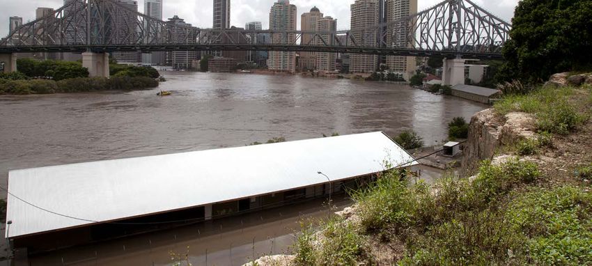
January 2021 marks 10 years since         Since then, further storm events          Brisbane is committed to a
floodwater ravaged Brisbane               and floods have occurred. Being           collaborative approach to floodplain
inundating almost 30,000 homes and        prepared for severe weather and           management, demonstrated through
businesses. The 2011 Floods was           natural disasters, such as flooding, is   our ongoing contribution to the
Brisbane’s largest national disaster in   no longer a once-in-a-lifetime event.     Brisbane River Catchment Flood
almost 40 years and the devastation       It has become part of our way of life.    Studies and Resilient Rivers Program.
to many people’s homes and
                                          Council continues to work hard to         I am keen to share with you what we
businesses was heartbreaking.
                                          make sure that Brisbane is prepared       have learned since the 2011 floods.
The disaster mobilised a ‘Mud Army’       for future flood events.                  This FloodSmart Future Strategy
of volunteers who rolled up their                                                   update provides an overview of the
                                          Adopting WaterSmart practices is
sleeves to get friends, family, virtual                                             catchment floodplain management
                                          a key priority in Brisbane. Clean,
strangers and Brisbane back on their                                                planning we have undertaken and
                                          Green, Sustainable 2017-2031 and
feet. Numbering around 25,000,                                                      outlines how we can continue to
                                          we continue to show how risk-based
and making news around the world,                                                   work together to build a resilient
                                          planning, clever construction and
these volunteers grabbed their                                                      city; a city that is safe, confident
                                          an engaged community create a
hats, gloves, sunscreen, shovels                                                    and ready for the future.
                                          liveable, resilient city.
and brooms to clean up our city.

                                                                                    Adrian Schrinner
                                                                                    LORD MAYOR
CATCHMENT FLOODPLAIN MANAGEMENT PLANNING   | 3

CONTENTS
Brisbane – A resilient city                                              4

Our floodplain management story                                          5

What have we achieved since 2011?                                        7

What Council is considering for the future                              10

How you can be prepared                                                 12

This document is...
• A framework for planning and decision-making
• A strategic guide for Council, businesses and the general public
• A suite of potential projects that could be implemented in the
  short, medium or long term
• A continuation of work undertaken under the FloodSmart Future
  Strategy 2012-2031

This document does…
• Consider flood impacts from the Brisbane River, local creeks and
  waterways, overland flow and storm tide
• Seek to continually improve Brisbane’s readiness for and resilience
  to flooding

This document isn’t…
• A statutory plan, detailed advice on specific locations or projects
  or a budget plan

This document doesn’t…
• Discuss specific management measures for storm tide and coastal hazards,
  as these will be addressed in Council’s Coastal Hazards Adaptation Strategy
4 |       BRISBANE’S FLOODSMART FUTURE UPDATE 2021

BRISBANE – A RESILIENT CITY
Brisbane is a coastal, subtropical         Flooding in Brisbane is multifaceted,   Resilience is the ability to plan,
city defined by its river and bay.         with a range of flooding types          prepare, respond and return to normal
Our lifestyle and recreation revolve       caused by different interactions        life with minimal disruption following
around the city’s many water courses.      of those elements. Brisbane has         an adverse event. It means that an
We play, relax and celebrate on            always lived with flooding, with        informed and empowered community
the banks of the Brisbane River,           impacts experienced firsthand by        will have access to the information
the tributaries and creeks that            our residents and businesses since      they need to act on to minimise
weave through our suburbs and              that time.                              the impact of future flooding.
along the shores of Moreton Bay.
                                           As our climate changes we want          The ability to be resilient is now
Our relationship with water is             to ensure our community remains         seen as one of the key attributes of
complex, but it is a key part of           safe by adapting and preparing for      a sustainable city – economically,
Brisbane’s much-loved identity.            future flood events from all sources    environmentally, socially and
                                           including river, creek, coastal and     institutionally. A resilient city balances
Flooding in Brisbane is a natural
                                           overland flow.                          community, environment, built form
process, shaped by Brisbane’s climate,
                                                                                   and infrastructure to provide a liveable
topography and geographical
                                                                                   city now and for future generations.
location on a floodplain.

       Our vision is for communities        Our vision is for growing our city      Our vision is for connected and
         on floodplains that are              and economy responsibly,              engaged communities that are

                  safe                             confident                                   ready
       because they understand their          in how we adapt to flooding.                     for flooding.
      level of flood risk and are taking
             action to manage it.
CATCHMENT FLOODPLAIN MANAGEMENT PLANNING                  | 5

  2011 flood

OUR FLOODPLAIN MANAGEMENT STORY
A catchment is an area             Flood risk management tools
of land surrounded by
natural features such as
hills, where water flows
to a common low point,
such as a creek, lake, river
or bay. A floodplain is an
area of land that is subject
to inundation by floods.
Catchment floodplain
management involves
assessing and managing
flood risks within a catchment,
or series of catchments,
to reduce the impact on            The FloodSmart Future Strategy uses four tools for flood risk
                                   management including:
people and to property.
                                   • flood-resilient buildings and infrastructure
                                   • flood awareness and information
The FloodSmart Future
                                   • land use planning and development control
Strategy 2012-2031 was developed
as an overarching strategy         • flood emergency management.
outlining Council’s approach       Up until the 1970s, flood mitigation infrastructure (e.g. dams, levees, channel
to floodplain management.          modifications) was the primary method of managing flood risks in Australia.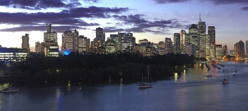
6 |    BRISBANE’S FLOODSMART FUTURE UPDATE 2021

A series of large floods in the 1970s    Over the past 10 years Council has        • Council’s Citywide Creek and
resulted in a change of focus from       committed to a series of studies            Overland Flow Path Mapping
mitigation infrastructure to land use    including the following, to provide the     Study was complete in 2017 and
planning as a means of controlling       most up-to-date technical information       provides the latest data relating
developments on floodplains.             regarding flood behaviour.                  to overland flow and previously
                                                                                     un-modelled creek flooding across
The 1990s saw a focus on flood           • Council commenced its current
                                                                                     the whole of Brisbane’s local
emergency management and                   program of creek flood studies in
                                                                                     government area.
more recently there has been               2011 and by 2015 had completed
an emphasis on providing flood             flood studies that provided the         The information provided by these
awareness and information.                 latest creek flood data for more        studies has been used to understand
                                           than 80% of urbanised areas             the consequences of flooding and
It is now recognised that best
                                           across the city.                        identify floodplain management
practice floodplain management
                                                                                   measures, through a process
requires the coordinated application     • The Brisbane River Catchment
                                                                                   known as catchment floodplain
of all of these management tools.          Flood Studies commenced in
                                                                                   management planning.
Catchment floodplain management            2012 as a partnership between
planning makes use of these tools to       the Queensland Government,              Council’s Local Floodplain
identify a range of measures to better     Seqwater and the four local             Management Plan includes a
manage flood risk within a catchment.      governments of Brisbane, Ipswich,       comprehensive and up-to-date
                                           Somerset and Lockyer Valley.            assessment of all sources of
The process of catchment floodplain
                                           This program of works has resulted      Brisbane’s flood risk, drawing
management planning considers the
                                           in the completion of the Brisbane       on a range of existing studies,
consequences of flooding on the
                                           River Catchment Flood Study in          information and management
community, environment, businesses
                                           2017 and the Strategic Floodplain       measures for future decision-
and infrastructure. It aims to:
                                           Management Plan in 2018.                making. The Local Floodplain
• reduce the flood risk to people                                                  Management Plan sets a roadmap
                                         • Council completed its Coastal
  and property                                                                     for long-term flood management
                                           Flood Study in 2015, providing
• maintain local economic                                                          that considers the possible
                                           a better understanding of tidal,
  development and growth                                                           impacts of a changing climate.
                                           storm surge and associated coastal
• ensure appropriate land                  flooding within Moreton Bay.
  use planning

• protect the local environment

• minimise impacts to
  infrastructure and services.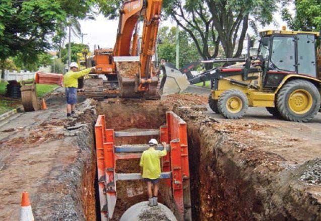
CATCHMENT FLOODPLAIN MANAGEMENT PLANNING                 | 7

WHAT HAVE WE ACHIEVED SINCE 2011?
Much work has been                OUR FLOOD AWARENESS ACHIEVEMENTS
undertaken since the              Promoting community understanding of flooding to encourage readiness.
adoption of the FloodSmart        An informed and empowered community will have access to the information
                                  they need to act, build resilience and minimise the impact of future floods.
Future Strategy, to ensure
that Brisbane is working          Council has improved the ways in           The Flooding in Brisbane Guides
                                  which it makes information available       are designed to help residents and
towards becoming a more           to residents and businesses. A range       businesses prepare for flooding and
resilient city; a city which is   of awareness tools is available online     outline simple things they can do to
safe, confident and ready.        and updated regularly with the best        be prepared.
                                  available flood study data.
Council has embraced                                                         Council’s Open Data platform

the integrated approach           First made available in 2008, the          supports re-usable, accessible,
                                  FloodWise Property Reports                 understandable and shareable
promoted by the strategy,         continue to be updated when new            Council data. Data sets are available
applying the four flood risk      flood information becomes available.       for creek, coastal and overland
management tools to deliver       The reports include information            flow flood studies, City Plan flood
                                  to ensure future building and              overlays, waterways and wetland
floodplain management             development contributes to                 assets, and stormwater infrastructure.
projects across the city.         a safe, flood-resilient city.
                                                                             The Flood Hub provides an
                                  The Flood Awareness Map                    interactive space for the community
                                  launched in 2013 and provides an           to learn about flood resilience, touch
                                  indication of the likelihood of a          and feel flood-resilient building
                                  flood occurring from one or more           materials and talk to flood engineers
                                  sources: creek, river, overland flow       about flood-resilient building
                                  and storm tide. Recent updates             strategies. More than 6300 people
                                  allow users to better understand the       have been engaged through the
                                  possible impacts of overland flow,         Flood Hub to date.
                                  while historical mapping provides
                                  the history of river floods in Brisbane.
8 |    BRISBANE’S FLOODSMART FUTURE UPDATE 2021

OUR FLOOD RESILIENT INFRASTRUCTURE AND BUILDING ACHIEVEMENTS
Maintaining and investing in flood mitigation assets to support the city’s economic growth. Designing with water
in mind, a key priority in Brisbane. Clean, Green, Sustainable 2017-2031 is helping Brisbane become an even more
attractive, liveable and resilient city.

Council has an ongoing program             Following on from technical                 Council has an ongoing CCTV
of both structural and non-                investigations, a series of backflow        inspection program of its drainage
structural flood mitigation                devices have been installed to              network to proactively identify
activities across Brisbane.                help minimise water flowing back            siltation and potential failure.
Council’s Flood Resilient Homes            up stormwater pipes.                        Following the 2011 floods, almost
Program offers homeowners at risk                                                      500 km of the stormwater network
                                           Council has invested more than
of frequent flooding from overland                                                     was inspected and cleaned to remove
                                           $87 million since 2011 with the aim
flow a free in-home service, a tailored                                                22 million litres of sludge that had the
                                           of minimising flooding impacts in
property report and an incentive                                                       potential to compromise the capacity
                                           local catchments by constructing
scheme for eligible properties.                                                        of the network.
                                           major and local drainage
The program seeks to help residents        infrastructure, obtaining drainage          Following a global competition,
prepare for, live through and then         easements and acquiring land.               Council commissioned designs
return to normal household routines                                                    for flood-resilient ferry terminals
following a flood, with the least          Council manages more than
                                                                                       and new terminals featuring the
amount of disruption. More than            800 km of urbanised open waterways
                                                                                       innovative design are now in action.
225 free in-home services have been        and approximately 4000 km of
                                                                                       Each terminal has a boat-hull-shaped
undertaken to date, with 71 homes          waterways in total. Desilting and
                                                                                       pontoon to reduce drag and a
retrofitted to improve flood resilience.   vegetation management activities
                                                                                       gangway that automatically detaches
                                           are undertaken on 40 km of creek to
During the January 2011 flood, some                                                    from the shore during floods,
                                           ensure optimum flood conveyance.
parts of Brisbane were affected by                                                     swinging behind the pontoon
water that came up from the river                                                      and out of the path of debris.
through the drainage networks
and into our streets.

Flood Hub                                  Construction of stormwater infrastructure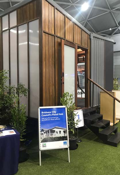
CATCHMENT FLOODPLAIN MANAGEMENT PLANNING                | 9

OUR FLOOD EMERGENCY MANAGEMENT                                                     OUR LAND USE
ACHIEVEMENTS                                                                       PLANNING ACHIEVEMENTS
We have further developed our capacity to respond to and recover from              Shaping the city’s built form to
flood events. Disasters can strike with little or no warning and it’s important    increase our resilience to flooding.
for Brisbane communities to be prepared, especially in areas that are likely
                                                                                   Brisbane City Plan 2014 is Council’s plan
to be isolated by flooding, or where there are vulnerable groups within
                                                                                   for the future development of Brisbane.
the community.
                                                                                   It guides how land in Brisbane can be
Since the 2011 Brisbane floods,            state-of-the-art FloodWise              used and developed. It also helps plan
Council has gained valuable                Information system. Council’s Creek     for infrastructure to support growth and
knowledge about disaster                   Flooding Alert Service makes use of     create a more diversified economy while
prevention, preparation, response          this information to issue alerts when   continuing to protect our city’s enviable
and recovery. Council has created          rain or flow levels in nearby creeks    way of life.
disaster management plans,                 indicate that properties may be at      As part of City Plan, a new hazard-based
guidelines and arrangements                risk of flooding.                       Flood Overlay Code was introduced,
to help residents and businesses                                                   to ensure that development adequately
                                           Council’s Be Prepared
prepare, respond and recover                                                       considers flooding. Flood Planning
                                           communication campaign informs
from various hazards, weather                                                      Areas were defined for the Brisbane
                                           the community on how to prepare
events and emergencies.                                                            River, creek flooding and overland
                                           for severe weather including
Council provides Brisbane residents        bushfires, severe storms, flooding      flow to guide future development
and visitors with a free Early             and heatwaves. It promotes the          in flood-prone areas.
Warning Alert Service to notify            awareness of Council’s online tools     Since the adoption of the Flood Overlay
them of severe thunderstorms,              including the severe weather Early      Code many practical outcomes have
destructive winds and potential            Warning Alert Service and Flood         been realised including:
flooding. The alerts are location          Awareness Maps.
                                                                                   • properties raised to achieve
based, so residents only receive
                                           Council provides pre-filled               acceptable flood immunity
warnings if their registered
                                           sandbags to residents and               • developments designed in a way
residential address may be impacted.
                                           businesses in Brisbane City to help       that maintain the conveyance of
Rainfall and stream height                 reduce the impact of flooding on          flood waters through a site
information is gathered from more          home or business. While sandbags
                                                                                   • essential electrical services suitably
than 80 hydrometric telemetry              will not stop the water entirely they
                                                                                     located to ensure public safety and
gauges located near creeks across          can reduce the amount of water
                                                                                     minimise flood recovery following
the city, which feed into Council’s        entering your premises.
                                                                                     a flood.

                                                                                   Since 2006 Council has purchased
                                                                                   112 residential properties at risk of
                                                                                   flooding with an approximate spend
                                                                                   of $58 million. Properties purchased
                                                                                   under the Voluntary Home Purchase
                                                                                   Scheme are used by Council for
                                                                                   conservation, drainage easements
                                                                                   and parklands, and it is Council’s
                                                                                   policy not to redevelop these flood-
                                                                                   prone areas for future residential use.

Early warning alert service                Emergency management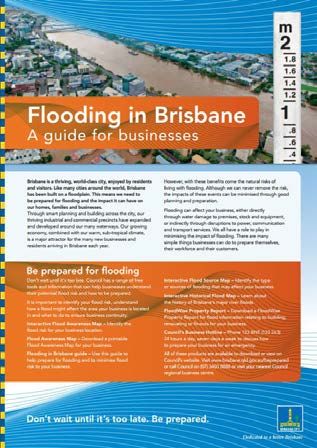
10 |   BRISBANE’S FLOODSMART FUTURE UPDATE 2021

WHAT COUNCIL IS CONSIDERING
FOR THE FUTURE

Catchment floodplain                      OUR FLOOD AWARENESS OPPORTUNITIES
management planning allows                • Maintain and update a detailed
us to better understand the                 flood risk database to support future
                                            floodplain management planning.
consequences of flooding
and identifies potential                  • Update the Flood Awareness Map
                                            and FloodWise Property Reports to
floodplain management                       reflect regional recommendations
opportunities that could                    for flood awareness mapping
be implemented in the                       and communication.

short, medium or long term                • Targeted community engagement
                                            with residents and businesses
by Council, businesses and                  located within flood areas to help
the public.                                 improve the safety and resilience
                                            of those most at risk of flooding.
The opportunities that have been
identified include an integrated          • Place-based education installations
mixture of land use planning, flood         and events to gather information
emergency management, flood                 about flooding experiences
information and awareness, and flood-       as part of consultation with
resilient infrastructure and buildings.     community groups.                       Flood awareness map
Some of the opportunities that            • Promote continued awareness
have been identified are likely to          of the future local impacts of
be applicable on a city-wide scale,         climate change across the city,
while others target specific areas          incorporating new information
of interest. Examples of potential          as it becomes available.
opportunities that Council may
consider are presented adjacent.
CATCHMENT FLOODPLAIN MANAGEMENT PLANNING | 11
OUR FLOOD RESILIENT • Developing a local flood warning • Flood planning scheme policy to
INFRASTRUCTURE system for Brisbane that would require consideration of data from
AND BUILDINGS provide enhanced warning of relevant studies (Brisbane River
Catchment Flood Studies and
OPPORTUNITIES
severe weather and flash flooding.
Local Floodplain Management
• Continue to use new information
• Continue to use new information Plan) during development
from the Brisbane River
from Council’s ongoing program assessment, through flood risk
Catchment Flood Studies
of works and from the Brisbane assessment and flood emergency
program to undertake local
River Catchment Flood Studies management plans.
evacuation planning and
program, to inform the design • Transition from a single flood
capability assessment.
of new resilient buildings planning area to multiple risk-
and infrastructure.
OUR LAND USE based planning areas for overland
• Planned road upgrade projects PLANNING flow, similar to the River and Creek
flood planning areas.
near creek crossings and
OPPORTUNITIES
waterway rehabilitation projects
to be investigated and cross- • Continue to use the best available WHAT DOES
referenced against known flood information to inform and improve COUNCIL DO WITH
mitigation opportunities and Council’s planning scheme,
THE FLOODPLAIN
MANAGEMENT
consider possible avenues including new information as it
becomes available from Council’s
for implementation.
ongoing program of works and
OPPORTUNITIES
• Consider purchasing flood- from the Brisbane River Catchment ONCE THEY HAVE
affected homes where there is Flood Studies program, including BEEN IDENTIFIED?
no viable flood-resilient measures or information relating to: Council is the largest local
alternatives exist. Consider potential – evacuation capability government in Australia, delivering
property purchase opportunities as
– available warning time a broad program of works
part of an extension to the Flood throughout our city. The process of
– flood islands cut off or
Resilient Homes Program. catchment floodplain management
isolated by floodwaters
– cumulative impacts of filling planning is just one part of the
OUR FLOOD within the floodplain. work Council undertakes.
EMERGENCY The floodplain management
MANAGEMENT • Incorporate Queensland
opportunities have been identified
OPPORTUNITIES
Government’s State Planning
initially in isolation from Council’s
Policy requirements to consider the
• Expanding Council’s creek flood broad program of works. The next
full range of flood risk and climate
step is to consider these opportunities
alert program and coverage change scenarios as part of future
alongside all of Council’s other
to allow additional residents plan-making exercises.
competing priorities. This will be
and businesses to register and
undertaken through Council’s annual
receive alerts when rain or flow
budget process, which considers and
levels in nearby creeks indicate
prioritises all of Council’s work in order
that properties may be at risk
to maximise value for the community.
of flooding.
Together with our partners, the
• Future expansions to Council’s floodplain management opportunities
existing flooded road warning will be implemented through a range
signage program to assist in of delivery plans, projects and actions
deterring traffic from entering including when scheduling new flood-
flood waters at additional locations. resilient infrastructure and buildings
During storm season message during updates to planning schemes
boards could also be used to (including during neighbourhood
display flood safety messaging. planning processes), planning new
emergency response measures
and when developing new flood
Land use planning information and awareness tools.HOW YOU CAN BE PREPARED
We all have a role to play in • FloodWise Property Report. • Flooding in Brisbane guides for
managing flood risk in our local area. Download a FloodWise Property both residents and businesses
Council has the following range Report for flood information help you prepare for flooding and
of free tools and information to relating to purchasing, building or help minimise the impact to your
help residents understand their renovating your home. home, family, property or business
property’s potential flood risk if flooding does occur.
• Early Warning Alert Service. Sign
and how to be prepared.
up to receive free alert messages For more information on being
• Interactive Flood Awareness Map. for severe weather. prepared for flooding visit
Identify the flood risk for your brisbane.qld.gov.au/beprepared,
• Responding to a flood threat web
local area, including: your nearest Council regional
page. Understand how to respond
business centre or call Council
– Flood Awareness Map to a flood, including the locations
on 3403 8888.
– download a printable of Council depots where sandbags
Flood Awareness Map are provided for collection.
for your locality
– Interactive Flood Source Map
– Identify the type or sources
of flooding that may affect
your locality
– Interactive Historical
Flood Map – learn about the
history of Brisbane’s major
river floods.
Brisbane City Council brisbane.qld.gov.au
GPO Box 1434 3403 8888
Brisbane Qld 4001
/BrisbaneCityCouncil
Every effort is made to ensure that CA20-1160949-03-5228 @brisbanecityqld
information is correct at time of publication © 2020 Brisbane City Council @brisbanecitycouncilYou can also read


