Cawthorne Neighbourhood Development Plan, July 2021 - Barnsley Metropolitan Borough ...
←
→
Page content transcription
If your browser does not render page correctly, please read the page content below
Cawthorne Neighbourhood Development Plan, July 2021

                                                      1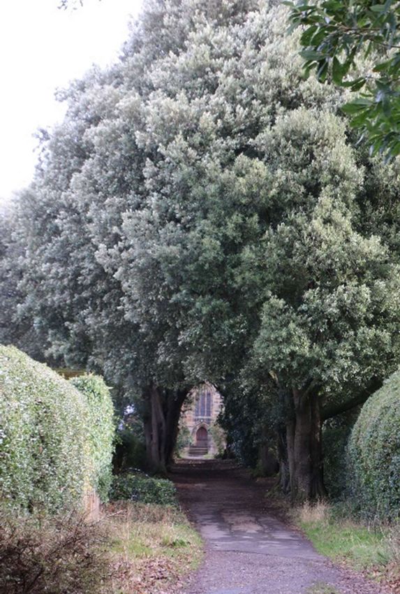
Cawthorne Neighbourhood Development Plan, July 2021

Cawthorne Parish
Neighbourhood Development Plan (NDP)
2021-2033

                          Prepared by the Cawthorne Neighbourhood Plan Steering Group
                                                  on behalf of Cawthorne Parish Council

                                                                                     2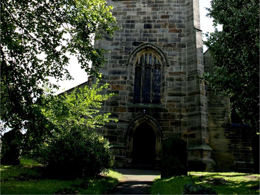
Cawthorne Neighbourhood Development Plan, July 2021

Contents

Foreword ................................................................................................................................................ 4
Executive Summary ................................................................................................................................ 5
1.      What is the Cawthorne Neighbourhood Development Plan (NDP)? ........................................... 6
2.      An NDP for Cawthorne Parish ........................................................................................................ 8
3.      Vision and Objectives ................................................................................................................... 10
4.      Planning Policies for Cawthorne Parish ....................................................................................... 12
     4.1       Landscape, Wildlife and Natural Environment ................................................................... 13
     4.2       Community and Sport Facilities ........................................................................................... 35
     4.3       Design and Heritage ............................................................................................................. 46
     4.4       Housing ................................................................................................................................. 61
     4.5       Tourism and Business ........................................................................................................... 65
Appendices ........................................................................................................................................... 68
     Appendix I Cawthorne Neighbourhood Plan Public Consultation November 2017 Comments
     Comparison Table............................................................................................................................. 69
     Appendix II Built Heritage ................................................................................................................ 74
     Appendix III Character Area Appraisals ........................................................................................... 80
     Appendix IV Conservation Area Appraisal and Management Plan Map 2 - Proposed Boundary
     Changes, Heritage Designations and Positive Buildings ................................................................. 82
     Appendix V Key issues identified in the consultation with local businesses at events held on 28th
     June and 5th September 2017 at the White Bull, Cannon Hall Farm .............................................. 83
     Glossary of Terms ............................................................................................................................. 85

All maps @Crown copyright and database rights [2019] Ordnance Survey 100055940
Cawthorne Parish Council (Licensee) License number 01000548000

                                                                                                                                                         3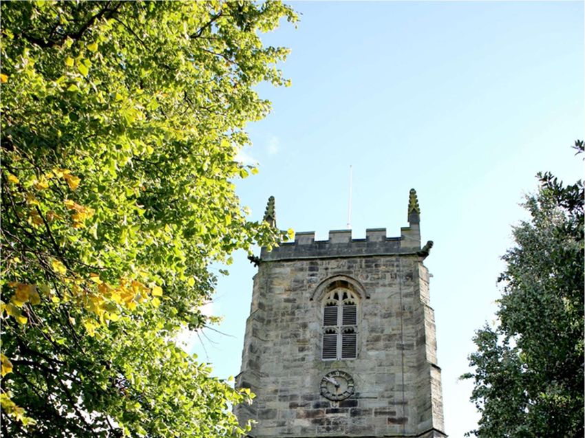
Cawthorne Neighbourhood Development Plan, July 2021

Foreword

Welcome to the Neighbourhood Development Plan (NDP) for Cawthorne Parish.

The NDP has been prepared through an extensive process of informal and formal public consultation
and was subjected to an independent examination in Spring 2020. The examiner recommended
that, subject to the proposed modifications set out in the Examiner's Report, the NDP should
proceed to a referendum.

The Plan was subject to a Referendum on 10th June 2021 with the result showing a majority in
favour of the Plan. The Cawthorne Neighbourhood Plan was made by BMBC on 14th July 2021. This
means that it is now part of the statutory development plan for Barnsley.

The NDP sets out the key planning issues for the parish and sets out planning policies to guide new
development. It builds on earlier work including the Cawthorne Parish Plan and the (recently
updated) Village Design Statement and it has been informed by the Conservation Area Appraisal and
Management Plan which forms a key part of the evidence base for design policies in the NDP.

The NDP has been developed to establish a vision for the Parish, helping to deliver the local
community's aspirations and needs up to 2033. The NDP is a statutory planning document and will
be used to help determine planning applications alongside national planning policies and Barnsley
MBC's planning policies.

Our plan has been prepared by local residents taking into account the views of residents in
Cawthorne Parish. The Steering Committee has consulted with and listened to the community, local
organisations and local businesses on a wide range of issues that will influence the well-being,
sustainability and long-term preservation of our rural community in an ever-changing technical
world.

                                                                                Tony Butterworth
                                              Chair of the Neighbourhood Plan Steering Committee
                                                                                        July 2021

                                                                                                    4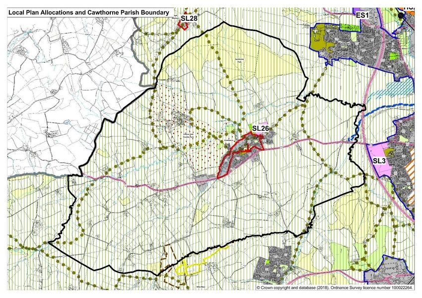
Cawthorne Neighbourhood Development Plan, July 2021
Executive Summary
The Cawthorne Parish Neighbourhood Development Plan (NDP) has been prepared by a Steering
Committee of local residents on behalf of Cawthorne Parish Council.
The NDP has been prepared within the framework of national and local (Barnsley MBC) planning
policies. It has the same plan period as the adopted Barnsley Local Plan - up to 2033. The village of
Cawthorne is inset within the Green Belt and has a conservation area, a number of listed buildings
and significant designated natural environment assets including an historic park and garden, ancient
woodlands and Local Wildlife Sites.
The NDP sets out a Vision for the parish and 6 Objectives.
Planning policies have been prepared to deliver the vision and objectives and to guide development
in Cawthorne up to 2033. The planning policies are provided under the following identified themes:
Landscape, Wildlife and the Natural Environment - these policies aim to protect and
enhance the distinctive local landscape character, key views and wildlife in the parish and
requires renewable energy schemes to minimise any adverse impacts on natural and built
heritage;
Community and Sports Facilities - important local facilities are identified and protected and
investment in new facilities is supported. Several Local Green Spaces are identified for
protection;
Design and Heritage - the Village Design Statement (VDS) was used as a basis for preparing
design policies which seek to protect the historic character of the village and promote high
quality design in new developments. Cawthorne Village Design Statement Supplementary
Planning Document was adopted by Barnsley MBC November in 20191;
Housing - a policy has been prepared to support limited infill development within the built-
up area of the village (development boundary) which provides the types and sizes of houses
that local people need; and
Tourism and Business - investment in local economic development is supported to help
provide local employment opportunities which are appropriate to the rural area.
1
See https://www.barnsley.gov.uk/media/13502/cawthorne-design-statement-spd-august-2019.pdf
5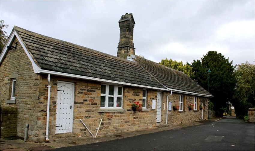
Cawthorne Neighbourhood Development Plan, July 2021

1.      What is the Cawthorne Neighbourhood Development Plan
        (NDP)?

1.1     Neighbourhood Development Plans (NDPs) are a new type of planning policy document,
        prepared by Parish Councils and some other bodies to guide new development within a
        defined area, such as a parish. They are used alongside Local Authority (here, Barnsley MBC)
        and national planning policy documents, to help determine planning applications. NDPs are
        powerful tools and present significant opportunities for local people to have a real say in
        how, and where, development should happen within their local area. An NDP can cover a
        range of planning related issues, or just have one, single policy.

1.2     It is important to remember that NDPs cannot be prepared in isolation. They have to be in
        general conformity with local strategic planning policies. These are set out in the Barnsley
        Local Plan up to 2033 which was adopted on 3rd January 2019.2

1.3     NDPs are also required to have regard to national planning policy (National Planning Policy
        Framework NPPF, Revised July 2018 and updated 19th February 20193 and other guidance).

1.4     All NDP planning policies and proposals have to be underpinned by a clear and robust
        evidence base of local opinion and technical resources, and overall the Plan has to meet a
        set of “basic conditions” set out in national guidance.

1.6     Preparing an NDP is a complex and lengthy process – see Figure 1. This is the final version of
        the NDP, and it incorporates modifications recommended in the Examiner's Report following
        the NDP examination.

                                        Figure 1 NDP Process

2
  https://www.barnsley.gov.uk/services/planning-and-buildings/local-planning-and-development/our-new-
local-plan/barnsleys-local-plan/
3
  https://www.gov.uk/guidance/national-planning-policy-framework

                                                                                                        6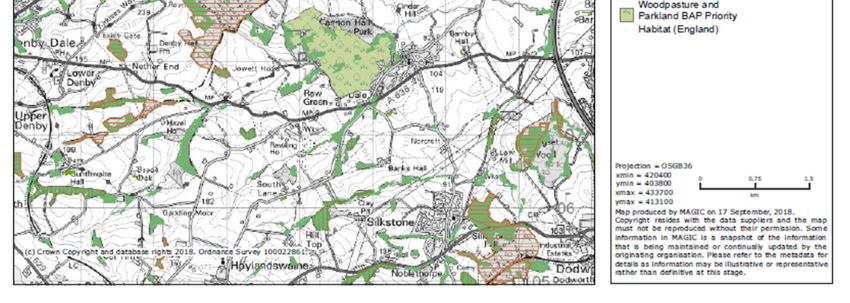
Cawthorne Neighbourhood Development Plan, July 2021

                                         Map 1 Cawthorne Parish and Designated Neighbourhood Area

                                                                                                    7
Cawthorne Neighbourhood Development Plan, July 2021
2. An NDP for Cawthorne Parish
2.1 The Parish of Cawthorne lies about 4 miles west of Barnsley and is located in the Green Belt.
The Parish comprises the village of Cawthorne and a wider rural area of scattered smaller
settlements and farms. It extends over 1500 hectares and had a population of 1,151 in the
2011 Census.
2.2 The following main businesses and tourist attractions are located within the Cawthorne
Parish boundary:
1. Naylor Industries, a multi-site organisation in the UK, has a major employment site
manufacturing clay pipes, drainage and ducting to the west of Cawthorne village
2. The tourist attraction of Cannon Hall (a country house owned by BMBC, with
gardens and a historic park)
3. Cannon Hall Farm (a family run farm and visitor centre with play facilities, café and
farm shop) which has 250 part-time employees
4. Cannon Hall Garden Centre which has a café and shop
5. A museum in the village.
2.3 The village has a primary school, village hall, church, parish room, Methodist church, post
office, village store, tea rooms, antique centre, gift shop, public house and restaurant and
two clubs.
2.4 Cawthorne Parish Council decided to prepare an NDP for the Parish in late 2016. The Parish
Council applied to BMBC for designation of the Parish as a neighbourhood area on 7th April
2017 and this was approved on 3rd May 2017. The designated neighbourhood area is the
same as the Parish boundary and is shown on Map 1 above.
2.5 Local residents were invited to an Open Meeting on 21st January 2017, following which a
Steering Group was set up consisting of interested local residents and parish councillors.
Around 130 local people attended the Open Meeting and a number of key planning themes
were agreed for further investigation and research. Volunteers were invited to a meeting on
20th February 2017 and formed a series of sub-groups to explore these themes in more
detail. The sub-groups are:
Landscape, Wildlife, Environment & Leisure
Housing, Design & Development
Tourism & Business
Infrastructure.
2.6 An Issues and Options document was prepared in 2017 and published for local, informal
public consultation with residents and stakeholders from November to December 2017. The
document and a summary leaflet set out the ideas of the sub-groups under each of the
identified planning themes.
2.7 The Issues and Options consultation was promoted on the NDP pages of the Parish Council
website and through The Barnsley Chronicle, Cawthorne Parish Magazine, Cawthorne News
and Information Facebook page. A leaflet ‘drop’ was made to all parish households advising
of the drop in event on the 25th November 2018 and posters were displayed in all public
8
Cawthorne Neighbourhood Development Plan, July 2021
places around the village. The documents were available on the website and a public drop
in event was held on 26th November from 11am to 4pm in the Parish Room. Completed
comments forms and written responses were returned to the Chair of the Steering Group or
handed into the Post Office by 15th December.
2.8 In total 17 written responses were returned. In addition, detailed written comments were
received from BMBC (Planning Policy) and also a local farmer. A summary report setting out
the responses to the Issues and Options Consultation is provided in Appendix I (this does not
deal with Barnsley MBC's objections). The degree of support from the respondents together
with their comments were considered carefully and used to inform the First Draft Plan.
2.9 The First Draft NDP for Cawthorne was published for informal public consultation from the
beginning of April until the end of April 2019. The First Draft Plan consultation was
publicised using posters displayed on two village notice boards, in three local shops and the
pub, notices in community buildings, emails to village groups and residents, the parish
magazine, a notice in the Barnsley Chronicle, the Facebook page and on the Parish Council
website. An open day was held on Sunday 28th April 2019 11am - 2pm in the Parish Room
for parishioners to view and discuss the First Draft Plan and hard copies of the NDP were
placed in Cawthorne Post Office and Cawthorne Village Store.
2.10 The consultation generated around 90 responses from local residents and an agent
representing a landowner (the Cannon Hall Estate). The vast majority of the comments were
very supportive of the NDP. There were a couple of minor amendments in response to some
of the suggestions for changes. Further details about the consultation responses are
provided on the website.
2.11 The Draft NDP was published for at least 6 weeks formal public consultation (Regulation 14)
from Monday 10th June until 5pm Wednesday 31st July 2019. There were various ways in
which local residents and organisations could find out more and comment on the document.
These included:
Reading and downloading the documents from the Parish Council website:
www.cawthorne.org.uk and
Viewing hard copies of the Draft Plan at Cawthorne Post Office and Cawthorne Village
Store.
Submitting comments by email or in writing to the Parish Clerk or by dropping them
into the box at the Post Office by 31st July 2019.
2.12 Detailed responses were submitted by Barnsley MBC and an agent, Savills, on behalf of a
local landowner, Cannon Hall Estates. There were also representations supporting the Plan
from a number of local residents and the local MP, and fairly standard responses from
several statutory consultation bodies. The Consultation Statement and accompanying 4
response tables set out the detailed comments together with the Parish Council's
consideration and any resulting changes to the Submission version of the NDP. The
Submission version of the NDP and accompanying documents were submitted to Barnsley
MBC in Autumn 2019.
2.13 Barnsley MBC published the submitted NDP for formal consultation until Friday 10th January
2020. The Plan was examined by an independent examiner in Spring 2020 and the
Examiner's Report was published in May 2020. The Examiner recommended that the
9
Cawthorne Neighbourhood Development Plan, July 2021

       Cawthorne Parish Neighbourhood Development, as modified by the recommendations set
       out in the Report, should proceed to a Referendum.

2.14   The Plan was subject to a Referendum on 10th June 2021 with the question being “Do you
       want Barnsley Metropolitan Borough Council to use the Neighbourhood Plan for Cawthorne
       to help it decide planning applications in the neighbourhood area?”. The result was 373 Yes
       and 30 No. The Plan was made by Barnsley MBC on 14th July 2021.

3.     Vision and Objectives

3.1    An NDP is required to have a vision and a clear set of objectives. The planning policies
       should be designed to meet the identified objectives.

3.2    The Vision and Objectives have been prepared by the Steering Group and are set out below.

                         Vision Statement for Cawthorne Parish NDP

        By 2033 Cawthorne will have developed an infrastructure to support
        21st century living but will retain the character of a rural village.

        Sustainable development will be promoted whilst the Parish’s built
        environment, rural heritage, green spaces and wildlife are protected
        and enhanced.

        This Vision will enable us to keep a foothold in the past whilst
        moving the Parish forward.

                                            NDP Objectives

            1. To protect and enhance the natural and physical environment
               of Cawthorne Parish including local landscape character,
               wildlife and biodiversity assets, amenity areas, green open
               spaces, open farm land, and community allotments.
               (Through Policies C1, C2, C4, C5 and C6)

            2. To support the provision of improved community leisure,
               sports and recreation facilities for future generations.
               (Through Policies C4, C5 and C6)

                                                                                                  10
Cawthorne Neighbourhood Development Plan, July 2021
3. To protect the distinctive built heritage and character of
Cawthorne Village and Parish by ensuring new development is
designed sensitively, conserves and enhances its significant
buildings, places and their setting.
(Through Policies C7, C8, C9 and C10)
4. To enhance the wellbeing of all members of our community by
supporting the provision of fair, accessible housing to meet the
needs of local people.
(Through Policy C10)
5. To preserve the unique atmosphere of the award-winning
village of Cawthorne, whilst at the same time encouraging
visitors to the area, so that business and tourism can thrive.
Local businesses will be nurtured to allow the agricultural and
rural economy to diversify and grow, enhanced by the
provision of community led sustainable green energy and
improved communication technologies.
(Through Policies C3 and C11)
11Cawthorne Neighbourhood Development Plan, July 2021
4. Planning Policies for Cawthorne Parish
All Saints Church
12Cawthorne Neighbourhood Development Plan, July 2021
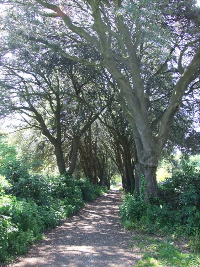
4.1 Landscape, Wildlife and Natural Environment
Church Walk
Introduction
4.1.1 Residents in Cawthorne Parish are fortunate to have a very high-quality natural and built
environment on their doorstep. The picturesque and historic village of Cawthorne is set in
an attractive valley surrounded by rolling countryside of woodlands, pasture and arable
fields with scattered farms and small holdings. Cawthorne Parish has a distinctive rural
character and is protected from major development by its location in the Green Belt.
4.1.2 This special landscape character is clearly valued by residents and visitors alike. In the
consultation on Issues and Options all 17 respondents (100%) supported policies in the NDP
to protect and enhance local landscape character and wildlife, and there were a number of
suggestions for issues that should be addressed including tackling noise and light pollution,
concerns about Himalayan Balsam, geese, pollution of Cawthorne Dike and litter and
rubbish.
13Cawthorne Neighbourhood Development Plan, July 2021
Cawthorne's Landscape Character
4.1.3 Cawthorne Parish lies within National Landscape Character Area (NCA) 38: Nottinghamshire,
Derbyshire and Yorkshire Coalfield. Barnsley Borough Landscape Character Assessment
published in 2002 (and reviewed in 2016)4 identifies several landscape character areas at a
local level. Cawthorne Parish lies within E1: West Barnsley Settled Wooded Farmland where
the key characteristics are:
• Gently rolling landform with hills and broad valleys.
• Small, medium sized and large woodlands, mainly deciduous and some coniferous.
• Substantial areas of intact agricultural land, both in arable and pastoral use.
• Irregularly shaped small, medium sized and large fields bounded by hedgerows, stone
walls and fences.
• Stone farmsteads, often with large modern outbuildings.
• Villages and hamlets set in open countryside.
• Large stone country houses set within designed parkland landscapes.
• Urban encroachment visible to the east, outside the character area.
4.1.4 The built-up area of Cawthorne village is in a fairly linear form, located in the valley bottom,
and surrounded by a rolling pastural landscape and woodlands. The landscaped estate
parkland of Cannon Hall lies to the north, east and west of the village.
Cannon Hall Estate Landscape
4.1.5 Cannon Hall Park is an eighteenth-century park created to adorn the site of a much older
house. It was formed in the earlier eighteenth century but the current form and that of its
gardens is the result of the laying out in the 1760s of Richard Woods for John Spencer and
the enlargements and modifications by Spencer’s nephew, Walter Spencer Stanhope.
4.1.6 The park is one of the earliest to be attributed to landscape architect Richard Woods and its
development is set out in the archives. It is a good example of his work and present
landscaping of the park is representative of his intentions.
4.1.7 This contributes to the significance of the landscape. The form of the pleasure grounds
survives, though the planting is largely representative of the nineteenth century. The walled
garden is in good repair and has the merit of being in full use, with several garden structures
in historic positions, though there have been modern alterations to the layout.
4.1.8 Under Walter Spencer Stanhope the park was enlarged and developed in the nineteenth
century into a typical Victorian Estate. Although the wider historic landscape is now in
divided ownership, it retains much of its visual cohesion, and recent planting has mitigated
the impact of mid twentieth century opencast mining.
4.1.9 The house and southern landscape has been in the possession of Barnsley MBC for more
than sixty years and it has become a cherished asset of the local and wider community.
Cannon Hall Environmental Factors
4.1.10 The site comprises a largely man-made historic landscape where the course of the Daking
Brook has been modified to create a chain of three lakes, referred to as the upper, middle
4
https://www.barnsley.gov.uk/media/4585/eb86-barnsley-landscape-character-assessment.pdf
https://www.barnsley.gov.uk/media/4582/eb87-barnsley-landscape-character-assessment-2016-update.pdf
14Cawthorne Neighbourhood Development Plan, July 2021
and lower in this report. Structures within the lake system comprise four weirs and a bridge,
which bisects the lower lake. Water enters the site from the Daking Brook via two inlet
culverts.
4.1.11 Over many tens of years, the lakes have been silting up and in danger of going septic in
summer. So the need has arisen to desilt them. Silt testing was undertaken and results
indicated that there was no contamination, and the silt was safe to transport and spread
without harm to human health. The silt was removed under contract in 2018 and deposited
on a low wildlife value area of grassland close by. The potential risk of spreading the invasive
American Crayfish which are present in the lakes was addressed by spreading the silt on site.
4.1.12 Barnsley Museums commissioned the production of a 10-year Management and
Maintenance Plan (MMP) that has set out the levels of resources required to sustain the
restored park to Green Flag standards. This includes the commitment to higher quality and
frequency of horticultural operations, the investment in new staff and training and exploring
and developing the volunteers’ role in the project. The MMP has set out the estimated
revenue uplift for both staffing costs and improved park maintenance to ensure that the site
is maintained to Green Flag status. This increase will ensure that the asset is well-
maintained, but that events, activities, and interpretation makes the site not only more
attractive and physically accessible, but intellectually accessible too.
Locally Important Views
4.1.13 There are several locally important views from public footpaths and seats which are valued
by local residents and visitors alike.
4.1.14 The Cawthorne Conservation Area Appraisal and Management Plan, 2019 (paragraphs 5.03
and 5.04) notes:
"On entering and leaving the conservation area from Darton Road, there are pleasing,
dynamic views of the gently curving road, lined by historic buildings and historic stone
boundary walls. Many buildings sit directly against the pavement, or with small front
gardens, and together with the boundary walls create a strong sense of enclosure here.
Along Darton Road, views can be glimpsed northwards, between buildings, of the landscape
surrounding the village. When these views are framed by historic buildings they are
particularly significant. Views are also gained eastwards towards the countryside beyond the
village. Likewise a number of footpaths provide routes and views into the surrounding
countryside from Darton Road, many of which are shown on historic maps. On the south side
of Darton Road, views can be glimpsed of historic outbuildings and the various paths leading
from the main road to the back of properties provide interesting views of often unaltered
rear elevations of historic buildings.
The land to the immediate west of the Church of all Saints provides long distance views
towards Cannon Hall, the estate which was historically so significant to Cawthorne. Views
along Taylor Hill also highlight the topography of the conservation area."
4.1.15 The key views are identified on Map 1 Spatial Analysis which is reproduced as Map 2C.
4.1.16 The Locally Important Views identified in the NDP are similar to or the same as many of the
views noted in the Conservation Area Appraisal and Management Plan, particularly those
within the village. The Locally Important Views include Views within the Village as shown
on Map 2A and Views into the Village as shown on Map 2B.
15Cawthorne Neighbourhood Development Plan, July 2021
Views Within the Village
Map 2A Locally Important Views within the Village
16Cawthorne Neighbourhood Development Plan, July 2021
View 1 - Looking south west from Darton Road towards village centre and church
View 2 - Looking east through Church Walk towards Church
View 3 - Looking north west across allotments towards Margery Woods
17Cawthorne Neighbourhood Development Plan, July 2021
View 4 - Looking north east to Clapper Bridge
18Cawthorne Neighbourhood Development Plan, July 2021
Views into the Village
Map 2B Views into the Village
19Cawthorne Neighbourhood Development Plan, July 2021
View 1 - Looking south east from Cannon Hall towards Village
View 2 - Looking south east from Margery Wood towards Village
View 3 - Looking south east from High Hoyland towards Village Centre
20Cawthorne Neighbourhood Development Plan, July 2021
View 4 - Looking east from football ground towards St Julian's Estate and Village
View 5 - Looking south west from St Julien's Estate towards windfarm
4.1.17 The Conservation Area Appraisal and Management Plan prepared for Cawthorne Parish
Council in 2019 includes proposed policies for the conservation area. These include "D1 Key
views into and within the conservation area shall be carefully considered, in particular key
views of the Church of All Saints." Map 1 Spatial Analysis of the Appraisal identifies these
Key Views and is reproduced as Map 2C Spatial Analysis, Conservation Area Appraisal and
Management Plan in the NDP.
21Cawthorne Neighbourhood Development Plan, July 2021
Map 2C Map 1 Spatial Analysis, Conservation Area Appraisal and Management Plan
4.1.18 The updated Cawthorne Village Design Statement Supplementary Planning Document
provides design guidance for development on farms and at Cannon Hall and the Historic Park
and Garden. This has been incorporated in Policy C1.
4.1.19 Policy C1 adds further local detail to Local Plan Policy D1 Design which sets out that high
quality development will be expected to respect, take advantage of and reinforce the
distinctive character and features of Barnsley, including: topography, Green Infrastructure
assets, important habitats, woodlands and other natural features, views and vistas to key
buildings, landmarks, skylines and gateways, heritage, townscape and landscape character
including the scale, layout, building styles and materials of the built form. This policy also
adds detail to the general aim of Local Plan Policy BI01 Biodiversity and Geodiversity which
seeks to protect and improve these aspects of the environment.
22Cawthorne Neighbourhood Development Plan, July 2021
Policy C1 Protecting Local Landscape Character
The location, design and layout of new development should respond positively
to Cawthorne Parish's local landscape character as set out in the Barnsley
Borough Landscape Character Assessment and regard should be had to Barnsley
Local Plan Policies D1 Design, BI01 Biodiversity and Geodiversity and the
Cawthorne Village Design Statement adopted Supplementary Planning
Document5.
Development proposals should be designed to minimise any adverse visual
impacts on the identified Locally Important Views shown on Map 2A and Map
2B, and the Key Views into and within the conservation area as shown on Map 1
Spatial Analysis of the Conservation Area Appraisal, and reproduced as Map 2C.
Where a development proposal impacts on an identified Locally Important View
or Key View, a Landscape and Visual Impact Assessment or similar study should
be carried out to ensure that scheme is designed and sited sensitively and
appropriately.
In the wider rural area, new farm buildings should be designed and sited to
blend into the landscape and when appropriate screened by planting of native
trees and shrubs. The uses of materials for agricultural buildings that are visually
complementary to the rural landscape setting are encouraged. Dark brown or
grey-green roofing, lighter brown or timber cladding and if possible stone
coloured block work should be encouraged. Buildings shall not be clad or have a
roof treatment in materials which are highly reflective or in bright intrusive
colours.
Proposals which affect Cannon Hall and Cannon Hall registered park and
garden should protect their features and setting. In particular drystone walls
and hedgerows shall be protected and retained when possible. Planting shall
be in native species and not include fast growing conifers such as Leylandii.
Wildlife in Cawthorne Parish
4.1.20 There are several areas of wildlife significance in the Parish, see Maps 3,4,5 and 6. These
include a number of Ancient Woodlands (Map 3) such as Margery Wood / Cawthorne Park,
Shuff Wood, Susannah Spring, Whin Moor Plantation and Bull Haw Carr (part), Banks Wood
and Low Mill Wood. Local Wildlife Sites (LWS) include Margery Wood, Daking Brook, and
Wool Greaves Meadows.
4.1.21 Significant habitats found at the LWS include:
Margery Wood (Map 4): Ancient woodland, Lowland Mixed Deciduous Woodland,
Ponds. Margery Wood is located in a gently south-facing landscape which is mainly
5
https://www.barnsley.gov.uk/media/13502/cawthorne-design-statement-spd-august-2019.pdf
23Cawthorne Neighbourhood Development Plan, July 2021
agricultural although there are linking and adjacent large blocks of woodland. The
site lies just north of the historic parkland of Cannon Hall Historic Park and Garden
and south of High Hoyland village. The majority of the site comprises broadleaved
semi-natural woodland dominated by sycamore with abundant sessile oak.
Contiguous broadleaved woodland forms a large block of ancient and semi-natural
woodland. Those parts of Margery Wood that are not on the register of ancient
woodland are designated as ancient replanted woodland. The extensive
broadleaved woodland cover has some areas of coniferous plantation in the western
and southern parts. There are also broad rides and tracks through the canopy, with
strips of modified neutral grassland and some marshy grassland. There is also some
scrub over a damp grassland mix6 (LWS Assessment and Phase 1 Survey, January
2011).
Daking Brook (Map 5): River, stream with White-clawed Crayfish. The source of
Daking Brook is found between Upper Denby and Ingbirchworth to the west of the
Borough of Barnsley. The brook flows west to east and on its way east the Brook
passes through a landscape of arable and pastoral farmland. The brook is often tree
lined or surrounded by a thin belt of semi-natural broadleaved woodland. It is
largely unmodified and unpolluted and is a good example of an upland stream7.
Wool Greaves Meadow (Map 6): Lowland Meadows, Lowland Dry Acid Grassland,
Hedgerows. Wool Greaves meadow is a complex of five former fields of mainly semi-
improved grassland, the eastern three exhibit predominantly species of neutral
habitats, whilst the westernmost one shows more acidic tendencies. A small area of
semi-natural broadleaved woodland occupies the south-western corner of the site
that once formed the smallest of the fields. A species-rich native hedgerow with
trees forms one of the field boundaries with the ancient woodland indicator species
dog’s mercury (Mercurialis perennis) suggesting that it may be of some age. This
species is also found in the more fragmentary former hedges to the east. The
western hedges are still intact and are species-poor with trees; those in the east of
the site are more fragmentary and comprise open lines of trees and shrubs rather
than dense hedgerows. At the time of the 2010 survey the fields were grazed by
horses8.
6
12. Margery Wood LWS Assessment and Phase 1 Survey Prepared by TEP for Barnsley Metropolitan Borough
Council January 2011 (Edited December 2011)
7
17. Daking Brook LWS Assessment and Phase 1 Survey Prepared by TEP for Barnsley Metropolitan Borough
Council January 2011 (Edited December 2011)
8
58. Wool Greaves Meadow LWS Assessment and Phase 1 Survey Prepared by TEP for Barnsley Metropolitan
Borough Council January 2011 (Edited December 2011
24Cawthorne Neighbourhood Development Plan, July 2021
Map 3 Ancient Woodlands
25Cawthorne Neighbourhood Development Plan, July 2021
Map 4 Margery Wood
26Cawthorne Neighbourhood Development Plan, July 2021
Map 5 Daking Brook
27Cawthorne Neighbourhood Development Plan, July 2021
Map 6 Wool Greaves Meadow
28Cawthorne Neighbourhood Development Plan, July 2021
4.1.22 There are also a couple of Local Geological Sites at Bentcliffe Hall Lane Quarry and
Cawthorne Bypass - see Maps 7 and 8.
Map 7 Bentcliffe Hall Lane Quarry Local Geological Site
29Cawthorne Neighbourhood Development Plan, July 2021
Map 8 Cawthorne Bypass Local Geological Site
30Cawthorne Neighbourhood Development Plan, July 2021
Water Quality
4.1.23 There is a significant ongoing problem of pollution of the streams of Cawthorne. Canada
Geese numbers are an issue around Cannon Hall and should be controlled. Following a
request by the Parish Council for further information, the Environment Agency advised that
"The overall classification in 2016 is poor for Cawthorne Dyke from Source to River Dearne in
2016. The reasons for not achieving good status include pressures from continuous sewage
discharges and rural land management. Currently the Environment Agency has an ongoing
active water quality investigation in the Daking Brook including Cannon Hall Lakes and
downstream Cawthorne Dike. Two significant permitted private wastewater treatment
works discharge into Daking Brook/Cawthorne Dike, Cannon Hall Farm and Barnsley Council
Cannon Hall. The local Land and Water Team are currently working with both operators to
understand their wastewater treatment systems and achieve compliance with their permit to
minimise their impact on the receiving watercourse. In the summer of 2018 the Environment
Agency provided pollution prevention advice to Barnsley Council regarding the Cannon Hall
Lakes restoration project. During these works water quality monitoring was undertaken by
Barnsley Council contractors and no measurable impact was recorded in the downstream
Cawthorne Dike. Tanyard Beck, receives a permitted continuous treated sewage effluent
from Yorkshire Water’s Cawthorne sewage treatment works. The Environment Agency plan
to make an inspection of this sewage works in the coming weeks."9
4.1.24 There are still trout at Cinder Hill Farm, but the area of the Cascades and the whole of
Cawthorne Dyke from Cannon Hall ponds to the confluence with the Dearne, has been
invaded by the non-native signal crayfish which is a problem without a known solution. The
species is posing a serious threat to the remaining native white clawed crayfish which exist in
the upper reaches of the Daking Brook system. Tanyard Beck has trout above Dark Lane.
4.1.25 Cawthorne lost its herd of Fallow deer about 40 years ago, as a result of poaching, however
Roe Deer are now establishing themselves in the area. As badger bating is now under
control, the number of badgers in the area is also recovering. Whilst grass snakes are
common in the area, the local ecologist community do not currently believe that adders are
present anywhere in the Borough. Water voles are no longer found in Cawthorne, which is
probably as a result of predators such as mink, which have been spotted on occasion. Water
shrews have been seen, and otters are in the process of re-colonising the catchment and
have probably already been present recently in the Parish.
4.1.26 There are a number of species of birds in the area, including the hobby, robin, woodpecker,
blackbird, curlew, cuckoo, woodcock and jay. Birds of prey are also relatively common, for
example: the barn owl, tawny owl, little owl, kestrel and sparrow hawk; buzzards have also
returned to the area and red kites were observed on several occasions in 2018.
4.1.27 With regards to flora, there are about 430 species in the Parish, which is deemed to be very
good for the coal measures of South Yorkshire. In 2004 John Lees prepared an illustrated list
of Cawthorne flora, but since this list was prepared some species have been lost, possibly
due to climate change or to modern farming practices. The lost species include Moschatel,
Giant Bell Flower, and Broad Helleborine Orchid.
9
For more water quality information please see https://environment.data.gov.uk/catchment-
planning/WaterBody/GB104027063150
31Cawthorne Neighbourhood Development Plan, July 2021
4.1.28 Ecological corridors such as mature trees and hedgerows are valuable to wildlife and should
be retained wherever possible in new development. The Daking Brook / Cawthorne Dyke
corridor is considered to be the most valuable wildlife corridor in the Parish. Wildlife
friendly landscaping and building designs (such as incorporating ponds, bat and bird boxes
and using local species such as pedunculate oak in planting schemes etc) can help to support
and enhance local biodiversity in new developments.
4.1.29 Barnsley's Biodiversity Action Plan10 provides more detailed information about species action
plans and habitat action plans for the Barnsley area.
Biodiversity at Cannon Hall Historic Park and Garden
4.1.30 The Cannon Hall site comprises a mixture of habitats within a rural and agricultural area.
There are 14 different habitats on site, of which seven are covered in the Barnsley Local
Biodiversity Habitat Action Plan (BLBHAP, 2008-2012, under review):
• HAP2 Lowland Mixed Deciduous Woodland
• HAP4 Wood Pasture and Parkland
• HAP5 Hedgerows
• HAP9 Lowland Dry Acidic Grassland
• HAP14 Reedbeds
• HAP15 Ponds
• HAP16 Rivers
4.1.31 Daking Brook is designated as a ‘Local Wildlife Site’ within the site boundary and has ancient
woodland indicators and has a Species Action Plan SAP20 for native bluebells Hyacynthoides
non-scripta, as this ground flora species is protected under the Wildlife and Countryside Act
and is indicative of ancient woodland. Veteran trees are a valuable ecological resource and
provide habitat for a wide variety of invertebrates, fungi and roosting bats.
4.1.32 Species Action Plans have been produced for all bat species in the Borough plus great
crested newts. Water voles are not believed to be present and that could be due to
occasional presence of the non-native American mink.
4.1.33 The park is well-recognised for the importance of its flora and fauna. It has a superb array of
ancient and veteran trees which probably support a number of bat species roosts. In
addition to be being a registered Historic Park and Garden, it is also designated as a:
• Traditional Orchard BAP Priority Habitat
• Deciduous Woodland BAP Priority Habitat and
• Wood pasture and Parkland BAP Priority Habitat listed on the national inventory of
woods and trees.
4.1.34 The parkland’s mosaic of grassland habitats of varying aspect and species composition, with
many plantings of specimen trees contributes to this richness. Many of the trees are of
significant age, size and visual appeal. The range of topography, habitat and use means that
Cannon Hall Park and Garden can support a burgeoning biodiversity and is increasingly
playing an important ecological role, although this is critically hampered by the silting up of
the lakes and issues of invasive species, which are the subject of the 10-Year Management
and Maintenance Plan.
10
http://www.barnsleybiodiversity.org.uk/
32Cawthorne Neighbourhood Development Plan, July 2021
4.1.35 Policy C2 adds further local detail to Local Plan Policy GI1 Green Infrastructure which sets
out that BMBC will protect, maintain, enhance and create an integrated network of
connected and multi-functional Green Infrastructure assets that enhance biodiversity. This
policy also adds detail to the general aim of Local Plan Policy BI01 Biodiversity and
Geodiversity which seeks to protect and improve these aspects of the environment.
Policy C2 Protecting Local Wildlife
Wildlife, green infrastructure and habitats will be protected in accordance with
Local Plan policies GI1 Green Infrastructure, BI01 Biodiversity and Geodiversity
and the associated adopted supplementary planning guidance. Important
designated natural environmental assets requiring priority protection are shown
on Maps 3, 4, 5, 6, 7 and 8.
Wherever possible, landscaping schemes should incorporate locally prevalent
species and provide areas of new habitat, such as grassland, deciduous
woodland, wood pasture and parkland, ponds and water courses to support
local wildlife.
Development should take into consideration the need to protect existing wildlife
which may be using local buildings as habitats, such as barn owls which are
known to nest locally. Buildings should incorporate bird nest boxes and roosting
opportunities for bats wherever possible.
Lighting schemes should be designed sensitively to reduce any adverse impacts
on wildlife.
Renewable Energy
4.1.36 The NPPF11 states that except for applications for the repowering of existing wind turbines, a
proposed wind energy development involving one or more turbines should only be granted
development where the development site is in an area identified as suitable for wind energy
development in a Local or Neighbourhood Plan and following consultation, it can be
demonstrated that the planning impacts identified by affected local communities have been
fully addressed and therefore the proposal has their backing. In applying these
considerations, suitable areas for wind energy development will need to have been allocated
clearly in a Local or Neighbourhood Plan. The Parish Council does not consider it
appropriate at the current time to include such a site allocation in Cawthorne NDP.
4.1.37 Other types of renewable / low carbon energy schemes are generally less contentious such
as solar schemes, geothermal and water power.
4.1.38 Renewable energy schemes support sustainable development by reducing carbon emissions,
which contribute to climate change. However, in a sensitive location such as Cawthorne,
11
Paragraph 154 of the NPPF
33Cawthorne Neighbourhood Development Plan, July 2021
where there is a conservation area and other heritage assets, schemes such as solar panels
can have an adverse visual impact.
4.1.39 The responses to the consultation on Issues and Options included comments suggesting that
consideration should be given to a hydro-electric scheme at the weir below Cinder Hill and
the NDP should seek to control solar panels and photo voltaic panels in the conservation
area due to potential visual impacts.
4.1.40 NDP Policy C3 provides locally appropriate detail for proposals under Local Plan Policy RE1
Low Carbon and Renewable Energy which requires such development to have no significant
harmful effects on such issues as character, biodiversity, heritage assets, views and
highways.
Policy C3 Renewable Energy
Proposals which have an unacceptable adverse impact on the Registered Park
and Garden of Cannon Hall will be resisted.
Proposals for solar panels and solar voltaic schemes should be designed and
sited sensitively so that they do not have an adverse visual impact on the
conservation area and other nearby heritage assets.
34Cawthorne Neighbourhood Development Plan, July 2021
4.2 Community and Sport Facilities
Parish Room
4.2.1 Cawthorne village has a range of local community and recreational facilities which are well
used and highly valued by local residents. In addition to the village hall and primary school,
there is Parish church (Church of England), a Methodist chapel, chapel room and Parish
Room.
4.2.2 The cricket ground and football field are used by Cawthorne Cricket Club and Cawthorne
Football Club. The village green is used and enjoyed by local residents both as an open space
for informal recreation and for village fetes.
4.2.3 There are several issues linked to the cricket ground and football field. The land on which
the football field is located is owned by Stanhope Fraser Trust and an extension to the three-
year tenancy agreement is being explored to help assist with applications for funding to
support investment in local facilities. Other clubs could also be encouraged to rent the pitch.
Development at the cricket club is constrained by the club's location in the Green Belt,
surrounded by a Registered Park and Garden.
4.2.4 There is a popular play area at the back of Orchard Terrace and there are allotments at
Tivydale, Church Walk and behind the Methodist Church. The allotments are currently on a
temporary lease from Cannon Hall Estate (managed as SW Fraser Settlement Fund by
Savilles). The allotments are to be registered as an Asset of Community Value and the Parish
Council is currently working to promote information on how to obtain an allotment, and to
35Cawthorne Neighbourhood Development Plan, July 2021
encourage local residents and groups to consider renting one12. The community facilities are
shown on Map 9 and recreational facilities are shown on Map 10.
4.2.5 The responses to the consultation on Issues and Options demonstrated support for a policy
in the NDP which identifies local community facilities and supports investment to improve
them with 16 responses (94% of respondents) agreeing that the NDP should include such a
policy. Comments included concerns that the playground facilities are inadequate and there
are safety issues with the railings on the A635 edge of the Village Green. The Village Green,
Recreation Ground, orchard site and Football pitch were all noted as important.
Cricket Ground
4.2.6 Policy C4 identifies those local community facilities in Cawthorne which are protected under
Local Plan Policy E7 Loss of Local Services and Community Facilities in Villages; this protects
local services and community facilities in villages; changes of use to new uses will only be
permitted where the business or facility cannot be economically successful; or the change of
use would not have a significant effect on the ability of local people to access local services.
Evidence of local community support for re-provision should be provided through the use of
local residents' surveys. The Parish Council in consultation with Barnsley MBC can provide
advice about the most effective local methods of community consultation and engagement.
Policy C4 Protecting and Enhancing Community Facilities
The following local community facilities are of recognised importance:
1. Village Hall
12
This is a non-planning issue. The current rent is £16 pa but this fee could change during the course of the
Plan.
36Cawthorne Neighbourhood Development Plan, July 2021
2. Museum
3. Church and Parish Room
4. Methodist Chapel
5. Cawthorne School
These are shown on Map 9.
There will be a presumption in favour of the re-use of such facilities for
community uses unless:
1. Clear evidence is provided to demonstrate that there is no longer a need
for the facility to remain in community use; or
2. The proposal includes alternative provision, on a suitable site within the
village of Cawthorne, of equivalent or enhanced facilities which are
accessible by walking and cycling and have adequate car and cycle
parking including catering for those with disabilities, and evidence can be
provided of appropriate local community support for the re-provision.
Development which contributes towards the improvement of existing, or
provision of new community and educational facilities will be supported subject
to the compliance with other statutory policies.
37Cawthorne Neighbourhood Development Plan, July 2021
Map 9 Protected Community Facilities
38Cawthorne Neighbourhood Development Plan, July 2021
4.2.7 The allotments behind Horncroft (4a) are located in close proximity to the safeguarded land
at Darton Road (Site SL26 North of Darton Road, Cawthorne in Barnsley Local Plan). The
allotments may come under pressure at a future date when the Local Plan is reviewed and
consideration will have to be given to access in relation to the proposed development site,
should it come forward as a site allocation.
4.2.8 Local Plan Policy GS1 Green Space protects recreational areas generally. Policy C5 identifies
local recreational facilities for protection and supports investment in new facilities. Once
again, evidence of local community support for re-provision should be provided through the
use of local residents' surveys, taking into account the advice of the Parish Council about the
most effective local methods of community consultation and engagement.
Policy C5 Protecting and Enhancing Recreational Facilities
The following recreational facilities are of recognised importance:
1. Cricket Ground
2. The Orchard Play Area
3. Allotments: 4a: Allotments behind Horncroft, 4b: Allotments at Church
Walk and 4c: Allotments opposite school
4. Peace Gardens
5. Football Field
6. Village Green
These are shown on Map 10.
There will be a presumption in favour of the re-use of such facilities for
recreational and health type uses. The change of use of these existing facilities to
other uses will not be permitted unless the following can be demonstrated:
1. The proposal includes alternative provision, on a suitable site within the
village of Cawthorne, of equivalent or enhanced facilities which are
accessible by walking and cycling and have adequate car and cycle
parking including catering for those with disabilities; and
2. Developers can provide evidence of appropriate local community support
for the re-provision.
Otherwise, developers should demonstrate that there is no longer a need for the
facility or there is evidence that the facility is no longer viable.
Development which contributes towards the improvement of existing, or
provision of new recreational facilities will be supported. Proposals for new
facilities will be supported subject to compliance with other statutory planning
policies.
39Cawthorne Neighbourhood Development Plan, July 2021
Map 10 Protected Recreational Facilities
40Cawthorne Neighbourhood Development Plan, July 2021
Local Green Space
4.2.8 NDPs can identify areas of land known as Local Green Space which is of particular local
significance and which should be protected from new development in a similar way to Green
Belt. In the consultation on Issues and Options 14 respondents (82% of respondents)
supported the inclusion of a policy in the NDP and suggested potential Local Green Spaces
could include the Village Green, Recreation Ground, Orchard Site and Football Pitch, which
are all protected in Policy C5 above. Local Green Space designation is for the small,
incidental open spaces around the village that help to contribute to local character, for
instance those identified in village design statement.
4.2.9 The NDP has to set out clearly the justification for such areas and this is set out in the NPPF:
99. The designation of land as Local Green Space through local and neighbourhood plans
allows communities to identify and protect green areas of particular importance to them.
Designating land as Local Green Space should be consistent with the local planning of
sustainable development and complement investment in sufficient homes, jobs and other
essential services. Local Green Spaces should only be designated when a plan is prepared or
updated, and be capable of enduring beyond the end of the plan period.
100. The Local Green Space designation should only be used where the green space is:
a) in reasonably close proximity to the community it serves;
b) demonstrably special to a local community and holds a particular local significance, for
example because of its beauty, historic significance, recreational value (including as a playing
field), tranquillity or richness of its wildlife; and
c) local in character and is not an extensive tract of land.
Table 1 Local Green Space Justifications
Local Green Space Reasonably Demonstrably Local in Character
Close to Special
Community
1. Side of Methodist Chapel This Local The space includes It is a small
Green Space a commemorative contained space
is located in bench paid for by next to the
the heart of the summer fete Chapel.
the village, group and includes
close to trees of local
residential significance to the
areas and community. It is
shops and the important to the
Methodist setting of a
Chapel. proposed non-
designated heritage
asset (the Chapel)
and provides a
place of rest and
relaxation for
visitors, walkers
and residents.
41Cawthorne Neighbourhood Development Plan, July 2021
Local Green Space Reasonably Demonstrably Local in Character
Close to Special
Community
2. Woodland and Millstone Marks Natural habitat of Small space
entrance to many birds and surrounded by
village and animals and roads.
close to enhances the
residential approach to the
areas. village, acts as a
buffer to the main
A635 road.
3. Entrance to Park Surrounded Green space which Small enclosed
by residential was originally part space
areas of the primary
access from the
village into Cannon
Hall Park and
therefore of
historical
significance.
42Cawthorne Neighbourhood Development Plan, July 2021
Map 11a Local Green Space 1
43Cawthorne Neighbourhood Development Plan, July 2021
Map 11b Local Green Spaces 2 and 3
44Cawthorne Neighbourhood Development Plan, July 2021
4.2.9 Local Green Space would be considered to fall under Green Infrastructure as protected in
Local Plan Policy GI1.
Policy C6 Local Green Spaces
The following are designated as Local Green Spaces:
1. Side of Methodist Chapel
2. Millstone and Woodland
3. Entrance to the Park.
These are shown on Maps 11a and 11b.
The NPPF advises that proposals to develop local green space will be considered
in relation to green belt policy. This establishes a presumption against
development in order to protect the landscape character and openness of these
areas. Development is only allowed in very special circumstances. This means
that these areas will be retained as local green space unless there are special
circumstances to allow development or it is considered as appropriate ancillary
development, which does not reduce the openness or character of the green
space.
45Cawthorne Neighbourhood Development Plan, July 2021
4.3 Design and Heritage
The Cross
4.3.1 Cawthorne residents are very fortunate to live in such an attractive village with its long
history and strong sense of identity. The NDP has a significant role in helping to protect the
special character of Cawthorne Parish and to ensure new development and changes to
existing buildings and places are designed to be sympathetic to built heritage and locally
significant features such as green spaces and streetscapes.
4.3.2 Cawthorne has a Conservation Area focussed on the core of the village and also has 81 listed
buildings in the Parish. A complete list of Listed Buildings is provided in Appendix II Built
Heritage.
4.3.3 The extent of the Conservation Area is shown on Map 12.
46You can also read