CITY OF BRANTFORD Oak Park Road Extension Municipal Class Environmental Assessment Study Virtual Public Information Centre #1 Question and Answer ...
←
→
Page content transcription
If your browser does not render page correctly, please read the page content below
CITY OF BRANTFORD

            Oak Park Road Extension
Municipal Class Environmental Assessment Study

      Virtual Public Information Centre #1

          Question and Answer Video

                 DECEMBER 18, 2020

                                                 1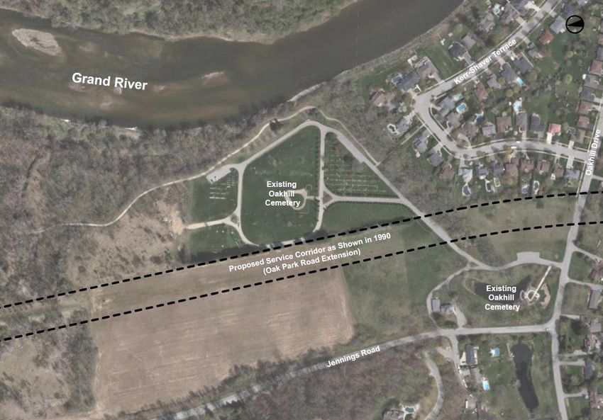
OVERVIEW
The City of Brantford is undertaking a Municipal Class
Environmental Assessment (EA) to study an extension of Oak
Park Road between the Kramer’s Way / Hardy Road intersection
and Colborne Street West.

The first Virtual Public Information Centre (PIC) was held online
beginning November 27, 2020 with the PIC comment period
closing on December 11, 2020.

To date, the project team has received approximately 100
comments from the virtual PIC.

The project team is working to provide individual responses to all
those who provided input. All individual comments are expected to
be responded to starting the week of December 21st and
completed by January 2021.

Input is welcomed at all phases of the Environmental Assessment
Study and the comment form remains open on the City’s project
website at www.Brantford.ca/OakParkRoad.

                                                                     2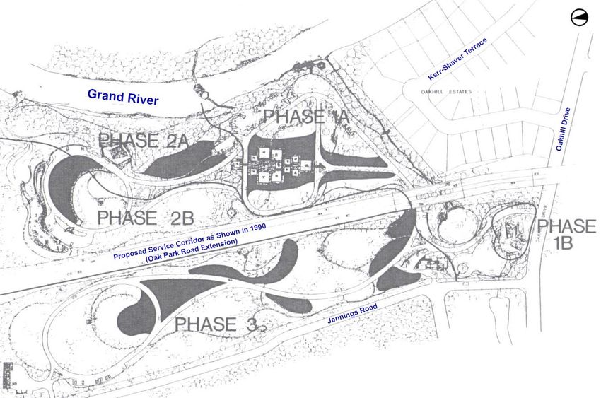
QUESTIONS AND ANSWERS
This presentation provides responses to commonly asked questions received at the first Public
Information Centre.

There are a total of three (3) additional Public Information Centres planned for this
Environmental Assessment.

                             Public     • The Municipal Class Environmental Assessment process being followed;
     November 2020        Information   • The study background and existing conditions of the study area; and
                            Centre #1   • The preliminary evaluation of Alternative Solutions.

                             Public     • The detailed evaluation of Alternative Solutions;
  February / March 2021   Information   • The recommended Alternative Solution(s); and
                           Centre #2    • Next steps in the project.

                             Public
                                        • Alternative Design Concepts for the Preferred Solution(s); and
    April / May 2021      Information
                                        • Detailed inventory of natural, cultural, economic and environmental impacts
                           Centre #3

                             Public     • The evaluation and selection of the Alternative Design Concept(s);
    June / July 2021      Information   • The Preliminary Preferred Design Concept;
                           Centre #4    • Anticipated impacts and mitigation measures; and next steps in the project

                                                                                                                        3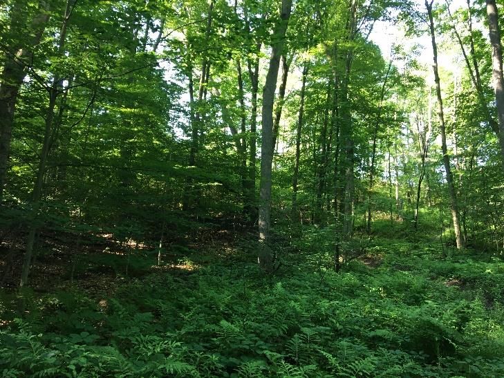
Question #1: Is the city’s plan to construct the Oak Park Road
 Extension considered a “done deal” and will there be additional
 opportunities for public input?
 Five (5) phases of the Municipal Class Environmental Assessment (MCEA) process:

      Summer 2020                 Fall / Winter 2020                    Spring 2021                      Summer 2021                           TBC

         PHASE 1                        PHASE 2                            PHASE 3                          PHASE 4                           PHASE 5
   Problem/ Opportunity           Alternative Solutions          Alternative Design Concepts        Environmental Study Report             Implementation

• Notice of Study             • Development of Alternative       • Development of Alternative       • Environmental Study Report    • Project Proceeds to Detailed
  Commencement                  Solutions                          Design Concepts for              • Notice of Study                 Design and Construction
• Establishment of Problem/   • Inventory of Natural, Cultural     Preferred Solution                 Completion                      (Timing to be confirmed)
  Opportunity Statement         and Economic Environment         • Detailed Inventory of Natural,   • 30-Day Public Review Period
                              • Evaluation of Alternative          Cultural and Economic
                                Solutions                          Environment
                              • Public Information Centre        • PIC #3
                                (PIC) #1                         • Evaluation of Alternative
                                                                   Design Concepts
                                      We Are Here                • Selection of Preferred Design
                                                                   Concept
                              • Selection of Alternative         • PIC #4
                                Solution(s)                      • Preliminary Design Drawings
                              • PIC #2                             for Preferred Design Concept

                                                                                                                                                              4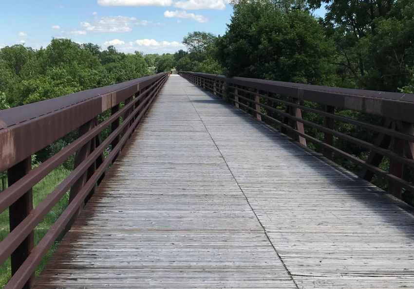
Question #2: Has the City engaged with Indigenous Communities
as part of the project consultation process?
The City of Brantford has engaged with the Six Nations of the Grand River and Mississaugas of the Credit First Nation
communities on this project.

Two (2) meetings have been held thus far with both representatives of the Six Nations of the Grand River and
Mississaugas of the Credit First Nation.

The City has committed to regular meetings with representatives from both Six Nations of the Grand River and
Mississaugas of the Credit First Nation throughout the course of the study to keep their respective communities updated
on study progress and findings and has agreed to share all relevant technical reports with them for their review and their
inputs.

                                                                                                                         5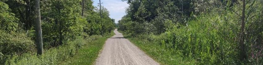
Question #3: What are the expected impacts to the Oakhill Cemetery?

                      Source: Master Plan Report for Oakhill Cemetery (March 1990)

                                                                                     6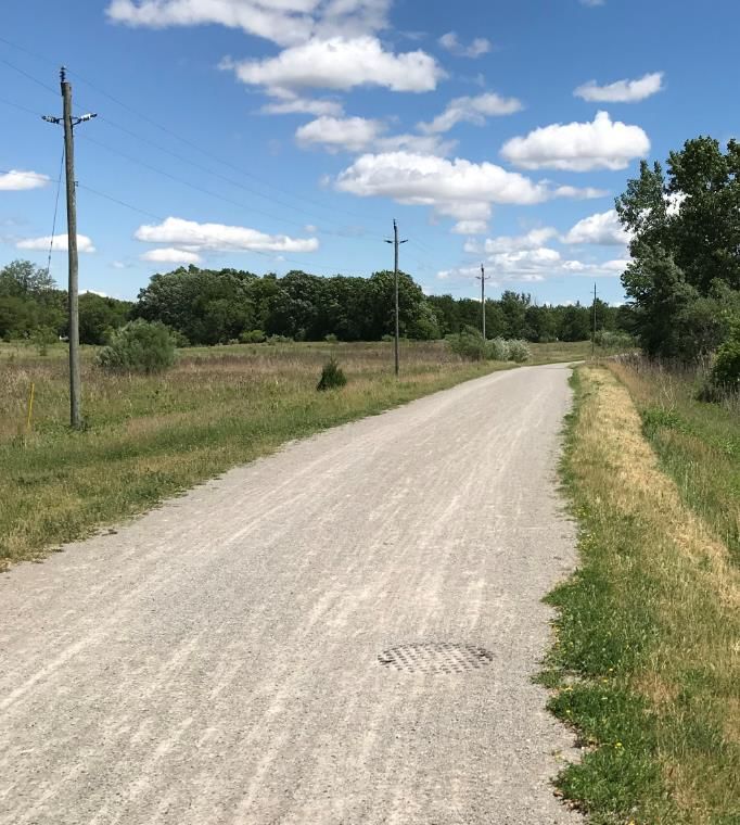
Question #3: What are the expected impacts to the Oakhill Cemetery?

                              Existing Conditions

                                                                      7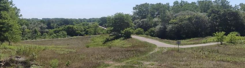
Question #4: What are the expected impacts to terrestrial and
aquatic habitats including short term and long-term effects? There
are many habitats in the study area that should be considered.

                                                                 8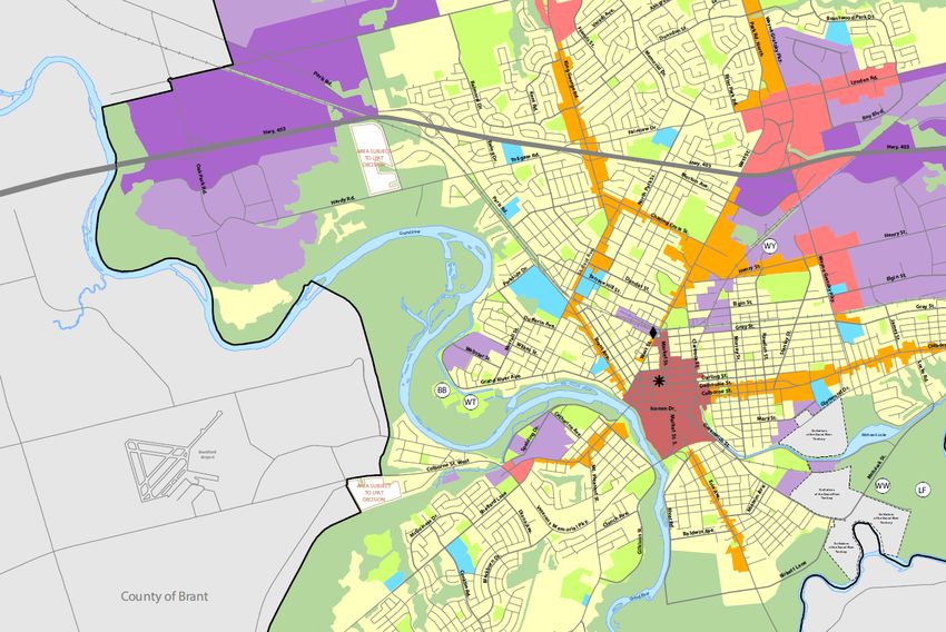
Question #5: What information can be provided on the Grand River
and Oakhill Cemetery Cultural Heritage Resources? Will data from
the future archaeological test pit investigations be provided?

                                                               9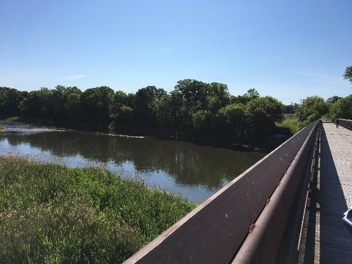
Question #6: Can combining alternative solutions 2-6 be considered as a
single solution?

                        New Alternative Solution (# 2-6 Combined)

                                                                          10
Question #7: What do the symbols on the alternative slide mean?
Symbols were developed to evaluate the alternative planning solutions.
Full circles are intended to resemble a score closer to 100% where potential impacts within a given criteria are reduced
or can be mitigated. For example, Alternative solution #7 (constructing a new crossing over the grand river) scores well
against the transportation criteria since it would help improve the existing and future transportation network.
For the transportation criteria under Alternative solution #1 (do-nothing), it is evaluated as a red circle (major flaw) since
there would be no improvements to the existing and future transportation network.
11Question #8: GPS calculations identify a route between West Brant and the
east (e.g. Hamilton and Burlington) over the Lorne Bridge onto Brant
Avenue to access Highway 403. Who travels further west to go east?
Image Source: Google Maps
12Question #9: Has the City considered an investigation into “Reversible Lanes” on
Brant Avenue and the Veterans Memorial Parkway over the River?
While reversible lanes have been used in some contexts in other jurisdictions, they are neither feasible nor a solution for
providing additional transportation network capacity and addressing requirements identified in the Problem and
Opportunity Statement.
Reversible lanes are typically used when there are ideal
geometric conditions and a disproportionate amount of
traffic volume heading in one direction during peak periods
that can justify a temporary increase in capacity. On Brant
Avenue and Paris Road, there is a high frequency of side
streets where left turn movement conflicts would be
present and future traffic demand will be over capacity in
both directions.
On Veterans Memorial Parkway, higher posted speed
limits do not warrant reversible lanes and the two-lane
approaches to the bridge over the Grand River are not
compatible with reversible lanes where a minimum of 3
lanes are needed. The westbound on-ramp from Market
Street would also need to be maintained on the bridge and
could not be used as a reversible lane.
Image Source: TAC
13Question #10: Why consider potentially impacting Archaeological resources,
crossing the Haldimand Tract along the Grand River against Indigenous
Community's wishes? Why potentially risk the understanding and respect of
Indigenous interests?
The intent of this Environmental Assessment Study is to identify and assess a range of alternative solutions that address
the requirements as outlined in the Problem and Opportunity Statement for the project.
As part of that assessment process the Study Team will work with stakeholders and Indigenous communities to receive
their input and identify solutions and potential mitigation measures for the preferred solutions and designs. Participation
of stakeholders and Indigenous communities is an important part of the successful completion of this Environmental
Assessment.
14Question #11: What is the forecasted rate payer tax % increase for this project?
As per Council’s directive in June 2019 (report 2019-384), the City is committed to keeping taxes affordable and
ensuring that tax increases do not exceed inflation.
For any alternative with construction, some funding through taxes would be required, the construction would also be
funded from Development Charges (DC), as the roadway would provide significant benefits to the development
community.
The next iteration of the DC study will be conducted in 2021 with consideration of the recommendations from the 2020
Transportation Master Plan (TMP).
Question #12: Why has the City not published their study directly comparing the
forecast traffic benefits, cost, timing and environmental and indigenous impacts of
each of the subject traffic flow options from West Brant?
All technical studies, including the Transportation Assessment for this Study will be made available to the public and
appended to the final Environmental Study Report expected to be completed by November/December 2021.
Please also refer to the City’s 2020 Transportation Master Plan Update which provides additional context and
background on this project and other transportation recommendations to address the City’s forecasted growth.
15Question #13: Do traffic calculations used by the City take into
account that many new residents to the southwest may now be
remote workers rather than commuters?
This Environmental Assessment will provide recommendations that consider present traffic conditions as well as
solutions that will help Brantford respond to traffic demands to 2041, as per recommendations in the City’s 2020
Transportation Master Plan.
It is extremely challenging to quantify how many residents in any given area work remotely, how consistent that number
is moving forward, and how many future residents of southwest Brantford may work remotely.
16Question #14: Would having a better mix of retail, services & jobs in
the southwest reduce traffic and the need to get across the river?
Source: City of Brantford Draft 2020 Official Plan
17Question #15: $100 million is the estimate in the Transportation Master Plan for
construction, but what is the full cost of ownership over the lifespan of the bridge (likely 40
years or more). What would the cost of financing the $100 million be, what would yearly
maintenance amount to? A total cost of ownership number (TCO) is essential.
While the Feasibility Study (2019) provided for a preliminary estimate for a construction alternative, a more accurate
cost estimate, including life-cycle cost analysis (LCCA) will be developed later in the Environmental Assessment
process for the preferred solution.
LCCA would include estimated costs for yearly maintenance and operating, should a construction alternative be
selected.
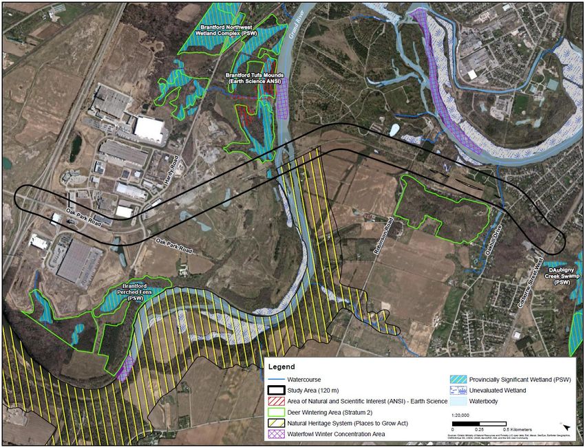
18Question #16: How specifically will the Tufa Mounds ANSI, perched fens and
Davisville Swamp Provincially Significant Wetland in the area be protected?
Brantford Northwest
Wetland Complex PSW
(Davisville Swamp)
Brantford
Tufa Mounds
Brantford
Perched
Fens
19Question #17: How will the drinking water supply for the City be protected? There
will be salty/contaminated runoff from the roadway - where will this go to?
What mitigation strategy is to be adopted to prevent toxic spills from transport
trucks going over the bridge damaging the water supply for us and downstream
communities?
How will the City deal with fluid leakage from vehicles including spills and
potential impacts to the ecosystem of the study area?
If an extension of Oak Park Road is identified as the preferred solution, current standards for roadway design will be
reviewed. Run-off would be contained within the curbs and directed to stormwater management facilities where quality
and quantity would be addressed.
A key component of this Environmental Assessment process would be developing mitigation measures for roadway run-
off.
The preferred approach for accommodating run-off would be presented at future Public Information Centres, depending
on the alternatives being evaluated, and refined further during the detailed engineering design phase.
20Question #18: What does the City intend to do about noise
pollution arising from trucks rumbling down grade with engine
breaks on?
If an extension of Oak Park Road is identified as the preferred solution, the introduction of several thousand vehicles
annually would be expected to increase noise levels and the noise levels at the adjacent receptors will be quantified as
part of the study in a Noise and Vibration Impact Assessment in June/July 2021.
In addition, the study will also review and recommend measures to mitigate the identified noise impacts on adjacent
properties and community facilities. These measures may include, but not necessarily be limited to, tree plantings,
berms, naturalized landscaping and possibly noise walls.
The preferred mitigation measures will be presented at future Public Information Centres for this project.
Example of Noise Berm with Landscaping
Image Source: Chester County Planning Commission
21Question #19: Will there be impacts to the existing Active
Transportation network including trails? Impacts to the existing
trail network should be considered in the evaluation.
22Question #20: For alternative solution #7 which includes a new crossing of the
Grand River, how did the City determine that it would have moderate impacts to
private property and noise/vibration/aesthetics. This should be counted as a major
flaw and least desirable. Environmental criteria should also be weighed with
higher impacts.
The City welcomes input on the evaluation of alternative planning solutions.
Impact to private properties and subsequent mitigation measures will be considered during this Environmental
Assessment. “Moderate” property impacts are those impacts that may require small property acquisition or easements
for road grading or minor works, but do not significantly alter the current uses of properties. High impacts would be
defined as alternatives where there is high potential for property acquisition or easements with significant changes to
current property use.
Since the Oak Park Road extension study area includes a protected corridor for a future roadway, impacts could be
reduced if that alignment were to be utilized.
Potential property impacts and subsequent mitigation measures to address factors such as noise, for the various
alternatives will be presented at future Public Information Centres planned for this project. Information on environmental
mitigation will also be presented.
23Question #21: Since Parsons has done 3D images of the project, can they provide
further renderings showing what it would look like along the route at ground level
in places like the cemetery, Oakhill neighborhood and crossing the river?
If an extension of Oak Park Road is selected as the preferred solution, this information would be prepared as part of the
evaluation of alternative design concepts in Phase 3 of the Environmental Assessment process and will be shared at
future Public Information Centres to be held for the project.
Question #22: Is the City considering pushing this roadway further south and
connecting with Shellard Lane?
No. The limits for this Environmental Assessment currently end at Colbourne Street West.
24Question #23: Has the project team considered the long-term impact of climate
change on the structure? We can expect more rain, more flooding over the next
century, does the design consider this? Also, what impact on flooding will the
structure itself have - for instance creating ice dams that can burst and head
downstream?
Climate Change and Sustainability are key criteria being used to assess this project.
A major evaluation criterion for the installation of any new bridge crossing is the limitation of upstream impacts to the
regional floodplain limits and this project would be no exception. Alternatives for a bridge structure would identify
measures to mitigate ice jamming that might result from the installation of bridge piers and/or abutments within the
Grand River floodplain.
In addition, should an alternative with a bridge be selected, the Environmental Assessment will consider 100-year storm
events for bridge design and will be in accordance with the Canadian Highway Bridge Design Code. The bridge design
would also consider regulatory flood limits set by the Grand River Conservation Authority.
Question #24: Will the City be applying for federal or provincial infrastructure
funding assistance to build the OPRE?
The possibility of additional funding sources would be reviewed by the City following the development of cost
estimations for the preferred alternative and completion of the Environmental Assessment.
25Question #25: Why did the City select the Oak Park Road Extension
to have its Environmental Assessment proceed over other Alternate
Routes (i.e. Rest Acres, County Road 18, Brant Ave)?
Completing the Municipal Class Environmental Assessment (EA) for the proposed Oak Park Road Extension has been
identified as a key recommendation of the City’s current and previous Transportation Master Plan (TMP) that identifies
the infrastructure necessary to meet the demands of the city’s forecasted growth.
Essentially, the proposed extension between the Kramer’s Way / Hardy Road intersection and Colborne Street West
would provide a third Grand River crossing for residents, businesses and visitors.
The additional river crossing would be located in an area upstream of the two existing crossings near the City’s core,
ultimately providing an alternative crossing in the event of an emergency requiring closure of the existing crossings.
Question #26: Why is crossing the Glebe lands no longer being
considered as an option?
At the August 27, 2019, Council Meeting, Brantford City Council passed a resolution to exclude the use of the Glebe
Lands in the transportation alternatives being developed for the City as part of the City’s Transportation Master Plan
(TMP) update.
26NEXT STEPS
In early 2021, the project team will continue with the following steps in the Environmental
Assessment:
• Respond to individual comments received from virtual Public Information Centre #1
• Complete detailed inventory of the natural, social and economic environment;
• Hold follow-up meetings with Indigenous communities, technical advisory committees and project stakeholders;
• Conduct the detailed evaluation of alternative solution(s);
• Confirm the preferred alternative planning solution(s); and
• Present the preferred alternative planning solution and next steps in the project at Public Information Centre #2.
Public input is welcomed at any point through the Environmental Assessment Process. To be added to the
project contact list to receive updates and future public notices, please contact any of the following project
team members:
Evie Przybyla, MCIP, RPP Marko Paranosic, P.Eng.
Senior Transportation Project Manager Consultant Project Manager
City of Brantford Parsons Inc.
100 Wellington Square 101-540 Bingemans Center Drive
Brantford, ON N3T 2M2 Kitchener, ON N2B 3X9
Tel: 519-759-4150 Ext. 5379 Tel: 519-340-1078
Email: OakParkRoadExt@brantford.ca Email: OakParkRoadExt@brantford.ca
27You can also read