COLLEGE STREET BATHURST STREET TO MCCAUL STREET - CITY OF TORONTO
←
→
Page content transcription
If your browser does not render page correctly, please read the page content below
CC23.6 - CONFIDENTIAL APPENDIX C TO CONFIDENTIAL ATTACHMENT 2 - made
public on August 6, 2020

                                                                          COLLEGE STREET URBAN DESIGN GUIDELINES
                        College Street
                        Urban Design Guidelines
    Revised July 2020

                                                                                                                   COLLEGE STREET URBAN DESIGN GUIDELINES

    College Street
    Bathurst Street to McCaul Street
                                                                       URBAN DESIGN
                                                                        GUIDELINES

                                                                        2017 1
COLLEGE STREET URBAN DESIGN GUIDELINES

                                                           City of Toronto
                                                           College Street Urban Design Guidelines - May 2017
                                                           _______________________________________________________________________________
                                                           The City of Toronto City Planning Division would like to thank all those who participated in the community consultation process. This document has been enhanced by your
                                         CITY OF TORONTO

                                                           knowledgeable and helpful feedback.
                                         2017

                                         ii
Table of Contents

                                                       COLLEGE STREET URBAN DESIGN GUIDELINES
Mandate											1

1.0 Introduction									3

  1.1   Study Area									4
  1.2   Historical Overview								5
  1.3   Community Feedback								6

2.0 Planning Context								9

  2.1   Provincial Planning Documents							10
  2.2   Official Plan Policies              10
  2.3   Additional Relevant Documents							13

3.0 Existing Character								15

  3.1   Built Form									16
  3.2   Heritage			 							17
  3.3   Streetscape		 							18
  3.4   Character Areas		 							19

4.0 Urban Design Guidelines							21

  4.1   Public Realm								22
        Pedestrian Connections 								22
        Streetscape        								23
        Views and Viewpoints								28
        Parks and Open Spaces 								29

                                                 iii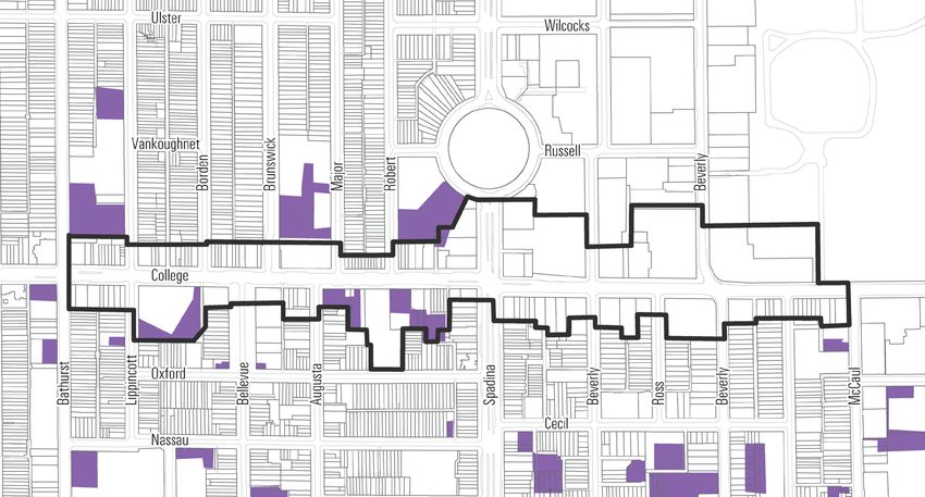
COLLEGE STREET URBAN DESIGN GUIDELINES

                                                            4.2     Built Form									30
                                                                    Built Form Guidelines for Character Areas						30
                                                            		Character Area A								31
                                                            		Character Area B								33
                                                            		Character Area C								36
                                                            		Character Area D								38
                                                            		Character Area E								39
                                                            		Character Area F								41
                                                                    Design Excellence and Sustainability							42

                                                            4.3     Heritage 									44
                                                                    Official Plan Heritage Policies                                    45
                                                                    Heritage Recommendations                                           45

                                                           APPENDICES
                                                            Appendix A: Summary of Public Realm Recommendations		              			001
                                                            Appendix B: Summary of Built Form Recommendations			                		002
                                                            Appendix C: Demonstration of the Design Guidelines on Character Area A			003
                                                            Appendix D: Map of Areas with Archaeological Potential in the Study Area			004
                                                            Appendix E: Heritage Inventory for the College Street Study Area           005
                                                            Appendix F: History and Evolution of Study Area                				012
                                         CITY OF TORONTO
                                         2017

                                         iv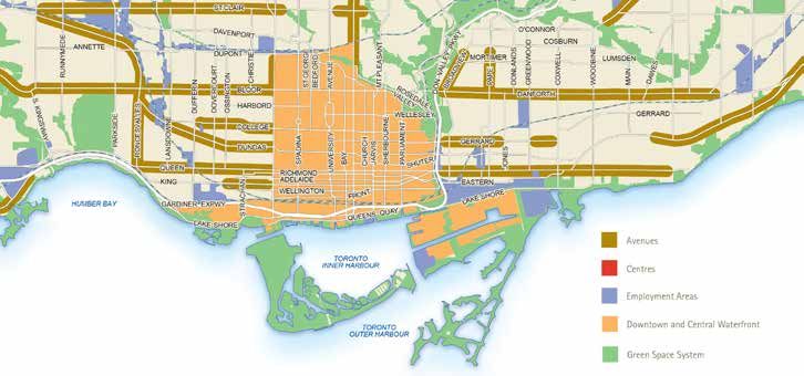
COLLEGE STREET URBAN DESIGN GUIDELINES
Mandate
On February 14, 2012, Toronto and East York Community
Council requested the City Planning Division to review the policy
context for College Street generally from University Avenue to
Bathurst Street in consultation with the Ward Councillor and the
local community. The mandate calls for a study that supports the
area's existing character by addressing:

 •   "land use and the inclusion of institutional uses within
     mixed-use buildings,
 •   building scale and height, and
 •   public realm, including special places and pedestrian
     improvements."

This was later amended to include analysis of the social value of
buildings, in addition to built form and physical character.

As part of this study, City Planning has developed Urban Design
Guidelines for this portion of College Street. These Design
Guidelines are intended to support the Official Plan and the Site
and Area Specific Policy (SASP) for the Study Area, and will be
used as a tool to evaluate proposed developments in the area as
well as ensuring that such development is compatible with the
existing context. The guidelines will assist with the implementation
of the Official Plan policies, provide an understanding of the
area's local character, explain how development will respect and
reinforce local character, promote an animated public realm, and
identify buildings of heritage interest.

The Official Plan provides a long-term vision for the City that is
intended to be supported by implementation plans, strategies and
guidelines. These supporting documents, including the urban
design guidelines, provide detailed implementation guidance
that is consistent with the Official Plan and responds to changing
circumstances and priorities.

                                                                       1
College Street from Bathurst to Lippincott looking North
CITY OF TORONTO
2017

2
COLLEGE STREET URBAN DESIGN GUIDELINES
1.0 Introduction
Historically, College Street was laid out as a private avenue to       College Street continues to evolve and new developments in
provide King's College with access to Yonge Street and Queen           recent years are a testament to these changes. The urban design
Street. Throughout the years, College Street's function, extent        guidelines in this document are intended to guide redevelopment
and character have evolved greatly. Today, College Street does         in the area in a way that will support College Street's diversity,
not only display a defined insititutional character inherited by its   vibrancy, its rich heritage value, and a harmonious fit with the
original function, but also displays a great diversity of building     surrounding residential areas.
typologies and land uses.

                   1.1       Study Area
                   1.2       Historical Overview
                   1.3       Community Feedback

                                                                                                                                                           3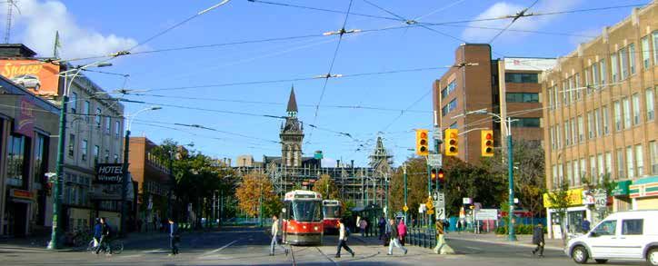
COLLEGE STREET URBAN DESIGN GUIDELINES
1.1 Study Area
The Study Area comprises all properties fronting onto College The boundaries of the College Street Study Area overlap with
Street between Bathurst Street and McCaul Street. The study also other concurrent studies including the Bathurst Street Study,
includes the properties north of College fronting onto Spadina the Kensington Market Heritage Conservation District (HCD),
Avenue, up to Spadina Crescent. The Study Area is immediately the Spadina Avenue Study and the review of the University of
surrounded by low density neighbourhoods, with the exception Toronto Secondary Plan. Through the course of the community
of lands north of College Street and east of Spadina Avenue, consultation and preparation of this planning and urban design
where the University of Toronto campus is located. This study study, efforts were made to ensure that the subject guidelines
does not propose changes to the existing Neighbourhood areas will support and not contradict the other studies.
inside or outside of the Study Area.
BANCROFT AVE.
KINGS C
T
OL
EN
L E GE
DINA CRESC
CR
CL.
RUSSELL ST.
ST GEORGE ST.
KINGS COLLEGE RD.
SPA
GALBRAITH RD.
BRUNSWICK AVE.
LIPPINCOTT ST.
BATHURST ST.
BORDEN ST.
MAJOR ST.
CROFT ST.
ROBERT ST.
HURON ST.
SPADINA AVE.
COLLEGE ST.
BELLEVUE AVE.
AUGUSTA AVE.
ROSS ST.
BEVERLEY ST.
GLASGOW ST.
HENRY ST.
Mc CAUL ST.
OXFORD ST.
N
Map of the Study Area
BANCROFT AVE.
KINGS C
BATHURST STREET STUDY
T
OL
SPADINA AVENUE STUDY
EN
L E GE
DINA CRESC
CR
CL.
UNIVERSITY OF TORONTO
RUSSELL ST.
ST GEORGE ST.
KINGS COLLEGE RD.
SPA
GALBRAITH RD.
SECONDARY PLAN
BRUNSWICK AVE.
LIPPINCOTT ST.
BATHURST ST.
BORDEN ST.
MAJOR ST.
CROFT ST.
ROBERT ST.
HURON ST.
SPADINA AVE.
COLLEGE ST.
BELLEVUE AVE.
AUGUSTA AVE.
KENSINGTON MARKET HCD
CITY OF TORONTO
ROSS ST.
BEVERLEY ST.
GLASGOW ST.
HENRY ST.
Mc CAUL ST.
OXFORD ST. N
Map of Concurrent Studies near the Study Area
2017
4
COLLEGE STREET URBAN DESIGN GUIDELINES
1.2 Historical Overview
College Street was developed in three phases and evolved from
an access road to King's College into a commercial thoroughfare.

The original portion of College Street, historically known as
College Avenue, was laid out in 1829 as a private avenue to
provide King’s College, present day University of Toronto, with
access to University Avenue and Yonge Street. The original
L-shaped route ran along the south boundary of King’s College
and turned to University Avenue.

In the 1840s, the second stretch of College Street was laid out       College looking east from Bathurst with the Fire Hall's Clock Tower in the background,
                                                                      1902 (City of Toronto Archives)
south of Spadina Crescent, yet not connected to the original
portion south of King's College. This was part of the development
of Baldwin estate. The Baldwin family laid out Spadina Avenue as
a central north-south thoroughfare, as well as Spadina Crescent
and residential subdivisions along Spadina Avenue and south of
Bloor Street.

Throughout the 1850s-1860s residential subdivisions west of
Major Street triggered the extension of College Street and the
connection from Bathurst Street to Yonge Street. Despite the
subdivisions, the area west of Spadina remained vacant until
the 1900s. At that time a dramatic change in demographics
occurred when the area became attractive to immigrants while
more affluent residents moved north of Bloor Street.
                                                                      The Wallberg Memorial Building in the University of Toronto, a Listed Heritage Property on
                                                                      College Street

The pattern of development in the Study Area corresponds to the
division of the historic park lots surveyed between present-day
Queen and Bloor Streets after the founding of the Town of York
(Toronto) in 1793. Other factors that contributed to the historical
evolution of the Study Area include the institutional uses east of
Spadina Avenue, the residential uses that came from the historic
subdivisions, and the commercial uses that emerged along
College Street to support the residential and institutional uses.

In overall, College Street displays, inside and outside of the
Study Area boundary, a rich collection of built heritage.

                                                                      The historic commercial character of College Street in the northwestern stretch of the study
                                                                      area, which is historically connected with the Harbord Village to the north.

                                                                                                                                                                     5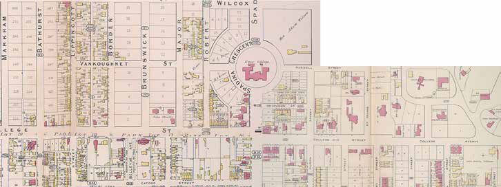
COLLEGE STREET URBAN DESIGN GUIDELINES

                                                           1.3 Community Feedback
                                                           Stakeholders and members of the community were involved in all phases of the study process, which included:

                                                             • Four Stakeholder Advisory Committee (SAC) meetings
                                                             • Three Community Consultation Meetings (CCM)
                                                             • One Walking Tour

                                                           The Study Team met with the SAC and the public to present the purpose and scope of the Study, discuss the key findings, and solicit
                                                           feedback from participants. Through the consultation process, residents, landowners, and stakeholders identified many aspects of
                                                           College Street that they were interested in preserving and enhancing, such as the:

                                                                Unique mix of uses
                                                                Spacious, well-balanced streets
                                                                Strong heritage presence
                                                                Diversity in character along the street
                                                                Fine grain retail and inviting environment

                                                           As a result, some key principles for redevelopment identified in the community and stakeholder feedback include:

                                                                Appropriate built form
                                                                Sensitive transition to Neighbourhoods
                                                                Healthy mix of retail
                                                                Preserve diversity
                                                                Strengthen heritage conservation
                                                                Improve Public Realm
                                                                Create opportunities for open spaces
                                         CITY OF TORONTO
                                         2017

                                         6
7
COLLEGE STREET URBAN DESIGN GUIDELINESCollege Street from Lippincott to Borden looking North CITY OF TORONTO 2017 8
COLLEGE STREET URBAN DESIGN GUIDELINES
2.0 Planning Context
                                     There are a number of municipal and provincial policies and
                                     guidelines that provide direction for growth in Toronto. The
                                     following section provides a synopsis of these policies and
                                     guidelines and their applicability to the study area.

   2.1   Provincial Planning Documents
   2.2   Official Plan Policies
   2.3   Additional Relevant Documents

                                                                                                                   9
COLLEGE STREET URBAN DESIGN GUIDELINES
2.1 Provincial Planning Documents
The 2014 Provincial Policy Statement (PPS) provides policy
direction on matters of provincial interest related to land use
planning and development. The PPS sets the policy foundation
for regulating the development and use of land. The key objectives
include: building strong communities; wise use and management
of resources; and protecting public health and safety. The PPS
recognizes that local context and character is important. Policies
are outcome-oriented, and some policies provide flexibility
in their implementation provided that provincial interests are
upheld. City Council’s planning decisions are required to be
consistent with the PPS.
The Growth Plan for the Greater Golden Horseshoe (GGH)
provides a framework for managing growth to implement
Ontario's vision for building strong, prosperous communities.
Principles expressed in the GGH Growth Plan include directions
for where and how to grow; the provision of infrastructure to
support growth; and protecting natural systems and cultivating
a culture of conservation. City Council’s planning decisions are
required by the Planning Act to conform, or not conflict, with the
Growth Plan for the GGH.
2.2 Official Plan Policies
The City of Toronto’s Official Plan provides a vision for a
2.2.1 URBAN STRUCTURE
successful city by directing growth to strategic areas, setting
infrastructure priorities, and identifying implementation
The Official Plan directs growth to the Downtown, Mixed Use
strategies. The vision of the Plan is about creating an attractive
Areas, Centres, and Avenues. The Study Area is identified as a
and safe City that evokes pride, passion and a sense of belonging
Downtown area on Official Plan Map 2 – Urban Structure.
- a City where people of all ages and abilities can enjoy a high
quality of life.
According to Section 2.2.1 of the Official Plan, the Downtown
will continue to evolve as a healthy and attractive place to live
This long-term vision for the City is intended to be supported
and work, as new development that supports the reurbanization
by implementation plans, strategies and guidelines. These
strategy and the goals for Downtown, is attracted to the area. In
supporting documents, including the Urban Design Guidelines
particular, the quality of the Downtown will be improved by "Design
CITY OF TORONTO
for College Street, provide detailed implementation guidance for
guidelines specific to districts of historic or distinct character
new development within the Study Area.
developed and applied to ensure new development respects the
2017
10COLLEGE STREET URBAN DESIGN GUIDELINES
Study Area
Extracted from Official Plan Map 2 - Urban Structure
context of such districts in terms of the development's fit with and housing in a manner that is appropriate to their surrounding
existing streets, setbacks, heights and relationship to landmark contexts, with adequate transportation and infrastructure
buildings." servicing.
In light of the foregoing, a planning analysis of this portion of The lands north of College Street generally east of Spadina
College Street was considered appropriate in order to develop Avenue are designated Institutional Areas. This designation is
urban design guidelines that complement the local context and comprised of major educational, health and governmental uses
the Official Plan policies. with their ancillary uses; cultural, parks, recreational, religious,
commercial uses; and institutional residence facilities. These
2.2.2 LAND USE DESIGNATIONS uses are encouraged to continue as they serve the needs of an
increasing city and regional population.
The Official Plan also includes development criteria to guide new
development in different areas across the City. Development There are a limited number of properties within the Study Area
criteria are described for each of the land use designations designated Neighbourhoods, including the Cawthra Mansions
within the Official Plan. The Study Area has a variety of land use Co-op, located in the south side of College Street between
designations including, Mixed Use Areas, Neighbourhoods, and Beverley and Ross Streets. Neighbourhoods are physically stable
Institutional Areas. areas and development within Neighbourhoods is anticipated
to respect and reinforce the existing physical character. Policy
A large portion of the Study Area is designated Mixed Use Areas 2.3.1 requires new development in Mixed Use Areas that are
on Map 18 of the City's Official Plan. This designation permits adjacent to Neighbourhoods to provide a transition in scale and
a broad range of commercial, residential and institutional uses, density towards the Neighbourhoods. New development in such
providing opportunities to live, work and shop within the same an area is also required to maintain adequate light and privacy for
area. Mixed Use Areas are intended to accommodate most of existing residential properties, and to mitigate traffic or parking
the anticipated growth in the city with new service, employment impacts on nearby residential streets.
11COLLEGE STREET URBAN DESIGN GUIDELINES
2.2 Official Plan Policies (continued)
SPADINA AVENUE
ULSTER ST
WILLCOCKS ST WILLCOCKS ST
Extracted from Official Plan Map 18 - Land Use Plan
BRUNSWICK AVE
HURON ST
BATHURST STREET
MARKHAM ST
SP
BORDEN ST
A DIN A CR
RUSSELL RUSSELL ST
ST
LIPPINCOTT ST
ST GEORGE STREET
ROBERT ST
ES
MAJOR ST
HURON ST
COLLEGE STREET
LIPPINCOTT ST
AUGUSTA AVE
BELLEVUE AVE
COLLEGE STREET
ROSS ST
BATHURST STREET
SPADINA AVENUE
Mc CAUL ST
BEVERLEY ST
HURON ST
MARKHAM ST
GLASGOW ST
HENRY ST
OXFORD ST
ORDE ST
CECIL ST N
Other Open Space Areas
Study Area Neighbourhoods Institutional Areas Mixed Use Areas Natural Areas Parks (Including Golf Courses, Cemeteries, Public Utilities)
2.2.3 ZONING BY-LAW
Most of the properties within the Study Area are zoned Commercial The harmonized City-wide Zoning By-law 569-2013 is currently
Residential, which permits a wide range of commercial and under appeal at the Ontario Municipal Board. It includes generally
residential uses (under the former City of Toronto Zoning By-law the same permissions as By-law 438-86 for the Study Area.
438-86). Other permissions in the Study Area include:
• Commercial-Residential densities that range from 2.5 to 3.0 There are also a number of properties that are exempt from
• The maximum permitted heights in the study area range City-wide Zoning By-law 569-2013 and are subject to the former
between 12.0 metres (approximately 4 storeys) and 23.0 City of Toronto Zoning By-law 438-86. These are mainly the
metres (approximately 7 storeys). lands north of College Street and east of Spadina Avenue, where
the University of Toronto is located, and four other properties
scattered throughout the Study Area.
R (d1.0) (x848)
SPA
Q T2.0
Q T2.0 GALBRAITH RD
D
R (d1.0) (x438)
INA
R (d1.0) (x848)
KINGS COLLEGE RD
CR Q
ST GEORGE ST
R3 Z1.0 ES
R (d1.0) (x848)
HURON ST
BRUNSWICK AVE
LIPPINCOTT ST
BATHURST ST
MCR T3.0
R3 Z1.0
BORDEN ST
ROBERT ST
C2.0 R2.5
MAJOR ST
CR 3.0
CYRIL LANE
R3 Z1.0
CROFT ST
(c2.0;
r2.5) SS2
(x1877)
GRIMSBY DAIRY LANE
SPADINA AVE
DOUGLAS CAMPBELL LANE
CR 3.0 (c2.0; r2.5)
SS2 (x1733)
CR 3.0 (c2.0; r2.5) SS2 (x1796)
CR 3.0 CR 3.0 Q
CR 3.0 (c2.0; r2.5)
CR 3.0 (c2.0; r2.5)
CR 3.0
(c3.0; r3.0) (c2.0; r2.5) G
(c2.0; r2.5)
MCR T3.0
SS2 (x2512) SS2 (x2363)
CR 3.0 (c2.0; r2.5) SS2 (x2363)
SS2 (x1581)
SS2 (x2363)
SS2 (x1581)
C2.0 R2.5 CR T3.0 Q T2.0
CR 3.0 (c2.0; r2.5) SS2 (x2363) CR 3.0 (c2.0; r2.5) SS2 (x2363) C2.0 R2.5
COLLEGE ST MCR T3.0 C2.0 R2.5
CR 3.0 COLLEGE ST R3 Z1.0
CR 3.0 (c2.0; r2.5) SS2 (x2363)
(c3.0; r3.0) MCR T2.5 MCR T2.5
CR 3.0 (c2.0; r2.5) SS2 (x2363)
SS2 (x2512)
CR 3.0 (c2.0; r2.5) SS2 (x2363) CR 3.0 CR 2.5 COLLEGE ST
CR 2.5
CR 3.0 (c2.0; r2.5) SS2 (x1244)
CR 3.0 MCR T2.5
(c2.0; r2.5) (c2.0; r2.5) C1.0 R2.5 (c1.0; r2.5) (c1.0; r2.5)
R3 Z1.0 SS2 (x2363) SS2 (x2360)
MCR T3.0 SS2 (x2363) SS2 (x2359)
CR 2.0 (c2.0; r1.5) C2.0 R2.5 MCR T2.5
SS2 (x2457) O
CR 2.5 MCR T2.5 Q T2.0
C1.0 R2.5 R(f4.5;d1.0)
BELLEVUE AVE
(c2.0; r2.0) R (f4.5; d1.0) R3 Z1.0 (x712)
SS2 (x1579) (x7)
CR 2.0 (c2.0; r1.5)
AUGUSTA AVE
CR 2.5 (c2.0; r2.0) SS2 (x1884)
SS2 (x2473) CR 2.5 (c2.0; r2.0) SS2 (x2269)
R (f4.5; d1.0) (x33)
R (f4.5; d1.0) (x835)
LIPPINCOTT ST
BATHURST ST
CR 2.5 (c2.0; r2.0) SS2 (x2267)
ELLEN AVE
CR 2.5
GLASGOW ST
(c2.0; r2.0)
BEVERLEY ST
MC CAUL ST
R (f4.5; d1.0) (x847) CR 2.5
HENRY ST
SS2
SPADINA AVE
HURON ST
(c2.0; r2.0)
ROSS ST
CITY OF TORONTO
OXFORD ST R (f4.5; d1.0) (x846)
MCR T2.5
C2.0 R2.0
SS2 (x1865)
ORDE ST
R3 Z1.0
CR 2.5
O (c2.0; r2.0) CR T2.5
O C1.0 R2.0
SS2 (x1865)
Residential Open Space
College Street Study - Zoning Extracted from Zoning Map
By-Law 569-2013
Study Area Not to Scale
2017
Extracted 09/21/2014
Commercial See Former City of Toronto By-law No. 438-86
12COLLEGE STREET URBAN DESIGN GUIDELINES
Existing and Zoned Heights
King's College Rd.
St. George St.
Brunswick Ave.
Bathurst St.
Spadina Ave.
Bellevue Ave.
McCaul St.
Beverley St.
Ross St.
Zoned Heights 12m 14m 16m 18m 23m
2.3 Additional Relevant Documents
2.3.1 AVENUES AND MID-RISE 2.3.2 TALL BUILDING GUIDELINES
BUILDINGS STUDY
In May 2013, Toronto City Council adopted the updated city-wide
Tall Building Design Guidelines and directed City Planning staff
In 2010, Toronto City Council adopted the Avenues and Mid-Rise
to use these Guidelines in the evaluation of all new and current
Buildings Study and related performance standards (commonly
tall building development applications. The Guidelines establish
referred to as the Mid-rise Guidelines). The study includes
a unified set of performance measures for the evaluation of tall
performance standards for mid-rise developments along the
building proposals to ensure they fit within their context and
City's Avenues that are identified on Map 2 – Urban Structure of
minimize their local impacts.
the Official Plan. The Study Area is not located on an Avenue and
therefore the performance standards/guidelines do not apply to
The Study Area is located within an area that is also subject
this section of College Street.
to the Downtown Tall Buildings: Vision and Supplementary
Design Guidelines (adopted by City Council in July 2012 and
Although the intention of the Avenues Study was to provide
consolidated with the city-wide Tall Building Design Guidelines
recommendations for mid-rise buildings on Avenues, it was
May 2013). This document identifies where tall buildings belong
identified by City Council that these guidelines may also be
in Downtown, and establishes a framework to regulate their
appropriate and useful to guide the review of proposals for
height, form and contextual relationship to their surroundings.
mid-rise buildings in Mixed Uses Areas that are not located on
Nonetheless, the Study Area falls within a segment of College
Avenues.
Street, between McCaul Street and Bathurst Street, which has
been identified as a "Special Study Street" in which no particular
height range or building typology has been assigned. Rather, the
height should be determined through a site by site assessment.
13College Street from Borden to Brunswick looking North CITY OF TORONTO 2017 14
COLLEGE STREET URBAN DESIGN GUIDELINES
3.0 Existing Character
College Street between Bathurst and McCaul Streets has a          uses, enriches the diversity experienced along College Street.
character that is very diverse, shaped by the mix of uses and     The scale, combined with the age, materials and detailing of
building typologies within the area.     This diversity makes     existing buildings also contribute to a unique character that
it challenging to define as a whole, but it is also what makes    should be respected and reinforced.  It is important to note that
College Street unique.                                            many buildings within the Study Area boundary display a rich
                                                                  collection of heritage elements and architectural attributes that
The institutional character of the University of Toronto lands,   define the character of this portion of College Street.
together with the mixed residential, commercial and warehousing

                  3.1      Built Form
                  3.2      Heritage
                  3.3      Streetscape
                  3.4      Character Areas

                                                                                                                                      15
COLLEGE STREET URBAN DESIGN GUIDELINES
3.1 Built Form
There is a wide variety of built form in the Study Area. The variety Street's unique character. Generally speaking, lot sizes west of
of buildings include semi-detached, house-form buildings, Spadina Avenue are small with a relatively consistent frontage
low-rise residential and mixed-used buildings, mid-rise office width. This results in buildings that are fine grain forming a
buildings, large and small scale institutional buildings, loft style continuous streetwall. This character is less consistent on the
buildings and some recently approved tall buildings. south side of College Street due to some atypical lot sizes.
Due to its location on the western edge of the Downtown, this The age and architectural typology of the buildings also vary.
section of College Street displays a variety of built form that Many buildings date back to the 1800s and early 1900s, resulting
gradually transitions to a larger scale of buildings located at the in a rich collection of buildings with heritage attributes. There
intersection of College Street and University Avenue. are also buildings that were built more recently, including some
approved tall buildings. These buildings are generally located
The built form is also partly shaped by the diversity of lot sizes, lot on the south side of College Street where lots are larger in both
configurations, frontages and depths which contribute to College depth and width.
House form mixed-use buildings on College Street Recent development on College Street
CITY OF TORONTO
University of Toronto Building Loft style commercial building
2017
16COLLEGE STREET URBAN DESIGN GUIDELINES
3.2 Heritage
The existing character in the Study Area corresponds to the Gage Institute, Oddfellows Buildings, and the Temple-Pattison
pattern of development and division of the historic Park Lots. Co. Building which are purpose-built loft buildings with offices
The Study Area originated as part of Park Lots 13, 14, 15, and light manufacturing, medical or dentistry related uses.
16, 17 and 18, of the series of 100-acre allotments surveyed
between present-day Queen and Bloor Streets after the founding Between Park Lots 15 and 16, the character of the intersection
of the Town of York (Toronto) in 1793. Other key factors that of College Street and Spadina Avenue changed dramatically
contributed to the historical evolution of the Study Area includes: with the demolition of notable corner buildings and the Grace
Hospital being replaced by the Clark Institute (present-day CAMH
• Spadina Avenue - the most prominent north south avenue facilities).
with views of Knox College at Spadina Crescent
• University of Toronto and other institutional uses east of On Park Lots 16 - 18, on the south side of College Street, most of
Spadina Avenue the historic blocks have been replaced by post-1950 buildings.
• The residential neigbourhoods that originated from the The remaining pre-1950 buildings include two commercial
subdivisions of the lands belonging to the Baldwin and the buildings close to Spadina Avenue, Toronto Fire Station 315, the
Denison families Church of Saint Stephen-in-the-Fields and a loft building adjacent
• Commercial uses that emerged along College Street to to the church. Also in this area, the intersection of College Street
support adjacent residential and institutional uses. The area and Augusta Avenue is of particular interest as it serves as the
west of Spadina Avenue has more of a main street character main entry point to Kensington Market to the south.
to support the established residential neighbourhoods at
Harbord Village, while the commercial uses east of Spadina The historic commercial character of College Street is more
Avenue and south of College Street mostly included medical- robust in the northwestern stretch of the Study Area that spans
related commercial uses, offices and warehouses. Park Lot 16, 17 and 18. This section has a main street feel with its
retail character and fine grain built form which is well connected
On Park Lots 13 - 15, with the growth of the University of and integrated with Harbord Village to the north.
Toronto north of College Street and the institutional uses on the
south side, this area became primarily dominated by institutional In the Study Area, there are 32 properties presently included on
uses with a number of house-form buildings between McCaul the Heritage Register. Of these, 28 are listed properties and 4 are
and Beverly Streets. Some examples of these buildings are the designated under Part IV of the Ontario Heritage Act.
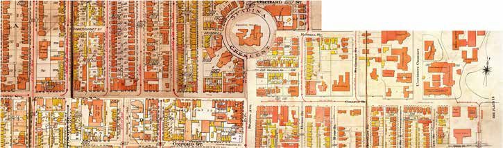
Park Lot 18 Park Lot 17 Park Lot 16 Park Lot 15 Park Lot 14 Park Lot 13
BANCROFT AVE.
KINGS C
T
OL
EN
LE GE
DINA CRESC
CR
CL.
RUSSELL ST.
KINGS COLLEGE RD.
ST GEORGE ST.
SPA
GALBRAITH RD.
BRUNSWICK AVE.
LIPPINCOT T ST.
BATHURST ST.
BORDEN ST.
MAJOR ST.
CROFT ST.
ROBERT ST.
HURON ST.
SPADINA AVE.
COLLEGE ST.
BELLEVUE AVE.
AUGUSTA AVE.
ROSS ST.
BEVERLEY ST.
HENRY ST.
GLASGOW ST.
Mc CAUL ST.
OXFORD ST.
N
Map of the Study Area: Dotted blue lines indicate the 1790s division of Park Lots College St. looking east from Bathurst, 1902 (City of Toronto Archives)
17COLLEGE STREET URBAN DESIGN GUIDELINES
3.3 Streetscape
The existing right-of-way width of College Street is 30 metres
from Bathurst Street to Beverley Street and 23 metres from
Beverley Street to McCaul Street.
Within this right-of-way, public sidewalk widths generally range
between 4 to 5 metres. However, due to generous front yard
setbacks of some institutional buildings (especially east of
Spadina Avenue where the University of Toronto is located), the
sidewalks feel much wider, above 20 metres in some instances.
It is important to note that these deep front yard setbacks have
expansive landscaping, creating a strong character of a "green
promenade". Deeper front yard setbacks with soft landscaping
Buildings west of Spadina Avenue, which are mainly mixed-use
buildings with retail at grade, are characterized by narrower
setbacks and recessed entrances, typical of a "main street"
character. This character is reinforced by heritage buildings
framing this section of College Street.
Of particular interest is that very few north-south streets within
the Study Area continue across College, namely Bathurst Street,
Lippincott Street, Spadina Avenue and Huron Street. This creates
opportunities to craft buildings of interest that terminate at vistas.
In terms of streetscape amenities, planting and seating areas are
Patio cafe at the corner of College and Henry St.
provided where the sidewalk widths allow. These are generally
located in the expansive landscape area in front of institutional
buildings east of Spadina, or on the wider corners of some
intersections west of Spadina. Patio cafes can also be found in
these locations.
CITY OF TORONTO
Sidewalk width near College and Robert St., where there is a strong Main Street character
2017
18COLLEGE STREET URBAN DESIGN GUIDELINES
3.4 Character Areas
Based on the variations in built form and land uses identified in • Area “C” is a main commercial intersection punctuated by
previous sections, for the purpose of these guidelines, College the view corridor towards Knox College, new home to the
Street can be described in six character areas: A, B, C, D, E and Daniels School of Architecture at Spadina Crescent. Building
F within the Study Area. typologies vary but generally keep an open feel to the street
due to the width of Spadina Avenue. Current zoning allows a
• Area “A” has a main street feel with a low-rise scale and mix of uses with a maximum height of 16 metres.
mixed-use buildings. Small retail storefronts frame the • Area “D” is characterized mainly by buildings with
street at the ground level. It is also an area with many institutional uses that are set back from the street, creating
heritage buildings, which corresponds to the residential a generous landscaped frontage. Many of these buildings
subdivisions throughout the 1850s-1860s that triggered the are heritage properties. It also corresponds with the area
extension of College Street. The zoning allows a maximum within the Univesity of Toronto Secondary Plan.
height of 16 metres. • Area “E” displays many institutional and commercial
• Area “B” is characterized by a variety of lot sizes comprising buildings that are loft style with historic architectural
small, medium and large lots and a diversity of building features. This character is evolving due to recent
typologies and uses including residential, commercial and developments. Current zoning allows for a mix of uses and
institutional. Two unique heritage buildings, the Church of maximum heights between 12 and 14 metres.
Saint Stephen-in-the-Fields and Toronto Fire Station 315 • Area “F” is comprised of low-rise commercial and institutional
with its recognizable clock tower, are visual landmarks on buildings, many of which are house-form buildings with
this section of College Street. Current zoning allows for a retail at-grade and patio cafes. Lots are generally small in
mix of uses and a maximum height of 16 metres. size and shallow. Current zoning allows for a mix of uses
and a maximum height of 14 metres.
Character Areas Map
BANCROFT AVE.
KINGS C
T
OL
EN
L E GE
DINA CRESC
CR
CL.
RUSSELL ST.
ST GEORGE ST.
KINGS COLLEGE RD.
SPA
GALBRAITH RD.
BRUNSWICK AVE.
LIPPINCOTT ST.
BATHURST ST.
BORDEN ST.
MAJOR ST.
CROFT ST.
ROBERT ST.
HURON ST.
C D
A
SPADINA AVE.
COLLEGE ST.
B E F
BELLEVUE AVE.
AUGUSTA AVE.
ROSS ST.
BEVERLEY ST.
GLASGOW ST.
HENRY ST.
Mc CAUL ST.
OXFORD ST.
N
19College Street from Major to Robert St. looking North CITY OF TORONTO 2017 20
COLLEGE STREET URBAN DESIGN GUIDELINES
4.0 Urban Design Guidelines
The following urban design guidelines will provide direction to    These guidelines address built form, public realm improvements,
help shape both the public and private realm within the College    and heritage considerations in terms of building design, rhythm
Street Study Area so that new development is compatible with the   and articulation.
existing local character of College Street and provides adequate
transition to the surrounding low-rise residential context.        The recommendations in these guidelines do not apply to
                                                                   Neighbourhood designated areas within the Study Area. No
                                                                   changes are proposed to Neighbourhoods.

                   4.1      Public Realm
                   4.2      Built Form
                   4.3      Heritage

                                                                                                                                     21
COLLEGE STREET URBAN DESIGN GUIDELINES
4.1 Public Realm
The public realm includes streets, sidewalks, parks, open spaces, views, and other community amenities that are accessible to the
public. The public realm should be beautiful, comfortable, safe and accessible because it is these shared assets that contribute to the
image and identity of the community and the City. The guidelines in this section are intended to set directions for the enhancement
of the pedestrian environment and the public realm. This will also help to improve accessibility for all users and the advancement of
Complete Streets goals.
View of the Spadina Crescent from the intersection of College and Spadina
4.1.1 PEDESTRIAN CONNECTIONS
Connections designed for pedestrians can create a pleasant and The City’s Urban Design Streetscape Manual provides standards
comfortable experience and contribute to the walkability and for the design of comfortable, aesthetically-pleasing sidewalks.
sense of community by joining linear parks, parkettes, playing It also emphasizes design quality and amenity in the pedestrian
fields, natural areas, plazas and historic buildings. Pedestrian realm with specifications for paving, trees, medians, lighting and
connections on College Street can be improved and expanded street furniture. All new development should meet the Manual's
through the following: requirements of a minimum pedestrian clearway of 2.1 metres
and other public realm design specifications.
Sidewalk Improvements Further consultation with the Kensington Market Business
Current sidewalk conditions along College Street can be Improvement Area (BIA) will help identify any streetscape
improved through new developments, by the creation of elements or requirements that will be needed to enhance the
wider sidewalks and the addition of landscaping. This will be entry point to Kensington Market from College Street. The
achieved by requiring front yard setbacks at-grade to allow for a Harbord Village Green Plan also provides guidance on greening
CITY OF TORONTO
sidewalk width that meets accessibility standards and provides opportunities on College Street between Bathurst Street and
for pedestrian amenities such as tree planting, street furniture, Spadina Avenue.
2017
lighting and soft landscaping.
22COLLEGE STREET URBAN DESIGN GUIDELINES
Off-street Linkages
Pedestrian connections can also be made available off-street,
through laneways. Laneways and other mid-block connections
are a potential open space resource in urban neighbourhoods that
can provide a safe, calm, and comfortable refuge for pedestrians
and cyclists. They can be transformed into shared spaces that
prioritize the use of the space for pedestrians to create enhanced
places for landscaping, seating and active transportation.
Laneway beautification can be achieved through embellishments
such as murals, enhanced paving materials, appropriate lighting,
and green walls. Laneway improvements will be considered in
the context of their ongoing function to provide automobile and
service access. This function helps to keep these activities off
of main street frontages to protect streetscaping and sidewalks.
Laneway improvements will be studied in consultation with
Transportation Services staff.
Additional pedestrian linkages, such as the pedestrian connection
secured through the development proposal at 297 College Street,
are also desirable. Opportunities for new pedestrian linkages will
be further explored and evaluated when new developments come
forward.
Laneway beautification on Croft Laneway, part of the Harbord Village Green Plan
23COLLEGE STREET URBAN DESIGN GUIDELINES
4.1.2 STREETSCAPE
Streetscape improvements will reinforce the existing character
while seeking opportunities to expand the public realm. New
developments should promote the pedestrian amenity area with
landscaping, benches, bicycle racks, and other street amenities.
The retention of existing trees and the introduction of new trees
and soft landscaping within the public realm will be encouraged
to protect and improve the health of the natural ecosystem.
The College Street Study identifies four types of existing
streetscape to be reinforced and improved through the
development application process. The below Streetscape
Recommendations Map indicates the location of each of these
streetscape typologies. See Appendix A for an enlarged version
of this map. The guidelines for the four streetscape typologies
as identified in the Streetscape Recommendations Map are as
follows:
Streetscape Recommendations Map
BANCROFT AVE.
KINGS C
T
OL
EN
L E GE
DINA CRESC
CR
CL.
RUSSELL ST.
ST GEORGE ST.
KINGS COLLEGE RD.
SPA
GALBRAITH RD.
BRUNSWICK AVE.
LIPPINCOTT ST.
BATHURST ST.
BORDEN ST.
MAJOR ST.
CROFT ST.
ROBERT ST.
HURON ST.
COLLEGE ST.
BELLEVUE AVE.
AUGUSTA AVE.
SPADINA AVE.
ROSS ST.
BEVERLEY ST.
GLASGOW ST.
HENRY ST.
Mc CAUL ST.
OXFORD ST.
N
4.8m Main Street 6m patios or seating areas >12m expansive front yard landscaping greening opportunities on flanking streets
CITY OF TORONTO
2017
24COLLEGE STREET URBAN DESIGN GUIDELINES
Main Street
The north side of College Street from Bathurst Street to
Spadina Avenue is characterized as a main street, with mixed-
use buildings which generate grade-related activities. These
buildings create a direct or "storefront" relationship with the
public realm, encouraging diverse types of social interaction at
a pedestrian scale. For this reason, wider sidewalks and more
pedestrian amenities are desirable in these types of streetscape,
which can also be found in other segments of the Study Area.
New developments can help achieve this improved condition.
4.8m
Where new development occurs, a minimum boulevard width
of 4.8 metres is recommended, measured from the curb to Existing boulevard width east of Lippincott Street
the building face of a new development. This will include an
edge zone along the curb, a tree planting zone of approximately
1.8 metres width and a minimum clear pedestrian walkway of
2.1 metres. Street trees should be planted except where they
conflict with utilities or transit stops.
Many heritage properties are also concentrated in this area. The
requirement for new developments to widen sidewalks may
not be applied where it conflicts with the continuous streetwall
established by heritage buildings or buildings of heritage interest. minimum dimensions: 2.1m 1.8m 0.5m
4.8m
Patios or Seating Areas
Currently, some locations of College Street provide patios and
seating areas that help animate the street and create bustling
meeting places for local neighbours and the wider community.
Creating more of these places, while still maintaining a minimum
2.1 metres pedestrian clearway, reinforces the community feel
found within the Study Area and the role they play as social
spaces where neighbours meet and congregate.
Widening the boulevard in strategic locations can help
accommodate patios and seating areas. A boulevard width of
more than 6 metres is recommended for locations intended to 6.8m
Existing outdoor patio on College, east of Huron Street
accommodate patios and seating areas, measured from the curb
25COLLEGE STREET URBAN DESIGN GUIDELINES
4.1.2 STREETSCAPE (cont'd)
to the building face of a new development. This will include an
edge zone along the curb, a tree planting zone of approximately
1.8 metres width, a clear pedestrian walkway of 2.1 metres, and
a patio zone of approximately 1.7 metres wide. In locations
where an outdoor patio is not desirable or where there are
existing heritage buildings, the 1.7 metres zone can be used to
accommodate seating areas and/or soft landscaping.
Locations where a boulevard width of 6 metres are recommended
minimum dimensions: 1.7m 2.1m 1.8m
(for the provision of these meeting places) are: the intersections 0.5m
of College Street with Borden Street, Bellevue Avenue, Augusta minimum 6m
Avenue, Major Street, Spadina Avenue; and along College Street
between Spadina Avenue and McCaul Street. These locations are
illustrated on the Streetscape Recommendations Map on page
27.
Expansive Front Yard Landscaping
On the north side of College Street, east of Spadina Avenue,
expansive front yard landscaping defines the existing character
of the street, creating a very green and open feel promenade. This
segment of College Street is characterized by deep setbacks with
institutional buildings that are recessed from the public street.
This is also the area where the University of Toronto campus is
located.
20m
To reinforce this green, open feel of the street, a minimum
boulevard width of 12 metres is recommended, measured from Landscaping in front of a University of Toronto building
the curb to the building face of a new development. This will
include a clear pedestrian walkway of 2.1 metres and a setback of
approximately 10 metres for soft landscaping and tree planting.
As many of the buildings facing this section of College are of
heritage value, the compliance with the minimum boulevard
width is not applicable where it conflicts with the setbacks of
heritage properties and buildings of heritage interest.
CITY OF TORONTO
minimum dimensions: 9.9m 2.1m
minimum 12m
2017
26COLLEGE STREET URBAN DESIGN GUIDELINES
Corners with Flanking Streets
There are other opportunities to introduce greener streetscapes
on the public right-of-way at the corners of College Street and
its flanking streets. Many of these flanking streets have an
existing boulevard widths of approximately 6 metres or more
measured from the curbside to the property line. Currently, there
are outdoor patios associated with at-grade retail shops at some
intersections, but other intersections are undertilized paved
Existing outdoor patio at the intersection of An underutilized corner at the intersection
surfaces. College St. and Major St. of College St. and Lippincott St.
These spaces have the potential to become small pockets of
green spaces and seating areas for public enjoyment. Street
improvements are encouraged in these locations and the design
and location will be decided in conjunction with City of Toronto
staff, the local councillor, the community and other stakeholders.
A similar initiative has been implemented in the Dundas Street
West Streetscape Project led by the Dundas West Business
Development Area. Dundas Street West Parkette. Image by PMA Landscape Architects
Other Improvements
Additional setbacks and streetscape improvements will be
encouraged to animate the public realm at locations of special
interest. Of particular interest are the entry point to Kensington
Market at the intersection of College Street and Augusta Avenue
and the northern entry point to Chinatown at the intersection of
College Street and Spadina Avenue. These improvements will be
reviewed in consultation with the Kensington Market BIA and the
Chinatown BIA; and may include coordinated street furniture,
enhanced paving, public art and temporary planters.
In 2015, the Harbord Village Residents' Association (HVRA) in
collaboration with Councillor Joe Cressy's office released The
Harbord Village Green Plan. This Plan identified opportunities
to expand and enhance green spaces in the neighbourhood and
"includes laneways, flankages, corners, and other spaces that
could be used to promote green infrastructure". The Harbord
Village Green Plan complements the Urban Design Guidelines
in this document and can be used to complement streetscape
improvements in this section of College Street.
27COLLEGE STREET URBAN DESIGN GUIDELINES
4.1.3 VIEWS AND VIEWPOINTS
Within the Study Area, there are two existing views and viewpoints Based on the local context, Toronto Fire Station 315's clock tower
protected under the Official Plan heritage policies: is also a prominent landmark within the Study Area, contributing
1. The Knox College building at 1 Spadina Crescent is a prominent to the area's character and identiy. Therefore, viewpoints to the
Toronto landmark since its construction in 1875 and an clock tower from the east and the west are recommended to be
excellent example of a High Victorian Gothic style college protected in the following locations:
building. The views from the public realm at the northeast
and northwest corners of College Street and Spadina Avenue 3. Sidewalk at the southeast corner of Bathurst and College
as identified on Official Plan Map 7B (Identified Views from Street looking east
the Public Realm) will include the prevention of any further 4. Sidewalk at the southwest corner of Robert and College Street
intrusion into the silhouette view against the sky above the looking west
spires and the east and west wing ridgeline of Knox College,
as shown in the view diagrams attached to OPA No. 368. The Future developments will be designed with sufficient setbacks
views from the identified public realm of College Street to and and stepbacks to ensure that the current and proposed
beyond Knox College will be conserved. viewpoints continue to exist for public use and enjoyment. New
2. The view of University College includes the full view of the developments should not negatively impact these existing views
south facing façade and tower of the building as viewed from or viewpoints.
both the northwest and northeast corners of Kings College
Road at College Street.
View of the Spadina Crescent from the intersection of College and Spadina Fire Station's clock tower
Map of Existing and Proposed Viewpoints BANCROFT AVE.
KINGS C
T
OL
EN
L E GE
DINA CRESC
CR
CL.
RUSSELL ST.
ST GEORGE ST.
KINGS COLLEGE RD.
SPA
GALBRAITH RD.
BRUNSWICK AVE.
LIPPINCOTT ST.
BATHURST ST.
BORDEN ST.
MAJOR ST.
CROFT ST.
ROBERT ST.
HURON ST.
COLLEGE ST.
V1
V3 V4 V2
CITY OF TORONTO
SPADINA AVE.
BELLEVUE AVE.
AUGUSTA AVE.
ROSS ST.
BEVERLEY ST.
GLASGOW ST.
HENRY ST.
N
Mc CAUL ST.
2017
OXFORD ST.
V Viewpoints currently protected by the Official Plan V Proposed viewpoints to be protected
28COLLEGE STREET URBAN DESIGN GUIDELINES
4.1.4 PARKS AND OPEN SPACES
As the City continues to grow and intensify, there is an increasing part of the city's public realm network, providing open space
need and demand to create new parks and open spaces as places in much needed locations and complementing existing and
of retreat, relaxation and recreation. Seeking opportunities to planned publicly-owned parks and open spaces. POPS are not a
create and implement these open spaces is a priority. This can replacement for new City Parks.
be achieved through the following mechanisms:
The location and design of POPS are negotiated during the
development application process and secured on title. Based
On-site Parkland Dedication
on site-specific needs, POPS can take the form of plazas,
In new developments of sufficient size, developers are typically
courtyards, gardens, pedestrian connections (walkways), and
required to either set aside an amount of land for parkland or pay
landscaped setbacks, among others. Opportunities to expand
cash-in-lieu of parkland dedication. In the context of this Study
the open space network through POPS is strongly encouraged
Area, the conveyance of land to meet parkland requirements
within the Study Area.
will be prioritized over cash-in-lieu of parkland for all new
developments.
Opportunities for Park Improvements
The design and location of these new open spaces will be
Improvements to the design, materials and programming
decided in conjunction with the Parks, Forestry and Recreation
of existing open spaces help revitalize the public realm and
Department, the community, the local councillor and other
reimagine public spaces to accommodate new needs. One
stakeholders during the development application process. New
example is the current improvement under construction at the
parks should face a public street.
Brunswick Parkette, which was spearheaded by the Harbord
Village Residents' Association. Improvements to the Brunswick
Privately Owned Publicly-accessible Spaces Parkette were funded by Section 37 contributions from new
developments in the area. A similar approach is encouraged for
(POPS)
other existing open spaces within the Study Area with public
POPS are a type of open space which the public are invited to
input and in consultation with Parks, Forestry and Recreation.
use, but remain privately owned and maintained. They are a key
Map of Existing Open Spaces BANCROFT AVE.
KINGS C
T
OL
EN
L E GE
DINA CRESC
CR
CL.
RUSSELL ST.
ST GEORGE ST.
KINGS COLLEGE RD.
SPA
GALBRAITH RD.
BRUNSWICK AVE.
LIPPINCOTT ST.
BATHURST ST.
BORDEN ST.
MAJOR ST.
CROFT ST.
ROBERT ST.
HURON ST.
SPADINA AVE.
COLLEGE ST.
BELLEVUE AVE.
AUGUSTA AVE.
ROSS ST.
BEVERLEY ST.
GLASGOW ST.
HENRY ST.
Mc CAUL ST.
OXFORD ST.
N
Publicly Owned Open Spaces Existing Institutional Open Spaces
29COLLEGE STREET URBAN DESIGN GUIDELINES
4.2 Built Form
The built form guidelines aim to provide directions on appropriate development and intensification forms within the Study Area.
Overall, new buildings will be sited and massed to provide adequate privacy and access to natural light, sunlight and sky views for
residents through the location and orientation of buildings and appropriate separation distance between building walls. The massing
of these buildings will also be designed in a way that minimizes negative impacts on the public realm and neighbourhing properties
such as adverse shadowing, pedestrian level wind and the blockage of sky view from the public realm. New buildings should also not
add any new net shadows on existing parks.
4.2.1 CHARACTER AREAS
BANCROFT AVE.
KINGS C
T
OL
EN
L E GE
DINA CRESC
CR
CL.
RUSSELL ST.
ST GEORGE ST.
KINGS COLLEGE RD.
SPA
GALBRAITH RD.
BRUNSWICK AVE.
LIPPINCOTT ST.
BATHURST ST.
BORDEN ST.
MAJOR ST.
CROFT ST.
ROBERT ST.
HURON ST.
C D
A
SPADINA AVE.
COLLEGE ST.
B E F
BELLEVUE AVE.
AUGUSTA AVE.
ROSS ST.
BEVERLEY ST.
GLASGOW ST.
HENRY ST.
Mc CAUL ST.
OXFORD ST.
N
Character Areas Map
Study Area boundary
The process of the College Street Study has identified six character areas recognize and acknowledges the diverse range
character areas within the Study Area: A, B, C, D, E and F. The of building typologies and uses along the street, while make
diversity along College Street is part of its unique character and recommendations for new developments that will complement
one single set of built form guidelines would not be appropriate the existing context.
for the entire area. Built form guidelines specific to each of the
CITY OF TORONTO
2017
30COLLEGE STREET URBAN DESIGN GUIDELINES
Character Area A BANCROFT AVE.
KINGS C
T
OL
EN
L E GE
DINA CRESC
CR
CL.
RUSSELL ST.
ST GEORGE ST.
KINGS COLLEGE RD.
SPA
GALBRAITH RD.
BRUNSWICK AVE.
LIPPINCOTT ST.
BATHURST ST.
BORDEN ST.
MAJOR ST.
CROFT ST.
ROBERT ST.
HURON ST.
C D
A
SPADINA AVE.
COLLEGE ST.
B E F
BELLEVUE AVE.
AUGUSTA AVE.
ROSS ST.
BEVERLEY ST.
GLASGOW ST.
HENRY ST.
Mc CAUL
OXFORD ST.
N ST.
N
North of College Street from Bathurst to Lippincott St. North of College Street from Lippincott to Borden St.
North of College Street from Borden to Brunswick St. North of College Street from Major to Robert St.
Character Area A comprises lots on the north side of College Building Height and Step Backs: The maximum height of the
Street from Bathurst Street to approximately the middle of the buildings will be 16 metres, which is approximately 5 residential
block between Robert Street and Spadina Avenue. This area is storeys. The street wall for new developments will be at a
the traditional main street of the Harbord Village Neighbourhood. maximum height of 14 metres (4 storeys), to complement the
existing low-rise character. The fifth floor should step back at a
Buildings in this character area are generally low rise and mixed- minimum of 3 metres above the fourth floor.
use, filled with fine grain retail forming a consistent streetwall.
The general feel of the street is commercial due to at-grade retail Rear Transition: Character Area A backs onto stable residential
uses. This area is also characterized by small and shallow lots neighbourhoods. New buildings should be setback a minimum of
with many properties included in the City's Heritage Register. 7.5 metres from the rear property line and be within a 45 degree
Only new developments that are sensitive and respect the existing angular plane taken from a height of 10.5 meters above the 7.5
fine grain character and heritage elements will be permitted in metre setback line. Where a public laneway abuts a site, the
Character Area A. public laneway may be included for the purposes of establishing
setbacks and angular planes.
Built Form Guidelines
This Character Area is not intended to experience significant Setback from the Street: Sidewalk conditions in Character Area
intensification. Existing height permissions will be maintained A are typically narrower than elsewhere in the Study Area due to
and infill through vertical additions to existing buildings is the historical main street condition. As higher pedestrian traffic
encouraged, rather than by demolition. Additional guidance is is expected from the commercial nature of the street, a wider
provided as follows: sidewalk condition is desirable for a new development provided
it does not interrupt the existing heritage streetwall pattern.
31COLLEGE STREET URBAN DESIGN GUIDELINES
Character Area A (cont'd)
New developments should set back to provide a minimum • providing commercial uses at-grade with a maximum
dimension of 4.8 metres between the curb edge and the front ground floor height of 4.5 metres
building face. This distance will allow for a 2.1 metre pedestrian • limiting retail sizes to a maximum of 400 square meters
clearway and a tree planting zone. The widening of sidewalks • respecting the significant design features and the horizontal
may not apply where it conflicts with the continuous streetwall rhythm of adjacent buildings.
established by heritage buildings or buildings of heritage interest. • introduction of vertical articulation every 5 to 8 metres in the
main façade to emulate existing storefront widths
Building Articulation: Character Area A is part of the historic • introducing more transparency at-grade and reduced glazing
Harbord Village and a number of buildings were identified on the upper floors in the form of punched windows
as properties with heritage interest. Some of the physical • providing recessed entrances
building attributes identified as being consistent throughout • use of traditional materials such as brick or masonry
this area are brick cladding, punched windows, horizontal and • use of colours that complement the existing colour palette
vertical articulations of building façades, small and pronounced which is comprised of earthy-tones ranging from neutral to
storefronts, and recessed entrances. New developments should reddish-brown (see diagram below)
complement this character with the following design strategies:
REAR PROPERTY LINE
FRONT PROPERTY LINE
3m
45
o
An
gu
lar
Pl
an
16m 14m
e
10.5m
COLLEGE ST.
4.8m 40m 7.5m
Cross section of a development in a deep lot that conforms to the built form guidelines in Character Area A.
CITY OF TORONTO
2017
Sketch of recommended built form on Character Area A Colour palette of existing buildings
32You can also read