Deep Maps: West Cork Coastal Cultures
←
→
Page content transcription
If your browser does not render page correctly, please read the page content below
Deep Maps: West Cork Coastal Cultures
           breda.moriarty@ucc.ie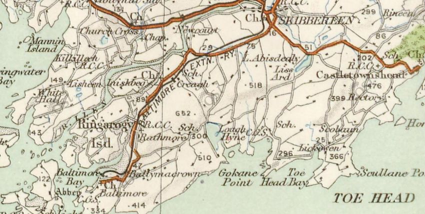
Deep Maps: West Cork Coastal Cultures

• Research Aims and Study Area

• Research Approach

• Materials being used

• Answer some questions
The Research Team

              College of Arts, Celtic Studies and Social Sciences                          School of Biological, Earth & Environmental Sciences

                              Prof. Claire Connolly                                                                 Dr. Rob McAllen
                                                                                                                 School of Biological, Earth and
                                   School of English
                                                                                                                    Environmental Sciences

Dr. Michael Waldron            Orla-Peach Power               Rachel Murphy                       Breda Moriarty                      Seán MacGabhann
                                 Digital Humanities /
  English / History of Art                                  Digital Humanities / History        Ecology / Rural Development                  Marine Biology
                                     Archaeology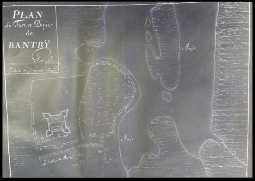
Research Aims

1. Develop a methodology for the interrelationship of cultural and biological knowledge
   that can be scaled for other maritime environments

2. Connect the priorities of scientific research to contemporary understandings of coastal
   environments via an exploration of the cultural history of selected sites in the context
   of stakeholder workshops

3. Develop a website that depicts the combined cultural and environmental richness of
   selected coastal sites
Study Area: West Cork Coast
Methodology

       Literature

                      Art
                                          Folklore

Present day
(Scientific priorities)
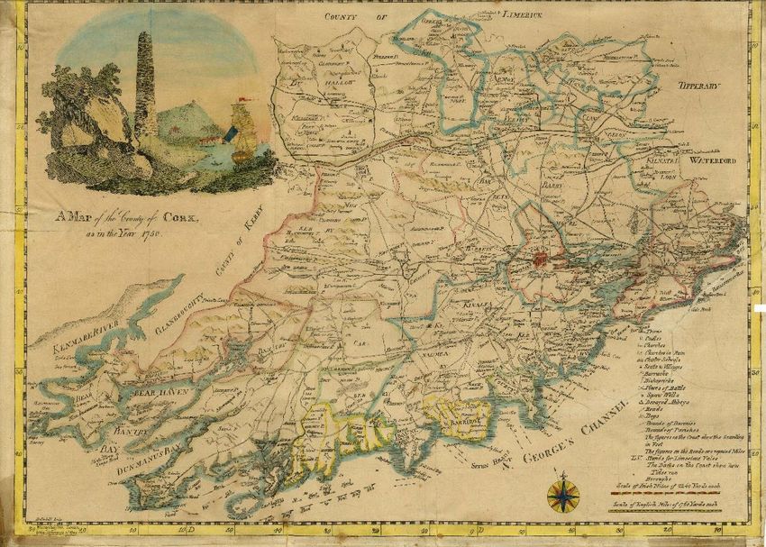
Antiquarianism: Charles Smith

                                                           The Ancient And Present
                                                           State of the County and
                                                           Citie of Cork

               Smith’s Map of County Cork, 1850, via Corkpastandpresent.ie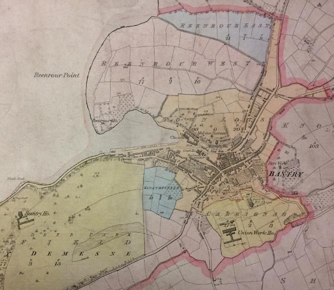
Richard Pococke, 1758
The Templebreedy
Rapids church and well
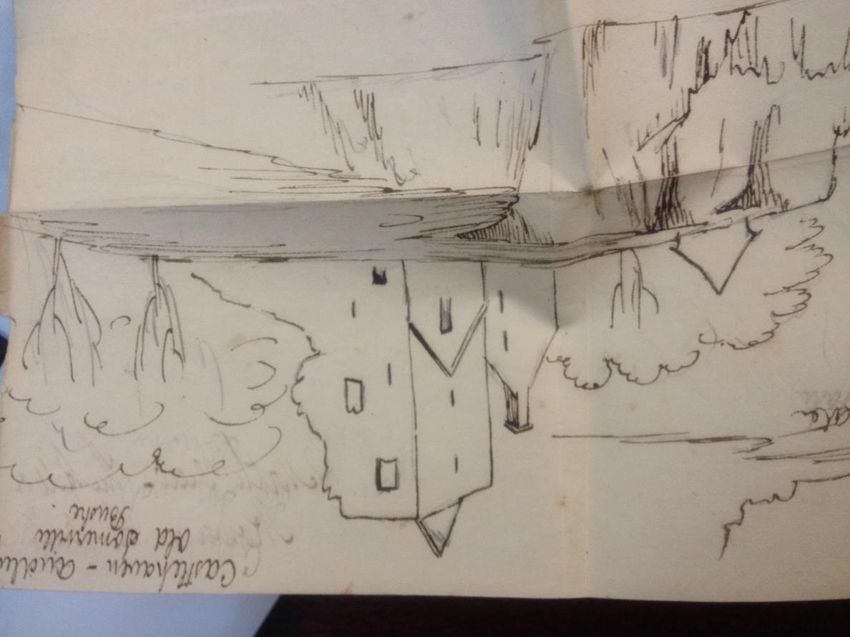
Cloghan Castle,
Castle Island
‘a promontory in it from the South, on which there is an old ruin’d Photograph: Rob McAllen
chapel, & an inlet on one side from the sea by which the water falls
when the tyde goes out like London Bridge. There is an Island in it,
Richard Pococke in Oriental Costume, 1738, with the remains of a Castle. Here is a great plenty of fish at all times
Jean-Étienne Liotard
& oysters always in season’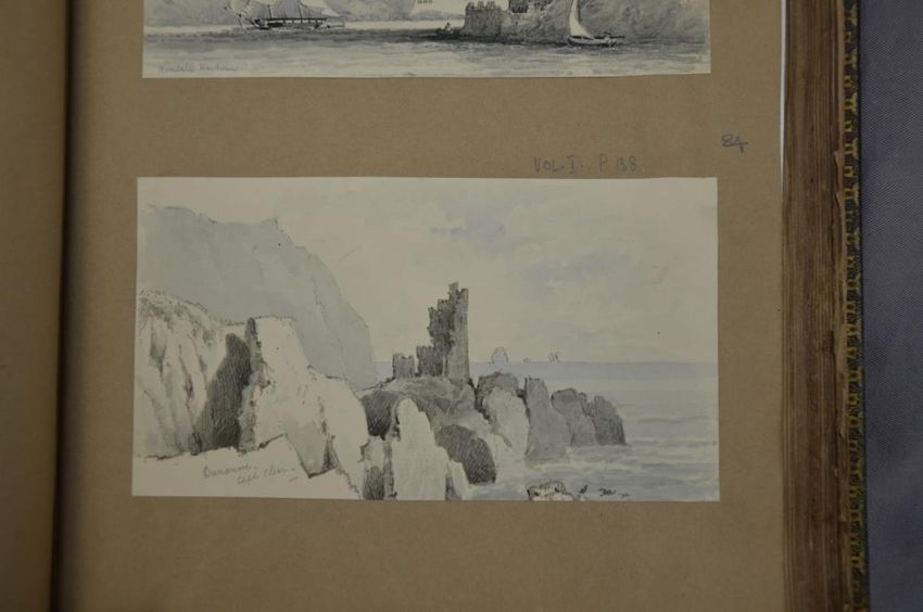
Taylor and Skinner’s Road Maps 1778

                Clonakilty

                                             Baltimore

                             Ross

                Bandon
                                             Skibbereen
Cork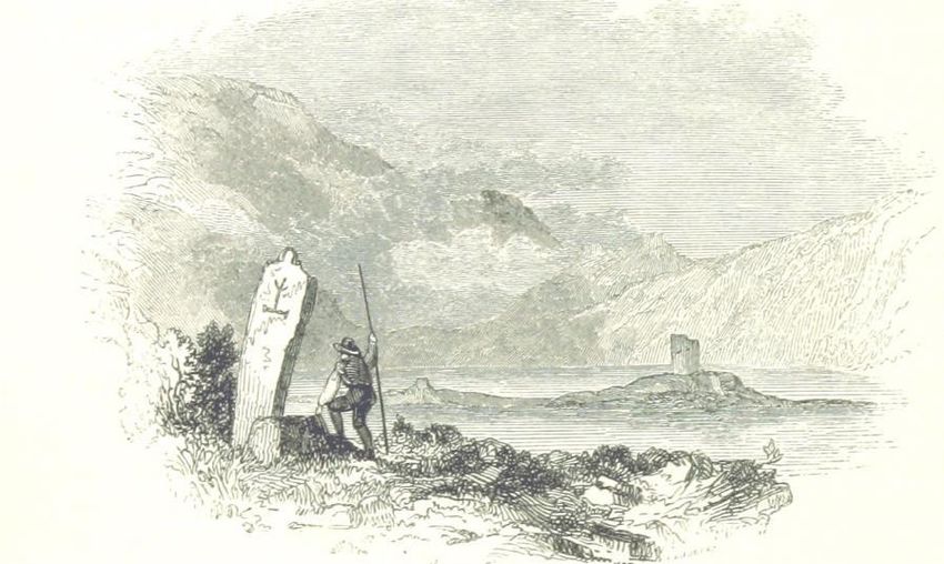
Anne Plumptre
The Halls

Illustration by W. Willes         Engraving by Landells
Windele Collection
??? Cape Clear
Purple sea urchin Paracentrotus lividus
Poetry

                                                       Poem by ‘Stella’, published in The Skibbereen and
                                                       West Carbery Eagle, 1865

                                                                                                           Poem by ‘M.Q.M.’, published in the West Cork and Carbery
                                                                                                           Eagle, 1868
Extract from Loch Ina, published in The Nation, 1845
Historical Sources: Maps
Plan du Fort et Baye de Bantry, Goubet, negative, (c.1690-5), NLI MS 2742 French Military Reconnaissance Plan of Bantry Bay, G. Pawley, May 1808
Map, 1789, NLI MS 809 NLI 15 B. 14 (32)
All maps reproduced with kind permission of the National Library of IrelandHistorical Sources: Maps
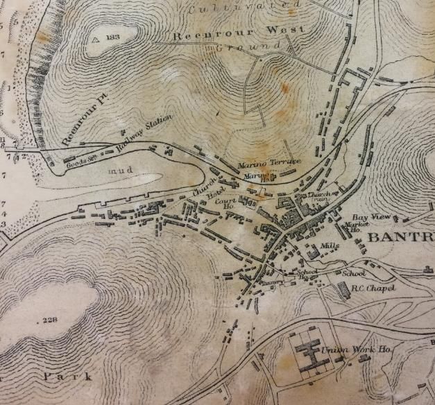
6" OS map of C. Cork, undated but OS map ‘Ireland – West Coast Harbours in Bantry Bay’ 25" OS map ‘Bantry Union and RD Cork
thought to be based on 1842 survey detail of Bantry Harbour, scale 1:10,580, 1914 (Bantry West Carbery)’, 1920
Source: Bantry House Papers, BL EP B 2159 Source: Bantry House Papers, BL EP B 2120 Source: Bantry House Papers, BL EP B 2124Historical Sources: Newspapers and Directories
Pigot’s Directory, 1824 Advertisement placed in
Cork Constitution, 12 April 1851Historical Sources: Photographs
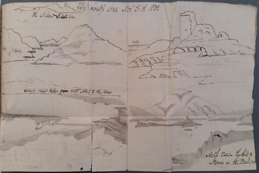
Lough Hyne, Co. Cork
Both images sourced from the Lawrence Collection, National Library of IrelandImage sourced from the Lawrence Collection, National Library of Ireland
Fish Palaces

…Fish palaces: The fishing and curing (smoking, pickling and pressing) of pilchards (Sardinia
pilchardis) became an important industry in West Cork during the 17th century. This industry
suffered from the erratic pattern of pilchard shoals (some years none would appear in Irish waters)
and was in serious decline by the middle of the 18th century. Today, all that remains are the ruins
of curing stations, called “pallices” along the coast. The word “palace” is of uncertain derivation, but
probably originated in the SW of England where it meant a cellar used for storing fish. Usually the
“press wall” is the only standing structure, with its horizontal line of lintelled support niches. These
held one end of a press beam; at the other end a heavy weight was suspended and in the middle
was a wooden press or “buckler”. The buckler was placed over an open barrel of pilchards and the
downward force of the press beam pressed the pilchards into the barrel. Also fish or “train” oil was
squeezed out through a drain in the base of the barrel; this was valuable as a luminant and was used
by the tanning industry…’
Fish Palaces
Baltimore
Fish Palace on Cape Clear
Historical Sources: Contemporary Accounts

                     Charles Smith                   Rev. Horatio Townsend
The Ancient and Present State of the                 Statistical Survey of the
     County and City of Cork (1750)                  County of Cork (1810)
Historical Sources: Estate Papers
Bantry Estate Collection (UCC Library)
including maps, legal papers, fisheries
and shooting leases, correspondences,
sketchbooks, and other materialsCultural Sources: Visual Art
James Gillray, The End of the Irish Invasion –
or – the Destruction of the French Armada
1797
View of Allihies Mines
Sketchbook of Richard White Joshua Rowley Watson William Magrath, Gathering Kelp
c.1820s/30s (courtesy UCC Library) Nelson’s Monument, Castletownshend 1877 (courtesy Crawford Art Gallery, Cork)
c.1815 (courtesy Crawford Art Gallery, Cork)Off to Skibbereen from Newlyn
Alexander Stanhope ForbesHistorical Sources: Official Records
Reports and Commissions
e.g. Annual Reports of Inspectors of Irish Census Reports
Fisheries
Source: British Parliamentary Publications Source: HISTPOP
and British Parliamentary PapersCultural Sources: Folklore
Labhras O Loinsigh
• https://www.youtube.com/watc
h?v=ofd-UMvTYMg
‘Sea-horses’ in Bantry Bay, referred to in The Schools’
Collection, Volume 0281 (Bantry School)Cultural Sources: Literature
RIA - JJ Callanan
Cultural Sources: Travellers’ Accounts

                                                                          Clodagh Leigh-White
                                                                          Nature Notebook
                                                                          (1913-18)

Georgiana Chatterton              Mrs & Mrs Samuel Carter Hall
Rambles in the South of Ireland   Ireland: Its Scenery, Character, etc.
in the Year 1838 (1839)           Vol I (1841)
Lough Hyne – Current Status • Europe's first statutory Marine Nature Reserve (since 1981) • The Lough sustains a huge variety of marine plants and animals • Important on an international scale
Environmental Issues at the Lough
            Biodiversity Loss and Changes

  Eutrophication                       Invasive Species
Deep Maps surveys and their role • What are the perceptions of stakeholders with regard to marine issues? • How is information about marine priorities being transferred to stakeholders? • Does more need to be done for outreach and dissemination of information? • Can these perceptions be linked to the heritage and culture that may have contributed to forging them?
Methodology

• Questionnaires

• Workshops

• In person interviews
Marine Environment

• What is the benefit/importance of the marine
 environment?

• What are the concerns for the marine environment?
Marine Conservation: Policies and role of scientific outreach

• Do you think that marine conservation efforts are appropriate and useful? There are a
  number of policies in place, how aware are you of these?
• Does the public need to know about policy?
• Can improvements with regard to how marine environmental issues and policies are being
  communicated be made so that there is greater understanding at a local level? (How….)
• Scientific outreach (for example; workshops, public talks, conferences, lectures, dedicated
  events...), what is their role in dissemination of marine environmental information?
Present linking to the past

• How do you learn/access information about the marine
  environment? (Role of relatives, word of mouth, media…)
• What role has culture/heritage played in your perceptions
  about the marine environment?
• Has the coastal (coast and sea) area changed in your lifetime?
  (Biologically, anecdotally...)
You can also read