FOREST STATE OF THE REPORTING PROGRESS ON CANOPY AND WOODLAND COVER - York Region
←
→
Page content transcription
If your browser does not render page correctly, please read the page content below
STATE OF THE
FOREST
REPORTING PROGRESS ON CANOPY
AND WOODLAND COVER
MAY 2021

YORK REGION FORESTRY
Healthy Trees, Healthy Communities
Forests include woodlands and
                                         trees in all urban and rural areas
2   THE REGIONAL MUNICIPALITY OF YORK
YORK REGION’S TREE COVER IS INCREASING,
BENEFITING PEOPLE AND COMMUNITIES
York Region is steadily increasing the benefits residents and communities enjoy from its trees and woodlands,
despite challenges from pests, extreme weather, and urbanization.
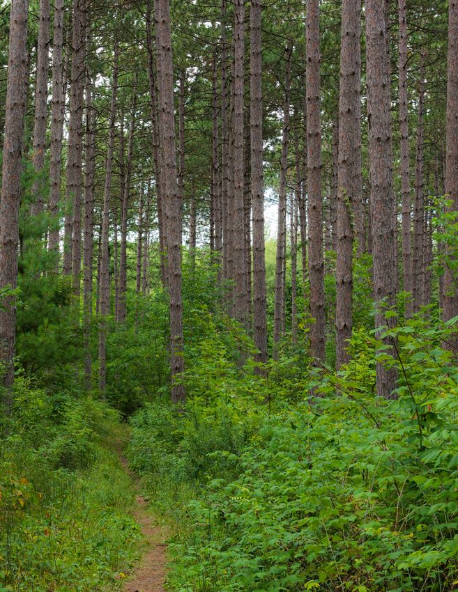
York Region has over 30 million trees, collectively called the Region’s forest. These trees grow on public and private
lands, including woodlands, trees along streets, in parks, cemeteries, and backyards.
In 2016, York Region published its Forest Management Plan, which laid out a path for protecting and managing
the forest within its borders. It included a goal for woodland cover as set out in the Regional Official Plan (2010),
added a new goal for canopy cover and provided the roadmap to achieve these goals. The management plan
also committed to regularly monitoring and reporting on canopy and woodland cover every five years and forest
diversity and benefits every ten years through the State of the Forest reports.
The first State of the Forest report was prepared in 2017 and this 2021 report
provides an update on canopy and woodland cover in York Region. The 2026 report
will incorporate a five-year update on canopy and woodland cover and a ten-year
update on forest diversity and benefits.
York Region has over 30 million trees,
S T A T E O F T H E
FO R ES TS
M A R C H 2 0 1 7
collectively called the Region’s forest. YORK REGION FORESTRY
Healthy Trees, Healthy Communities
CANOPY COVER WOODLAND COVER
Area of land across the Region under Area of land across the Region under heavily treed areas
every tree that are at least 0.2 hectares in size
STATE OF THE FOREST | MAY 2021 3
Studies carried out for this report show that woodland Trees outside woodlands now make up about one-
cover had a net gain of 260 hectares, increasing it to third of the total canopy and are expected to be
23.6% in 2021. Woodlands were estimated to cover important in achieving the 2051 goal of 40% canopy
41,500 hectares of the Region, making up about cover. Their contribution will depend, however, on
two-thirds of the Region's entire canopy cover. Despite continued new plantings and good care of existing
a net gain in woodland cover, the Region is unlikely trees to ensure their long-term health.
to meet the target of 25% woodland cover by 2031.
While the natural expansion of woodland edges
and large-scale tree planting outpaced the loss of
woodland due to clearing, the net gains achieved are 2051 GOAL 40%
not enough to close the gap by 2031. Even though the 2021 CANOPY COVER 33.4%
rate of increase is less than anticipated, reasonable
gains are being made despite the ongoing pressure
from different land use needs. With continued planting
and protection efforts, the target of 25% woodland
cover can reasonably be achieved by 2051.
The distribution of canopy cover varies across the
Canopy cover reached 33.4% in 2021, moving it closer Region due to urban and rural landscapes. While it
to the goal of 40% by 2051. Canopy cover increases would be impossible to distribute canopy cover evenly
were largely due to the growth and planting of trees across the Region, there is the potential in every
in newer residential areas. Many new developments municipality to increase the number and size of trees
involve the planting of neighbourhood trees. As well, and shrubs.
the Region and local municipalities plant and maintain
trees along roads and parks, and support partnerships
that encourage planting on private property.
Canopy Recommended Woodland Recommended
First Nation/Municipality
Cover Range Cover Range
Chippewas of Georgina Island
88.9% 78.7%
First Nation
Aurora 34.0% 29% to 35% 18.4% 19% to 20%
East Gwillimbury 37.4% 39% to 44% 30.4% 31% to 33%
Georgina 44.4% 46% to 47% 34.8% 39% to 40%
King 34.3% 36% to 41% 26.5% 26% to 28%
Markham 20.6% 20% to 35% 7.5% 8% to 10%
Newmarket 28.1% 25% to 35% 9.8% 11% to 13%
Richmond Hill 29.8% 26% to 35% 14.7% 14% to 15%
Vaughan 21.9% 25% to 35% 12.4% 14% to 17%
Whitchurch-Stouffville 38.9% 40% to 45% 30.9% 30% to 32%
York Region 33.4% 40% by 2051 23.6% 25% by 2051
4 THE REGIONAL MUNICIPALITY OF YORK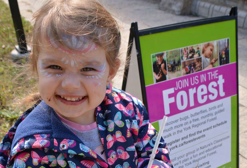
THE 2021 CANOPY COVER ASSESSMENT FOUND THAT:

   More rural municipalities have the                                               CANOPY COVER                    WOODLAND
   most canopy cover, including                                                     OUTSIDE WOODLANDS               COVER

   more woodlands

  Areas with a higher population density have                                     Chippewas of Georgina Island

  significantly lower canopy cover

                                                                                    Lake Simcoe
   Urbanized areas typically
   have lower canopy cover and
   higher surface temperatures
                                                                       Georgina

   In general, neighbourhoods
   with lower median
   family income have
   less canopy cover
   than those with
   higher income
                                                                            East Gwillimbury

                                                   Newmarket
       King
                                                                       Whitchurch-Stouffville
                                                    Aurora

                                                                                                      It takes eight to ten
                                                                                                      years for newly planted
                                                                                                      tree seedlings to grow large
                                            Richmond Hill
                                                                                                      enough to be recognized
                                                                                                      as woodlands. That means
                                                                                                      large-scale tree plantings
                                                                                                      since 2015 are growing into
        Vaughan                                                   Markham
                                                                                                      our future woodlands.

  Satellite Imagery © 2019 DigitalGlobe, Inc., a Maxar company.

                                                                                                  STATE OF THE FOREST | MAY 2021   5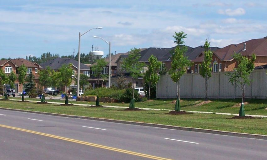
ADVANCED MEASURING TOOLS GIVE A BETTER
    ESTIMATE OF CANOPY AND WOODLAND SIZE
    For this report, canopy cover estimates were updated     Previous estimates of canopy cover relied on a variety
    using sophisticated methods that included high-          of methods used at different points in time, and
    resolution multi-spectral satellite imagery and LiDAR,   satellite imagery was not available for the entire
    which stands for Light Detection and Ranging.            Region. Because the combination of LiDAR and Region-
                                                             wide orthoimagery improved the accuracy of canopy
    Multi-spectral satellite imagery captures different
                                                             mapping, for this report visual inspections were carried
    wavelengths of light to identify vegetation, bare
                                                             out in some areas to determine how much of the
    ground, water and built structures like roads and
                                                             apparent increase in canopy from earlier studies was
    buildings. Images are corrected for viewing angles,
                                                             due to more precise measurement techniques and how
    topography, and earth curvature to give what is
                                                             much reflected actual canopy growth.
    called orthoimagery.

    To generate LiDAR data, a pulsed laser beam is
    projected from an aircraft to measure the constantly
    changing distance to the earth, producing a three-
    dimensional image of the surface. LiDAR data is then
    combined with orthoimagery and other information to
    produce a detailed image of the earth’s surface that
    identifies canopy cover provided by trees and shrubs.

          HOW LIDAR WORKS                                      Airborne Imaging Inc., 2019 LiDAR

                         First pulse and return                   Subsequent readings
                         reading from the ground                  from return pulse

6   THE REGIONAL MUNICIPALITY OF YORK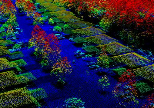
Woodland cover across the Region
has increased by 260 hectares -
that's about 363 soccer fields

 The analysis showed that just over half of the increase    The techniques used for this report have created a solid
 resulted from better measuring techniques while the        baseline, and the Region plans to use them again to
 remaining increase was from actual canopy growth.          measure canopy and woodland cover in 2026 to ensure
 Canopy cover grew to 33.4% in 2021, and the previous       consistency and accuracy in measuring progress.
 canopy cover estimate of 31% was underestimated.

 Unlike canopy cover, woodlands are identified from
 digital orthophotographs based on size and tree
 density. Past assessments calculated woodland cover
 using the total area but using land area (excludes
 water bodies) is a more accurate reflection of
 woodland cover. From satellite imagery and LiDAR,
 the land area for the Region is derived, therefore, with
 this report, the land area is used to estimate the 2021
 woodland cover and correct the 2017 woodland cover
 from 23.2% to 23.5%.
                                                             © First Base Solutions Inc., 2019 Orthophotography

                                                                                       STATE OF THE FOREST | MAY 2021   7
WITH GROWTH AND URBANIZATION, INVESTING IN
    TREES IS MORE ESSENTIAL THAN EVER

    Forests provide a wide variety of public health, economic, social, and environmental services that help make York
    Region a better place to live. These services are becoming more essential as growth and urbanization continue,
    bringing more people and more intense development.

    Attempting to provide these same services with built or manufactured infrastructure would be extremely costly
    and in some cases impossible. In addition, the huge intrinsic value that nature provides to residents cannot be
    quantified or replaced.

    Examples of services that trees and forests provide:

      REDUCING ENERGY USE                                           IMPROVING AIR QUALITY

    The shade provided by trees around homes and                  Air pollutants reduce respiratory health and air
    buildings reduces the need for conventional air               quality. Each year, the Region’s trees and shrubs
    conditioning, saving York Region property owners              “breathe in” about 3,300 tonnes of air pollutants such
    an estimated $8 million a year in energy costs. In            as ozone, sulfur dioxide and nitrogen dioxide through
    winter, trees planted as windbreaks can lower home            their leaves, trap or convert the harmful chemicals,
    heating bills.                                                and breathe out pure oxygen in return.

      FIGHTING CLIMATE CHANGE                                       SHELTERING WILDLIFE

    Trees in York Region store, or sequester, roughly             Trees and shrubs provide critical habitat for a wide
    80,000 tonnes of carbon each year by absorbing                range of wildlife, including birds, pollinators and
    carbon dioxide. This is equivalent to taking 62,000           other insects.
    vehicles off the road.

8   THE REGIONAL MUNICIPALITY OF YORK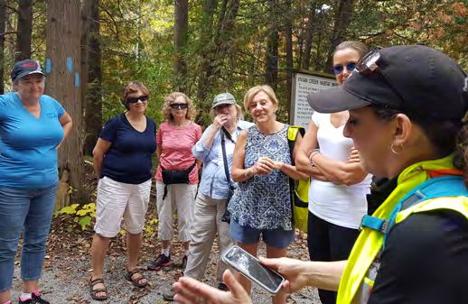
REDUCING EXTREME HEAT IN BUILT-                            ADDING TO PROPERTY VALUE
  UP AREAS
                                                           Canadian surveys have shown that having mature
Hard surfaces such as roads and buildings collect          trees around a house can increase its value by up to
the sun’s heat, then radiate it out again. This “urban     15% by providing privacy and adding character to a
heat island effect” raises local temperatures and is       neighbourhood. Trees and shrubs also advance the
especially hard on children, seniors and the chronically   Region’s goal of creating Complete Communities by
ill. Numerous studies show that canopy cover reduces       encouraging active transportation and enhancing
temperatures and the heat island effect.                   natural heritage.

  IMPROVING MENTAL AND PHYSICAL                              ABSORBING STORMWATER AND
  HEALTH                                                     IMPROVING WATER QUALITY

Research has verified that simply spending time near       If unchecked, the runoff from storms can flood
trees improves physical, emotional, mental, and            basements and low-lying areas, carry away valuable
social wellbeing. Woodlands and urban trees create         topsoil, erode stream banks and overburden storm
an appealing environment that encourages walking,          sewers. The Region’s trees and shrubs absorb
running, cycling and other outdoor exercise. Trees         millions of cubic metres of stormwater each year
block UV rays, which helps prevent skin cancer, and        through their roots, countering these threats. They
their shade makes exercising more comfortable.             also reduce suspended solids in streams and rivers,
                                                           making water cleaner and clearer.

                                                                                  STATE OF THE FOREST | MAY 2021   9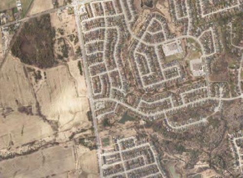
LIDAR GIVES FIRST DETAILED LOOK
     AT TREE HEIGHTS ACROSS THE REGION
     Using LiDAR for the 2021 assessment allowed the                                Results from the Region’s 2020 Street Tree Health
     varying height of the canopy across the Region to be                           Assessment reinforced the importance of actions
     measured for the first time. Height was found to range                         such as mulching and watering to reduce stress from
     from 2 metres to 36 metres (or about 6 to 120 feet) with                       transplanting and drought. This attention is especially
     half of the canopy measuring at a height below average.                        important for trees outside woodlands, which tend to
                                                                                    face more stressful growing conditions.
     This supplements earlier conclusions based on trunk
     diameter that the trees in the Region’s forest are                             Since larger trees provide far more services, investing
     generally younger. Over the past 20 years, the Region                          in their survival in the early years provides excellent
     and its partners have planted trees along streets and                          returns. Continuing to plant and encourage new trees
     in residential areas, often after land was developed.                          every year also remains important, so that when the
     In areas with little canopy cover, even a small tree                           largest and oldest trees eventually die, trees of the
     significantly improves the local environment.                                  right size are always in place to succeed them.

     Larger trees, however, provide exponentially more                              The use of LiDAR for future five-year reports on the
     canopy cover and associated services than smaller                              state of the forest, combined with field measurement
     ones. One large healthy tree can store about 65 times                          every ten years, will help improve management
     more carbon and remove 15 times more air pollution                             decisions by providing valuable insight into how the
     annually than one small tree. It also provides far more                        forest is maturing.
     shade and shelter.
                                                                                                                   80 m2 canopy
     The most effective way of developing the large trees
     the Region needs is to protect and care for younger
     trees as they grow, especially in the first few years                                                         REMOVES
     after planting when they are most vulnerable.                                                                  15%
                                                                                                                   MORE AIR
                                                                                                                  POLLUTION
                                                                                                                  ANNUALLY
                                                                                        20 m2 canopy
                                              COMMUNITY BENEFITS

                                                                    1 m2 canopy
                                                                                                                     HOLDS
                                                                                                                     65%
                                                                                                                MORE CARBON

                                                                      TODAY              20 YEARS                    40 YEARS
                                                                       5 cm.                20 cm.                      40 cm.
                                                                   trunk diameter       trunk diameter              trunk diameter

10   THE REGIONAL MUNICIPALITY OF YORK
Human life could not exist
if there were no trees.
A MIX OF SPECIES PROVIDES
BETTER PROTECTION FROM THREATS
Greater species diversity is important to the health of by maple, cedar and ash. The 10-year assessment
a forest because it reduces vulnerability to threats like being carried out for 2026 State of the Forest report,
invasive pests and diseases and climate change. It using the i-Tree Eco tool developed by the United
also supports a greater range of ecological processes States Department of Agriculture Forest Service, will
and provides food and habitat for more birds, show how tree species composition is changing.
pollinators and other wildlife.
One important shift has been in the prevalence of
When the mix includes native species, the benefits ash, which has been declining in the Region because
are even greater. While a central goal of forestry of the invasive emerald ash borer. The 2026 State of
programs is continuing to encourage native species, the Forest report will also provide an update on the
the challenges posed by some planting locations, impact of this and other invasive species.
especially in highly urbanized areas, coupled with a
changing climate, support the use of select non-
native species.
The 2017 State of the Forest Report showed that
EMERALD ASH BORER
forests in York Region contained approximately (EAB)
50 different native tree species and were dominated
STATE OF THE FOREST | MAY 2021 11FOREST MANAGEMENT PLAN: THE REGION'S
ROADMAP TO A HEALTHY FOREST
The 77 actions in the 2016 York Region Forest Management Plan are the roadmap to achieving the goals of 40%
canopy cover and 25% woodland cover by 2051.
In the four years since the plan was adopted, 45 of the 63 short and medium term actions have been completed or are
being delivered on an ongoing basis, and work on the 14 long term actions are planned for future implementation.
Actions aim to leverage opportunities to grow the forest by engaging private landowners and communicating the value
of trees to all residents, while addressing challenges like the impacts of invasive species. Since 2016, the Region has:
Secured $10 million in funding Planted over 350,000 trees Developed and adopted
from the federal Disaster and shrubs through the Region’s It’s in our Nature: Management
Mitigation and Adaptation Greening Strategy and on heavily Plan for the York Regional Forest
Fund for land securement and travelled roads as part of the 2019 – 2038
tree planting Viva bus rapidways program
Secured an additional 64.5 Worked with partners to counter Shown leadership in innovation
hectares to link natural areas in invasive species such as in forestry practices, as evidenced
the Greenlands System, bringing dog-strangling vine, and taking by research findings presented
the total to 1,376 hectares part in ongoing forums to share at a total of 35 science and
of environmentally significant knowledge about other known technology gatherings from
land protected through its land and emerging threats 2018 to 2020
securement program since 2001
Developed a communication Developed best practices for tree Created a planting prioritization
strategy to increase public planting along rural roads, based tool to analyze planting
awareness of the benefits of on a review of existing practices opportunities across the Region
trees and forests
12 THE REGIONAL MUNICIPALITY OF YORKPublic engagement and education are key to creating a sense of forest stewardship across the Region. Recent
outreach efforts include:
Hosting or co-hosting over 400 events between 2018 Delivering an outdoor education pilot project,
and 2020 involving more than 15,000 participants, targeting the Region’s rapidly growing seniors’ cohort,
who learned about the importance of the natural to highlight the York Regional Forest and explain the
environment and the benefits of trees benefits of connecting with nature
STATE OF THE FOREST | APRIL 2021 13CONTINUING TO GROW: THE JOURNEY AHEAD
Gathering in-depth data and using it to work toward the goals of the York Region
Forest Management Plan is an important aspect of adaptive management -- that is,
management that is flexible to respond to changing needs and conditions.
A key example is the next important step in realizing the plan: working in partnership
with local municipality and conservation authorities to undertake forest studies
across the Region. These studies will be completed between 2021 and 2025 and
results will be included in the 2026 State of the Forest report, along with updated
canopy and woodland cover metrics. These results will be used to review and update
the overall plan to ensure its strategies and actions remain effective.
As it continues to implement the forest management plan, York Region will:
Promote and support stewardship Participate in programs that
and planting programs on private land, such communicate the value of trees and support
as Grow Your Legacy and residential tree- tree-planting initiatives, such as Adopt-A-
planting programs Stream and planting on school grounds
Work with partners to leverage the Plant 400,000 trees and shrubs
prioritized planting tool to target planting and establish 100 additional hectares
to areas that will most benefit of woodland by 2027 with funding from
Infrastructure Canada's Disaster Mitigation
Deliver the Nature's Classroom and Adaptation Fund
program to engage and increase public
awareness of the York Regional Forest and Enhance and rehabilitate natural
the natural environment areas with local municipalities and
conservation authorities through the
Continue to use the Green Infrastructure Greening Action Partnership
Asset Management Plan to drive better
stewardship and care of the Region's
existing trees and woodlands
Canada's federal government has committed
Identify and work towards securing
to using nature-based solutions to fight climate
land for conservation and planting in
partnership with local organizations and change, including planting two
billion
municipalities trees over the next 10 years. The Region
looks to this and other federal initiatives to
Work with partners to research and provide additional funding for its tree-planting
monitor the forest to protect and enhance initiatives.
forest health
14 THE REGIONAL MUNICIPALITY OF YORKMAKING HEADWAY DESPITE A RANGE OF THREATS
REQUIRES CONTINUED COMMITMENT
Guided by the Regional Official Plan and York Region It will also call for recognition that as living
Forest Management Plan, the Region has made infrastructure, trees and woodlands are a long-term
good progress on the goal of increasing tree cover. investment in the Region's future. Rows of saplings
While woodland cover is growing more slowly than planted 8-10 years ago to reclaim and rebuild
anticipated, reasonable gains are being made as the woodlands are now starting to show the diversity
Region balances tree-planting and stewardship efforts and complexity of thriving woodlands. Street trees in
with the need for land for development, agriculture their fifth growing season are beginning to soften the
and other uses. Progress on all fronts is being made hardscaping around them, providing shade, shelter
despite threats posed by invasive species and weather and visual interest.
that is both less predictable and more extreme.
This is a reminder that while the impacts of today's
These threats are not just continuing, they are work to expand the canopy and enhance its health will
increasing. If left unchecked, they could easily push the take decades to fully mature, the ultimate result will
Region and its communities off their current path to be an invaluable legacy to the people of York Region.
success. Reaching the Region's goals for canopy and
woodland cover, which are key to the Region remaining
welcoming and livable as it grows and urbanizes, will
require continued vigilance and commitment.
STATE OF THE FOREST | MAY 2021 15YORK REGION FORESTRY Healthy Trees, Healthy Communities
You can also read