Fraser Thomas GUIDE TO SUBDIVISION & LAND DEVELOPMENT - 50Years
←
→
Page content transcription
If your browser does not render page correctly, please read the page content below
GUIDE TO SUBDIVISION
& LAND DEVELOPMENT

    50         Fraser
               Thomas
       Years

 ENGINEERS RESOURCE MANAGERS SURVEYORS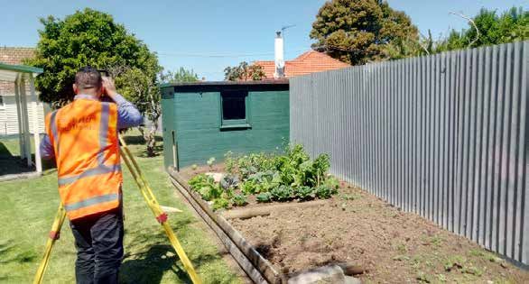
The Fraser Thomas
    Difference:
    Fraser Thomas Ltd is an engineering
    and surveying consulting firm
    based in Highbrook, and has                Engineering
    been      providing;     Surveying,
    Engineering,      Planning     and
    Resource Management services in
    the greater Auckland area for over
    50 years.                                   Surveying

    Fraser Thomas Ltd has additional
    offices in Central Auckland and
    Christchurch, which ensures that
    we can offer services throughout          Subdivisions &
    both the wider Auckland and             Land Development
    Canterbury Regions.
    Subdividing or developing land
    normally involves inputs from              Resource
    many different professionals              Management
    such as Surveyors, Civil and
    Geotechnical Engineers as well as
    other disciplines who may need to
    address specific issues.
                                             Peer Review &
    Fraser Thomas Ltd provides a full        Expert Witness
    range of these services and has
    built relationships with other
    consultants, local Councils, utility
    providers and contractors to              International
    ensure a cost effective and efficient
    service is provided to our clients.

   50 Fraser
                                            Contaminated Land

              Thomas
      Years

ENGINEERS RESOURCE MANAGERS SURVEYORS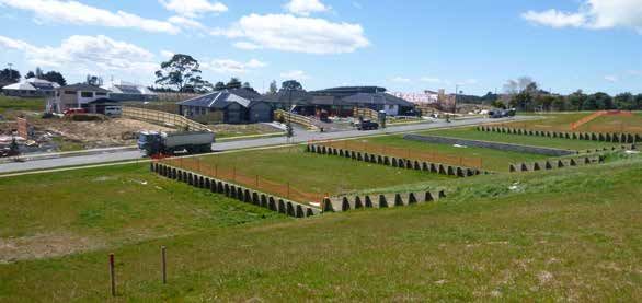
This guide on subdivision and land development aims to
provide you with information on important steps in the
process, from initial feasibility investigations, the resource
consent process, right through to obtaining new titles for
your subdivision to allow new sites to be created and sold.

1. What is Subdividing?
Subdividing involves dividing land or buildings into separate parts,
to enable them to be sold or split into separate ownership. There
are various reasons why you might want to subdivide your property.
It may be that your section is too big for your needs, or that your
section may have been re-zoned so that you are now permitted to
subdivide, in a manner that was prohibited before.
A particular type of resource consent, called a “subdivision consent”,
is required from the local Council to do this. A subdivision consent
is also required to alter a boundary between two properties. A
number of legislative provisions govern the subdivision of land, the
most prominent being the Resource Management Act 1991. This
Act enables Councils, through District Plans and resource consents,
to control all subdivisions, therefore controlling any adverse effects
on the community and environment that the subdivision may have.
Before deciding to subdivide property, whether it be in a rural or
urban area, it is important to appreciate the length of time involved
in the process. The length of time will differ depending on the size
and complexity of your project.
2. Can I Subdivide?
      To enable you to subdivide your
      property you must meet the
      requirements of the Council’s
      Unitary or District Plan.
      These include various planning
      controls    and     development
      standards such as provision
      of suitable building platforms,
      minimum lot sizes, building
      height in relation to boundary,
      minimum yard sizes, private
      open space, vehicle access,
      parking and manoeuvring. These
      requirements vary according to
      the zoning of your property.
      You must also show that
      adequate provision can be
      provided for utility servicing to
      all the lots created. This includes
      provision for disposal of waste
      water, stormwater and supply of
      power, telephone and water.
      If your property is located on an
      overland flowpath or in an area
      affected by flooding, you must
      be able to demonstrate that your
      project will adequately provide
      for overland flow and not worsen
      the flood risk on neighbouring
      properties.

   50 Fraser
              Thomas
      Years

ENGINEERS RESOURCE MANAGERS SURVEYORS
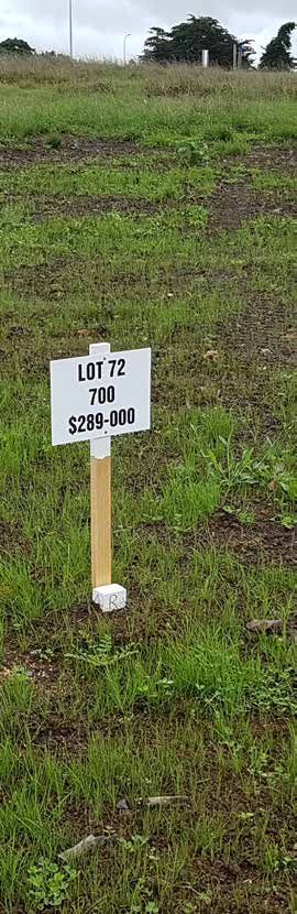
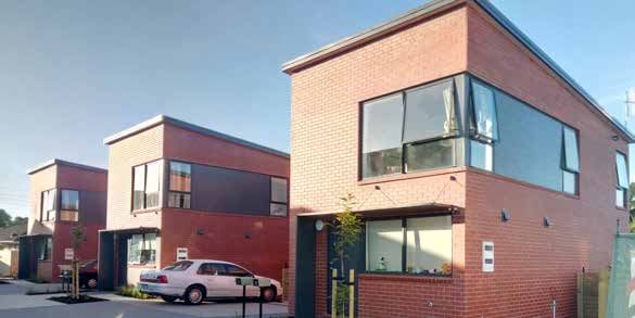
3. Types of Subdivision
The three most common types of subdivisions are:
Fee simple, Unit title, and Cross-Lease

 Fee simple
 A fee simple subdivision creates one or more additional sections
 from an existing parcel of land. New records of titles are created
 for each parcel. A fee simple subdivision is the most common
 type of subdivision

 Unit title
 A unit title subdivision creates individual titles to units,
 apartments or semi-detached dwellings over an existing fee
 simple parcel of land. The unit title plan identifies each dwelling
 as a “principal unit”. In some instances, the unit plan may
 also show accessory units associated with each principal unit.
 The units usually have a share in the common property such
 as vehicle acess, manoeuvring areas, lifts, stairs and gardens.
 A body corporate must be formed to manage the common
 facilities, insurance and maintenance.

 Cross-lease
 A cross-lease (or flat plan) subdivision is generally less desirable
 in today’s market. In this instance, a lease is created over the
 household unit and is identified as a “flat”. The remainder of
 the section. e.g. gardens, or vehicle access is usually held in
 covenant area and common ownership.
4. What is a Consent?
      A “consent” gives you, as the developer, the right to carry out
      specific work in accordance with various legislation and associated
      regulations. You will need to obtain the required resource consents
      from Council before any subdivision work starts on the property
      you own.
      For subdivision/ land development projects, the following consents
      are usually required:
         • Land use consent
         • Subdivision consent
         • Building consent
      Land Use Consent
      A land use consent is a written approval from Council to use or
      modify your land in a manner that contravenes a rule in the Unitary
      or District Plan. All activities, except those permitted, require a
      land use consent before you can carry out the activity.
      Subdivision Consent
      A subdivision consent allows you to create new titles on a piece of
      land. All subdivisions require consent from Council to ensure that
      the land is suitable for the proposed development and is capable
      of being fully serviced and to address any land stability or flooding
      issues. A subdivision allows you to be able to sell part of your land
      provided you meet the relevant standards.
      Building Consent
      A building consent is a written approval from Council for you to
      carry out specific building works. A building consent ensures
      compliance with the Building Act 2004 and with the New Zealand
      Building Code. Before Council issues a building consent, they need
      to be satisfied on “reasonable grounds” that the proposed works
      will be structurally sound, that there is adequate sanitary plumbing
      and drainage, and that the minimum fire and other safety standards
      are met. Some basic work does not require building consent;
      however most building work will require a building consent in
      order to comply with current regulations.

   50 Fraser
              Thomas
      Years

ENGINEERS RESOURCE MANAGERS SURVEYORS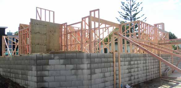
5. How Much Will It Cost?
The cost can vary widely. Basically, the more complicated the more
costly the development. However, by engaging a consultant at the
start of the process you can ensure the procedure is simplified for
you as much as possible and ensure all Preliminary Investigations
are carried out at the appropriate time, to reduce the risk of having
to duplicate trips to site and Council.

6. How Long Will It Take?
Again, this is highly subjective, but a more straightforward
subdivision, ie that which comes with less conditions, will progress
more quickly than a site that is required to undergo multiple
preliminary investigations.
50 Fraser
              Thomas
      Years

ENGINEERS RESOURCE MANAGERS SURVEYORS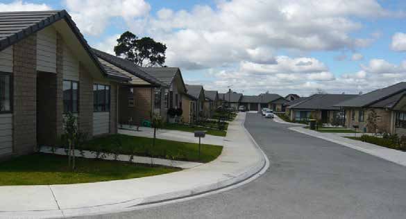
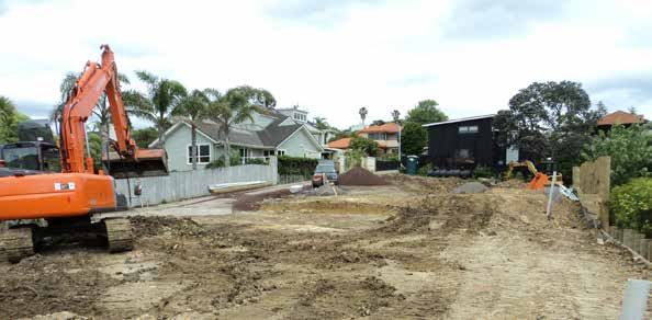
7. Typical Subdivision
Process
                                We can assess your project, and depending
  Feasability Assessment/        on the complexity, we may consult our
     Budget Costings                  inhouse Geotechnical, Civil,
                                      and Environmental Engineers

                               Our licensed surveyors can survey your block
   Topographic survey/                  and produce a scheme plan
 Development scheme plan                   for your development

Resource Consent application
    and issue of Consent

   Site Construction works
  (eg Accessways, drainage
           utilites)

      Preparation of           Our licensed surveyors will prepare the new
      New Title Plans                Title Plans for your development

    Section 223/224(c)
   approval from Council

   Land Transfer survey           Our licensed surveyors will lodge the
                                    completed Title Plans with LINZ
   and lodgement with                  and liase with your solicitor
   Land Information NZ

  Solicitor applies for and
     obtains New Titles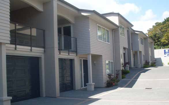
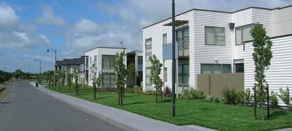
Auckland Unitary Plan
    The Auckland Unitary Plan has opened up considerable infill land
    development opportiunites. The Unitary Plan has simplified the
    residential zones throughout Auckland with six zones created to
    allow for different levels of housing intensity.
    The residential zones which allow for infill development
    opportunities include the following:
       • Single house zone
       • Mixed housing suburban zone
       • Mixed housing urban zone
       • Terrace housing and apartment building zone
    If your property falls within one of the above residential zones then
    there may be an opportunity to complete an infill development.
    This may only be limited to one additional dwelling depending
    on the zoning, area of our property and the ability to service the
    property.
    Fraser Thomas can complete a desktop assessment of your
    property to provide you with a summary of any potential infill
    opportunities. Should a more detailed assessment be required to
    assess the opportunities we can provide you with a comprehensive
    services offer covering the provision of planning, surveying and
    engineering services.

   50 Fraser
              Thomas
      Years

ENGINEERS RESOURCE MANAGERS SURVEYORS
“ Fraser Thomas Ltd showed excellent co-ordination
”
and time keeping within their team... They provided
an excellent service with a reasonable price...
- Zainal Ali, Manurewa6. Some Definitions...
Feasibility Assessment/ Budget Costings
Prior to commencing any subdivision it is essential to assess
whether a proposed subdivision is possible in terms of the Unitary
or District Plan requirements and feasible in terms of return on
investment. Fraser Thomas Ltd can provide a feasibility assessment
detailing the budget costs to complete a subdivision.
Topographical Survey/ Scheme Plan of Development
This is a survey of the ground levels and significant features on a site.
From this field information, we produce a plan showing such things
as ground levels, contours, buildings, services, legal boundaries,
trees and any other features relevant to the future development
of the site. This information is used for any engineering design
required and the plan forms the basis of the scheme plan showing
the proposed subdivision. The scheme plan is submitted to Council
as part of the resource consent application. If the project includes
proposed new dwellings, the topographical survey is used by the
architectural designer to prepare plans.
What’s Included in a Resource Consent Application?
The amount of information that needs to be in a consent application
varies according to the scale and complexity of the proposed
development. For subdivisions, typical information required to be
submitted with an application include:
• Scheme plan of subdivision
• Detailed engineering design for access and servicing
• Details of compliance Council planning requirements
• Assessments of effects and mitigation measures.
50 Fraser
Thomas
Years
ENGINEERS RESOURCE MANAGERS SURVEYORSSections 223/224(c) Approval from Council A section 223 certificate is issued by Council to certify that the new Title Plan conforms to the subdivision consent. A Section 224(c) certificate is issued to certify that all of the conditions of the subdivision consent have been completed to the satisfaction of Council. Both of these certificates need to be issued before a solicitor can obtain new records of title. Land Transfer Survey This involves investigating old survey plans and information and performing various calculations to define the existing and new boundary positions. These boundary positions are marked (usually with boundary pegs) on site, and a new Title Plan is prepared. The new Title Plan, along with other reports, plans and calculations, form the Cadastral Survey Data-set which is lodged with the government agency, Land Information New Zealand (LINZ). Only Licensed Cadastral Surveyors can undertake this work.
7. Preliminary
      Investigations
      There are a number of specific investigations that may be undertaken
      either at the feasibility stage, or as part of preliminary design.
      These include flood reports, contaminated land assessments and
      infrastructure assessments.

      A critical question in the development process is can your site be
      serviced for water supply, stormwater and wastewater?

      With stormwater, if your development will result in an increase in
      impervious area, then there may be additional requirements you
      need to address to ensure that stormwater can be discharged from
      your site without causing downstream pipe capacity issues. Fraser
      Thomas has considerable expertise in stormwater and is familiar
      with the sometimes complex Unitary Plan requirements in this
      area, including those sites located in Stormwater Management
      Area – Flow 1 and 2 areas.

      With wastewater, if you are adding living space, your wastewater
      generation will increase and may cause capacity problems in the
      downstream wastewater system. Council may require the capacity
      of this system to be assessed as part of your application. If you are
      located in a “red area” with confirmed wastewater system capacity
      constraints, then you will either need to delay your development,
      or install temporary wastewater storage and pump at night into the
      wastewater network. Fraser Thomas is familiar with this process,
      having designed a number of private wastewater pump stations,
      and obtaining the necessary Watercare approvals.

   50 Fraser
              Thomas
      Years

ENGINEERS RESOURCE MANAGERS SURVEYORS
Flood Reports Fraser Thomas produce Flood Assessment Reports. Council may will require these reports if you wish to develop your property and if your property is located within a flood hazard area, or an overland flowpath. As part of this process, we will establish the required finished floor level for any new buildings, assess any associated resource consenting requirements, and investigate mitigation measures that may be taken to facilitate your development. Asbestos If your development project involves the demolition or refurbishment of existing buildings, structures or plant on site, you are required to undertake an asbestos survey, prior to undertaking these works, under the Health and Safety at Work (Asbestos) Regulations 2016. This typically involves a desktop study of historical building records, site buildings inspection, collection and testing of potential Asbestos Containing Material (ACM) and preparation of an Asbestos Management Plan, which will list all suspect and confirmed ACM sources and set out appropriate management measures. Fraser Thomas has accredited Asbestos Buildings Inspectors and is also familiar with testing soil for potential ACM associated with uncontrolled demolition. Contaminated Land Assessment When subdividing land, changing land use or undertaking soil disturbance, you are required to demonstrate whether or not HAIL activities (Hazardous Activities or Industries List) have “more likely than not” taken place in the past or present on the land (or part of the land) subject to development. Fraser Thomas cover all facets of contaminated land work including: Preliminary site investigations (PSI): desktop study, site walkover and reporting; and Detailed site investigations (DSI): PSI + soil/water sampling, analysis and interpretation. Our team is led by a Certified Environmental Practitioner in Contaminated Land (CEngP-CL).
8. Council Application
      Process
      Most resource consents can be processed without being publicly
      notified, in which case Council is required to complete the processing
      within 20 working days. Publicly notified applications have longer
      timeframes, with the processing time varying depending on the
      complexity of the application.

      The length of time to gain consents can be minimised if the consent
      application is prepared by people with experience in both the
      consents process and with council requirements.

      9. Affected Person’s
      Approval
      If there are persons or property that may be assessed as being
      adversely affected by the proposal, their written approval will be
      required before we lodge the application with Council. This involves
      approaching both the landowners and occupiers with information
      and plans of the proposal for their consideration. If an affected
      person does not give approval to the proposal, this may impact on
      the way that the application is processed by Council.

      A right of entry approval is required from adjoining landowners if
      any work is to be undertaken on their property, such as connections
      to existing drainage lines.

   50 Fraser
              Thomas
      Years

ENGINEERS RESOURCE MANAGERS SURVEYORS
10. Duration of Consent Once your subdivision or land-use consent is granted, you have a specific time frame within which to build or establish what has been approved. A subdivision or land-use consent typically lapses five years after the date on which it was granted, unless you have given effect to your consent (see explanation below). For a land use consent, “given effect” means that all works have been completed such that, the activity is established or the buildings built. For a subdivision consent, “given effect” has been defined by the Act as the time when your survey plan has been submitted to Council and they have issued their Section 223 certificate. Once your survey plan has a Section 223 approval, you have three years from that date to deposit your plan with LINZ to allow your new titles to be issued, thus giving a maximum total development time of up to eight years.
Disclaimer
    The information contained in this guide is intended to be of a
    general nature, to provide guidance in the area of subdivision
    and land development. While we have endeavoured to provide
    accurate information at the time of publication, due to changing
    regulatory requirements, Council processes and the peculiarities
    of particular sites, we cannot guarantee the information contained
    herein.

    No liability is accepted by this firm or by any Principal, Director, or
    any servant or agent of Fraser Thomas Ltd in respect of the use of
    this guide, and any person who relies upon any matter contained
    in this guide does so entirely at their own risk.

    The information and details contained herein are copyrighted by
    Fraser Thomas Ltd, and all rights related thereto are reserved.

   50 Fraser
              Thomas
      Years

ENGINEERS RESOURCE MANAGERS SURVEYORS
Contact Us If you wish to discuss your proposed project with us, then please contact our Survey Department today and we can arrange a free 30 minute initial consultation with a senior member of our staff to explain what your options are and how we can help you achieve your goals. Level 1, 21 El Kobar Drive East Tamaki, Auckland PO Box 204 006, Highbrook, Auckland 2161 p. 0508 2 SURVEY | p. 09 278 7078 e. admin@ftl.co.nz www.fraserthomas.co.nz
Delivering your project:
      • Consulting Engineering
      • Surveying & Planning
      • Civil Engineering
      • Structural Engineering
      • Geotechnical Engineering
      • Environmental Engineering
      • Contaminated Land
      • Asbestos
      • Waste Management
      • Resource Management
      • Land Development
      • Project Management
      • Infrastructure Planning

         50 Fraser
                    Thomas
            Years

      ENGINEERS RESOURCE MANAGERS SURVEYORS

      21 El Kobar Drive, Highbrook, Auckland
Unit 3a, Barry Hogan Place, Riccarton, Christchurch
           P.O Box 7011, Taradale, Napier

        p. 09 278 7078 | p. 0508 278 7839
                e. admin@ftl.co.nz
             www.fraserthomas.co.nz
You can also read