General Aviation Pilot's Guide to Preflight Weather Planning, Weather Self-Briefings, and Weather Decision Making - Federal Aviation Administration
←
→
Page content transcription
If your browser does not render page correctly, please read the page content below

Federal Aviation
                         Administration

General Aviation Pilot’s Guide
to Preflight Weather Planning,
Weather Self-Briefings, and
Weather Decision Making
General Aviation Pilot’s Guide
   Preflight Planning, Weather Self-Briefings, and Weather Decision Making

  Foreword……………………………………………………………                                             ii

  Introduction………………………………………………………                                           1

I Preflight Weather Planning……………………………………                                    2

      Perceive – Understanding Weather Information………………….....                2

      Process – Analyzing Weather Information ………………..………...                  7

      Perform – Making A Weather Plan.…………………………………...                       11

II In-flight Weather Decision-Making……………………………                              14

      Perceive – In-flight Weather Information……………………..........             14

      Process – (Honestly) Evaluating In-flight Conditions……………..            16

      Perform – Putting It All Together……………………………………                        20

III Post-Flight Weather Review…………………………………...                               22

IV Resources…………………………………………………………                                           23

      Appendix 1 – Weather Products & Providers Chart……………...                24
      Appendix 2 – Items for Standard Briefing………………………….                    25
      Appendix 3 – Automated Weather Systems (definitions)………...             26
      Appendix 4 – Developing Personal Weather Minimums. ………..               27
      Appendix 5 –Aviation Weather Analysis Worksheets…..………….               31
      Appendix 6 –Weather Analysis Checklists (VFR)………………….                  32
      Appendix 7 – Weather Analysis Checklists (IFR)…………………..                34
      Appendix 8 – Estimating In-flight Visibility & Cloud Clearance……..     36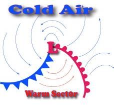
Preflight Guide v. 1.3

Foreword

This guide is intended to help general aviation (GA) pilots, especially those with
relatively little weather-flying experience, develop skills in obtaining appropriate
weather information, interpreting the data in the context of a specific flight, and
applying the information and analysis to make safe weather flying decisions.

It has been developed with assistance and contributions from a number of
weather experts, aviation researchers, air traffic controllers, and general aviation
instructors and pilots. Special thanks are due to Dr. Dennis Beringer and Dr.
William Knecht of the FAA’s Civil Aviation Medical Institute (CAMI); Dr. Michael
Crognale, Department of Psychology and Biomedical Engineering, University of
Nevada/Reno; Dr. Douglas Wiegmann, Institute of Aviation, University of Illinois;
Dr. B.L. Beard and Colleen Geven of the NASA Ames Research Center; Dr. Paul
Craig, Middle Tennessee State University; Paul Fiduccia, Small Aircraft
Manufacturers Association; Max Trescott, SJFlight; Arlynn McMahon, Aero-Tech
Inc.; Roger Sharp, Cessna Pilot Centers; Anthony Werner and Jim Mowery,
Jeppesen-Sanderson; Howard Stoodley, Manassas Aviation Center; Dan
Hoefert; Lawrence Cole, Human Factors Research and Engineering Scientific
and Technical Advisor, FAA; Ron Galbraith, FAA Air Traffic Controller, Denver
ARTCC; Michael Lenz, FAA General Aviation Certification and Operations
Branch, Christine Soucy, FAA Office of Accident Investigation; Dr. Rich Adams,
Engineering Psychologist, FAA Flight Standard Service; and Dr. William K.
Krebs, Human Factors Research and Engineering Scientific and Technical
Advisor, FAA.

This guide is intended to be a living document that incorporates comments,
suggestions, and ideas for best practices from GA pilots and instructors like you.
Please direct comments and ideas to: susan.parson@faa.gov.

Happy – and safe – flying!

                                                                                         ii
                                                                                     12/09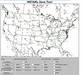
Preflight Guide v. 1.3

Introduction

                                Aviation has come a long way since the Wright
                                brothers first flew at Kitty Hawk. One thing that
                                has unfortunately not changed as much is the role
                                that weather plays in fatal airplane accidents.
                                Even after a century of flight, weather is still the
                                factor most likely to result in accidents with
                                fatalities.

                                From the safe perspective of the pilot’s lounge, it
                                is easy to second-guess an accident pilot’s
                                decisions. Many pilots have had the experience
                                of hearing about a weather-related accident and
                                thinking themselves immune from a similar
                                experience, because “I would never have tried to
                                fly in those conditions.” Interviews with pilots who
narrowly escaped aviation weather accidents indicate that many of the
unfortunate pilots thought the same thing -- that is, until they found themselves in
weather conditions they did not expect and could not safely handle.

Given the broad availability of weather information, why do general aviation (GA)
pilots continue to find themselves surprised and trapped by adverse weather
conditions? Ironically, the very abundance of weather information might be part
of the answer: with many weather providers and weather products, it can be very
difficult for pilots to screen out non-essential data, focus on key facts, and then
correctly evaluate the risk resulting from a given set of circumstances.

          This guide describes how to use the Perceive – Process – Perform risk
          management framework as a guide for your preflight weather planning
          and in-flight weather decision-making. The basic steps are:

--Perceive weather hazards that could adversely affect your flight.

--Process this information to determine whether the hazards create risk, which is
the potential impact of a hazard that is not controlled or eliminated.

-- Perform by acting to eliminate the hazard or mitigate the risk.

Let’s see how the 3-P model can help you make better weather decisions.

                                                                                          1
                                                                                      12/09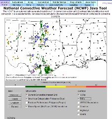
Preflight Guide v. 1.3

Preflight Weather Planning
Perceive – Understanding Weather Information
                                                        When you plan a trip in a
                                                        general aviation (GA)
                                                        airplane, you might find
                                                        yourself telling friends
                                                        and family that you are
                                                        first going to “see” if
                                                        weather conditions are
                                                        suitable. In other words,
                                                        your first major preflight
                                                        task is to perceive the
                                                        flight environment by
                                                        collecting     information
                                                        about      current     and
                                                        forecast conditions along
the route you intend to take, and then using the information to develop a good
mental picture of the situation you can expect to encounter during the flight.

Because there are many sources of weather information today, the first challenge
is simply knowing where and how to look for the weather information you need.

For many GA pilots, the FAA Flight Service Station
(FSS) remains the single most widely used source
of comprehensive weather information. Like other
weather providers, the FSS bundles, or
“packages,” weather products derived from
National Weather Service (NWS) data and other flight planning information into a
convenient, user-friendly package that is intended to offer the pilot not only
specific details, but also a big picture view of the flight environment. In this
respect, you might think of the FSS as “one-stop shopping” for GA weather
information.

Flight Service offers four basic briefing packages:

   •   Outlook (for flights more than six hours away),
   •   Standard (for most flights),
   •   Abbreviated (to update specific items after a standard briefing); and
   •   TIBS (telephone information briefing service), which provides recorded
       weather information.

The specific weather information packaged into a standard briefing includes a
weather synopsis, sky conditions (clouds), and visibility and weather conditions

                                                                                       2
                                                                                   12/09
Preflight Guide v. 1.3

at the departure, en route, and destination points. Also included are adverse
conditions, altimeter settings, cloud tops, dew point, icing conditions, surface
winds, winds aloft, temperature, thunderstorm activity, precipitation, precipitation
intensity, visibility obscuration, pilot reports (PIREPs), AIRMETs, SIGMETs,
Convective SIGMETS, and Notices to Airmen (NOTAMs), including any
temporary flight restrictions (TFRs).

Although a Flight Service weather briefing is still the single most comprehensive
source of weather data for GA flying, it can be difficult to absorb all the
information conveyed in a telephone briefing. Pictures are priceless when it
comes to displaying complex, dynamic information like cloud cover and
precipitation. For this reason, you may find it helpful to begin the preflight
planning process by looking at weather products from a range of providers. The
goal of this self-briefing process is to develop an overall mental picture of current
and forecast weather conditions, and to identify areas that require closer
investigation with the help of an FSS briefer.

Here is one approach to conducting your initial self-briefing. Keep in mind a
simple rule-of-thumb as you work through the weather data collection process:
the more doubtful the weather, the more information you need to obtain.

                     Television/Internet Sources.       For long-range weather
                     planning, many pilots start with televised or online weather,
                     such as The Weather Channel (TWC) on television or the
                     Internet.    TWC is not an FAA-
                     approved      source   of     weather
information, but its television and Internet offerings
provide both tactical and strategic summaries and
forecasts (up to 10 per day). TWC provides compact,
easy-to-use information that can be a useful supplement
to approved sources. For example, one TWC Internet
page includes a weather map with color-coding for
Instrument Flight Rules (IFR) and Marginal Visual Flight
Rules (MVFR) conditions at airports around the country
(http://www.weather.com/maps/aviation.html). This and
other TWC features can give you a very useful first snapshot of weather
conditions you will need to evaluate more closely. The National Weather
Service’s Aviation Weather Center (http://aviationweather.gov/) is another useful
source of initial weather information. A look at the AIRMET and SIGMET watch
boxes can quickly give you an idea of areas of marginal or instrument weather.

                 Direct User Access Terminal System (DUATS). Next, get a
                 printed version of the FSS briefing package by obtaining a
                 standard briefing for your route on DUATS.             Free and
                 accessible to all pilots via the Internet at www.duat.com (DTC)
                 or www.duats.com (CSC), this resource provides weather

                                                                                          3
                                                                                      12/09
Preflight Guide v. 1.3
information in an FAA-approved format and records the transaction as an official
weather briefing. You might want to print out selected portions of the DUATS
computer briefing for closer study and easy reference when you speak to a Flight
Service briefer.
Aviation Digital Data Service (ADDS): You should also
take a look at the wealth of weather information and
resources available online via the Aviation Digital Data
Service (ADDS), a joint effort of NOAA Forecast Systems
Laboratory, NCAR Research Applications Program (RAP),
and the National Centers for Environmental Prediction
(NCEP) Aviation Weather Center (AWC). Available at
http://adds.aviationweather.noaa.gov, ADDS combines information from National
Weather Service (NWS) aviation observations and forecasts and makes them
available on the Internet along with visualization tools to help pilots use this
information for practical flight planning. For example:
• For METARs, TAFS, AIRMETS,
and SIGMETS, the ADDS java tool
can zoom in on specific parts of the
country.
• For pilot reports (PIREPs), the
ADDS Java tool can zoom in on a
specific part of the country and
specify the type of hazard reported
(icing, turbulence, sky and
weather). The tool also allows you
to limit data to specified altitudes
and time periods. Map overlays
including counties, highways,
VORs, and Air Route Traffic Control
Boundaries are available.
• For the National Convective
Weather Forecast (NCWF), the
latest convection diagnostic is
shown together with the one hour
forecast. The java tool allows the
user to select the height and speed
of the forecasted thunderstorm, as
well as the one-hour forecast from
the previous hour to help the user
understand how well the NCWF is
performing.
4
12/09Preflight Guide v. 1.3
• ADDS also includes a Flight Path
Tool that helps pilots visualize high
resolution weather products
together with winds aloft and pilot
reports.
Although some of the other ADDS tools
(e.g., icing potential and maximum
turbulence potential) are only
authorized for operational use by
meteorologists and dispatchers, these
products can still help you develop a
mental picture of vertical and horizontal
“weather hazard areas” for your flight.
Flight Service Station Briefing. Once you have formed a basic mental picture of
the weather conditions for your trip, it is time to call the FSS. If you have just
obtained a DUATS briefing or if the weather situation and mission are both
simple, ask for an abbreviated briefing. If not, ask for a standard briefing. Armed
with what you already know from your self-briefing process, you will find that it is
much easier to absorb information from the briefer – and to know what questions
you should ask.
A few guidelines for getting weather data from FSS:
9 DO be sure to get the right FSS. When you dial the standard number, 1-800-
WX-BRIEF from a cell phone, this number will connect you to the FSS
associated with your cell phone’s area code – not necessarily to the FSS
nearest to your present position. If you are using
a cell phone outside your normal calling area,
check the Airport/Facility Directory to find the
specific telephone number for the FSS you need
to reach.
9 DO know what you need, so you can request the
right briefing “package” (outlook, standard, or
abbreviated).
9 DO use the standard flight plan form to provide the background the briefer
needs to obtain the right information for you. Review the form before you call,
and develop an estimate for items such as altitude, route, and estimated time
en route so you can be sure of getting what you need to know.
5
12/09Preflight Guide v. 1.3
9 DO be honest – with yourself and with the briefer – about any limitations in
pilot skill or aircraft capability.
9 DO let the FSS specialist know if you are new to the area or unfamiliar with
the typical weather patterns, including seasonal characteristics. If you are
unfamiliar with the area, have a VFR or IFR navigation chart available while
you listen to help sharpen your mental picture of where the weather hazards
may be in relation to your departure airport, proposed route of flight, and
destination.
9 DO ask questions, and speak up if you don’t understand something you have
seen or heard. Less experienced pilots sometimes hesitate to be assertive.
Smart pilots ask questions to resolve any ambiguities in the weather briefing.
The worse the weather, the more data you need to develop options.
9 DO be sure to get all the weather information you need. If you are flying in
IMC or MVFR that could deteriorate, don’t end the briefing without knowing
which direction (north, south, east, west) to turn to fly toward better weather,
and how far you would have to fly to reach it.
6
12/09Preflight Guide v. 1.3
Process – Analyzing Weather Information
Obtaining weather information is only the first step. The critical next step is to
study and evaluate the information to understand what it means for your
circumstances.
The knowledge tests for most pilot certificates include questions on weather
theory and use of weather products in aviation. However, it takes continuous
study and experience to develop your skill in evaluating and applying weather
data to a specific flight in a GA airplane. You might find it helpful to approach the
task of practical, real world weather analysis with several basic concepts in mind.
What creates weather? Most pilots can recite the textbook answer -- “uneven
heating of the earth’s surface” – but what does that mean when you are trying to
evaluate weather conditions for your trip? Let’s take a look.
The three basic elements of weather are:
• Temperature (warm or cold);
• Wind (a vector with speed and direction); and
• Moisture (or humidity).
Temperature differences (e.g., uneven heating) support the development of low
pressure systems, which can affect wide areas. Surface low pressure systems
usually have fronts associated with them, with a “front” being the zone between
two air masses that contain different combinations of the three basic elements
(temperature, wind, and moisture).
The illustration shows the “classic” northern
hemisphere low pressure system with the
associated cold and warm fronts.
Remembering that air circulates
counterclockwise around a low pressure
system in the Northern Hemisphere will help
you visualize the overall temperature, wind,
and moisture patterns in a given area.
Because weather is associated with fronts,
which are in turn associated with low pressure
systems, you can get some idea of possible
conditions just by looking to see where the low
pressure systems are in relation to your route.
What can weather do to you? Temperature, wind, and moisture combine to
varying degrees to create conditions that affect pilots. The range of possible
7
12/09Preflight Guide v. 1.3
combinations is nearly infinite, but weather really affects pilots in just three ways.
Specifically, the three basic weather elements can:
• Reduce visibility
• Create turbulence
• Reduce aircraft performance
How do you evaluate weather data? One approach to practical weather analysis
is to review weather data in terms of how current and forecast conditions will
affect visibility, turbulence, and aircraft performance for your specific flight.
Here’s how it works. Suppose you want to make a flight from Cincinnati
Municipal Airport (KLUK) to Port Columbus Airport in Columbus, Ohio (KCMH).
You want to depart KLUK around 1830Z and fly VFR at 5,500 MSL. Your
estimated time en route (ETE) is approximately one hour. Your weather briefing
includes the following information:
METARs:
KLUK 261410Z 07003KT 3SM -RA BR OVC015 21/20 A3001
KDAY 261423Z 14005KT 3SM HZ BKN050 22/19 A3003
KCMH 261351Z 19005KT 3SM HZ FEW080 BKN100 OVC130 22/17 A3002
TAFs
KLUK 261405Z 261412 00000KT 3SM BR BKN015
TEMPO 1416 2SM -SHRA BR
FM1600 14004KT 5SM BR OVC035
TEMPO 1618 2SM -SHRA BR BKN015
FM1800 16004KT P6SM BKN040
FM0200 00000KT 5SM BR BKN025
TEMPO 0912 2SM BR BKN018
KDAY 261303Z 261312 06003KT 5SM BR SCT050 OVC100
TEMPO 1315 2SM -RA BR BKN050
FM1500 15006KT P6SM BKN050
TEMPO 1519 4SM -SHRA BR BKN025
FM1900 16007KT P6SM BKN035
FM0200 14005KT 5SM BR BKN035
FM0600 14004KT 2SM BR BKN012
KCMH 261406Z 261412 19004KT 4SM HZ SCT050 BKN120
FM1800 17006KT P6SM BKN040
TEMPO 1922 4SM -SHRA BR
FM0200 15005KT 5SM BR BKN035
FM0700 14004KT 2SM BR BKN012
WINDS ALOFT
3000 6000 9000 12000 15000 18000 21000 24000 27000
CMH 1910 2108+15 2807+10 2712+05 2922-07 2936-17 294532 294540 313851
CVG 2310 2607+16 2811+11 2716+06 3019-05 2929-16 293430 293240 293652
8
12/09Preflight Guide v. 1.3
Remember that you have the option of
getting this information in “plain English”
format if you prefer not to decode.
Whichever format you select, the first step
is to look at your weather data in terms of
three specific ways that weather can affect
your flight: turbulence, visibility, and aircraft
performance.
Organize the information into tables such
as the one below, (see Appendix 5 for blank
forms). This kind of format allows you to see and make “apples-to-apples”
comparisons more easily. The column headings in the top row – arranged to
match the order in which the briefing information is presented – can help you
quickly identify the specific weather hazard(s) you might face on this trip. You
may also find it helpful to convert Zulu (UTC) times to local time, and to write
note expected ETAs for each waypoint on your flight plan.
Using the Cincinnati (KLUK) to Columbus (KCMH) trip as example:
CURRENT CONDITIONS
Visibility &
Turbulence Ceiling & Visibility Trends
Performance
Place Time Wind Visibility Weather Ceiling Temp/Dewpt Altimeter
KLUK 1410Z 07003KT 3SM RA, BR OVC015 21/20 A3001
KDAY 1432Z 14005KT 3SM HZ BKN050 22/19 A3003
FEW080,
KCMH 1351Z 19005KT 3SM HZ 22/17 A3002
OVC130
FORECAST CONDITIONS
Turbulence Ceiling & Visibility
Place Time Wind Visibility Weather Ceiling
KLUK FM1800Z 16004KT P6 SM BKN040
TEMPO 1519Z -- 4SM -SHRA BKN025
KDAY
FM1900Z 16007KT P6 SM -- BKN035
FM1800Z 17006KT P6 SM -- BKN040
KCMH
TEMPO 1922Z -- 4SM -SHRA, BR --
WINDS ALOFT
Visibility &
Turbulence
Performance
Place Altitude Wind Temp
CVG 6000 260/07 16 C
CMH 6000 210/08 15 C
9
12/09Preflight Guide v. 1.3
1. Ceiling & Visibility. First, look at the weather data elements that report ceiling
and visibility.
In the case of the proposed VFR flight from KLUK to KCMH,
current visibility at your departure and destination airports is
marginal, and the small temperature/dew point spread should
trigger a mental red flag for potentially reduced visibility. The
forecasts call for conditions to improve at your departure airport,
KLUK, by the time you plan to launch (1830Z).
Note, however, that you could encounter marginal conditions,
including light rain showers, en route and also at your destination
(KCMH). Since the forecast ceilings will probably not allow you to fly VFR at the
planned altitude (5,500 MSL), this part of the analysis tells you that terrain and
obstacle avoidance planning (discussed in the next section) will be necessary for
this flight if you choose to depart at the originally scheduled time.
2. Aircraft Performance. Next, carefully review current and
forecast temperatures – departure, en route, and destination
– for possible adverse impact on aircraft performance. If the
temperatures are high, you need to know and plan for the
effects of high density altitude, especially on takeoff, climb,
and landing. If temperatures are low and you plan on flying in the clouds, you
should pay special attention to known or forecast icing and freezing levels.
In the sample VFR flight from KLUK to KCMH, temperatures on the surface and
at your planned altitude are moderate, so performance problems associated with
density altitude or icing are not likely to occur on this flight.
3. Turbulence: Review wind conditions for departure airport, en
route, and destination airport. You will also need a mental picture
of vertical wind profiles, so as to select the best altitude(s) for cruise
flight, and to determine whether wind shear is present.
For the sample flight from KLUK to KCMH, the chart format allows
you to see quickly that you will encounter light southerly surface
winds at your departure and destination airports. Winds aloft will also be light,
but from a westerly direction. There are no indications for wind shear or
convective activity (thunderstorms), so you can conclude that turbulence is not
likely to be a hazard for this particular flight.
For checklist questions and weather analysis worksheets to help you analyze the
impact of these weather elements on your specific flight, see Appendix 6 (VFR)
and Appendix 7 (IFR).
10
12/09Preflight Guide v. 1.3
Perform – Making a Weather Plan
The third step in practical preflight weather planning is to perform an honest
evaluation of whether your skill and/or aircraft capability are up to the challenge
posed by this particular set of weather conditions. It is very important to consider
whether the combined “pilot-aircraft team” is sufficient. For example, you may be
a very experienced, proficient, and current pilot, but your weather flying ability is
still limited if you are flying a 1980s-model aircraft with no weather avoidance
gear. On the other hand, you may have a new technically advanced aircraft with
moving map GPS, weather datalink, and autopilot – but if you do not have much
weather flying experience, you must not count on the airplane’s capability to fully
compensate for your own lack of experience. You must also ensure that you are
fully proficient in the use of onboard equipment, and that it is functioning properly.
One way to “self-check” your decision (regardless of your experience) is to ask
yourself if the flight has any chance of appearing in the next day’s newspaper. If
the result of the evaluation process leaves you in any doubt, then you need to
develop safe alternatives.
Think of the preflight weather plan as a strategic, “big picture” exercise. The goal
is to ensure that you have identified all the weather-related hazards for this
particular flight, and planned for ways to eliminate or mitigate each one. To this
end, there are several items you should include in the weather flying plan:
Escape Options: Know where you can find good weather within your aircraft’s
range and endurance capability. Where is it? Which direction do you turn to get
there? How long will it take to get there? When the weather is IMC (ceiling
1,000 or less and visibility 3 nm or less), identify an acceptable alternative airport
for each 25-30 nm segment of your route. The worksheets in Appendices 5, 6,
and 7 include space to record some of this information.
Reserve Fuel: Knowing where to find VFR weather does you no good unless
you have enough fuel to reach it. Flight planning for only a legal fuel reserve
could significantly limit your options if the weather deteriorates. More fuel means
access to more alternatives. Having plenty of fuel also spares you the worry
(and distraction) of fearing fuel exhaustion when weather has already increased
your cockpit workload.
Terrain Avoidance: Know how low you can go without encountering terrain
and/or obstacles. Consider a terrain avoidance plan for any flight that involves:
• Weather at or below MVFR (ceiling 1,000 to 3,000; visibility 3 to 5 miles)
• A temperature/dew point spread of 4° C. or less;
• Any expected precipitation; or
• Operating at night.
11
12/09Preflight Guide v. 1.3
Know the minimum safe altitude for each segment of your flight. All VFR
sectional charts include a maximum elevation figure (MEF) in each quadrangle.
The MEF is determined by locating the highest obstacle (natural or man-made) in
each quadrangle, and rounding up by 100 to 300 feet.
Charts for IFR navigation include a Minimum En route Altitude (MEA) and a
Minimum Obstruction Clearance Altitude (MOCA).
Jeppesen charts depict a Minimum Off Route Altitude
(MORA), while FAA/NACO charts show an Off Route
Obstruction Clearance Altitude (OROCA) that
guarantees a 1,000-foot obstacle clearance in non-
mountainous terrain and a 2,000 foot obstacle
clearance in mountainous terrain.
In addition to these sources, many GPS navigators
(both panel-mount and handheld) include a feature
showing the Minimum Safe Altitude (MSA), En route Safe Altitude (ESA), or
Minimum En route Altitude (MEA) relative to the aircraft’s position. If you have
access to such equipment, be sure you understand how to access and interpret
the information about safe altitudes.
The Air Safety Foundation’s Terrain Avoidance Plan is another helpful resource.
Passenger Plan: A number of GA weather accidents have been associated with
external or social pressures, such as the pilot’s reluctance to appear “cowardly”
or to disappoint passengers eager to make or continue a trip. There is almost
always pressure to launch, and pressure to continue. Even the small investment
in making the trip to the airport can create pressure to avoid “wasted” time.
For this reason, your weather planning should include
preflighting your passengers (and anyone waiting at
your destination) as well as your aircraft. If you jointly
plan for weather contingencies and brief your
passengers before you board the aircraft, you as the
pilot will be less vulnerable later on to the pressure to
continue in deteriorating weather conditions.
Suggestions:
9 DO use the worksheet in Appendix 4 to develop personal minimums that will
help you make the toughest go / no-go and continue / divert decisions well in
advance of any specific flight.
9 DO be aware that the presence of others can influence your decision-making
and your willingness to take risks, and let your passengers know up front that
12
12/09Preflight Guide v. 1.3
safety is your top priority. Share your personal minimums with your
passengers and anyone who might be waiting for you at the destination.
9 DO establish “weather check” checkpoints every
25-30 nm along the route, at which you will
reevaluate conditions. If possible, have your
passengers assist by tracking progress and
conditions at each weather checkpoint.
9 DO use your pre-established personal minimums
to determine exactly what conditions will trigger a
diversion at any given weather checkpoint. Let
your passengers know what these conditions are.
9 DO decide specifically what you will do if you have
to divert at any particular point, and inform your
passengers of these plans. Preflight is the time to
make alternative arrangements (e.g., hotel and rental car reservations) in the
event that weather conditions worsen. You can always put passengers (or
yourself) on an airliner if you absolutely have to return on time.
9 DO advise anyone meeting you at your destination that your plans are flexible
and that you will call them when you arrive. Be sure that they too understand
that safety is your top priority, and that you will delay or divert if weather
becomes a problem.
9 DO remember that one of the most effective safety tools at your disposal is
waiting out bad weather. Bad weather (especially involving weather fronts)
normally does not last long, and waiting just a day can often make the
difference between a flight with high weather risk and a flight that you can
make safely.
13
12/09Preflight Guide v. 1.3
In-flight Decision-Making
Perceive – Obtaining In-flight Weather Information
Many times, weather is not forecast to be severe
enough to cancel the trip, so pilots often choose to
take off and evaluate the weather as they go.
While it is not necessarily a bad idea to take off
and take a look, staying safe requires staying alert
to weather changes. GA pilots and their aircraft
operate in (rather than above) most weather. At
typical GA aircraft speeds, making a 200-mile trip
can leave a two to three hour weather information
gap between the preflight briefing and the actual flight. In-flight updates are vital!
Let’s take a closer look at in-flight weather data sources.
Visual Updates. One of the most important things you can do is to look outside.
Use your eyes to survey the weather and literally see whether the conditions
around you match the conditions that were reported or
forecast. Sometimes there are local deviations in
weather conditions (isolated cells, fog, etc.) that may
not be immediately known to the FSS specialist or that
may not appear on weather-product depictions,
especially if there is no weather-reporting capability at
your departure point. Even if you looked at radar during
your preflight briefing process, remember that NEXRAD
data is at least 8 minutes old by the time you see it on a display, and older still by
the time you are ready to depart. Weather can change very rapidly.
ATIS/ASOS/AWOS. One of the easiest ways to monitor conditions en route is to
listen to ATIS and ASOS/AWOS broadcasts along your route. These broadcasts
can help you update and validate preflight weather information about conditions
along your route of flight.
En route Flight Advisory Service (EFAS, or Flight Watch). Available on 122.0 in
the continental United States from 5,000 AGL to 17,500 MSL, EFAS, addressed
as Flight Watch, is a service specifically designed to provide en route aircraft with
timely and meaningful weather advisories pertinent to the type of flight intended,
route of flight, and altitude. If you are in contact with ATC, request permission to
leave the frequency to contact EFAS. Provide your aircraft identification and the
name of the VOR nearest to your position.
14
12/09Preflight Guide v. 1.3
Air Traffic Control (ATC). Simply monitoring ATC frequencies (available on
aeronautical charts) along the way is one way to keep abreast of changing
weather conditions. For example, are other GA aircraft along your route
requesting diversions? You can also request information on the present location
of weather, which the controller will try to provide if workload permits. When you
ask ATC for weather information, though, you need to be aware that radar – the
controller’s primary tool – has limitations, and that operational considerations
(e.g., use of settings that reduce the magnitude of precipitation returns) will affect
what the controller can see on radar.
Datalink and Weather Avoidance Equipment. Radar and lightning detectors have
been available in some GA aircraft for many years. These devices can
contribute significantly to weather awareness in the cockpit. An increasing
number of GA aircraft are now being equipped with weather datalink equipment,
which uses satellites to transmit weather data such as METARs, TAFs, and
NEXRAD radar to the cockpit, where it is often shown as an overlay on the
multifunction display (MFD). Handheld devices with weather datalink capability
are also a popular source of en route weather information.
There are several basic methods for transferring weather data from a weather
data network provider to an aircraft:
• Request/Reply - In these systems, the pilot must decide what is needed and
then request the specific information and coverage area. This request must
then be sent from the aircraft to the satellite, from the satellite to the ground,
processed by the ground system and transmitted back to the airplane.
Transmission time can require as long as 10 or 15 minutes. Since weather
can change very rapidly, this delay can significantly reduce utility of the data.
• Narrowcast - Some providers offer “narrowcast,” which automatically sends
data directly to the aircraft according to the pilot’s pre-established preferences
for products, update rate, resolution, coverage area, and other parameters.
• Broadcast - Broadcast systems continuously send available weather
products to every user in the area through a satellite network and a system of
interconnected ground stations. Satellite broadcast systems use high-power
geosynchronous satellites to deliver large amounts of data in a very short
time.
One of the most important, and critical, things to know about datalink is that
regardless of the transmission method, it does not provide “real-time”
information.
15
12/09Preflight Guide v. 1.3
Process – (Honestly) Evaluating and Updating In-flight Conditions
Safe weather flying requires continuous evaluation of in-flight weather conditions.
Visual Updates. Seeing is believing – or so we are
conditioned to think. Although you should certainly use
your eyes during the flight to perceive the weather, you
need to be aware that our prior visual experience largely
determines our ability to “see” things. In the narrow runway
illusion, for instance, the aircraft appears to be at a greater
height over the runway because we have learned through
previous experience what a typical runway should look like
at a given altitude. The human brain prefers to adjust the
apparent height of the aircraft rather than adjust the
concept of what a runway should look like.
Similarly, scientists who study human vision have determined that weather
transitions are sometimes too subtle for the limits of the visual system. Like other
sensory organs, the eye responds best to changes. It adapts to circumstances
that do not change, or those that change in a gradual or subtle way, by reducing
its response. Just as the skin becomes so acclimated to the “feel” of clothing that
it is generally not even noticed, the eye can become so accustomed to
progressive small changes in light, color, and motion that it no longer “sees” an
accurate picture. In deteriorating weather conditions, the reduction in visibility
and contrast occurs quite gradually, and it may be quite some time before the
pilot senses that the weather conditions have deteriorated significantly. In
essence, you have to learn how to look past the visual illusion and see what is
really there.
Certain weather conditions also make it particularly difficult to accurately perceive
with the eye. For instance, a phenomenon called “flat light” can create very
hazardous operating circumstances. Flat light is a condition in which all available
light is highly diffused, and information normally available from directional light
sources is lost. The result is that there are no
shadows, which means that the eye can no
longer judge distance, depth features, or
textures on the surface with any precision. Flat
light is especially dangerous because it can
occur with high reported visibility. It is common
in areas below an overcast, and on reflective surfaces such as snow or water. It
can also occur when blowing snow or sand create flat light conditions
accompanied by “white-out,” which is reduced visibility in all directions due to
small particles of snow, ice or sand that diffuse the light.
16
12/09Preflight Guide v. 1.3
Awareness is important in overcoming these challenges, but you can also
develop your visual interpretation skills. Appendix 8 provides tips and techniques
you can use to estimate in-flight visibility and cloud clearance, thus enhancing
your ability to evaluate in-flight weather conditions accurately.
ATIS/ASOS/AWOS. In-flight weather information obtained from ATIS and
ASOS/AWOS broadcasts can contribute useful pieces to the en route weather
picture, but it is important to understand that this
information is only a weather “snapshot” of a limited area.
ATIS and ASOS/AWOS broadcasts are primarily intended
to provide information on conditions in the airport vicinity.
The information reported is derived from an array of
sensors. While these systems are designed to be as
accurate as possible and are increasingly sophisticated,
the automated system is actually monitoring only a very
small area on the airfield and that it reports only what it can
"see." For example, sensors that measure visibility are
actually measuring a section of air less than 24 inches
wide. Even a dense fog on a portion of the airfield will go undetected by the
system unless the fog actually obscures the sensors. The system will not “see”
an approaching thunderstorm until it is almost directly over the automated site’s
ceiling instruments.
EFAS. Assuming that you do find or suspect deteriorating conditions while en
route, be sure to contact the En route Flight Advisory Service (EFAS – Flight
Watch) for additional information. EFAS can be an immensely helpful resource,
but interpreting and applying the information you receive while you are also flying
the aircraft – especially if you are in adverse or deteriorating conditions with no
autopilot – can be very challenging. The key is understanding where the weather
is in relation to your position and flight path, where it is going, and how fast it is
moving. A good practice is to have an aeronautical chart with your route clearly
marked readily available before you call Flight Watch. The chart will help you
visualize where the weather conditions are in relation to your current position and
intended route of flight, and determine whether (and where) you need to deviate
from the original plan.
Another interpretation useful tool is the In-flight Advisory Plotting Chart (figure 7-
1-2 in Chapter 7 of the Aeronautical Information Manual (AIM)). This chart
includes the location and identifier for VORs and other locations used to describe
hazardous weather areas. Consider keeping copies of this chart in your flight
bag for easy reference whenever you call EFAS.
ATC. ATC radar can detect areas of precipitation, but does not detect clouds or
turbulence. The existence of turbulence may be implied by the intensity of a
precipitation return: the stronger the return, the more likely the presence of
17
12/09Preflight Guide v. 1.3
turbulence. Similarly, icing may be inferred by the presence of moisture, clouds,
and precipitation at temperatures at or below freezing.
ARTCC facilities and many of the terminal approach
control facilities now have digital radar display systems
with processors that can better determine the intensity
(dBZ) of radar weather echoes and display that
information to the controller. Consequently, approach
controllers, center controllers, and AFSS specialists
have all begun using four terms to describe weather
radar echoes to pilots: “light,” “moderate,” “heavy,” and
“extreme.” Each term represents a precipitation intensity level paired with a
decibel (dBZ) range to help pilots interpret the severity of the flight conditions
present. (Note: A dBZ is a measure of radar reflectivity in the form of a
logarithmic power ratio with respect to radar reflectivity factor “Z.”)
Although the terms are consistent, there are still some equipment-related
differences in what can be described.
9 In Air Route Traffic Control Centers, NEXRAD data is fed through the
Weather and Radar Processor (WARP), which organizes 16 NEXRAD levels
into four reflectivity (dBZ) categories. Reflectivity returns of less than 30 dBZ
are classified as “LIGHT” and are filtered out of the center controllers’ display,
which means that center controllers cannot report areas of “light” weather
radar echoes.
9 A terminal radar approach control has neither NEXRAD nor WARP, so
weather radar echoes are displayed by the Airport Surveillance Radar (ASR)
systems using Common Automated Radar Terminal System (Common
ARTS) or Standard Terminal Automation Replacement System (STARS)
digital weather processors. Paired with a weather processor, digitized ASR 9
and 11 systems display the four weather radar echo intensity categories to
the controller.
9 Terminal radar approach control facilities can, and do, display “light” (less
than 30 dBZ) areas of precipitation. Not all terminal facilities have digitized
systems, however, and systems without digital processors cannot discern
radar echo intensity. In these cases, ATC can describe the position of
weather radar echoes, but will state “intensity unknown” instead of using the
terms, “light,” “moderate,” “heavy,” or “extreme.”
A critical element in interpreting weather information from ATC is a thorough
understanding of pilot-controller communications. Be sure to review the AIM
Pilot/Controller Glossary, and clarify points you do not understand.
Datalink and Weather Avoidance Equipment. When analyzing this information, it
is vital to remember that the quality of the information depends heavily upon
18
12/09Preflight Guide v. 1.3
update rate, resolution, and coverage area. When flying an aircraft that has
datalink equipment, safe and accurate interpretation of the information you
receive depends on your understanding of each of these parameters.
Datalink does not provide real-time information. Although weather and other
navigation displays can give pilots an unprecedented
quantity of high quality weather data, their use is safe and
appropriate only for strategic decision making (attempting
to avoid the hazard altogether). Datalink is not accurate
enough or current enough to be safely used for tactical
decision making (negotiating a path through a weather
hazard area, such as a broken line of thunderstorms).
Be aware that onboard weather equipment can inappropriately influence your
decision to continue a flight. No matter how “thin” a line of storms appears to be,
or how many “holes” you think you see on the display, it is not safe to fly through
them.
19
12/09Preflight Guide v. 1.3
Perform – Putting It All Together
In the preflight planning process, you used weather data and analysis to develop
a strategic, “big picture” weather flying plan. During the en route phase, use the
data and analysis to make tactical weather decisions. Good tactical weather
flying requires you to perceive the conditions around you, process (interpret) their
impact on your flight, and perform by taking appropriate action at each stage.
9 DO reassess the weather on a continuous basis. Designate specific fixes
(e.g., airports) on or near your flight path as “weather check” checkpoints and
use one of the in-flight resources described above to get updated information.
9 DO take action if you see or suspect deteriorating weather:
• Trust your eyes if you see weather conditions deteriorating.
• Contact EFAS for detailed information.
• Head for the nearest airport if you see clouds forming beneath your
altitude, gray or black areas ahead, hard rain or moderate turbulence, or
clouds forming above that require you to descend. It is much easier to
reevaluate conditions and make a new plan from the safety of an airport.
9 DO contribute to the system by making pilot reports (PIREPS) when you call
Flight Watch. To learn more about making good PIREPS, take the Air Safety
Foundation’s free online “Skyspotter” course.
ATC. If you need help from ATC in
avoiding or escaping weather, ask sooner
rather than later. Guidelines:
9 DO be sensitive to ATC communications
workload, but keep controllers advised
of your weather conditions. Tell the
controller if you need to deviate.
9 DO remember that navigational
guidance information issued to a VFR flight is advisory in nature. Suggested
headings do not authorize you to violate regulations, and they are not
guaranteed to keep you clear of all weather.
9 DON’T hesitate to ask questions if you do not understand or if you are
unsure.
9 DON’T make assumptions about what the controller knows about your flight:
20
12/09Preflight Guide v. 1.3
• If you need ATC’s help to avoid
convective weather, it never
hurts to remind the controller
that you have no onboard
weather avoidance equipment.
• If you are handed off while on a
suggested heading for weather
avoidance, confirm that the
next controller knows you are
requesting weather avoidance
assistance. For example, your
initial call might be: “Center, N2817S, level 5,000, zero two zero heading
for weather avoidance.”
• Never assume that “cleared direct when able” means that flying a direct
course at that time will keep you clear of weather. To ATC, “direct when
able” means to fly direct when you are able to receive a signal and
navigate directly to the fix. If you have any doubt, ASK whether a direct
course will keep you clear of areas with moderate and heavy radar
returns indicative of thunderstorm activity.
• Words such as “showers” and “precipitation” can be very misleading.
Some pilots mistakenly assume that these words indicate areas of rain
with no thunderheads present. In the world of ATC, weather radar
echoes are all referred to as “precipitation.” Do not proceed into areas of
“showers” or “precipitation” without clarifying whether the level of
precipitation is “light,” “moderate,” or “heavy.”
DON’T terminate VFR flight following or other services and leave an ATC
frequency without informing the controller that you are doing so.
21
12/09Preflight Guide v. 1.3
Post-Flight Weather Review
When you land after a challenging flight in the
weather, you may want nothing more than to
go home and unwind. The immediate post
flight period, however, is one of the best
opportunities to increase your weather
knowledge and understanding. Studies show
that pilots sometimes fly into bad weather
simply because they lack relevant experience,
and thus did not recognize that certain weather
“cues” might create a safety hazard to the
flight. Make it a point to learn something from
every weather encounter. At the end of a flight involving weather, take a few
minutes to mentally review the flight you just completed and reflect on what you
learned from this experience. To guide your post flight weather review:
9 What weather conditions/hazards existed, and how did they impact this flight?
Turbulence / Winds __________________________________________
Ceilings / Visibility __________________________________________
Aircraft Performance _________________________________________
9 How did the conditions encountered during this flight compare with the
information obtained in the preflight briefing?
9 Which source(s) of preflight weather information provided the best (or most
useful, most accurate, most relevant) data for this flight?
9 Which source(s) of en route weather information provided the best (or most
useful, most accurate, most relevant) data for this flight?
Another way to develop your weather experience and judgment is simply to
observe and analyze the weather every day. When you look out the window or
go outside, observe the clouds. What are they doing? Why are they shaped as
they are? Why is their altitude changing? This simple habit will help you develop
the ability to “read” clouds, and understand how shape, color, thickness, and
altitude can be valuable weather indicators. As your cloud-reading skill develops,
start trying to correlate the temperature, dew point, humidity, and time of day to
the types of clouds that have formed. Take note of the wind and try to visualize
how it wraps around the tree or whips around the corner of a building. This
exercise will help you become more aware of wind at critical points in your flight.
Weather is a fact of life for pilots. Developing your weather knowledge and
expertise is well worth the time and effort you put into it, because weather
wisdom will help keep you – and your passengers – safe in the skies.
22
12/09Preflight Guide v. 1.3
Resources
Appendix 1 Weather Products and Weather Providers Chart
Appendix 2 Items for Standard Briefing
Appendix 3 Automated Weather Observing Systems
Appendix 4 Developing Personal Weather Minimums
Appendix 5 Aviation Weather Analysis Worksheets
Appendix 6 Weather Analysis Checklist - VFR
Appendix 7 Weather Analysis Checklist - IFR
Appendix 8 Estimating In-flight Visibility and Cloud Clearance
23
12/09Preflight Guide v. 1.3
Appendix 1
Weather Products and Weather Providers
The table below lists some of the most common weather products and providers:
Center Weather Advisory (ATC)
FD (winds/temps aloft forecast)
FD (winds/temps aloft forecast)
charts, Convective outlook
charts, Weather depiction
charts, Radar (NEXRAD)
AC (Severe Wx Outlook)
FA (18-hr area forecast)
charts, Surface analysis
charts, Radar summary
AIRMET / SIGMET
SD (hourly radar)
charts, Prog.
Satellite
METAR
Source
PIREP
TWEB
TAFs
Format: T = text; G = Graphic. Text may be written or spoken.
Preflight T T G G G G G T G T T G T T G T T T
Commercial vendor Search Internet for "commercial weather products."
Public NWS or NOAA site X X X X X X X X X X X X X
ADDS (aviation digital data) X X X X X X X X X X X X X X X X X
DUATS X X X X X X X X X X X
FSS (automated TIBS) Short automated briefing, origin & radius, advisories & summary, ceil, vis, w. easy link to FS Specialist
FSS (standard) Verbal synopsis of all available information
FSS (abbreviated) Short, verbal synopsis, based on all available information
FSS (outlook) Short, verbal forecast based on all available information
The Weather Channel X X X
En route
cockpit avionics products vary
EFAS Verbal synopsis, based on all available information
HIWAS X X X
TWEB Short automated synopsis, origin & radius, wx advisories, ceil, vis, winds, radar, PIREPS, alerts
Both
ASOS
ASOS, ATIS, AWOS are similar to METAR, incl. Place, Time, Wind direction/speed, Visibility, Ceiling,
ATIS
Temp/Dewpoint, Altimeter
AWOS
CWA Short, verbal synopsis, based on all available information
(NOTE: Products directly accessible to the user are marked with an “X.”)
ADDS Aviation Digital Data Service (ADDS) (http://adds.aviationweather.noaa.gov/)
ASOS Automated Surface Observing System
ATIS Automated Terminal Information Service
AWOS Automated Weather Observing System
CWA Center Weather Advisory
DUATS Direct User Access Terminal System
EFAS En route Flight Advisory System
FSS Flight Service Station
HIWAS Hazardous In-flight Weather Advisory System
LLWAS Low Level Wind Shear Alert System
NOAA National Oceanic and Atmospheric Association
NWS National Weather Service
TIBS Telephone Information Broadcast Service
TWEB Transcribed Weather Broadcast
24
12/09Preflight Guide v. 131
Appendix 2
Items for Standard Briefing
9 Type of Flight (VFR or IFR)
9 Aircraft identification
9 Aircraft Type / Special Equipment
9 True Airspeed
9 Departure Point
9 Proposed Departure Time
9 Cruising Altitude
9 Route of Flight
9 Destination
9 Estimated Time En Route
9 Remarks (e.g., “no weather avoidance equipment on board”)
9 Fuel
9 Alternate Airports
9 Pilot’s Name
25
12/09Preflight Guide v. 1.3
Appendix 3
Automated Weather Observing Systems
AWOS- Automated Weather Observing System.
ASOS- Automated Surface Observing System.
AWOS-3 reports all the items in a METAR – time of observation, wind,
visibility, sky coverage/ceiling, temperature, dew point and altimeter setting.
The designator "A02" in the remarks portion of the observation indicates the
station has a precipitation discriminator that determines the difference between
liquid and freezing/frozen precipitation.
ASOS reports the same data as AWOS-3 plus precipitation type and intensity
like the AWOS-3 sites with the A02 capabilities.
AWOS-2 reports the same METAR items as an AWOS-3 except it does not
report sky coverage/ceiling information.
AWOS-1 reports the time of observation, wind, temperature, dew point and
altimeter setting. It does not report visibility or sky coverage information.
AWOS-A reports only the time of observation and altimeter setting.
The prefix "AUTO" indicates the data is derived from an automated system. A certified
weather observer may provide augmented weather and obstruction to visibility information in
the remarks of the report at AWOS locations.
The "AUTO" prefix disappears when the report has been augmented by human observers.
26
12/09Step 4: Assemble and evaluate baseline personal minimums.
Baseline Personal Minimums
Federal Aviation
Weather Condition VFR MVFR IFR LIFR
Ceiling
Administration
Day
Night
Visibility
Day
Night Developing Personal Minimums
Turbulence SE ME Make/Model Think of personal minimums as the human factors
Surface equivalent of reserve fuel. Personal minimums
Wind Speed
Surface should provide a solid safety buffer between:
Wind Gust
Crosswind
Component • Skills required for the specific flight, and
Performance SE ME Make/Model
• Skills available to you through your training,
Shortest
experience, currency, and proficiency.
runway
Highest
terrain
Highest
density altitude Step 1 – Review Weather Minimums
Step 5: Adjust for specific conditions. Step 2 – Assess Weather Experience and
Adjust baseline personal Personal Comfort Level
If you are facing:
minimums to:
Illness, medication, At least Step 3 – Consider Winds and Performance
stress, or fatigue; lack of 500 feet to ceiling
Pilot
currency (e.g., haven’t A
flown for several weeks) d At least Step 4 – Assemble Baseline Values
d ½ mile to visibility
An unfamiliar airplane, or At least Step 5 – Adjust for Specific Conditions
Aircraft an aircraft with unfamiliar 500 ft to runway
avionics/ equipment: length
Airports and airspace S Step 6 – Stick to the Plan!
enVironment with different terrain or u
unfamiliar characteristics b
t At least
“Must meet” deadlines, r 5 knots from winds
External a
passenger pressures;
Pressures c
etc.
t
4 1You can also read