LAND-SEA PROJECT - Interreg Europe
←
→
Page content transcription
If your browser does not render page correctly, please read the page content below
LAND-SEA PROJECT
         “Sustainability of the Land-sea System for Ecotourism Strategies”

                                    THEMATIC PAPER I

The Land-Sea project has been funded with support from the Interreg Europe programme. This publication
reflects the views only of the authors, the Interreg Europe programme authorities are not liable for any use
that may be made of the information contained therein.

  Released version_                      | Rev. 06 | THEMATIC PAPERS PROPOSAL 05-04-2019

                                                                                                          1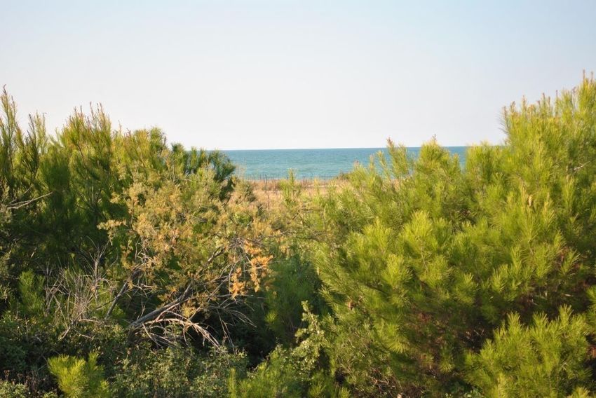
ECOTOURISM INTEGRATED APPROACH FOR
COASTAL ZONE MANAGEMENT
Federica Roscioni, Pasquale Contestabile, Michele Greco, Heike Markus-Michalczyk, Xavier Cazorla i Clarisó,
Guillem Mas, Velislava Tihcheva, Galina Nikolova

Coordinated by Federica Roscioni index

   1. Introduction (led by F. Roscioni):                                                                      3
       Urban vs Natural coastal zones                                                                         3
                 a. User Expectations                                                                         7
                 b. Management framework                                                                      8
                 c. SWOT analysis                                                                             8

   2. Legal aspect (led by H. Markus-Michalczyk )                                                             9

   3. Ecotourism best practices (led by X. Cazorla i Clarisó and G. Mas)                                      11

   4. Ecotourism governance to produce an actual integrated approach (led by X. Cazorla i Clarisó and
       G. Mas)                                                                                                13

   5. Skills involved and developed (led by M. Greco, P. Contestabile and F. Roscioni)                        16

   6. Staff exchange preparation (all the experts)                                                            23
   7. Socio-Economical aspect (led by P. Contestabile and M. Greco)                                           28
   8. References                                                                                              30

                                                                                                                   2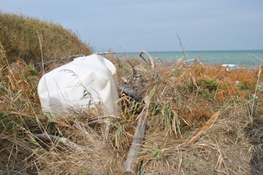
1. Introduction

Urban vs Natural coastal zones

In Europe in the last decades the expansions of invasive building construction and artificial planting
actually modified the landscape of coastal zones, especially in the Mediterranean area [1]. It is very rare to
find locations in which nature conserves its peculiarity and that can be considered residual places of
wilderness (Fig.1).

Fig.1 Semi-natural environment in the Molise coast. These dunes have a good level of wilderness however they had been
managed planting native species to recover a wild fire that destroyed the area during 2007 summer.

The anthropic effect is so evident especially in the coastal area. Actions devoted to promote tourism did
not take into account during the economic boom of the ‘60s the great importance that such vulnerable
ecosystems represent (Fig.2).

                                                                                                                        3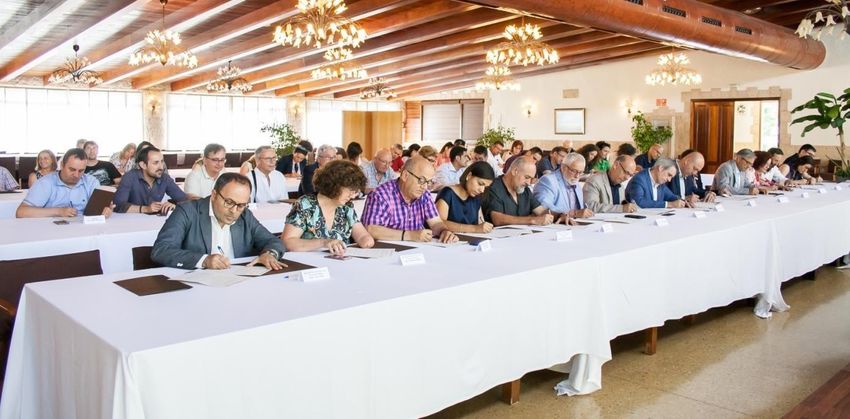
Fig.2. Massive building and planted pine in a Mediterranean coastal area

Coastal areas are wonderful landscapes that also have important roles for the maintenance of the
equilibrium in such perturbed ecosystems. The role of coastal area is important even in relation of
geomorphological events. Erosion is a big and continuous process, natural since the ‘60s and completely
altered by the human activities that now is actually difficult to manage and be controlled.

Nowadays, different fields of scientific research need adequate tools and applications in order to obtain
high quality outputs for realistic and accurate representation of the coastal environment. This is a
fundamental requirement when knowledge, managing and planning territorial issues are concerned.
Coastal areas are very valuable environments where various habitats are each other linked by complex
interaction rules within a status of dynamic equilibrium. Moreover, coastal areas are often occupied by
infrastructures and urban settlements implying important commercial and economic activities. Hence, in
order to ensure the adequate management and to contribute to set up a permanent monitoring system of
so complex areas, an accurate environmental characterisation of these areas is necessary. Integrated River
Basin Management (IRBM) (2000/60/EC) and Marine Strategy Framework Directive (MSFD) (2008/56/EC)
identify several keys descriptor to assess the environmental status of coastal area and marine waters.

The impact of human activities involves the loss of coastal area resources, i.e. the building of dams along
rivers and their discharge control, the construction of jetties at sea and other engineering works, altering
the natural equilibrium of coastal areas and consequently affect the distribution sediments and beaches
[2]. Over the past 50 to 60 years, rapid expansion of economic activities, settlements and tourist activities
have increased the demand for littoral areas and it has also led to hydrogeological and environmental
stresses along the coast. Erosion is caused by a large number of factors such as changes of winds pattern
                                                                                                           4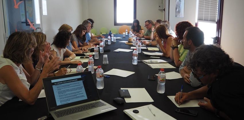
and wave climate, increase of wave energy and reduction of rivers solid discharge and compromises the
delicate equilibrium governing coastal environment creating a sensitive impacts on all habitats associated
with this complex ecosystem. Understanding of conservation status, and coastal dynamics and evolution
is essential not only for the protection of habitats, but also for proper management of all components of
the band coast. Submerged beach, backshore and dune area are three separate interdependent elements
mutually strong interact. For that, it is plausibly expect that changes affecting one of these three
components induce direct or indirect influences on the state of the other two.

The assessment of the direct impacts due to interaction between coastal structures and shoreline represents
one of the crucial issues to be taken into account in the coastal management plan both in terms of littoral
morphodynamics and marine ecosystem maintenance. In fact, the widespread presence of permanent and
seasonal structures built on the longshore sand dune close to the foreshore, amplified the wave action
increasing the local erosion rates with an appreciable reduction in beach width and sensitive
impoverishment in local economy mainly based on tourism activities.

Timing is of the utmost importance, also considering as in the Mediterranean Area, more than 40% of
48.000 km of shoreline has been artificialized. In any case, the anthropization caused by coastal structures
may easily affect the visual impact causing a loss of aesthetics and naturalness. The result is a negative
trend about touristic activities. Natural Engineering may be a fine solution to avoid erosion, granting a
less anthropic impact (Fig. 3). However, the long term effectiveness should be accurately estimated.

Stretching from the North-East Atlantic and the Baltic to the Mediterranean and Black Sea, more 200
million European citizens live near coastlines. Biodiversity loss, habitats destruction, pollution, as well as
conflicts between potential uses, and space congestion problems have become daily occurrence questions.
Coastal zones are also among the most vulnerable areas to climate change and natural hazards. Risks
include flooding, erosion, sea level rise as well as extreme weather events. These impacts have the potential
to change the lifestyle and lifehoods of coastal communities. From the environmental status of the coastal
area, therefore, depends the well-being of populations and the economic viability of many businesses. The
promotion of ecotourism, included in a broader strategy of integrated coastal management, is essential to
enhance the protection of coastal resources whilst increasing the efficiency of their uses. Ecotourism, in
fact, could represent the key factor to balance urban and natural aspect in coastal zone.

                                                                                                            5
A B
Fig. 3. A) Natural engineering structure to avoid erosion effect. B) Artificial engineering structure to avoid erosion effect
Coastal zones need to be managed in order to assure its functionality (ecological and touristic) in the long
term. In order to achieve this objective is fundamental to promote a land-sea management that take into
account the coastal heritage that need to be preserved but also to be valorised to make people change
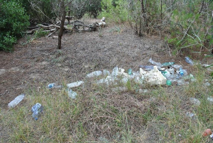
attitude towards the use of these vulnerable areas. It is of urgent importance to promote a sustainable
management to avoid the great accumulation of waste and marine litter (Fig. 4 and 5)
6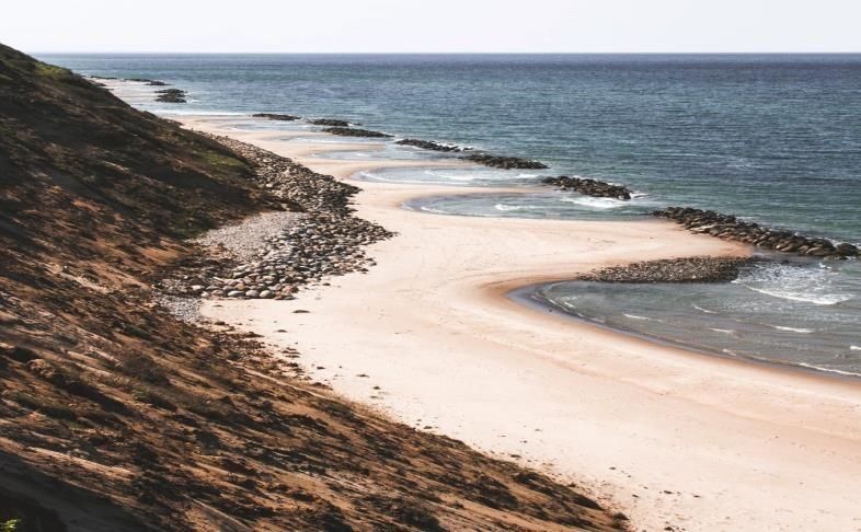
Fig. 4. Waste in a retrodunal habitat

                                                Fig. 5. Marine litter

    a) Users Expectations

Beaches are systems where plainly physical, ecological, social and economic dimensions interact.
Although these systems can provide several protective, recreational and natural functions, only recreation
has been traditionally prioritized by managers. This situation has led to the homogenization of beach
management culture and practices. Major flexibility and adaptation capability are required in order to set
management strategies to beach setting and beach users. In two antagonistic beaches (natural protected
vs. urban) travellers have different motivations and expectations which should be satisfied during
holidays, in order to get their satisfaction and hence their future returns. A recent study [3] suggest that
users’ motivations, priorities, and expectations in these two antagonistic beaches are not notably different.
Therefore, the usual expectations of the Mediterranean “sun, sand and beach” tourism model is confirmed
[4; 5; 6]. Often, users expectations blend with perceptions. In fact, in urban intensive tourist coastal areas,
beach services are generally poorly evaluated, albeit their quality was awarded with a Blue Flag.

Land-sea project with its guidelines and action plans encounters the exigencies of people who already
have a particular attention towards a correct use of naturalistic coastal habitat. In addition it promotes
activities directed to change the attitude of the general users of coastal habitat. To the users will be offered
the opportunity of living these habitats in a full comfort but in complete respect of nature assuring facilities
that can be sustainable ecologically also promoting slow mobility in order to reduce the use of cars and
every type of motor vehicles.

                                                                                                              7
b) Management framework

Coastal habitat will be managed considering the following focal aspects: dune restoration, delta
requalification, erosion control, natural ponds restoration, slow mobility, flood control, scattered hotel to
promote a tourism in contact with local people.

   c) SWOT Analysis

                      Strengths                                             Weakness

     -   Natural value of coastal habitat                  -   Difficulty in dealing with too altered
     -   Economic value of coastal     habitat     it          coastal zones
     -   Socio economic benefderiving from
         ecotourism
                   Opportunities                                             Threats

     -   halt human impact                                 -   human impact
     -   increase people awareness                         -   socio   political  pressures        to     an
     -   reduction of waste                                    unsustainable development

                                                                                                           8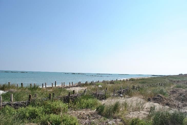
Chapter 2 Legal aspect

“The achievement of integrated coastal zone management (ICZM) in the European Union inevitably
raises questions of law revealed considerable diversity within the national legal systems governing the
European Union (EU) coastal zone” [7]. Actions have to be assessed by legal frameworks and evaluated
regarding the compatibility of sectoral legislative instruments within the Member States. On the
international level, European Directives are legally binding on Member States, and offer the benefit of
legal enforceability. Still, any directive needs to allow the principle of subsidiarity to guide its
implementation [8]. Five key European Directives driving the management at the national and local level
were identified by the Institute of Estuarine and Coastal Studies (IECS) [9] which are crucial for ICZM.

Key International and European Directives related to Integrated Coastal Zone Management:

    1. Birds Directive (2009/147/EC): The BD [10] is one of the most important nature legislation pieces,
       creating a comprehensive scheme of protection for wild bird species naturally occurring in the
       EU.

    2. Habitats Directive (92/43/EEC: Member states are legally bound to promote the maintenance of
       biodiversity by requiring measures to maintain or restore habitats and species listed on the
       Annexes at a favourable conservation status and introducing robust protection for those while
       taking in account economic, social and cultural requirements. Designated Natura 2000 sites serve
       for conservation and restoration of habitats in a good conservation status. The HD [11] together
       with the BD [10] are the “cornerstones” of the EU´s nature conservation policy.

    3. Water Framework Directive (2000/60/EC): The WFD [12] defines quality by using biological
       elements together with physical-chemical elements to access good ecological status at the
       ecosystem level. The achievement of “Good Chemical and Good Ecological Status" or in case of
       Heavily Modified Water bodies “Good Chemical Status” and "Good Ecological Potential" of
       inland surface waters (rivers and lakes), transitional waters (estuaries), coastal waters and
       groundwater is intended.

    4. Marine Strategy Framework Directive (2008/56/EC): The MSFD [13] is an integrated framework
       for the management of marine spaces. The MSFD aims at achieving or maintaining a good
       environmental status for community waters by 2020 at the latest and contains the explicit
       regulatory objective that "biodiversity is maintained by 2020" as the cornerstone for achieving
       Good Environmental Status.

    5. Flood Risk Management Directive (2007/60/EC): The FRMD [14] aims to reduce and manage the
       risks that flooding poses to human, environment, cultural heritage and economics. All inland and
       coastal waters must be assessed regarding the flooding risk and adequate measures to reduce
                                                                                                            9
this flood risk have to be taken. The FRMD needs to be implemented in coordination with the WFD.
Furthermore, environmental assessment aims to integrate environmental considerations into the
preparation of plans and the implementation of projects which are likely to have significant
environmental effects in the EU member states [15]. The Environmental Impact Assessment and
Strategic Environmental Impact Assessment Directives [16; 17] are the assessment framework, which
sets out principles for an environmental assessment regime that is also relevant to the coastal, estuarine
and related riverine environment.
The base for each directive´s implementation are the general principles in the field of environmental
policy. The “prevention principle” is a strategy for decisions on uncertainties that can be expressed in
terms of known probabilities based on the notion of a maximum acceptable risk level to be chosen by
society. The “polluter pays principle” is based on the concept that the party responsible for producing
pollution is responsible for paying for the damage done. Regarding pre-damage control, the
“precautionary principle” emerged e.g. for anticipatory measures associated with climate change. Based
on the “Aarhus Convention” the public “participation principle” was implemented in order to provide
access to information, public participation in decision making and access to justice in environmental
matters. The “participation principle” is applied e.g. in the Environmental Impact Assessment directive
(EIA Directive). The overall guiding principle is “sustainable development” as an approach to foster
economic growth while preserving the quality of the environment for today and future generations at
the local and global level. This is also a important principle in the adoption of both the Birds and
Habitats Directives because protecting and conserving species and habitats are also the base for their
sustainable utilization.
10Chapter 3. Ecotourism best practices
Exists lots of ecotourism good practices in Europe but here we highlight some of the best that occurs in
Catalonia.
Delta Birding Festival
Delta Birding Festival (www.deltabirdingfestival.com) is the most important ornithological trade fair in
the Mediterranean region, jointly promoted by two NGOs and a shop for birders and naturalists. The
DBF takes place annually in the Ebro Delta, one of the most important natural places in the Western
Mediterranean, and hosts a wide and attractive program of activities with lectures, courses, workshops,
contests and others coupled with a large fair of products and services for the birder and people who
enjoy nature as a whole.
In addition, the DBF sets aside the profit of ticket selling to a project related to the study and
conservation of birds and nature. In 2018, for instance, the financial contribution will be dedicated in a
research project to study the migration routes of European Turtle Dove.
The festival has reached a renowned prestige among birders as a result of the category of its invited
lecturers and the large number of scheduled activities and the quality of exhibitors, highlighting the
wide participation of all major brands of optics and photography and numerous stands of products and
services.
WildSea Europe
Different coastal areas in Catalonia (including the Ebro Delta) are destinations of WildSea Europe
(www.wildsea.eu), a network of tourism destinations and operators working together to give market
visibility to a rich choice of ecotourism experiences in Europe. They do it while building a pan-European
network of tourism operators who actively nurture love and respect for the Ocean through sustainable,
responsible tourism. Diving, snorkeling, trekking, birding, kayaking... marine wildlife can be
experienced in so many different ways.
Other key elements of WildSea Europe mission include empowering small, local businesses of coastal
communities, supporting sustainable livelihoods, enhancing ocean literacy through citizen science and
preserving our marine ecosystems.
The Government of Catalonia (Catalan Tourism Agency) and the NGO Submon are the catalan partners
of the WildSea Europe project.
Eco-briefings
A briefing is a short talk (5-10 minutes) given by the diving instructor just before divers jump into the
water. A regular briefing includes crucial aspects of the dive site to make the experience both safer and
11more enjoyable: sea bottom topography, maximum depth, recommended itinerary, points of interest,
hazards (currents, caves, poisonous animals…), entry and exit procedures, hand signals and instructions
in case of emergency.
In Catalonia diving centers operating in the Medes Islands Natural Park are obligated to add some
aspects regarding marine conservation in the briefings, so is called eco-briefing. Instructors strongly
reminds to divers they are in a protected area and they cannot touch or take anything, not feed animals
and pay attention to the buoyancy near walls with gorgonians.
In addition, every instructor working in these diving centers must be certified by the Park, so it means
they must to complete a course to complement and enrich his training in order to transfer to people the
best practices in relation to the needs of preservation of the environment.
Fishing tourism
Fishing tourism activity could be described as the one that other people, different from the crew,
participate on a professional fishing activity with a recreational and touristic purpose, to know the
methods and fishing practices in situ.
Catalonia’s government established a legal framework for fishing tourism in order to regulate the
activities related totally or partially to sea fishing and aquaculture that allow to improve or complement
the incomes of the people that integrate the professional fishing sector, in order to achieve the economic
diversification of the sector and the promotion of its products.
There are several designed activities for the fishing tourism activity in Catalonia: from accompanying the
fishermen on a fishing journey (on the fishing boat or on another boat that is sailing alongside), to visit a
floating structure for the production of mussels or join a seafood fisherman to collect seafood from sandy
shores. Most of the activities includes a gastronomic complement.
12Chapter 4. Ecotourism governance to produce an integrated approach
Good governance is a key factor to implement ecotourism strategies and to have an integrated approach
for coastal zone management, usually identified as a complex context. Implementing good governance
schemes allow stakeholders to participate in the development of tourism strategy, communicate and
achieve their goals and interests, and successfully implement tourism programs. In Catalonia, one of the
top reference Mediterranean tourism destinations, ecotourism governance has a cross-sector and
multilevel approach.
REGIONAL LEVEL: A common strategy (NaturCAT2020) and a public-private partnership (PPP)
It is essential to define a common strategy on ecotourism, a cross-cutting sector by definition,
establishing a roadmap with specific goals and milestones. In 2015 was approved in Catalonia the
NaturCAT2020 Strategy [18], a common plan to boost ecotourism sector in natural areas engaging
tourism, natural areas and local development. The first action was to issue the Catalan Ecotourism Board
(CEB), a stakeholder partnership integrated by 30 representative professionals and experts from public
and private sectors, which help for the implementation and evaluation of actions related to
NaturCAT2020. The plenary of the board meet every 3 months, and usually it works with a Secretariat
and Working Groups in different topics such as the definition of resources with ecotouristic potential,
the principles that defines ecotourism practices, etc. So, the interventions of CEB include to improve the
tourism product offered (e.g., clustering businesses together and developing touring routes, developing
packages), marketing strategies (collaborative destination promotion), funding (e.g., obtaining donor
funding), human resources (e.g., offer training), and infrastructure (e.g., new buildings).
Meeting of the Catalan Ecotourism Board in the Ebro Delta
Meeting of the Catalan Ecotourism Board in the Ebro Delta
13The EPPBC also promotes every two years the celebration of a 3 day- meeting of ecotourism professionals:
Forum ENS: Ecotourism, Nature and Sustainability.
LOCAL LEVEL: European Charter for Sustainable Tourism in Natural Protected Areas
The European Charter for Sustainable Tourism (ECST) [19] in Protected Areas is a practical management
tool that enables Protected Areas to develop tourism sustainably. It was set up in 1995 by EUROPARC
Federation. In Catalonia 7 Natural Protected Areas are granted by ECST, in Europe 164 NPA. The core
element of the Charter is working in partnership with all relevant stakeholders to develop a common
sustainable tourism strategy and an action plan on the basis of a thorough situation analysis. The aim of
all Charter projects and activities is the protection of the natural and cultural heritage and the
continuous improvement of tourism in the Protected Area in terms of the environment, local population
and businesses as well as visitors.
The European Charter for Sustainable Tourism in Protected Areas is awarded by the EUROPARC
Federation through an independent verification process. The award recognises not just a commitment to
sustainable tourism but also the implementation of practical sustainable actions by public and private
partners. Such actions;
• bring measureable economic, social and environmental benefits from well-managed sustainable
tourism,
• strengthen relations with local tourism stakeholders and the wider tourism industry,
• provide access and membership of an extensive and dynamic European network.
The Charter provides a model of governance that delivers Protected Areas as sustainable tourism
destinations. Further, all actors through the application of sustainable tourism practice in their region
ensure the natural habitat and landscapes upon which they all depend are conserved for future
generations.
The process of pursuing and achieving the award enables all involved to receive expert advice, maintain
motivation and incentive, and obtain international recognition.
The Ebro Delta Natural Park is one of the NPA granted by ECST with extensive experience (over 10
years). A very useful governance tool is the Sustainable Tourism Forum. It is a permanent participative
platform established between the protected area authority, local municipalities, conservation and
community organizations and representatives of the tourism businesses. The constitution and numbers
involved in the Forum and any associated Executive Committees or other structures, and the regularity
of their meetings, should be sufficient to enable effective discourse and decision making. In the Ebro
Delta, the ST Forum is set up by 132 members, divided in 6 work commissions [20].
14Sustainable Tourism Forum of the Ebro Delta: signature of commitment
15Chapter 5 skills involved and developed
In this thematic paper we show what skills are involved to properly manage the coastal habitat and
develop the ecotourism in a very sustainable manner.
Ecology. Some best practices will be exchanged with the other partners in order to manage coastal habitat
in terms of dune conservation, as well as prevention of erosion and flood.
Dune habitats conservation can be obtained managing invasive alien species, planting native species,
controlling the trampling posing boardwalks and access bars, managing fires [21]. All these activities
preserves the foredune habitats and permits the formation of the sand and a natural requalification of
these vulnerable areas. However, in order to achieve these objectives is fundamental to control erosion.
Shoreline erosion can be caused by both natural (storms, subsidence, eustatism, bradyseism) or anthropic
(bad designed harbors or defensive coastal structures) phenomena and can be defined as the
disproportionate removal of sediments along the coast despite the one naturally deposited.
Erosion can be distinguished in short-term erosion (which usually is a reversible process, due to cross-shore
currents) and long-term erosion (which usually is a non-reversible process, due to longshore currents).
Dunes represent the natural structural defense concerning erosion. They are a natural reservoir of
sediments formed by wind transportation, able to give a contribution during the extreme storms and, at
the same time, are the upper limit of the shore. Typically, erosion can be avoided by using several kinds
of structures which can be classified as “hard” or “soft”.
Traditional solutions are typically seawalls, groins, breakwaters, artificial beaches and nourishments.
These are very useful solutions but take in account several disadvantages, mainly linked to heavy visual
impact, high costs or periodical maintenance, limiting circulation of nearshore currents.
In order to preserve against erosion and to safe ecosystems, a number of non-conventional “hard” systems
exist. An example is the submerged structures which, during the calm conditions are able to maintain the
equilibrium of the protected environment and during the storm events grants the breaking wave and the
wave dumping to reduce the hydraulic loading. They also offer a lower cost of realization and a smaller
intrusion in the landscape. In some cases, it could be useful to employ alternatives elements such as
EcoReef (snowflake-like ceramic modules crated in a 3D hexagonal shape, with a microporous surface
texture for improved coral adhesion) and Reef Balls (which are porous modules that combine the ability
to protect the shore and the opportunity to act as a habitat for marine organisms).
As non-conventional “soft” solution, it may be taken in account the employment of sand bypassing
systems. It is an efficient technique which uses the sediments accumulated along the part exposed to the
current, relocating them where erosion occurs. In this way it is possible to partially restore the sediments’
budget avoiding a high environmental impact. Beach nourishment and beach drainage are other example
16of “environmental friendly” solution. However, their application must be carefully considered, in order
to prevent physical and ecological impacts, ongoing maintenance cost and potentially short lifespan.
Furthermore, the assessment of the direct impacts due to interaction between coastal structures and
shoreline represents one of the crucial issues to be taken into account in the coastal management plan both
in terms of littoral morphodynamics and marine ecosystem maintenance. In fact, the widespread presence
of permanent and seasonal structures built on the longshore sand dune close to the foreshore, amplified
the wave action increasing the local erosion rates with an appreciable reduction in beach width and
sensitive impoverishment in local economy mainly based on tourism activities.
Renewable energy from the sea. Some schemes on how optimise the sea energy are shown. The idea to
harvest energy from oceans has always fascinated scientists and engineers. Waves are generated in large
part when the wind blows over the ocean’s surface, which itself is a function of temperature and pressure
differences across the globe caused by the distribution of solar energy. Wave energy carries both kinetic
and gravitational potential energy, the level of which is a function of both the height and the period of the
wave.
Oceanic Tides are the function of the motion of the moon and sun relative to the earth. These gravitational
forces in combination with earth rotation on its axis cause periodic movements of the oceans and seas. The
vertical rise and fall of water - known as tides – is accompanied by incoming and outgoing currents from
the bays, harbors and estuaries. These currents are called tidal streams it is possible to exploit energy from
them using turbines. It is something really similar to the concept of harnessing wind to create energy. The
energy potential of the tidal currents is typically located in areas with the greatest range. Anyway, this
potential increases in areas where the flow of water is constrained or funneled by local topography such
as narrow straits and headlands. The gravitational forces from the sun and moon generate oceanic tides
and the difference in sea level between high and low tide is known as the tidal range. At most coastal sites,
high and low tides occur twice a day. Even so, these tides have been studied for centuries and can be easily
forecast the tidal range energy.
Devices able to convert wave energy in electricity are called Wave Energy Converters and they can be
mainly distinguished considering the different methods of operation: Oscillating Water Columns, Wave
Activated Bodies and Overtopping.
Tidal stream devices convert the kinetic energy of free-flowing water into electricity. A number of devices
exist and these typically fall into following categories: Horizontal-Axis Turbine, Vertical-Axis Turbine,
Oscillating Hydrofoil, Ducted Turbine Tidal Kite and Archimedes’ Screw.
17Tidal range technology shares a range of similarities with hydropower, capitalizing on the artificial
height differential of two bodies of water created by a dam or a barrier, and so the gravitational potential
energy to generate electricity via turbines.
Ecology – Flood prevention
Floodplain vegetation controls sedimentation and erosion processes and is a key function to prevent floods
within fluvial corridors. Poplars and willows show a strong mechanical resistance to physical disturbance.
These floodplain forest species explain the synergy between vegetation succession and the construction of
landforms identified as an ‘ecosystem functions’ that additionally act as diversity reservoirs [22].
However, dams and dykes reduce water level fluctuations and lead to substantial changes in the
floodplain plant species composition [23] and thus wetland restoration and dyke relocations are required.
The European Habitats Directive [24] protects biodiversity on species and habitats level and alluvial forests
are listed as priority habitats (e.g. Alluvial Forests; 91E0* HD annex I) that have to be maintained or
restored. Thus, White Willow Softwood Floodplain Forest restoration along the tidal freshwater section of
the Elbe estuary in Hamburg is recently implemented [25].
Willow floodplains reduced the overtopping of dykes in a scheme that combines lowered dyke height and
construction costs with landscape conservation. Willow plantations in locations where the soil is not
constantly saturated are proposed for coastal flood protection on the macro-scale, whereas oyster and
mussel beds should be used lower in the intertidal and dunes and coastal wetlands like salt marshes
intermediate on the landscape scale [26].
A further “building with nature” approach is managed realignment what is increasingly considered as an
option with `no-regret´ [27], bringing together improved flood risk management, reduced costs for flood
protection and habitat restoration [28]. Kreetsand serves as one example located along the Elbe estuary in
Hamburg. The Hamburg Port Authority (HPA) created an extended new shallow water area in the
foreland where dyke realignment had been carried out in 1999 but due to high elevated foreland it was
not influenced by the tidal action. HPA set up this Kreetsand pilot project to reduce the upstream sediment
transport and decrease tidal energy of the Elbe estuary. This example of sustainable river engineering shall
also be used to improve the public understanding of the function of tidal systems and estuaries [29].
Sustainable planning and Sustainable tourism. In different coastal areas different methodologies to
develop tourism in a very sustainable way will consider the characteristics of the area historically and
ecologically.
With a surface of 300.000 km2 and a total shoreline of over 7.500 Km, Italy has in coastal tourism one of
the most important economic features, thanks also to a fine geographical collocation. At the same time, the
diversity along the coast may encourage ecotourism. In Italian coastal areas, the number of sustainable
beaches and restoration project “working with nature” are increasing. They combine the touristic offer
18with the environmental protection and making unspoilt nature the measure of all things. In particular,
with an emphasis on enriching personal experiences and environmental awareness through
interpretation, ecotourism promotes greater understanding and appreciation for nature, local society, and
culture. Several technological (e.g. improvement of green power technologies, cycle waste and wastewater
management) and non-technological (i.e. sustainable territory maintenance and integrated coastal zone
management) approach should be combined in order to obtain effectiveness conversion from tourism to
ecotourism. Initiatives like these are sponsored by important authorities and associations. Economic
operators benefit from their own quality offer and are conscious that it is thanks to the environmental
protection if they could keep having their business, aiming to an equilibrium between ecosystem and
anthropic impact.
Sustainable planning and sustainable tourism example by Hamburg
The city of Hamburg is located along the tidal freshwater section of the Elbe estuary that expends 140 km
from an upstream barrier near Geesthacht up to the North Sea including the island Neuwerk and the
Nationalparc “Hamburgisches Wattenmeer” beside the city. Thus, sustainable planning and tourism
covers the estuarine and coastal environment and the related river basins with a focus on the Elbe estuary.
The Hamburg Port Authority (HPA) together with the Waterways and Shipping Directorates (WSA)
developed firstly a concept for the sustainable development of the tidal Elbe in 2006. Based on the
hydrodynamic changes during the last decades, the concept focusses on (i) damping the tidal energy in
particular in the estuary mouth, (ii) creating room for retention in the tidal freshwater and brackish section
and (iii) optimising the sediment management in the whole system. A shallow water area created in a 42ha
former flushing field in the foreland “Kreetsand” served as pilot project. The project aims to reduce tidal
pumping and tidal amplitude, and sediment load. The concept was developed in accordance to the HD
and WFD in cooperation with the administration and NGO´s. Communication is important part of the
project, e.g. via the dyke booth what is being frequently visited by tourists.
The whole Elbe estuarine stretch except the Hamburg harbour and other industrial sites are protected via
the Natura-2000 network. Impact assessments are required regarding planning's which may affect a
Natura 2000 site and for each Natura 2000 site management plans must be set up. The Integrated
Management Plan Elbe Estuary (2012) was established as a joint state plan by voluntary commitment of
all stakeholders to sustainably develop the Elbe estuary as part of the Natura-2000 network. Two hundred
measures are proposed, many of them have been implemented by the Elbe Habitat Foundation including
“Wilderness-Camps” for both locals and tourists.
The Tidal-Elbe concept and the IMP Elbe Estuary were created by regional administration and
stakeholders. Within the Interreg IVb TIDE project, international representatives of four North Sea Region
estuaries including the Elbe estuary worked together to improve management of estuaries by developing
concrete tools which enable stakeholders to take the whole estuary into account (ecology, economy,
19society). Ecosystem function, governance and measures were selected as focus areas in the transnational
cooperation that delivered the Tide Tool Box based on an ecosystem service approach comprising tools
for effective governance and communication. Moreover, the Forum Tideelbe, a cooperation among the
Länder Hamburg, Lower, Saxony and Schleswig-Holstein, the federation, municipalities and NGO´s
aiming to sustainably develop the tidal Elbe was initiated in 2016.
Estuary-Management is also part of the long-term research project KLIMZUG-NORD that targets to
develop adaptation strategies to climate changes concerning the metropolitan area of Hamburg up to the
North Sea. Moreover, the Hamburg Climate Plan aims bringing together climate change mitigation and
adaptation to climate change. While (eco-)tourism is not explicitly mentioned, most of the action areas (e.g.
urban development, buildings, education, mobility, human health, nature conservation) aim to promote a
climate friendly tourism. However, the most recent development to promote sustainable tourism is the
set-up of the Destination Management section in the leading Hamburg Tourismus GmbH.
Sustainable planning and sustainable tourism example by Varna
Coastal zone representing the boundary between sea and land is a highly dynamical and sensitive area
that comprises a large variety of natural resources. Population growth in the littoral causes rapid
urbanization of the coast, development of infrastructures, transport system and so on. Therefore, coastal
ecosystems experience pressure and become vulnerable to pollution, habitat degradation, and loss,
overfishing, and increased coastal hazards. Accelerated tourism development during recent years is an
extra risk factor for the Bulgarian Black Sea coastal zone. Considering that the coastal zone is a limited and
very vulnerable land area, the high population increase due to tourism is one of the most hazardous factors
for coastal zone sustainability. Although tourism growth and coastal development give rise to a number
of economic benefits, they also could lead to loss of habitat, green space, and biodiversity. Introduction
Coastal zone is a highly dynamical and sensitive area that comprises a large variety of natural resources.
This predetermines the attractiveness of the littoral for settlement and other human activities, like tourism,
recreation etc. Population growth causes rapid urbanization of the littoral, development of infrastructures,
transport system etc. Therefore, coastal ecosystems experience pressure and become vulnerable to
pollution, habit-tat degradation and loss, overfishing and increased coastal hazards. Vast sandy beaches
along the Bulgarian Black Sea coast, in combination with favorable climate and clean seawater, are valued
preconditions for tourist industry development. Speeded tourism development during recent years is an
extra risk factor for the coastal zone. Both local residents and tourists cause pressure to the ecosystem,
therefore population in the coastal regions is used as pressure indicator for ICZM.
Analysis The Bulgarian Black Sea coast, situated in the Western part of the Black Sea, has a 378 km long
coastal line, 140 km of which occupied by 78 beaches. 14 of 262 state municipalities are located in the
coastal zone. The Bulgarian Black Sea coastal zone is 5.21% of the country territory and hosts 8.85% of the
national population. Official census results show that during 1934-2001 the total coastal population growth
is almost six times higher than in the entire country. Thus, the Bulgarian Black Sea coastal zone is one of
20the most rapidly growing and developing areas on a national scale. Tourism and in particular coastal
tourism is one of the fastest developing world industry sectors, and Bulgaria follows this tendency. Tourist
spate towards Bulgarian Black Sea coast dramatically increased during the last years and will continue to
grow at least for few more years. Tourist spate towards Bulgarian Black Sea coast dramatically increased
during the last years and will continue to grow at least for few more years. The existing facilities in some
municipalities are not able to meet this additional pressure and to reduce the adequately anthropogenic
impact on the marine ecosystems. Considering that the coastal zone is a limited and very vulnerable land
area, the population increase due to tourism is one of the most hazardous factors for coastal zone
sustainability. Although tourism growth and coastal development give rise to a number of economic
benefits, they also could lead to loss of habitat, green space, and biodiversity, especially in case of newly
constructed tourist sites, some of which are in very low populated coastal regions or neighboring protected
territories. Public policymakers and coastal managers are now facing the challenging task of finding a
balance between benefits of tourist growth and mitigation of its effects on the coastal environment. Data
for tourist international arrivals in Bulgaria during the period 20014 -2018 show that the number of tourists
has been continuously increasing: from 9 408 821 in 2014 to 12 368 363 in 2018, so there is a rapid
development of coastal tourism. On the north coast of the Black Sea, sustainable projects have been
implemented for sustainable planning land – sea system:
The Institute of Oceanology - at the Bulgarian Academy of Sciences is implementing a research project
"Dynamics of the sea level in the western part of the Black Sea. Estimates and impacts on ecosystem
characteristics." [30] The following activities were carried out:
• Creating a single set of historical data on sea level fluctuations in the western part of the Black Sea;
• A pilot system for operational observation and reporting of adverse natural events caused by extreme
sea level increase in a scientific research base at Shkorpilovtsi village, Varna region;
• identifying risk floodplains with regard to extreme hydro-climatic events during a storm and river
floods;
• a methodology for the determination of the morphological vulnerability of a coastal area by modeling
the morpho-dynamical processes under conditions of extreme hydro-climatic events has been
established.
A project MICORE [31] (Morphological and Coastal Risks Caused by Extreme Events) was carried out by
the EC. The main objective is to develop and demonstrate tools for reliable prognosis of morphological
impact and damage caused by storm events. The results of the project are fully orientated to help strategies
for the protection of the population from disasters, the development of the probability mapping of the
morphological impact of the sea storms and the creation of an early warning system and information
system for long-term disaster reduction.
21The SPICOSA[32] project is implemented by the Bulgarian Academy of Sciences with the main goal of
creating and developing an innovative, interdisciplinary research approach to help develop criteria for
assessing sustainable coastal ecosystem management policies through environmental, social and economic
equality. The coastal ecosystem of the Varna District is part of the scientific experimental Black
Sea-Danube delta, one of the 18 projects envisaged within SPICOSA. The main focus in implementing the
Environmental Approach (SER) will be the growing tourism industry, identified as one of the current
threats to the ecological balance of the Northwest Black Sea coastal zone, and the challenge of formulating
and implementing an adequate science-based strategy for sustainable coastal management.
The National project BG161PO001 / 3.2-02 / 2011 "Support for the development of regional tourist product
and destination marketing", operation 3.2. "Development of the regional tourist product and destination
marketing", priority axis 3 "Sustainable development of tourism". Тhe main objective is developing and
promoting a regional tourism product and increasing the effectiveness of regional marketing on the basis
of an integrated approach to sustainable tourism development at regional level. The specific project
objectiv is promoting the natural, cultural and historical heritage of the tourist region, including the
municipalities of Varna, Avren, Aksakovo, Beloslav, Devnya in Varna which have significant tourism
potential [33]. The Interactive Cities is a cutting-edge project aimed at exploring how digital, social media
and user generated content can improve today´s urban management in European cities, whatever size.
Interactive Cities is a network of URBACT, the European Territorial Cooperation programme aiming to
foster sustainable integrated urban development in cities across Europe. Interactive Cities focused not only
on the technological side but also on how this kind of innovation can be concretely useful for local
authorities and urban residents, promoting better urban governance, citizen participation and economic
growth.
22Chapter 6 Staff exchange preparation
TO
Italy Bulgaria Germany Spain
RBD Molise Varna Hamburg Catalonia BCN
Region Region
8-9/04/19 10-12/04/2019 10-20/06/2019 18-22/02/2019 20-24/05/2019 27-31/05/2019
RBD 2 2
Italy Molise 1 1
Region
Bulgaria Varna 2 2
Germany Hamburg 1 1 1
Catalonia 2
Spain Region
BCN 1
The partners are going to concentrate in the concrete transfer of experience into the local policies through
the elaboration of 4 local action plans, that have to be finalized at the end of the year.
For this activity they ask the active cooperation of other partners (a period of staff exchange will facilitate
this "phisical" transfer and exchange), so that the transfer can entail a consistent adaptation of a good
practice in a new context.
Regarding the Lead Partner (RDB) two modules will be activated, as described in the following.
• Module A: Management and valorization of coastal geoarcheological sites. The module aims to
transfer and develop competences in the field of coastal geoarcheological sites, bulding new
strategy to promote these sites. Through the integration of geologic concepts and information,
geoarchaeology offers an effective means of finding early sites in the modern coastal landscape
and in the now-submerged paleocoastal landscape. Particular attention will be paid to the
fundraising activities and operative planning. Four days are planned, covering office visit and
technical meeting with the manager of the natural sites, technical visits to a pair of natural sites,
participation at the local stakeholder meeting.
• Module B: Management and valorization of coastal habitats, aimed to boost competencies on the
integrated management of transitional small wetlands and coastal forests. These areas are among
the most degraded and threatened ecosystems in the EU. This has resulted in many habitats and
species in Mediterranean coastal areas having ‘unfavourable’, ‘vulnerable’ or ‘near threatened’
conservation status according to the Habitats Directive. The program focus on three main themes:
23planning of marine and coastal areas; protection, preservation and restoration of coastal and
marine habitats; sustainability of socio-economic stress on the coastal zone.
First day visit at the Offices of Regione Molise in Termoli-Demanio Marittimo. Suvery in the
portual and Natura 2000 sites in the coastal areas. Visit at the Offices of ARPA Molise.
Second day visit at the ARPA Molise of Campobasso laboratories where will be illustrated the
procedure for the analyses of sea water samples both for touristic (“Balneability”) and
environmental purposes (“Ecological state of coastal and marine water” and Ecological state for
the Marine Strategy” according to the Directive 2000/60/EC and 2008/56/EC. The procedure for the
elaboration and classification for dissemination will be also showed. At the end visit to the
technical infrastructure of Molise Region.
Staff Exchange preparation; Hamburg, Gemany (Heike)
The Hamburg Staff Exchange Programme will consider the wishes of our guests regarding the
topic, method, timetable and participating people as much as possible. The selected topics are
“Multipurpose flood protection infrastructure” and “Managing ecotourism in protected areas”.
The staff exchange programme will start at the upstream city border and follow the river through
the districts (Bergedorf, Hamburg Mitte, Harburg, Altona) that cover the Elbe estuary up to the
downstream city border. The programme will comprise both study visits and discussions with the
persons in charge regarding the selected topics.
Proposal with a selection of activities for the Hamburg staff exchange programme:
Day 1 - Study visit district Bergedorf
• Weir Geesthacht that limits the tidal influence of the Elbe estuary and ensures sufficient
water level for shipping in the upstream river Elbe; European largest Fish Pass that was
admitted an “Outstanding project in fishery and ecohydrology” (Vattenfall Europe)
• Restoration of the tidal influence in the protected area “Borghorster Elblandschaft” via
sluices to allow a controlled tide (retention room and beaver habitat) (Ministry for
Environment and Energy; Nature protection agency BUE); viewing platform for public
information
• Large compensation measure “Zollenspieker” with restoration of protected habitats in the
Elbe foreland (BUE); neighbouring and highly frequented Tourist Infrastructure (ferry,
hotel, …) • Nature protection measure “Wrauster Bogen” with lowering of revetments to
allow limited tidal influence for habitat restoration (Elbe Habitat Foundation); Willow
Plantations along the dyke for flood protection (Waterways and shipping administration)
Discussion: Destination Management Hamburg Tourismus GmbH; Nature Conservation
Authority
Day 2 – Study visit district Mitte
• Nature protection area with Tidal softwood forest relict; Elbe-Tidal-Wetland Information
Centre NGO GÖP (Society for Ecological Planning/GÖP); Tourist destination at former
24Stackmeisterei
• Pilot project “Kreetsand” – large shallow water area for flood water retention and habitat
restoration (Hamburg Port Authority HPA); Dyke booth Information location for tourists
• Insight into the recent Hamburg Flood Prevention Program on the Elbe island
Wilhelmsburg
Discussion: Hamburg Port Authority; Ministry for environment and energy; Institute for River and
Coastal Engineering TUHH
Day 3 – Study visit district Altona
• Multipurpose flood protection infrastructure in the HafenCity and Hamburger Hafen
(HPA)
• Experiences in Elbe-Tourism by ferry
• Museum harbour Hamburg. Elbe Beach as Tourism destination and Flood protection
measures connected to the Elbe Beach
• Overview Elbe estuary (protected areas Elbe islands, shallow water area “Mühlenberger
Loch” and planned fairway adjustment measures, cruise vessel traffic) Final
Discussion, conclusions, steps to be taken
Staff Exchange Programme – BCN Ecology
From 27th to 31st May, 2019, it will take placed in Barcelona, organized by Urban Ecology Agency
of Barcelona (BCN Ecology), the Staff Exchange Programme, in which Regional Administration
Varna (from Bulgaria) will participate.
The training plan is going to focus on Ecosystemic urbanism and is aimed to learn keys and tools
to generate a new model at a more sustainable city, based on efficiency and habitability. It
intends to develop competences on the following fields: Urban fabrics analysis and keys of their
unsustainability reflection; Rethinking of the city model from flows and cycles (urban
metabolism); Identification of the factors that determine the city (efficency and habitability);
Learning the instruments for ecosystemic urbanism design and planning, and Dissemination of
existing good practices to get at a sustainable city model.
The Staff Exchange Programme is divided also in three thematic sections: 1) Conceptual
framework and instruments of Ecosystemic Urbanism; 2) Ecosystemic’s Urbanism Tools, and 3)
Charter for the Ecosystemic Planning of Cities and Metropolises. The first section consists in two
sections training: General presentation of Ecosystemic Urbanism and Organizational instruments
of the Ecosystemic Urban Planning. The superblocks and the three-level urbanism. On the
second one, 4 sessions are included: Presentation and practical application of the SIMEU
program, of the
25Habitability index in public space, of SIMUR program, and of GHG emission calculator
(greenhouse Gas). And the third section, it will be target on the Charter’s presentation and
application.
This programme is also comprised of 4 hour-visit and technical meeting with the manager of
Urban Ecology Agency of Barcelona, Mr. Salvador Rueda; 23 hour-technical meeting different
Agency’s areas responsible; 8 hour-technical visit to three of superblocks (Poblenou, Sant Antoni
and El Born), and 4 hour-participation at local stakeholders’ meetings.
Staff Exchange Programme – DG Tourism (Catalonia)
Ebro Delta & Barcelona, 20th- 22nd May, 2019
The Staff Exchange Programme of Land-Sea Interreg Europe to Catalonia will take place in the
Ebro Delta and Barcelona, from 20th to 22nd May, 2019 organized by DG Tourism (Catalan
Government). There will attend representatives from River Basin Authority of the rivers Liri –
Garigliano and Volturno / Southern Apennines River Basin District and Molise Region (from
Italy).
The training plan will be focused on how is implemented eco-tourism and sustainable tourism in
coastal and wetland areas. It intends to develop competences on the following fields: Integrated
Coastal Zone Management; Climate Change; Ecotourism facilities; Governance; Land planning,
and Strategic planning on tourism.
The Staff Exchange Programme is divided also in three thematic parts: 1) Conservation and
Ecotourism 2) Integrated Coastal Zone Management & Land planning; 3) Strategic planning,
governance and tourism marketing. The first part consists in visiting the Ebro Delta Natural Park
and their most relevant facilities (observatories, hides, interpretation centers, cycling paths, etc.)
combining ecotourism promotion and natural heritage conservation. We will also learn how small
companies and public institutions are working together (under the European Charter of
Sustainable Tourism –ECST- and other collaborative structures such as a Water Sports & Tourism
Center) to consolidate a top-level land-sea destination on ecotourism. The second part, also in the
Ebro Delta aims to share knowledge and experience regarding Integrated Coastal Zone
Management & Land planning facing current and future challenges such as invasive species (and
the loss of native ones), the subsidence and salinization of deltaic areas, and climate change
(increase of extreme weather episodes, rise of sea level, etc.). In this sense we will become
acquainted about several ongoing and/or recently finished European projects (LIFE Delta Lagoon,
LIFE Migratoebre, etc.), on habitats restoration and integrated coastal management, and migratory
fish recovery through rivers ecological connectivity. Finally, the third part, centered in Barcelona
will be focus on the strategic planning on tourism (DG Tourism – 2018-2022 Strategic Tourism Plan
for Catalonia) and ecotourism (NaturCAT2020); how to establish a good-governance scheme based
on the Catalan Ecotourism Board, and the marketing strategy and actions to promote ecotourism
(Catalan Tourism Board – 2018-2022 Strategic Tourism Marketing Plan)
26Staff Exchange Varna – Bulgaria 5th
semester
FIRST DAY – 20TH OF MAY
Official visit at Regional administration Varna, located on 26 Preslav str. Followed by an official
meeting with Regional Governor to present the international participant /participants in the staff
exchange in Varna. Followed by a discussion with experts dealing with spatial planning,
inspection of the beaches and regarding landslide coastal area landslide prevention.
SECOND DAY -21TH OF MAY
Office inspection and technical meeting with the commission implemented with an order of
Regional Governor of coastal infrastructures in Varna, based on the north and south of Varna
region. Visit of the site and monitoring of Alley first, Trifon Zairean landslide and small-scale
landslides allocated in the municipalities of Varna region .
THIRD DAY -22 TH OF MAY
Technical visit for monitoring of coastal beaches, provision of water-rescue infrastructures and
warning signs, monitoring of the cleaning procedure of the beach and maintenance of
unprotected beaches from the Black Sea in the region of Varna. Followed meeting regarding the
features of the modern landslide. Discussion regarding the operational planning procedure and
the procedure for requesting allocation of funds from the Interdepartmental Commission for
Accidents and Emergencies.
Inspection of the beaches in the Black Sea coast area. Allocation of the area occupied by
umbrellas and deck chairs, the cleanliness, the designation of the free zones and the lounges
occupied by the lounges, the medical provision, the availability of equipment necessary for water
saving and the connection of the provision of medical services - first aid.
FOURTH DAY -23 TH OF MAY
Participation at the local stakeholder meeting. Inspection of the beaches in the Black Sea coast
area. Allocation of the area occupied by umbrellas and deck chairs, the cleanliness, the
designation of the free zones and the lounges occupied by the lounges, the medical provision, the
availability of equipment necessary for water saving and the connection of the provision of
medical services - first aid.
27You can also read