Landscape Recovery Framework - Environmental Land Management Scheme 2. Pressures, condition and management - The Cornwall Area ...
←
→
Page content transcription
If your browser does not render page correctly, please read the page content below
Environmental Land Management Scheme

Landscape Recovery Framework
The Cornwall AONB Section 08, South Coast Western
2. Pressures, condition and management
Contents
1      Landscape pressures and condition ...................................................................................................................................................................................3
    Environmental Land Management Scheme Priorities ............................................................................................................................................................3
    Pressures and condition .........................................................................................................................................................................................................4
    Farmland ................................................................................................................................................................................................................................4
    Woodland ..............................................................................................................................................................................................................................4
    Heathland and wetland ..........................................................................................................................................................................................................5
    Estuary, rivers and coast ........................................................................................................................................................................................................5
    Historic features.....................................................................................................................................................................................................................6
2      The state of agriculture ......................................................................................................................................................................................................7
    Farm size ................................................................................................................................................................................................................................8
    Farm type ...............................................................................................................................................................................................................................9
    Tenure and labour................................................................................................................................................................................................................10
    Crops and livestock ..............................................................................................................................................................................................................11
3      The state of nature...........................................................................................................................................................................................................12
    Species density mapping ......................................................................................................................................................................................................12
    Amphibians and Reptiles......................................................................................................................................................................................................12
    Mammals .............................................................................................................................................................................................................................13
4      Landscape management ..................................................................................................................................................................................................14
    Nature designations .............................................................................................................................................................................................................16
5      Cornwall AONB Policy ......................................................................................................................................................................................................17
    Relevant policies from CAONB Management Plan 2016-2021.............................................................................................................................................17

2. Pressures, condition and management
Produced by www.gainconsulting.co.uk 2020 for the Cornwall AONB partnership                                                                                                                                                         2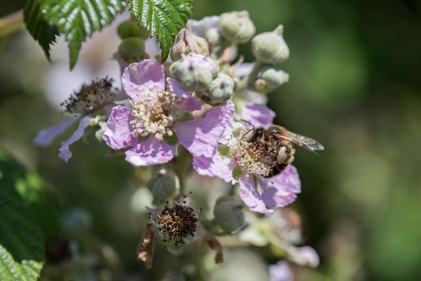
1 Landscape pressures and condition
The Cornwall AONB Section 08, South Coast Western is under pressure from many different forces for change. These forces act on the landscape and
natural capital of the AONB and impact upon the delivery of ecosystem service and Defra's six main scheme priorities. The table below summarises the
main condition factors and pressures for change which could be influenced by the new Environmental Land Management Scheme.
Environmental Land Management
Scheme Priorities
• Clean and plentiful water
• Clean air
• Protection from and mitigation
of environmental hazards
• Mitigation of and adaptation to
climate change
• Thriving plants and wildlife
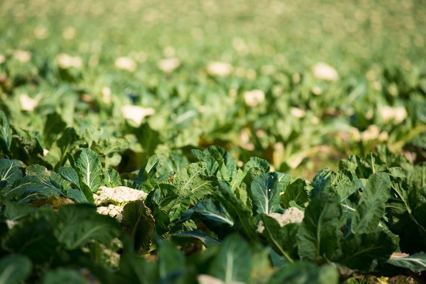
• Beauty, heritage, and Photo credit: Clare Lemon
engagement
2. Pressures, condition and management
Produced by www.gainconsulting.co.uk 2020 for the Cornwall AONB partnership 3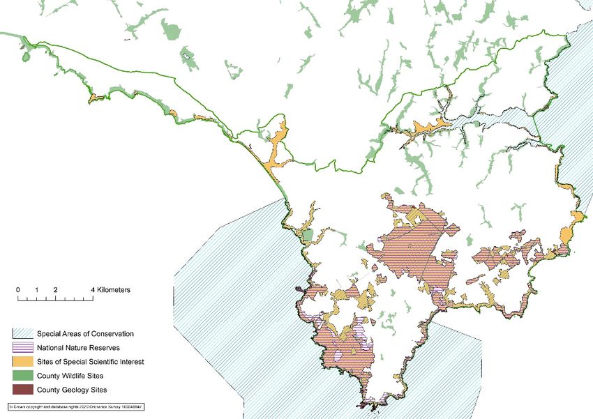
Pressures and condition

 Farmland
 Cornish hedges have been removed to create larger fields and the widening of gateways to facilitate larger farm
 machinery. This has resulted in landscape change and facilitated more intensive management. Inappropriate management
 of Cornish hedges, such as over flailing and overstocking, has resulted in structural damage to Cornish hedges in places
 and reductions in species diversity.
 Changes in agricultural practice have led to the further conversion of pasture to arable, larger-scale horticulture and novel
 crops like biofuels resulting in landscape change and pressure on soils.
 Tourism and recreation demand has resulted in the conversion of farmland to amenity land and has resulted in erosion
 and landscape impact from land cover change. Many farms have diversified to tourism accommodation.
 Increased storminess and winter rainfall have resulted in major runoff and resultant soil erosion and water quality issues,
 particularly where bare soil is exposed, for example after maize and potato cropping.

 Woodland
 Conifer plantation woodland for forestry Goonhilly Downs has impacted upon heathland condition and resulted in adverse
 landscape and visual impact.
 Ancient sessile oak woodlands around the Helford have fallen out of management resulting in less diverse structure and
 sycamore becoming more dominant.
 There has been significant loss through the disease of hedgerow elm trees impacting on habitat connectivity and
 landscape character. Similarly, ash within the landscape is now at risk from Ash Die Back. Some stream valley woodlands
 are impacted by invasive species such as Japanese Knotweeds

2. Pressures, condition and management
Produced by www.gainconsulting.co.uk 2020 for the Cornwall AONB partnership                                                      4
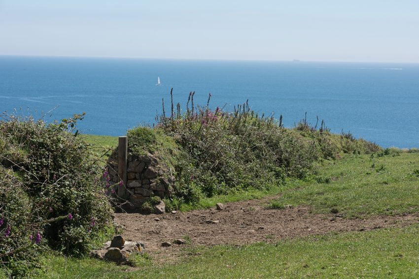
Heathland and wetland
 There has been a lack of grazing management of marginal land and neglect of important habitats such as heathland, that
 has resulted in overgrowth of scrub such as gorse and willow. There has been a lack of financial incentives to maintain
 stock on heath, resulting in under grazing.
 There has been a lack of low intensity, controlled burning of the heathland to facilitate grazing animals. Overgrown areas
 of heath with woody scrub pose a summer fire risk.
 A changing climate with increased carbon dioxide and nitrogen levels could result in changes to species composition on
 the heathland, favouring swards with are grass-dominated, over heather stands. Drier summers pose a significant risk to
 wet heath and wetland habitats on the Lizard and the continued survival of the distinctive Mediterranean temporary pools
 and associated niche species (which are also linked to the decline in historic trackways crossling the downs).
 20% of dwarf shrub heath (lowland heath) SSSIs contain units which are classified as 'unfavourable recovering' with 80%
 classed as in 'favourable' condition.

 Estuary, rivers and coast
 Access points to the Helford river have increased and become enlarged over time, and there has been over-use of the
 river for boating recreation, which has impacted on water quality and biodiversity.
 Future climate change effects such as rising sea levels and increased storminess elevate flood risk at Porthleven, Gweek,
 Cadgwith and Coverack, as demonstrated by the 2017 flash flood in Coverack which swept away the road and damaged a
 number of properties. Increased storminess also increases the risk of damage to harbours, such as at Mullion, which has
 seen numerous repairs in recent years due to storm damage.
  Loe Pool is affected by 'runoff' from surrounding farmland as well as seasonal water level changes from the Helston flood
 alleviation scheme resulting in significant eutrophication and algal blooms, impacting on water quality, biodiversity and
 amenity.
 Hottentot Fig is a significant problem at the coast, invading coastal slopes, smothering native coastal vegetation and
 changing soil composition.
 Coastal grasslands have suffered from both intensive management and extensification. Many areas have been improved
 and overgrazed in places with managed grazing extending to the cliff edge. Whilst under grazing has resulted in blackthorn
 scrub dominance. Climate change may compound this by encouraging an increase in tree and scrub growth at the coast.
 Sea level rise may impact on intertidal habitats such as the important mudflats and eelgrass beds on the Helford Estuary.
 The Helford River is designated as a shellfish waters because of the oysters that are commercially farmed there. In
 addition, Natural England has identified much of the Lizard plateau as headwater areas for priority rivers. The AONB

2. Pressures, condition and management
Produced by www.gainconsulting.co.uk 2020 for the Cornwall AONB partnership                                                   5
section contains 13 designated bathing waters, Marazion; Perranuthnoe; Praa Sands West; Praa Sands East; Porthleven
 Sands; Church Cove; Poldhu Cove; Pollurian Cove; Kennack Sands; Coverack; Porthoustock; Pothallow and Maenporth.
 Currently, all of the bathing waters are of 'excellent' quality, apart from Porthleven Sands and Maenporth, which are
 classified as 'good'.

 Historic features
 116 Scheduled Monuments are located in Section 08 of the AONB - of these, 5 (excluding two 'at risk' churches) are on
 the 2019 Heritage at Risk register. The main reason for the poor condition of scheduled monuments is an overgrowth of
 scrub.
 The distinctive historic trackways which criss-cross Goonhilly Downs, connecting ancient settlement have become
 overgrown, and some have been lost.
 Removal of Cornish hedges to facilitate modern agriculture has erased the historic medieval field pattern. Unenclosed
 rough ground is culturally important, and some of this was enclosed in the 20th century.
 Inappropriate conversion and alteration of historic buildings and the overdevelopment of historic farmsteads have
 resulted in impacts on heritage and character.
 Many non-designated heritage assets which contribute significantly to local distinctiveness such as stone stiles, Cornish
 hedges, traditional paving and fingerposts are in poor condition or have been lost.

 Access
 The South West Coast Path extends the full length of the Cornwall AONB section, crossing the Helford Estuary by ferry
 between Helford and Helford Passage. Some good circular routes extend from the coastal path. However, walking routes
 inland are more fragmented, and there is little footpath access around the upper reaches of the Helford Estuary.

2. Pressures, condition and management
Produced by www.gainconsulting.co.uk 2020 for the Cornwall AONB partnership                                                  6
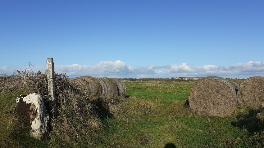
2 The state of agriculture
The other major factor affecting landscape and land cover and the condition of ecosystem services is the current state of the farming sector. The Defra
June Agricultural census can provide clues to the health and wealth of the farming sector on the Lizard, with results being available for the Lizard National
Character Area. While this is not strictly contiguous with the area covered by the Cornwall AONB Section 08, it is a reasonably accurate proxy.
The prosperity of farms and the state of natural capital and ecosystem services have not historically gone hand in hand. As farms have intensified in
response to increasing economic pressures and driven by the low price of food, there have been negative impacts on semi-natural habitats and natural
resources on farm 1. Farming overall has become a large emitter of greenhouse gasses and has lost carbon from soils. In general, small farms are seen as
good custodians of the countryside, better able to manage natural resources and not so driven by yield.
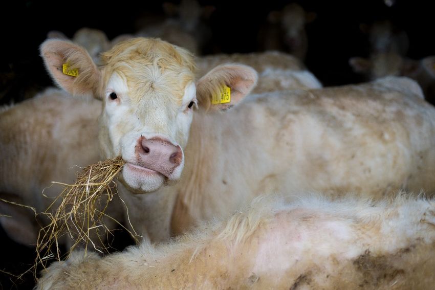
Photo credit: Lawrence Sampson, FWAGSW
1
National Ecosystesm Assessment 2011 Chapter 7, Enclosed farmland
2. Pressures, condition and management
Produced by www.gainconsulting.co.uk 2020 for the Cornwall AONB partnership 7Farm size
Farms on the Lizard are small, with only 1/5th of farms being over
Fig 1. Percent Farm Size, 2010 and 2016
100Ha and 62% of holdings being less than 50ha. This reflects the
relatively high quality of the environment in the area. However, the 35.00%
graphs show a reduction in farms of 50 to 100 ha and corresponding 30.00%
increases in farms of between 5 and 20 ha and 20 and 50 ha. The
25.00%
reason for this is not completely clear although land sales for purposes
other than farming and land rentals to large horticultural contractors 20.00%
could be factors. This potentially shows that small farms are struggling 15.00% Sum of 2010
to such an extent that they are coming out of farming or renting land
10.00% Sum of 2016
to supplement income.
5.00%
If the data does suggest that farm incomes are marginal, then it 0.00%
presents both a risk and an opportunity for natural capital and =5ha and >=20ha >=50ha >100ha
ecosystem services. If payments are at a level that is attractive, thereFarm type
It is a mixed picture for farm type on the Lizard although grazing
livestock, which would primarily be beef with some sheep is the Fig 2. Percent Farm Type 2010 and 2016
overriding farm activity. The grazing livestock LFA shows the livestock
40%
numbers grazing the less favoured area on the national nature reserve
35%
and demonstrates the relative lack of grazing animals here compared 30%
with the rest of the Lizard. General cropping such as maize and potatoes 25%
and dairy, taken together, make up more of the total farm activity than 20%
grazing livestock. However, both have reduced slightly since 2010, whilst 15%
livestock farming has somewhat increased. There has been a relatively 10% Sum of 2010
sharp increase between 2010 and 2016 in horticulture, although still 5%
Sum of 2016
relatively low level. Interestingly, cereals seem to have declined to 0%
practically zero in 2016, which could have serious implications for
farmland birds.
Photo credit: The Cornwall AONB
2. Pressures, condition and management
Produced by www.gainconsulting.co.uk 2020 for the Cornwall AONB partnership 9Tenure and labour Fig 3. Land Tenure
Nearly three-quarters of the farms on the Lizard are owned directly by 80.00%
the farmer, with just over a quarter being tenanted, perhaps reflecting 70.00%
the high number of family, multi-generational farms. This is reflected in
60.00%
the labour type, with most farms being managed by the principle farmer,
supported by casual or gang workers. The marginality of farming is starkly 50.00%
demonstrated by the fact that only 15% of farmworkers are in secure 40.00% Sum of 2010
part- or full-time employment, and only 2% employ of farms employ any 30.00% Sum of 2016
kind of salaried management. This is reflective of the seasonality of the
20.00%
work and economic uncertainty.
10.00%
0.00%
Owned Tenanted
Fig 4 Farm Labour
350
300
250
200
150 Sum of 2010
100 Sum of 2016
50
0
Casual / FT Principal PT Salaried
gang workers(l) farmers(k) workers(l) managers
workers(l)
2. Pressures, condition and management
Produced by www.gainconsulting.co.uk 2020 for the Cornwall AONB partnership 10Crops and livestock Fig 5. Livestock Numbers
80%
Pastureland forms the primary land cover on the Lizard and with a small 70%
mix of several others associated with arable, horticulture and mixed 60%
farming. Livestock numbers show the majority of this pasture is grazed by
50%
cows, with a reasonably significant number of sheep and some chickens.
40% Sum of 2010
The number of cattle and pigs fell slightly between 2010 and 2016, whilst 30% Sum of 2016
sheep and poultry numbers rose, potentially reflecting the trend towards 20%
smaller, mixed farms, potentially directed at local markets. 10%
0%
Total cattle Total pigs Total poultry Total sheep
Fig 6. Crop type
90.00%
80.00%
70.00%
60.00%
50.00%
40.00%
30.00%
20.00% Sum of 2010
10.00%
0.00% Sum of 2016
Photo credit: The Cornwall AONB
2. Pressures, condition and management
Produced by www.gainconsulting.co.uk 2020 for the Cornwall AONB partnership 113 The state of nature
The Cornwall and Isles of Scilly Environmental Records Centre (ERCCIS) have provided the Cornwall AONB trial with species density mapping for a range
of species assemblages based on the number of records for each 1km square. The different species sets will indicate quality and extent for different
habitats on the Lizard which support different species. The location of different species records will show where habitats are currently performing well. In
addition, separate species density maps showing the JNCC species of conservation concern (SOCC) (see Appendix 1) will give us more of an indication
about the state of rare and threatened species on the Lizard.
Species density mapping
Birds
The species density mapping for all birds shows a weak correlation between coastal and heathland habitats; however, this is more strongly correlated
within the farmland birds 2 subset. The land around Lizard Point seems particularly crucial for Species of Conservation Concern although this is likely to be
reasonably skewed by recorder effort to spot the Chough.
Amphibians and Reptiles
The amphibian (SOCC) density maps show a correlation between the wet heath habitats in Character Area 07 and a slightly weaker correlation with the
tributary valleys of CA09 Helford Ria. The reptile mapping shows a robust correlation with warm, open grassland and heathland habitats around the
coastal strip, particularly to the east of Lizard Point and to a slightly lesser extent with the open heathland habitats of CA07.
Insects
There is a notable absence of insects on agricultural land to the north of Goonhilly Downs, centrally in Character Area 08 and in agrarian habitats around
the Helford. Whilst this could be slightly skewed due to recorder effort, it is considered that these areas are likely to be in poor condition for biodiversity,
particularly pollinators.
2
https://www.rspb.org.uk/our-work/conservation/conservation-and-sustainability/farming/near-you/farmland-bird-indicator/
2. Pressures, condition and management
Produced by www.gainconsulting.co.uk 2020 for the Cornwall AONB partnership 12Mammals There is a much stronger relationship with areas of stream valley woodland in Character Areas 09 and 06 and the Helford Estuary woodlands particularly for mammals of conservation concern associated with woodland or woodland edges, such as deer, all species of bat, and hedgehog. Vascular Plants The coastal hinterland is particularly important for vascular plants. The SOCC map for vascular plants shows a reduction in vascular plant density in the agricultural areas to the North of Goonhilly Downs and agricultural land in CA08 and CA09. Photo credit: Clare Lemon 2. Pressures, condition and management Produced by www.gainconsulting.co.uk 2020 for the Cornwall AONB partnership 13
4 Landscape management
 Current management

 Farmland
 Farmland is influenced by the current Countryside Stewardship Scheme for which Natural England has produced a Lizard Targeting
 Statement for the National Character Area.

 Heathland and wetland
 Natural England manages the Lizard National Nature Reserve which includes much of Goonhilly Downs, and they work with a
 number of different graziers on the NNR.
 The National Trust have a pony grazing scheme to tackle scrub encroachment on coastal heathland.

 Estuary, rivers, coast and sea
 The Loe Pool Forum (LPF) is an environmental partnership working to improve water quality and reduce flood risk in the River
 Cober catchment. Recent work with South West Water on upstream thinking within the Cober catchment have had a good
 influence and are improving water quality at Loe Pool.
 The Helford and Fal Estuaries are a recently designated Special Area of Conservation for their shallow inlets and bays; the
 designation also covers salt marshes, intertidal mudflats and subtidal sandbanks.
 The Manacles Marine Conservation Zone was designated in 2013 with two new MCZ's, The Western Channel, a large offshore area
 south-east of the Lizard Peninsula and Mounts Bay both designated in 2016. The Helford Estuary is the most recent area to be
 designated an MCZ.
 The Helford Voluntary Marine Conservation Area was designated in 1987. The Helford Marine Conservation Group is a voluntary
 organisation working to safeguard the marine life of the beautiful Helford River, to increase its biological diversity and raise
 awareness of its marine interest and importance.

2. Pressures, condition and management
Produced by www.gainconsulting.co.uk 2020 for the Cornwall AONB partnership                                                         14
The Lizard coast from Gunwalloe Fishing Cove around Lizard Point to Carrick Luz near Kennack Cove is a proposed candidate for
 Special Area of Conservation status in respect of the submerged reefs.

 Historic features
 The Lizard Peninsula Heritage Trust has surveyed roadside heritage assets (milestones, fingerposts etc).
 The Cornwall AONB Monumental Improvements Project is seeking to work with landowners to restore the condition of Scheduled
 Monuments.

 Access
 The South West Coast Path team, funded by Natural England manage the national trail. The South West Coast path Association
 exists to represent users.

 Biodiversity
 The Linking the Lizard partnership seeks to establish a landscape scale and co-ordinated approach to landscape and habitat
 management between the relevant partnership agencies. The Partnership has worked successfully to extend the National Nature
 Reserve to include Cornwall Wildlife Trust and National Trust land, making it one of the largest nature reserves in the South West.
 Linking the Lizard supports the website the-lizard.org which is a comprehensive information website for the area's biodiversity.
 The RSPB works with the National Trust and Natural England to promote the conservation of habitats that support Cornwall's
 choughs and to monitor the growing population and protect their nests.
 The National Trust runs a wildlife watchpoint at Lizard Point and data feeds into the local records centre and the British Trust for
 Ornithology.
 The Welcome to 'Wild Lizard' tourism group champions sustainable tourism that promotes nature as a key USP for the Lizard.
 The National Trust are one of the largest landowners in the area and manage a range of different sites such as Lizard Point, Mullion
 Harbour and Pottesco as well as a large area of land, some of which is managed in-house whilst some farms are tenanted. The
 'Land, Outdoors and Nature Strategy' of the NationalTrust is a current driving force behind management.
 Cornwall Wildlife Trust owns and manages Windmill Farm Local Nature Reserve and has recently restored the historic stone
 windmill structure to include a small interpretation centre and viewing platform. The Trust also manages North Preddannack
 Downs, alongside some parts of Preddannack Airfield.
 The Cornwall Biodiversity Initiative aims to include support for the Linking the Lizard Partnership and 'All of the Coast' habitat
 enhancements for birds.

2. Pressures, condition and management
Produced by www.gainconsulting.co.uk 2020 for the Cornwall AONB partnership                                                             15
Nature designations
The Lizard peninsula is one of the best locations in the
country for wildlife, with a wealth of rare plants,
invertebrates and habitats that make visiting the area a
must for nature lovers and this is reflected in the
considerable extent of nature-based designations.
The Cornwall AONB Section 08 contains 20 Site of Special
Scientific Interest covering 3294 ha of land, and this is
augmented by a locally designated County Wildlife Sites
and County Geology Sites. Cornwall AONB Section 08 also
contains the contains three Special Areas of
Conservation, Lizard Point, The Lizard and The Fal and
Helford.
The Lizard National Nature Reserve was extended in 2016
from 1960 to 2426 ha to include land under the
stewardship of the National Trust and Cornwall Wildlife
Trust, making it one of the largest nature reserves in the
South West. The enlarged reserve now stretches from
Mullion Cove in the west, across Goonhilly Downs in the
centre of the peninsula, to Lowland Point, near Coverack
in the east.
                                                             Map 1 Nature designations in Cornwall AONB Section 08, South Coast Western
                                                             © Crown copyright and database rights 2020 Ordnance Survey 100049047

2. Pressures, condition and management
Produced by www.gainconsulting.co.uk 2020 for the Cornwall AONB partnership                                                               16
5 Cornwall AONB Policy
Relevant policies from CAONB Management Plan 2016-2021
The strategic policies within the Cornwall AONB Management are all applicable to the trial area and can be accessed by clicking the link below. The
Cornwall AONB Management Plan 2016-2021: Policy
The following policies in the current Cornwall AONB Management Plan are taken from the set of local policies and are directly relevant in terms of guiding
land management in the trial area.
• Support appropriate improvements to footpath access around the Helford River and its creeks with respect to the Marine and Coastal Access Act
2009, provided that this does not encourage an increase in traffic levels or the provision of further car parks and that this conserves and enhances
natural beauty.
• Support appropriate improvements to coastal footpath access between Godrevy Cove and Porthallow provided that this respects local landscape
character and conserves and enhances natural beauty.
• Support the Linking the Lizard Partnership in its initiatives to integrate land management, farming and the conservation of biodiversity and historic
environment together with the promotion of a vibrant local rural economy and community and support the complementary work of the 'Welcome to
Wild Lizard' group who promote sustainable nature-based tourism on the Lizard.
• Help to support coastal management which promotes natural processes wherever possible and support initiatives with communities which consider
the long term future and value of coastal areas, e.g. Marazion, Mounts Bay, Porthleven, Loe Bar, Praa Sands, Gweek, Cadgwith, Coverack, and
Maenporth in respect to predicted effects of sea-level rise and increased storminess. Manage realignment as identified in the Shoreline Management
Plan, where they conserve or enhance the landscape character and natural beauty of the AONB. Conserve the undeveloped nature of the coast in this
section.
• Encourage the conservation and positive management of mining features that are outside of the World Heritage Site, south of the A394 around
Perranuthnoe, Rosudgeon, Kenneggy, Praa Sands and Porthleven.
2. Pressures, condition and management
Produced by www.gainconsulting.co.uk 2020 for the Cornwall AONB partnership 17• Support the work of the Loe Pool Forum and encourage measures to improve water and habitat quality at Loe Pool by improved management of
nutrients from diffuse pollution sources in the Cober catchment and the improved management of effluent from Helston and RNAS Culdrose sewage
treatment works.
• Support measures to improve water and habitat quality in the Helford by encouraging measures to reduce runoff and nitrate input and improve the
management of sewage.
• Support conservation and enhancement of the character of the open heathland plateau. Where possible, this should be achieved by felling with
restoration to open habitats balanced with equal or greater productive woodland creation using appropriate sites and species selected with regard to
landscape character.
• Support measures to extend the Lizard National Nature Reserve to incorporate County Wildlife Sites and National Trust and Cornwall Wildlife Trust
holdings to increase the protection of the important habitats, species and geology across the Lizard.
• Support the Helford Marine Conservation Group and the continuation of the Helford Voluntary Marine Conservation Area to encourage engagement
and involvement in enjoyment and sensitive use of the Helford Estuary Special Area of Conservation.
2. Pressures, condition and management
Produced by www.gainconsulting.co.uk 2020 for the Cornwall AONB partnership 18You can also read