Liskeard 2030 Liskeard Town Council A Place to Relax and Enjoy - Open Space and Leisure - Liskeard Neighbourhood Plan
←
→
Page content transcription
If your browser does not render page correctly, please read the page content below
Liskeard Open Space and Leisure strategy, 2016

         Liskeard 2030
               Liskeard Town Council
A Place to Relax and Enjoy - Open Space and Leisure
                   October 2016

                         1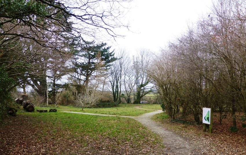
Liskeard Open Space and Leisure strategy, 2016

Contents
1.      Introduction                        4
2.      Summary of evidence                                  7
3.      Conclusions from the evidence 22
4.      Strategic Overview – Vision/Aims & Objectives                                                             38
5.      Policy and Projects 41
        Appendices                          56

Liskeard Town Council
3-5 West Street
Liskeard
Cornwall
PL14 6BW
Tel: 01579 345407
Fax: 01579 324429
October r 2016

All mapping based upon Ordnance Survey mapping with the permission of the Controller of Her Majesty’s Stationery Office
©Crown Copyright 2015. Unauthorised reproduction infringes Crown Copyright and may lead to prosecution or Civil Proceed-
ings. OS License No. 100049047.
                                                            2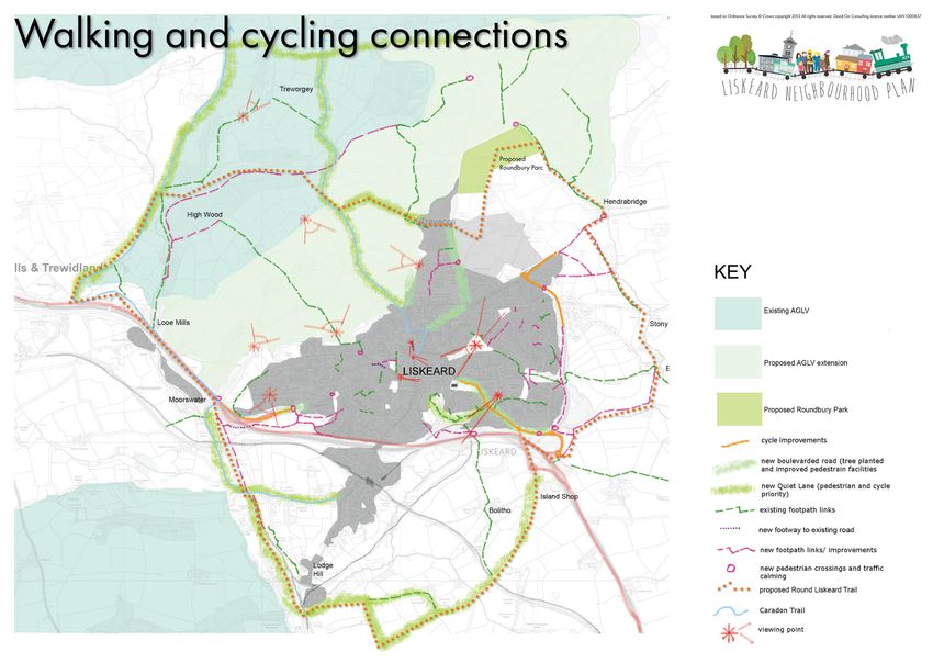
Liskeard Open Space and Leisure strategy, 2016

REVISION

             version   Author                 Chkd by                   Approved
03/11/2015             Working Group
31/07/2016             S Besford-Foster
03/08/2016   D1        D Orr
04/09/2016   D2        D Orr
09/09/2016   3         D Orr                  L Shrubsole
12/09/2016   4         D Orr                  All other Working Group
                                              members
03/10/2016   5         D Orr                  All other Working Group
                                              members

                                          3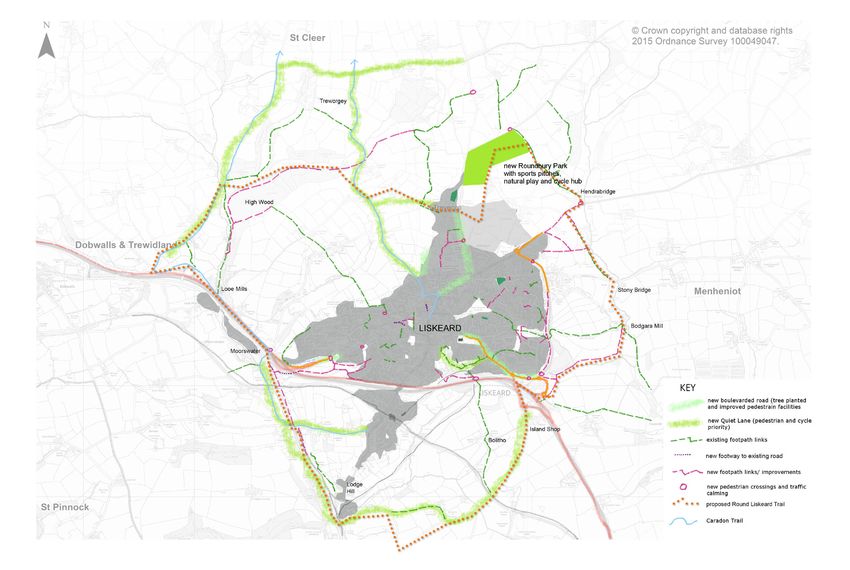
Liskeard Open Space and Leisure strategy, 2016

1.       Introduction
This report incorporates the findings of the Liskeard Neighbourhood Plan ‘A Place to
Relax and Enjoy’ (Open Space And Leisure) Working Group, along with material from the
evidence base and the most recent (April 2016) versions of the Cornwall Local Plan and
other documents, along with recommendations to the NP Steering Group as to appropriate
objectives and outline polices that would make up a deliverable and well supported
sustainable development strategy for the protection and enhancement of open spaces and
community facilities in Liskeard to 2030.

Task
Each Working Group was given a brief by the Steering Group. The Brief for the ‘A Place to
Relax and Enjoy’ (Open Space And Leisure) Working Group was to: Develop options to
support a sustainable development strategy for the protection and enhancement of open
spaces and community facilities. The full brief for the work is given as Appendix ‘A’. The group
was asked to look at two distinct parts to this theme for consideration:

Green Spaces
     •   Formal – Parks, gardens and places to meet and relax, as well as play areas,
         particularly for very young children
     •   Informal – protection and enhancement of immediate countryside and access to
         it including the towns link with the World Heritage Mining Site (Cornwall Local Plan
         objective) making use of quiet lanes, cycle routes and footpaths.

Leisure facilities
     •   Cinema, bowling, restaurant, museum, library, clubs, indoor soft-play for children
     •   Sport – leisure centre, sports pitches
In summary the areas for research were identified as being:
     •   What do we know?
     •   What role can neighbourhood planning have?
     •   What do we have to find out? – what do we already have in place? (Liskeard TC
         policy and audit/Local Plan)
     •   How do NPPF and Local Plan affect the process?
     •   How can green spaces and relevant infrastructure be protected, enhanced or
         created?
     •   How is it financed? What sources of grants exist?
     •   Who owns/manages/maintains formal green spaces within the town?
     •   What design standards should be applied to facilities and infrastructure?
     •   How can the Neighbourhood Plan influence the provision of property-based/
         commercial leisure facilities such as leisure centres/sports pitches/cinema/bowling/
         children’s soft-play/cultural centres?
     •   What opportunities will arise from potential devolution of Cornwall Council site/
         services?

                                                  4
Liskeard Open Space and Leisure strategy, 2016
Sustainable Development
Our over-riding purpose is to deliver sustainable development. Sustainable
development means making sure we grow and develop in a way that’s safe and fair for
future generations. To get the best long-term outcome our housing strategy must follow the
guiding principles of sustainable development, which are:
• Living within the planet’s environmental limits – protect and enhance our natural and
man-made environment, and respond to climate change.
• Ensuring a strong, healthy and just society – meet present and future needs for the
housing, work and services that support the wellbeing of all our community.
• Achieving a sustainable economy – support actions that build prosperity for all and use
resources wisely.
• Promoting good governance – make sure that all are involved in creating the
Neighbourhood Plan
The National Planning Policy Framework says that at its heart ‘is a presumption in favour of
sustainable development, which should be seen as a golden thread running through both
plan-making and decision-taking’.
The NPPF explains that when making plans, local planning authorities must seek opportunities
to meet ‘objectively assessed’ local development needs, with sufficient flexibility to adapt to
rapid change, unless any adverse impacts of doing so would significantly and demonstrably
outweigh the benefits, when assessed against the policies in the NPPF, or be against specific
policies in this NPPF which indicate development should be restricted.
For decision-taking the ‘presumption in favour of sustainable development’ means
approving development proposals that accord with the development plan without
delay; and where the development plan is absent, silent or relevant policies are out-of-
date, granting permission unless any adverse impacts of doing so would significantly and
demonstrably outweigh the benefits, when assessed against the policies in the NPPF, or
be against specific policies in this NPPF which indicate development should be restricted.
(NPPF14) The Cornwall Local Plan and The Liskeard Neighbourhood Plan will provide the
context to make such decisions in future.
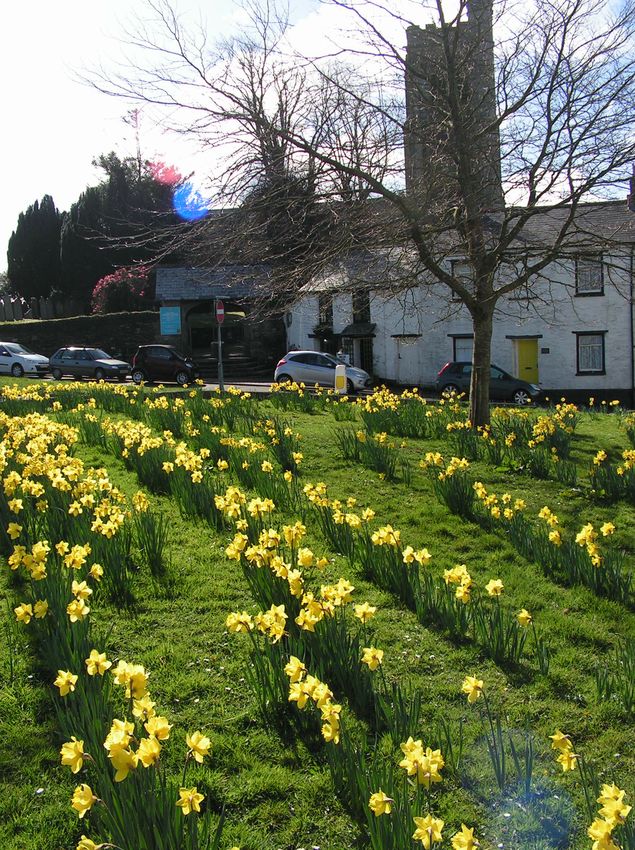
Figure 1 Westbourne Gardens Figure 2 Trevillis Park open space
5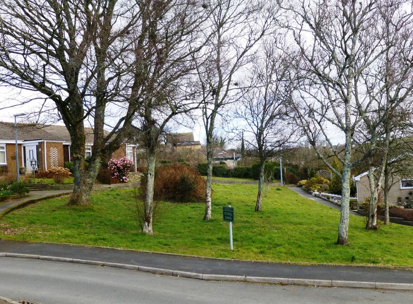
Liskeard Open Space and Leisure strategy, 2016

Process
Creation of this report involved reviewing the findings of the community engagement of
Summer 2015, summarized in the report by Prof Lynne Butel at Plymouth University, followed
by a period of evidence gathering and researching a range of issues that might influence the
open space and leisure strategy of the NP. These included a leisure facilities audit, a walking
and cycling audit, and an open space audit. Following that a series of meetings were held
to process the evidence and define the outline of a strategy, using various basic strategy
building techniques. A stakeholder session with local walkers and cyclists was also held,
aimed at discovering the views of experienced users of such facilities.

Definitions
This strategy uses the definitions of Open Space as set out in ‘Open Space Strategy for Larger
Towns in Cornwall, Cornwall Council, 2014’ that Open Space is ‘land that is in some form of
public ownership and is regularly available for recreational or sporting use by the community.
This includes beaches, woodland & wetlands, school playing fields, private sports clubs,
allotments and graveyards, as well as parks and gardens and amenity land.’ Leisure is taken
to mean indoor and outdoor activities for recreation, cultural, and artistic pleasure.

                     Figure 3 The local nature reserve at Old Road provides a publicly
                     accessible natural open space, albeit in a small area.

Figure 4   Carnclaze Close play area                     Figure 5   Pengover allotments

                                                     6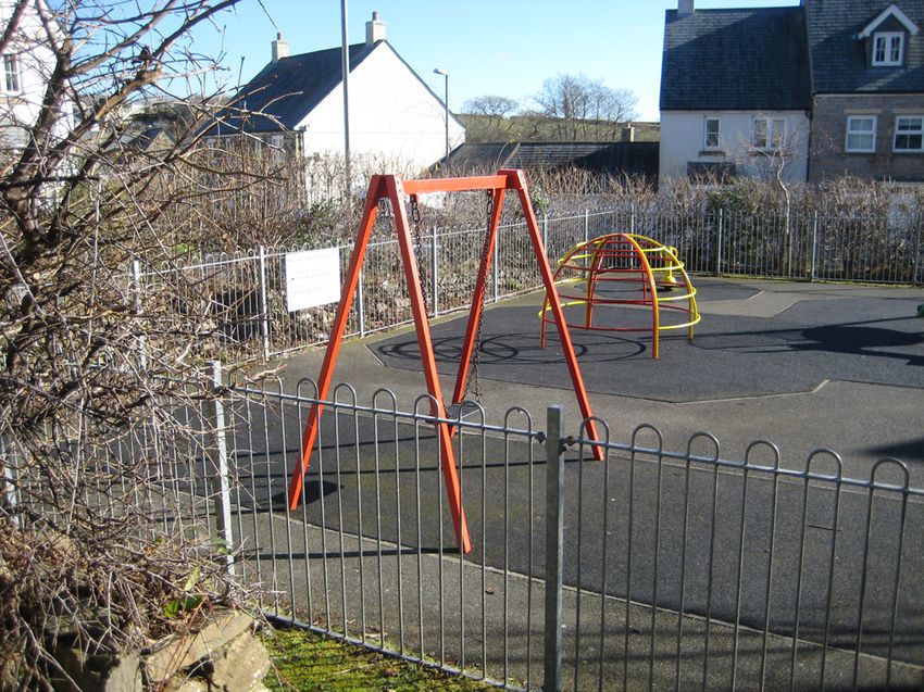
Liskeard Open Space and Leisure strategy, 2016

2.      Summary of evidence
Key evidence is set out in policy documentation at national, county and local level. The
Neighbourhood Plan must accord with national policy and local plan polices. Other policy
documents cited add weight and evidence to these strategic requirements.

National policy
Key Evidence - National Planning Policy Framework 2012
The National Planning Policy Framework, section 11 – ‘Conserving and enhancing the natural
environment’ - looks at protecting valued landscapes, areas of tranquility, and impact of light
pollution: section 8 Promoting healthy communities considers the importance of access to
high quality open spaces and the protection of existing open space, sports and recreational
buildings and land).
With regard to Local green space NPPF Para 76 says that Local communities through local
and neighbourhood plans should be able to identify for special protection green areas of
particular importance to them. By designating land as Local Green Space local communities
will be able to rule out new development other than in very special circumstances.

Local policies
Key Evidence - Caradon Local Plan, 2007
Caradon Local Plan First alteration – August 2007 (First alteration 2013) Until a Local Plan
for Cornwall is prepared the statutory development plan for the Caradon District at 31st
March 2009 remains the Caradon Local Plan First Alteration (adopted in August 2007) . This
contains a combination of policies that were adopted in August 2007 including a housing
chapter, employment land allocations and retail policies; and “saved” policies from the local
plan that were adopted in December 1999. Due to the weight of saved policies, material
considerations (particularly national and regional planning guidance that has emerged
since December 1999) are likely to have significant weight in decisions where saved policies
are used. The weight will vary with the degree to which the Policy is still relevant in terms of
evidence and National Policy.
Saved policies - EV6: Open Areas of Local Significance in Towns & Villages CL 9 protection of
AGLV to North & LISK 5 Bay Tree Hill improvements)
ALT 15 Open Recreation – St Cleer Road. This saved policy states “Approximately 8.8 hectares
of land adjacent to St Cleer Road and identified on the Proposals Map is allocated for open
recreational use. Land use will comprise playing fields, play areas, public open space, and
ancillary buildings such as changing rooms.”
The following policies are retained as part of the new Local Plan (below):
•    CL8 – Landscape of County Importance – which identifies the boundary of the Area of
     Great Landscape Value
•    CL9 – Areas of Great Landscape Value – which sets the policy for development within the
     AGLV
•    LISK5 – Bay Tree Hill Improvements – which provides for improvements to Bay Tree Hill
•    LISK7 – Educational Reserve – which reserves land off Callington Road for educational

                                                7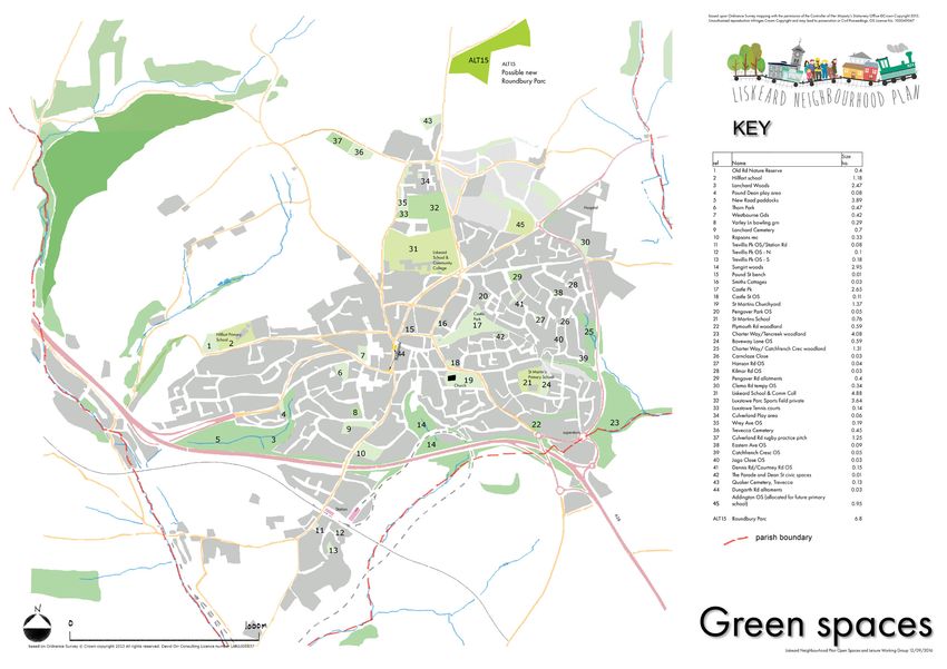
Liskeard Open Space and Leisure strategy, 2016
    purposes.

Key Evidence - Draft Cornwall Local Plan 2010 -2030 [Proposed submission (March 2014)
Schedule of Focused Changes (September 2014) and Schedule of Further Significant
Changes (January 2016) Combined document, January 2016]
Key relevant policies include:
•   PP15 – 1(d): ‘retention and enhancement of heritage assets with physical linkages
    between Liskeard and the Cornwall and Devon Mining Landscape World Heritage Site’ ;
•   Objective 5 – improve and maintain lei-sure facilities;
•   Policy 17 - Health and wellbeing;
•   Policy 22 – landscape value;
•   Policy 23 – Natural environment – respecting landscape character, dark skies & tranquility
    and ref to AGLV’s;
•   Policy 24 – looks at conserving and enhancing heritage assets and their settings, including
    historic landscapes & World Heritage Sites;
•   Policy 25 – green infrastructure;
•   Policy 27 – Transport and accessibility – includes info on sustainable & safe cycle and
    pedestrian routes as well as public transport)

Key Evidence - Green Infrastructure Strategy for Cornwall, Cornwall Council 2012
This document sets out a strategic framework and plan to guide the future planning and
delivery of green infrastructure (GI) in Cornwall. It provides a strategy to focus on tow main
areas:
•   Where new housing and employment growth is likely to be delivered through allocation
    of housing growth and distribution options, as set out in the Core Strategy (now the Local
    Plan)
•   On a catchment level to increase the ability of natural systems to function more
    effectively
The strategy requires policies to see how GI can address health and well-being; economy,
education; climate change and environmental quality. The strategy will map GI and show
where new requirements lie. In addition a focus will be directed towards improving the quality
or accessibility of existing green infrastructure assets.

Key Evidence - Open Space strategy for larger towns in Cornwall, Cornwall Council July 2014
This study shows the open space definitions used in planing in Cornwall plus an assessment
of open space provision and proposed requirements. We found particular weakness in
Cornwall Council’s Open Space strategy for larger towns in Cornwall July 2014 as it had
wrongly identified some open space as public space. In addition, it identified a very small
Local Area for Play (with a single toddler slide) as the play provision for the whole western
neighbourhood in the town.

Key Evidence – Cornwall and West Devon Mining Landscape World Heritage Site
Management Plan 2013 and SPD (Draft 2016), Cornwall Council
The UNESCO recognised World Heritage Site has a Management Plan 2005-10 that sets out

                                                8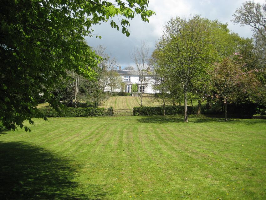
Liskeard Open Space and Leisure strategy, 2016
the approach to planning the conservation of the universal value of the WHS1. Alongside
the Management Plan is the Cornwall and West Devon Mining Landscape World Heritage
Site, Supplementary Planning Document, Consultation Draft, February 2016 which Cornwall
Council has published to assist in making planning decisions related to conserving the WHS, its
setting and context.

Key Evidence – Liskeard Conservation Area Character Appraisal and Management Plan
Consultation Draft, Cornwall Council, 2012
The Liskeard Conservation Area Character Appraisal & Management Plan (consultation draft)
2012 acknowledges the towns unique topography, historic buildings and attractive setting in
its surrounding landscape. It recommends tree-planting to further enhance the centre, and
improvement to the Bay Tree Hill area.

Key Evidence – Connecting Cornwall 2030, Implementation Plan, Cornwall Council, 2014
Connecting Cornwall 2030 is the third Local Transport Plan for Cornwall and sets out a 20 year
transport vision aimed at supporting economic prosperity and more sustainable travel with
less reliance on the private car. The outcome is intended to be a vibrant, accessible and safe
town environment with strong links to other communities in Cornwall and beyond.
The lead agency is CC. The strategy identifies £1.5million for implementing town-wide walking
and cycling networks, to encourage modal shift & healthy active lifestyles, and £0.661million
for a junction improvement at Island Shop to prevent queuing back on the A38, in it’s
Implementation Plan 2015 to 2019.

Key Evidence – Cycling and Walking Investment Strategy, Cornwall Council (Draft 2016)
The Infrastructure Act 2015 requires the Secretary of State to create a Cycling and Walking
Strategy. The draft Strategy for 2016 sets a 2040 ambition to:
•   Double cycling, where cycling activity is measured as the estimated total number of
    bicycle stages made each year, from 0.8 billion stages in 2013 to 1.6 billion stages in 2025;
•   Reverse the decline in walking activity, measured as the total number of walking stages
    per person per year;
•   Reduce the rate of cyclists killed or seriously injured on England’s roads, measured as the
    number of fatalities and serious injuries per billion miles cycled, each year;
•   Increase the percentage of children aged 5 to 10 that usually walk to school
The Strategy says that local bodies are best placed to determine local solutions to local
transport issues. Therefore, it says that the government will issue guidelines on the preparation
of Local Cycling and Walking Infrastructure Plans (LCWIPs) and support the production of
LCWIPs in areas with significant potential for high levels of cycling and walking. Cornwall
Council, in responding positively to the draft Strategy, has supported the concept of LCWIPs.

Key Evidence – Bodmin Moor Dark Sky Park Initiative
Cornwall Council has been working in collaboration with the Caradon Observatory and
wants to make a bid to the International Dark Sky Association to have Bodmin Moor
recognised as an International Dark Sky Park.
A consultation was held between 4 April and 2 May 2016 on whether or not the proposal
should proceed. Cornwall Council is currently considering the feedback received.

1      http://www.cornish-mining.org.uk/pdf/downloads.htm

                                                            9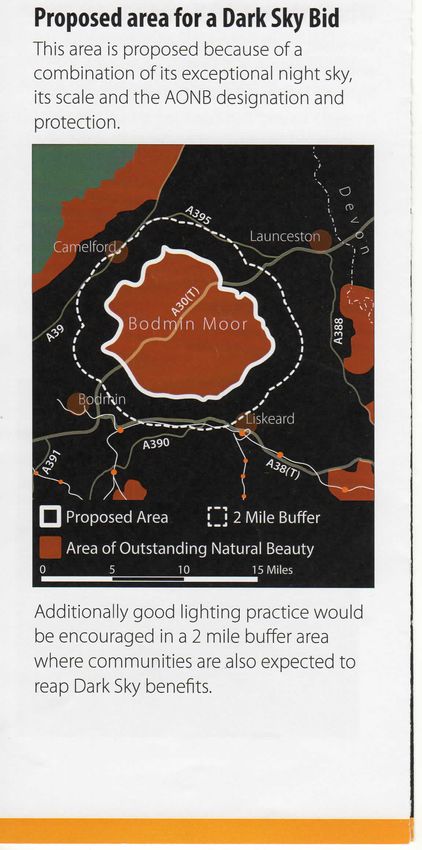
Liskeard Open Space and Leisure strategy, 2016
A Dark Sky Park is an area of land that is recognised as having an exceptional or distinguished
quality of starry nights and a nocturnal environment that is protected for its scientific, natural,
educational, cultural heritage, and/or public enjoyment.
Within and on the boundaries of such Parks, steps to reduce light pollution, such as Installing
lights that point down not up, turning lights off when not needed, using automatic timers and
only lighting where necessary, are encouraged.
As well as helping to protect the night sky from light pollution, Dark Sky designation provides
a focus for awareness and learning about the stars and solar systems, bring health and bio-
diversity benefits, and provide an opportunity for local tourism.
Recent light readings show the quality of the night sky over Bodmin Moor is amongst the best
in the world.
The current proposal is for the core area to follow the designated Bodmin Moor Area of
Outstanding Natural Beauty (AONB) boundary, with a 2 mile buffer area around this in
which good lighting practice would be encouraged and where communities would also be
expected to reap some of the benefits. That 2 mile buffer includes the northern part of the
Liskeard Neighbourhood Plan area.

                     Figure 6   Cornwall dark skies, Natural England

Key Evidence – Liskeard Transport Strategy, Cornwall Council, 2012
Cornwall Council has developed a Liskeard Transport Strategy traffic model to identify
transport issues arising from the housing and employment growth proposed in Cornwall Local
Plan, and the transport measures that will be required to mitigate the impacts. [Planning
Future Cornwall, Infrastructure Planning: Town Framework Evidence Base Paper, 20122]
The CC Strategy says that ‘Liskeard’s highway network does not suffer from significant levels of
congestion’, has a highway infrastructure ‘sufficient to accommodate the predicted growth’
and a ‘good interurban bus and main line rail links which will see further improvements to
2030’, so other than the A38 junction improvement mentioned above, focuses mainly on
increasing the level of trips made by sustainable modes. With 25% of households with no
car, opportunities for improved cycle and pedestrian links and crossing points have been
identified which will help connect new housing developments to the town.

Key Evidence - Liskeard Town Council Open Space Audit & Policy, 2014
This document recognises the towns attractive and popular green hinterland &
supports recreation that can be accessed by all members of the community, whilst also
acknowledging Liskeard’s close link & proximity to the WHS at Caradon and is keen to protect

2      https://www.cornwall.gov.uk/media/3641202/Infrastructure-Planning-Town-Overview-v5-Dec-2011.pdf

                                                         10
Liskeard Open Space and Leisure strategy, 2016
and enhance the physical link between the two. Following on from the Open Space audit,
on 21st January 2014 the Town Council adopted the policy: “to protect and enhance the
character and accessibility of the natural green spaces around the boundary of the town,
accessed via green corridors and quiet lanes, which would also fulfil the objective of the
Cornwall Local Plan to maintain the physical link between Liskeard and the world mining
heritage site at Minions”.
Key Evidence - Liskeard Town Framework, Cornwall Council (Draft) 2011/12
One of the primary aims in this document is to ‘improve local walking and cycling links
at Morrisons roundabout and throughout the town’. In addition, the Green Infrastructure
Strategy advises protection and enhancement of green corridors such as Lake Lane and
disused Caradon Hill railway line.
Key Evidence - Planning Future Cornwall – Growth Factors: Liskeard & Looe Community
Network Area, Version 2, 2013
This examination of the Community Network Area says that ‘studies are required on the
Liskeard & Looe town streetscape, links to World Heritage site, conservation areas, historic
landscape character re- views, highway heritage assets and Cornish character’.
Key Evidence - Liskeard & Looe Historic Environment Data Sheets, Cornwall Council 2011
This include comments on Liskeard’s setting ‘on its hilltop overlooking wide tranches of
landscape as an important characteristic’ and mentions missing evidence, threats and
proposed projects e.g. ‘threats to landscape setting and development on skyline around
the outer limits’. It points out that the underlying structure of the area remains medieval or
earlier. This paper emphasised that the area beyond the urban areas and Bodmin Moor are
understudied and that an historic landscape characterisation study is required (which has not
been carried out to date) which would provide a detailed assessment of the heritage assets
and setting of the rural hinterland to the town.
Key Evidence - Liskeard Community Strategic Plan, Liskeard Town Council, 2008
This locally created strategy highlighted issues around safe cycling and walking, protection
and enhancement of green spaces, a desire to connect the town to World Heritage sites and
promote this as part of Liskeard’s identity to enhance economic prosperity. Also, similarly to
our recent NP consultation the community had a strong wish for better family entertainment
and leisure activities.
Key Evidence - Cornwall & Scilly Urban Survey Project, Liskeard, 20053
This project by the Cornwall & Scilly Urban Survey (2002-2005), a partnership project, provides
a comprehensive set of data, reports and mapping intended to describe the distinctive
quality and character of Liskeard’s historic environment so that it can be used to achieve
successful and sustainable regeneration.
It identifies key ‘character-based principles for regeneration’ in Liskeard:
• Respect for the fundamental importance of Liskeard’s natural setting and topography.
• Recognition of the quality and particular distinctiveness of Liskeard’s historic
environment.
• Commitment to achieving comparable quality and character in new buildings and
evolving townscapes.
• Promoting a continuing diversity of functions and activities in the town.
3 http://www.historic-cornwall.org.uk/csus/towns/liskeard/liskeard.htm
11Liskeard Open Space and Leisure strategy, 2016
• Respect for the different Character Areas within the town and a commitment to
acknowledging and reinforcing the urban hierarchy and diversity they represent.
It also provides prescriptions for each of the character areas within the town, which can be
used as a starting point for developing proposals to support and manage regeneration in
Liskeard.
Key Evidence - Liskeard Action Plan 2002, WS Atkins
Identified Liskeard’s potential as a cycle network hub and highlights the town’s connection
with the old Liskeard and Caradon railway, with St Cleer and the wider Caradon Mining World
Heritage Site.
Key Evidence - Other Guidance
• CPRE’s Guide to Quiet Lanes, 2003
• Open space strategies: best practice guidance, CABE 2009
• Sports facility need assessment, Sport England, 2014
• Sport, Recreation & Open Space Issues Paper, Cornwall Council, January 2012
Key Evidence – Liskeard Open Space Audit 2015
The Neighbourhood Plan Open Spaces and Leisure Working Group audited (through site
visits) 44 open spaces within Liskeard town area (i.e. within the limits of the built up area, there
being no public accessible spaces except public rights of way, outside the town limits). We
used the Green Flag Award4 quality system as a basis for our appraisal.
We have around 37 ha. total open space (excluding civic spaces i.e. hard paved squares).
Cornwall Council’s Open Space Strategy for Larger Towns, July 2014 suggests we should have
40 sq m/ person so in 2010. This total includes space not accessible to the public. Tables
below shows Open Space Audit results and requirements with planned growth.
Table 1 Open space audit results
pitches and
sports clubs
Cemeteries
Allotments
Children’s
park and
provision
amenity
total 1-6
outdoor
Natural
School
space
Public
sports
Youth
type
total
Play
ha 5.6 15.69 0.14 0.17 0.2 0.84 2.65 12 36.89* 21.8
* see Table 3
4 http://www.greenflagaward.org.uk/
12Liskeard Open Space and Leisure strategy, 2016
Table 2 Open space existing, planned and required 2010-2030
Year Persons Dwellings Persons total total OS OS OS total OS required
per OS m2/ new standard ha. to meet
dwelling m2/ dwelling ha. standard
person
2010 Existing 9,415 4220 2.2 40 ~ 37.66 37.84 0.18
2010- Additional 3,220 1400 2.3 44 ~ 14.17 52.01 13.50
2030 (min.)
2010- committed 16.14
2016 development
OS*
2030 Future 3220 1400 2.3 44 51.83 53.98 rolling
additions programme
as required
to make up
difference
*Existing population based on 2011 baseline census5.
**OS already committed in new development, 2016 (ALT 15 Roundbury Park; Addington, Tencreek) 16.14ha
There is around 16 ha of open space (sport and natural space) that has limited access to the
public or can only be used through private hire leaving only 22 ha of publicly accessible open
space. This public accessible amount of open space is 3 ha below the level recommended
by the Cornwall Council Open Space strategy which requires 42 sq m/person. i.e. 39 ha total.
We have high amounts of natural green space though this largely has poor access. We have
a low provision of allotments (some are in private ownership) and no community orchards.
The main shortfall in current provision is in just over 1 ha of park and amenity space and in
public use outdoor sport (around 1 ha). In addition, current open space land at Addington
allocated LISK7 as a new primary school site at Martins Park will reduce public accessible
open space by 0.95ha when it becomes operational and will require compensatory
accessible open space provision elsewhere.
Private spaces contribute to openness and biodiversity and provide sport and recreation for
their users. These include approximately:
• 7 ha of schools
• 5 ha. private paddocks and limited access woods
• 5 ha limited access sports grounds
In addition there is around 0.3 ha temporary green space at both Clemo Road and
Heathlands industrial estates but earmarked for employment use.
There is also a small community garden at Liskerret Community Centre. The A38 is bounded
on embankment and cuttings by woodland belts which provide green corridors in narrow
bands through the town.
Table 3 Open spaces in Liskeard
Ref Name Size ha.
1 Old Rd Nature Reserve 0.4
2 Hillfort school 1.18
3 Lanchard Woods 2.47
4 Pound Dean play area 0.08
5 http://www.cornwall.gov.uk/council-and-democracy/data-and-research/data-by-topic/population/town-populations
13Liskeard Open Space and Leisure strategy, 2016
Ref Name Size ha.
5 New Road paddocks 3.89
6 Thorn Park 0.47
7 Westbourne Gds 0.42
8 Varley Ln bowling grn 0.29
9 Lanchard Cemetery 0.7
10 Rapsons rec 0.33
11 Trevillis Pk OS/Station Rd 0.08
12 Trevillis Pk OS - N 0.1
13 Trevillis Pk OS - S 0.18
14 Sungirt woods 2.95
15 Pound St bench 0.01
16 Smiths Cottages 0.03
17 Castle Pk 2.65
18 Castle St OS 0.11
19 St Martins Churchyard 1.37
20 Pengover Park OS 0.05
21 St Martins School 0.76
22 Plymouth Rd woodland 0.59
23 Charter Way/Tencreek woodland 4.08
24 Boveway Lane (Maudlin Farm)/Carthew Close OS 0.59
25 Charter Way/ Catchfrench Cresc woodland 1.31
26 Carnclaze Close 0.03
27 Hanson Rd OS 0.04
28 Kilmar Rd OS 0.03
29 Pengover Rd allotments 0.4
30 Clemo Rd tempy OS 0.34
31 Liskeard School & Comm Coll 4.88
32 Luxstowe Parc Sports field private 3.64
33 Luxstowe Tennis courts 0.14
34 Culverland Play area 0.06
35 Wrey Ave OS 0.19
36 Trevecca Cemetery 0.45
37 Culverland Rd rugby practice pitch 1.25
38 Eastern Ave OS 0.09
39 Catchfrench Cresc OS 0.05
40 Jago Close OS 0.03
41 Dennis Rd/Courtney Rd OS 0.15
10AA Rapsons MUGA 0.2
42 The Parade and Dean Street civic spaces 0.01
43 Quaker Cemetery, Trevecca 0.13
44 Dungarth Rd allotments 0.03
45 Addington temporary OS (allocated for primary school) 0.95
total 37.84ha.
When looking at quality of open space, we found that whilst our open spaces scored
reasonably on maintenance and access (other than for disabled), that they were poor in
provision of cultural heritage, interpretation and education, or adequate responsiveness to
the needs of people in terms of signage, seating, interest, or other elements that would make
14Liskeard Open Space and Leisure strategy, 2016
Figure 7 Some open spaces and countryside in and around Liskeard
15Liskeard Open Space and Leisure strategy, 2016
them attractive. In an age of increasing obesity and mental health problems, this low quality
indication suggests our open spaces are failing to provide basic levels of service that might
contribute to reducing pressure of other services such as health and education.
The best quality spaces audited were: Varley Lane bowling green (private club); Old Road
Nature Reserve, Liskerret Community Garden, and Carnclaze Close play area. Worst were
Kilmar Road open space and Charter Way woodland.
Our town being developed over a number of old lanes and greenways retains these green
links weaving behind now built up areas. Narrow lanes like Lanchard, Sungirt Lane and
Boveway (Maudlin Farm) and Lake Lane form an important backbone of ancient pedestrian
routes. In more recent times other old public footpaths have been built over and around,
with routes over the A38 severed by the road and new housing estates being built without
interconnecting pedestrian routes. It is important to retain good footpath links to allow
walking and cycling and promote non-vehicular movements especially to local facilities like
shops, schools and parks. It is also a key aim to improve the network of these links and provide
a far more robust network that will promote walking and cycling for functional and leisure
trips. Our audit identified places where cycle improvements to roads would be of benefit
and where there are gaps in the walking and cycling network, most notably in being able to
circumambulate the town easily within the countryside collar that surrounds it. A peripheral
trail around the town would provide this, with high quality surfaces, stiles and road crossings
that prioritise pedestrians.
Key Evidence - Leisure Facility Audit 2015
The Neighbourhood Plan Open Spaces and Leisure Working Group also audited leisure
facilities in the town. Our key leisure facilities is Lux Park Leisure Centre, a publicly owned
leisure facility run by a franchise. This provides sports and fitness facilities in the form of a
swimming pool, sports hall, fitness suite, indoor bowls hall, aerobiking facility and dance
studio. There is a multi-purpose/function room and a cafe. Also the centre has an astro turf all
weather pitch and a sports hall which are shared with Liskeard School & Community College.
The centre averages just under 30,000 visits a month of these the pool averages about 12,000
visits a month and the fitness suite between 3,500 to 4,000 visits a month. The centre is used by
all age ranges and runs school holiday kids clubs, walking groups and fitness campaigns for
over 50s.
Within the centre sports include swimming, squash, badminton, netball, basket ball, indoor
cricket, 5 aside football and martial arts. On Wednesday and Saturday morning it is used for
soft play for babies and young children. The centre is the home to Caradon Cobras swim
club and ladies and men’s indoor bowls clubs.
The Liskeard and District Sports Association (LDSA) was founded in the early seventies and the
building, opened in 1973, was funded entirely by public donations. The LDSA runs the facilities
on the site next to Lux Park Leisure Centre. The land for the LDSA building and for all the other
clubs on the site was donated by various benefactors and is currently leased.
The town has 5 main hirable venues for performance and live music entertainment: Liskerret
Community Centre, Public Hall, Methodist Church, .St Martins Church Hall, St Martins Church
and Liskeard School & Community College. All are not entirely suitable for all forms of
entertainment and the building stock is old and not attractive to quality use. The town has 5
pubs and a hotel with function room which provide some live entertainment, some regularly
and some occasionally.
The town has a small slot machine/ amusements shop in Market Street.
For cultural leisure the town has a museum with local interest items along with the Tourist
Information Centre.
16Liskeard Open Space and Leisure strategy, 2016
In Varley Lane, Liskeard Bowling Club manage the impeccably looked after outdoor at green
bowls facility.
Key Evidence - Community Engagement Survey 2014, Feedback
A community survey was carried out for the whole Neighbourhood Plan between April and
October 2014. 600 or so responses were received. Total responses on open space and leisure
were varied but can be categorised into eight broad topic themes as follows:
A place to relax and enjoy
Two thirds of respondents selected this as one of their top four priorities. There was a
considerable consensus that Liskeard has beautiful green spaces in town and that the
green environment around the town should be preserved and, if possible, made more
accessible and more attractive. Local walks, cycle trails, heritage trails, links to St Cleer,
Minions and the moors, to Lanhydrock through the Glyn Valley and down to Looe, there
was considerable support for the need to identify ways of developing these existing,
widely appreciated resources. This was linked to the housing question, as people wanted
to keep the green spaces and agricultural land around the town, to avoid linking up with
other settlements and to keep the green parks in the town itself. If housing must be built,
respondents said it was important to ensure green spaces were included in the plans and,
more importantly, that the developers delivered as promised. This was first and foremost
for residents but also it was recognised that the parks and walking, cycling and heritage
activities would attract tourists.
Some changes were suggested. The local parks were criticised as having poor facilities
for children, and no baby swings. They are considered unsafe by some, as they are in
secluded places and some have problems of litter and vandalism.
Lux Park Leisure centre was criticised as being too expensive and too geared up to
adults, not children and families. Some more substantial developments were proposed, a
cinema and bowling alley, an indoor soft play facility, perhaps a family friendly restaurant
or pub to ensure Liskeard does not ‘die at night’ as one respondent claimed. This section
in particular was the focus for considerable concern amongst many people of all ages,
about the lack of facilities for children and young people.
For young and old better security and more affordable activities in the evening were
suggested. It was widely recognised that attracting these kinds of investments would
be difficult. If there was thought to be a market for these sorts of facilities, the businesses
would possibly already be here.
Getting Around
Question 10 asked respondents to comment on how to use the road network more
effectively, how to make cycling and walking safer and easier and also asked to
comment on public transport. The local bus services received the most criticism with
respondents claiming that the services were infrequent, unreliable, and in some cases
unavailable, especially in the outlying villages but also on some town estates. The
evening and early morning services to Plymouth, Bodmin and Callington were also
criticised. There was considerable support for the provision of better cycling routes and
also for bike racks in town. Better safely for cyclists and pedestrians was supported; wider
pavements, lower speed limits and one- way roads, were also proposed. The railway was
widely supported as a huge asset to the town. Many people did not think that transport
was an issue.
17Liskeard Open Space and Leisure strategy, 2016
Table 9 Community survey - concerns about Table 10 Community survey - Facilities that
leisure and green space respondents would like to have
Key Evidence – Stakeholder Consultation
We held a consultation exhibition to gather responses to initial ideas on walking and cycling
in particular as we felt this was a topic that was of special interest to many groups and
individuals. This was held in the Public Hall refreshment room on 23 April 2015. Around 25
people attended.
Figure 8 Stakeholder consultation 17/4/2015
Figure 9 ideas for Barras St/Dean St/Windsor Place
junction
Figure 10 Potential for a new Roundbury
Park on St Cleer Road with sports pitches, play
facilities and cycle hub
18Liskeard Open Space and Leisure strategy, 2016
Green spaces
based on Ordnance Survey © Crown copyright 2013 All rights reserved. David Orr Consulting Licence number LAN1000837
Possible new
Roundbury Parc
KEY
Size
ref Name ha.
1 Old Rd Nature Reserve 0.4
2 Hillfort school 1.18
3 Lanchard Woods 2.47
4 Pound Dean play area 0.08
5 New Road paddocks 3.89
Hospital 6 Thorn Park 0.47
7 Westbourne Gds 0.42
8 Varley Ln bowling grn 0.29
9 Lanchard Cemetery 0.7
10 Rapsons rec 0.33
11 Trevillis Pk OS/Station Rd 0.08
Liskeard 12 Trevillis Pk OS - N 0.1
School &
13 Trevillis Pk OS - S 0.18
Community
College 14 Sungirt woods 2.95
15 Pound St bench 0.01
16 Smiths Cottages 0.03
17 Castle Pk 2.65
18 Castle St OS 0.11
19 St Martins Churchyard 1.37
20 Pengover Park OS 0.05
Castle
Park
21 St Martins School 0.76
22 Plymouth Rd woodland 0.59
Hillfort Primary 23 Charter Way/Tencreek woodland 4.08
School 24 Boveway Lane OS 0.59
de
25 Charter Way/ Catchfrench Crec woodland 1.31
The Para 26 Carnclaze Close 0.03
27 Hanson Rd OS 0.04
St Martin’s
28 Kilmar Rd OS 0.03
Primary School 29 Pengover Rd allotments 0.4
Dean St/ Windsor Place/ Bay Tree Hill
Church 30 Clemo Rd tempy OS 0.34
Barras St junction
31 Liskeard School & Comm Coll 4.88
32 Luxstowe Parc Sports field private 3.64
33 Luxstowe Tennis courts 0.14
34 Culverland Play area 0.06
35 Wrey Ave OS 0.19
superstore 36 Trevecca Cemetery 0.45
37 Culverland Rd rugby practice pitch 1.25
38 Eastern Ave OS 0.09
39 Catchfrench Cresc OS 0.05
40 Jago Close OS 0.03
41 Dennis Rd/Courtney Rd OS 0.15
10A Manley Rd substation 0.01
10AA Rapsons MUGA 0.2
8A Liskerret Community Garden 0.17
total 37.24
Station
A3
8
improved public realm
play area
parish boundary
Liskeard Neighbourhood Plan Open Spaces and Leisure Working Group 22/4/2015
Figure 11 Consultation ideas. Green spaces audited and potential for improved walking and cycling links,
Quiet Lanes, boulevards and pedestrian and cycle improvements
19Liskeard Open Space and Leisure strategy, 2016
Key Evidence - SWOT Analysis
The Working Group agreed the following strengths, weaknesses, opportunities and strengths
were relevant to Open Space and Leisure assets in Liskeard.
Table 4 SWOT analysis by Open Space and Leisure working group, 2015
Strengths Weaknesses
close to countryside/rural setting easy safe access / lack of connectivity e.g.
access to countryside Walkers are Charter Way not enough allotments
Welcome status World Heritage Site (if needed) lack of play equipment
nearby designated heritage trail - (swings) wet weather play areas
“Caradon Trail” plinth circular walks from
lack of teenage facilities family
town
entertainment e.g. restaurant, cinema litter
between moor and coast AGLV on / dogs / seagulls
doorstep interesting topography/good
vistas Looe Valley line + main rail line +
national busses sports clubs and leisure
centre
cultural facilities e.g. museum / Liskerrett
centre / Stuart house / library
sense of community
Opportunities Threats
Improve connectivity unfettered development
transport plan for new developments housing on edge of town affecting skyline
views and landscape
cycle-ways
housing taking green space / quality
community bus
farmland lack of funding from
s 106 / CIL funding developments complacency about what
new developments to enhance / fund we have
green spaces
innovative play equipment
outdoor / green gym
cattle market site – culture / leisure
market our culture and leisure facilities
better
more allotments/community gardens/
street trees
quiet lane status living streets
20Liskeard Open Space and Leisure strategy, 2016
We also asked the same questions to Liskeard School and Community College pupils in April
2015.
Table 5 SWOT Analysis school students, 2015
Strengths of the present provision Weaknesses of the present provision
Good leisure facilities in Lux Park and the Under-maintained pathways: brambles,
Sports Club. These are mostly accessible to unsafe (lighting issues for certain pathways
everyone. A good range of sports clubs for in town). Lack of pathways between
young people to join. certain areas of town.
Range of parks which have play Lanes unsafe for walkers because of
equipment. Westbourne Gardens inconsiderate drivers, brambles and thorns
in hedgerows encroach on road space.
The school.
Parks generally boring, except for toddlers
Accessibility to the rail network
and young- er children. Equipment is
targeted at the very young. No provision
for teenagers. Lack of social areas for older
teenagers.
Poor public transport from the villages into
the town.
Opportunities for improvement Threats to improvement
Renovation of parks to make them more The southern part of the town being
attractive to all age groups: flowers, better cut off. Over population due to housing
equipment. development.
Better maintenance of pathways. Continue Small population so no impetus for change.
publicising local network of paths to keep Hilly terrain discourages footfall.
people off busy lanes or encourage drivers,
Resistance to change so Liskeard is lagging
cyclists and walkers to be aware of the
behind other towns.
particular safety issues associated with
using narrow lanes. Continue development A need to find our USP so that we can
of Liskeard as a walking hub. have an edge on other towns.
A place for youngsters to hang out. Unsympathetic development which leads
Perhaps a billiards room. to a lack of essential facilities, e.g. schools,
shops and surgeries.
Better and more frequent transport links.
More community events which teenagers
can be involved in: markets, fairs, parades
etc
Town shops staying open on Saturday and
Wednesday afternoons.
21Liskeard Open Space and Leisure strategy, 2016
3. Conclusions from the evidence
Having carried out both a desktop analysis of the evidence and a site audit, it was clear that
there are some fundamental weaknesses in both quantity of provision of open space and
quality and diversity of open space. There are also low provision of play for all ages and no
natural play provision. Consultation results from community surveys also showed key areas
of concern about provision of play for young children, activity or entertainment facilities for
teenagers, as well as the need for family recreation/entertainment.
The key messages from analysis of the evidence, audit and consultation are:
• Our open spaces are barely sufficient in area for our town’s present size and we are
expecting growth in the plan period of another 500-1200 homes. The quality and
nature of our spaces in very low and our richer spaces such as woodlands and larger
parks have poor accessibility. We want to conserve our open spaces and focus limited
resources on enhancing strategic ones.
• People would value making more of our rural hinterland and an opportunity to link up
our open spaces for lei- sure and recreational walks and cycling.
• The town would ideally provide more leisure opportunities for families, young people
and for the elderly and less mobile. This may be In the form of indoor soft play,
cinema or indoor ten pin bowling. The desire reflects a need to provide alternatives to
passive recreation. Viability of supply is outside the scope of any analysis but previous
traditional suppliers of these services enquired of in the past have said they would not
see an economic return on these and the public sector are not able to nor are they
required to provide them so new ways of enriching our leisure offer in scale with our
town are required.
• Sports pitches are also part of a package of provision that the town needs to maintain
active participatory sports and maintain sports club viability. Balancing this with
provision of quality park space for non-sport users at the same time or when not in use
as pitches, will need to be accommodated.
Figure 12 Figure 18 A surf n turf cycle network idea, linking the Caradon Trail, Round Liskeard Trail and a
potential Looe Valley Trail
22Liskeard Open Space and Leisure strategy, 2016
Recognising our neighbourhoods
The opportunity exists to provide high quality recreational and green space as well as
good leisure provision that fits into a hierarchy of neighbourhood provision (for our five main
neighbourhoods) and town-wide provision.
Therefore, the key issues we want to address are set out below with proposals for:
• Parks, natural green spaces and countryside
• Public ream and civic spaces
• Pedestrian and cycle links and corridors
• Play
• Sport and leisure
• Arts, culture and community activities
• Rural amenity and economic sustainability
Figure 13 Roundbury Park would provide new sports
facilities, park and play amenities and a cycle hub for a
round Liskeard trail
Figure 14 Neighbourhoods around Liskeard
23Liskeard Open Space and Leisure strategy, 2016
Parks and natural green space
Parks of quality: our audit found many of our parks lacking in the area of cultural resonance,
provision of facilities for all ages such as places to sit and relax, imaginative planting or natural
habitats that encourage wildlife. Parks are generally well kept with grass cut and litter usually
collected. This is the minimum we would expect of public services where funds are tight,
though at times the lack of attention to development of our parks means little investment
when situations change. We want to invest in improving a few parks and natural green
spaces as the primary community spaces, and maintain other spaces at an appropriate level
of management for their position, access and use. More innovative uses, such as community
orchards and green burial could be encouraged in appropriate locations.
Natural green spaces accessible to all: We have a good supply of natural green spaces
around and within the town but their undesignated nature and lack of any positive
management means they have lacked design, management or investment to provide
adequate walking and cycling to and from them and within and through them. We want
to ensure these areas are clearly available for access by residents of all types and ages, be
safe and convenient whilst recognizing their rural nature and avoiding the urbanizing of their
features. Spaces should have quality access and should be managed to maintain biodiversity
and rural character. We want to prioritise those that have public rights of way through them
or that form natural routes to and from local facilities such as schools, shops etc.
Proposals
The Working Group propose that the Town Council work with community groups or set
up a town-wide development trust to help manage parks, open and green spaces. The
Neighbourhood Plan will designate the list of open spaces in Appendix as Local Green Space
under para 76-78 of the NPPF. The Plan will seek to achieve:
More diverse parks: Conserve and enhance existing parks. Utilise new gravel paths, mowing
regimes and natural planting with low-cost native plants, provision of simple timber or granites
seats, localised community planting/ gardens within parks etc to provide more varied,
accessible and interesting parks. Enhance provision of amenities and renew and restore tired
landscapes and facilities.
Key sites:
• Castle Park,
• Westbourne Park,
• Thorn Park and
• Rapsons green space.
Richer natural green space: the intention is to bring greater diversity and lower maintenance
costs, for example by utilizing gravel paths, mowing regimes and natural planting with low-
cost native plants, provision of simple timber or granites seats, localised community planting/
gardens etc to provide more varied, accessible and interesting facilities.
Key sites:
• Sungirt woods,
• Lanchard Woods,
• Catchfrench Crescent woods.
24Liskeard Open Space and Leisure strategy, 2016
Figure 15 Castle Park, Liskeard’s largest and most central park.
Edible landscapes: Potential to enhance open space with edible planting and create
community orchards on otherwise barren grass spaces.
New Park at Roundbury: Provide new sports & multi use park off St Cleer Rd at Roundbury.
Provide sports pitches, natural play area, native planting, car park, sport changing room with
pavilion café concession, potentially with cycle hire facility. Floodlighting of sports pitches will
not be permitted due to proximity to WHS and AGLV. Link to Round Liskeard trail (below).
Orchards and allotments: Promote health and well-being through community gardens/
orchards/allotments – protecting what we have and extending this provision, especially
in close proximity to houses with little or no garden space. Look at providing more flexible
edible spaces and landscapes other than just allotments, diversifying barren grass spaces by
allowing and promoting community vegetable and fruit planting and community orchards.
Key sites
• Pengover allotments
• Dungarth Road allotment
• Boveway Lane (Maudlin Farm) open space: provide area for community garden and
orchard.
• Addington: 2 x 12 half plots with water and access to be provided by developer, to be
managed by Town Council by agreement.
Other sites at Culverland Road area, Woodgate Lane area and in new development to the
east of the town such as at Tencreek and Charter Way or other sites that come forward,
should also include space for community orchards and modern allotment growing space.
Cemeteries and green burial: Provide for green burial as well as traditional memorial/ burial
grounds. Our edge of town cemetery at Culverland Road will be required to be designed to
fit into its rural environment and be constructed using only natural materials such as timber
and natural stone and shall be screen planted. Conserve and enhance the burial grounds
Figure 16 St Martins Churchyard (left) and
Trevecca Cemetery (right)
25Liskeard Open Space and Leisure strategy, 2016
Figure 17 Is there potential for a community
use of currently barren mown grass as edible
landscapes such as orchards or even perhaps
for growing fruit and vegetables?
Figure 18 Open space in Eastern Avenue
provide welcome large trees and native
shrubs, place to play informally and a high
quality outlook for houses that adds value to
this area.
at Lanchard Cemetery, a site with Commonwealth War Graves and St Martins Church. Both
have significant heritage assets and mature vegetation. Encourage provision of seating and
native vegetation planting. There is green space reserved by Cornwall Council for future
burial space at Culverland Lane (currently rugby practice pitch).
New open spaces of quality: Open space includes all open space of public value from formal
sports pitches to open areas within a development, linear corridors and country parks. With
good access it provides health and recreation benefits to people living and working nearby;
has a beneficial ecological value as well as being an important part of the landscape
and setting of built development, and an important component in the achievement of
sustainable development.
26Liskeard Open Space and Leisure strategy, 2016
New developments shall supply high quality new open space to the standards in Tables 1
and 8 in addition to those set out in the Cornwall Local Plan ‘Open Space Strategy for Larger
Towns in Cornwall Recommendations for future provision standards’ (July 2014).
Table 1 Local open space standards
application standard
Connection, design and Open space scheme shall incorporate areas of existing on site and off
management site landscape features such as mature woodlands, copses individual
trees, wildflower meadows and hedgerows, watercourses etc and
include appropriate new planting. Design should allow for good natural
surveillance and overlooking, with lighting in appropriate circumstances
such as a key route to school or workplace. A mechanism for long-term
management of the developing landscape shall be submitted.
Open space development that encourages and contributes to improving
the interconnectedness of green spaces, green corridors, significant
woodlands, vegetation areas and road verges and tree-planted streets, will
be encouraged.
Housing development open Open spaces should be provided within or adjoining new housing
spaces development including housing specifically built for the elderly, in
addition to the play space requirement. Open spaces should ideally be
created around existing landscape features on the site and connect to
landscape and green infrastructure off site. They should allow for additional
landscaping as appropriate.
Non- housing developments In addition to the standards detailed above, informal open space
provision will be encouraged as part of business park, retail and large-scale
commercial developments; this is for the benefit and well being of the
workforce and also visitors to the site. Any spaces provided should have
regard to the nature and location of the development.
Exclusions from open space Open space must be usable for recreation unless set aside for biodiversity
standard calculations reserve. The Appendix E lists the types of green and open space that shall
not be used to fulfil the open space standard obligations.
Figure 19 Open space in housing areas needs make a far more positive contribution by
being easily accessible and connected to desire lines, well-overlooked, and sufficiently
designed as to be usable for appropriate recreational use
27Liskeard Open Space and Leisure strategy, 2016
Public Realm and Civic Spaces
Better civic spaces: Pedestrian use of Barras Street in Liskeard has been shown by Cornwall
Council to have consistently fallen year on year in the past decade whilst traffic levels of
around 12,500 vehicles a day make it one of the busiest trafficked town centre main streets
in the county. We want to create a better balance between traffic and other town users,
improve conditions for walking and cycling in the town, and improve the visual quality of the
streetscape.
There are key focal areas within the public realm of Liskeard that have consistently been
mentioned in surveys as being of concern or causing difficulty to users. These include the
main junction at Barras St/Dean St/Windsor Place where barriers, footway levels and signage
are all combining to prevent a good walking or visual environment; and Bay Tree Hill which
is a natural urban three sided space that is dominated by vehicles although could have far
more pedestrian priority within it. Other spaces, such as the area fronting the Railway Station,
could contribute more as an important gateway to the town.
Figure 20 Potential to provide a simplified shared space junction at Dean St/ Barras St
providing better pedestrian and cylce priority whilst allowing good vehicular access to
continue. The added benefit is the potential to declutter this junction in the centre of the
conservation area
Proposals
Create a high degree of pedestrian priority in key streets in the town centre. Provide quality
paving, better but reduced signing and further greening of our streets with trees.
Bay Tree Hill: Carry forward the Caradon saved policy (Lisk 5) on enhancing Bay Tree hill
with improved traffic flow & extended pedestrian space, public art, seating and (bay) tree
planting. Utilise historic paving removed from Fore Street in safe areas.
Dean St/ Barras St shared space: create a shared space junction and remove pedestrian
barriers and tighten radii of corners. De-clutter, remove guard rail and trief kerbs, provide flush
surface crossings and rationalise signage.
Liskeard station gateway: work with rail authorities to enhance public realm and pedestrian
spaces around station entrances and links between mainline and branch line stations.
Provide quality signage, tree planting, cycle parking, public seating and trolley friendly
surfaces. Rationalise disabled parking, kiss ‘n ride, rail staff parking and taxi rank to reduce
conflicts and promote sense of place for arriving passengers.
Town centre lighting: provide low energy feature lighting, tree uplighters and permanent fairy
lighting for trees in town centre.
28You can also read