London just broke a 300-year-old weather record-but you probably didn't even notice it
←
→
Page content transcription
If your browser does not render page correctly, please read the page content below

London just broke a 300-year-old weather
record—but you probably didn't even notice
it
21 January 2020, by Stephen Burt

                                                       amateur meteorologists like John Locke, the
                                                       philosopher. He lived in London during the 17th
                                                       century and kept a daily record of the height of his
                                                       barometer between 1692 and 1696. But we have
                                                       readings for somewhere in London for almost every
                                                       day since then, often through individual diary
                                                       entries. In the middle of the 19th century, the
                                                       observatories at Kew and Greenwich started
                                                       keeping daily records. Since 1949, a 24-hour
                                                       record has been kept at Heathrow.

                                                       Between 9pm on Sunday January 19 and 3am on
Credit: Jan Duplnszki/Shutterstock                     Monday 20, a center of high pressure lay over
                                                       south Wales, Somerset and Devon. A Met Office
                                                       barometer in Dunkeswell, Devon at 2am recorded
                                                       1,050.4 millibars—the first time in almost 90 years
In the early hours of Monday January 20 2020,          that 1,050 millibars has been observed anywhere in
something unusual was happening in the                 England or Wales, and the first time for over 60
atmosphere above the southern British Isles. Just      years that this level has been reached anywhere in
after midnight, air pressure records for London        the British Isles.
were broken at Heathrow airport, where the
barometer reached 1,049.6 millibars. That's the        Since 1800, 1,050 millibars has been reached
highest level since records began in 1692. It broke    somewhere in the British Isles on only nine
the previous record for London of 1,049.1 millibars,   occasions, and for short periods. While air pressure
which was recorded at Kew Observatory at 11am          set a record high for south-east and central
on January 18 1882.                                    southern England on January 20 2020, the existing
                                                       national record of 1,053.6 millibars, logged in
If you have a household barometer, you might           Aberdeen on 31 January 1902, remains intact.
have seen its needle settle well beyond "Very Dry."
But despite this being an exceptionally rare
weather event, it's very unlikely that anyone else
would have noticed anything unusual, because the
human body is not very sensitive to atmospheric
pressure. People are much more sensitive to the
colour of the sky though, and anyone out for a
Sunday afternoon walk in southern England cannot
have failed to notice breathtakingly blue skies.
That's because high pressure systems bring clear
skies and dry conditions.

We're lucky to know air pressure readings from
London all the way back to 1692, because of

                                                                                                    1/3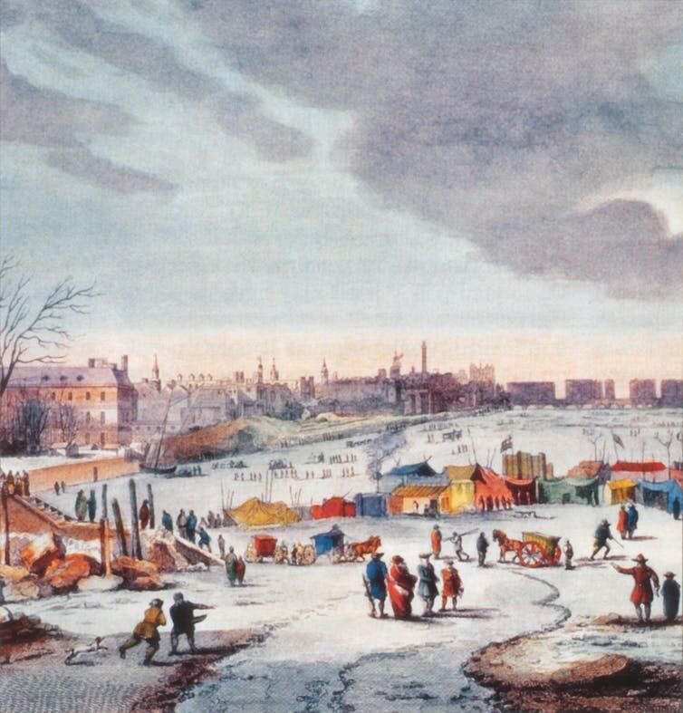
levels in the atmosphere over a relatively small part
                                                        of the North Atlantic, because of several other
                                                        atmospheric depressions. This resulted in an
                                                        intense anticyclone (an area of high pressure)
                                                        forming and then developing rapidly close to the
                                                        British Isles. High pressure areas are large regions
                                                        of gently sinking air. The descending air warms as
                                                        it sinks, evaporating clouds, and that's why
                                                        anticyclones tend to produce dry, settled weather.
                                                        In winter, you can expect clear skies with frost and
                                                        fog.

During the winter of 1683–84, the Thames froze over.
Regular weather records from London would begin a
decade later. Credit: Thomas Wyke/Wikipedia

A change in the air                                    A typical winter morning with high air pressure. Credit:
                                                       Nicolas Lysandrou/Unsplash, CC BY-SA
Although it may sound counter-intuitive, Britain's
recent atmosphere of high pressure
(meteorologically speaking) may have been caused
by very low pressure on the other side of the          Computerised forecast models run by the Met
Atlantic Ocean. A deep center of low pressure          Office and the European Centre for Medium Range
developed rapidly off the east coast of the US a few   Weather Forecasts (ECMWF) predicted the high
days prior which resulted in a severe snowstorm in     pressure area with near pinpoint precision. Its
eastern Canada. The blizzard dumped around 75          eventual position and record intensity was
cm of snow on Newfoundland, but it may also have       accurately forecast several days in advance, before
helped break high pressure records in Britain.         it had even begun to form.

That's because the air drawn out from the low          The combination of clear polar air with very dry air
pressure system off the US east coast by a strong      throughout the lower atmosphere—caused by the
jet stream had to be redistributed elsewhere.          sinking air in the high pressure area—made for one
Normally this would happen over a much larger          of those rare, sparkling winter days that are more
area of the North Atlantic, leading to the rapid       typical of expensive high-altitude Alpine resorts.
development of a fairly intense anticyclone, which     Enjoy it while it lasts.
is not uncommon.
                                                      This article is republished from The Conversation
On this occasion, though, the outflow of air from the under a Creative Commons license. Read the
intense storm could only be redistributed at high     original article.

                                                                                                          2/3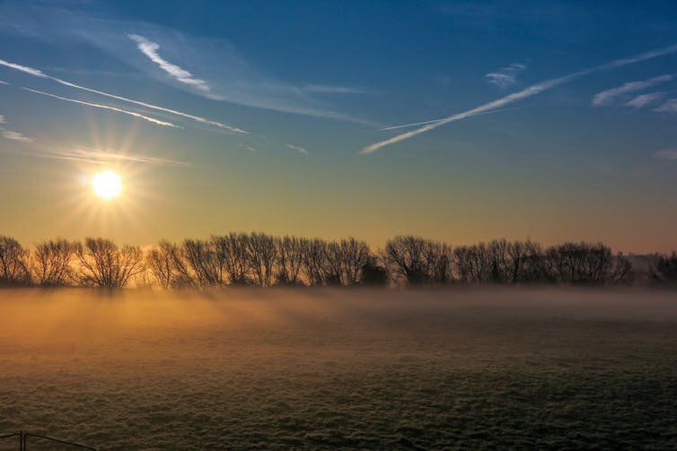
Provided by The Conversation
                                   APA citation: London just broke a 300-year-old weather record—but you probably didn't even notice it
                                   (2020, January 21) retrieved 22 September 2021 from https://phys.org/news/2020-01-london-broke-year-
                                   old-weather-recordbut.html

                                   This document is subject to copyright. Apart from any fair dealing for the purpose of private study or research, no
                                   part may be reproduced without the written permission. The content is provided for information purposes only.

                                                                                                                                                3/3

Powered by TCPDF (www.tcpdf.org)
You can also read