MAKING SAFE SPACE FOR CYCLING IN 10 DAYS - A GUIDE TO TEMPORARY BIKE LANES FROM FRIEDRICHSHAIN-KREUZBERG, BERLIN - Mobycon
←
→
Page content transcription
If your browser does not render page correctly, please read the page content below
PLAN • DESIGN • LEARN
MAKING SAFE SPACE FOR
CYCLING IN 10 DAYS
A GUIDE TO TEMPORARY BIKE LANES
FROM FRIEDRICHSHAIN-KREUZBERG,
BERLIN

www.mobycon.com
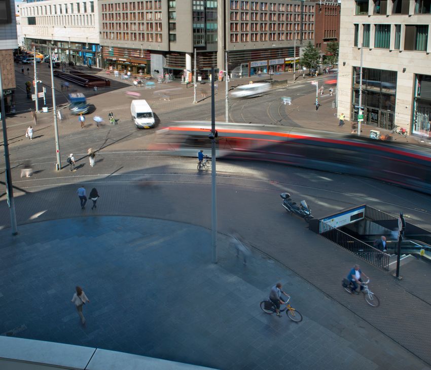
PopUp BikeLane in Berlin - Friedrichshain - Kreuzberg (Source: Peter Boytman Creative Commons CC0 1.0)

Mobycon is available to answer questions about this guide and to support municipalities in applying the information
herein.

Please contact us:

Lennart Nout - Manager of International Strategy
l.nout@mobycon.com
T: + 31 6 393 422 65

Mobycon would like to thank Mr. Felix Weisbrich, Department Head, and Mr. Olaf Rabe, Head of Roads Department,
                         from the Roads and Green Areas Office in Friedrichshain-Kreuzberg (www.berlin.de/ba-frie-
                         drichshain-kreuzberg) for the conception of this guide and for permission to use the docu-
                         ment "Rule plans for the temporary installation and expansion of cycle traffic facilities". We
                         would also like to thank Christian Haegele, Head of the Traffic Management department at
                         the Berlin Senate Department for Environment, Traffic and
                         Climate Protection.

Colophon
Johan Diepens, Bernhard Ensink, Lennart Nout, Melissa Bruntlett,
Sophie Simon, Jason Colbeck, Stephen Kurz, Benjamin Lang
Mobycon B.V.
Hooikade 13
2627AB Delft
info@mobycon.com

Cover image: Peter Boytman Creative Commons CC0 1.0)

Copyright ©
This document may be used for reference and shared as a whole, but may not be replicated in any form without
written permission from the publisher.
CONTENTS

    FOREWORD	                                                          5

1.0 THE CHALLENGE: SPACE FOR CYCLING IN THE 1.5-METER SOCIETY 	         7

2.0 THE SOLUTION: TEMPORARY MEASURES IMPLEMENTED IN 10 DAYS 	           9


3.0 PLANNING TEMPORARY CYCLING INFRASTRUCTURE: THE BASIC PRINCIPLES	   11

4.0 IMPLEMENTING TEMPORARY MEASURES: 11 STEPS IN 10 DAYS	              13

5.0 CREATING MORE SPACE FOR BIKES WITH CONCRETE TEMPORARY MEASURES     17

6.0 PROJECT PLANNING	                                                  21

7.0 APPENDIX	                                                          23
    7.1 BERLIN REFERENCE DOCUMENT
4

    Before: Hallesches Ufer (Source: Bezirksamt Friedrichshain-      After: Hallesches Ufer (Source: Bezirksamt Friedrichshain-
    Kreuzberg)                                                       Kreuzberg)

    PopUp BikeLane in Berlin - Friedrichshain - Kreuzberg (Source: Peter Boytman Creative Commons CC0 1.0)

    PopUp BikeLane in Berlin - Friedrichshain - Kreuzberg (Source:          After: Petersburger Street (Source: Bezirksamt Friedrichshain-
    Peter Boytman Creative Commons CC0 1.0)                                 Kreuzberg)
5

    FOREWORD
    The chain is only as strong as its weakest link!

    The world is currently crippled by the Corona virus. It is affecting everyone's life in every possible way, influencing how
    people work, stay connected to each other, find time for leisure and many other aspects. It is also having an incredible
    impact on their mobility. Streets are deserted and many people are reluctant to use public transport and shared
    mobility systems. Positively, while the number of cars on our streets has plummeted, walking and cycling are being (re)
    discovered. We are seeing examples of this worldwide, including in Berlin, where people are increasingly getting back
    on their bicycles and discovering their neighbourhoods on foot.

    The Berlin district of Friedrichshain-Kreuzberg was one of the first cities to implement temporary infrastructure
    to facilitate safer and more comfortable cycling in reaction to these changing mobility patterns. We are proud to
    have supported Friedrichshain-Kreuzberg in the development of these measures and were asked by the district to
    produce this guidebook. This guide provides a good foundation for planning safe, temporary infrastructure that can be
    implemented almost immediately in towns and cities that do not currently offer enough space for cyclists. It serves as
    inspiration to cities worldwide that want to do something, but don’t know how to start.

    The chain is only as strong as its weakest link: bottlenecks and unsafe spots on cycle routes must be eliminated quickly
    so that everyone can cycle safely and comfortably and still maintain the required distance from one another.

    We hope that the current (re)discovery of the bicycle will help re-establish it as a popular, healthy and space-efficient
    means of transport in the long term and contribute to more liveable, sustainable and dynamic cities!

    With kind regards,

    Johan Diepens,

    CEO Mobycon

-
6

    Source: Mobycon B.V.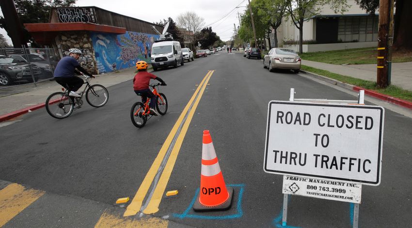
7

1.0
THE CHALLENGE:
SPACE FOR CYCLING IN THE 1.5-METER SOCIETY

How can you quickly create more space for cycling in the        city compared to non-Corona times, it is an opportune
city within two weeks? The Berlin district of Friedrichshain-   moment to reach out to target groups who have been
Kreuzberg has stepped up to this challenge and is               interested but cautious about cycling in the city to (re)
answering the question. Because of pressures related to         discover the bicycle.
mobility during the Corona measures, Berlin, like all cities
and towns, had to react quickly to create more space for        Additionally, in cities around the world with a low
people walking or cycling. Sufficient space for cycling         proportion of cycling in the traffic mix, relatively fewer
was already a problem under normal circumstances,               women cycle. For this target group in particular, often
the current crisis has merely compounded this problem.          responsible for more care trips and comprising a high
According to the Berlin regulations–similar to those in         percentage of people working in the essential services,
most cities–people are expected to keep a minimum               subjectively and objectively safer cycling infrastructure is
distance of 1.5 meters from each other. What does this          needed, in the very short term.
mean for people on bikes and cycling infrastructure?
                                                                Cyclists generally need a minimum width of 2.5m to ride
Like countless other cities, the standard German widths         safely next to or past each other (plus the usual minimum
of the existing bicycle infrastructure in Berlin are too        safety zones at the edge). With the 1.5m measure an
small to keep the minimum required distance of 1.5m.
The solution cannot be a cycling ban on streets and in
areas where it is impossible to maintain this minimum
distance. Such a ban would be counterproductive–
especially with regard to Corona measures. Those who
cannot use a car for transportation are dependent on
walking, cycling and public transport. On sidewalks and
public transport, the 1.5m minimum distance also poses
a problem. Increasing rates of cycling takes the strain
off the sidewalks and public transport and helps people
maintain the minimum recommended distance.

People who have to make necessary trips, for example
those with essential jobs, should not be exposed to
an increased risk of infection due to lack of space. It is
apparent that in times of Corona, the use of bicycles in
the transport mix increases in relative terms. In terms
of absolute figures, an increasing trend is also to be
expected, especially in spring and summer months.
During this period of reduced motorized traffic in the

                                                                   PopUp BikeLane in Berlin - Friedrichshain - Kreuzberg
                                                                    (Source: Peter Boytman Creative Commons CC0 1.0)
8

    additional 0.5m is all that is needed to achieve this safe
    and comfortable distance, creating a lane width of at
    least 3m for cyclists. The minimum distance between
    cyclists and people on the sidewalks must also be 1.5m.

    The result is that we need wider cycle paths in
    this pandemic period. The target width for cycling
    infrastructure such as cycle paths and cycle lanes should
    be at least 3m wide in Corona times. Coincidentally,
    this is also a common lane width for vehicle lanes. The
    challenge therefore is how to quickly convert vehicle
    lanes to make safe cycling possible with a minimum
    distance of 1.5m between people.

                                                                 Gitschiner Street after the establishment of the temporary
                                                                 measures (Source: Bezirksamt Friedrichshain-Kreuzberg)

                                                                 Gitschiner Street after the establishment of the temporary
                                                                 measures (Source: Bezirksamt Friedrichshain-Kreuzberg)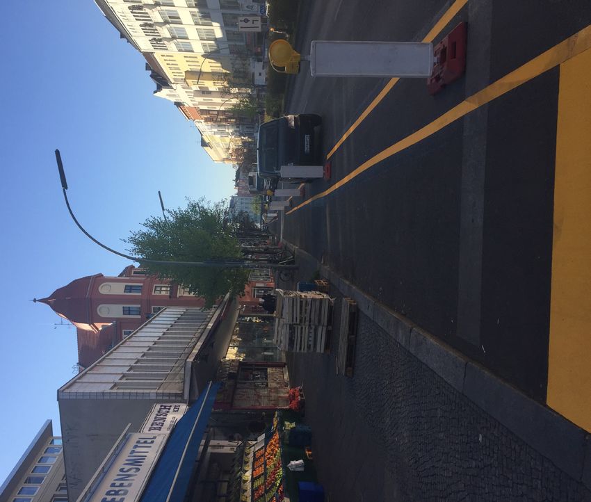
9

 2.0
 THE SOLUTION:
 TEMPORARY MEASURES IMPLEMENTED IN 10 DAYS

 The Friedrichshain-Kreuzberg district has stepped up to       Calgary has closed off one lane of car traffic on some
 the challenge by developing and implementing temporary        streets to be converted to a cycle lane. Overall, isolated
 measures within 10 days. This example is used to inspire      measures are now taking place in many cities, however
 other cities and municipalities to think creatively and       plans for the entire city are still rare.
 implement measures as quickly as possible.

 With the temporary installation and expansion of bicycle
 facilities, Berlin is currently at the forefront of cities
 taking action worldwide, followed by a group of other
 cities and communities that are taking similar measures.
 For example, the city of Bogotá in Colombia was one of
 the first cities to designate 35 kilometers of new bicycle
 lanes. Paris recently announced they are bringing forward
 the construction of 650 km of cycleway and starting with
 temporary measures in the coming weeks. Budapest and
 Mexico City are also planning a network-wide approach.
 In the USA, Philadelphia and Minneapolis, among others,
 have closed individual streets in recreational areas to car
 traffic to create more space for pedestrians and cyclists.    Budapest, Hungary (Source: Dávid Vitézy @vitdavid / Twitter)
 Most recently, New York City announced the closure of
                                                               At present (late April 2020), the volume of motor
 100 miles of city streets to cars. In Canada, the city of
                                                               vehicle traffic is well below capacity due to the Corona
                                                               crisis. This makes it possible to divide up traffic areas
                                                               differently depending on the situation and without
                                                               causing disruption to motor vehicle traffic, including
                                                               bus services. Additional space for cyclists offers more
                                                               people an alternative to using public transport, where
                                                               high ridership can increase susceptibility to infection,
                                                               ultimately reducing the load on public transport. It is also
                                                               a great opportunity to show people what a city with a
                                                               comprehensive cycle network can look and feel like and
                                                               how it functions. This, over time, can inspire increased
                                                               support for future bicycle infrastructure construction
                                                               and reduce future “bike-lash”.

Bogotá, Colombia (Source: Gabriel L. Guerrero/Shutterstock)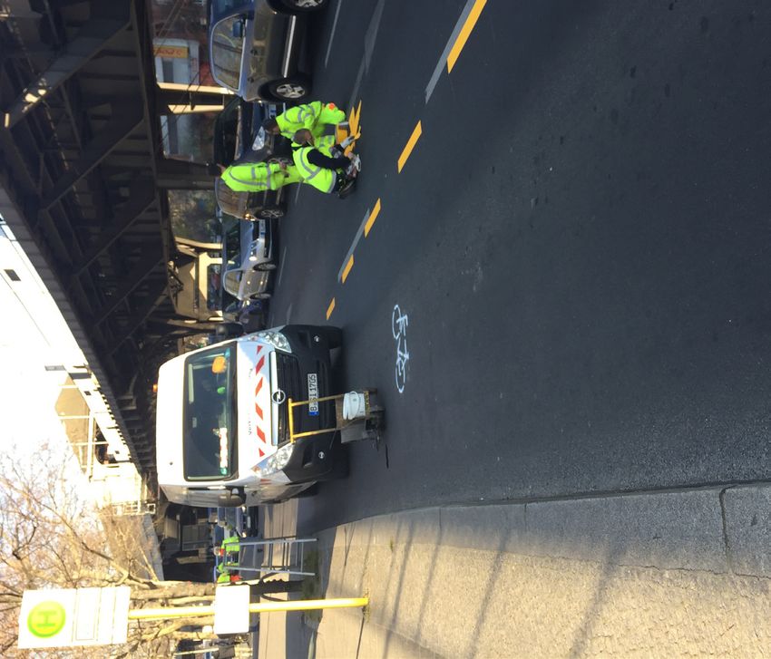
10

     Oakland, USA (Source: AP Photo/Jeff Chiu)
      The instruments available for redistributing road space        therefore necessary for danger prevention where the
      in favour of cycling include the temporary designation of      existing cycling infrastructure does not comply with
      new cycling facilities, the widening of existing ones, and     the 1.5m minimum distance measure. To counter the
      the closure of secondary roads to through traffic, either      public health hazard posed by narrow cycle facilities
      physically or by time restrictions.                            in combination with a global pandemic, a short-term
                                                                     adjustment of the existing infrastructure through an
      According to the German Road Traffic Regulations (StVO)        accelerated procedure is required.
      the construction of cycle lanes doesn’t require a warrant
      or certain volume of traffic. This also applies to the         In the city of Berlin, the Senate Administration of the State
      widening of existing facilities. Traffic counts to prove the   of Berlin is responsible for the operation of main roads.
      decreased traffic volumes are also not necessary. In times     For secondary roads the offices of the city districts, such
      of a pandemic, dangerous situations may arise because          as Friedrichshain-Kreuzberg are responsible. In order
      reduced traffic volumes invite car drivers to speed            to follow the example implemented in Friedrichshain-
      through the empty streets. At the same time, cyclists          Kreuzberg, consideration of the responsibilities in one’s
      cycling too close together are in itself a public health       own country/local jurisdiction, including the other laws
      hazard. Rapid action on the part of City government is         and regulations is necessary.
11
3.0
PLANNING TEMPORARY
CYCLING INFRASTRUCTURE:
THE BASIC PRINCIPLES
Quickly creating more space for people cycling (and due to unilateral collisions in which a cyclist hits a kerb or
walking) presents the opportunity to test a variety of post, for example. Adding physical separation between
solutions, measure and observe them and then adapt if bicycles and cars is definitely beneficial, but one should
necessary. However, there are also risks associated with minimise the risk of a cyclist hitting a separator by, for
rapidly changing road environments. For these reasons, example, adding safety buffers. The use of flexible or soft
we outline the following design principles that cities and separator materials also reduces the risk of injury. One
local authorities should consider when planning and option is to use hay bales for rapid implementation.
designing temporary measures.
Another example of this principle is that, whenever
TRAFFIC SEPARATION possible, the temporary infrastructure should also be
It is imperative to effectively separate walking and designed to ensure there is a buffer zone between
cycling from high volumes (or speeds) of motorized turning vehicles and cyclists or pedestrians. The creation
traffic. This should be achieved - wherever possible - by of a certain buffer zone should enable right-turning
physical separation and not simply with paint. Vertical motorists to look over their shoulders to comfortably
physical separation of traffic is particularly crucial for and sufficiently recognise that someone is in the cycle
temporary measures, as drivers will not be used to the and/or pedestrian space and react accordingly.
new street layout. For smaller roads, consideration
should be given to completely closing the road to car PREDICTABILITY
traffic, or alternatively to closing a road to through traffic This principle is based on the fact that recognizing
and giving priority to bicycles. For larger roads, the change and understanding how to behave in a new traffic
conversion of a car lane is the most effective strategy to environment always takes time. In order to minimise
create more space for cyclists. Particular attention must the effects of this unavoidable risk, it is important that
be paid to parking spaces on the street: motorists who temporary facilities are planned and designed in such
want to park on a street should not be made to cross the a way that they can be easily understood by all road
cycle lane if possible. users. For example, the introduction of a new two-way
cycle path on the left side of the road would confuse
FORGIVING INFRASTRUCTURE motorists. It is much safer to introduce a one-way cycle
This principle focuses on creating infrastructure that path on both sides of the road. If there is not enough
anticipates the potential for human error and ensures space for two separate cycle paths, other measures such
that it does not lead to injuries. A simple example of this as temporary roadblocks and/or modal filters should be
principle is that planned physical barriers to be installed considered.
must not in themselves constitute a safety risk. The
largest increase in injuries to cyclists in the Netherlands is12
NETWORK APPROACH As with all networks, a key feature of a temporary road
During a pandemic, the last thing a City would want is closure network is that the intersections with other
to create a new attraction or space that brings people roads become very important. At these intersections,
together in too small an area. Closing a street to traffic it is important to limit the potential for conflict (or
has often historically generated high levels of public infection). This can be achieved by adding pedestrian
enthusiasm, quickly transforming the street into a mini- refuges or temporary kerb build-outs. If available, bicycle
festival or street party. Under the current conditions, this and pedestrian signals should be tweaked to minimize
is not a desirable outcome for obvious reasons. Instead of their waiting time. This helps improve safety through
closing a short stretch of road, it is therefore imperative minimizing red light running and is made possible due
to create a network of open roads. This will reduce the to severely reduced car traffic volumes. Pedestrian and
pressure on the space of a single open street and allow bicycle call buttons should be turned off to minimize
people to walk and cycle in their neighbourhood while the potential for infection through touch. If space is
maintaining the necessary distance. This network should limited, consider applying stencils on the road to identify
not only provide links to the main centres for essential appropriate waiting locations for people on bikes, while
services (such as supermarkets and hospitals), but also maintaining the required distance.
provide sufficient space for recreational cycling and
walking.
PopUp BikeLane in Berlin - Friedrichshain - Kreuzberg (Source: Peter Boytman Creative Commons CC0 1.0)
PopUp BikeLane in Berlin - Friedrichshain - Kreuzberg
(Source: Peter Boytman Creative Commons CC0 1.0)13
4.0
IMPLEMENTING
TEMPORARY MEASURES:
11 STEPS IN 10 DAYS
Following the example from the Friedrichshain-Kreuzberg district, a process in eleven steps, to be completed within
10 days, is described here:
CREATE A PROJECT LIST OF THE STREETS AND CROSSINGS
STEP 1 TO BE ADAPTED, INCLUDING:
• Location and length of the streets and the crossroads
• Priority of each project
• Identification of design scenario to apply based on guiding designs
• Target date and project status
STEP 2 DRAFT AN ACTION SHEET FOR EACH PROJECT IDENTIFYING:
• The assigned design concept
• Material requirements
• Steps to create a network map with the assigned design concept
• Creating a cross-section sketch
• Preparation steps for implementation (with contractor if necessary)
• Planned implementation date
• Preparatory and traffic management measures (e.g. no stop signs)
STEP 3 ENABLE QUICK IMPLEMENTATION:
• Coordinate a transportation committee hearing for the relevant authorities
formally involved in the measure on-site if necessary
• Having the relevant authorities who will sign-off on the proposed temporary
measures meet on-site greatly speeds up the decision making process.
• Time limit: within 48 h
• Consideration for decisions / changes / concretisation
• If necessary, an on-site visit/hearing14
STEP 4 FORMALLY DESIGNATE MEASURES WITH THE RELEVANT
AUTHORITY:
• Include reason for the designation
• Formal designation of the design concepts
• If necessary verbally, to be done during an on-site visit
STEP 5 DEVELOP COMMUNICATIONS PLAN AND NOTIFICATION
SIGNAGE:
• Work with municipal communications department to establish clear messaging
for press and public relations outreach
• Develop clear “notice of change” signage if necessary (i.e. no stopping)
STEP 6 IMPLEMENT SIGNAGE AND MARKING:
• Executed by commissioned company / municipal personnel
• Regular and consistent monitoring of project by the relevant authority
• Visual documentation of installation as a provisional traffic signage plan (including
as-built aerial photo by drone)
STEP 7 SUBMIT FINALIZED TRAFFIC SIGNAGE PLAN TO THE
RELEVANT AUTHORITY:
• Deadline: within 24 h
• Format: visual documentation (created by drone and on-street photography/
video)
With the help of a drone camera, the temprary measures and the associated signage
can be effectively documented. (Source: Mobycon B.V.)15
PopUp BikeLane in Berlin - Friedrichshain - Kreuzberg (Source: Peter Boytman Creative Commons CC0 1.0)
STEP 8 FINALIZE DESIGNATION WITH RELEVANT AUTHORITY:
• Addition of signage plan
• Determine duration of the designation:
• Until expiry of the generally applicable social distancing measures (for cities
using temporary measures as a pre-amble to permanent cycle infrastructure,
this can be a different timeframe)
STEP 9 EVALUATE MEASURE WITH THE RELEVANT AUTHORITY(IES):
• Deadline: within 72h
• Quick-scan assessment reviewing:
• reduced risk of infection
• traffic safety
• traffic flow.
STEP 10 ADJUST AND MODIFY (IF NECESSARY):
• Determine necessary adjustments based on the evaluation
• Create a plan to adjust projects as needed
• Execute additional evaluation and make further modifications if necessary
STEP 11 COMPLETE MEASURE
• Visual documentation (created by drone) of the completed measure and usage
Following the completion of implementation, if desired or considered necessary, text documents can be created after
step 11 for the designated measures.
The temporary measures should be evaluated regularly throughout the process to identify areas in need of
improvement. The evaluation of temporary facilities can inform the permanent infrastructure that can replace the
temporary measures. Cities should start planning permanent measures already during this phase to ensure the rise in
cycling levels can be maintained after the corona related restrictions have been lifted.16
Before: Kottbusser Damm (Source: Bezirksamt Friedrichshain- After: Kottbusser Damm (Source: Bezirksamt Friedrichshain-
Kreuzberg) Kreuzberg)
PopUp BikeLane in Berlin - Friedrichshain - Kreuzberg (Source: Peter Boytman Creative Commons CC0 1.0)17
5.0
CREATING MORE
SPACE FOR BIKES WITH
CONCRETE TEMPORARY
MEASURES
When implementing temporary measures, it is important used to construct temporary cycle paths or cycle lanes.
to observe the four basic principles described above: The specific details of the measures in Friedrichshain-
separation, forgiveness, predictability and network Kreuzberg are abstracted from the basic concepts in
approach. Below are some examples of temporary order to inspire other cities and municipalities to take
measures that are easy to implement and follow the concrete action. Graphics based on a concrete example
basic principles as closely as possible. These measures from Friedrichshain-Kreuzberg are numbered as per
can be applied in different cities and different contexts. the document developed by Berlin (see Appendix 7.1),
where FrKr RP TEER 01 means: Friedrichshain-Kreuzberg
This section contains several before-and-after cross- Rule Plan 01.
section examples illustrating which measures can be
Temporary Measures on Zossener Brücke (Source: Bezirksamt Friedrichshain-Kreuzberg)18
EXAMPLE 1: CYCLE LANE WITHOUT ON-STREET PARKING
On streets with two vehicle lanes in each direction, the entire width of the existing kerbside lane is designated as a
temporary cycle lane. Added measures for the visibility and safety of cyclists are:
• Separation of the temporary cycle lane by markings on the ground and by vertical separation such as bollards or
guide beacons
• Clear and consistent temporary “cycleway” signage
• Buffer zone between car and cycle lane
More technical details can be found in Appendix 7.1.
FRKR RP TEER 01 BEFORE FRKR RP TEER 01 AFTER
EXAMPLE 2: CYCLE LANE WITH ON-STREET PARKING
On streets with two car lanes in each direction and a lane of car parking on the kerbside, the existing outside travel
lane is designated as a temporary cycle lane for its entire width. The existing on-street parking only remains in place if
absolutely necessary and parking bays are present, making the parking lane not usable for bicycles. If on-street parking
is in a continuous lane, see example 3. Measures for the visibility and safety of cyclists are:
• Separation of the temporary cycle lane by markings on the ground and by vertical separation such as bollards or
guide beacons, where possible
• Clear and consistent temporary “cycleway” signage
• Buffer zone between the car and cycle lane and between cycle lane and parking lane
FRKR RP TEER 02 BEFORE FRKR RP TEER 02 AFTER19
EXAMPLE 3: PARKING PROTECTED CYCLE LANE WITH BUFFER
On streets with 3 car lanes in each direction, where parking is also allowed in the kerbside lane, the middle car lane is
designated the car parking lane, and the kerbside lane is designated the full width of a temporary cycle lane. Measures
for the visibility and safety of cyclists are:
• Separation of the temporary cycle lane by markings on the ground and vertical separation such as beacons
• Clear and consistent temporary “cycleway” signage
• Extended buffer zone between the cycle lane and the parking lane so that there is enough space for motorists
getting out of the car
FRKR RP TEER 03 BEFORE FRKR RP TEER 03 AFTER
EXAMPLE 4: SIGNALIZED INTERSECTIONS (SEE FRKR RP TEER 04)
Where a temporary cycle path or cycle lane meets a signalized intersection, it is important to prevent motorised traffic
turning into the path of cyclists travelling straight ahead or also turning. To avoid conflict, measures for the visibility
and safety of cyclists are:
• Where possible, create a temporary ''protected intersection'' with temporary kerbstone extensions
• If this is not possible:
• Install cycle-friendly signalling phases with separate, exclusive green phases for pedestrians and cyclists, or;
• Green phases for cyclists before the green phase for cars
• Consider temporary markings to highlight appropriate locations for cyclists to wait for a green light, while
maintaining their distance20
PopUp BikeLane in Berlin - Friedrichshain - Kreuzberg
(Source: Peter Boytman Creative Commons CC0 1.0)21
6.0
PROJECT PLANNING
All streets and intersections to be modified are listed as sub-projects, priorities are decided (1 - 3), proposed measures
are briefly described with reference to the relevant design guidance scenario, the relevant authorities and participants
to be involved are noted (e.g. a = country, b = district, c = municipality, d = police, etc.), for streets, the width is
specified and the target date for the last step (step no. 11) in the process is entered. The project status (step no.) in
which the subproject is located is noted daily.
An example of a project schedule from Berlin is shown below:
DESIGN
PROJ. STREET NAME OR PRIO- RELEVANT WIDTH TARGET PROJECT
REQUIRED MEASURES GUIDANCE
NO. INTERSECTION RITY AUTHORITY (M) DATE STATUS
NUMBER
1 Street a 2 ... 4 a; b xxx dd/mm 1
2 Street b 1 ... 1 b x.xxx dd/mm 2
3
Intersection c/d 3 ... 1 a; b - dd/mm 5
4
... .. ... ... ... ... ... ...
...
... .. ... ... ... ... ... ...22
23

7.0
APPENDIX
7.1 REFERENCE DOCUMENT
© Broytmann/SenUVK

   Berlin: mobiler

   Regelpläne zur temporären Einrichtung
   und Erweiterung von Radverkehrsanlagen
Senatsverwaltung für Umwelt,
                 Verkehr und Klimaschutz
                   Abteilung VI - Verkehrsmanagement
                                                              Radfahrstreifen ohne                    RP
genehmigt am                                                   ruhenden Verkehr                     TEER 01
  02.04.2020            Haegele, Abteilungsleiter

                                                                               Die Breite des Radfahrstreifens ergibt
                                                                               sich durch die Breite des vorhandenen
                                                                0,12
                                                                               Fahrstreifens.

                          15,00                                     Z 237

                                                                 0,24-0,25

       Z 224

                                                    5,00                       Vorhandene Beschilderung für den
                                                                               ruhenden Verkehr ist abzudecken.

                                                                               Furtmarkierungen (0,50 m : 0,20 m)
                                                                               nur bei Vorfahrt für den Radverkehr
                                                                               und an signalisierten Knoten.
                          15,00
                                                                               Z 295 ist an Grundstückszufahrten/
                                                                               -ausfahrten nicht zu unterbrechen.

                                                                               An Haltestellen und ggü. von
                                                    10,00                      Einmündungen sind Leitlinien zu
                                                                               markieren (1,00 m : 1,00 m).
      Z 237
                                                                               Sinnbild "Radverkehr" ist in
                                                                               regelmäßigen Abständen (ca. 25 m)
                                                                 Z 605-10
                                                                               zu wiederholen.
                           5,00
                                                                               Bei Bedarf können die Abstände der
                                                                               Zeichen 605-10 reduziert werden.

                                                           Grundlage: RP 310                         Ohne Maßstab
                                                           vom 12.09.2019                          Maßangaben in Meter
Senatsverwaltung für Umwelt,
Verkehr und Klimaschutz
Abteilung VI - Verkehrsmanagement
Radfahrstreifen bei RP
genehmigt am Parkstreifen rechts TEER 02
02.04.2020 Haegele, Abteilungsleiter
Die Breite des Radfahrstreifens ergibt
sich durch die Breite des vorhandenen
Fahrstreifens.
2,50
0,75
1 5,00
0,24-0,25
Parkflächenmarkierungen als
5,00 Schmalstrich sind an
Grundstückszufahrten und ggü.
Einmündungen zu unterbrechen.
Gegenüber Einmündungen sind statt Z 295
0,75 Leitlinien (1,00 m : 1,00 m) zu markieren
(vgl. RP TEER 01).
Z 295 ist an Grundstückszufahrten/
-ausfahrten nicht zu unterbrechen.
0,24-0,25
2 Sicherheitstrennstreifen zum
Parkstreifen mit Z 340 als
Schmalstrich (1,00 m : 1,00 m).
Furtmarkierungen (0,50 m : 0,20 m)
nur bei Vorfahrt für den Radverkehr
und an signalisierten Knoten.
Sinnbild "Radverkehr" ist in
regelmäßigen Abständen zu
Z 237 wiederholen (ca. 25,00 m).
Grundlage: RP 311 Ohne Maßstab
vom 12.09.2019 Maßangaben in MeterSenatsverwaltung für Umwelt,
Verkehr und Klimaschutz
Abteilung VI - Verkehrsmanagement
Radfahrstreifen bei RP
genehmigt am Parkstreifen links TEER 03a
02.04.2020 Haegele, Abteilungsleiter
Die Breite des Radfahrstreifens ergibt
sich durch die Breite des vorhandenen
0,12 Fahrstreifens.
5,00
Z 237
0,24-0,25
Sicherheitstrennstreifen zum
5,00 Parkstreifen mit Z 295 (Doppellinie
Schmalstrich).
Furtmarkierungen (0,50 m : 0,20 m)
nur bei Vorfahrt für den Radverkehr
und an signalisierten Knoten.
Sicherheitstrennstreifen ist an
Grundstückszufahrten/
10,00 -ausfahrten auf ein Zeichen 295 zu
1,00
reduzieren, Parkflächenmarkierungen
sind zu unterbrechen, ggü. Einmündungen sind statt
des Z 295 Leitlinien (1,00 m : 1,00 m) zu markieren.
Sinnbild "Radverkehr" ist in
regelmäßigen Abständen zu
wiederholen (ca. 25 m).
2,50
Zeichen 605-10 können optional
verwendet werden; sie müssen verwendet
werden, wenn weitere VZ im
Sicherheitstrennstreifen aufgestellt werden.
Grundlage: RP 311 Ohne Maßstab
vom 12.09.2019 Maßangaben in MeterSenatsverwaltung für Umwelt,
Verkehr und Klimaschutz
Abteilung VI - Verkehrsmanagement
Radfahrstreifen bei RP
genehmigt am Parkstreifen links TEER 03b
02.04.2020 Haegele, Abteilungsleiter
Die Breite des
Radfahrstreifens ergibt
sich durch die Breite des
vorhandenen
Fahrstreifens.
0,12
1,00 Sicherheitstrenn-
streifen zum
Parkstreifen mit Z 295
(Doppellinie
L* Schmalstrich).
Zeichen 605-10 nur an
jedem Beginn des
Z 605-10 Parkstreifens und im
Sicherheitstrennstreifen,
wenn dort noch andere
VZ aufgestellt werden.
Z 237 Markierung im Bereich
von Haltestellen als
Leitlinie
0,24-0,25
(1,00 m : 1,00 m) auf
einer Länge von 15 m vor
und hinter dem ersten
bzw. letzen Z 224.
15,00
L*: Verziehungslänge
1:10 (bei 2,50 m
Parkstreifen: 25,00 m).
Je nach örtlichen
Verhältnissen sind zur
Ankündigung Spurtafeln
gem. RP TEER 04
vorzusehen.
Bild 1 Bild 2 Ohne Maßstab
Maßangaben in Meter
Ende des Parkstreifens Beginn des ParkstreifensSenatsverwaltung für Umwelt,
Verkehr und Klimaschutz
Abteilung VI - Verkehrsmanagement
Radfahrstreifen bei RP
genehmigt am Parkstreifen links TEER 03c
08.04.2020 Haegele, Abteilungsleiter
Beginn auf freier Strecke
0,12
1,00
L*: Verziehungslänge 1:10
Bei vorher auf ausreichender Länge freien
Fahrstreifen kann bei örtlichem Bedarf eine
L* Verkürzung erfolgen (jedoch nicht im Bereich von
Haltestellen von Linienbussen gem. RP TEER 03b).
Vorankündigung durch Z 531
(Einengungstafel)
in ausreichendem Abstand
(je nach örtlichen Gegebenheiten).
Zusätzlich sind mind. 2x Z 297.1-21
(gem. RP 221/1 Nr. 4) zu markieren.
Der Zufahrtsbereich des
Radfahrstreifens ist mit Z 283 freizuhalten.
5,00
Z 237
1,00
1,00
6,00
Z 283-10
Ohne Maßstab
Maßangaben in MeterSenatsverwaltung für Umwelt,
Verkehr und Klimaschutz
Abteilung VI - Verkehrsmanagement
Verschwenkung bei RP
genehmigt am Parkstreifen links TEER 03d
08.04.2020 Haegele, Abteilungsleiter
Führung an Engstellen
oder am Beginn (1) bzw.
Z 237 am Ende (2) eines
Radfahrstreifens mit
L*
linksseitigem Parken
Auf die Markierung einer
Sperrfläche kann je nach
örtlichen Verhältnissen
verzichtet werden.
Für die Sperrflächen gilt
RP 240.
Bei einer möglichen
Fußgängerquerung im
Bereich von
Gehwegvorstreckungen
sind die Leitbaken
behinderungsfrei
aufzustellen.
L*
L*: Verziehungslänge 1:10
0,12
1,00
Ergänzung für
Ohne Maßstab
Radfahrstreifen mit
Maßangaben in Meter
Parkstreifen linksSenatsverwaltung für Umwelt,
Verkehr und Klimaschutz
Abteilung VI - Verkehrsmanagement
Radverkehrsfurt in RP
genehmigt am signalisiertem Knoten TEER 04
02.04.2020 Haegele, Abteilungsleiter
Die Breite des Radfahrstreifens ergibt
sich durch die Breite des vorhandenen
Fahrstreifens.
Z 237
0,24-0,25
0,50
Mindestens 15,00 m vor der Haltlinie darf
links vom Radfahrstreifen das Halten/
Parken gem. RP TEER 03 ff. nicht erlaubt
sein.
Vorhandene Z 297 müssen gegebenenfalls
angepasst oder ungültig gemacht werden.
Ohne Maßstab
Maßangaben in Meter32
PLAN • DESIGN • LEARN
Mobycon
Hooikade 13
2627 AB Delft
Netherlands
T: +31 (15) 214 78 99
info@mobycon.com
www.mobycon.comYou can also read