Metropolitan Parks and Open Space Commission
←
→
Page content transcription
If your browser does not render page correctly, please read the page content below
Business Item No. 2021-229
Metropolitan Parks and Open Space Commission
Meeting date: September 2, 2021
For the Community Development Committee meeting of September 20, 2021
For the Metropolitan Council meeting of October 13, 2021
Subject: Minnehaha Parkway Regional Trail Master Plan, Minneapolis Park and Recreation Board,
Review File No. 50226-1
MPOSC District, Member: District C, Cana Yang; District D, Assata Brown
Council District, Member: District 6, Lynnea Atlas-Ingebretson; District 8, Abdirahman Muse
Policy/Legal Reference: Minnesota Statutes § 473.313; 2040 Regional Parks Policy Plan: Chapter 5,
Planning Strategy 1; Chapter 7, Recreation Activities and Facilities strategies 1-3
Staff Prepared/Presented: Colin Kelly, Planning Analyst (651-602-1361)
Division/Department: Community Development / Regional Planning
Proposed Action
That the Metropolitan Council:
1. Approve Minneapolis Park and Recreation Board’s Minnehaha Parkway Regional Trail Master
Plan, including the addition of two parcels detailed in this report and the supplemental
information provided in the submittal letter dated June 7, 2021, with the exception of classifying
existing tennis courts as “regional.”
2. Require Minneapolis Park and Recreation Board, prior to initiating any new development of the
regional trail corridor, to send preliminary plans to the Metropolitan Council’s Environmental
Services Interceptor Engineering Assistant Manager.
Background
Minneapolis Park and Recreation Board’s (MPRB) Minnehaha Parkway Regional Trail is located near
the center of the Regional Parks System (Figure 1) in the southern portion of the City of Minneapolis
(Figure 2).
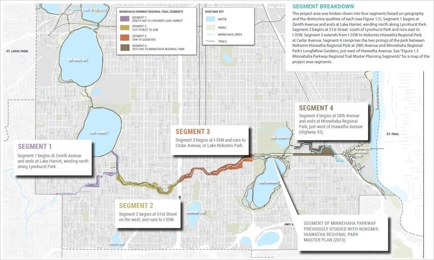
The project area spans a roughly 7-mile stretch of Minnehaha Creek through Minneapolis between
Zenith Ave at 54th Street and Longfellow Gardens (Figure 3). Though this entire area constitutes
Minnehaha Parkway Regional Trail, paved pedestrian and bicycle trails and the parkway road only
currently exist from Lake Harriet eastward. The western segment of the project area (west of Lynnhurst
Park) does not feature a formal network of trails or the Parkway road along the Creek.
The section of Parkway through Nokomis-Hiawatha Regional Park was master planned as part of the
2015 Nokomis-Hiawatha Regional Park Master Plan and is not included in the project area for this plan.
The master plan includes a proposed boundary change that would add Lynnhurst Park, MPRB-owned
land currently classified as a local park, into the regional trail corridor boundary. More information on
this proposed boundary change is available in the Analysis.
The submittal of the Minnehaha Parkway Regional Trail Master Plan was accompanied by a letter
outlining which amenities MPRB proposes to be fully included in the
regional trail corridor and therefore eligible for funding and visitor counts
(Attachment 1). As noted on the third page of the letter, local park
Page - 1 | METROPOLITAN COUNCIL
amenities in Lynnhurst Park would continue to be classified as local and excluded fr om Regional Parks
System funding and visitor counts.
Rationale
The Minnehaha Parkway Regional Trail Master Plan is consistent with the requirements of the 2040
Regional Parks Policy Plan, particularly Planning Strategy 1 (Master plan requirements) and Recreation
Activities and Facilities strategies 1-3 (Balance conservation and recreation, Range of recreation
opportunities, Equitable use), and other Council policies.
The June 7, 2021, submittal letter proposes classification of the existing tennis courts in the regional
trail corridor as “regional.” However, the 2040 Regional Parks Policy Plan clearly states that “ball
diamonds and tennis courts… are not eligible for regional funding for improvement or expansion” (pg.
99). Therefore, Council staff do not recommend classifying existing tennis courts in the Minnehaha
Parkway Regional Trail corridor as regional.
Thrive Lens Analysis
The Minnehaha Parkway Regional Trail Master Plan advances the Thrive outcome of Livability by
increasing access to nature and outdoor recreation, which enhances quality of life in the region. The
master plan also advances the outcome of Stewardship by responsibly managing our region’s natural
resources and investing in natural resource restoration.
Funding
The total estimated cost to implement the master plan over a 30-year period is $108,385,853.
It is important to note that not all of these costs will be borne by MPRB. The master plan includes costs
from a variety of elements that may be jointly implemented with partner agencies. Examples of such
projects include road modifications, creek meanders, and stormwater best management practices
(BMPs). The master plan and its cost estimates are meant to guide the efforts of multiple agencies.
Annual operations, maintenance, and public saf ety costs are funded through MPRB’s budget and
Metropolitan Council’s Operations and Maintenance Program. The budget is administered by the
MPRB’s Superintendent and approved annually by the MPRB Board of Commissioners.
Known Support / Opposition
In November 2020, the Minneapolis Park and Recreation Board’s Board of Commissioners adopted
Resolution 2020-330, a Resolution Adopting the Minnehaha Parkway Regional Trail Master Plan
(Attachment 2).

Page - 2 | METROPOLITAN COUNCIL
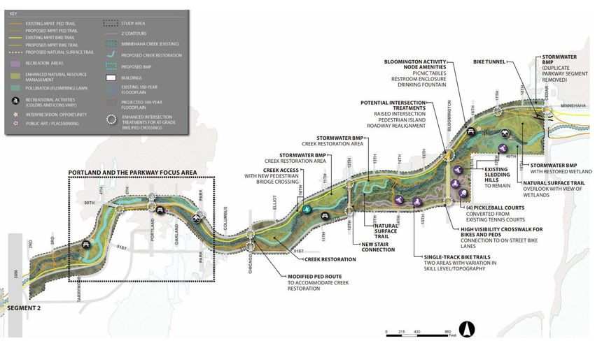
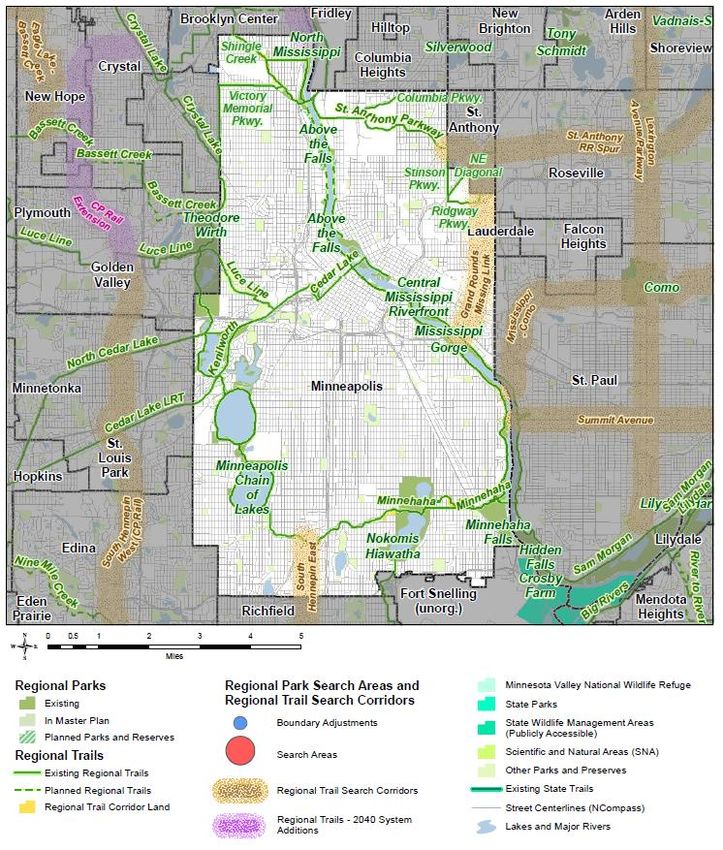
Figure 1: Minnehaha Parkway Regional Trail location in the Regional Parks System

                                Minnehaha Parkway
                                  Regional Trail

Page - 3 | METROPOLITAN COUNCIL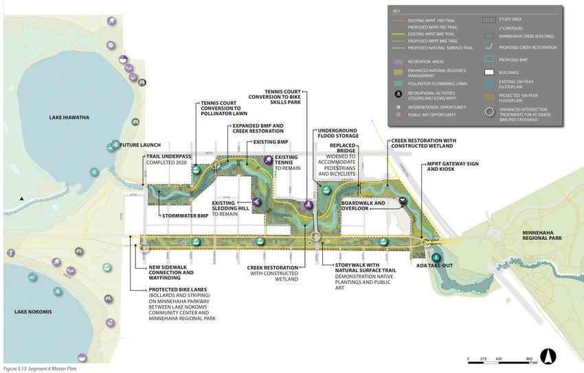
Figure 2: Regional Parks System, City of Minneapolis, Hennepin County – Minnehaha Parkway Regional Trail location

          Minnehaha Parkway
            Regional Trail

Page - 4 | METROPOLITAN COUNCIL
Figure 3: Minnehaha Parkway Regional Trail Master Planning Segments (MP Fig. 1.5)

Page - 5 | METROPOLITAN COUNCIL
Analysis
Planning Strategy 1 of the 2040 Regional Parks Policy Plan requires that master plans for destination
regional trails address 13 items: boundaries and acquisition costs, demand forecast, development
concept, conflicts, public services, operations, partner engagement, public engagement and
participation, equity analysis, public awareness, accessibility, stewardship plan, and natural resources.
The following analyzes the master plan against those requirements.
Boundaries and Acquisition Costs
There are no new property acquisitions necessary by MPRB to implement this master plan. At
Lynnhurst Park, MPRB is proposing a boundary change to the regional trail, though additional land to
be added to the regional facility is wholly owned by MPRB. Such a change would accommodate future
development of the proposed environmental-themed community center, the construction of a new
bridge/overpass at 50 th Street, and the daylighting of the tributary from Lake Harriet.
The two parcels to be added to the regional trail boundary are 8.27 acres (PID 160282424001) and 0.8
acres (PID 1602824310080) in size, and are immediately adjacent to the existing regional trail
boundary.
Demand Forecast
According to a November 2019 Metropolitan Council Regional Forecast, the population of the seven-
county metro is projected to increase by approximately 15% between 2020 and 2040. In 2017,
Minnehaha Parkway Regional Trail was estimated to have had more than 1.3 million visits annually,
based on the Metropolitan Council’s annual use estimates. If the population of the seven-county metro
increases as projected and park usage rates remain the same, the regional trail could see an additional
232,335 visitors each year by 2040.
By 2040, 1 in 5 Minneapolis residents will be 65+ years old, making this cohort the fastest growing
segment of the population. Older adults tend to have more free time than other segments of the
population, but face health challenges at greater rates, making passive outdoor recreation an important
offering. Trail use is a low-impact activity that has positive impacts on health and wellbeing.
Additionally, the connectivity provided by a cross-city trail network like the Minnehaha Parkway
Regional Trail offers a safe and convenient way to travel for those who cannot or choose not to operate
a motor vehicle. In order to accommodate an aging user population, providing additional trail amenities
like restrooms, seating, wayfinding, shelters, and drinking fountains at reliable intervals would help
ensure a comfortable experience. Designated loop trail routes with wayfinding that identifies distances
and rest areas would make it easier to design trips that cater to different ability levels.
By 2040, 40% of residents in the Twin Cities metro area will be people of color , up from 24% in 2010.
The MPRB has identified lower rates of nature-based park usage among non-white populations as a
concern. According to the MPRB, overcoming a lack of awareness of the regional park system and its
offerings was found to be the most significant barrier among communities of color. Addressing this
issue as well as perceptions about the safety of wild-feeling natural corridors like Minnehaha Parkway
Regional Trail will be critical if this valuable amenity is to continue to be enjoyed by a changing future
population.
Households are projected to increase in size by 2040, as a result of rising housing costs and multi-
generational cohabitation. Reductions in available personal space make access to the outdoors a
desirable amenity. When members of a household recreate together, first-come first-served picnic
areas and shelters with nearby amenities help accommodate family gatherings. Larger picnic grounds
with convenient parking and transit access are a great way to welcome new visitors into the regional

Page - 6 | METROPOLITAN COUNCIL
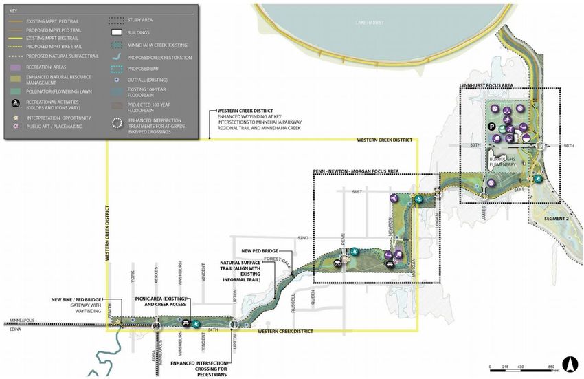
park system, create space for heritage and holiday celebrations, and increase awareness of formerly
unfamiliar parks and trails so that people are comfortable visiting on their own in the future.
Development Concept
The Regional Trail is divided into four segments for planning purposes. Additional detail about each
segment, as well as focus areas within those segments, is included below.

Segment 1
Segment 1 is the westernmost section of the regional trail, extending from the border of Minneapol is
and Edina at Zenith Avenue to Lynnhurst Park and north to Lake Harriet, along the tributary between
the lake and the creek (Figure 4). Segment 1 has two focus areas:
   •   Penn-Newton-Morgan
   •   Lynnhurst
This segment is unique in that it is not bounded by the parkway road and lacks paved trails for the
majority of its length. Instead, Minnehaha Creek winds past backyards and a somewhat disconnected
grid of residential streets for much of this segment. Without the parkway’s visual proximity or the
coherent network of crossings and access points elsewhere in the corridor, Segment 1 lacks legibility
as a public park. No additional acquisitions are planned in this part of Segment 1.
The plan for Segment 1 responds to its lack of legibility or formal trail network by implementing a
broader “Western Creek District” intended to improve wayfinding, promote access, and increase use of
this segment. The District is bounded by Morgan Avenue on the east, Zenith Avenue o n the west, 54th
Street on the south, and 50th Street on the north.
The Western Creek District will provide enhanced wayfinding on city streets, sidewalks, and bikeways
to Minnehaha Parkway Regional Trail and Minnehaha Creek at key intersections.
Entry points to the Western Creek District’s trail network will be defined by signage, wayfinding kiosks,
and trailhead amenities like bike parking where active recreation or natural surface trails are present.
New creek access points for paddling or tubing are proposed at 54th Street and Vincent Avenue, east
of Penn Avenue, at Morgan Avenue south of 51 st Street, and near the realigned Minnehaha Parkway
intersection south of Lynnhurst Park.
A new waterside lounge and picnic area is proposed north of the Creek near Newton Avenue. Active
recreation in this segment consists of tennis at the Morgan Avenue tennis courts, sledding on the hill at
51st and Newton, and traditional neighborhood park activities at Lynnhurst Park and Burroughs
Elementary School.
No new active recreation is proposed in Segment 1, except at Lynnhurst Park.
Segment 1 where Penn Avenue meets the Creek is one of the most essential locations for flood
mitigation within the corridor. Opportunities for creek re-meanders around Penn and James Avenues,
repair of storm sewer outlets and overland flumes (most of which are in very poor repair), and the
construction of best management practices (BMPs) will all contribute to increasing habitat, gaining flood
storage, and improving water quality in Segment 1.
At the Lynnhurst Focus Area, the existing culvert carrying the tributary from Lake Harriet across 50th
Street to the Creek is undersized and contributes to flooding problems near 49th Street. The master
plan proposes daylighting and re-meandering the tributary from Lake Harriet.

Page - 7 | METROPOLITAN COUNCIL
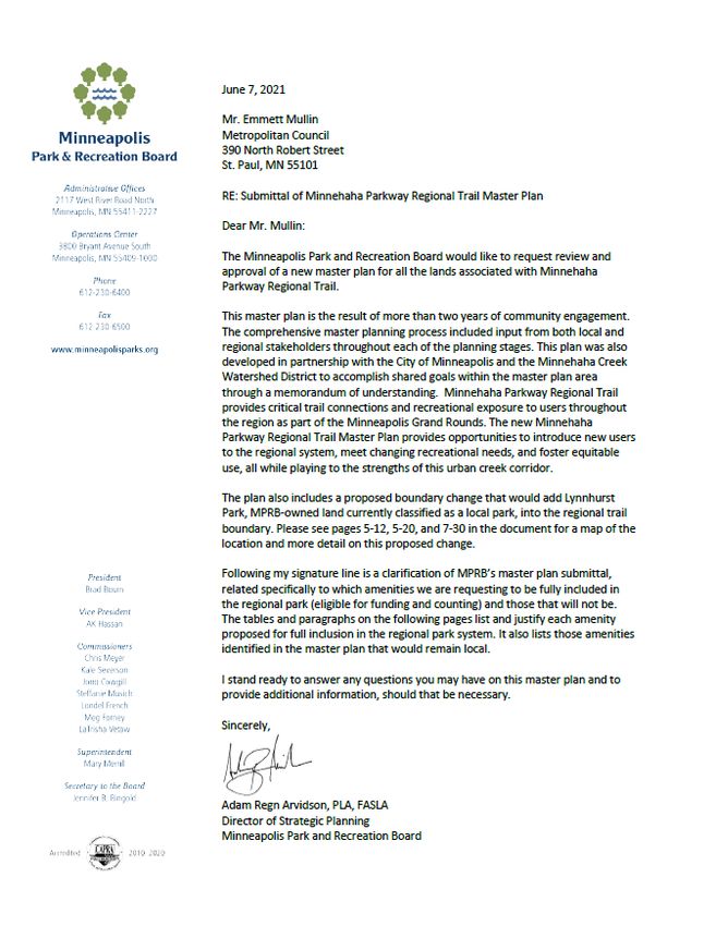
Figure 4: Segment 1 (MP Fig. 5.8)

Page - 8 | METROPOLITAN COUNCIL
Segment 1 – Penn-Newton-Morgan Focus Area
The area between Penn and Logan Avenues represents a transitional space for Segment 1 and the
creek corridor as a whole, as it moves from the isolated network of natural surface trails at its western -
most edge to the new paved trail that is the recognizable regional trail route east of Morgan. In order to
make up for the lack of accessible trails here, the proposed Penn Avenue Interpretive Overlooks will
provide exceptional views and a visual connection to Minnehaha Creek for those unable to use the
natural surface paths.
The area around the Morgan Avenue bridge will include bike parking for those who wish to con tinue
west on foot, and wayfinding for those hopping on or off of the paved Minnehaha Parkway Regional
Trail. When this project is initiated, trail route options between Morgan and Logan will be considered in
detail before a trail is constructed.
Additional improvements proposed include the addition of a shelter and picnic area along the creek
where players and onlookers can relax, and a nature play area, which fills a service gap in the
recreation system.
The area around Penn Avenue is a prime location for stormwater management. West of Penn, a
braided channel restoration will increase flood storage, while east of Penn, a stormwater BMP and
creek re-meander will help treat 230 acres of stormwater runoff, reduce the volume of water entering
the creek directly from pipe outfalls, and slow flow velocities, while creating habitat.
An existing concrete spillway between Newton and the creek is proposed to be replaced with a multi -
cell, stormwater runoff BMP, which will detain and treat runoff rather than discharging it immediately
into the creek untreated.
Segment 1 – Lynnhurst Focus Area
This focus area is unique because Lynnhurst Park is a neighborhood park, and was planned jointly as a
part of the Southwest Service Area Master Plan (Figure 5). As noted in the Background, the master
plan includes a proposed boundary change that would add Lynnhurst Park into the regional trail
corridor boundary.
Lynnhurst Park and its surrounding neighborhoods are very vulnerable to flooding. The park offers the
most available space to store floodwater, but is also beloved for its field recreation offerings. The joint
planning process resulted in a flexible rearrangement of Lynnhurst’s fields and courts and the proposed
integration of underground water storage, which will maintain space for multi-use diamonds and
hockey. Active uses are grouped safely out of the floodplain while land along the tributary is reclaimed
for restored habitat and floodable passive recreation.
The master plan proposes a reconnection of park function and ecology, relinking Lynnhurst Park and its
community center by moving the building north of 50 th Street, and daylighting the tributary by
constructing a new raised bridge at 50 th Street in order to accommodate the channel and bike and
pedestrian trails underneath.
ADA-accessible paved trails are proposed throughout this focus area, including along 5 1st Street, where
there are none currently. This area also includes an accessible fishing pier and water access.
Paved pedestrian trails are separated from bike trails throughout the Lynnhurst Focus Area. A new
pedestrian bridge south of Burroughs Elementary allows the primary pedestrian route to remain along
the west side of the tributary for easy access to recreational amenities at Lynnhurst Park. A new
pedestrian bridge over the tributary provides access to the Community Center from 50th Street.

Page - 9 | METROPOLITAN COUNCIL
Bike trails generally remain on the east side of the tributary. A new bike bridge is proposed on the north
side of the project area to facilitate this.
Lynnhurst Park has the westernmost ADA-accessible creek access in the project area. Located just
downstream of the tributary’s confluence with the creek, the launch will have sidewalk access from
nearby ADA parking spaces along Minnehaha Parkway.
The new community center will function as a recreation and activity hub along Minnehaha Parkway
Regional Trail. The facility is proposed to have an environmental learning focus, which leverages its
location next to the tributary as an educational tool that will enable visitors to learn about the challenges
and wonders of urban ecology.
Segment 2
Segment 2 runs from Lynnhurst Park to I-35W and is fully bounded by Minnehaha Parkway roads
(Figure 5). It is surrounded by residential homes and has one focus area – “Nicollet Hollow” – between
Girard Avenue and Minnehaha Parkway east of Nicollet Avenue.
The master plan for Segment 2 focuses on maintaining the natural feel of the trail network, while
improving access and safety for trail users. Where possible, the MPRB separates bike and pedestrian
trails throughout the segment.
The MPRB reroutes many of the trails in Segment 2 in order to accommodate stormwater BMPs and
restored meanders along Minnehaha Creek, interventions that add flood storage and are intended to
reduce the frequency and duration of inundation. In order to maintain passage during flood conditions,
alternate trails are made available on higher ground where possible.
MPRB proposes two new creek access points, one on the north side of the creek between Garfield and
Harriet, and another east of the Nicollet Avenue underpass, which will be ADA-accessible.
According to the plan, new path connections around 51st Street should be designed to maintain access
to the existing sledding hill in the winter. Other trail additions, including boardwalks and interpretive
overlooks, will supplement the trail network and offer better access to natural resources and wildlife
viewing.
A proposed picnic area in the knoll between the Minnehaha Parkway roads near Valleyview Drive offers
a peaceful creekside gathering place.
Segment 2 – Nicollet Focus Area
ADA-accessible paved trails are proposed throughout this focus area. Nicollet Hollow also includes the
regional trail’s central ADA-accessible water access.
The Nicollet Focus Area is the only area where new active recreation is proposed. This area is a key
rest stop between existing trail amenities at Lynnhurst Park and Nokomis-Hiawatha Regional Park, and
will have water, a restroom enclosure, seating, and picnic tables, in addition to the ADA-accessible
water access. Nature-themed play features and public art will enliven the space and mark the area as a
worthwhile trail stop.
Pedestrian trails are separated from bike trails throughout the Nicollet Focus Area. New segments of
pedestrian trails respond to a re-meandered creek alignment and are moved farther from the creek in
order to avoid flooding. A segment of the bike trail is relocated closer to the lower Parkway road, in
order to remain outside of the floodplain and make room for creek restoration. Bike parking and multi -
modal options should be made available at Nicollet Hollow as part of the activity area.

Page - 10 | METROPOLITAN COUNCIL
Figure 5: Segment 2 (MP Fig. 5.11)

Page - 11 | METROPOLITAN COUNCIL
The reconstruction of the Nicollet Avenue underpass presents a unique opportunity to integrate play as
part of the bridge. A bouldering course fits the theme of nature-based active recreation and would offer
a no-cost introduction to climbing as the sport gains popularity. MPRB is also considering swings,
creative lighting, and public art in the bridge’s design to make the underpass more welcoming and
enhance the recreational potential of Nicollet Hollow in addition to holding traffic above.
Situated at a mid-point between Lynnhurst Park and Nokomis-Hiawatha Regional Park, Nicollet Hollow
is an ideal location for comfort amenities and gathering space. Picnic tables, seating, drinking water,
and a restroom enclosure will all be available. In the event of inclement weather, the bridge will provide
trail users with some temporary protection from the elements.
Segment 3 – Overall
Segment 3 runs from I-35W to Cedar Avenue (Figure 6). West of Park Avenue, it is predominantly
bounded by Minnehaha Parkway roads, while east of Park Avenue Minnehaha Parkway runs along the
north side of Minnehaha Creek. The segment is surrounded by residential homes, and there is a small
commercial node at Cedar Avenue where Minnehaha Parkway Regional Trail enters Nokomis-
Hiawatha Regional Park. Segment 3 has one focus area, referred to as “Portland and the Parkway”
near the iconic bunny sculpture.
To promote safety, the MPRB is recommending intersection improvements at many locations. Specific
interventions will be determined in the detailed design phase.
A one-block segment of MPRB-owned frontage road is proposed to be removed west of Cedar Avenue.
This road is used as a cut-through for vehicles, but is otherwise functionally redundant from a traffic
standpoint. Removal of this excess impervious surface to make way for a stormwater BMP that will
provide water quality and flood benefits.
Proposed intersection enhancements include features like larger landings for queueing, mode
separated crosswalks, and signal timing adjustments that will make biking and walking Segment 3 safer
and more convenient.
Additions to the trail network include a new bridge near 10th Avenue that will connect bike and
pedestrian paths to a proposed water access point on Minnehaha Creek. A proposed bike tunnel
beneath Cedar Avenue will allow grade-separated crossing of the busy county road into Nokomis-
Hiawatha Regional Park, eliminating the need to cross at a high-conflict intersection.
A proposed picnic ground on the north side of the creek at 16th Avenue will provi de restroom and water
access to support the active recreational uses around the Bloomington Activity Node. These include a
sledding hill, four new pickleball courts that will replace the existing tennis courts, and a new course of
single-track bike trails between 12th and 16th Avenues, on the south side of Minnehaha Creek.
Segment 3 – Portland and the Parkway Focus Area
ADA-accessible paved trails are proposed throughout this focus area.
This section of Segment 3 has the corridor’s most complicated roadway network. As a cross-town pinch
point, it experiences a lot of congestion at peak hours and can feel unsafe no matter which mode of
travel one prefers. Proposed medians at Portland Avenue and conversion of the Parkway’s frontage
roads to opposing one-ways endeavors to restrict the cut-through traffic that plagues this area during
rush hour.

Page - 12 | METROPOLITAN COUNCIL
Figure 6: Segment 3 (MP Fig. 5.13)

Page - 13 | METROPOLITAN COUNCIL
West of 50th Street, bike and pedestrian trails are proposed to be rerouted in order to make room for a
creek re-meander and maintain mode separation. Intersection realignment, vegetation management,
and the addition of stop signs will greatly improve safe crossing of Minnehaha Parkway and 50th Street.
A new creekside overlook at Park Avenue provides a welcoming feature for visitors entering the trail
from the north. A revitalized rest area at “The Bunny” will be fortified with permeable pavers, and offer
working drinking water, seating, bike racks, and picnic tables for visitors. South of 50t h Street on the
west side of the creek, a new picnic grounds will provide inviting views of a newly restored braided
channel.
Segment 4 – Overall
Segment 4 runs from the border of Nokomis-Hiawatha Regional Park at 28th Avenue to 39th Avenue S
(Figure 7). This segment is unique because the parkway roads form a boulevard south of Minnehaha
Creek, while the regional trails run along the creek itself. The two prongs connect at the blocks around
34th Street, but pockets of residential homes keep the parkway and trails separate elsewhere in the
segment.
The trail network generally remains the same, except where existing trails are relocated to make room
for creek re-meanders or stormwater BMPs, as is the case between 28th and 30th Avenues, and
between 36 th and 39th Avenues.
From a water access perspective, the final takeout before Minnehaha Falls is located just south of the
Minnehaha Parkway bridge east of 39th Avenue. It is proposed to be converted to an ADA-accessible
water access with available on-street parking, a new curb ramp, and an accessible path.
Segment 4 currently has several underutilized tennis courts that are in poor condition. In order to
diversify recreation offerings here, the westernmost court is proposed to be removed and converted to
an open pollinator play lawn, the courts at 32nd are slated to be repaired, and the courts at 34th are
proposed to be converted into a bike skills park.
The master plan proposes the addition of a Storywalk, which will connect Nokomis -Hiawatha Regional
Park to Longfellow Gardens. The new natural surface trail will provide a more direct route between
Lake Nokomis Recreation Center and Minnehaha Regional Park, and offer a unique interpretive
program along the way. For cyclists, protected bikeways will be installed on Minnehaha Parkway to
connect the two parks.
The proposed Storywalk will provide a place where traditional foods and medicines, and other native
plants can ground visitors in a facet of Dakota culture that is rooted in the land. Here, indigenous artists
can create and showcase artworks, and choose to speak to culture in their own way .
Conflicts
Uncontrolled intersections, where vehicles are not required to stop at stop signs or traffic lights, can
pose a barrier for trail users. Crosswalk markings, signage, and sometimes flashing lights indicate
where trail users have the right-of-way, but for families with children walking or biking together,
intersections like this present a concern. There are a number of intersections that require trail users to
trust that vehicles will see them and yield right of way.
Busy intersections like those around 50 th and Portland are cited by residents and trail users as a
particular concern, as drivers are often in a hurry to make a turning movement and do not stop ahead of
a trail crossing, or fail to take the time to look for trail users.
Public input also underscored the general desire for separate bicycle and pedestrian paths, to reduce
the potential conflict between dog walkers and bicyclists.

Page - 14 | METROPOLITAN COUNCIL
Figure 7: Segment 4 (MP Fig. 5.15)

Page - 15 | METROPOLITAN COUNCIL
Public Services
The plan identifies many intersections that would benefit from improvements to increase safety for all
modes moving through the regional trail corridor. Recommendations include:
    •   Improve safety at intersections, especially where the trails cross roadways, through the use of
        innovative signage and wayfinding information, and provide facility upgrades like:
            o High visibility, mode-separated striping at crosswalks
            o Forward stop bars at all stop signs
            o Curb extensions
            o Signage alerting drivers of trail crossings
            o Speed tables/raised intersections
            o Limited or prohibited right turns for vehicles
            o Pedestrian/bicycle signal timing standards
    •   At roadway crossings of the trail, widen curb ramps, and expand waiting area to accommodate
        increased queuing at intersections.
    •   Visibility of trail users from roadways at intersections is a priority. Avoid siting new elements
        that obstruct drivers’ vision of trail users and ensure vegetation is trimmed to maintain views.
MPRB, Minnehaha Creek Watershed District (MCWD), and the City of Minneapolis will continue to
coordinate on stormwater infrastructure and opportunities to implement BMPs.
Additionally, MPRB has identified as essential continued communication between MPRB, MCWD, and
the City of Minneapolis’ Public Works Department about planned capital improvement projects. The
Plan includes the following recommendations:
    •   Examine existing stormwater outfalls and overland flumes and schedule repair and
        replacement. Utilize BMPs suited to the existing conditions, water volume, and location.
    •   Daylight the buried section of tributary between Lake Harriet and Minnehaha Creek.
    •   When repairs to existing infrastructure are planned or new projects are designed, assess t he
        feasibility of water and sewer connections to provide additional drinking fountains and/or
        restroom facilities.
    •   Limit views of electrical transformer boxes and other utility infrastructure via considerate site
        selection, burying, camouflaging, or otherwise screening from view in order to maintain a natural
        aesthetic along the corridor.
    •   Design new bridges over the Creek to minimize debris and ice buildup, and to maintain safe
        passage beneath for paddlers.
Partner Engagement
The master plan was created through a joint effort between MPRB, MCWD, and relevant departments
at the City of Minneapolis. Implementation will need to occur with continued collaboration with all
relevant agencies. As the owner and operator of the regional trail, MPRB will take a lead i n coordination
efforts. Projects that involve direct impact of the creek and stormwater, daylighting of new waterways,
changes to permeable surfaces, and addition of creek access points will require coordination with
MCWD. Where implementation involves re-alignment of local roadways, curb and gutter improvements,
signage and wayfinding installation, and stormwater outlet improvements, the City of Minneapolis will
serve as a collaborator or project lead. Projects involving county roadways, or transit service will require
coordination with Hennepin County, Metro Transit, adjacent municipalities, and the Metropolitan
Council.

Page - 16 | METROPOLITAN COUNCIL
In order to accomplish an efficient and comprehensive stacking of functions within the space of the
parkway, which falls within several jurisdictions, MPRB, MCWD, and the City of Minneapolis
established a Memorandum of Understanding (MOU). Approved in 2017, the MOU outlines how the
agencies will work together to achieve the following goals:
• Enhancing the ecological and recreational opportunities of the creek corridor
• Reducing flooding
• Achieving regional pollutant load reductions identified in Total Maximum Daily Loads (TMDLs)
• Reducing runoff volumes and peak flows to Minnehaha Creek
• Eliminating combined sewer outflows
Public Engagement and Participation
Community engagement for this planning process began in the spring of 2018 and continued through
the approvals process and plan completion. The overall engagement goal for the project was to be
collaborative with as many stakeholder groups as possible. This means that the design team and
MPRB staff worked directly with stakeholders throughout the process to ensure that perspectives were
consistently understood, considered, and reflected in project decisions.
In order to achieve these goals, the project process involved a variety of means of gathering community
input from a wide variety of events and methods. Those methods included a series of kick-off open
houses and attendance at 23 community events throughout much of 2018. Participants were invited to
provide feedback on things they like and where they had concerns, and to share their ideas for the
future. Efforts were made to range farther afield of the creek itself, to ensure participation by those not
in close proximity. This also brought more racially and ethnically diverse voices into the process
because the neighborhoods along the creek tend to be less diverse. In total, hundreds of comments
were collected over the course of these events.
A web survey was launched during the same time. The intention of the survey was to gather broad
community feedback on ideas, concerns, and missing activities and programs along Minnehaha Creek.
252 people participated.
“Social Pinpoint,” a web-based map platform, was also used throughout much of 2018. Like other
engagement activities, participants were able to call out items that were working, share ideas, and
voice concerns by placing a variety of icons on a map and providing additional comments. 327
comments were collected.
Four common themes emerged from early engagement including trail quality, roadways, natural
resources, and programs/facilities. Some of the feedback included:
• Separate trails for bikes and pedestrians throughout
• Street level bump-outs, leading pedestrian intervals, and separate crossing signals for bikes and
pedestrians were common suggestions at nearly every intersection
• Concern above invasive species, especially buckthorn, along the creek
• Improved path lighting throughout the trail corridor was frequently suggested
Additional community open houses, meetings, and web surveys were used in 2019, along with a project
team design charette, creek tours with youth, and a traffic study.
A Community Advisory Committee (CAC), comprised of 19 community members, provided guidance
and support for the master plan. Committee members were appointed by MPRB Commissioners, City
Council members, and neighborhood groups. MCWD was also asked to appoint a CAC member . The
Page - 17 | METROPOLITAN COUNCILCAC members were intended to represent a mix of viewpoints that includes residents, park users,
stakeholder groups, and others.
The CAC met three times in 2018, seven times in 2019, and twice in 2020. CAC meetings were open to
the public with time allotted for public comment. All meeting minutes are located on the project website,
and summaries of feedback and meeting minutes are located in the appendix of the master plan .
A 45-day comment period began on June 19, 2020 and concluded on August 17, 2020. At the close of
the public comment period, MPRB staff compiled and reviewed all comments. Recommendations for
modifications to the document were reviewed by the project team and revisions were completed. A
public hearing was conducted and the final plan was presented to the Board of Commissioners for
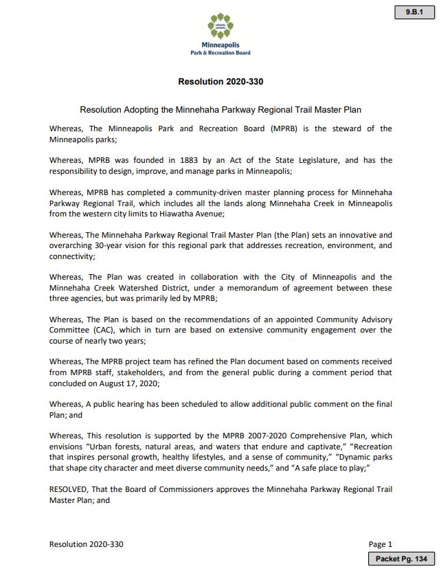
approval on November 18, 2020.
Equity Analysis
Project Data
The following local and regional stakeholders were identified early on and confirmed throughout the
planning process through demographic information gathered through surveys and in -person
engagement events. These stakeholders represent the primary user stakeholders for the regional park.
There is significant overlap between these stakeholders, as the high number of regional park users and
potential users encompasses a wide and broad demographic. In the case of Minnehaha Parkway
Regional Trail, the most underserved stakeholders are likely those that are not frequent users or nearby
residents.
Local Stakeholders
• The majority of residents in immediately adjacent neighborhoods are aged 40 -64 years old.
Census block data shows that approximately 35-45% of residents within 2 miles of the Creek
Corridor fall within this age range.
• Residents in immediately adjacent neighborhoods to the Creek Corridor report lower
percentages of disabilities than other areas of the city of Minneapolis.
• Adjacent neighborhoods to the Creek Corridor show some of the lowest levels of racial or ethnic
diversity in the city, with the majority (70-95%) reporting as White/Caucasian.
• While the population immediately adjacent to Minnehaha Creek is primarily older residents, the
number of youths (under 18 years old) who live further away from the Creek (between 3-4
miles) is higher (30-40%).
• Youth in the Powderhorn, Phillips, North Minneapolis, and Northeast Minneapolis
neighborhoods tend to live in lower-income households (0-20th percentile income levels),
versus residents immediately adjacent to the Creek (80-100th percentile).
• The above-mentioned neighborhoods are far more diverse than other parts of the city, with the
highest concentration of all other races other than white. A significant (42 -46%) number of
Hispanic residents live in the Phillips neighborhood and a significant number of Black residents
live in Near North/North Minneapolis (39-67%).
• Through the Mapping Prejudice project, we know that the areas surrounding Minnehaha Creek
had some of the highest levels of racial covenants, when compared to other parts of the city .
The area around the Creek benefitted from the practice of redlining, as most of this area was
rated as ‘best’. Contrasting diversity in other areas of the city, such as in Powderhorn and the
Phillips neighborhood, are reflective of how these covenants have influenced generations of
potential inequities over time throughout the City.
Page - 18 | METROPOLITAN COUNCILRegional Stakeholders
• Just outside of the 2-mile service area, there are increased numbers of residents who report
disabilities (20-24%), which appears to correspond to a higher number of senior housing
developments. People who experience disabilities tend to rely more on public transportation and
non-motorized modes for transportation and recreation.
• Minnehaha Parkway Regional Trail has some of the highest bike and pedestrian user counts in
the entire city, with an estimated daily bicycle traffic of 1,090 riders and an estimated daily
pedestrian traffic of 650 pedestrians (2016, City of Minneapolis).
• Within the 3–4-mile area surrounding Minnehaha Creek, the income levels of residents tend to
be much lower than the neighborhoods immediately along the creek. People with less money
tend to rely more heavily on public transportation and non-motorized modes (biking, walking).
Public Engagement and Participation
Of the primary stakeholder groups identified, two of the three could be categorized as underserved:
Youth in Other Parts of the City and Non-motorized Transportation and Recreational Trail Users.
Engagement for the regional trail master plan was conducted at a number of scales and with a broad
and targeted approach to understand ideas, feedback, and concerns of all interested stakeholders.
Youth Engagement
The main method for engaging with youth who live in other parts of the city was conducted through
creek tours with middle and high school age youth during the summer of 2019. General topics
surrounding inclusion, access, stewardship, and outdoor recreation were discussed, and in-process site
concepts were shared with the youth with feedback collected.
According to the International Association for Public Participation (IAP2) Spectrum, the role that this
stakeholder group played in the development of the master plan ranged from Consult to Involve.
Some of the higher-level themes that emerged from youth who live in other parts of the city included:
• In general, youths expressed an experience of calm, quietness, and serenity while touring
Minnehaha Creek.
• The outdoor environment presented a new experience for many youths, with responses ranging
from discomfort to enthusiasm and curiosity.
• In general, youths expressed a frustration that there weren’t very many amenities or features
that were relatable to them within the park.
• Some youths expressed discomfort in the park, not feeling that it was designed or meant for
their use.
Non-Motorized Trail User Engagement
There were a variety of methods for gathering input from non-motorized trail users as this stakeholder
group is more spread out throughout the region and represents a wider variety of ages, abilities, and
preferences.
According to the International Association for Public Participation (IAP2) Spectrum, the role that this
stakeholder group played in the development of the master plan ranged from Consult to Collaborate.
Some of the higher-level themes expressed by the non-motorized trail users included:
• General desire for separated trails for slower trail users (e.g., pedestrians) and faster trail users
(e.g., bicyclists).
• This group quickly identified a number of high-conflict intersections in the planning process,
which influenced much of the scope of the master plan and subsequent recommendations.
Page - 19 | METROPOLITAN COUNCIL• Minnehaha Parkway Regional Trail is a heavily used corridor by non-motorized users for both
transportation and recreational purposes. This use should continue in to the future with more
attention paid to sustainable trail design and location of areas that are frequently flooded.
• A variety of facility types and experiences are desired, such as skills courses for young
bicyclists, single-track mountain biking, and natural surface hiking trails.
Evaluation Summary
The master plan is the result of a robust public participation process that occurred at a variety of scales
over the course of more than two years. The most prominent results of equitable engagement in the
master plan focus on accessibility and race/ethnicity. With regard to accessibility, one key feature is the
system of accessible canoe and kayak launches at three locations in the corridor. Another accessibility
enhancement is the extension of trails farther west in the corridor.
Specific desires for Black, Indigenous and People of Color (BIPOC) community members were harder
to come to understand in the project. According to MPRB, it was thought the generally low participation
by those identifying as BIPOC was because of the location of the corridor and because of the series of
high-energy and contentious meetings that took place during the summer of 2019. Despite efforts made
by the CAC, MPRB staff , and consultants, the master plan notes that these meetings were not
welcoming places for anyone not interested in talking about the roadway itself. The meetings were
overwhelmingly dominated by those that live along or very close to the corridor , an area that is not
demographically or economically diverse. Staff’s work with city-wide youth at this time was a
counterpoint to those meetings. The direct outcome of this engagement responds to the mostly BIPOC
youth’s frustration about a lack of relatable amenities in the regional trail corridor. The new recreation
facilities in the Nicollet Focus Area specifically address this concern.
Ongoing implementation of the master plan will require continued engagement. MPRB intends to reach
beyond the corridor itself when engaging around detailed design projects.
Public Awareness
As MPRB implements projects as funding becomes available, neighborhood organizations and
identified stakeholder groups will be engaged by the MPRB to complete the next level of design
development or construction. Projects and general outcomes are identified in this master plan that
demonstrate these ideas. As conditions change over the years, some items that seemed like a priority
during the master planning process may be replaced by more immediate needs to address, and further
detail will need to be determined for implementation of any of the projects identified.
Community engagement will continue to follow the equity standards set forth by MPRB in the
Community Engagement Policy, which embeds the use of a racial equity toolkit into the community
engagement plan required for every project. Approaches may involve convening neighborhood focus
groups or committees, hosting pop-up or open houses, or gathering feedback through online
engagement.
Today, public awareness of existing facilities and services is communicated through the MPRB website,
posted on MPRB kiosks along Minnehaha Parkway and throughout the Grand Rounds, and through
gateway and trail signage. Programs are communicated through similar methods. Future
implementation of wayfinding improvements as planned for the Western Creek District and for new
activity areas will be designed further with community/neighborhood input and in coordination with the
City of Minneapolis and local affected agencies. Collaboration with Metro Transit will continue to occur
to raise awareness along bus routes that intersect Minnehaha Parkway.
Page - 20 | METROPOLITAN COUNCILAccessibility
The Minnehaha Parkway Regional Trail Master Plan provides an ADA-accessible trail throughout the
length of segments 2-4. ADA-accessible paved trails are proposed in Segment 1 where they do not
currently exist. At Penn Avenue in Segment 1, overlooks are proposed on the bridge in order to offer a
safe and convenient place to take in the views up and down Minnehaha Creek. Recommendations
include:
• Provide alternative ways to experience the Creek corridor in areas where only natural surface
trails exist or where trails cannot be made universally accessible.
• Employ design cues to clearly mark all transitions to non-accessible trails.
• Include information on trail maps and signage about trail slope and surface, as well as alternate
accessible routes, loops, entrances, and exits.
• As intersections get safety upgrades, adjust crossing to be more accommodating of all users
through proper alignment of curb ramps, adequate landing areas, and tactile warming strips for
wheelchair users and the visually impaired.
• Locate pedestrian signal buttons so that they are reachable by wheelchair users, no higher than
42” from the ground.
In addition to trail standards, the master plan includes recommendations for accessible seating
intervals, drinking water, restrooms, ADA-accessible creek launches.
Stewardship Plan
MPRB and MCWD will continue to serve as partner agencies to manage the creek corridor. Trail,
facility, and grounds maintenance will continue to be the responsibility of MPRB, through the direction
and operation of the MPRB Environmental Stewardship Division.
Today, there are active neighborhood groups, bicycle and pedestrian advocacy groups, and natural
resource stewards that are working to advance their special interests along the creek corridor. MPRB is
committed to working alongside these groups to promote volunteerism, outreach, and support equitable
access to the resources provided through the Regional Trail corridor.
Natural Resources
The area surrounding Minnehaha Creek as it flows through Minneapolis has been under development
for over a century. The creek’s course, while disturbed, is generally stable and has decent grade
control. The flow of the creek is influenced by the discharge at Gray’s Bay Dam, although a majority of
the creek’s flow in Minneapolis is also attributed to watershed runoff. Extensive land development and
impervious land cover, coupled with far-reaching storm sewer pipe-shed, direct large volumes of water
into the creek very quickly, resulting in fluctuating flows that contribute to erosion and sediment
deposition within the project area.
Within the Minnehaha Creek corridor, the channeling of the stream, loss of wetlands, corridor
fragmentation and increasing levels of impervious surfaces have disrupted the fluvial processes of the
creek. This has increased runoff volumes and pollutant loads, decreased infiltration and baseflow, and
fragmented and degraded habitat. All of these changes have negatively impacted the ecological
integrity of Minnehaha Creek and its riparian system. As a result, M innehaha Creek is listed by the
Minnesota Pollution Control Agency (MPCA) as an impaired water body for multiple parameters.
Further, due to the sediment and nutrient loads transported by Minnehaha Creek, the MPCA has listed
Lake Hiawatha as impaired for excess nutrients and along with the creek itself, has an approved Total
Maximum Daily Load (TMDL).
Page - 21 | METROPOLITAN COUNCILThe project area is largely covered with deciduous tree canopy over turf or mixed shrub understory. More densely vegetated areas are typically found along the banks of the creek, where roots help to hold the shoreline in place. The Minnesota County Biological Survey shows no remaining natural communities, rare species, or sites of biodiversity significance in the project area. Still, Minnehaha Creek functions as a valuable habitat corridor and is a Minnesota Department of Natural Resources-designated conservation corridor for birds and other urban wildlife. Assessments of fish communities along the creek consistently return classifications of degraded and poor, indicating stream disturbance and lack of conditions that support healthy riverine fish communities. The overall strategy for protecting the water quality within Minnehaha Creek is to reduce pollutant loading and stormwater runoff volume from the landscape. Stormwater management will focus on reducing runoff volumes and rates as well as reducing pollutant loading from runoff -producing rain events. Investments in BMPs at select locations along the regional trail have the potential to significantly improve the ecological function of the creek corridor and the flood resilience of surrounding neighborhoods. MPRB, MCWD, the City of Minneapolis, and other public agencies will continue to study surface water, groundwater, and their interactions with each other across the City and the broader watershed. Consistency with Other Council Policies and Systems Community Development – Forecasts (Todd Graham, 651-602-1322) – The Park Board has identified that the current Master Plan includes park visitation estimates and connects that to the forecasted population growth rate. Further, the Park Board discusses expected aging of the population and changing trail user needs (page 3.32). Council staff concur with this demand assessment. Community Development – Housing (Hilary Lovelace 651-602-1555) – The Minnehaha Parkway Regional Trail Master Plan is consistent with the Council’s 2040 Housing Policy Plan. The plan doesn’t require the acquisition of private residential land that could impact housing. Within a half-mile of the trail there are at least six affordable housing developments serving various household income levels at or below 30-80% of Area Median Income. The proposed trail would directly affect various populations living in these developments—many residents have families with children, are seniors, live with disabilities, and/or need supportive services at their residence. The public engagement process detailed in the plan seemed to rely on youth engagement to reach anyone other than long-time white homeowners for perspectives on the project. Residents of affordable housing nearby were not explicitly listed as a target audience in engagement or the equity analysis. Community Development – Solar Energy and Natural Resources (Cameran Bailey, 651-602- 1212) Regarding the plan’s Infrastructure Recommendations for Stormwater, Council staff recommend coordinating with the stated partners of the Creek’s three-agency partnership (MPRB, Minnehaha Creek Watershed District, and the City of Minneapolis) to address upstream stormwater management practices impacting Minnehaha Creek to complement the stated Infrastructure Recommendations. Examples include an integrated network of native vegetated bioswales within residential boulevards, integrated residential and commercial rain barrels, integrated front lawn conversions into native Page - 22 | METROPOLITAN COUNCIL
vegetated bioswales, commercial and multi-family residential applications of green roofs, sub-grade
retention and filtration chambers for roadways, etc.
Council staff also recommend as part of future planning efforts that the MPRB consider strategically
acquiring properties adjacent to the creek for wildlife and habitat restoration and transportation
connectivity improvement as an additional strategy.
Environmental Services – Sewers (Roger Janzig, 651-602-1119) – The Minneapolis Park and
Recreation Board has submitted the Minnehaha Parkway Regional Trail Master Plan for review. The
construction of any new or updating of existing paths, trails, bridges, or any other construction project
may have an impact on multiple Metropolitan Council Interceptors in multiple locations. To assess the
potential impacts to our interceptor system; prior to initiating any project, preliminary plans should be
sent to Tim Wedin, Interceptor Engineering Assistant Manager (651-602-4571) at the Metropolitan
Council Environmental Services.
Portions of Metropolitan Council Interceptors (1-MN-344 and 1-MN-345) are within Minnehaha Park.
The interceptors were built in 1928 and 1929 and are 33-inch and 30-inch Vitrified Clay Pipes with
Cured In Place Pipe linings. There are specific processes that must be followed before encroachment
on Metropolitan Councils assets can occur. Before activities near our assets can occur, copies of the
preliminary plans related to the proposed project need to be submitted to Tim Wedin, Interceptor
Engineering Assistant Manager (651-602-4571) at the Metropolitan Council Environmental Services for
review to assess the potential impacts to our interceptors.
A portion of Metropolitan Council Interceptor 1-MN-345, near the intersection of Girard Avenue South
and Minnehaha Parkway West, is deteriorated and needs rehabilitation. To rehabilitate the pipe and
maintain existing capacity, the Council is restricted to removing and replacing the pipe, coating it, or
installing a cured in place pipe (CIPP) liner. All these methods require temporary conveyance of
wastewater around the pipe segment being rehabilitated.
The Metropolitan Council Environmental Services will be working with the Minneapolis Park and
Recreation Board to coordinate the two projects.
Environmental Services – Water Resources (Joe Mulcahy, 612-913-8864) –The Master Plan is
comprehensive and ambitious. It appears to be accurate and complete in regards to water resources,
and potential water resource impacts appear to be addressed. Full implementation of the projects in the
Plan could improve existing water resource issues in the area.

Page - 23 | METROPOLITAN COUNCIL
Attachment 1: MPRB submittal letter, page 1 of 6

Page - 24 | METROPOLITAN COUNCIL
Attachment 1, continued: MPRB submittal letter, page 2 of 6

Page - 25 | METROPOLITAN COUNCIL
Attachment 1, continued: MPRB submittal letter, page 3 of 6

Page - 26 | METROPOLITAN COUNCIL
Attachment 1, continued: MPRB submittal letter, page 4 of 6

Page - 27 | METROPOLITAN COUNCIL
Attachment 1, continued: MPRB submittal letter, page 5 of 6

Page - 28 | METROPOLITAN COUNCIL
Attachment 1, continued: MPRB submittal letter, page 6 of 6

Page - 29 | METROPOLITAN COUNCIL
Attachment 2: Resolution 2020-330, page 1 of 2

Page - 30 | METROPOLITAN COUNCIL
Attachment 2, continued: Resolution 2020-330, page 2 of 2

Page - 31 | METROPOLITAN COUNCIL
You can also read