National Parks and Wildlife Service - Office of Environment and Heritage Proceedings - CiteSeerX
←
→
Page content transcription
If your browser does not render page correctly, please read the page content below

National Parks and Wildlife Service
                      Office of Environment and Heritage

Southern Ranges Regional Advisory Committees’ Conference
          Tumut Bowling Club & Kosciuszko National Park
                               11 – 13 November 2011

                                   Proceedings

 Photos Taken By David Moore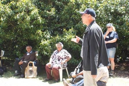
Published by:
Office of Environment and Heritage
59 Goulburn Street, Sydney NSW 2000
PO Box A290, Sydney South NSW 1232
Phone: (02) 9995 5000 (switchboard)
Phone: 131 555 (environment information and publications requests)
Phone: 1300 361 967 (national parks, climate change and energy efficiency information, and publications
requests)
Fax: (02) 9995 5999
TTY users: phone 133 677 then ask for 131 555
Speak and listen users: phone 1300 555 727 then ask for 131 555
Email: info@environment.nsw.gov.au
Website: www.environment.nsw.gov.au

        Report pollution and environmental incidents
        Environment Line: 131 555 (NSW only) or info@environment.nsw.gov.au
        See also www.environment.nsw.gov.au

ISBN 978 1 74293 715 1
OEH 2012/0551
May 2012

Printed on environmentally sustainable paper

© 2012 State of NSW and Office of Environment and Heritage

With the exception of photographs, the State of NSW and Office of Environment and Heritage are pleased to
allow this material to be reproduced in whole or in part for educational and non-commercial use, provided the
meaning is unchanged and its source, publisher and authorship are acknowledged. Specific permission is
required for the reproduction of photographs.

                                                       2                                   Record of Proceedings
                                                                  Southern Ranges RAC Conference 11-13 Nov 2011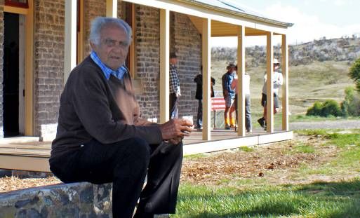
TABLE OF CONTENTS
FOREWORD.........................................................................................................................................................4
FRIDAY 11 NOVEMBER 2011 – SESSION ONE
EARLY BIRD AFTERNOON ACTIVITY, BIRIMAL WAGGA AMPHITHEATRE .................................................................5
BBQ DINNER & WELCOME - STOCKWELL ROOM, TUMUT BOWLING CLUB
Paul Davies, Welcome..........................................................................................................................6
Ken Prendergast & Suzanne Jones, NPWS Advisory Council Review................................................6
Dave Darlington, Acknowledgement of Country and Overview of Field Day and Logistics..................7
Martin Chalk, Photographic Journey.....................................................................................................7
SATURDAY 12 NOVEMBER 2011 – SESSION TWO
FIELD TRIP
Blowering Foreshores – Green Fleet Site......................................................................................................8
Cotterill’s Cottage............................................................................................................................................9
Yarrangobilly Caves
Cave Tour...........................................................................................................................................10
Caves House Restoration...................................................................................................................11
Introduction to Site and Welcome To Country....................................................................................14
Seed Bank Program, Sewage and Grass Rehabilitation....................................................................15
Tumut Ponds Hairpin Bend Rehabilitation Site..........................................................................................16
Cabramurra Township – Lookout.................................................................................................................19
Kiandra Courthouse Precinct.......................................................................................................................19
Black Perry Lookout......................................................................................................................................24
OFFICIAL OPENING DINNER AND PRESENTATION
Paul Davies, Chair Southern Ranges Region RAC - Master of Ceremonies......................................25
John Larter, Mayor Tumut Shire Council - Welcome To Tumut..........................................................25
Sally Barnes, Deputy Chief Executive-Head NPWS - Introduction of The Minister...........................25
The Hon Robyn Parker, Minister for the Environment - Official Opening...........................................26
Armstrong Osborne, Ass. Prof.- Key Note Speaker-National & Int. Trends in Geodiversity...............28
Dave Darlington, Regional Manager Southern Ranges Region – Thank You Presentation...............31
SUNDAY 13 NOVEMBER 2011 – SESSION THREE
CLOSING SESSIONS
Bob Conroy, Welcome and Overview of Arrangements and Logistics...............................................32
Stephen Meehan, Geodiversity and NSW Parks................................................................................33
Dr Bob Young, The Snowy Mountains within the Geodiversity of South-Eastern Australia................37
Dr Ann Young, Geodiversity and Ecological Niches...........................................................................39
Ted McDonnell, Former Snowy Scheme Sites Rehabilitation Program..............................................41
Liz MacPhee, Principles of Successful Rehabilitation........................................................................42
Sally Barnes, DCE- Head NPWS - Year Ahead and Concluding Address.........................................43
Paul Davies, Conference Evaluation..................................................................................................43
PROGRAM.........................................................................................................................................................44
PRESENTERS AND STAFF INVOLVED...................................................................................................................48
LIST OF DELEGATES..........................................................................................................................................49
PRESENTERS AND SPEAKERS’ BIOGRAPHIES......................................................................................................50
SEE APPENDIX ONE FOR ANNUAL REPORTS.......................................................................................................54
3 Record of Proceedings
Southern Ranges RAC Conference 11-13 Nov 2011
FOREWORD
                                                 Paul Davies

                                           Photo Taken By Jo Caldwell

Regional Advisory Committees Conference Tumut 11 - 13 November 2011
“Rehabilitation, Restoration and Geodiversity”

Tumut was the ideal location for the 2011 Regional Advisory Committees Conference as it offered all
the amenities needed, and is close to Kosciuszko National Park, which provided excellent on-ground
examples to showcase the Conference theme of “Rehabilitation, Restoration and Geodiversity”.
Tumut also turned on great weather for the weekend.

Kosciuszko National Park is the jewel in the crown of the Southern Ranges Region and, indeed NSW,
and provided a full day of field activities. Rehabilitation examples included former grazing land along
the Blowering foreshores, which is being revegetated in partnership with Greenfleet, the former
Jounama pine plantation and two of the more than 400 former Snowy Hydro sites used in the
construction of the Snowy Scheme. Further information was provided on these Snowy sites by Park
staff on Sunday morning outlining in more detail the work they are undertaking. This work has
recently received recognition through a National Engineering Excellence Award and is a major
achievement by the National Parks and Wildlife Service (NPWS) which is an organisation not usually
associated with engineering.

Examples of restoration sites visited were Yarrangobilly Caves House and Kiandra Courthouse.
Yarrangobilly Caves House has been restored and is now being successfully used for
accommodation and there are plans to restore and extend accommodation to the two-storey building.
The restoration of the Kiandra Courthouse is an excellent example of the rich history of the area in
gold mining and early skiing. These sites will also increase the range of visitor opportunities available
in the northern part of Kosciuszko.

The improved visitor facilities and interpretation at Black Perry lookout and Yarrangobilly caves
provided excellent examples of the Geodiversity theme, which was further explored by expert
speakers at the opening dinner and on Sunday morning.

The Aboriginal discovery program presented on Friday afternoon provided memorable hands-on
experience and it has recently won a Canberra and Capital Region Indigenous Tourism Award.

The Conference could not have been a success without the hard work of the steering committee,
members of the Southern Ranges Advisory Committee and NPWS staff based in the region at Tumut
and Jindabyne and in Head Office. On behalf of the Committee, I would like to thank everyone for
their help and assistance and to the presenters and speakers for their professional expertise and
insights into the field day and conference themes.

Paul Davies
Chair Southern Ranges Regional Advisory Committee
                                                      4                                          Record of Proceedings
                                                                        Southern Ranges RAC Conference 11-13 Nov 2011
DAY 1 – FRIDAY, 11 NOVEMBER 2011
      EARLY BIRD ACTIVITY – “A TASTE OF INDIGENOUS CULTURE”
                          Mark Lees, Shane Herrington and Talea Bulger
For those attendees arriving early on Friday afternoon the Tumut Visitor Services Unit arranged an
early bird afternoon activity at the Tumut Birimal Wagga Amphitheatre. Delegates were whisked away
on a bush walk, where they sampled local bush tucker and were presented with a hands-on
experience in rope and spearhead making, and basket weaving.

                                       Photos Taken By David Moore

                                      Photos Taken By Lorraine Donne

                                                    5                                           Record of Proceedings
                                                                       Southern Ranges RAC Conference 11-13 Nov 2011
DAY 1 – FRIDAY, 11 NOVEMBER 2011
SESSION 1:                  INFORMAL BBQ DINNER & WELCOME
                                              Paul Davies

On Friday evening, delegates were greeted with gift bags on arrival at the Stockwell Garden Room.
The conference then commenced with a warm welcome to the first day of proceedings by Paul
Davies, the evening’s MC and Chair of the Southern Ranges Region Advisory Committee.

                                       Photos Taken By Lorraine Donne

                                     Photos Taken By David Moore

                            ADVISORY COUNCIL REVIEW
                                             Ken Prendergast

                                        Photo Taken By Lorraine Donne

Ken Prendergast, a member of both the National Parks and Wildlife Advisory Council and the
Southern Rangers Region Advisory Committee, briefed the attendees on the backgrounds, expertise
and experience that the members bring to the NPWS Advisory Council.

                                                      6                                          Record of Proceedings
                                                                        Southern Ranges RAC Conference 11-13 Nov 2011
Photo Taken By Lorraine Donne
Suzanne Jones, a National Parks and Wildlife Advisory Council member, addressed the attending
delegates on the Advisory Council’s expertise and experience, functions, makeup and roles:
The Council was not Sydney-centric; it is comprised of members from various towns and rural
areas throughout NSW.
The skills and backgrounds that members brought to the Council were exceptionally varied –
nature conservation; education; scientific knowledge; aboriginal culture; farming; recreation;
tourism; fire management; planning; local government etc.
The role of the Council is to provide the Minister of the day with independent, expert advice on
issues of strategic significance and matters specified under the legislation.
Council members respect diversity of opinion within Council. Wherever possible, Council
members try to reach a consensus position to advise the Minister. However, this option is not
always possible so sometimes a range of views are submitted.
Examples of where the Council provide advice:
Strategic or long-term planning issues
Policies related to state-wide operations or issues e.g. Sustainability Guidelines, Biking Policy
Proposed changes to the legislation
Strategy for new parks and reserves
Proposed revocations (hopefully not too often)
Proposed licences and leases longer than 10 years
Draft plans of management
High impact or state-wide issues, e.g. pests and invasive weeds and bushfires
Council’s legislated roles include providing the Minister with advice on:
Draft conservation plans
Draft plans of management
Leases or licences involving new permanent structures or for a term longer than 10 years
Head leases for Perisher and/or Smiggins Hole
Permanent residential leases
Draft guidelines relating to easements, right of ways etc for in holdings
ACKNOWLEDGEMENT OF COUNTRY AND FIELD DAY LOGISTICS
Dave Darlington
Dave Darlington, Regional Manager Southern Ranges Region, greeted the attendees, gave an
acknowledgement of country and ran through an overview of field day logistics for Saturday.
PHOTOGRAPHIC JOURNEY
Martin Chalk
After a delicious BBQ dinner, Martin Chalk, a SRR RAC member took delegates on an incredible
photographic journey with his breathtaking photos highlighting the regions picturesque beauty.
7 Record of Proceedings
Southern Ranges RAC Conference 11-13 Nov 2011
DAY 2 – SATURDAY, 11 NOVEMBER 2011
                           SESSION 2:
            FIELD TRIP – KOSCIUSZKO NATIONAL PARK
Delegates assembled bright and early in the Tumut Bowling Club Courtyard for staff introductions and
a field trip activities briefing by Dave Darlington and Bob Conroy before splitting into designated
Kiandra and Jounama Groups.

                                BLOWERING FORESHORES
The first site was a drive by of Blowering Foreshores on Humes Crossing to view the Blowering
Rehabilitation project, which included planting of native species on former agricultural land. The
program is a joint initiative between Greenfleet and National Parks and Wildlife Service.

                                           Photos Taken By Jo Caldwell

                                         Photos Taken By Lorraine Donne

                                                       8                                          Record of Proceedings
                                                                         Southern Ranges RAC Conference 11-13 Nov 2011
COTTERILL’S COTTAGE
                                                     Mick Pettitt
Cotterill’s Cottage is located in the Yarrangobilly Karst area and near the Jounama Pine Plantation
Rehabilitation site. During their morning tea break, conference delegates were able to view the
destruction caused just days before by the rain and cyclonic wind at picturesque and historic
Cotterill’s Cottage.

                                              Photos Taken By Jo Caldwell

              Photo Taken By David Moore                                        Photo Taken By David Moore

This was also our first taste of the gourmet refreshments provided by Mylk Delights and Catering’s
mobile canteen, which also provided lunch at Yarraongobilly Caves and snacks further along our
journey.

                                               Photo Taken By Lorraine Donne

                                                            9                                        Record of Proceedings
                                                                            Southern Ranges RAC Conference 11-13 Nov 2011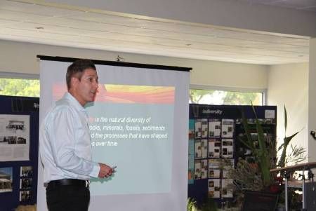
YARRANGOBILLY CAVES
Slide 1 Slide 2
Yarrangobilly is regarded as nationally
significant karst environment in terms of its
geological, geomorphological, hydrological and
zoological values
The showcave precinct has historic values of
state significance as an example of 19th century
tourist cave development and the associated
social movement
Providing for a wide range of recreational
NATIONAL PARKS & WILDLIFE pursuits it is also recognised as a recreational
SERVICE destination of national significance
Southern Ranges Region
Riverina Highlands Area
Slide 3 Slide 4
Yarrangobilly Caves is of State social significance as a place Caves House Heritage Accommodation
traditionally visited by locals and tourists for more than 150 years.
This long and continuous history of use has created a strong sense
Closed for almost 50 years – reopened August 2007
of community attachment to the place. [Bradshaw et al 1998] 1901-built single-storey East and West Wings restored,
Maintaining or enhancing this recreational resource is comfortably furnished and fully-equipped for small self-
essential if the park is to continue to serve as a key contained groups:
recreational and economic hub in the region [KPOM 2006]
- Family reunions and
Coach tours - approximately 70 coaches per year; friendly gatherings
Supporting local education with curriculum-based cave - Nature lovers and
tours – approximately 1075 school students per year special interest groups
- Workplace meetings,
Tailor-made tours - elderly and wheelchair-bound visitors
training & conferences
Aboriginal Discovery and Caves Discovery Programs
Slide 5 Slide 6
Caves House Heritage Accommodation “A wonderful experience being
lost in old world charm & unspoilt
Revenue increased 61.9% from 2007 to 2011, with 17% nature”
repeat visitation, currently operating at 69% occupancy. – Phil Clark, 14/09/08
Fully operated and serviced by NPWS staff, providing a
sense of ownership, commitment to customer service and
increased employment opportunities for casual staff
“Your resurrection of
Caves House is “Best equipped & decorated accommodation
we’ve stayed in. Great beds. And all set in
excellent. It’s going to magnificent surroundings”
capture enormous – Ian & Meri Stewart, 6/10/08
appeal from
discerning travellers”
– Rowley & Clare, 28th
December 2007
Slide 7 Slide 8
South Glory (Self-Guided) Cave Project:
LED lighting installation involved:
South Glory (Self-Guided) Cave - 700m mains cable - 600m fibre optic cable
Project - 3,000m lighting cable - 1,200m comms cable
The Project has removed and replaced Before After
all 1960’s lighting and handrail
infrastructure, reducing negative cave
impacts and improving safety and the
visitor experience
Stainless steel handrail installation:
- 570m handrail
- 292 posts
The new lighting system uses far less energy than the old
- 529m safety wires incandescent lighting i.e. 500 watts per hour rather than 7000
Computer-programmed, energy watts per hour, with the overall reduction in the electrical load of
efficient LED lighting installation around 3 KVA
10 Record of Proceedings
Southern Ranges RAC Conference 11-13 Nov 2011Slide 9 Slide 10
South Glory (Self-Guided) Cave Project:
No mains connection – Hydro power generation
LED lighting components installed:
- 119 Enviro Mini lights (6W) and 115 Rockstar lights (1.5W)
- 7 stainless steel distribution boxes
- Emergency lighting equipment (with no visitor impact)
Chemical-free sewerage treatment, UV potable water treatment
and black water reuse
Climate Change Cave Research - assisting with future climate
Before After change modelling and projections
Slide 11 Slide 12
In the 5 years from 2006/07 to 2010/11: Yarrangobilly Caves House:
- Total revenue increased 40.6% (excluding Caves House) Double-storey section undergoing adaptive reuse,
- Visitors Centre sales revenue increased 87.6% aiming to provide for a wider demographic
- Cave tour revenue increased 36.7% to $216,448 Develop an interpretive centre with conference and
- Cave visitation increased 18.7%
kitchenette facilities for groups
Improving access to Visitors Centre and precinct for
Visitors on cave tours during summer holidays increased
by 26.8% from 2007/08 to 2010/11 (a 33.6% increase in revenue)
elderly and disabled guests through landscaping,
pathways and access ramps
Easter Long Weekend cave visitation increased by a
massive 62.9% from 2010 to 2011 (a 42% increase in revenue)
Utilise environmentally-friendly technologies:
- Hydronic heating and black water reuse
Caves House revenue increased by 61.9% over 4 years
- Energy-efficient cogeneration for power & heating
to $111,447
- Photovoltaics and battery power storage bank
Slide 13 Slide 14
Caves House adaptive reuse will provide Visitor Services:
opportunities for Precinct wide improvements:
Develop new interpretive walking tracks – heritage
and eco-techo tours (sustainable infrastructure tours)
Repeat visitors looking for other experiences and tours Seal the access road so that we can accommodate a
Increase in number of cave tours available daily broader range of tourist groups and vehicles
Improved visitor services and cave tour variety Purchase of 4WD minibus to assist visitors access
Aboriginal Discovery and the Outdoor Classroom the thermal pool and provide a more diverse range of
Discovery Tours in the Northern Kosciuszko region
Opportunities for CTO – walking and fishing tours
Utilize the popularity of Yarrangobilly Caves as a
Increase in local employment
regional tourist icon to promote the Northern
Kosciuszko National Park region
Slide 15
Increase Power Generation & Capacity:
Installation of a Solar Array to feed back into the
Stand Alone Grid, providing additional load for the
precinct during the summer months, at a time when
water is not available 24 Hrs per day.
Installing Wind Turbines, while not as regular or
predictable as solar the advantage of a wind system is
that they are not limited to daytime hours and would
supplement what's already being achieved
While we have no “one” solution to our power
requirements, we do have a great sustainability story, a
story that should be told.
11 Record of Proceedings
Southern Ranges RAC Conference 11-13 Nov 2011YARRANGOBILLY CAVES - CAVES TOUR
George Bradford
Delegates were treated to a cave tour by George Bradford, Manager Yarrangobilly Caves. The
tour highlighted the lighting systems, handrails, energy conservation measures and hydro plant
electricity generation.
Photos Taken By Jo Caldwell
Photos Taken By Lorraine Donne
12 Record of Proceedings
Southern Ranges RAC Conference 11-13 Nov 2011YARRANGOBILLY CAVES – CAVES HOUSE RESTORATION
George Bradford
An inspection of the single-storey Caves House was conducted and delegates were briefed on plans
for the two-storey building, which will undergo a refurbishment program during March 2012 to October
2012.
Photos Taken By David Moore
Photos Taken By Jo Caldwell
Photos Taken By Lorraine Donne
13 Record of Proceedings
Southern Ranges RAC Conference 11-13 Nov 2011YARRANGOBILLY CAVES
INTRODUCTION TO SITE & WELCOME TO COUNTRY
Aunty Marg Berg and Uncle Vince Bulger
Photo Taken By Lorraine Donne
Lunch commenced with a site introduction by Dave Darlington, Regional Manager Southern Ranges
Region, followed by a warm Welcome to Country from Aunty Marg Berg and Uncle Vince Bulger.
Delegates were kept entertained by Uncle Vince’s jokes and story telling. Both Aunty Marg and Uncle
Vince are Aboriginal Elders from Wiradjuri and Wolgalu Country.
Photos Taken By Jo Caldwell
14 Record of Proceedings
Southern Ranges RAC Conference 11-13 Nov 2011SEED BANK PROGRAM – SEWAGE & GRASS REHABILITATION PROGRAM
Ted McDonnell and Elizabeth MacPhee
Photos Taken By David Moore
Yarrangobilly Caves is a tourist destination within Kosciuszko National Park and a sewerage
treatment system has been installed that results in nitrate laden (grey) water being released into the
soil profile under pressure. The discharge area at Yarrangobilly is a large flat sedimentary rock area
of about one hectare in size located outside the karst geological systems.
To utilise this nitrogen and to stop it moving into the limestone karst system of the caves, 17,000 Poas
(nature grasses) of five species were planted in 2006. Plants were spaced at 50 cm apart and were,
planted in the spring of 2006 and the summer of 2007. Nearly 100 kilos of seed was collected in the
second summer after planting. To date over 300 kilos of highly viable Poa seed has been collected
and used in rehabilitation across the park. The thatch (seed heads and cut off straw) has also been
harvested and used as organic mulch on some of the sites.
Soil tests within the production area and the surrounding area have been done for the last three years
and nitrogen levels have not increased. A slight change in pH (tending to pH 5 as compared to pH 5.5
to 6) occurred after two years of production. Lime was incorporated at 2.5 tonnes of lime per hectare
and the pH has moved closer to six rather than five. The analysis suggests that the change in pH
came about because of the displacement of calcium ions with sodium ions from the effluent. Annual
soil monitoring and peizometer monitoring of the ground water is done to keep track of the use and
movement of nitrogen in this landscape and to monitor any changes in soil chemistry.
Other target species needed for rehabilitation in KNP have also been planted in the last two years for
seed production (Bossiaea foliosa and Lomandra longifolia) to provide cutting material for propagation
of a variety of difficult to germinate shrubs.
The success of the seed bank illustrates how one person’s problem is the solution to another’s and
how ingenuity and lateral thinking can produce inventive results to problems.
Photos taken by Elizabeth MacPhee
Yarrangobilly Sewerage Discharge Area Prior To Poa Species Growing In The Yarrangobilly Sewerage Grasses Ready For Harvesting
Planting Treatment Area
15 Record of Proceedings
Southern Ranges RAC Conference 11-13 Nov 2011TUMUT PONDS HAIRPIN BEND
Photo Taken By Elizabeth MacPhee
The Site Prior To The Works
Ted McDonnell and Liz MacPhee
Ted McDonnell, Manager Assets, Roads and Rehabilitation Unit, and Liz MacPhee, Rehabilitation
Officer, provided a summary of the rehabilitation activities that have occurred at the Tumut Ponds
Hairpin Quarry and Spoil Dump, and delegates were able to inspect the rehabilitation of the former
Snowy Hydro scheme quarry site.
Tumut Ponds quarry and hairpin site was created for the construction of Tumut Pond dam. The quarry
was established to supply rock for the road construction and works associated with the Tumut Ponds
Dam Wall construction. Spoil was also dumped into it as part of the scheme construction and for
many years after by Snowy Hydro, National Parks and Tumbarumba Shire. The site had major
erosion, weed and aesthetic issues that needed to be addressed.
Rehabilitation of the site commenced in November 2007 with landform re-shaping works undertaken
to reduce the risk of slope failure. The aim of the reshaping was to construct a slope that personnel
could traverse in revegetation activities; that would better support plant growth and enable the creek
to flow through the site without producing scour and erosion in high flow events. About 10,000
seedlings were planted at the site in late 2007. A further 2,000 seedlings have been planted since
then in maintenance programs.
In September 2008, a large storm event occurred which scoured the creek channel traversing the site
which threatened the stability of the western side and bottom of the site. In May 2009 further
stabilisation works were undertaken in the channel which included using concrete (and Shotcrete)
lining to areas of the channel and importing additional rock to the site for use as riprap.
The site is being maintained on an annual basis. Maintenance activities include weed control, further
planting and monitoring the drainage channel.
The Tumut Ponds Hairpin site is a medium sized site in the Former Snowy Scheme Sites
Rehabilitation Program. There are numerous sites that present much larger challenges; however,
these sites are more remote and access is more difficult. What this site does allow us to see are the
three main challenges faced in the rehabilitation program: landform stabilisation, revegetation
activities and allowing water to flow safely through our sites.
16 Record of Proceedings
Southern Ranges RAC Conference 11-13 Nov 2011Photos Taken By Elizabeth MacPhee
Initial Rehabilitation Land Form Design Planning
3D Landform Design Winter Conditions Initial Rehabilitation Land Form
Design Planning
Design Credit to Ian Rose
Drainage Line Work 2009
17 Record of Proceedings
Southern Ranges RAC Conference 11-13 Nov 2011Shotcrete stabilisation of Zone 2 Rock bars spaced at 10m c/c Rock chute and flow dissipation Concrete apron
Flow dissipation
Reshaped and planted landform
Photos Taken By Gabriel Wilks
The Site Now
18 Record of Proceedings
Southern Ranges RAC Conference 11-13 Nov 2011CABRAMURRA TOWNSHIP
At Cabramurra Township, delegates were driven through the town located within Kosciuszko National
Park where they were briefed by Steve Horsley, Special Projects Manager, and Mick Pettitt, Area
Manager Riverina Highlands, on the Snowy Hydro Scheme and Snowy Hydro contributions with
regard to the shared Kings Cross Road.
Photo Taken By Jo Caldwell
KIANDRA COURTHOUSE PRECINCT
Mick Pettitt and Jennifer Hewitson
Photos Taken By Jo Caldwell
19 Record of Proceedings
Southern Ranges RAC Conference 11-13 Nov 2011KIANDRA COURTHOUSE PRECINCT
Mick Pettitt and Jennifer Hewitson
Uncle Vince Bulger - Photo Taken By Lorraine Donne
At Kiandra Courthouse Precinct Mick Pettitt, Area Manager Riverina Highlands, and Jennifer
Hewitson, Kiandra Historic Heritage Project Coordinator, updated delegates on the Kiandra Heritage
Tourism Project, restoration and adaptive reuse, heritage, skiing and Gold Mining History of the site.
Overview
In the short term, the building will function as an interpretation centre and other uses are being
evaluated.
Prior To Stage 1 Restoration 2009 – Photo Taken By Simon Allender At The Completion Of Stage 1 Restoration June 2010
Photo Taken By Jennifer Hewitson
Whilst the restoration of the Kiandra Courthouse and Chalet is the focus of works at Kiandra the
NPWS has widened the scope of works and activities to include actions aimed at revitalising the
precinct and most importantly ‘putting people back in the picture’ at Kiandra.
20 Record of Proceedings
Southern Ranges RAC Conference 11-13 Nov 2011Precinct works and activities include:
Two new heritage trails with digital interpretation – one over New Chum Hill and the other
around the perimeter of the Kiandra town plan taking in Kiandra’s first township site ‘Camp
Town’ and the Gold Commissioner’s camp, as well as other sites;
Renew and provide digital interpretation for the existing heritage trail;
Establish Wolgal’s Lodge for paid accommodation;
Conserve and re-present Pattinson’s Hut for viewing at open days and for possible volunteer
accommodation, and
Commence landscape rehabilitation reconciled with heritage management.
Revitalisation activities aimed at ‘putting people back in the picture’ include:
Building a dedicated Kiandra volunteer group to assist with works, tour-guiding and Kiandra
research within a NPWS framework;
Continue to run the established annual events and public programs schedule in April and
November in order to reconnect the site with local communities, stakeholders and others;
Ensure that the progressively released interpretation for the site is based on accurate social
commentary, first person narrative, primary references and family histories and that it draws
on the breadth and depth of research already undertaken at Kiandra, including that by the
ANU School of Archaeology;
Continually aim to expand the group of people connected with Kiandra to include those from
tertiary institutions, other NPWS sites and key target markets such as motorcyclists, skiers,
fishermen and others, and
Establish Kiandra as a place of meaningful exchange and authenticity of experience as is
befitting its local and regional significance.
2009
Stage 1 of the restoration of the Kiandra Courthouse and Chalet commenced in 2009 and were
completed in May 2010. Despite terrible weather, 160 visitors attended the celebratory open day on
29 May 2010. Images of the open day can be found at
http://www.flickr.com/photos/thekiandraproject/sets/72157625607515234/
21 Record of Proceedings
Southern Ranges RAC Conference 11-13 Nov 20112010/11
In late 2010 community members sent letters of support for the continued restoration of Kiandra to
Mick Pettitt, Riverina Highlands Area Manager. These letters demonstrated Kiandra’s enduring social
significance.
Digital media projects
There are several key drivers behind using digital media at Kiandra. As far as heritage trails are
concerned, NPWS is reluctant to install any more signage panels in the open Kiandra landscape. As
far as the Courthouse is concerned, the limited space available within it and the possible infrequency
of its use as an interpretation centre will necessitate use of digital media.
In addition to digital heritage trail interpretation, the NPWS has worked with an internship student from
the Australian National University (ANU) to create a 30-minute Kiandra ski history movie and a shorter
150 years of skiing promotional clip, which can be viewed at: http://vimeo.com/22796751. This clip
was produced at the one-day Kiandra ski history exhibition in April:
http://www.flickr.com/photos/thekiandraproject/sets/72157626519177857/
Kiandra stakeholders Bruce and Colin Hoad, Tumut, 2010 after being interviewed for the
Kiandra ski history movie, which will feature in Kiandra’s ski history exhibition.
Photo Taken By Vanessa Bertagnole
Historic Heritage Hub projects
The idea behind the ‘Historic Heritage Hub’ with Kiandra as a key driver is to promote the heritage
assets and history of the region – including off-Park assets, such as the Adaminaby Snowy Scheme
Museum. The historical and social connections between sites will be promoted during the annual April
heritage festivals. This activity will develop Kiandra’s heritage market.
As far as on-Park assets are concerned, Kiandra will link especially well with Yarrangobilly and
Currango to provide activities and accommodation for consecutive days and nights spent within the
Park. This will enable NPWS to develop packaged tours and accommodation across the three sites.
In April 2011, the NPWS (Kiandra) assisted to facilitate the following historic heritage hub activities:
ANU delivered a week long traditional building conservation course, based at Currango;
Kiandra-Snowy's coach tour to Kiandra, Three Mile Dam, Adaminaby Snowy Scheme Museum
and Neville Locker’s private museum collection;
Kiandra ski history exhibition to celebrate Kiandra’s 150th anniversary as the birthplace of
recreational skiing in Australia this year, and
Assisted in establishing a stonework and lime workshop and tour at Adelong falls.
The NPWS promoted the ski exhibition and the Kiandra-Snowy’s tour widely in the ACT and NSW
Heritage programs.
22 Record of Proceedings
Southern Ranges RAC Conference 11-13 Nov 2011Exhibition projects
The Kiandra Ski History Exhibition was the first simple themed exhibition delivered at Kiandra. The
second exhibition due for release on 20 November 2011 focuses broadly on Kiandra’s historical
themes, its ongoing revitalisation and its context within the Australian Alps National Landscape. The
exhibition is part of Kiandra’s annual public programs and events schedule but this year will also
coincide with the 25-year celebrations for the Australian Alps National Landscape.
The aim of Kiandra’s exhibitions is to progressively develop exhibition content with community input.
The exhibitions are based in community celebration as is befitting Kiandra’s social significance. They
also help re-establish Kiandra as an authentic tourism destination in keeping with the Australian Alps
National Landscape Tourism Strategy.
About 100 visitors attended the two-hour only Kiandra ski history exhibition. In addition to the exhibition, Ray Quinn from the Tumut and District bushwalkers
took tours of the New Chum Hill heritage trail.
Photos Taken By Vanessa Bertagnole
Successes
The Kiandra Courthouse and Chalet won the Adaptive reuse under $1 million
corporate/government award at the 2011 NSW National Trust Awards.
The Kiandra Courthouse and Chalet was awarded a grant (from the Foundation of National
Parks and Wildlife) for two months of the Historic Heritage Project Coordinator’s Salary.
The Kiandra Courthouse and Chalet was also awarded a grant under the National Landscapes
Promotional Scheme to promote Kiandra as the birthplace of recreational skiing in Australia.
Highlight
University of Canberra Conservation students, led by Conservation Lecturer John Greenwood, and
(partly funded by the Federal Government’s National Landscapes Promotional Scheme), commenced
work uncovering a mural on the Courtroom wall. The NPWS continues to work on the mural and on
determining who its creator was.
See the mural behind the UC team. It is of two men carrying their skis. – Photo Credit To University Of Canberra Students
Contact information
For more information on Kiandra please contact Jen Hewitson on 02 6947 7011.
23 Record of Proceedings
Southern Ranges RAC Conference 11-13 Nov 2011BLACK PERRY LOOKOUT
Stephen Meehan, Matt White & Mick Pettitt
At the Black Perry lookout tour Stephen Meehan, Manager Karst and Geodiversity Unit, Mick Pettitt,
Area Manager Riverina Highlands, Steve Horsley, Special Project Manager, and Matt White, Ranger,
provided delegates with a very informative session on Geodiversity, Centenary Funding, 2006
Kosciuszko National Park PoM Visitor site, Aboriginal Heritage and post-works rehabilitation.
Photos Taken By Karst and Geodiversity Unit
Garnet-rich skarn, Black Perry Mountain
Black Perry Mountain is one of the best skarn exposures in Australia. Combined with its
topography and diverse mineralogy, this renders it of state and potentially national significance.
Skarn is a coarse-grained metamorphic rock (i.e. a type of rock converted into another due to the
influence of heat, pressure or chemical changes), which typically consists of garnet, pyroxene,
epidote and wollastonite minerals.
The skarn at Black Perry Mountain is comprised of uncommon and rare calcium, iron and silica
rich minerals, such as babingtonite and hedenbergite, and formed in the early Devonian period
(approx 410 million years ago), when molten granite interacted with the Yarrangobilly limestone.
Skarn is often more resistant to erosion than other types of rock. Hence, Black Perry Mountain
protrudes in an area that has otherwise been heavily eroded over millions of years.
A limited number of smaller skarn deposits also occur in the area. These are located within a few
kilometres of Black Perry Mountain and in proximity to Yarrangobilly Village.
On the lower slopes of Black Perry Mountain and its adjoining ridges, the limestone was exposed
to less intense heat and turned into marble, rather than skarn. Small caves have formed in marble
including at least one on the mountain and 15 in Cave Creek Valley.
Potential threats to the skarn and adjoining karst include invasion by introduced flora (e.g. briar,
pine and blackberry species), intense and frequent fire events and the illegal collection of skarn
minerals.
On the lower slopes of Black Perry Mountain and its adjoining ridges, the limestone was exposed
to less intense heat and turned into marble, rather than skarn. Small caves have formed in the
marble including at least one on the mountain and 15 in Cave Creek Valley.
Bibliography
Basden, H. (ed) (1990). Geology of the Tumut 1:100 000 Sheet 8527. New South Wales Geological Survey, Department of Minerals and Energy
Gole, M.J. (1981). Ca-Fe-Si skarns containing babingtonite. Canadian Mineralogy 19:289 –77.
The mineral and locality database 2011. www.Mindat.org
Spate, A.P. (2004) Chapter 7: Karst Values. Independent Scientific Committee: An Assessment of the Values of Kosciuszko National Park, NSW National Parks and
Wildlife Service, Sydney.
24 Record of Proceedings
Southern Ranges RAC Conference 11-13 Nov 2011FORMAL DINNER & PRESENTATION - OFFICIAL OPENING
Paul Davies
The 2011 Regional Advisory Committee Conference officially opened with a formal dinner held at the
Tumut Bowling Club, in the Stockwell Garden Room. Paul Davies, Chair Southern Ranges Region
Advisory Committee the Master of Ceremonies, warmly welcomed delegates and introduced John
Larter, the Mayor of Tumut Shire Council who addressed and welcomed the Conference Delegates to
Tumut on behalf of the Council.
Paul Davies, Chairs Southern Ranges
Region Advisory Committee John Larter, Mayor Tumut Shire Council
Photos Taken By Jo Caldwell
Sally Barnes, Deputy Chief Executive, Head NPWS introduced Minister Robyn Parker, who
performed the official opening of the Regional Advisory Committee Conference.
Sally Barnes, Deputy Chief Executive, Head NPWS
Photo Taken By Jo Caldwell
25 Record of Proceedings
Southern Ranges RAC Conference 11-13 Nov 2011The Hon Robyn Parker , Minister for the Environment
Photo Taken By Jo Caldwell
Minister’s address
The Hon Robyn Parker , Minister for the Environment
Welcome
The Minister acknowledged the Elders Auntie Marg Berg and Uncle Vincent Bulger from Wiradjuri and
Wolgalu Country.
It was only a few months prior that the Elders and key members of the Tumut Brungle Gundagai
community had signed a Memorandum of Understanding with the National Parks and Wildlife Service
which was one of the 23 Aboriginal joint management arrangements covering around 28% of the park
system from Mungo National Park and Mutawintji National Park in the far west, to Arakwal National
Park and the Worimi Conservation land on the eastern seaboard.
Having met local staff and having caught up with many of the operators of the alpine resorts while
visiting Kosciuszko National Park a week before, the Minister was happy to learn that everyone
shared a desire to see more visitors enjoying the national park and to have more and better facilities
to attract and support them. She was certain that the conference field trip had left delegates inspired
by the wonderful area with its high mountains, crystal clear streams and underground landscapes.
The Minister also remarked that one of the most enjoyable parts of her role had been getting out-and-
about in our magnificent network of national parks.
Key Messages
There are more than 850 national parks and reserves in New South Wales, protecting more than 7
million hectares and comprising a stunning diversity of landscapes and habitats.
National Parks have a key role to play in achieving 2021 targets to double tourism expenditure by
2020, as well as encouraging greater participation in cultural and recreational activities.
Engaging with more visitors is also critical to help build support for conservation.
The Minister thanked delegates for providing their interest and expertise to assist NPWS in
undertaking their role.
26 Record of Proceedings
Southern Ranges RAC Conference 11-13 Nov 2011Achievements
This Government has a strong commitment to environmental issues, especially national parks.
This has been made clear through our election commitments and through priority actions in NSW
2021: A Plan to Make NSW Number One.
Government is committed to improving customer service and access to information and this
includes development of a new, visitor-focused national parks website that will make it easier to
find out about all the great things to do and places to stay in our parks.
Providing experiences that help all groups in our community visit remarkable places, such as
Kosciuszko National Park, is critical to help build support for conservation. We are also committed
to helping people of every age enjoy a healthy lifestyle.
I recently launched a new Sustainable Mountain Biking Strategy for NSW National Parks,
encouraging cyclists into our national parks for safe and sustainable recreation. This ten-year plan
delivers on the O’Farrell Government’s promise to create high quality, sustainable mountain biking
experiences for the community and visitors to enjoy.
In June, I launched an innovative and dynamic nature-based tourism campaign – Wild-About
Whales. It follows the annual whale migration along our coast, and taps into the immense
fascination that humans have for these giant but graceful marine mammals.
Wild about Whales embodies our commitment to improving access to information; allowing people
to find out what’s going on in their parks, and providing new and compelling reasons to visit prime
coastal destinations such as Cape Byron, Montague Island and Sydney’s beaches and headlands
over the cooler months – our off-season.
Conclusion
We certainly have many wonderful experiences in NSW and I strongly believe that it is critical that
local communities have a say in how their parks are managed.
I want to thank you for offering your interest and your expertise to assist National Parks in
undertaking their role. I would appreciate if you could pass on my thanks to your colleagues on
the regional advisory committees who are not here today.
I am pleased to officially open this conference for 2011. It is a very full and exciting agenda, and I
hope that you all have an enjoyable and informative stay.
I would like to finish by leaving you with a short video of one of our new initiatives to improve
communication and promote nature and cultural tourism.
As I touched on earlier, a key priority is to deliver a new visitor focused website for national parks
– and importantly, allow us to communicate information in exciting new ways.
It is indeed the digital age and now is the time for us to use this technology to our advantage,
whether it be for real-time information on what to do and see; high quality interpretation; making
booking your holiday easier, or helping to keep our visitors safe.
This video shows our vision for what we will achieve over the next three years …
Vision video played…
27 Record of Proceedings
Southern Ranges RAC Conference 11-13 Nov 2011NATIONAL & INTERNATIONAL TRENDS IN GEODIVERSITY
Armstrong Osborne – Conference Keynote Speaker
Saturday night’s keynote speaker Armstrong Osborne, Associate Professor from the University of
Sydney, provided an interesting presentation on “The Value of Geodiversity to the Community”
from National and International perspectives, including emerging trends, case studies in
geoconservation, and current and future challenges anticipated, followed by questions from the floor.
Photo Taken By Jo Caldwell
Presentation by Armstrong Osborne “National & International Trends in Geodiversity”
Figure 1 Figure 2
GEODIVERSITY
The natural range of geological, geomorphological and soil features,
National & International Trends assemblages, and processes including evidence of past life, ecosystems
and environments in the history of the earth as well as the range of
in Atmospheric, hydrological and biological processes currently acting on
rocks landforms and soil (after ANHC, 2002).
Geodiversity
Armstrong Osborne
Gora Zborow, Poland 2
Figure 3 Figure 4
NATIONAL INTERSTATE
GSA Committees active in all states and territories, NSW just revived Qld- Regional Books
after hiatus of 17 years.
1974 “Hope” Report on the National Estate recommends funding for Vic Geoconservation included in Regional Environmental Plans since 1990
documentation of Geological Heritage.
AHC, Environment Australia, DEH, long interest, funds geoheritage work Tas Work in Tas Forests by G. Dixon & C. Sharples
work through NEGP, RFA and National List. Many sites listed on RNE developed Geodiversity principle
TGD from 1997, 2010 version lists 1049 sites
Australian Natural Heritage Charter (1996-2002) gives Geodiversity equal status Conservation Geomorphology course by K. Kiernan
with Biodiversity in natural heritage conservation.
2007 RNE “Frozen” SA 9 Volumes of Geological Heritage of SA since 1977 listing
Feb 2012 Federal Minister no longer required to consider RNE 400+Sites, Strong links with Museum, National Parks and Mines Dept
WA Active GSA Committee
3 4
28 Record of Proceedings
Southern Ranges RAC Conference 11-13 Nov 2011Figure 5 Figure 6
NSW INTERNATIONAL
1865 W ombeyan Caves
1872 Bungonia Lookdown
1888 Slaven Cave
1890s-1900s Cave Reserves: Colong, Yessabah, Bendithera, Willi Willi
1904 Fennel Bay Fossil Trees
1927 Hatton’s Corner
1970 Talbragar Fish Beds
1979 Geological Heritage of NSW Volume 1 (+3 more Vols to 1991)
1998 Osborne, Docker & Salem, CRA 1746 sites
2001 NPWS Act amended to include: -
“iii) landforms of significance, including geological
features and processes, and
(iv) landscapes and natural features of significance
including wilderness and wild rivers,”
2006 K & GU
2010 Symposium on Geodiversity, Geoheritage and Geotourism
2011 EPA Act Review
5
Figure 7 Figure 8
USA UK Brief History
US National Parks Service : - National Parks & National Monuments
Geologic Resources Division
"The Geologic Resources Division, in partnership with parks, regions, networks, Nature Conservancy Council- SSSI
and others, works to preserve, protect, enhance, and understand geologic features and National Trust
and integrate this knowledge into resource stewardship within the
National Park System."
1990 Earth Science Conservation in Great Britain
Report
Geologic Heritage 1991 NCC Split into 3
Over time, as Congress added to the National Park System, the variety and diversity of 1993 1388 RIGS
geologic features in parks has come to represent America's geologic heritage. Significant
geologic features include fossil resources, cave & karst resources, and much more. 1997 Geological Conservation Review begins
Bureau of Land Management : - Geologists, National Conservation Areas 2011 2,100 Geo SSSI in UK,
Landscapes of the American Spirit
The National Landscape Conservation System consists of 900 units covering 27-million acres
3,500 RIGS in UK,
of our most treasured landscapes. Learn about these diverse resources of the American 36 of 42 GCR Volumes Completed,
landscape, including red-rock deserts, rugged ocean coastlines, deep river canyons, and 40 Local Geodiversity Action Plans
broad Alaskan tundra.
7 8
Figure 9 Figure 10
UK Organizations UK Publication
Natural England: Local Geodiversity Action Plans (40+)
Area Geology Trusts
“The Geology Trusts is a national umbrella organisation for Geoconservation
and Earth Heritage groups. Presently its members are the counties of
Herefordshire & Worcestershire, Gloucestershire, Monmouthshire,
Oxfordshire, Shropshire, Warwickshire, Wiltshire, and Bedfordshire. It is a
county-based association working in a similar way to the Wildlife Trusts””
“Earth Heritage is a magazine produced twice yearly to stimulate interest in a
broad range of geological and landscape conservation issues within the UK and
further afield. It circulates among geological conservation specialists, and to
universities, colleges and to many staff in secondary education”.
9 10
Figure 11 Figure 12
TRAINING EUROPE- ProGEO
“School of Geography at Queen Mary, University of London
GEG6208 Geodiversity and Geoconservation
Rating: 15 credits
Lectures: 2 per week, semester A
Seminars: Module will be taught through updating lectures and class discussions based on pre-reading of the
course text and other material
Fieldwork: 1 day or half day trip – date and location to be confirmed
Assessment: 2.5 hour exam - 50%, Course paper outline - 10%, Course paper c 4,000 words - 40%
Module convenor: Dr Murray Gray, Lecturer: Dr Murray Gray
Module aims:- Most emphasis in nature conservation is on living nature (wildlife and biodiversity). The main
aim of this module is to outline abiotic nature (geodiversity) of the planet and the –
• values of non-living nature
• threats to these values
• need for geoconservation
• approaches to geoconservation
• principles of integrating geodiversity and biodiversity in sustainable land management”
11 12
29 Record of Proceedings
Southern Ranges RAC Conference 11-13 Nov 2011Figure 13 Figure 14
JOURNAL HUNGARY K & G UNIT & Pangea
Geoheritage,
International journal published by Springer
“Covers all aspects of geoheritage and its protection
This journal details all aspects of our global geoheritage, both in situ
and portable. It examines conservation of sites and materials--use,
protection and practical heritage management--as well as its
interpretation through education, training and tourism.
The journal covers all aspects of geoheritage and its protection. Key
topics include:
- Quantification and management of geoheritage
- Integration of biodiversity and geodiversity in nature conservation
and land-use policies
- Geological heritage, sustainable development, community action,
practical initiatives and tourism
- Geoparks: creation, management and outputs
- Conservation in the natural world, Man-made and natural impacts,
climate change;
- Geotourism definitions, methodologies, and case studies
- Pedagogical use of geological heritage: publications, teaching Csardra Heygi
media, trails, centers, on-site museums.”
13 14
Figure 15 Figure 16
POLAND- Landscape Conservation POLAND-Geotourism
15 16
Figure 17 Figure 18
SLOVENIA- Motorway Studies SLOVENIA
Maintaining natural
earth processes
is a key idea in the
Australian Natural
Heritage Charter,
In Slovenia they take
this idea seriously!
The culvert must allow
the blocks to pass
While motorways across the Karst require extra care, geodiversity studies are
undertaken on all new motorway developments
Natural Process Culvert Block stream above culvert
17 18
Figure 19 Figure 20
Czech-German Sandstone Landforms For Progress we need in addition to K & GU
Thanks for your attention
19 20
30 Record of Proceedings
Southern Ranges RAC Conference 11-13 Nov 2011SPECIAL THANKS
Before dessert the Planning Committee, Elders, and external speakers were presented with thank-
you gifts of genuine Australian made millet brooms made from Riverina Highlands millet dried and
created in the traditional way. The premium and great long-lasting brooms have been manufactured
by the family-owned factory at Tumut for over 66 years.
Photos Taken By Jo Caldwell
Special thanks and bottles of Tumut wine were also presented to two Southern Ranges
Region Advisory Committee members Martin Chalk for his spectacular “Photographic
Journey” presentation and David Moore who stepped in to help as a last minute
Photographer on Friday 11 November 2011 when Jo Caldwell, our official Photographer,
fell ill.
31 Record of Proceedings
Southern Ranges RAC Conference 11-13 Nov 2011DAY 3 – SUNDAY, 13 NOVEMBER 2011
SESSION 3: CLOSING SESSIONS
LOCATION: Tumut Bowling Club Bistro – 24-30 Richmond Street
Bob Conroy and Paul Davies
Bob Conroy, Executive Director Park Management Division and Paul Davies, Chair Southern Ranges
Region Advisory Committee welcomed delegates to the closing sessions of the conference, and
provided an overview of the days arrangements and logistics, with short biographies from Bob
Conroy.
Photos Taken By Jo Caldwell
32 Record of Proceedings
Southern Ranges RAC Conference 11-13 Nov 2011GEODIVERSITY & NSW PARKS
Stephen Meehan
Photo Taken By Jo Caldwell
Stephen Meehan, Manager, Karst and Geodiversity, was the first presenter of the day with his
presentation on “Geodiveristy and NSW Parks” followed by questions from the floor.
The term ‘geodiversity’ describes the natural diversity of rocks, minerals, landforms, fossils, sediments
and soils, and the processes that have shaped these features over time. Geodiversity is the
foundation on which ecosystems are based and is largely responsible for the variety of plants,
animals and other organisms, which exist today. The Office of Environment and Heritage (OEH)
groups geodiversity into three broad types: landforms, bedrock and soils, which are further defined
into categories and subsequently, elements, to derive the basic geodiversity model (Attachment 1).
Historical perspectives
The term geodiversity was first used in the early 1990s as the geological equivalent of biodiversity. In
Australia a landmark event for having geodiversity formally considered in conservation planning was
the adoption of the Australian Natural Heritage Charter in 1996. This document gives equal weight to
biodiversity and geodiversity when assessing proposals for nature conservation sites and requires
conservation to involve the least possible physical intervention to ecological processes, evolutionary
processes and earth processes.
Consideration of geodiversity in the conservation paradigm gained momentum from 2000 to the
present day. Over this period, countries such as Canada, Japan, Ireland, Italy, Portugal, Poland, New
Zealand and the USA declared parks and other public lands as geoheritage sites, due principally, to
their geodiversity values. In England (and more recently Australia), geodiversity action plans have
also been developed for areas containing significant geodiversity values.
33 Record of Proceedings
Southern Ranges RAC Conference 11-13 Nov 2011You can also read