(OMAO) NOAA's Office of Marine and Aviation Operations Aircraft Flights and Mission Info Summary - March 2018 - NOAA Legislative Affairs
←
→
Page content transcription
If your browser does not render page correctly, please read the page content below

NOAA’s Office of Marine and Aviation Operations
                   (OMAO)

   Aircraft Flights and Mission Info Summary
                   March 2018
Contents

Aircraft Operations ............................................................................................................................3
March Mission Summary....................................................................................................................4
   P3 “Hurricane Hunter" [Tail ID# N42RF] ................................................................................................... 4
   P3 “Hurricane Hunter" [Tail ID# N43RF] .................................................................................................. 4
   G-IV “Hurricane Hunter" [Tail ID# N49RF] ............................................................................................... 5
   Jet Prop Commander [Tail ID# N45RF] ..................................................................................................... 5
   King Air [Tail ID# N68RF] ........................................................................................................................... 6
   Twin Otter [Tail ID# N46RF] ...................................................................................................................... 6
   Twin Otter [Tail ID# N48RF] ...................................................................................................................... 7
   Twin Otter [Tail ID# N56RF] ...................................................................................................................... 8
   Twin Otter [Tail ID# N57RF] ...................................................................................................................... 8

                                                                           2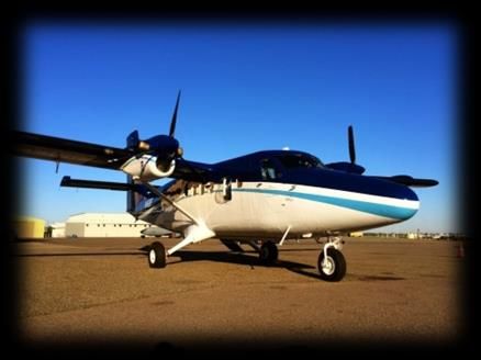
Aircraft Operations
NOAA’s fleet of nine manned aircraft is operated, managed and maintained by NOAA’s Office of Marine
and Aviation Operations (OMAO) and the NOAA Commissioned Officer Corps (NOAA Corps) – one of the
nation’s seven Uniformed Services - based at OMAO’s Aircraft Operations Center (AOC). Located at
Lakeland Linder Regional Airport in Lakeland, Florida, the officers, crew, and scientists from AOC provide
capable, mission-ready aircraft and professional crews to the scientific community – see photo below.
AOC is committed to the safe, efficient and economical use of NOAA aircraft and has more than four
decades of experience developing, coordinating and successfully and safely conducting airborne
environmental data gathering missions. OMAO’s aircraft fleet includes the following platforms and the
web links provide additional photos, information on each aircraft, and the missions they serve:
Lockheed WP-3D Orion (P3) “Hurricane Hunter" [Tail ID# N42RF]
Lockheed WP-3D Orion (P3) “Hurricane Hunter" [Tail ID# N43RF]
Gulfstream IV-SP (G-IV) “Hurricane Hunter" [Tail ID# N49RF]
Gulfstream Turbo (Jet Prop) Commander AC-695A (Jet Prop Commander) [Tail ID# N45RF]
Beechcraft King Air 350CER (King Air) – [Tail ID# N68RF]
De Havilland DHC-6-300 Twin Otter (Twin Otter) [Tail ID# N46RF]
Twin Otter [Tail ID# N48RF]
Twin Otter [Tail ID# N56RF]
Twin Otter [Tail ID# N57RF]
In addition to the fleet of nine, manned aircraft, AOC provides oversight and guidance for all of NOAA’s
Unmanned Aircraft System (UAS) operations. Please visit AOC’s UAS Section for additional information.
3
March Mission Summary

Whether studying severe weather, assessing marine mammal populations, surveying coastal erosion,
investigating oil spills, flight checking aeronautical charts, or improving hurricane prediction models, the
AOC flight crews, scientists, and partners, operate all across the United States and beyond, including in
some of the world's most demanding flight regimes.

The following Mission Summary provides an overview of the status or location(s) and mission(s) for each
aircraft for the month. Please note all mission bases, projected flight locations, and mission parameters
and requirements may shift based on changing needs and circumstances.

P3 “Hurricane Hunter" [Tail ID# N42RF]

Who: Officers and crew of OMAO/NOAA Corps along with scientists from NOAA’s Office of Oceanic and
Atmospheric Research
What: Verification of the Origins of Rotation in Tornadoes EXperiment-Southeast (VORTEX-SE). Flights
conducted 5 – 10 miles from convective storms.
When: March 7 to April 1
Where: Flights will occur over Mississippi, Alabama, Tennessee, and Georgia.
Why: These flights will be conducted to better understand how environmental factors that are
characteristic of the southeast United States affect the formation, intensity, and path of tornadoes for
this region. The ultimate goal is to improve tornado forecasts and warning performance in the
southeast.

P3 “Hurricane Hunter" [Tail ID# N43RF]

Currently down for re-winging in Naval Air Station Jacksonville, Florida. The aircraft is due out of
maintenance in October 2018; instrumentation and outfitting at AOC will follow.

                                                     4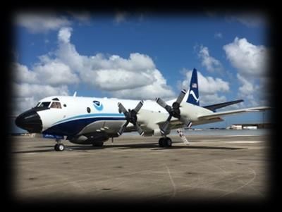
G-IV “Hurricane Hunter" [Tail ID# N49RF]

Aircraft will be in a scheduled maintenance period in Savannah, Georgia, for the month. Hurricane
equipment installation begins at AOC on April 13.

Jet Prop Commander [Tail ID# N45RF]

Who: Officers and crew of OMAO/NOAA Corps along with scientists from NOAA’s National Weather
Service (NWS), National Operational Hydrologic Remote Sensing Center
What: Water Resource Surveys
When: Present – May 15
Where: Surveys will be conducted over Maine, Vermont, New Hampshire, New York, and Massachusetts
through March 15. After March 15, surveys will be conducted over Minnesota, North Dakota, and South
Dakota.
Why: The aircraft will conduct Low level (500 feet) surveys to collect Snow Water Equivalent data for
NWS River Forecast Centers. This data is used by NWS Weather Forecast Offices and NWS River Forecast
Centers when issuing river and flood forecasts, water supply forecasts, and spring flood outlooks.

                                                   5
King Air [Tail ID# N68RF]

Who: Officers and crew of OMAO/NOAA Corps along with scientists from NOAA’s National Ocean
Service, National Geodetic Survey’s Coastal Mapping Program
What: Coastal mapping flights
When: Present – March 26
Where: TBD based on weather and tide stages. Currently based out of Sarasota, Florida, with flights over
Florida.
Why: These flights provide critical baseline data to help accurately map the U.S. shoreline. The data is
important for national security, maritime shipping, and navigation.

Twin Otter [Tail ID# N46RF]

Who: Officers and crew of OMAO/NOAA Corps along with scientists from NOAA’s National Weather
Service (NWS), National Operational Hydrologic Remote Sensing Center
What: Water Resource Surveys
When: Present – April 22
Where: Based out of Grand Forks, ND. Aircraft will be conducting surveys over North Dakota, South
Dakota, Minnesota, and Iowa.
Why: The aircraft will conduct Low level (500 feet) surveys to collect Snow Water Equivalent data for
NWS River Forecast Centers. This data is used by NWS Weather Forecast Offices and NWS River Forecast
Centers when issuing river and flood forecasts, water supply forecasts, and spring flood outlooks.

                                                   6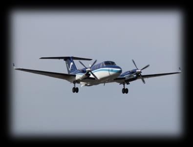
Twin Otter [Tail ID# N48RF]
Project 1
Who: Officers and crew of OMAO/NOAA Corps along with scientists from NOAA’s National Marine
Fisheries Service (NMFS), Southeast Regional Office
What: Southeast Right Whale Survey
When: Present – March 15
Where: Currently based on Saint Simons Island, Georgia, with flights along the coasts of Florida, Georgia,
and South Carolina. The aircraft may shift its base of operations to Florida, North Carolina, or Virginia
based on lack of sightings – TBD
Why: With as few as 400 remaining, surveillance flights to track their migration patterns are important
for conservation and recovery efforts. Each fall, right whales travel more than 1,000 miles from their
feeding grounds off Canada and New England to the warm coastal waters of South Carolina, Georgia and
northeastern Florida. These southern waters are the only known calving area for the species; an area
where they give birth and nurse their young.

Project 2
Who: Officers and crew of OMAO/NOAA Corps along with scientists from NOAA’s National Marine
Fisheries Service (NMFS), Northeast Fisheries Science Center (NEFSC)
What: North Atlantic Right Whale Survey
When: March 16 – July 31
Where: The plane will base out of Falmouth, Massachusetts, and Halifax, Nova Scotia, Canada. The
survey area will cover Coastal waters off Massachusetts, New Hampshire, Maine, and Nova Scotia,
Canada.
Why: The objectives of this project are to provide real time sighting information to commercial shipping
interests in an effort to reduce collisions between ships and North Atlantic Right Whales, to better
understand the distribution and abundance of the North Atlantic Right Whale, and to collect
photographic images of individual right whales for mark-recapture analysis to monitor the population.
With as few as 400 remaining, surveillance flights to track their migration patterns are important for
conservation and recovery efforts.

                                                    7
Twin Otter [Tail ID# N56RF]
Who: Officers and crew of OMAO/NOAA Corps along with scientists from the Gulf of Mexico Marine
Assessment Program for Protected Species
What: Marine resource stock assessment
When: Present – March 15
Where: The plane is currently based in Lake Charles, Louisiana, and is conducting flights along the Gulf
Coast – Florida, Alabama, Mississippi, Louisiana, and Texas.
Why: Improved information is needed on living marine resource abundance, distribution, habitat use,
and behavior in the Gulf of Mexico to properly mitigate and monitor for potential impacts of human
activities, including related to offshore energy development.
Twin Otter [Tail ID# N57RF]
Who: Officers and crew of OMAO/NOAA Corps along with scientists from NOAA’s National Ocean
Service, National Geodetic Survey’s Coastal Mapping Program
What: Coastal mapping flights
When: March 13 – Sept 30
Where: The plane will base out of New Bedford, Virginia, and survey the Chesapeake Bay area (Virginia
and Maryland) in March and April.
Why: These flights provide critical baseline data to help accurately map the U.S. shoreline. The data is
important for national security, maritime shipping, and navigation.
8You can also read