Ocean exploration Highlights of National Academies Reports - The National Academies Press
←
→
Page content transcription
If your browser does not render page correctly, please read the page content below
O C E A N S c i ence S er i es

                                    ocean
                                 exploration

                                 Highlights of National Academies Reports
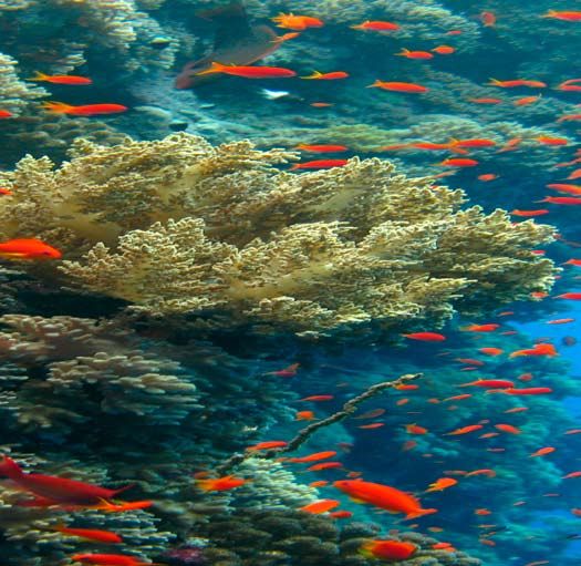
Among all the planets
   of the Solar System,
EARTH STANDS OUT
		    AS A WATERY OASIS.
   The ocean is the largest biosphere on Earth, covering nearly three-
   quarters of our planet’s surface and occupying a volume of 1.3 billion
   cubic kilometers. Despite the major role of the ocean in making the Earth
   habitable—through climate regulation, rainwater supply, petroleum and
   natural gas resources, and a breathtaking diversity of species valued for their
   beauty, seafood, and pharmaceutical potential—humankind has entered the 21st
   century having explored only a small fraction of the ocean.

   Some estimates suggest that as much as 95 percent of the world ocean and 99
   percent of the ocean floor are still unexplored. The vast mid-water—the region
   between the ocean’s surface and the seafloor—may be the least explored, even though
   it contains more living things than all of Earth’s rainforests combined. Similarly, the ocean
   floor and sediments encompass an extensive microbial biosphere that may rival that on the
   continents, which is not yet understood and remains largely unexplored.

   The impacts of human activities on the ocean drive a growing urgency for its exploration
   before permanent and potentially harmful changes become widespread. Even events that oc-
   cur far inland, such as nutrient runoff from agriculture and pollutants and debris carried by
   stormwater, have impacts. The ocean bears a double burden from the burning of fossil fuels and
   associated climate change; not only is it warmer, but the additional carbon dioxide dissolves in
   the ocean, making it more acidic.

   Although mariners have traversed the ocean for centuries, exploring its inky depths is no easy
   task. Recent technological advances now make possible scientific investigations only dreamed of
   20 years ago. The development of state-of-the-art deep-sea vehicles and a host of other technol-
   ogies have opened doors for finding novel life forms, new sources of energy, pharmaceuticals,
   and other products, and have promoted a better understanding of the origins of life, the work-
   ings of this planet, and of humanity’s past.
making
Discoveries
New discoveries are being made all the time.

“. . . there is still so much we do not know about the oceans that often we do
not even know the proper questions to ask or an unambiguous way to test what
hypotheses we do have. For that reason, I am a fan of ocean exploration.”
                                          —Marcia McNutt, president and CEO,
                                      Monterey Bay Aquarium Research Institute

In 2003, scientists made a discovery that set the telecommunications industry
buzzing. The skeleton of a type of deep-sea sponge known as the Venus Flower
Basket, or Euplectella, was shown to consist of thin silicon fibers, called spic-
ules, that transmit light at least as well as commercial optical fibers.1 Unlike
manmade optical fibers that will break if bent too far, the silicon spicules of
the Venus Flower Basket can be tied in a knot without breaking. Marine biolo-
gists have known for decades that sponge skeletons transmit light, but until
recently they hadn’t studied the light carrying properties of spicules. Even
though practical applications could be decades away, this deep-sea discovery
gives researchers new perspectives on how nature creates materials with na-
noscale precision.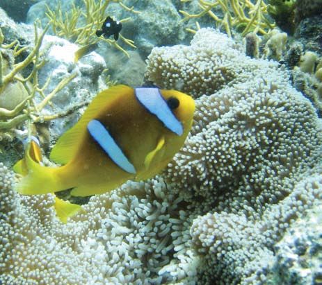
There are many such discoveries. An enzyme, taken
from bacteria that break down fats in cold water, has
been used to improve laundry detergent. A glowing
green protein from jellyfish has been widely used in
medicine, helping researchers illuminate cancerous
tumors and trace brain cells leading to Alzheimer’s
disease—an accomplishment that garnered the 2008
Nobel Prize in Chemistry for the researchers Osamu
Shimomura, Martin Chalfie, and Roger Y. Tsien, who
discovered and developed this technology. Each new
discovery is a reminder of how little is known about the
ocean environment, which is so critically important to
health and life on Earth.

                                                                              Something new under the
To enable the full exploration of the oceans and seafloor                     sun: The Big Red jellyfish. This
and the sustainable development of their resources, the                       bizarre creature—the “Big Red” jellyfish,
                                                                              named for its impressive size and blood-red color—was
National Research Council report Exploration of the                           discovered in 1998 by a team of marine biologists at the Monterey Bay Aquarium
Seas: Voyage into the Unknown (2003) recommended                              Research Institute. The team first glimpsed Big Red in video recordings from
                                                                              exploratory missions off the coast of San Francisco. When, after a 3-year search,
that the United States vigorously pursue the establish-                       the team was finally able to capture a specimen, they determined that Big Red
ment of a global ocean exploration program. Such an                           represented not just a new species, but also a new genus and sub-family, which
                                                                              is a relatively rare biological find.2 Photo courtesy Monterey Bay Aquarium
effort could be modeled after the federally funded space                      Research Institute.
exploration program, involving multiple federal agen-
cies as well as international participation.

                                                            Sea creature sheds new light on fiber optics.
                                                            In 2003, Dr. Joanna Aizenberg, a research scientist
                                                            at Bell Labs, and her colleagues discovered that
                                                            the thin and supple fibers of the Venus Flower
                                                            Basket (Euplectella), a sponge that lives deep in the
                                                            tropical ocean, transmit light in a manner strikingly
                                                            similar to commercial fiber optics. Venus Flower
                                                            Baskets are among the brightest creatures on the
                                                            seafloor, transmitting the light of tiny biolumines-
                                                            cent (light-producing) shrimp that live inside them.
                                                            Photo courtesy Harbor Branch Oceanographic
                                                            Institute, Florida Atlantic University.

ocean exploration 
Ocean discoveries
                                                                                           have answered
                                                                                           critical questions
                                                                                           about Earth’s processes
                                                                                           and history.
                                                                                           Since its inception in the late 1960s, the theory of
                                                                                           plate tectonics—that heat from Earth’s interior drives the
The “Rasta” sponge, discovered a few miles off the Florida Keys in early 2000,             movement of plates on the surface—has revolutionized
contains an antitumor agent used to treat cancer. Photo courtesy Harbor                    our understanding of the forces that shape Earth. This
Branch Oceanographic Institute, Florida Atlantic University.
                                                                                           groundbreaking idea, which contributes fresh insights
Ocean Exploration and Human Health                                                         into disciplines ranging from earthquake science to
At least 20,000 new biochemical substances from marine plants and animals have             mineral and gas exploration, could not have been de-
been identified during the past 30 years, many with unique properties useful in fighting   veloped without ocean exploration.

disease. “Biodiscovery” researchers have had success in all types of ocean environments.
                                                                                           As early as the 16th century, it was thought that the con-
A 1991 expedition by the Scripps Institution of Oceanography’s Paul Jensen and William
                                                                                           tinents could once have been joined, suggested by the
Fenical resulted in the discovery of a new marine bacterium, Salinispora tropica, found
                                                                                           apparent fit of the facing shores of South America and
in the shallow waters off the Bahamas. This bacterium produces compounds that are
                                                                                           Africa. In the early 20th century, German researcher Al-
being developed as anticancer agents and antibiotics. It is related to the land-based      fred Wegener published the hypothesis of “continental
Streptomyces genus, the source of more than half of our current suite of antibiotics.3     drift,” which posited that the continents had drifted apart
                                                                                           from a single large land mass he called Pangaea. At the
Deep-water marine habitats constitute a relatively untapped resource for the discovery     time, Wegener’s theory wasn’t generally accepted be-
of drugs. In early 2000, Shirley Pomponi and Amy Wright from Harbor Branch                 cause there was no explanation for the forces required
Oceanographic Institution explored deep waters a few miles off the shore of the Florida    to drive the continents apart.
Keys. Using the robotic claws and high-powered vacuums of the Johnson Sea-Link
submersibles, the team gathered a host of deep-water organisms. They met success with
the discovery of a new genus of sponge, nicknamed the “Rasta” sponge, containing
anticancer compounds.4

The promise and problems of developing novel marine chemicals into bioproducts, from
pharmaceuticals to compounds used in agriculture, is examined in the National Research
Council report Marine Biotechnology in the Twenty-First Century. The report recommends
revitalizing the search for new products by making it a priority to explore unexamined
habitats for new marine organisms.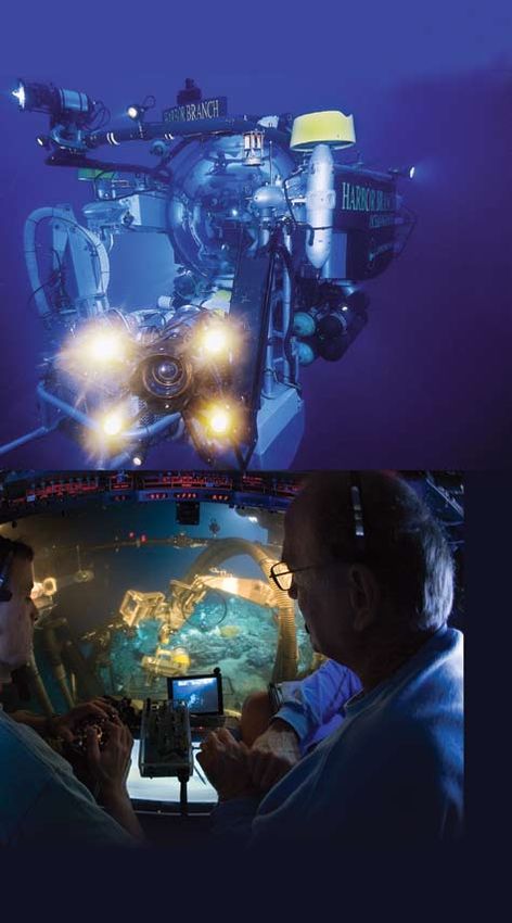
A chain of underwater mountains
                                   65,000 kilometers (40,000 miles)            MAPPING THE SEAFLOOR
                                 long known as the mid-ocean ridge
                               winds its way around the globe at the           As early as the 16th century, navigators
                             edges of the plates that make up Earth’s          began measuring ocean depth with heavy
                           crust. If the oceans were drained, the
                        mid-ocean ridge would be the most massive              ropes, called sounding lines, that were
                     and continuous feature on Earth as viewed from
                  space. Image courtesy NOAA.
                                                                               dropped over the side of the ship. By the
                                                                               19th century, deep-sea line soundings
                                                                               (bathymetric surveys) were routinely
                                                                               conducted in the Atlantic and Caribbean. In
The key to the puzzle lay on the seafloor at one of the
                                                                               1913, the use of sound waves (echo sound-
ocean’s most distinctive features: a 65,000-kilometer-long
(40,000 miles) underwater, volcanic mountain range that
                                                                               ings) to measure ocean depth was patented by
winds its way around the globe, known as the mid-ocean                         German physicist Alexander Behm, who was originally searching for a method to detect
ridge. New seafloor mapping technologies available by                          icebergs following the Titanic disaster. With echo sounding, the time it takes for an out-
the 1940s and 1950s brought many explorers to the                              going pulse to go to the seafloor and back is measured and used to calculate distance
ridge. In 1961, scientists from Scripps Institution of                         based on the average speed of sound in water.
Oceanography studying the mid-ocean ridge off the
U.S. northwest coast documented a distinctive pattern
                                                                               The next breakthrough came with the introduction of sonar—“sound navigation and
of magnetized rocks that resembled the stripes on a ze-                        ranging”—first used in World War I. Multibeam sonar, developed by the U.S. Navy in
bra.5 In a landmark 1963 publication, scientists                               the 1960s, uses an array of beams at varying angles, enabling much larger swaths of
hypothesized that the striping resulted from shifts in                         ocean floor to be mapped with much greater precision. A project in Tampa Bay gener-
Earth’s magnetic field during a period when hot magma                          ated continuous maps of that area from land out through the shoreline and beneath the
erupted at the mid-ocean ridges and solidified to form                         water. The National Research Council report A Geospatial Framework for the Coastal
new ocean floor.6 Other supporting evidence for this                           Zone examines the requirements for generating such maps, which help show how
phenomenon, known as seafloor spreading, eventually                            natural and manmade forces interact and affect processes in complex coastal areas. All
developed into the theory of plate tectonics.                                  of the new mapping techniques have revolutionized our understanding of the topogra-
                                                                               phy of the ocean floor and helped to develop ideas about the fundamental processes
                                                                               responsible for creating seafloor terrains and modifying the oceanic crust.

                             Earth’s crust is made up of a series of tecton-   This image of San Francisco Bay
                             ic plates, analogous to a hardboiled egg with       (right) is created by combining
                             a cracked shell. It forms at mid-ocean ridges,    multibeam sonar data with topo-
                             where two tectonic plates move away from          graphic data. Such images allow
                             each other, and is destroyed at subduction        complex ocean environments to
                             zones, where the plates collide. Many of               be explored in ways that are
                             the world’s great volcanoes and earthquake-         both intuitive and quantitative.
                             prone regions are located near subduction            Image courtesy the Center for
                             zones, driven by these tectonic forces.               Coastal and Ocean Mapping,
                             Image courtesy NEPTUNE and the Center for           University of New Hampshire.
                             Environmental Visualization, University of
                             Washington.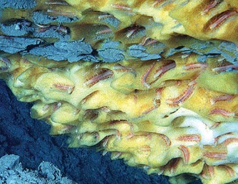
Ocean exploration continues to illuminate details
about Earth processes. The Ridge Inter-Disciplinary
Global Experiments (RIDGE) program, established in
1987 and supported largely by the National Science
Foundation and other federal agencies, funded expedi-
tions that served to broaden understanding of the global              Vent organisms and DNA detection
ridge system and the life it hosts. Since 2001, the new               Microbes associated with hydrothermal vents have evolved enzymes that can
NSF-sponsored Ridge 2000 program (http://www.                         withstand some of the harshest conditions on Earth. One such enzyme, Vent DNA
ridge2000.org) has conducted detailed integrated stud-                polymerase, has been employed by researchers to improve the polymerase chain
ies at three mid-ocean ridge sites in the eastern and                 reaction (PCR), a technique used to detect and identify trace amounts of genetic
western Pacific.                                                      material. PCR involves many cycles of heating and cooling to separate and replicate
                                                                      the two strands of the DNA molecule. The heat-stable DNA polymerase from the vent
Ocean discoveries have answered
                                                                      microbes is a perfect fit for this revolutionary technology. This technique is widely
critical questions about life on earth.
                                                                      used in biological research and in practical applications, such as DNA forensic analysis
In 1977, the deep-sea submersible, Alvin, was sent
to explore a part of the mid-ocean ridge north of the
                                                                      in criminal investigations, medical diagnostic procedures, biowarfare agent detection,
Galápagos Islands known as the Galápagos Rift. Alvin                  and genetic studies of extinct species, for example, woolly mammoths.
was following in the tracks of an unmanned vehicle,
towed by the research vessel Knorr, that had detected
unusually high bottom-water temperatures and had tak-
                                                                and amazed people everywhere. They revealed a rich
en photographs of odd white objects among the under-
                                                                oasis of life, teeming with never-before-seen varieties of
         water lava flows—tantalizing clues about
                                                                shrimp, large clams, huge red tubeworms in white cas-
                    curious, possibly biological fea-
                                                                ings, and other creatures.
                           tures. The images research-
                                 ers took from Alvin
                                                                These images attracted a flurry of attention from sci-
                                     that day stunned
                                                                entists. One of the most puzzling questions was how
                                                                this assortment of creatures managed to thrive in the
                                                                dark in the absence of photosynthetic algae—the base

                                                  The discovery in 1977 of a world of colorful tube worms, crabs, and
                                                   fish living off the chemosynthetic bacteria at the hydrothermal
                                                    vents surprised scientists everywhere. Photo used with permission
                                                     from Richard Lutz, Rutgers University, Stephen Low Productions,
                                                      and the Woods Hole Oceanographic Institution.
of the food web for all known ecosystems in the ocean      scientists expect that
and on land. It turned out that the ecosystem Alvin had    many new species
visited, and other hydrothermal vent ecosystems like it,   await discovery.
are supported by chemosynthetic bacteria that derive
energy from compounds such as hydrogen sulfide and         In 1991, Rachel Haymon,
methane that are found in the waters emanating from the    from the University of Califor-
vents. At vents on the Pacific ridge system, chimneylike   nia, Santa Barbara; Dan Fornari, a
structures known as black smokers spew large amounts       scientist at Woods Hole Oceanograph-
of hydrogen sulfide into the environment. Large clams      ic Institution (WHOI); and their colleagues
and tubeworms soak up hydrogen sulfide to feed the         working near the mid-ocean ridge in the eastern Pacific       A black smoker, as seen
                                                                                                                         from Alvin, is formed when
chemosynthetic bacteria they harbor in their tissues, a    witnessed a new phenomenon— a “blizzard” of microbes
                                                                                                                         superheated, sulfide-rich
symbiotic relationship so central to their biology that    and microbial debris spewing out of the seafloor7. The ma-    water from below Earth’s
                                                                                                                         crust comes through the
these animals don’t even have a mouth or a gut. More       terial rose more than 30 meters above the ocean bottom
                                                                                                                         ocean floor. At 2,500-3,000
than 500 new species have been found at seafloor vents     and formed a thick white layer on the seafloor. Since then,   m below sea level, pres-
                                                                                                                         sures rise dramatically, pre-
since their discovery—a rate of about one new species      this phenomenon of rapid effusion of microbial material
                                                                                                                         venting water from boiling.
every 2 weeks for an entire human generation (~30          has been observed several times in the vicinity of undersea   One of the highest tempera-
                                                                                                                         tures recorded at a black
years). With much of the ocean ridge still unexplored,     volcanic eruptions.
                                                                                                                         smoker is 407ºC (765ºF),
                                                                                                                         measured by the German
                                                                                                                         remotely operated vehicle
                                                                                                                         Quest in 2006 in the South
                                                                         Instead of photosynthesis, vent
                                                                                                                         Atlantic. Photo courtesy
                                                                         communities in the ocean are
                                                                                                                         Woods Hole Oceanograph-
                                                                         powered by chemosynthesis,
                                                                                                                         ic Institution.
                                                                         a process that, in the absence
                                                                         of sunlight, harvests energy
                                                                         from the chemical compounds
                                                                         eminating from the vent. Image
                                                                         used with permission of E. Paul
                                                                         Oberlander, Woods Hole
                                                                         Oceanographic Institution.

ocean exploration 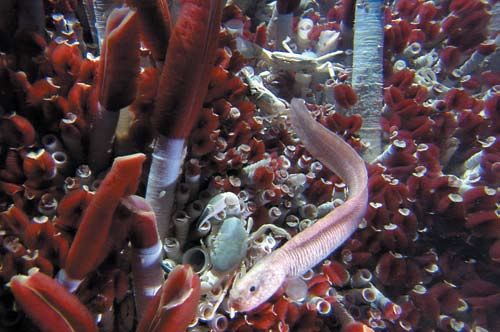
Discovery of “Lost City” Reveals Vents of a
Different Kind
In 2000, a team of scientists led by Donna Blackman from the Scripps Institution of                                                               A blizzard of microbes
                                                                                                                                                  witnessed at the East
Oceanography, Deborah Kelley from the University of Washington, and Jeff Karson of Duke                                                           Pacific Rise advanced
University (now at Syracuse), were exploring the Atlantic on a National Science Foundation-                                                       the hypothesis that a
                                                                                                                                                  massive biosphere may
supported expedition on the research vessel Atlantis. About 2,300 miles east of Florida, on                                                       exist beneath the ocean
the Mid-Atlantic Ridge, the team stumbled on an amazing sight: a hydrothermal vent field                                                          floor. Photo courtesy
                                                                                                                                                  Woods Hole Oceano-
with mounds, spires and chimneys reaching18 stories high. Not only were these structures                                                          graphic Institution.
higher than the black-smoker vents discovered earlier, but they were very different in color,
ranging from cream color to light gray. Kelley dubbed the find “The Lost City.”

The Lost City vents were found to be made up of nearly 100 percent carbonate, the same
material as limestone in caves. The fluids discharging at Lost City are very alkaline—the
opposite of the acidic black smokers—and in some places as caustic as drain cleaner. The
heat and chemicals at the vents come, in part, from the strong chemical reactions produced
when seawater interacts with dark green rocks, called peridotites, which have been thrust up
from deep beneath the seafloor. Lost City microbes live off methane and hydrogen instead
                                                    of hydrogen sulfide and carbon dioxide        These discoveries led to the hypothesis that a massive,
                                                    that are the key energy sources for life at   deep biosphere may exist beneath the ocean floor and
                                                    black-smoker vents. Kelley believes that      overlying marine sediments that rivals the combined bio-
                                                    many more Lost City-type systems may          mass in the entire ocean above the seafloor—or even on
                                                    exist and study of these systems may be       the planet. These microbes might have evolved when the
                                                    key to understanding the origin of life.8     Earth was much hotter, potentially providing new insights
                                                                                                  into the origins of life on Earth, as well as the possibility
                                                                                                  of life on other planets. Studies of how these life forms
                                                                                                  relate to energy from the Earth’s mantle are being
                                                                                                  conducted within the NSF-sponsored RIDGE
                                                                                                  2000 Program.
                                                   This limestone vent, known as
                                                   the Nature Tower, rises 30 meters
                                                   (98 feet) above the seafloor and
                                                   harbors unique microbes that thrive
                                                   without oxygen in warm, methane-
                                                   and hydrogen-rich alkaline fluids.
                                                   Image courtesy D. Kelley,
                                                   University of Washington.
Human History Revealed Through Nautical
archeology
Ocean exploration Answers questions Archeologist George F. Bass was the first person to excavate an ancient shipwreck
about humanity’s past. in its entirety on the sea bed. Since 1960, Bass has excavated a number of
In 1997, oceanographer Bob Ballard took an expedition shipwreck sites dating from the Bronze Age through the 11th century A.D.
to the Black Sea to search for the remains of ancient One of Bass’s expeditions helped change the accepted history of the ancient
dwellings that might have been submerged there. Schol- Mediterranean.
ars agree that the Black Sea, once a freshwater lake, was
flooded when rising sea levels, most likely from melting
Upon hearing news that a local diver had found metal artifacts off the coast of
ice sheets, caused the Mediterranean to overflow. The
Turkey in 1982, Bass took a team of researchers to the site for a decade of
flood was thought to have happened gradually about
expeditions. After more than 20,000 dives, the team uncovered what
9,000 years ago, but a 1997 report by marine ge-
turned out to be the world’s oldest known shipwreck and the largest
ologists Walter Pitman and Bill Ryan at Lamont-
Doherty Earth Observatory posited that the
collection of artifacts from a single site. More than 20 tons of
flood was sudden and took place about 7,150 metals, glass, ceramics, and fine wood were found, among which
years ago—a theory that could provide support was found the oldest documented “diptych,” an early writing
for the biblical story of a great flood.9 tablet consisting of two wooden boards joined by an ivory hinge.
Although the explorers found no evidence to in- The crew dated the ship to the 14th century B.C. Previously,
dicate the loss of an ancient civilization, Ballard’s historians had attributed all sea exploration at the time to the Greeks,
team did find shells and other materials. Carbon but clues from the wreckage indicated that the people aboard the ship
dating of these materials supported the theory that may have been of Middle East origin. Based on these and other important dis-
This early writing
a freshwater lake was inundated about 7,000 years tablet, called coveries, George Bass was awarded the National Medal of Science in 2001 for his
ago. Ballard’s team also made another serendipitous a diptych, was
recovered from an pioneering work as “the father of nautical archeology.” He founded the Institute of
find: four ancient shipwrecks, one almost perfectly ancient shipwreck off Nautical Archaeology in 1973.11
preserved because of low oxygen at the bottom of the coast of Turkey.
Photos (above
Black Sea. The expedition also saw the debut and right) by the
of the remotely operated vehicle Hercu- Institute of Nautical
Archaeology.
les, a 7-foot robot that can retrieve
artifacts using high-tech pincers
with pressure-regulated sen-
sors that operate much like
a human hand.10enabling DiscoverY Exploration is the first step in scientific discovery. “The next generation will explore more of Earth than all previous generations combined.” —Robert Ballard, University of Rhode Island Scientific exploration of the oceans can be traced back at least to Captain James Cook’s three Pacific Ocean expeditions between 1768 and 1779, although expe- ditions by Chinese explorers starting with the Ming Dynasty in 1405 had already provided many navigational clues for later expeditions.12 By the time Cook died, he had mapped much of the Pacific’s shoreline from Antarctica to the Arctic. Cook’s explorations set the stage for Darwin and his voyage on the Beagle (1831- 1836), which laid the groundwork for Darwin’s development of the theory of evo- lution. The influence of the discoveries associated with these early expeditions is impossible to overestimate in terms of both science and culture. The first ocean expedition undertaken purely for the sake of ocean science was the voyage of the HMS Challenger (1872-1876), which set out to investigate “ev- erything about the sea.” With support from the British Admiralty and the Royal
What Is Ocean
                  Exploration?                                                 Exploration continues to evolve as a
                                                                               systematic endeavor. A recent example
    As defined by the President’s Panel on Ocean
                                                                               is the Census of Marine Life (CoML at http://
    Exploration (National Oceanic and Atmospheric
                                                                               www.coml.org)—a concerted 10-year effort in-      Charles Darwin,
    Administration, 2000), ocean exploration is dis-                                                                             voyaging on the
                                                                               volving thousands of scientists from more than
    covery through disciplined, diverse observations                                                                             Beagle in the 1830s,
                                                                               80 nations who are cataloging the diversity,      might have seen a
    and recordings of findings. It includes rigorous,                                                                            Sally Lightfoot crab like
                                                                               distribution, and abundance of marine life in
    systematic observations and documentation of                                                                                 this one on his visit to
                                                                               the world’s oceans. Findings are collected in     the Galápagos Islands.
    biological, chemical, physical, geological, and                                                                              Photo courtesy Susan
                                                                               the Census database and will be issued in a fi-
    archeological aspects of the ocean in the three                                                                              Roberts.
                                                                               nal report in 2010. The Census has uncovered
    dimensions of space and in time.
                                                                               hundreds of previously unknown species—
                                                                               including 150 species of fish—and many
                                                                               new phenomena, such as a school
Society, crew members made systematic measurements                             of 20 million fish, roughly the size
every 200 miles around the globe, traversing each ocean
except the Arctic. Ocean depth was measured by lower-
ing a sounding rope over the side; specimens were col-
lected with nets and dredges. The results were staggering,
filling 50 volumes and resulting in the identification of
4,417 new species. The Challenger also discovered that
the ocean was not—as had been assumed at the time—
deepest in the middle, giving the first hint of the existence
of a global mid-ocean ridge system. The Challenger expe-
dition also confirmed that life existed in the deepest parts
of the ocean.

      From 1872-1876, the HMS Challenger followed this expedition route
     to investigate “everything about the sea.” Reprinted with permission of
    Brooks/Cole, a division of Thomson Learning. www.thomsonrights.com.
in the United States, a new program to fund exploration,
as recommended in Exploration of the Seas: Voyage
into the Unknown, could provide the resources needed
to systematically survey the vast unknown regions of
the ocean.
of Manhattan, swarming just off the coast of New
Jersey. The Census is intended to help identify rare spe-
cies and important breeding areas to aid in the pursuit
of sustainable management of marine resources, among
other goals.
Research vessels: The basic platform for ocean research
Currently, a substantial portion of the limited resources and exploration. Research vessels, or R/Vs, carry the
scientists, equipment, and instrumentation from the shore
for ocean research is spent revisiting established study to research sites in the coastal and deep ocean. Two of the
sites to verify hypotheses and confirm earlier findings. newest R/Vs in the U.S. research fleet are the Marcus G.
Langseth (top), owned by the National Science Founda-
For example, researchers return to hydrothermal vent tion and operated by Lamont-Doherty Earth Observatory of
sites due to their unique environmental conditions, Columbia University, and the Kila Moana (bottom), owned
by the U.S. Navy and operated by the University of Hawaii.
biological diversity, and intriguing research ques- The Marcus Langseth is specialized to conduct geophysi-
tions. However, it is harder to secure funding to visit cal research, such as imaging the ocean crust beneath the
seafloor. The Kila Moana is a general purpose R/V with a
places yet unexplored—missions considered high-risk unique “SWATH” hull (small waterplane area, twin hull)
in terms of return on investment. Given the continued designed to provide a comfortable, stable platform in high
sea conditions. Photos courtesy Columbia University and
support for and successes of oceanographic research the University of Hawaii.
12 OCEAN SCIENCE SERIESBeing there is essential to a true
understanding of the deep ocean.
“This unattractive jello-like mass is the unfair land
version of amazing and delicate creatures that can
display their true beauty only in their natural watery
environment.”
—Lawrence Madin, Director of Research,
Woods Hole Oceanographic Institution
In 1934, William Beebe and Otis Barton crouched inside
a 54-inch-diameter steel bathysphere and were lowered In 1934, William Beebe and
Otis Barton descended to a record
by cable to a record depth of 922 meters (3,025 feet) off depth of about 3,000 feet near
the coast of Nonsuch Island, near Bermuda. With only Bermuda in this tethered bathysphere,
which was devised in 1928 by Barton.
two small windows and a 250-Watt light to illuminate Photo courtesy NOAA. Beebe
the area directly outside the sphere, Beebe and Barton described a world of “twinkling lights,
silvery eels, throbbing jellyfish,
were able to view sea life that had never been seen be- and living strings,” such as those
fore in the natural environment. The bathysphere had shown here. Images courtesy
E. Widder, Harbor Branch
no propulsion capability and was raised and lowered Oceanographic Institution.
by cable on the mother ship. It was reported that Beebe
was so overcome with what he saw that he had difficulty
describing it.13
Before researchers had the vehicles to transport them to
the deep ocean, they relied on samples pulled to the
surface by dredge or trawl—yielding sea creatures that
were typically damaged, misshapen, and out of their el-
ement on dry land. Development of deep submergence
vehicles by the U.S. Navy helped meet the scientific
need to visit the deep ocean to systematically sample
and obtain intact specimens, conduct experiments, and
view animal behavior or habitat in real time.
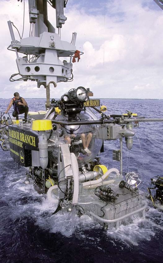
ocean exploration 13Since World War II, more than 200 human- Just as the space shuttle is built to withstand the near
occupied vehicles, known as HOVs for short, total vacuum of outer space, Alvin is built to withstand
have been built, although only a few of the crushing pressure of the deep ocean. Its titanium hull
them are dedicated to scientific research. can remain submerged for 10 hours under normal con-
Alvin is the best-known HOV both in the ditions, but its life support systems allow occupants to
United States and abroad. Built in 1964 remain underwater for 72 hours if necessary. Alvin can
with funding from the US Navy’s Office of dive to a depth of 4,500 meters (2.8 miles).
Naval Research, it is now operated as
a research vessel by the Woods Hole Two other U.S. academic and research organizations
Oceanographic Institution as part of the operate human-occupied submersibles: the University
the National Deep Submergence Facil- of Hawaii has two Pisces submersibles capable of diving
ity (NDSF) located in Woods Hole, Mas- to 2,000 meters (1.2 miles), and Harbor Branch Oceano-
sachusetts. For about the past 20 years, graphic Institution in Florida has two Johnson Sea-Link
the facility has been cooperatively fund- submersibles that can dive to approximately 1,000 meters
ed by the National Science Foundation, (0.6 miles). France and Russia operate HOVs that can dive
the Office of Naval Research, and the to a depth of 6,000 meters (3.7 miles), and Japan’s Shinkai
National Oceanic and Atmospheric 6500 is able to dive down 6,500 meters (4.0 miles). China
Administration (NOAA). is building an HOV that will be able to dive to 7,000 me-
ters (4.3 miles).
(Top) The Harbor Branch Oceano-
graphic Institution’s Johnson Sea-Link
hovers in midwater with a pilot and
observer on board.
(Bottom) Researchers on a dive
in the Johnson Sea-Link.
Photos courtesy Harbor Branch
Oceanographic Institution.Unoccupied vehicles greatly enhance
ocean exploration capabilities.
Descending beneath the surface to explore the ocean’s
depths provides unique opportunities for observation,
but new technologies have made it possible to virtually
see and study much more of the ocean than would be
possible with just HOVs. Scientists and engineers con-
tinue to develop and improve unoccupied vehicles that
can be remotely operated from ship or shore to increase
access and enhance capabilities of ocean researchers.
In the 1960s, towed instruments were first developed for
underwater photography, acoustical mapping, and mea-
surement of water temperature, magnetic field strength, The Woods Hole
Oceanographic
and other properties. The first success was Deep Tow, Institution’s remotely
developed in 1960 by Fred Spiess and his colleagues at operated vehicle Jason
duced in the 1980s and rapidly advanced in the 1990s.
II is lowered into the
Scripps for mapping the deep seafloor. ROVs are controlled by a pilot on a surface ship and water. Photo courtesy
Woods Hole Oceano-
tethered by a fiber-optic cable. The cable transmits real-
graphic Institution.
Towed vehicles were succeeded by unoccupied, re- time data to the scientists and engineers on board the
motely operated vehicles (ROVs), which were intro- ship, and the pilot can use dexterous manipulator arms
The many faces of Alvin. The Alvin,
which is operated by the Woods Hole
Oceanographic Institution,
Massachusetts, is the best known
deep-diving vehicle in the world.
Alvin has one pilot and routinely
carries two scientific observers—the
only deep-diving submersible that can
do this—and dives as deep as 4,500
meters (2.8 miles). It is fitted with
two manipulator arms and four
externally mounted video cameras.
Photo courtesy Woods Hole Oceano-
graphic Institution.
ocean exploration 15(Left) The Woods Hole AUV known as ABE (Autonomous Benthic Explorer)
can dive to depths of 5,000 meters (16,500 feet) for 16 to 34 hours and is
equipped with innovative robotics and sensors to accomplish a variety of
missions. (Right) The AUV Xanthos, which was designed by the Massachusetts
Institute of Technology, can dive to 3,000 meters (1.86 miles). Photos courtesy
Massachusetts Institute of Technology Sea Grant.
pied, untethered vehicles are sent on preprogrammed
missions that can cover much more ground than ROVs
in the same amount of time. The Woods Hole AUV ABE
to collect samples. Because the cable provides power to (Autonomous Benthic Explorer) has been used to survey
the vehicle, ROVs can remain on the bottom longer than the seafloor by night; when it surfaces at dawn, it deliv-
HOVs. The National Deep Submergence Facility oper- ers high-precision maps that scientists can use during
ates the Jason II-Medea ROV system; many more ROVs daytime to guide their explorations in Alvin.
are owned and operated by other institutions around the
world (see Table 1). New types of autonomous robotic vehicles are being
developed that can journey across hundreds of miles of
ROVs are a good match for detailed experiments and ocean, gathering data along the way. One such vehicle,
observatory work at sites of interest on the seafloor. the glider, is a type of AUV with wings that can propel it-
Special tool sleds equip ROVs with the specific sampling
and observing gear needed for each mission. These
tool sleds can be changed aboard ship within hours to
reconfigure a vehicle for another type of mission.
Complementing the work of ROVs and HOVs is the au-
tonomous underwater vehicle, or AUV. These unoccu-
With a body 1.8 meters (~6 feet) long, the Uni-
versity of Washington’s pink Seaglider weighs 52
kilograms (~114 pounds) in air and has a low-
drag shape enabling it to slip efficiently through
the ocean. Seagliders have carried out missions
lasting as long as seven months on a single set
of batteries to profile temperature, salinity, dis-
solved oxygen, and bio-optical properties in the
upper layer of the ocean. Photo courtesy
Charlie Eriksen, University of Washington.
16 OCEAN SCIENCE SERIESDeep-Sea ROVs Used for Scientific Purposes Getting under the Arctic ice
Maximum The Arctic Ocean is the world’s most isolated ocean—cut off from the deep
Operating
ROV Operator Depth (m) waters of the rest of the world’s oceans by geologic changes almost 65
UROV7K JAMSTEC, Japan 7,000 million years ago. Interest in the Arctic Ocean’s hydrothermal vent activity has
Jason II-Medea WHOI, United States 6,500 stimulated many expeditions. In 2007, a 30-member research team based at
Victor 6000 IFREMER 7,000 WHOI, with funding and support from the National Science Foundation, began
ISIS Southampton Oceanography Centre, 6,500
U.K.
exploring the Gakkel Ridge, located between Greenland and Siberia. The team
Kiel 6000 Leibniz Institute of Marine Sciences, 6,000 used three new vehicles specifically designed for the Arctic ice—two AUVs, the
Germany
Puma and Jaguar, and a tethered, remote-controlled sampling system called the
LUSO Portuguese Task Group for the Extension 6,000
of the Continental shelf (EMEPC) CAMPER. NASA partially funded the project, because the findings and meth-
Ropos Canadian Scientific Submersible Facility, 5,000 odologies may be applicable to future space missions, such as the exploration
Sidney, B.C., Canada
of Europa, a moon of Jupiter, where liquid water lies beneath the icy surface.
QUEST Center for Marine Environmental Studies 4,500
(MARUM), Germany This Arctic venture is one of many projects involved in the International Polar
Tiburon Monterey Bay Aquarium Research 4,000 Year (IPY), a multinational effort begun in February 2007 to explore the polar
Institute (MBARI), United States
region that is described in the National Research Council report, A Vision for the
Hyper Dolphin JAMSTEC, Japan 3,000
HYSUB 75-3000 International Polar Year (2004).
The AUV Jaguar being lowered into the ocean (below)
and recovered (left). Photos courtesy Woods Hole
Oceanographic Institution.
self through the water column, both horizontally
and vertically. Gliders can be programmed to go
to particular places both when they are launched
and during their mission, via satellite, when they
surface to transmit data. Equipped with diverse
sensors, gliders can measure ocean currents, sa-
linity, temperature, phytoplankton concentrations,
and chemical changes. Gliders could very soon mea-
sure the properties of the ocean on a near constant ba-
sis, whereas 20 years ago, such measurements could be
made only during infrequent research cruises.SUPPORT for research is insufficient to
realize the scientific potential of deep-
diving vehicles.
“The bottom of the ocean is Earth’s least explored fron-
tier, and currently available submersibles—whether
manned, remotely operated, or autonomous—cannot
reach the deepest parts of the sea.”
—Shirley A. Pomponi, president and CEO of Harbor
Branch Oceanographic Institution, Fort Pierce, Florida.
Although a dozen men have walked on the moon, just
two have traveled to the farthest reaches of the ocean,
but only for about 20 minutes—and it happened back
in 1960. Lt. Don Walsh and Jacques Piccard descended
Trieste is one of two vehicles, and the only occupied vehicle, to
in the Trieste, the deepest-diving HOV ever built. Trieste make it to the deepest part of the ocean—the bottom of the Mariana
settled into the deepest part of the ocean, the bottom of Trench off the coast of Guam, 10,915 meters (6.7 miles) deep. The
ship was originally built to dive to 6,300 meters, but after purchasing
Challenger Deep in the Mariana Trench off the coast of her in 1957, the Navy refitted her to withstand the 16,000 pounds
Guam at 10,915 meters (6.7 miles) below the surface. (about 1,000 atmospheres) of pressure at the bottom of the trench.
Photo courtesy U.S. Navy.
This remarkable HOV, purchased by the U.S. Navy in
1957, dove under her own power with forward control Scientists and engineers are now testing innovative hy-
from a propeller and rudder. The Trieste was designed to brid vehicles to revisit these astounding depths. These
descend only to a depth of 6,300 meters, but the Navy vehicles can operate as both an AUV and ROV, thus
refitted her with a stronger sphere to withstand the wa- bringing the advantages of both types of vehicles to
ter pressure at the bottom of the trench, which is more the same expedition.14 Nereus, being developed by en-
than 1,000 times the atmospheric pressure at sea level. gineers at Woods Hole, is one such vehicle; it can be
Only one other vehicle to date has made it to the converted during an expedition from an AUV that identi-
bottom of the Mariana Trench—Japan’s ROV Kaiko, in fies the most promising sites for exploration into an ROV
1995. Unfortunately, the Kaiko was lost in a typhoon in that can explore those sites in detail. Nereus will be able
May 2003. to dive down to depths of 11,000 meters (slightly deeper
18 OCEAN SCIENCE SERIESthan the Trieste) and swim freely. It operates under in-
tense pressures, icy temperatures, and complete dark-
ness, and it is completely battery operated. The Nereus
will be used for a variety of purposes, from taking sam-
ples of rock and fluids from the seafloor to surveying
life forms that exist in the vast unknown expanses of the
deep sea.
Although Nereus and other high-tech AUVs and ROVs
are expanding scientists’ reach into the deepest trenches
of the world ocean, these tools do not yet emulate the
way a scientist can perceive the seafloor from within a proposal to build a replacement for Alvin, with an ex-
a manned submersible. There is still high demand for pected completion date of 2011. If the new vehicle ulti-
HOV access. Exploration of the Seas called for a fleet of mately meets its goal of 6,500 meters, it will reach close
new manned submersibles capable of diving to at least to 99 percent of the of the global ocean seafloor. Ascent
6,500 meters (21,325 feet). Since these reports were and descent speeds will also be improved to maximize
published, the National Science Foundation has funded the “bottom time” available per dive.
The National Research Council report Future Needs in
Deep Submergence Science (2004) concludes that the
scientific demand for deep-diving vehicles (both HOV
and ROV/AUV) is not being met, primarily due to lack
of operational funding support. Without operational
support, the best-array vehicles, sensors, and other
tools will remain grounded. The report recommends
improvements in funding for and access to deep-
diving vehicles.
Nereus, being developed by engineers at Woods Hole
Oceanographic Institution, can serve as both an AUV
and an ROV and will be able to dive to a depth of
11,000 meters. Photo courtesy Woods Hole
Oceanographic Institution.
ocean exploration 19DeepeNING DiscoverY Ocean observatories enable exploration through the dimension of time. Expeditions to new areas for short periods can provide “snapshots” of the state of the ocean, but a revolution in technology is needed to observe change or transient events over time, such as the development of algal blooms, transport of ocean sediments, the generation of tsunamis, changes in fish stocks, volcanic eruptions, and the effects of climate change on ecosystems. The National Research Council report Illuminating the Hidden Planet: The Future of Seafloor Observatory Science (2000) concludes that ocean floor observatories— unmanned systems of instruments that collect and transmit data via satellite or high-bandwidth telecommunications networks—enable exploration through the dimension of time. U.S. and international efforts have made significant progress in recent years to- ward establishing ocean observatories. The Integrated Ocean Observing System (IOOS), the U.S. contribution to the international Global Ocean Observing Sys- tem, is designed as a large network that collects high-resolution data along the entire U.S. coast. This information supports a wide range of operational services, including weather forecasts, coastal warning systems, and the monitoring of al- gal blooms.
The Ocean Observatories Initiative (OOI), a National
Science Foundation program, will enable land-based
exploration and monitoring of processes throughout the
seafloor, water column, and overlying atmosphere by
real-time, remote interactions with arrays of sensors, in-
struments, and autonomous vehicles. For the first time,

                                                                        scientists, educators and
                                                                        the public will have real-
                                                                        time access to the data and
                                                                        imagery being collected, so that
                                                                        they can learn about events such as
                                                                        underwater volcanic eruptions and anoxia
                                                                        events as they happen, even if there are no ships
                                                                        in the area.
                                                                                                                                        Ocean observatories are
                                                                                                                                        unmanned systems of
                                                                        The National Research Council report Enabling Ocean             instruments, sensors, and
                                                                        Research in the 21st Century (2003) concludes that re-          command modules that
                                                                                                                                        are connected either to a
                                                                        search in the Ocean Observatories Initiative should be          surface buoy or to fiber
                                                                        closely linked to the operational activities of the Integrat-   optic cables that provide
                                                                                                                                        research scientists continu-
                                                                        ed Ocean Observing System. The report recommends                ous interaction with the
                                                                        coordination in the areas of developing infrastructure,         ocean environment. Image
                                                                                                                                        courtesy University of
                                                                        instrumentation, protocols for use of ships and undersea        Washington.
                                                                        vehicles, and data integration and management. Today,
                                                                        this collaboration is supported by the Interagency Work-
                                                                        ing Group for Ocean Observations.
The world’s first underwater cabled observatory to span an entire
plate will be installed as part of a collaborative effort between the
U.S. Ocean Observatories Initiative (OOI) and U.S. and Canadian
institutions. Fiberoptic cables will extend high bandwidth and power
to a network of hundreds of sensors across, above, and below the
seafloor, allowing in situ, interactive monitoring of the ocean and
seafloor for the next 20 to 30 years. Image courtesy University of
Washington Center for Environmental Visualization.
                                                                                                                           ocean exploration 21
Observations from
satellites reveaL new
insights into the
ocean.
Although ships have been crisscrossing
the ocean for centuries, Earth observations
from satellites provided the first truly global view
of the ocean and its processes. Since the earliest satel-
lites were launched more than 50 years ago, they have
revolutionized ocean exploration. Satellites provided
the first uniform view of seafloor topography, and, by
the 1990s, global positioning system satellites had dra-
matically improved navigation for submersibles. Even
through 4,000 meters of water, deep submergence ve-
hicles can be precisely located within meters, enabling
repeated visits to small, isolated sites.
Recent improvements in satellite communications on
ships are fundamentally changing the nature of sea-go-
ing science. Many oceanographic ships now have Inter-
net connections through a network known as HiSeasNet.
With this network, shipboard scientists can work in real-
time with their land-based colleagues. In preparation for
the OOI, in 2005, the University of Washington used a
Galaxy XR10 satellite connected to the research vessel
Thompson and the ROV Jason to send, for the first time,
real-time high-definition video of an active hydrothermal
vent field off Vancouver to viewers throughout the United
In 2007, this massive steel pyramid was placed on the seafloor at a depth
of 900 meters off Monterey Canyon in California to house and protect the States, Europe, and Asia.
electronic heart of the Monterey Accelerated Research System (MARS)
deep-sea ocean observatory. The MARS observatory is a testbed for future
components of the Ocean Observatories Initiative. Photos courtesy Satellite data are also vital to understanding ocean pro-
Monterey Bay Aquarium Research Institute. cesses. For example, although ship-based expeditions
22 OCEAN SCIENCE SERIESImage courtesy NASA.
had advanced some hypoth-
eses, the Gulf Stream was not
fully understood until sea surface
temperature readings from satellites
were able to clearly show the complex,
winding track of the warm Gulf current, which
shifts location over time. These measurements of
sea surface temperature were made by Advanced Very
High Resolution Radiometer that began in 1978 with the
launch of the satellite TIROS-N. These temperature data
have been used to address a broad range of oceano-
graphic research questions, including studies of climate
change and regional climate variability, and the dramat-
ic sea surface warming associated with El Niño.
The ability to derive global maps of chlorophyll concen-
tration in the upper ocean from satellite sensors such
as SeaWiFS has been another groundbreaking achieve-
ment for the oceanographic community. Chrorophyll
measurements are used to estimate the biomass of
phytoplankton, which is an indicator of the biological
productivity in various water masses around the globe.
These images can be used to guide ship-based research
related to harmful algal blooms, climate change, fisher-
ies management, and other topics.
(Top) NASA’s SeaStar spacecraft, launched in 1997, carries an instrument called the
Sea-viewing Wide Field of View Sensor or “SeaWiFS.” SeaWiFS takes ocean color
Data management is vital to scientific measurements that can be used to calculate chlorophyll concentrations, which
discovery. can help identify harmful algal blooms. (Bottom). NASA’s Terra and Aqua satellites
carry instruments known as MODIS (moderate resolution imaging spectroradiom-
New oceanographic sensor systems could potentially eter), which capture detailed measurements of sea surface temperature that are vital
collect more data in one hour than the ocean explora- to climate- and weather-related research. Images courtesy NASA.
tion vessel Challenger collected in one year. But effec-
tive management of data—including making sure that
ocean exploration 23Studying the same places in new ways using
“metagenomics”
Researchers are now looking at the ocean through a new lens: the science of data formats are compatible and that data are archived
”metagenomics.” In the ocean, as on land, thousands of species of tiny microbes and retrievable—is a continuing challenge. Data man-
play a key role in nutrient cycles, including the carbon cycle, and in maintaining agement is important for many reasons, not the least of
Earth’s atmosphere, among other important functions. Metagenomics enables which is that data collected now may be used to answer
researchers to quickly sequence the DNA of all microbes in a given sample, in this questions that arise in the future.
case seawater, revealing how microbes function and how they may work in different
For example, scientist Ken Johnson of
environments.
Monteray Bay Aquarium Research
Institute set out to find evidence for
Working off the coast of Hawaii, Ed DeLong, of the Massachusetts Institute of Technol-
one of the oldest questions in ge-
ogy, and his team have been collecting marine microbes at various depths. After
ology: how marine canyons,
mapping 64 million base pairs (units of DNA), the team discovered thousands of new
such as the one at the mouth
genes and also variations in the genetic composition of microbes at different depths. of the Salinas River in Mon-
For example, microbes near the ocean surface had more genes devoted to taking in terey Bay, are formed. In
iron, an element necessary for growth in that zone. Genomes from organisms in the 1933, Francis Shephard of
deep ocean had many “jumping genes,” or pieces of DNA that can move from one the Scripps Institution of
part of the genome to another. Oceanography hypothe-
sized that canyons are
The National Research Council report The New Science of Metagenomics (2006) calls for formed by infrequent but
more metagenomic research, not only in the ocean but in all environments on Earth. high-energy “hyperpycnal”
river flows so thick with sus-
pended sediment that they sink
and scour the seafloor at the riv-
er’s mouth despite being warmer
and fresher than the surrounding
ocean water.
Johnson used a Monterey Bay database to study
10 years of recorded ROV dives in Monterey Bay. The
database stores information on the date, time and lo-
cation of all dives, ocean conditions at the time of the
dive, and video frames of any significant observations.Sea worms in methane hydrates
A few decades ago, a potential new source of fuel called methane hydrate was discovered
Johnson scanned the database for an example of a dive in the ocean. Produced when water and methane mix under low temperatures and in
that occurred as the Salinas River reached flood stage, deep water under high pressures, methane hydrates look like ice but will burn if ignited.
and he found one from March 1995. The video cam- By some estimates, the energy locked up in methane hydrate deposits could be more
eras told it all. They showed a mudflow so thick that the than twice the global reserves of all conventional gas, oil, and coal deposits combined.
video cameras could not detect the energy from However, no one has yet figured out how to mine the gas inexpensively and safely.
their own lights. Johnson had discovered a
hyperpycnal flow actively eroding Mon- Scientists had hypothesized that bacteria might live in methane ice mounds, but in 1998
terey Canyon.15
a surprising discovery was made. On a dive in the Harbor Branch Oceanographic Institute’s
Johnson Sea-Link in the Gulf of Mexico, pilot Phil Santos and Pennsylvania State Univer-
Exploration of the Seas recom-
sity scientist Chuck Fisher came upon dense colonies of 1- to 2-inch-long, flat, pinkish
mends that data access and man-
worms that were living in the methane ice mounds. Researchers think that the worms
agement policies be established
may be living off bacteria that grow on the methane using energy from chemical reactions
before a national ocean explo-
ration program begins. In par- to produce organic compounds for food, rather than using sunlight (chemosynthesis).
ticular, the program should Study of the worms may shed light on the chemistry of methane hydrates that would be
encourage oceanographers to useful in the quest to extract, store, and use it as an energy source.
improve their capacity to ac-
cess and integrate data from Photo courtesy Harbor Branch Oceanographic Institution.
many ocean sciences, extract
new information from those
data sets, and convey new in-
sights to decision makers and the
public. The program should seek
ways to contribute to or link explora-
tion data to existing oceanographic and
archeological data archives.
The National Research Council report Earth Obser-
vations from Space identifies resources needed to sustain
By combing through videos of exploratory dives, researchers discovered that
underwater canyons, as shown in this image of Monterey Canyon, are cut when
floodwaters from the Salinas River that are thick with sediments sink rapidly
and erode the bottom of the ocean. Image courtesy Monterey Bay Aquarium
Research Institute.the momentum in satellite observations. The report rec- A sustained international exploration effort is not unprec-
ommended funding for training the necessary workforce, edented. The International Decade of Ocean Exploration
developing more accurate instruments, and expanding (1971-1980) is the most significant modern precursor,
the infrastructure to make the best use of satellite data. with 28 countries cosponsoring multidisciplinary re-
search motivated in part by concern for the health of the
To be of most use, exploration efforts world ocean and anticipated uses of marine resources,
must be coordinated and sustained. as well as scientific curiosity. The program is considered
In June 2000, the President directed the Secretary of a great success; it enabled the discovery of the hydro-
Commerce to convene an Ocean Exploration Panel, thermal vent systems and provided data on the physics,
comprising ocean explorers, researchers, non- geochemistry, biology, and geophysics of the ocean that
governmental organizations, industry representatives, fueled hypothesis-driven research for decades.
and marine educators. The panel developed a national
strategy for exploring the oceans in Discovering Earth’s Following the publication of the Ocean Exploration Pan-
Final Frontier: A U.S. Strategy for Ocean Exploration. el’s report and the National Research Council’s Explora-
The report details recommendations for estab- tion of the Seas, the National Oceanic and Atmospheric
lishing and promoting an interagency, mul- Administration (NOAA) took the lead in creating a
tidisciplinary Ocean Exploration Pro- new ocean exploration effort. To date, NOAA has
gram that is global in scope but conducted several multidisciplinary research mis-
concentrated in U.S. waters. sions sometimes with collaborative funding from the
National Science Foundation. In 2008, NOAA launched
the Okeanos Explorer, a ship dedicated to discovery
expeditions. The ship is wired to send live images and
data from the ocean via broadband satellite to scien-
tists standing watch in any of five Exploration Command
Centers, where those scientists can lend their expertise
to the expedition from ashore.
Exploration of the Seas concludes that the sweeping
goals of an exploration program can be met only if spe-
cific ocean regions or problems are tackled. The report
Image courtesy Woods Hole Oceanographic Institution.You can also read