OFFICIAL 2021 PROGRAM - Register today at www.locateconference.com - Locate Conference
←
→
Page content transcription
If your browser does not render page correctly, please read the page content below
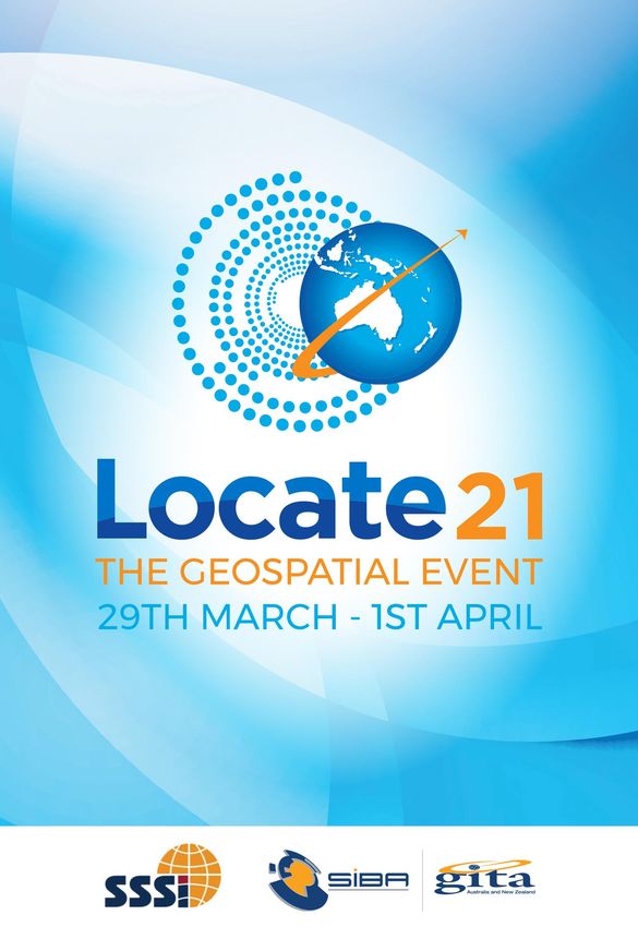
OFFICIAL 2021 PROGRAM

        Register today at
     www.locateconference.com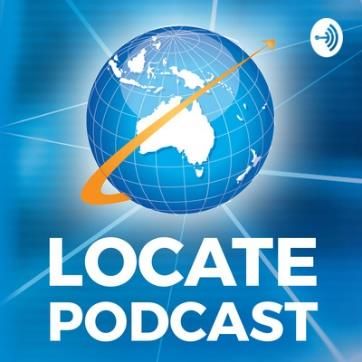
Convergence, Collaboration and Community –
 towards a stronger economy

                             COME & JOIN US AT THE GEOSPATIAL EVENT OF THE YEAR
FOUR DAYS OF LEARNING, NETWORKING & COMING TOGETHER AS AN INDUSTRY WHO BELIEVE THAT NOW,
                           MORE THAN EVER, LOCATION MATTERS!
Each year, the Locate conference attracts national and international delegates from within and outside the spatial & surveying
industry. As Australia’s premier spatial & surveying conference, Locate provides guests with a unique opportunity to learn about
the latest trends and applications in geospatial technologies and encourages them to harness the power of location like never
before.
It also facilitates networking and business development. This year we are excited to introduce our new hybrid model event for the
Locate21 Conference. The conference will see a combination of virtual and live in person events in Brisbane, Sydney, Melbourne,
and Canberra. With a range of new formats and events we hope this will allow even more people to participate, whether that be
meeting up at one of many local live sites or patching in online from your workplace or home.
Virtually and in person, we will share how geospatial and location technologies and practices are being used, highlighting the
fundamental role they play in enabling our digital economy throughout theme Convergence, Collaboration and Community –
towards a stronger economy.
We will also explore and facilitate the convergence of the spatial industry and the influence and importance of our industry to
broader industries and the wider economy. Spatial data and location services now underpin many activities driving us to explore
collaborative partnerships with businesses in other sectors, working together to produce a greater whole and to recognise new
ways of doing things.
Locate21 will also provide delegates an opportunity to discover how new technologies and practices are able to equip us to meet
the many challenges our planet is faced with, enlighten us as to how we can learn from our collective experiences and enable us
to share in new collaborative partnerships that will enhance the ecosystem of the geospatial community and ensure the value of
location data to inform and enable good decision making in the broader community.
Locate Conferences have always been the event where the industry meets, and Locate21 will be no different. So please join us,
wherever you are in Australia, or across the world for what will be a new and exciting chapter in our journey, together…

LIVE SITE LOCATION

CANBERRA: Rex Hotel, 150 Northbourne Ave, Braddon ACT 2612

There will not be any plenary speakers presenting live in Canberra.

Have the chance to meeting the following sponsors:

                                   www.locateconference.com
                                      Program is correct at time of print and subject to change.
Convergence, Collaboration and Community –
towards a stronger economy

                                       MONDAY 29 MARCH – VIRTUAL ONLY
                                      CANBERRA TIME SHOWN ON PROGRAM
OPTIONAL WORKSHOPS
Workshops on Monday are being held to the platform only, no in person aspect. Pre-registration is required.
1030 – 1130 Canberra time
Virtual only – workshop is being held to the platform only, no in person aspect. Pre-registration is required.
Southern Positioning Augmentation Network (SouthPAN)
Moderator: Eldar Rubinov, FrontierSI
Panellists: Christian Wullems, Qascom Australia Pty. Ltd., Charles Wang, Queensland University of Technology, Dean Dobson,
Buildvation, Grant Pearse, Scion Research
The aims of this workshop are to inform attendees of the Satellite Based Augmentation System (SBAS) for Australia and New Zealand,
explain what the system is and how it works, present some findings from the SBAS Test-bed between 2017-2019, and outline current
work being done to test the SBAS for operational use across all sectors of industry. We hope that the attendees will be aware of the new
signals, the benefits of using the new technology, will know where to go to get further information about SBAS, and how to go about
integrating the system with industry-specific solutions.
1030 – 1300 Canberra time
Virtual only – workshop is being held to the platform only, no in person aspect. Pre-registration is required.
Making Data Smarter
Andrej Mocicka, Ashish Manandhar, Michael Studdert, Andrew Bashfield, Sam McDonald, Priyantha Pallagama, Tom Farrington
+ Simon Laird, 1-Spatial
Whether you are working in government, utility or transportation industries, the one thing that most people would agree on, is that
data has never been quicker and easier to obtain. With this, the amount of data that can and is collected, has increased exponentially
in a number of areas. What arguably has not become easier, is managing the data and providing smart data to both the spatial and non-
spatial industries.
This workshop will showcase our product range and case studies providing examples of how data is being obtained and then utilised for
a variety of purposes. They will show that the data provided was not suitable for various reasons and how by using simple business rules
data was validated. In addition, it will be shown that where data has not complied to the business rules, data can be rectified to ensure
it will validate and thus allow it to be used with confidence going forward. Ultimately being able to use the business rules to create and
extract additional intelligent information from the validated and corrected data.
The workshop will cover Intro to 1Spatial, 1Integrate – case study, How FME is used around the world, 1Data Gateway – case study, FME
Products, FME Case Study Yarra Valley Water, A chat with 1Spatial’s Tech team.
1130 – 1330 Canberra time
Virtual only – workshop is being held to the platform only, no in person aspect. Pre-registration is required.
Fundamentals of Digital Twin Readiness (30 participants max)
Adam Beck, Smart Cities Council & Gavin Cotterill, PCSG Australia
The Smart Cities Council and consultancy firm PCSG will be hosting a Digital Twin Readiness Workshop at Locate21. This first of its kind
training session will provide delegates with a thorough overview of digital twins, the benefits, the core principles, and practices, as well
as explore the role that the spatial sector play in this emerging agenda. This workshop has been designed for both government and
private sector stakeholders alike, and will touch on both policy making issues, and key issues relevant to practitioners. The workshop
also draws on leading frameworks and standards, and relevant guidance documents that delegates will be able to reference after the
session.
The workshop agenda will be structured as follows:
 Overview: The Digital Twin                     Participants will gain a full understanding of what a digital twin is; how its different
                                                components work together synergistically; the benefits it delivers to governments,
                                                industry and citizens; and a conceptual framework for understanding opportunities.
 Universal principles of a Digital Twin         Understand the key universal principles that apply to any digital twin, as outlined in the
                                                Digital Twin Guidance Note (Smart Cities Council). These principles were derived from
                                                existing reference materials, such as the Centre for Digital Built Britain and supporting
                                                BSI and ISO standards.
 Digital Twin Case Studies                      Presentation of diverse digital twin use cases, drawing upon real-life case studies from
                                                around the world.
 Strategy on a Page                             High-level drafting of Digital Twin strategy for your organisation, including targets,
                                                outcomes, investments, and actions.

                                    www.locateconference.com
                                          Program is correct at time of print and subject to change.
Convergence, Collaboration and Community –
towards a stronger economy
MONDAY 29 MARCH – VIRTUAL ONLY (CONTINUED)
CANBERRA TIME SHOWN ON PROGRAM
OPTIONAL WORKSHOPS
Workshops on Monday are being held to the platform only, no in person aspect. Pre-registration is required.
1130 - 1330 Canberra time
Virtual Only – workshop is being held to the platform only, no in person aspect. Pre-registration is required.
Surveying and Spatial Professional Volunteers Program – Making Life Better for Others through Knowing Where!
Dr Lesley Arnold, President-elect SSSI and Chair SSSI DMR-SIG & Nathan Eaton, NGIS Australia
This workshop aims to gather information from surveying and spatial sciences professionals on what they want from a ‘Surveying and Spatial
Professional Volunteers Program’. One of the many reasons people join a professional body is to give back to the community. Traditionally,
volunteers have achieved this through committee roles, providing support at events, and mentoring young professionals. Increasingly, our
Members are now turning to SSSI for a pathway to contributing to national and global efforts in times of crisis. This was the case during the
Australian bushfire crisis. During the height of the fires, SSSI received an unprecedented number of ‘Calls to Action’ by its Members and
sustaining partners to respond in a professional capacity to the bushfire crisis. Their question “what could they do to help their fellow
Australians”. SSSI recognised quickly, that as a national peak professional body, it was well-positioned to respond to Member aspirations, and
it did this by spearheading the Bushfire Recovery Map-a-thon. The map-a-thon highlighted the need for a Volunteer Capability Framework to
build a solid plan of action to quickly and routinely manage national volunteer response efforts in the future - be it a response to bushfire, flood
or pandemic etc. There is also growing interest from SSSI young professional community for an Australian surveying and spatial sciences
professional volunteer network to support community development overseas, much like the strong volunteer networks achieved by MapAction
and Engineers Without borders, globally.
Join us to share your thoughts and aspirations for a ‘Surveying and Spatial Professional Volunteers Program’. This information will be
incorporated into the Surveying and Spatial Professional Volunteer Strategy and Framework’ being developed by the SSSI Disaster Management
and Recovery Special Interest Group (DMR-SIG). It will also help to define and develop the partnerships SSSI needs to make this much needed
‘Volunteering Capability’ a reality for our profession.
1430 – 1630 Canberra time
Virtual only – workshop is being held to the platform only, no in person aspect. Pre-registration is required.
Hyperspectral Analysis for Material Identification (30 participants max)
Megan Gallagher, L3 Harris Geospatial
In this hands-on workshop, we will be using hyperspectral imagery (UAV and Aerial based) to find and classify rare materials, such as minerals
on the Earth's surface. Using hyperspectral imagery and the ENVI software suite the attendee will be able to isolate and exploit more distinct
spectral features than that with multispectral imagery. L3Harris Geospatial will be providing temporary license of ENVI and data for the
workshop one week prior to all attendees registered for the workshop; The attendees will be able to keep the licenses for further 2 weeks to
enable them to practice the materials covered during the workshop on their own on completion of the workshop.
1430 – 1630 Canberra time
Virtual only – workshop is being held to the platform only, no in person aspect. Pre-registration is required.
Complex Visualisation Workshop (10 participants max)
Dayna Hayman, Strategic Designer
Here’s a scenario: you’ve just undertaken an incredible journey to develop an in-depth understanding of a system, new service, framework or
data insight. The inputs and issues to consider may have been vast and complicated. However, you have managed to create a nuanced and
innovative response that tackles them all. Now all that’s left to do is to get your target audience to engage deeply with the initiative, and action
it in the way you need them to.
So how do you translate your complex new initiative into clear and powerful messaging? How do you cut through the noise without losing the
nuance that makes your initiative impactful?
If you’re interested in exploring how you can transform your ideas, research and data in powerful, engaging visuals come along to this workshop.
I’ll introduce you to a new method to communicate, begin exploring your key audience and messages and even pick up a pencil to visually
conceptualise them.
www.locateconference.com
Program is correct at time of print and subject to change.Convergence, Collaboration and Community –
towards a stronger economy
MONDAY 29 MARCH – VIRTUAL ONLY (CONTINUED)
CANBERRA TIME SHOWN ON PROGRAM
OPTIONAL WORKSHOPS
Workshops on Monday are being held to the platform only, no in person aspect. Pre-registration is required.
1430 – 1530 Canberra time
Virtual only – workshop is being held to the platform only, no in person aspect.
Next-generation AI content: Helping government departments plan for community change
Michael Bewley, Senior Director of AI, Nearmap
Join Michael Bewley, Senior Director of AI in a discussion that will explore the use of automated vector maps from Nearmap in
navigating community change. Hear real world examples of how government departments are leveraging a rich stack of aerial
content to detect change over time — from shifts in tree canopy to impervious surface analysis.
There will also be a ‘Getting Started’ discussion, and an opportunity for a Q&A to answer any questions related to the transition
from simple property attributes to detailed, HD vector maps.
1515 – 1615 Canberra time
Virtual only – workshop is being held to the platform only, no in person aspect.
AWave – Maxar’s automated change detection solution
Mr Rafael Kargren, Senior Manager, Sales (Oceania)
AWave is the Earth Intelligence alerting and notification system for near real time multisource monitoring of the physical world
focusing on change Detection via EO and SAR. It’s an AOI based monitoring product for users that need to have consistent
awareness for non-technical users to leverage the advanced analytics capabilities of Maxar
1630 – 1830 Canberra time
Virtual only – workshop is being held to the platform only, no in person aspect. Pre-registration is required.
Influencing Decision Makers
Andrew Coote, Nigel Edmead & Maurits van der Vlugt
As a geospatial professional it can be difficult to make the business case for investment in geospatial information and systems. A
strong business case containing strong socio-economic and strategic reasons is not however sufficient to persuade decision
makers. You need to think about how you craft and communicate your messages to these individuals. This webinar has been
developed to help you plan, prepare and execute an effective communications strategy to ensure decision makers, be they CEOs
in business or Policy Advisors in Government, are convinced. The speakers bring many years of experience in effective
communications with decision makers:
Andrew Coote, Chief Executive and Principal Consultant, ConsultingWhere
B.Sc (Land Surveying and Geography), M.Sc Computer Science, FRGS, MRICS, MBCS
Andrew has over thirty years’ experience in the development and use of information systems, specialising in the management of
location-enabled applications. He has held senior management positions in both the public and private sector in the UK and
Seychelles. His expertise lies in strategy development and implementation, return on investment and market assessment. He has
undertaken an extensive range of strategic assignments in East Asia, Eastern Europe, Southern Africa, Australasia, North and
South America and the Middle East for customers including the World Bank, European Union, United Nations Food and Agriculture
Organisation, Land Information New Zealand and Ordnance Survey.
Nigel Edmead, Principal, Enumanation
B.Sc (Geography), M.Sc Land Resource Management, FRGS
Nigel is a geo-focused learning development specialist with over 30 years’ experience in the geo-spatial sector. Specialising in
training and documentation he has applied GIS to improve urban and environmental planning in Indonesia and the Philippines,
worked on introducing new computerised land administration systems in Nigeria, Uganda and Zambia and supported the launch
of new geospatial products and solutions to the market in the UK.
Maurits van der Vlugt, Director Location Solutions, Mercury Project Solutions
Maurits was doing GIS subjects before they were formally offered at his university, so he has always been a step ahead in this
game — just one reason why he is a leading authority in location information in Australia. Maurits consults across government
and the private sector delivering strategic location-intelligence solutions and spends time volunteering with GeoRabble, Locate
Conferences and mentoring young professionals to give a voice to emerging trends and topics.
www.locateconference.com
Program is correct at time of print and subject to change.Convergence, Collaboration and Community –
towards a stronger economy
TUESDAY 30 MARCH – VIRTUAL & IN PERSON
CANBERRA TIME SHOWN ON PROGRAM
0930 Arrival at live sites & access to online platform
OPENING CEREMONY & PLENARY SESSION Room: Room 2
Chair: Steven Jacoby, Department of Resources
1015 Live site Host Welcome
Nicholas Brown, GeoScience Australia
1030 Welcome to Country & Opening Ceremony
Mike Kaiser, Acting Director-General, Department of Resources
1100 The geography of crime: How the NY State Police catch a killer
Kellen Crouse, Senior Intelligence Analyst, New York State Police
1125 Powering Australia’s future through land and spatial innovation
Melissa Harris, Deputy Chair, ANZLIC
1150 Future science and future researchers: how will we work in the future
Dr Cathy Foley AO PSM, Chief Scientist of Australia
1215 Break & networking: Catering provided for those in live site locations Room: Room 6
1215 Hear from our sponsors 1 Spatial, Geoplex and Planet
1230- The Locate Hub – hosted by Laura Kostanski & Roshni Sharma
1250 Join Kellen Crouse, Melissa Harris & Dr Cathy Foley to discuss the future application of spatial
PLENARY SESSION Room: Room 2
Chair: Danika Bakalich, General Manager, SIBA|GITA
1300 Transforming GEOINT
Scott Dewar, Director, Australian Geospatial-Intelligence Organisation (AGO)
1325 Space and Spatial - Challenges & Opportunities
Prof Alan Duffy, Director, Swinburne’s Space Technology and Industry Institute
1350 Grand Debate: Opportunities and Challenges in Space + Spatial sector
Chair: Dr Zaffar Sadiq Mohamed-Ghouse, Vice Chair, Locate Conferences Australia
Speakers:
Team A: Private Sector
Dr Kumar Navulur, Senior Executive Director, Maxar
Nick Lindsay, Chief of Staff, Gilmour Space Technologies
Team B: Government
Alison Rose, Chief of Place, Space & Community Safety, Geoscience Australia
Scott Dewar, Director, Australian Geospatial-Intelligence Organisation (AGO)
Team C: Research
Dr Alex Held, Director, Earth Observation, CSIRO
Dr Peter Woodgate, Chair, SmartSat CRC
Team D: Business Association
James Brown, CEO, Space Industry Business Association
Glenn Cockerton, Director, Spatial Industry Business Association
1430 Break & networking: Catering provided for those in live site locations Room: Room 6
1450- The Locate Hub – hosted by Laura Kostanski & Roshni Sharma
1520 Join Alison Rose, Dr Peter Woodgate, Prof Alan Duffy, Scott Dewar, Dr Zaffar Sadiq Mohamed-Ghouse
to discuss Transformational change
www.locateconference.com
Program is correct at time of print and subject to change.Convergence, Collaboration and Community –
towards a stronger economy
TUESDAY 30 MARCH – VIRTUAL & IN PERSON
CANBERRA TIME SHOWN ON PROGRAM
CONCURRENT SESSIONS – The below individual speaker times may vary slightly than the time shown
SUSTAINABLE SURVEYING THE ADAPTATION,
LIVEABLE CITIES: DATA &
DEVELOPMENT GOALS LANDSCAPE: BIG DATA & MODERNISATION:
DIGITAL TWINS
(SDG) NEW TECHNOLOGIES TOWARDS THE FUTURE
Chair: Nathan Quadros,
Chair: Cheryl Desha Chair: Rob Clout, Chair: Helen Spencer,
Veris
Broadcast shown in room: Aerometrex DNRME
Watch on own device
Room 2 Watch on own device Watch on own device
1530 Virtual Reality’s role in the AusSeabed: Collaborating Positioning Queensland:
future of GIS/BIM to maximise Australia’s Queensland’s Spatial
Visualisation seabed mapping efforts Modernisation Program
Marcus Jakovljevic, GHD Kim Picard, Geoscience Steven Jacoby, Department
Digital Australia of Resources
1540 The AURIN ecosystem of
data, analytics and Unmanned (RPAS) Laser
modelling services for the Scanning - where are we 3D Qld RoadMap - Pathway
social and urban data today, and what should we to Digital Spatial Future
science community expect in the near future? Peter Sippel, Veris Australia
Michael Reid, Office of the Stuart Barr, Australian Glenne Blyth, Riegl Pty Ltd
Commissioner for Urban Research Australia Pty Ltd
Environmental Infrastructure Network
1550 Sustainability Lessons Learned in
Abbas Rajabifard, The Spatial Digital Twins – Victoria’s Digital Cadastre
University of Melbourne learnings from the journey Data Acquisition - Modernisation Project –
towards a National Digital combining data from From Business Case to
Martin Brady, Geoscience
Twin Ecosystem heights and depths Production
Australia
Marie Truelove, CSIRO Amy Steiger, Cardno Roger Fraser, Department
Michelle Blicavs, Data61 of Environment, Land,
Association of Consulting Water and Planning
1600 Surveyors NSW Ingredients for an 1610 start time.
Digital Cadastral
Environmental Digital Twin:
Graeme Martin, Spatial Modernisation Adjustment
A Coastal Hazards Use Case Lidar panel
Vision System
for Port Phillip Bay, Victoria
Ian Miller & Tom Hollands,
Mahesh Prakash, Csiro Samuel Holt, Aerometrex
Spatial Vision
Data61
1610 Pau: The French Smart City Heath McMahon,
A national approach
that is pioneering the art & Melbourne Water
towards digital cadastral
science of Multiscale 3D
survey lodgement
Modelling Liam Thierens, Bennett +
Anselm Haanen, LINZ
Fabrice Marre, Aerometrex Bennett Group
1620 1625 - 1640 1630 -1640 1630 -1640
Panel discussion Panel discussion Panel discussion
1640 End of sessions
1645- Strengthening the partnership between Defence and defence industry Broadcast shown in:
1735 Chair: Kate Williams, Chief Business Officer, FrontierSI Room 2
Dr Peter Sawczak, First Assistant Secretary Defence Industry Policy
Allison Patrick, Director GEOINT Program Office
Brendan Beahan, Deputy Leader Resilient Multi-Mission Space STaR Shot
Air Commodore Philip Gordon, Director General Air Defence and Space – Air Force
1800 “Happy Hour” - For anyone who wants to continue networking at the end of the day,
Howling Moon Rooftop Bar, The Canberra Rex Hotel, is the nominated bar nearby.
www.locateconference.com
Program is correct at time of print and subject to change.Convergence, Collaboration and Community –
towards a stronger economy
TUESDAY 30 MARCH – VIRTUAL & IN PERSON (CONTINUED)
CANBERRA TIME SHOWN ON PROGRAM
Broadcast in:
OPTIONAL WORKSHOP
Room 2
1645 – 1845 Canberra time
The Open Data Cube (ODC) Workshop (30 participants max)
Alex Leith, Geoscience Australia
Available virtually. Pre-registration required.
The Open Data Cube (ODC) is a collaborative effort to develop software and a community of users around a common goal of increasing the ease
of access to Earth observation data. The increase in the number of Earth observing satellites over the past few years, coupled with new open
data policies and new storage formats like Cloud Optimised GeoTIFF, means that there is a need for a standard way to plug in to this data and
enable analysis processes. The ODC provides this way.
This workshop will introduce you to Digital Earth Australia’s (DEA) implementation of the ODC, the DEA Sandbox, and through the use of the
Sandbox, you’ll work through a suite of examples that show you what the ODC can do and what data DEA make available for Australia. This
workshop will cover the following topics:
• What is analysis ready data
• What is Jupyter and how can I use it
• Using simple Jupyter apps to explore data
• Do-it-yourself example implementing NDVI from scratch
• Advanced example using Landsat 8 optical data to identify coastlines over time
• Advanced example using Sentinel 1 radar data to identify water
LOCATE PODCAST
Where we share with you a deep dive into the lives, motivators, and future legacies of some of
the key players of the Locate Conference, Australia’s annual national gathering for custodians of
location data creation and management.
Listen now at https://anchor.fm/locate-podcast, or on your podcast provider of choice!
www.locateconference.com
Program is correct at time of print and subject to change.Convergence, Collaboration and Community –
towards a stronger economy
WEDNESDAY 31 MARCH – VIRTUAL & IN PERSON
CANBERRA TIME SHOWN ON PROGRAM
0900 Registration opens at live sites Room 2
0905 Live site Host Welcome Room 2
Claire Krause, GeoScience Australia
0915- Why we need to dramatically improve the diversity of our industry and the equally Broadcast shown in room:
0940 important role of inclusion Room 2
Amelia (Chapman) Davies - DELWP, Kellie Dean - Spiire, Prof Matt Duckham - RMIT
University, Maurits van der Vlugt - Mercury Project Solutions & Roshni Sharma -
FrontierSI
0945- The Locate Hub coffee catch up – hosted by Laura Kostanski & Roshni Sharma Broadcast shown in room:
1005 Cheryl Desha, Nathan Quadros, & Rob Clout Room 2
Providing an opportunity to hear what happened in yesterday’s concurrent sessions
and to discuss questions like ‘How does spatial data help deliver on the SDGs?’ and
‘How can we leverage spatial data to adapt towards a changing future?’
PLENARY SESSION Room: Room 2
Chair: Noel Davidson, Department of Transport
1020 Live site collaboration
Take a sneak peek at what is happening at the Locate live sites!
1030 The integrating Power of Location
Dr Nadine Alameh, CEO, Open Geospatial Consortium (OGC)
1055 Creating a location-enabled Australia
Alison Rose, Chief of Place, Space and Community Division, Geoscience Australia
1120 How Marketing Often Confuses The Destination with The Journey
Adam Ferrier, Founder, THINKERBELL Appears by arrangement with Saxton Speakers Bureau
1145 Break & networking: Catering provided for those in live site locations Room: Room 6
1220- The Locate Hub – hosted by Laura Kostanski & Roshni Sharma
1240 Join Nadine Alameh and Adam Ferrier to discuss how do we tell the new stories of geospatial?
PLENARY SESSION Room: Room 2
Chair: Paul Reed, East Coast Surveys (Aust) Pty Ltd
1245 Sustaining the prosperity and wellbeing of your nation
Peter Hedlund, CEO/Managing Director, Ordnance Survey
1310 Its all about IA now, not just AI
Alexis Smith, Founder & CEO, IMGeospatial
1335 Project DNA – An update on Cross River Rail’s unique and innovative approach to 3D Digital Engineering
Russell Vine, Chief Innovation Officer, Cross River Rail
1400 Break & networking: Catering provided for those in live site locations Room: Room 6
1420- The Locate Hub – hosted by Laura Kostanski & Roshni Sharma
1450 Join Peter Hedlund, Alexis Smith & Russell Vine to discuss how do we sustain momentum in a time of continuous
change?
IMPORTANT PROGRAM NOTES
• All sessions unless stated will be broadcast online and recorded so you can watch back later – this means
you get access to 100% of the program!
• Live sites will only be held on Tuesday 30 and Wednesday 31 March
• Program times are listed in Canberra time
• Yellow tabs throughout the program indicate if a presentation/session is being made at a live site or
virtually.
• All concurrent sessions are held virtually – only plenary speakers may present at a live site.
• One stream of concurrent sessions will be shown at a live site – bring along your own device to watch
other streams.
www.locateconference.com
Program is correct at time of print and subject to change.Convergence, Collaboration and Community –
towards a stronger economy
WEDNESDAY 31 MARCH – VIRTUAL & IN PERSON (CONTINUED)
CANBERRA TIME SHOWN ON PROGRAM
CONCURRENT SESSIONS – The below individual speaker times may vary slightly than the time shown
HOW TO BUILD A NEURO-
LIVEABLE CITIES: PEOPLE,
DIVERSE TEAM, AND THE LOCATION IN ACTION FOR LOCATION IN ACTION FOR
PLANNING &
BENEFITS FOR THE THE COMMON GOOD A RESILIENT
TECHNOLOGY
GEOSPATIAL INDUSTRY Chair: Alison Rose, ENVIRONMENT
Chair: Harmen Romejin,
Chair: Craig Sandy Geoscience Australia Chair: Peter James, Cohga
Spatial Vision
Broadcast shown in: Watch on own device Watch on own device
Watch on own device
Room 2
1500 SAR (Synthetic Aperture
Victorian Planning in 3D Satellites: The nexus of
Radar) and Deep Learning
Justin Madex, Department convergence, collaboration
for Wildfire Mapping
Of Environment, Land, and community
Megan Gallagher, L3Harris
Water And Planning Matthew Adams, Landgate
Geospatial
1510 Resolving multidisciplinary
challenges of seamless
Through exploring a case Exploring the work of the Emergency preparedness –
integration of data on
study from the DELWP Intergovernmental pulling information
people, business, and the
Digital Cadastre Committee on Surveying & together to achieve GOLD
environment through
Modernisation Project, this Mapping (ICSM) status
applying Location Index
panel will discuss why Simon Costello, Geoscience Inga Playle, Hydro
Framework
neuro-diversity is Australia Tasmania
Shane Crossman,
important, the barriers and
Geoscience Australia
pathways to employment,
1520 Community inputs to How the United Nations The Australian Exposure
and the benefits for
refine multi-criteria Land Subcommittee on Geodesy Information Platform,
projects, individuals, teams
Assessment is strengthening geodetic (AEIP) impact during the
and our industry.
Coraline Jauniau & foundations to improve 2019 and 2020 summer
Katherine Gardner, GHD decision making seasons
Digital Nicolas Brown, Geoscience Mark Dunford, Geoscience
Digital Cadastre
Australia Australia
Modernisation (DCM)
1530 An Overview of the How AGO is partnering From research to
Panellists include:
Victorian ePlan ‘One Stop with the Spatial production - developing
Shop’ Platform Community for Innovative multispectral aerial
Louise Mackenzie, Kirk
Hamed Olfat, Centre for outcomes imaging and Artificial
Mason, Mark Grant
SDIs and Land Claire James, Australian Intelligence for detecting
Administration (CSDILA), Geospatial-Intelligence Red Imported Fire Ant
The University of Organisation (AGO) nests
Melbourne Ross Lewin, Outline Global
Pty Ltd
1540 1550 - 1600 1545 - 1600 1550 - 1600
Panel discussion Panel discussion Panel discussion
1600 Day end
1610 Broadcast shown in: Room 2
APSEA Online including afternoon tea (inclusive for all registered delegates)
www.locateconference.com
Program is correct at time of print and subject to change.Convergence, Collaboration and Community –
towards a stronger economy
THURSDAY 1 APRIL – VIRTUAL ONLY
CANBERRA TIME SHOWN ON PROGRAM
The Locate Hub coffee catch up – hosted by Laura Kostanski & Roshni Sharma
1000 - Craig Sandy, Harmen Romejin & Peter James
1020 Providing an opportunity to hear what happened in yesterday’s concurrent sessions and to discuss questions like
‘How might we get location in action working for all sectors?’ and ‘Who else needs to be adopting spatial?’
CONCURRENT SESSIONS – The below individual speaker times may vary slightly than the time shown
THE OPEN GEOSPATIAL SURVEYING THE FUTURE LIVEABLE CITIES: DATA & LOCATION IN ACTION FOR
CONSORTIUM (OGC) FOR OUR PROFESSIONALS CHALLENGES RESILIENT COMMUNITIES
SESSION Chair: Paul Reed, East Chair: Gregg Franz, Chair: Kate Crawford,
Chair: Chris Body, OGC Coast Surveys Hexagon Eviva
1030 Consulting Surveyors Spatially enabling remote Where spatial meets road
National power networks on the safety: saving lives with
Professional Standards Bass Strait Islands innovation, insights and
Scheme Josh Hawkins, Hydro intelligence
Steve Bishop, ACSIS Ltd Tasmania Dale Harris, Abley
1040 Easy access to government Realising the opportunities
Challenges and
geotechnical reports and for growing geotourism in
Opportunities for
Nadine Alameh, Open data to support regional Australia:
Professional Organisations
Geospatial Consortium infrastructure delivery in collaborative geotrail
in the 21st Century - The
(OGC) NSW projects in NSW
future of SSSI
Trisha Moriarty, Regional Guy Fleming, Department
Paul Digney, Jacobs
Nicholas Brown, NSW Of Regional NSW
1050 Geoscience Australia Searching for the future of
Spatial challenges for Cliniface – Unlocking Facial
surveyor's intellectual
cooperative vehicles Clues
Jennifer George, Strategic property
Justin White, Transport Petra Helmholz, Curtin
Commercialisation Jack De Lange, Australian
And Main Roads University
Australia Copyright Trust
1100 How can spatial analysis
Building a Census of Land
Scott Simmons, Open 1015 start time. reduce single car
Use and Employment
Geospatial Consortium occupancy and increase
platform for Local
(OGC) Future panel session more sustainable
Governments
transport modes for
Christabel Mccarthy, City
Adam Beck, Smart Cities Laren Collen, Land Surveys journeys to work?
of Melbourne & Liam
Council April Tole, Mott
Densley, Geoplex
Mina Jahanshahi, Veris Macdonald
1110 Where is everybody? - Inclusive mapping -
Eamon Mansoor, putting Australians on the Designing for the
Omnilink map! Colourblind
Elizabeth Stark, Symbolix Ben Jones, GHD
1120 1130 - 1140 1130 - 1140
Panel discussion
Panel discussion Panel discussion
1140 Break & networking
1145- The Locate Hub – hosted by Laura Kostanski & Roshni Sharma
1210 Paul Reed, Gregg Franz, Kate Crawford, Hannah Martin, Megan Stanley & Catherine Gilbert
Providing an opportunity to hear what is being discussed in today’s concurrent sessions
www.locateconference.com
Program is correct at time of print and subject to change.Convergence, Collaboration and Community –
towards a stronger economy
THURSDAY 1 APRIL – VIRTUAL ONLY (CONTINUED)
CANBERRA TIME SHOWN ON PROGRAM
CONCURRENT SESSIONS – The below individual speaker times may vary slightly than the time shown
EARTH OBSERVATION:
POSITIONING: SUPPORTING OUR
WHAT MIGHT THE FUTURE LIVEABLE CITIES:
INNOVATIVE COMMUNITY
OF PLACE BE? DESIGNING SOLUTIONS
SOLUTIONS Chair: Catherine Gilbert,
Chair: Adam Beck, Smart Chair: Megan Stanley,
Chair: Hannah Martin, Department of
Cities Council GHD
Beveridge Williams Environment, Land, Water
and Planning
1215 As our cities and communities Rural Cadastral Data sharing for works
grow, and evolve, there is a Surveying in North planning and asset Taking AgTech to the
continuing tightening of the Queensland protection masses
physical/digital relationship. It Dale Atkinson, Atkinson Justin McKinlay, Esri Tim Neale, DataFarming PL
is clear that our decisions on Surveys Pty Ltd Australia - SmarterWX
1225 'digital' often have a 'physical' Better together: improving
impact. And vice versa. Mega maps for safer Spatial Adjustment of Digital Earth Australia's
journeys Network Assets educational resources
So, if our goal is to plan and Steve Ford, Abley Gregory Oaten, We-do-it through collaboration
steward our growth in a more Caitlin Adams, FrontierSI
1235 sustainable and liveable way, Spatially Managing Asset
Free and open data from
that brings prosperity to Risk at Urban Utilities Building Digital Earth Africa
a national GNSS network
citizens and productivity to Ryan Bannister, Jacobs & Alex Leith, Geoscience
Ryan Ruddick,
our economy, where are the Justin Mendelow, Urban Australia
Geoscience Australia
opportunities and what is the Utilities
1245 playbook we should use? SAR today and tomorrow:
Subsurface utility
Usefulness of Synthetic
Join us for this unique Engineering - Challenges
Aperture Radar (SAR) for
discussion about how we use and Solutions for
defence and intelligence
place, technology and data to Surveyors
application
drive a more prosperous Purchasing & viewing 3D Graham Wirth, 12d
Dipak Paudyal, APAC
nation. Point Clouds & BIM Solutions Pty Ltd
Geospatial
online
1255 Geospatial Intelligence: How
Kate Williams – FrontierSI Simon Cookes, LARKI
It’s Transforming the
Insurance Industry
Wayne Patterson –
Ryan Bank & Cisco Urbina,
ServiceNSW
Geospatial Intelligence
Meredith Hodgman - Smart Center
1305 Cities Workstream Chair, 1305 – 1325
Internet of Things Alliance Panel discussion
Australia
1310 – 1325 1310 – 1325
Claire Daniel - Scientia PhD Panel discussion Panel discussion
Scholar at UNSW on PlanTech
and City Analytics
1325 Sessions end
CLOSING SESSION
1330 The Locate Hub & Closing Ceremony
www.locateconference.com
Program is correct at time of print and subject to change.You can also read