PLACE NAMES OF THE CATERAN TRAIL - STAGE FIVE: ALYTH TO BLAIRGOWRIE DR PETER MCNIVEN
←
→
Page content transcription
If your browser does not render page correctly, please read the page content below
Stage Five: Alyth to Blairgowrie

Place Names of the Cateran Trail

Dr Peter McNiven
Alyth to Blairgowrie
PLACE NAMES OF THE CATARAN TRAIL
DR PETER MCNIVEN
CONTENTS
Section 1: Introduction .......................page 1
Language ...........................page 3
The Caterans .....................page 4
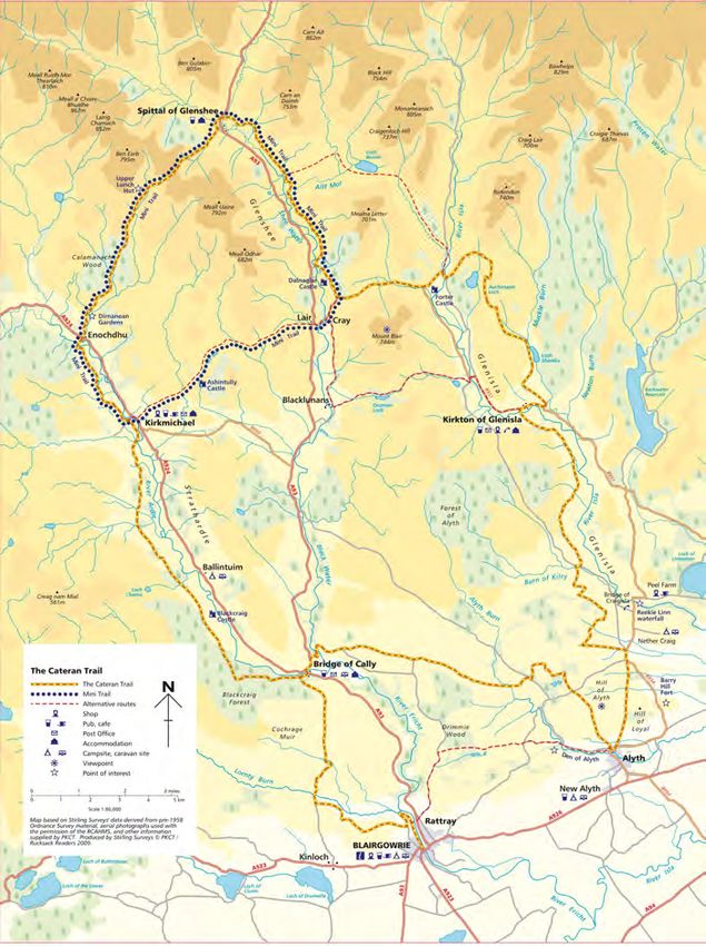
Cateran Trail Map, courtesy of Perth & Kinross Countryside Trust
People ................................page 5
Places .................................page 7
Landscapes .......................page 8
Section 2: Place Name Index .............page 10
Bibliography .....................page 31
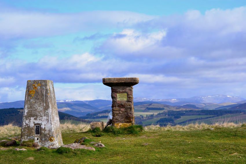
Cover: Plaque and Trig Point on Alyth Hill, photo Clare Cooper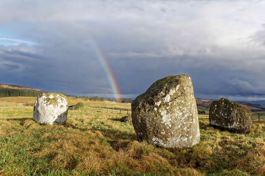
Alyth to Blairgowrie

FOREWARD

The Cateran Trail is one of Scotland’s great long-distance footpaths. Fully
waymarked, its circular 64-mile (103-km) route through Eastern Perthshire
and the Angus Glens follows old drove roads and ancient tracks across a
varied terrain of farmland, forests and moors. Some of the routes follow those
used by the Caterans, the name given to the Highland cattle raiders who were
the scourge of Strathardle, Glenshee and Glen Isla from the Middle Ages to
the 17th century, and after whom the trail is named.

This booklet is the fifth in a series detailing new research on the place names
of the Cateran Trail. Each follows one of its five stages and begins with an
introductory essay followed by a place name index. There is also one for the
shorter ‘mini’ Trail.

The research was commissioned by Cateran’s Common Wealth, a locally-led
initiative which is using the Cateran Trail as a stage for a multi-year
programme of diverse arts, cultural and heritage activities and events aimed
at inspiring people to think about and celebrate our ‘common wealth’, the
things that belong to all of us.

  Drumderg Windfarm, photo © Perth & Kinross Heritage Trust
Alyth to Blairgowrie

                                                   of information about such topics as people, the   Place-names are very much an under-utilised
   INTRODUCTION                                    landscape, how that landscape was used,           resource for Scottish history, but can be said to
                                                   belief, and of course language. For place-        be one the main resources for the study of
Place-names matter. If there are any doubts        names are words and once we can understand        important questions, such as those relating to
about that statement, imagine trying to travel     what a place-name means we can begin to use       the Picts. However, one of the problems we
anywhere in the world without them; try            it to tell us about the past.                     face is that Scotland is very limited when it
booking flight from 55°57'00" N, 003°22'21" W                                                        comes to how many counties have had their
to 51°28'39" N, 000°27'41" W. How much                                                               place-names closely scrutinised. Scotland
simpler is it to say you want to go from                                                             lacks the intensive surveys of England and
Edinburgh Airport to London Heathrow? For                                                            Ireland, particularly the Republic of Ireland.
most of us place-names are merely words,                                                                 Research in place-name involves looking for
often incomprehensible, on maps or road-signs                                                        their earliest spellings. The reasoning is that
indicating where a place is in the world. Some                                                       the earlier the spelling the closer we are to the
place-names have special resonance for                                                               language spoken when the name was first
people; for example, their home town or village,                                                     coined. For example, Pictish is generally
a place where they spent a special holiday or                                                        thought to have died out by around the year
occasion, or perhaps they just delight in the                                                        900. There are few Pictish place-names
sound of the name – many Scots like how            The Silver Ball of Rattray,                       along the Cateran Trail, the language having
                                                   photo courtesy of Perth Museum & Art Gallery
‘Scottish’ places such as Auchtermuchty or                                                           been replaced by first Gaelic, perhaps around
Ecclefechan sound, and can take great                 Place-names can be a great aid in helping      900 to 1000, and then Scots which probably
delight in their mispronunciation by non-Scots     historians and archaeologists understand rural    began to make inroads into the area when the
speakers.                                          settlement and society in the Middle Ages and     monks of Dunfermline, Scone, and Coupar
   Place-names, however, meant something to        beyond to the cusp of the Agricultural            Angus Abbeys were granted lands in
the people who originally coined them. Once        Improvements and Industrial Revolution in         Strathardle and Glenisla from the mid twelfth
we crack the code, as it were, we can discover     Scotland in the late eighteenth and early         century. Researchers look at various material
a great deal about the landscape in which the      nineteenth centuries. Not only do they give us    for early spellings, including old maps, the
place-name is situated. Place-names are a          clues to landscape use, but they also indicate    earliest detailed of which are Timothy Pont’s
window through which we can glimpse                important religious and social organisation       maps dating to the 1590s. Other useful maps
Scotland’s past. They contain a large amount       that would otherwise have gone unrecorded.        are William Roy’s Military Map (1747-53),

                                                                                 1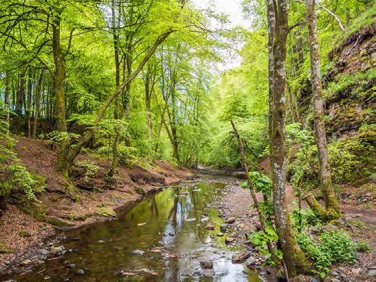
Alyth to Blairgowrie

James Stobie’s Map of the Counties of Perth        and compulsory education. It is not unusual          records will have survived the tribulations of the
and Clackmannan (1783), and John Aislie’s          while looking at medieval documents for the          Protestant Reformation of the mid sixteenth
Map of the County of Forfar or Shire of Angus      place-name researcher to find two or more            century. Royal records, such as charters, can
(1794). While these maps are very useful, they     different spellings for the same place in the one    sometimes be dated back to the reign of
are not as accurately drawn as the Ordnance        sentence! Nevertheless, old documents are            David I (1124-53), but here the records are not
Survey maps which only started in the early        where most of the early spellings of place-          so detailed. Strathardle was granted to Scone
nineteenth century, and did not reach              names are to be found and there are a myriad         Abbey in David’s reign, but we are given no
Perthshire and Angus until the 1860s. It is from   of different documents.                              information regarding the settlements in
the Ordnance Survey that we get the majority           Generally, however, they fall into a small       Strathardle until the fourteenth or fifteenth
of our current spellings of place-names.           number of types, including: charters granting or     centuries. Royal records can go missing too,
                                                   exchanging land; rentals of land; wills and          often due to war, or accident (in 1661 many
                                                   testaments; travellers’ and ministers’ accounts;     Scottish records were lost when the ship carry
                                                   letters and recollections. All of these can be       them sank off the English coast. The records
                                                   further sub-divided into royal, ecclesiastical,      were being returned to Edinburgh after they
                                                   and private. All this affects how early and how      had been taken to London by Oliver Cromwell).
                                                   often which names appear on record.                     There are many documents of private
                                                       Many Pictish and Gaelic place-names only         landowners held in the National Records of
                                                   appear on record due to the modern map               Scotland in Edinburgh (along with royal and
                                                   makers of the eighteenth and nineteenth              ecclesiastical records), but they are often not
                                                   centuries. The reason is in part due to the          published like the royal and ecclesiastical
                                                   survival of records (they can be lost, among         records, while others are in the hands of
                                                   other reasons, due to war, fire, rot, rodents,       individuals or companies which can make
                                                   and damp) and in part due to who the                 access difficult. The most useful private records
Alyth Arches, photo Clare Cooper
                                                   landowner or landholder was. The medieval            for the Cateran Trail are those relating to the
   Prior to the arrival of the Ordnance Survey     church was very jealous of its possessions and       Invercauld estate for Glenshee and the
there was no system of standardised spelling       often kept detailed records of their properties,     Ramseys of Bamff for the areas around Bamff
of place-names; indeed, standardised spelling      the records of Coupar Angus Abbey are                and Alyth. Hill-names only generally come on
only arose in the nineteenth century with the      particularly useful for the Glenisla stages of the   record from the time of the Ordnance Survey,
appearance of mass produced newspapers             Cateran Trail. However, not all of the church        although some of the bigger or more prominent

                                                                           2
Alyth to Blairgowrie

hills, such as Mount Blair, can be found on         in southern Perthshire where it was stated that       The change from /n/ to /r/ in Gaelic words
Pont and Stobie.                                    Gaelic was corrupted by its vicinity to Scots,        beginning cn or gn is ‘comparatively late’
                                                    and in Glenshee this ‘corruption’ of Gaelic was       according to Thomas O’Rahilly, a prominent
                                                    probably the result of the interaction of two         Irish scholar; he suggested the change took
   LANGUAGE                                         distinct linguistic communities lying on the          place in Scotland by the mid-sixteenth century
                                                    border of Highland Glenshee and Lowland               or later. Crock reflects modern Gaelic
Underpinning all this, of course, is language.      Strathmore with its trading centres such as           pronunciation of cnoc, and means that the
Gaelic predominates along the Cateran Trail.        Blairgowrie and Coupar Angus, who were both           representation of this spelling, Crock rather
Not only is it the original language of most of     linked to Dundee and Perth.                           than Knock, on a modern map indicates that
the settlement names, but is the language of                                                              Gaelic was still being spoken in this part of the
the majority of relief features such as hill and                                                          Angus Glens in the mid to late sixteenth
river-names. Pictish, or at least Pictish                                                                 century. About 4 km to the north-west of Crock
influence is only present in a few important                                                              is a hill called The Knaps and is presumably
places, including Strathardle, Alyth, Cally, The                                                          pronounced similar to English naps. The name
Keith, Mount Blair, possibly Rochallie, and                                                               derives from Gaelic cnap ‘knob, lump, little hill’.
probably Forter. Persie within Glenshee may                                                               Cnap in modern Gaelic is pronounced krahp.
also be Pictish. Scots and Scottish English                                                               So the fact that The Knaps is so spelled
have a sizable presence, mainly in some                                                                   probably means we should view this hill being
settlement- names and a small number of hill                                                              named before the sound change occurred.
and stream- names. In the late eighteenth                                                                 However, from the late 1400s many Gaelic
century the area was still mainly Gaelic            Interior of a Blairgowrie Mill,                       names contain Scots prefixes, such as Litle
                                                    photo courtesy of the Laing Photographic Collection
speaking. The Rev. Allan Stewart, minister for                                                            Fortyr and East Innerherraty, suggesting that
Kirkmichael, wrote in the 1790s that: ‘the             It is also the case that place-names don’t         Gaelic was probably extinct in Glen Isla as the
prevailing language in the parish is the Gaelic.    just tell us what language was spoken in an           naming language at least among the landlords.
A dialect of the ancient Scotch, also, is           area, but can, sometimes, tell us about                   Place-names can give an indication of an
understood, and currently spoken. These two,        changes in pronunciation within a language.           area’s past landscapes, whether natural or
by a barbarous intermixture, mutually corrupt       There was a change in Gaelic pronunciation            human influenced; past social organisation and
each other. All the names of places are Gaelic’.    in words beginning cn, which seems to have            land divisions can be revealed; beliefs, both
This ‘intermixture’ is noted in Kilmadock parish,   taken place in the early modern period.               religious and mythical are contained in the

                                                                                      3
Alyth to Blairgowrie

names of many features, whether they be hills,          form, size and position, and through metaphor              Caterans first come on record in the 1380s
burns or vegetation. Indeed, so varied are the          using the anatomy of the whole human body.             at a time of trouble and rebellion in Moray, led
topics for place-name research that a recently          Many, if not all these categories can be found         by the son of Robert II, Alexander Stewart, earl
published book on the Gaelic landscape by               along the Cateran Trail and the surrounding            of Buchan, better known as the Wolf of
John Murray gives the following categories for          area. Here, however, we will concentrate on            Badenoch. In 1385 it was said that there was a
looking at place-names in the landscape:                the themes of the Cateran Trail project –              ‘lack of justice in the higher and northern
landforms – mountains, hills, passes, hollows,          People, Places, and Landscapes.                        regions, where many malefactors and caterans
valleys; hydronomy (river and loch-names);                                                                     are roaming’. Raids by the Wolf of Badenoch
climate, season, sound and time; land-cover                                                                    occurred throughout Moray leading to the
and ecology – flaura and fauna; agriculture –              THE CATERANS                                        burning down of Elgin cathedral in 1390, the
crops, domestic and farm animals; buildings                                                                    culmination of a dispute with the bishop of
and settlement; church and chapel; cultural             The Cateran Trail is itself now a place-name.          Moray. However, these cateran raids also
artefacts; people and occupations; events;              The trail was opened in the summer of 1999;            spread to Angus and Perthshire. In 1392,
legend and the supernatural.                            the word cateran, however, dates back to at            Buchan’s sons led a raid into Angus, causing,
                                                        least the late fourteenth century. Cateran             according to one medieval chronicler ‘grete
                                                        derives from a Gaelic word ceatharn meaning            discorde’, and which led to a pitched battle
                                                        ‘warrior’, but usually one that is lightly armed. In   between the caterans and forces headed by Sir
                                                        the Lowlands cateran came to epitomise                 David Lindsay of Glenesk. The battle is
                                                        Highland violence, and is indicative of a              variously said to have been at Glasclune near
                                                        Lowland perception of a particularly Gaelic            Blairgowrie or at Dalnagairn in Strathardle. The
                                                        Highland problem. Caterans have come to our            caterans eventually fled the field of battle. They
                                                        notice because throughout the Middle Ages              were to cause problems in the area over the
                                                        and up until shortly before the Jacobite risings       next two centuries. In 1602, it was reported to
                                                        of the eighteenth century, the records of the          the Privy Council by the ‘good subjects’ of
                                                        Scottish government bristle with complaints            Strathardle, Glenshee and Glenisla that a
Looking toward Kirkmichael from Drumderg,               about the activities of the caterans. In the           group of 200 persons ‘all thieves and sorners1
photo Clare Cooper
                                                        fourteenth century the problem became so               of the Clan Chattane and Clan Gregour, and all
   All   of   these    categories     can   also   be   acute that a council decided that caterans
                                                                                                               1
                                                                                                                Sorner: A person who exacts free quarters and
described in terms of colour, pattern, texture,         should be arrested or killed on sight.                 provisions by threats or force, as a means of livelihood.

                                                                                 4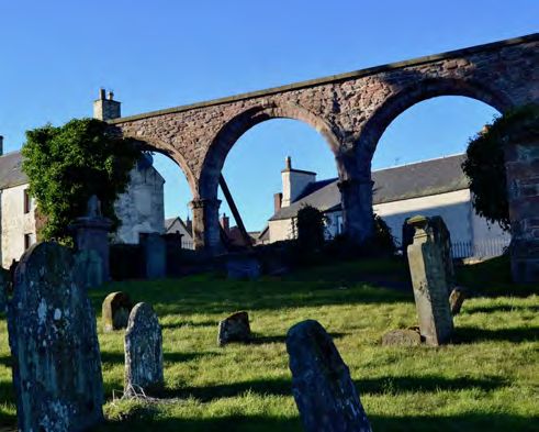
Alyth to Blairgowrie
Donald McAngus of Glengarry’s men, armed Airlie’s lands in Glen Isla and neighbouring accoutrements of medieval Highland life,
with bows, habershons, hagbuts and pistolets, Glen Prosan in Angus; they had been given including Gaelic speakers and a mainly
came to Glenyla, and there reft all the goods information by John MacCombie of Forter. pastoral economy, these glens were in fact
within the said bounds, consisting of 2700 nolt Although prosecuted by the earl of Airlie, the Highland extensions of nearby Lowland
(Scots – cattle; oxen, bulls and cows, long drawn out legal process eventually estates, with many of the lands belonging to
collectively), 100 horses and mares, with the petered out. either the crown, prominent Lowland families,
plenishing of the country’. The caterans continued their activities and or to the medieval church in the shape of
in 1667 stole a horse and 36 cattle from Airlie’s monastic institutions, especially Coupar Angus,
estates, but eventually with the assimilation of Scone, and Dunfermline Abbeys. Cattle were
the clan chiefs into the wider Scottish and easier to move than large quantities of grain,
British governing class came better law and in pre-industrial times cattle were a source
enforcement and control of the Highlands and of wealth. From cattle are derived the more
led to the demise of the caterans. obvious items, such as milk, cheese, and
But what gave rise to the caterans and why butter, but also their fat for making candles and
did they attack places like Glenshee, Glen Isla their hides for leather. We can get an idea of
and Strathardle? Given that the cateran raids how rich in pastoral resources the area was
begin, so far as we are aware, after the mid- from rentals, such as those of Coupar Angus
fourteenth century, one Scottish historian has Abbey who held much of Glen Isla. The
highlighted reasons including the aftermath of settlement of Dalvanie in 1556, for example,
the wars with England, plague, and had to provide 40 non-milk producing cows and
environmental factors, such as climate change; pay 2 ½ stones of cheese and ½ stone of
it became wetter and colder from about 1315. butter per year as part of its rental.
All this meant both a fall in population and
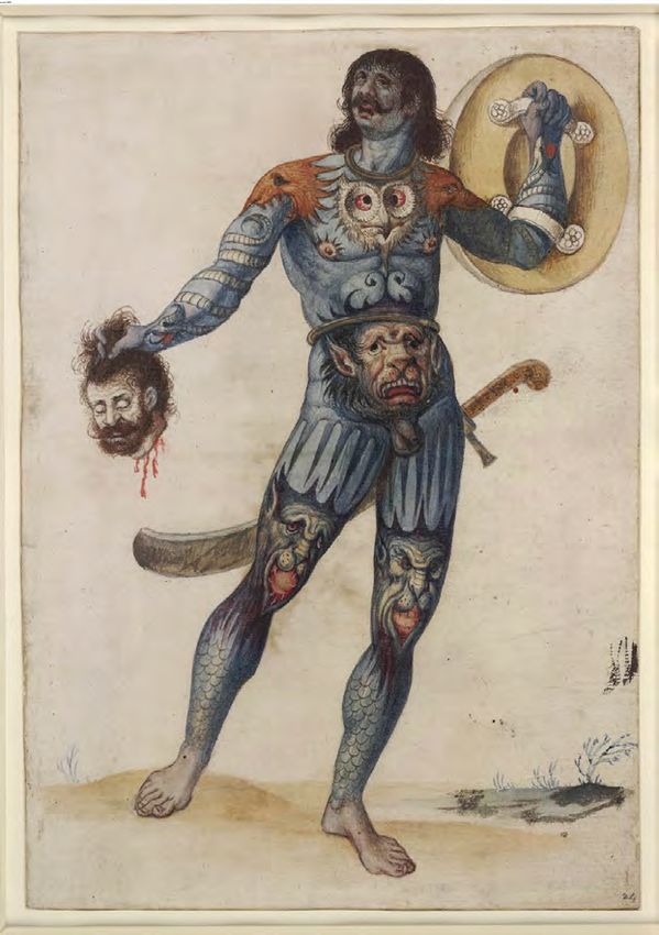
A Cateran in Glenshee by Kevin Greig staneswinames.org
greater difficulty in raising crops in an area (i.e.
The caterans were pursued by the the Highlands) that was always marginal. PEOPLE
inhabitants of the area and were partially There were two alternative ways of making
defeated at the Cairnwell Pass north of Spittal a living – herding cattle and raiding. Although Alyth is probably Pictish, containing a cognate
of Glenshee. In the 1650s, the MacDonalds of the glens of Strathardle, Glenshee, and of Gaelic a(i)l ‘rock, cliff’, which may be the
Glencoe, among others, raided the earl of Glen Isla were Highland areas, with all the fairly steep face of the ridge of hills immediately
5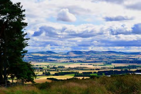
Alyth to Blairgowrie

to the north of Alyth containing Hill of Alyth, Hill    Argyll (called Dál Riata) and replaced Pictish       of 1388. Morganston, on record from 1581, is
of Loyal, and Barry Hill. If Alyth is indeed            sometime around 900. Two other Gaelic                a settlement about 4 km north of Blairgowrie
Pictish, then it is evidence for the longevity of       settlement names can be found in Balwhyme            (the Cateran Trail crosses the Morganston
settlement in these parts.                              and Pitdray. The former is not a baile-name,         Burn) and is named after someone called
                                                        meaning ‘farm, settlement’ like so many other        Morgan. We may never know who he was but
                                                        bal-names in Scotland, but instead contains          one possibility is Andrew Morgone or Morgunt
                                                        Gaelic both ‘hut’, perhaps originally a sheiling     who was a tenant in Balbrogy 3 km north-east
                                                        or other temporary settlement. It is not clear       of Coupar Angus in 1524 and 1535.
                                                        what the –whyme element is. Pitdray contains            One of the great advantages of the
                                                        the element pit, or more properly pett ‘portion,     Ordnance Survey maps is that we see much
                                                        landholding, farm’, which has a Pictish              more detail in the landscape in respect of
                                                        provenance; importantly, however, most of the        place-names, minor names are much more
                                                        second, or specific, elements are Gaelic,            evident. One of these is Serjeant’s Hill, just
                                                        making these settlements not Pictish but Gaelic      north of Glasclune Castle. We are familiar
                                                        place-names. There are about 300 pit-names           with the rank of sergeant, a senior non-
                                                        mostly in eastern Scotland, and they                 commissioned role, in the Armed Forces or
                                                        demonstrate the range of Gaelic-speakers in          police. In the Middle Ages it was originally ‘a
                                                        the tenth century as Alba expanded from its          serving-man, attendant, servant’, from the
Den ‘o’ Alyth, photo, George Logan
                                                        western heartlands in Argyll to the area             French term sergent via Latin serviens
    It also predates Bamff, a settlement about          between the Dornoch Firth in the north and the       ‘one who serves’, but could also be ‘a tenant by
4 km north-west of Alyth. Bamff was coined by           Firth of Forth in the south. The –dray element is    military service under the rank of a knight;
Gaelic speakers and while the name can mean             Gaelic ScG droigheann making this name               especially one of this class attending on a
‘pig’, specifically ‘suckling pig’, it is believed by   ‘thorn, bramble portion’. Place-names can often      knight in the field’; ‘an officer whose duty is
place-name scholars that Bamff is a name                have the names of people attached.                   to enforce the judgements of a tribunal or the
along with Atholl, Elgin, and Earn that are                Tullymurdoch, just a little bit off the Cateran   commands of a person in authority; one who
names meaning ‘Ireland’ in Scotland, i.e. ‘New          Trail is the hill of someone called Murdoch,         is charged with the arrest of offenders or
Ireland’, coined as the Gaelic language moved           perhaps Muryoch of the Rynde (possibly Rhind         the summoning of persons to appear before
east out of its traditional western heartland in        south of Perth), who is mentioned in a charter       the court’
                                                                                                                .

                                                                                6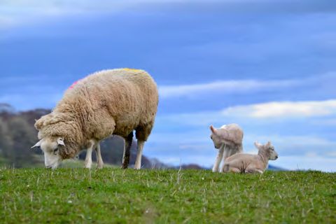
Alyth to Blairgowrie

                                                     for the most part agricultural, both pastoral        indicates that a settlement was the chief
   PLACES                                            and arable. Arable agriculture would not have        settlement of a landowner is mains, deriving
                                                     been as extensive as it was in the flat lands        from Old French demeine, English demesne,
Cally refers to an area of land near the junction    along the River Isla to the south of Alyth           and meaning ‘the home farm of an estate,
of the River Ardle and Black Water and               and Blairgowrie, but there are places that           cultivated by or for the proprietor’; there are two
includes Bridge of Cally, Cally House, West          indicate crops were grown along the trail.           mains farms along this stage of the Cateran
Cally, Cally Mill, and Hill of Cally. It may also    Milton of Drumlochy was the fermtoun of the          Trail – Mains of Drumlochy Mains of
include Rochallie (perhaps containing Pictish        mill of Drumlochy.                                   Glasclune, and Mains of Creuchies.
*roth meaning ‘fort of Cally’) across the River                                                           Creuchie is derived from ScG cruach ‘pile,
Ericht from Bridge of Cally. The name Cally is                                                            heap; rounded hill standing apart’. The element
almost certainly Old Gaelic and may even be                                                               is behind the Argyll mountain-name Ben
Pictish, the earliest spellings (Kalathyn 1214 ×                                                          Cruachan.
1238; Calady 1326) suggest OG calathin ‘hard                                                                  In Scotland there are place-names that have
place’ or ‘at a hard place’. Quite what was                                                               been derived from the Bible, including Babylon,
‘hard’ about Cally is not clear; the word is found                                                        Sodom, and Gomorrah in Fife. The Cateran
in places all over Scotland containing names                                                              Trail is not indifferent to this trend. Smyrna lies
like Calder, Cawdor, Keltie, and possibly                                                                 about a kilometre north of the trail and is
Callander. However, these names all relate in                                                             named from a place in what is now western
some way to rivers in that they are named after                                                           Turkey, which until the early 20th century was a
a river or they are near rivers which have some                                                           centre of Greek culture. It was also a centre of
kind of ‘hard’ attribute. It may be that Cally                                                            early Christianity and is one of the seven
takes its name from some perceived hardness                                                               churches mentioned in the Book of Revelations
                                                     Park Neuk Stone Circle, photo Ron McGill
in the River Ardle, or, alternatively, the name                                                           in the Bible (Revelations 1:8; 2:8-11). The
relates to the hardness of the ground; perhaps           Mills were an important source of baronial       church at Smyrna was admired for its
it was thought rocky or difficult to farm when it    income and the miller was often resented by          tribulation and poverty. In the second chapter
was named.                                           the local populace because they were obligated       of Revelations it was forecast to suffer
    The landscape that the people along the          to take their grain to the miller and often had to   persecution and it is written ‘be thou faithful
Cateran Trail lived in was also one they worked      pay a heavy tax or multure to have the grain         unto death, and I will give thee a crown of life’
in. In a pre-industrial society, that work was       ground into meal. Another element that               (Revelations 2:10).

                                                                                 7
Alyth to Blairgowrie
names themselves relate to landscape particular perspective or direction. Near
LANDSCAPES features. Colour is ever present in place- Glasclune and Gormack is Drumlochy which
names, but it can sometimes be difficult to work has nothing to do with a loch, but is probably
The Cateran Trail passes through a dramatic out why the namers chose a particular colour for druim lochaidh ‘black or dark ridge’.
landscape. While many of the settlements have for a particular place. Glasclune is probably Elsewhere on the Cateran Trail and in the
Scots names or Scots elements attached, the from Galeic glas claon ‘green slope, brae’. landscape between the three glens of
majority of the landscape features are Gaelic. Used in place-names glas probably indicates Strathardle, Glenshee and Glenisla there are
Names were needed to navigate and make good grass-lands or grass-covered features quite a few landscape features that have
sense of an area full of hills and valleys of (see also Gormack below). Gaelic claon is a animal or bird names attached. On the stage
various sizes and shapes, as well as numerous ‘slope; brae or (steep) path descending to or between Alyth and Blairgowrie, animal and bird
bogs, and rivers and burns. Gaelic, much more ascending from a ford or bridge’. The –clune place-names are scarce, with only two along
than English, is a language of the landscape element may, however, represent ScG cluain the route.
and so it has a profusion of generic terms for ‘pasture, green field, meadow, lawn’ from Old One of these is Buzzart Dykes, a large
different parts of the landscape. Gaelic clúain ‘meadow, pastureland, glade’. man-made feature in the landscape west of
Another shade of green or perhaps blue is Blairgowrie, once thought to have been a
found in nearby Gormack ‘blue or green place’. Roman camp. It was probably a medieval
Gaelic gorm can mean both blue and green, in hunting park, and possibly the dykes around
particular ‘an azure blue or verdant green’, the park were places buzzards could gather to
depending on perspective. The further away a clean up after the slaughter of deer. Another
place, the more blue it looks and, as a Gaelic animal name is found in Cloquhat ‘slope of the
proverb says Is gorm na cnuic a tha fada wild cat place’. The earliest spellings from 1224
bhuainn ‘blue are the hills that are far from us’. show Clenkatyn which may be Gaelic claon
However, when applied to grass, gorm means ‘sloping, awry’. Strone Bridge and Strone
green, and so we might have an area that was House sit on a promontory formed by the
originally suitable or even prized for grazing. It confluence of the Black Water/Shee Water and
Sheep and lambs at Drimmie, is interesting that Gormack is near Glasclune the River Ardle. The stron element is Gaelic
photo Clare Cooper and since both names are suggestive of the sròn ‘nose’, and is one of the many human
Many of these terms can often now be colour green, presumably the original namers body parts that have been transferred to
contained in the names of settlements, but the must have been looking at the area from a names of features in the landscape.
8Alyth to Blairgowrie
Stage 5 ends in Blairgowrie. Blair derives has meant that much of Gowrie is well Both Blairgowrie and Kirkmichael held
from Gaelic blàr ‘muir, open level land, plain’, documented from the twelfth century. The apdaine lands, that is lands belonging to an
perhaps originally an extensive area of grazing. name Gowrie is derived from the territorial abbey of a church organisation that was in
The –gowrie element itself, which does not name Cenél nGabrain, the name of the territory place in Scotland before David I and his
appear along with Blair in the records until the around Kintyre from which it is held that the successors brought orders such as the
1560s, relates to a large territory in eastern people of Gowrie were descended in the 9th Augustinians and Cistercians up from England
Perthshire, and is thought to have been a and 10th centuries; while Angus is thought to or over from the Continent.
subordinate part of the ancient province of Atholl. derive from Cenél nOengsua, the territorial
There was clearly a need to differentiate Blair name of the islands of Islay and Jura. Cenél
in Gowrie from Blair in Atholl, another extensive nGabrain in turn was named after a king called
area of open level land. By the reign of Donald Gabrán.
Ban (1094-97) Gowrie had become an earldom. It may be that as Gaels moved across to the
The earl in this case was also the king and east to take over the kingdom of the Picts in the
much of the area was a royal lordship in the ninth century they renamed districts to remind
twelfth century. The earldom of Gowrie, them of their homeland. Related to the
stretching from the Firth of Tay in the south to phenomenon may be Bamff, meaning ‘New
the watershed of the earldom of Mar in the Ireland’, just north of Alyth on Stage 5 of the
north, was rich in resources with excellent Cateran Trail.
agricultural lands in the Carse of Gowrie on the A parson of Blare called Adam lived about
banks of Tay and along the alluvial plain of the 1198 and is among the first people we are Strathmore from Alyth Hill,
photo Clare Cooper
Isla. More significantly for the Cateran Trail, the aware of that belonged to Blairgowrie.
earldom of Gowrie possessed considerably high However, he was not the first priest there; in
quality grazing lands in the north of the earldom. 1608 there is mention of Abden de Blair. This
These lands, both agricultural and pastoral, Abden is a connection with the Christian
were highly coveted by the ecclesiastical and church that goes back to earlier than 1198 and
secular landlords introduced to the area by is evidence of monastic landholdings in the
successive kings including Coupar Angus, area before the monasteries of Scone and
Scone and Dunfermline Abbeys. This Coupar Angus were founded in 1114 and
proprietorship of monastic and royal lordship c.1162 respectively.
9Alyth to Blairgowrie
INDEX
Rather than, as is customary, arrange the entries alphabetically, I have BDY Bendochy
decided to arrange the entries as far as possible as they are BGE Blairgowrie
encountered while walking on the ground. They are grouped in five main Brit. British
stages, plus a Mini Trail, and these stages follow those shown on the CAP Caputh
Perth and Kinross Countryside Trust website at www.pkct.org/cateran- GLI Glenisla
trail. However, there are short alternative routes shown in the 2007 KLC Kinloch
booklet Explore the Cateran Trail by Chic Leven and Ken Roberts and KRK Kirkmichael
these are shown below (as a, b, or c). MOU Moulin
PER Perthshire
Mini Trail: Circular route – Kirkmichael via Spittal of Glenshee RTR Rattray
and Lair Sc Scots
Stage 1: Blairgowrie to Kirkmichael ScEng Scottish English
Stage 2: Kirkmichael to Spittal of Glenshee ScG Gaelic
Stage 3: Spittal of Glenshee to Kirkton of Glenisla SSE Scottish Standard English
Stage 3a: Invereddrie to Forter
Stage 3b Forter to Kirkton of Glenisla A four-figure grid reference has been given along with the following
Stage 3c: Cray to Kirkton of Glenisla abbreviations indicating what the name refers to: A = antiquity; O = other
Stage 4: Kirkton of Glenisla to Alyth (e.g. bridge, road), R = relief feature; S = settlement; V = vegetation. Note
Stage 5: Alyth to Blairgowrie also that there was an alteration of the parish boundaries along the southern
Stage 5a: Alyth to Blairgowrie edge of the study area as a result of the 1891 changes to the parish and
county boundaries by the Boundary Commissioners for Scotland under the
Abbreviations Local Government (Scotland) Act, 1889 (see Shennan 1892). 2
A Antiquity
ALY Alyth 2
This difficult to access book, giving details of the changes in the county and parish
ANG Angus boundaries, can be seen at http://www.scotlandsplaces.gov.uk/digital-volumes/published-
gazetteers-and-atlases/hay-shennan-county-and-parish-boundaries-1892
10Alyth to Blairgowrie
In the text of the main discussion place-names with ALY (e.g.
Blacklunans ALY) indicate that the early forms and linguistic analysis can
be found in the survey of Alyth parish; likewise those place-names with
KRK (e.g. Spittal of Glenshee KRK) indicates they can be found in the
survey of Kirkmichael parish.
Note that in the analysis line the Gaelic spellings conform to the modern
spellings found in the SQA Gaelic Orthographic Conventions.3
A name preceded by * indicates a hypothetical unattested form.
3
http://www.sqa.org.uk/sqa/files_ccc/SQA-Gaelic_Orthographic_Conventions-En-e.pdf
11Alyth to Blairgowrie
Stage 5: Alyth to Blairgowrie
ALYTH ALY ES NO244487 Alicht 1528 RMS iii no. 693 [terra totius ville de Alicht, in baronia de Alicht
‘the whole lands of the toun of Alyth in the barony of Alyth’]
apud Alitht 1165 x 1170 RRS ii no. 110
ville de Alycht 1546 RMS iii no. 3231
unum plenarium toftum apud castellum de Alith 1196 x 1199 RRS ii no. 410
Elycht 1590s Pont 28
[o.c. + apud Alith’]
baronia de Elyth 1610 Retours PER no. 77
helia de Alid c.1200 Coupar Angus Chrs, no. 9 [Elias of Alyth, a witness to a
baronia de Elicht 1606 Retours PER no. 156
charter of John, bishop of Dunkeld]
in terris et baronia de Alith 1608 Retours no. 189
apud Alicht 1201×1205 RRS ii no. 456
terras de lie Forrestis de Alight 1646 Retours PER no. 551
apud Alitht 1202×1213 RRS ii no. 437
in terris et baronia de Alicht 1615 Retours PER no. 232
in feodo de Alyth 1232 Bamff Chrs. no. 1 [royal lands of ? Kinkeadly ALY
Alyth 1623 Retours PER no. 313
(Kynkel) and Pitdray ALY (Petdreyne) and Ardormie ALY (Ardormyne) and
baronia de Alyth 1628 Retours PER no. 360
Bamff (Banef) in feodo de Alyth et terram de Foyl (Fyal ALY) all granted by
Alyth 1794 Ainslie
Alexander II to Master Nessus his physician]
Alyth 1867 OS 6 inch 1st edn PER & CLA LIII
forestam domini regis de Alith 1234 Coupar Angus Chrs no. 34 [the lord
king’s forest of Alyth]
This could be a Pictish place-name. If so, the first element may be a Pictish
Alyth 1319 RRS v no. 145 [‘terras de Aythnacathyl et de Blarerouthnak’ infra
cognate of G a(i)l ‘rock, cliff’. See DIL aileach collective of ail ‘rock’, figuratively
thaynagium nostrum de Alyth’ (the lands of Aythnacathyl and of
4 ‘foundation, basis’. Since records begin in the twelfth century, the final
Blarerouthnak’ in our thanage of Alyth)]
consonant seems to be a dental fricative –th (the sound found in English the);
thanagium de Alicht 1375 RMS i no. 705
other forms seem to show a velar fricative –ch (the sound found in Scots loch).
Alythe 1376 RMS i no. 595
thanagium de Alicht 1385 RMS i no. 763
Although the church of Alyth dates from 1458, the fact that it was dedicated to
ecclesia de Alith 1458 RMS ii no. 614
Mo Luóc of Lismore, probably better known as St Moluag, suggests that there
prebenda de Alytht 1472 RMS ii no. 1056
was a church here from a fairly early date. He was an Irish saint who seemingly
terras et baroniam foreste de Alitht 1527 RMS iii no. 494 [‘lands and barony
died in 592 (http://saintsplaces.gla.ac.uk/saint.php?id=155). However, a
of the forest of Alyth’]
chapel was also dedicated to St Ninian, and despite Ninian supposedly being a
preacher to the Picts, it is likely that his dedication dates to the later Middle Ages
4
The whereabouts of Aythnacathyl and Blarerouthnakis are not known (Coupar Angus
Chrs no. 100, note).
when there was a revival of his cult (see PNKNR forthcoming under Kinross
12Alyth to Blairgowrie
parish). However, the most convincing evidence for an early church at Alyth is a Sc kirkland + Sc bank
Pictish cross slab which was rediscovered near the old kirk of Alyth in 1887 This must have been part of the churchlands belonging to the old medieval
(https://canmore.org.uk/site/30756/alyth). parish kirk of Alyth, which sits at NO244487.
ALYTH BURN ALY W NO278495 BLINDWELLEYES ALY S NO241495
Alyth Burn 1783 Stobie blindwallheid 1595 Bamff Chrs no. 115
Alyth Burn 1867 OS 6 inch 1st edn PER & CLA LIII blindwall 1595 Bamff Chrs no. 115
Blindwells 1783 Stobie
en Alyth + Sc burn Blindwells 1794 Ainslie
Blindwelleyes 1867 OS 6 inch 1st edn PER & CLA LIII
DEN WELL ALY W NO241490
Den Well 1867 OS 6 inch 1st edn PER & CLA LIII Sc blind + Sc wall + Sc eye or ee
DOST has blind as an adjective describing a natural feature: ‘of natural features:
ScEng den + ScEng well Not patent to the sight; covered, hidden. Occurring early in place-names’ and
A den is defined as ‘a narrow valley or ravine’ (DSL). gives a Blyndewelle dating to c 1200 as an example. It is not known which
Blyndewelle is being referred to here. Sc wall is simply ‘well’, which may in this
ROSEBANK ALY S NO244491 case be the spring of a burn. Sc wall-ee, well-e(y)e, wulee is ‘a water-logged
Rosebank 1867 OS 6 inch 1st edn PER & CLA LIII place in a bog from which a spring rises’ (SND).
SSE rose + SSE bank HILL OF ALYTH ALY R NO243503
Hill of Alyth 1867 OS 1st edn 6 inch PER & CLA LIII
KIRKLANDBANK ALY S NO235494
Kyrklandbank of Alyght 1506 Dunkeld Rent., 25 ScEng hill + ScEng of + en Alyth
Kirklaybank 1565 Bamff Chrs no. 69
Kirklandbank 1574 Bamff Chrs no. 74 BALWHYME ALY S NO237508
Kirklandbank 1623 Retours PER no. 313 Bucham 1464 C. A. Rent. i, 140
Kirklandbank 1867 OS 6 inch 1st edn PER & CLA LIII Bucham 1472 C. A. Rent. i, 164
Bucham 1477 C. A. Rent. i, 205
Buchame 1504 C. A. Rent. i, 255
13Alyth to Blairgowrie
our town callat Bucham is set to Fyndlay Alexander 1511 C. A. Rent. i, 284 NEWTON OF BAMFF ALY S NO232510
terras de Buchquhane 1517 Mylne, Vita, 44 [land of Balwhyme] Newtown of Bamff 1534 Bamff Chrs no. 45
the tenement called Bucham 1524 C. A. Rent. i, 300 Newtoun de Bamff 1620 Retours PER no. 278
Boquhane 1534 Bamff Chrs no. 44 Newtown 1783 Stobie
Balquwhime 1534 Bamff Chrs no. 44 Newtown 1794 Ainslie
Boychame 1534 Bamff Chrs no. 45 Newton 1867 OS 6 inch 1st edn PER & CLA LIII
Balquhome 1595 Bamff Chrs no. 114
Balquhem 1595 Bamff Chrs no. 115 Sc newtoun
the landis of Balquhane 1595 RMS vi no. 271 [long, detailed boundary This settlement was probably founded due to settlement splitting due to
descriptions of Ardormie ALY in Scots, full of minor local names: ‘beginnand at population expansion in the centuries after the Black Death of the 14th century.
the south at the north syd of the burne qhuilk devydis the landis of Balquhane
and Ardormy at the fit of the north bank ... the burne quhilk devydis Ardormie fra BURNIESHED OF BAMFF ALY S NO227513
Balquhane at the fut of the bank callit the North-bank ...’ etc.] Burnhead 1783 Stobie
Buthquhan 1623 Retours PER no. 313 [associated with lands around Alyth] Burnhead 1794 Ainslie
Balwhime 1783 Stobie Burnieshed of Bamff 1902 OS 6 inch 2nd edn PER & CLA XLIII.SW
Balwhome 1794 Ainslie
Balwhyme 1867 OS 6 inch 1st edn PER & CLA LIII ScEng burn + ScEng shed+ ScEng of + en Bamff
Burnie is a diminutive of Sc burn ‘stream’. Going by the early forms, the second
ScG both + ? ScG cam element of Burnieshed is ScEng head, and the name relates to the head of the
‘Crooked bothy/sheiling/hut etc’? The first element is probably ScG both ‘hut, sheiling’, burn flowing past Burnieshed of Bamff, via Burnieshed Den (see next entry) on
but has been assimilated to the widespread Bal- (from G baile) in the Scots-speaking its way to its meeting with the Incheoch Burn 3 km to the east-north-east.
era (first appearing in the written record in 1534). The second element is more However, as the modern form suggests, the second element might be SSE
problematic, but the early forms suggest the ScG adjective cam ‘crooked, bent’. shed, as in watershed.
However, given the later development of the vowel from /a/ (as in ‘jam’) to /ai/ (as in
‘time’), it may be the genitive caim ‘of a crooked person’. Alternatively, we could be
dealing with a ‘bent’ or ‘crooked’ landscape feature, possibly one of the un-named
east-ward flowing burns to the north and south of Balwhyme.5
5
My thanks to Simon Taylor for help with this difficult name.
14Alyth to Blairgowrie
BURNIESHED DEN ALY R NO229515 This is a Gaelic word that can mean ‘pig’, specifically ‘suckling pig’ (Dwelly;
Burnieshed Den 1902 OS 6 inch 2nd edn PER & CLA XLIII.SW Clancy 2010, 91; Watson 1926, 231-2). Clancy contends that naming a place
after a suckling pig ‘does not inspire confidence’ (Clancy 2010, 91). Instead he
en Burnieshed + ScEng den agrees with W.J. Watson that Bamff is a name along with Atholl, Elgin, and Earn
A den is a ‘narrow or steep-sided valley’, usually one with a burn or river flowing that are names meaning ‘Ireland’ in Scotland, i.e. ‘New Ireland’ coined as the
through it (PNF 5, 351). Gaelic language moved east out of its traditional western heartland and replaced
Pictish sometime around 900.
BAMFF ALY S NO221514
Banef 1232 Bamff Chrs no. 1 In 1595 the lands and barony of Bamff was said to contain ‘the Manes of Banff,
Dominus de Banff c.1360 Bamff Chrs no. 6 tour, fortales, maner place, ortcheardes, Hiltoun of Banff, Litill Banff, Newtoun of
baronia de Banf 1383 Bamff Chrs no. 7 Banff, corne milne of Foyell, Miltoun and millandes thairof, with the multoures
baronia de Banff 1483 Bamff Chrs no. 14 sequelles and pertinentis, mekle Foyel, Peddry, Kinkedlie, Eister Mawes, Hiltoun
baronia de Bamff 1581 Retours PER no. 40 of Mawes, with pertinents, lying in the parishes of Elyth (Alyth) and Blair, barony
Banff 1507 Bamff Chrs no. 27 of Banff by annexation, and shire of Perth’ (Bamff Chrs no. 114).
Banff 1527 Bamff Chrs no. 35
lands of Bamff 1534 Bamff Chrs no. 43 KINKEADLY ALY S NO212519
Banf 1549 Bamff Chrs no. 52 ? Kynkel 1232 Bamff Chrs. no. 1
Bamffe 1554 Bamff Chrs no. 53 Kinkedlie 1508 Dunk. Rent. 94 [listed amongst lands in barony of Banff, par.
Banffe 1564 Bamff Chrs no. 65 of Alyght]
Banff 1578 Bamff Chrs no. 88 Kincathlie 1515 Dunkeld Rent., 145
Bamf 1590s Pont 27 and 28 Kinkedly 1590s Pont 27
in terris et baronia de Bamff 1620 Retours PER no. 278 Kinkedlie 1595 Bamff Chrs no. 14
Bamff 1635 Bamff Chrs no. 217 Kynkedlie 1620 Bamff Chrs no. 172
dominicall landis and maines of Bamffe 1656 Bamff Chrs no. 256 Kynkedlie 1620 Retours PER no. 278
Bamff 1783 Stobie Kinkedlie 1634 RMS ix no. 318 [Kinkedlie, Petdry, Foyell...]
Bamff 1794 Ainslie Kinkeadly 1783 Stobie
Bamff 1867 OS 6 inch 1st edn PER & CLA XLIII Kinkeadly 1794 Ainslie
Kinkedly 1867 OS 6 inch 1st edn PER & CLA XLIII
ScG banbh Kinkeadly 1902 OS 6 inch 2nd edn PER & CLA XLIII.SW
15Alyth to Blairgowrie
ScG ceann + ? pn Gauld + ScEng well
The earliest form from 1232, if it is indeed Kinkeadly, may be for ScG ceann Blacks states that Gauld is a mainly Aberdeenshire surname, on record from the
coille ‘wood end’. However, all the other forms, except that for 1515, show mid-sixteenth century (Black 1946, 292).
kedl/keadl in the second element; it is not known what this represents, although
a possibility is ScG cèide ‘market, fair; green; hillock’ (Dwelly). SMIDDYHILL ALY S NO212512
Smithy 1867 OS 6 inch 1st edn PER & CLA LIII
FYAL ALY S NO217507 Smithyhill 1901 OS 6 inch 2nd edn PER & CLA LIII.NW
terram de Foyl 1232 Bamff Chrs no. 1 Smiddyhill 1977 OS 1:10,000 NO25SW
Foyell 1508 Dunkeld Rent. 94 [listed amongst lands in barony of Banff, par.
of Alyght] ScEng smithy + ScEng hill
Phoyall 1515 1506 Dunkeld Rent. 145 ‘Hill attached to a smithy’.
Foyell 1564 RMS iv no. 1531 [to George Ramsay of Banff lands of Petdrye
and Fyal (Foyell) with mill, in barony of Bamff (Banff) vic Perth] PITDRAY ALY S NO207512
Foyel 1590s Pont 27 Petdreyne 1232 Bamff Chrs no. 1
Foyle 1620 Retours PER no. 278 Petdrey 1483 Bamff Chrs no. 14
Foyell 1634 RMS ix no. 318 Peddry 1483 Bamff Chrs no. 15
Fyal’s 1783 Stobie Petdrey 1515 Dunkeld Rent., 145
Mill of Fyal 1783 Stobie Padrey 1530 Bamff Chrs no. 36
Fyals 1794 Ainslie Petdrye 1564 Bamff Chrs no. 66
Mill of Fyals 1794 Ainslie Baldrey 1590s Pont 27
Fyal 1867 OS 6 inch 1st edn PER & CLA LIII Peddry 1595 Bamff Chrs no. 114
Pitdrey 1620 Retours PER no. 278
? Pitdrey 1783 Stobie
It is not known what this name represents. Pitdrey 1794 Ainslie
Pitdray 1867 OS 6 inch 1st edn PER & CLA LIII
GAULDSWELL ALY S NO210514
Galdswell 1783 Stobie ScG pett + ScG droigheann
Gladwells 1794 Ainslie ‘Thorn, bramble portion’. The earliest form indicates that ScG droigheann ‘thorn,
Gauldswell 1867 OS 6 inch 1st edn PER & CLA XLIII bramble’ is likely here. Coldrain in Fossoway parish, Kinross-shire contains this
16Alyth to Blairgowrie
element and indeed has almost the same spelling in its earliest form – Tullimurdoch 1783 Stobie
Cuhyldrayne in 1366 (RMS i no. 221; see also PNKNR forthcoming). For the Tullimurdoch 1794 Ainslie
element pett/pit see introduction. Tullymurdoch 1867 OS 6 inch 1st edn PER & CLA XLII
MAINS OF CREUCHIES ALY S NO207508 ScG tulach + pn Murdoch
Manys of Cruquheis 1559 Bamff Chrs no. 87 It is not known who the eponymous Murdoch in the place-name is, but a
Creuchyes 1590s Pont 27 possibility might be Muryoch of the Rynde, who is mentioned in a charter of
the third part of the Mains of Cruchyes 1610 Bamff Chrs no. 143 1388 relating to Gilbert laird of Bamff (Bamff Chrs no. 8).
the third part lands of the Mains of Crewchie 1683 Bamff Chrs no. 316
Mains of Creuchie 1683 Bamff Chrs no. 318 POLTARA ALY S NO194511
Mains of Crochies 1783 Stobie Palary 1783 Stobie
Mains of Crochie 1794 Ainslie Paltory 1794 Ainslie
Mains of Creuchies 1867 OS 6 inch 1st edn PER & CLA LIII Poltara 1867 OS 6 inch 1st edn PER & CLA LII
Sc mains + Sc of + en Creuchies ? ScG poll + ?
See Mains of Glasclune for the definition of Sc mains. Creuchie is derived from The first element could be ScG poll ‘pool, bog’ (Dwelly), however, the spellings
ScG cruach ‘pile, heap; rounded hill standing apart’ (Dwelly). The element is are too late to be able to say anything meaningful about final element.
behind the Argyll mountain-name Ben Cruachan (Drummond 2007, 32). Almost
1 km to the south-east lies Welton (toun with a well) of Creuchies. PARKNEUK ALY S NO189514
Parknook 1783 Stobie
TULLYMURDOCH ALY S NO198525 Parknook 1794 Ainslie
Tullemurdo 1506 Dunkeld Rent. 76 Parkneuk 1867 OS 6 inch 1st edn PER & CLA XLII
Tullumurdach 1590s Pont 27
Little Tillemordoch 1595 Bamff Chrs no. 118 Sc park + Sc neuk
the saidis landis of Tullymurdo and Brawland 1662 Bamff Chrs no. 302 [in a Sc neuk can be a ‘piece of land’, ‘a headland or promontory’, ‘an outlying or
document dated 1673] remote part’. Sc park is often a hunting area, or in later periods, a piece of
Tullimurdo 1672 Bamff Chrs no. 291 ornamental ground.
Tullymurdo 1673 Bamff Chrs no. 301
Tullymurdoch 1683 Bamff Chrs no. 319
17Alyth to Blairgowrie
BREWLANDS OR BRAWLING OF TULLYMURDOCH 156). Smyrna is a city in western Turkey. Until the early 20th century it was a
ALY S NO192520 centre of Greek culture in Turkey. It was also a centre of early Christianity and is
the saidis landis of Tullymurdo and Brawland 1662 Bamff Chrs no. 302 [in a one of the seven churches mentioned in the Book of Revelations in the Bible
document dated 1673] (Revelations 1:8; 2:8-11). The church at Smyrna was admired for its tribulation
that pendicle of the lands of Moortoune of Crewchies called Brawlin 1672 and poverty. In the second chapter of Revelations it was forecast to suffer
Bamff Chrs no. 291 persecution and it is written ‘be thou faithful unto death, and I will give thee a
Brauland 1783 Stobie crown of life’ (Revelations 2:10).
Branland 1794 Ainslie
Brewlands or Brawling of Tullymurdoch 1867 OS 6 inch 1st edn PER & CLA HEATHERYHAUGH ALY S NO178518
XLII Heathyhall 1783 Stobie
Heatheryhall 1794 Ainslie
ScEng brewland + ScEng of + en Tullymurdoch Heatheryhaugh 1867 OS 6 inch 1st edn PER & CLA XLII
The early spellings do not suggest a connection with brewing; it may simply be
the Sc adjective braw ‘fine, elegant, beautiful, excellent’. Sc heathery + Sc haugh
BLACK BRIGGS ALY R NO184514 ALNAKEITH ALY S NO177520
Black Briggs 1867 OS 6 inch 1st edn PER & CLA XLII Alnakich 1783 Stobie
Alnakich 1794 Ainslie
ScEng black + ScEng riggs Altnakeith 1867 OS 6 inch 1st edn PER & CLA XLII
SMYRNA ALY S NO186532 ScG ail + ScG an + ? ScG cìoch
Smyrna 1901 OS 6 inch edn PER & CLA XLII.SE ? ‘Cliff or rock of the breast, nipple’.
According to Meikle, Smyrna, ‘a shepherd’s house’, was built in the summer of GALLOWS KNOWE ALY R NO175526
1866 or 1867 (Meikle 1925, 156). He explains how the place got its name: ‘A Gallahills 1783 Stobie
few months before [the cottage was built] a tramp’s fire had spread and kindled Callahills 1794 Ainslie
the wood above Tyllymurdoch. Failing to get it out, the tramp made off, but was Gallows Know 1867 OS 6 inch 1st edn PER & CLA XLII
caught. At his trial, he gave his name as ‘John Leon, a native of Smyrna’. The
name attached itself to the cottage up the road when it was built’ (Meikle 1925, Sc gallows + Sc knowe
18Alyth to Blairgowrie
CAIRNS OF DRIMMIE ALY S NO172516 This is a new settlement built between 1867 and 1900; it is not shown on Stobie
Cairns of Drimmie 1867 OS 6 inch 1st edn PER & CLA XLII or Ainslie, and lies 0.5 km north-east of Middlepark of Cloquhat (at NO145525,
originally Middlepark of Ashmore). However, the name Ashmore dates to before
Sc cairn + Sc of + en Drimmie 1867 since there is a Hill of Ashmore at NO152536, about 850 metres north of
Drimmie is an estate centred on Runnagulzion House, which is about 1 km Ashmore House.
south-west of Cairns of Drimmie. Runnagulzion House is called West Drimmie of
the OS 6 inch 1st edn map. Drimmie probably contains ScG druimean ‘ridge, CLOQUHAT ALY S NO146520
hill’. Places such as Drymen in Stirlingshire and Drummond in Perthshire Clenkatyn 1224 Coupar Angus Chrs i, no. 34
contain this same element. de terris de crouchyn et de cloncater c.1232 Scon Liber no. 63 [the lands of
Creuchies and Cloquhat]
BURN OF DRIMMIE ALY W NO169504 Clochat Ouer 1590s Pont 27
Burn of Drimmie 1867 OS 6 inch 1st edn PER & CLA LII Nether Clochat 1590s Pont 27
Cloquhatt 1642 Retours PER no. 508 [terris de Over Cloquhatt, Middle et
Sc burn + Sc of + en Drimmie Nathir Cloquhattis]
See Cairns of Drimmie above. Cloquhat 1654 Retours PER no. 622 [the lands of Over Cloquhat, Middle and
Nether Cloquhats]
FERNS OF CLOQUHAT ALY S NO155520 Cloquhat 1668 Retours PER no. 780
Farns 1783 Stobie Over et Midle Cloquhatts 1688 Retours PER no. 978
Farns 1794 Ainslie Upr. Cloquhate 1783 Stobie
Ferns 1867 OS 6 inch 1st edn PER & CLA XLII Nethr. Cloquhate 1783 Stobie
Upr Colquhate 1794 Ainslie
ScG feàrna or ScEng fern Nr Cloquhate 1794 Ainslie
If this place-name does not contain ScG fearna ‘alder’ then it may simply be Clayquhat 1867 OS 6 inch 1st edn PER & CLA XLII
ScEng fern. Cloquhat 1961 OS one-inch to the mile map, sheet 49
ASHMORE HOME FARM ALY S NO149527 ScG claon + ScG cat + ScG –in
Middlepark of Ashmore 1867 OS 6 inch 1st edn PER & CLA XLII ‘Slope of the wild cat place’. The earliest forms appear to show ScG claon ‘sloping,
Ashmore Home Farm 1900 OS 6 inch 2nd edn PER & CLA XLII.SW awry’, which Watson suggests is in Clinterty in Aberdeenshire (Crag de Clentrethy
in 1316) and Clentrie in Fife (Watson 1926, 265; Alexander 1952, 36; PNF 1, 125).
19Alyth to Blairgowrie
STRONE BRIDGE ALY O NO143521 491). However, Oliver O’Grady, an archaeologist specialising in assembly
Strone Bridge 1867 OS 6 inch 1st edn PER & CLA XLII mounds in Scotland, has suggested that the farm Courthill, north of Rattray on
the Drimmie road or the motehill off Kirk Wynd in Blairgowrie, the site of which is
en Strone + ScEng bridge just south-east of the old kirk, may be meant (O’Grady 2008, 134-50).
Nevertheless, if this is the derivation, it is a strange name for a river.
STRONE HOUSE ALY S NO144517
the wuddis (woods) of Stroyncalady 1473 C.A. Rental i, 198 BRIDGE OF CALLY BGE/KRK O NO139514
Stron 1590s Pont 27 Bridge of Cally 1783 Stobie
Strone 1783 Stobie Bridge of Cally 1794 Ainslie
Strone 1794 Ainslie Bridge of Cally 1867 OS 6 inch 1st edn PER & CLA LII
Strone House 1867 OS 6 inch 1st edn PER & CLA XLII
Strone of Cally 1867 OS 6 inch 1st edn PER & CLA XLII ScEng bridge + ScEng of + en Cally
The local tradition that the meaning of the name ‘bridge of the skirts’ –
ScG sròn apparently relating to the dress of the monks who held this area (Leven and
‘Nose or promontory’. Stone sits on a promontory formed by the confluence of Roberts 2007, 27) – really is a non-starter. A more plausible explanation for the
the Black Water/Shee Water and the River Ardle. name Cally is found in its early spellings:
Kalathyn 1214 × 1238 Coupar Angus Chrs no. 25
RIVER ERICHT BGE/[OTHERS] W NO237428 Calady 1326 Coupar Angus Chrs no. 108
Ariht c.1198 Coupar Angus Chrs no. 13 Calady 1443 C.A. Rental i, 121
Aqua de Arith 1224 Coupar Angus Chrs no. 24 Cally 1463 C.A. Rental i, 131 [Marches between Ester Cally or Monkis Cally,
Aqua de Aricht 1300 Coupar Angus Chrs no. 69 and Parsy (Persie) and Myddil Cally or Buttiris Cally]
aqua de Erichtis 1604 Retours PER no. 129
Ericht Riv 1794 Ainslie Cally probably derives from OG calath + OG ˗in ‘hard place’ or ‘at a hard place’.
River Ericht 1867 OS 6 inch 1st edn PER & CLA LII While on the face of it, the current spelling and the early forms for nearby
Rochallie (q.v. above), might suggest a meaning of ScG coille ‘wood, woodland’
? ScG eireachd, OG oireacht – early forms for Faskally near Pitlochry PER include Foscailye 1505, Fascalzie
W. J. Watson suggests the name of the river takes its name from ScG eireachd, 1615. However, the earliest forms for Cally – Kalathyn in 1214 × 1238 and
OG oireacht ‘assembly’, meaning a court of justice, perhaps on some eminence; Calady in 1326 – suggest a name based on Pictish *caled, from a Proto-Celtic
Watson suggests the motte site at Rattray is meant here (Watson 1926, 439, *kaleto-, ‘hard’. The Old Irish form of this was calath, developing into calad and
20Alyth to Blairgowrie
caladh (Watson 1926, 456). The earliest form seems to contain the OG –in Pictish *roth or ScG rath + Pictish *celli or ScG coille or en Cally
ending ‘place of; place at’, so common in pre-1300 documents and later The generic element may be a Pictish cognate of ScG ràth ‘fort, earthen rampart
reducing to an –ie, or -y ending, such as Abernethy (Abyrnethyn 1093 × 1107 St surrounding a chief’s residence’ (PNF 5, 477; Flanagan & Flanagan 1994, 132-
A. Lib., 116; Abernythy 1210 × 1212 Arb. Lib. i no. 214). Quite what was ‘hard’ 35). If so, then the specific could be Pictish *celli ‘a wood’ which is a cognate of
about Cally is not clear; the word is found in places all over Scotland containing ScG coille ‘a wood, woodland’. However, it may be that the specific is the
names like Calder, Cawdor, Keltie, and possibly Callander PER. However, these existing name Cally, for which see Cally House, below. If Cally is indeed the
names all relate in some way to rivers in that they are named after a river or specific then it might mean that Cally is functioning here as a territorial name.
they are near rivers which have some kind of ‘hard’ attribute. It may be that Cally Another example of a Perthshire name containing *roth is Rohallion near
takes its name from some perceived hardness in the River Ardle, or, Dunkeld, which Watson renders ‘Rath of the Caledonians’ (Watson 1926, 21).
alternatively, the name relates to the hardness of the ground; perhaps it was
thought rocky or difficult to farm when it was named. MORGANSTON BURN BGE W NO174493
Morganston Burn 1867 OS 6 inch 1st edn PER & CLA LII
Another possibility is that the name is ScG calltainn + aidh ‘hazel place’. Bridge
of Cally crosses the River Ardle. en Morganston + Sc burn
The settlement of Morganston lies about 2 km from where the Cateran Trail
ROCHALLIE BGE S NO151511 crosses the Morganston Burn. Early forms for Morganston include:
Rocquhalye 1581 RMS v no. 258 Morgostoun 1581 RMS v no. 258
Rowchailly 1590s Pont 27 Morgunstoun of Maers 1590s Pont 27
Roquhalyie 1608 RMS vi no. 2138 Morgostoun 1608 RMS vi no. 2138
Roquhalzeoch 1599 Retours PER no. 56 [Archibald Butter … de Gormock … Morganstoun 1612 RMS vii no. 645
in terris de R.] Morgunstoun 1633 Retours PER no. 420
Rahalloche 1624 Retours PER no. 317 Morgunstoun 1642 Retours PER no. 508
Rochquhallioch 1662 Retours PER no. 701 Morganstoun 1662 Retours PER no. 701
Rochalzie 1783 Stobie Morganstone 1668 Retours PER no. 780
Rochalzie 1794 Ainslie Morganstown 1783 Stobie
Rochallie 1867 OS 6 inch 1st edn PER & CLA LII Morganstown 1794 Ainslie
Morganston 1867 OS 6 inch 1st edn PER & CLA LII
21Alyth to Blairgowrie
pn Morgan + Sc toun CARNASHACH WOOD KLC V NO144482
It is not known who the eponymous Morgan was. Morgan, a British, possibly Carnashach Wood 1867 OS 6 inch 1st edn PER & CLA LII
also a Pictish, name, was already being used by the ruling families of Dál Riata
in the seventh century, and by the mormaers of Moray in the tenth; also it was en Carnashach + ScEng wood
current in Aberdeenshire in the early twelfth century; the name is found in Carnashach probably contains ScG càrn ‘cairn’, but the second element is
Ramornie in Fife (PNF 2, 299-300; Watson 1926, 239; Jackson 1972, 45 and obscure. Adam Watson (2013, 21) tentatively suggests the name is in Gaelic
136; and ES i cli and 480).). More locally, Andrew Morgone or Morgunt was a Carn Aiseaich ‘hill of the little stronghold’, but there is no indication of a
tenant in Balbrogy 3 km north-east of Coupar Angus in 1524 and 1535 (C. A. fortification near here on the Canmore website.
Rental i, 301, 317).
In the wood is a two-metre tall cup-marked boulder with at least eleven cup-
MOSS OF COCHRAGE BGE R NO130500 markings on it (RCAHMS 1990, 26 [no. 88]). Cup-marked stones are stones
Moss of Cochrage 1867 OS 6 inch 1st edn PER & CLA LII which were decorated in the prehistoric era, possible Neolithic or Bronze Age,
by ‘pecking out hollow depressions or cup-marks on to the surface of boulders’
ScEng moss + ScEng of + en Cochrage (Ritchie and Ritchie 1981, 72).
The settlement of Cochrage sat on the south bank of the River Ardle at
NO125514. Early forms include: BUZZART DIKES KLC R NO127479
Cochrich 1510 RMS ii no. 3423 The Buzzart Dikes 1797 OSA xix, 368 [The Buzzart Dikes on Garrydrums, in
Kochradge 1590s Pont 27 the parish of Kinloch, (being earthen dikes of 8 or 10 feet high, inclosing
terris de Cocherage 1635 Retours PER no. 451 great part of a square mile)]
Cochrage 1867 OS 6 inch 1st edn PER & CLA XLII Buzzart Dikes 1867 OS 6 inch 1st edn PER & CLA LII
Cochrage may contain a Pictish cognate with Welsh coch ‘red’, and may be ? Sc buzzard + Sc dike
found in Kercock, near Murthly in Perthshire. The second element is obscure. This is the remains of a deer park covering an area of about 86 hectares (168
acres), and may have been part of the royal forest of Clunie, first mentioned in
MUIR OF DRUMLOCHY BGE R NO152486 1161 (Gilbert 1979, 21; see also Dixson 2001, 41-48). For details of the
Muir of Drumlochy 1867 OS 6 inch 1st edn PER & CLA LII archaeology of the site, see https://canmore.org.uk/site/28801.
ScEng muir + ScEng of + en Drumlochy
22You can also read