Port Lands Flood Protection Public Information Centre June 19-20, 2019
←
→
Page content transcription
If your browser does not render page correctly, please read the page content below
Port Lands Flood Protection
                                       Public Information Centre
                                                 June 19-20, 2019

This report was prepared by Waterfront Toronto. If you have any questions or comments regarding this report, please contact:

Waterfront Toronto
20 Bay Street, Suite 1310, Toronto, ON M5J 2N8
Telephone: 416-214-1344
Email: info@waterfrontoronto.ca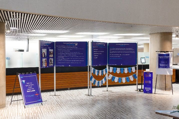
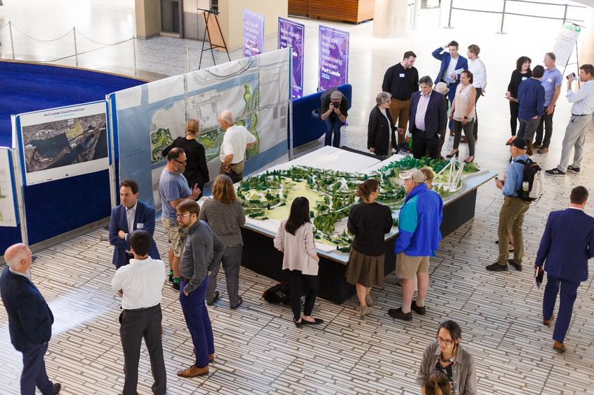
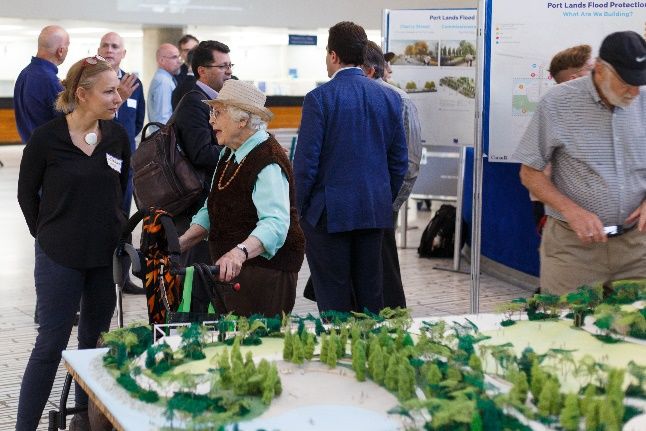
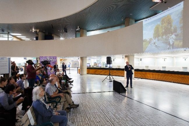
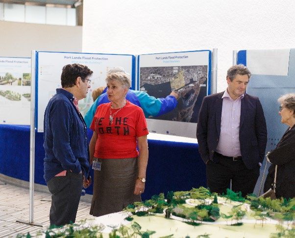
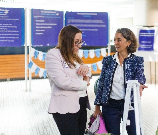
Overview

We hosted a two-day Public Information Centre at City Hall (100 Queen Street West) June 19-20, 2019.
Our focus for this display was to provide an overview and background information for those unfamiliar
with the project, as well as updates on the design of the river valley and ecosystems, parks, new roads
and new bridges and construction progress. On June 20, we presented design updates for the parks,
bridges and roads we’re building as part of Port Lands Flood Protection.

Member of Parliament for Toronto–Danforth Julie Dabrusin and Toronto City Councillor Paula Fletcher
welcomed members of the public. Waterfront Toronto’s SVP of Planning and Design, Chris Glaisek,
provided an overview of the challenges and opportunities in the Port Lands. Presenters Herb Sweeney
(MVVA), James Roche (DTAH) and Michael Meschino (Entuitive) provided design updates and answered
questions.
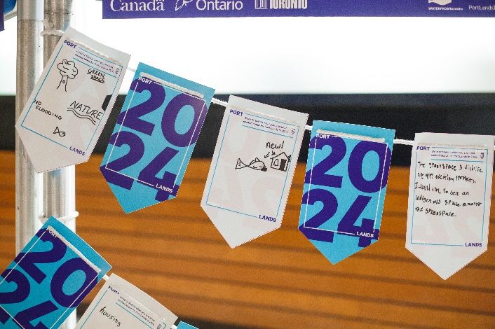
Displays

   •   Project Overview
   •   Construction Overview
   •   Design Update

Presentation

   •   Presentation deck
   •   Presentation video recording

Questions and Answers

   •   Transcript (Appendix A)

Feedback

Our feedback section included a report back on what we’ve heard since starting detailed design on the
new parks, roads and bridges in 2017.

To read summary reports from previous public consultations:

   •   PIC #1 meeting summary
   •   PIC #2 meeting summary
   •   Focus groups summary

During the two-day information centre and the June 20 meeting, participants were asked to leave
comments or feedback for the project team.

We received comments related to the following topics or issues:

   •   Natural green space
   •   Wildlife
   •   Affordability
To help design future consultations, participants were also asked to identify specific areas of interest. Fill
out this very short survey to tell us what topics you’re interested in learning more about at a future
public meeting. This online survey will remain open until October 2019. If you would like to provide
comments, or have questions or concerns about any of the materials from this meeting, please email us.
APPENDIX A

Q&A – June 20 PIC Presentation

Q: Has the design team taken the steps necessary to create conditions that will sustain future growth
and soil sustainability?

A: Yes, the team is going to great lengths with the plant selection and soil design in order to lay the
foundation for that system to function as a developed ecosystem and support the wildlife we expect to
come from the surrounding areas.

Q: I’m concerned that tree trunks or trees themselves might hide the differences between the
pedestrian, bike, and car lanes. For example, where the crosswalks are, if a tree is covering a
pedestrian crosswalk, will cars be able to see pedestrians?

A: When we the design teams create the layout for a planting plan, they take in consideration all the
traffic sightlines. There won’t be any plantings proposed that would be a hazard or obscure views.

Q: Commissioners Street is heavily used by industrial trucks. Are the proposed pavers able to sustain
that amount of weight, or will the trucks be diverted before reaching the park area?

A: All roads have been designed to accommodate heavy truck traffic.

Q: Will the bridges be high enough to accommodate large freight ships and shipping container boats
that navigate the Keating Channel now?

A: The Cherry Street North bridge over the Keating Channel will have enough clearance for Ports
Toronto’s sediment management. Large freight ships will not have clearance.

Q: In previous designs, the main pathway was shown as a continuation of the overall waterfront trail
system that connects the downtown with Promontory Park North. How come that’s not being shown
today?

A: We’re not building Promontory Park North and those associated trail connections as part of the Port
Lands Flood Protection project. We did, however, design those elements in order to ensure the overall
vision for the Port Lands is cohesive. The expectation is that these elements will get built in lockstep
with future development. Today, we wanted to show only project elements on which we’ve advanced
design since our last public meeting. Since we haven’t advanced the park and trails that aren’t part of
this project’s scope beyond 30% design, we aren’t showing them in this presentation.

Q: Since Promontory Park and the pedestrian footbridge that would connect it to downtown aren’t
being built now, is there concern that Promontory Park South, in the early days, will be isolated and
cut off from the rest of the world?
A: There will be public transit on Cherry Street over the new Cherry Street Bridge, as well as along
Commissioners Street. New bicycle routes are also being built and will provide a good connection that
ties into both the existing Martin Goodman Trail and the Lower Don Trail. So, the connections will be
there when we complete construction in 2024.

Q: What provisions have you made or considered for ensuring the safe passage of wildlife to Villiers
Island over the new bridges?

A: The plan is not to get them over the bridges, but rather to provide connections under the bridge in
wildlife corridors. We anticipate that wildlife will move along these corridors along and between the
shorelines.

Q: Regarding the green infrastructure for the streets, what design considerations have been taken
into account and are they meant to absorb rainfall?

A: Low-impact development or green infrastructure has been incorporated into the streets following
industry best practices. We’re aiming to reduce the heat island effect and also reduce the amount of
rainwater that goes into the storm system.
You can also read