PRESTON & SOUTH RIBBLE FLOOD RISK MANAGEMENT SCHEME AUTUMN 2020
←
→
Page content transcription
If your browser does not render page correctly, please read the page content below
PRESTON & SOUTH RIBBLE FLOOD RISK
MANAGEMENT SCHEME AUTUMN 2020
WHOLE SCHEME UPDATE
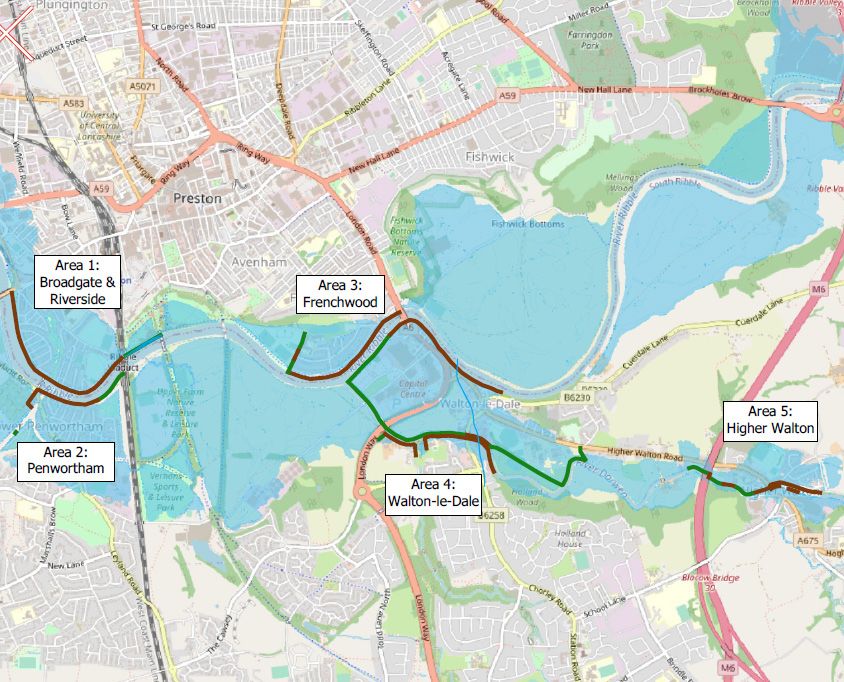
Scheme Overview
The Scheme is divided
into 5 areas of work:
AREA 1
Broadgate and Riversway
AREA 2
Lower Penwortham
AREA 3
Frenchwood and Fishwick
Bottoms
AREA 4
Walton-Le-Dale
(along the Capitol Centre)
AREA 5
Higher Walton and
Samlesbury
Online Engagement Launched Scheme Funding
Coronavirus is affecting us all, presenting challenges in how
we engage with our communities and demanding new The proposed scheme is
and adaptive ways of working. The situation is constantly currently expected to cost
developing and changing and it is essential that we observe around £49m to deliver the flood
and comply with the UK Government’s restrictions.
defences. £6.525m in funding
For the Environment Agency, this means that we are not is coming from the European
currently holding face-to-face public consultation events as Regional Development Fund
we would normally do. (ERDF) with further funding
We are instead providing alternative ways for you to access from other sources such as the
scheme information, ask questions and ultimately make an Environment Agency Flood
informed response to our proposals.
Defence Grant in Aid and from
You can visit our scheme page The Flood Hub at www. the Regional Flood and Coastal
thefloodhub.co.uk/psr which provides information on our Committee.
engagement to date and details of the proposed scheme.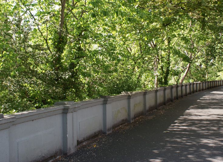
OPPORTUNITIES TO ENGAGE
Throughout the life cycle of the scheme so far we have provided opportunities for people to give their view on the
scheme design and plans, help us to shape flood defences that are fit for purpose and reflect the majority view in the
community. These opportunities will continue as we move into the next stage of the scheme and beyond.

All responses received during the public consultation will be recorded and analysed. Where it is possible, we will use
your feedback to help develop the scheme design or to help identify ways to address concerns about the impacts of
the scheme.

Due to COVID 19 restrictions it has not been possible to hold community engagement events. Our digital
engagement platform is now live and can be accessed via our scheme web page at www.thefloodhub.co.uk/psr.
Whilst this will be focused initially on areas 1 & 2 (Broadgate, Riversway and Lower Penwortham) of the scheme, as
planning applications for this area are due to be submitted later this year. We will still be providing an opportunity for
residents in the later stages of the scheme to view designs to date and provide comment.

Learn more about the previous engagement sessions we held with the local
community in 2017, 2018 and 2019 by visiting our scheme webpage www.thefloodhub.co.uk/psr
or scan the QR.

 500                                          4,800
                                                                                                5
                                                                               New trees planted for
 To date, we’ve                                                                 every one removed
                                               Homes will be
 engaged with                                                                    to facilitate new
                                              better protected
 over 500 local                                                                      defences
 people on the
 project
                                                                    Over
                         3                                                                    £49m
                         5                                   £400m
                         0
                         Businesses will be
                                                               £££
                                                               In costs avoided
                                                                                                     Cost of the
                                                                                                 Flood Management
                                                                                                      Scheme
                         better protected                     from future flood
                                                                   damages

   Ribble Sidings
   Working in partnership with South Ribble Borough Council, we would like
   to enhance the public green space as part of the flood risk management
   scheme. Using the concept design developed by the council’s landscape
   architect, a variety of wetland habitats will be created within a new network
   of footpaths.

   The design includes dipping platforms which will allow people to interact
   with the new habitat. As the scheme progresses, these plans will form part
   of our public engagement.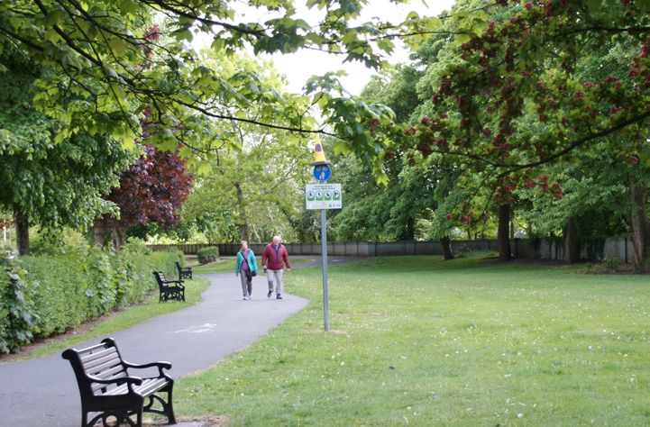
LOCAL ENVIRONMENT

Tree removal decisions                                                  Self-seeded Trees
During previous public drop in sessions for the Preston and             There are a number of ‘self seeded’ trees on
South Ribble Flood Risk Management Scheme the community                 the riverside of the flood defences which
raised concerns about the loss of trees in the area. To facilitate      will be removed. Removal of these will allow
work and ensure the defences have a long life, some trees               access for construction and ensure new
will need to be removed, this work will be scheduled to avoid           defences are not damaged by tree root
bird-nesting season. The areas for replanting are starting to           growth. Self-seeded trees are trees that
be identified and the trees will range from saplings to more            haven’t been planted or planned, these
mature trees.                                                           trees can be as a result of seeds arriving by
                                                                                   birds, the river and the wind.
The Environment Agency commits to planting 5 trees for every                               They can cause damage to
1 removed for this scheme. Prior to any decisions being made                                  flood barriers, footpaths
about trees a full topographic survey will be undertaken.                                        and walls due to lack
The survey helps the project team identify where there are                                        of maintenance.
trees that need to be removed, trees where the crown                                                Maintenance for
can be thinned to provide safe access to the site and
                                                                                                     trees planned and
trees that have a tree preservation order. In line with our
                                                                                                     located close to
commitment to planting 5 trees for every 1 removed as
                                                                                                      flood defences
part of this scheme, we are working closely with partners
                                                                                                     is regularly
to identify best locations locally where these trees can
                                                                                                     undertaken by the
be planted and are also linking in to the South Ribble
Borough Council “Plant 110,000 trees” ambition.                                                     local authority.

Wildlife and habitat surveys
Bats, otters and great crested newts are just a few of the species afforded legal protection and are protected
under the legal framework of protected species.
As responsible developers, the Environment Agency has a statutory obligation to ensure our projects do not
adversely impact on protected species or their habitats. where possible we will always try to avoid negative
impacts.

In order to understand the likely impacts of the scheme and to comply with wildlife legislation we have
commissioned and undertaken a number of protected species surveys, which include but are not limited to bats,
otters and great crested newts.

                OTTERS
                Otter surveys involve looking for field signs such as footprints, spraints (droppings / faeces) and
                resting places (holts and couches). Otters may breed in these places or use temporary sites or lie-
                ups. Otters using our rivers may be impacted upon through habitat loss or degradation so a flood
                protection scheme must incorporate sympathetic design to address the impact it may have.

                BATS
                Bat survey techniques can be mobile or static and include a number of devices such as detectors
                and endoscopes. The surveys check for bat activity and emergence at certain times of the day and
                we also assess the roosting potential in cervies in structures such as bridges and trees.

                GREAT CRESTED NEWTS
                Surveying for Great Crested Newts involves a variety of traditional survey techniques such as bottle
                trapping and torch and egg searches. More recent surveyors have adopted the Environmental DNA
                (eDNA) survey method which involves taking a water sample from potential breeding ponds which
                are then sent to a laboratory for testing for Newt DNA. Newt DNA can enter the water during
                reproduction, from excreta and via shed skin cells.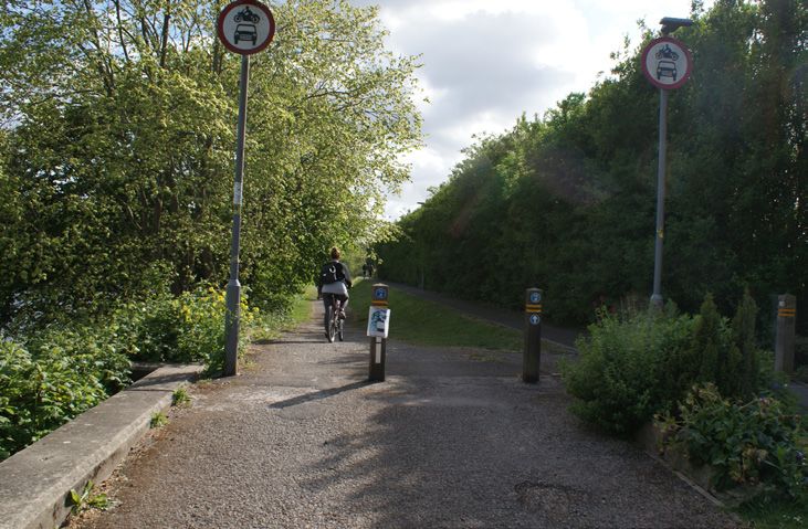
BROADGATE, RIVERSWAY & PENWORTHAM UPDATE

                 AFTER
                            REACH A - BROADGATE:
                            Replacement of the existing concrete wall, with a new
                            concrete wall, between Liverpool Road bridge and
                            Penwortham Old Bridge.
                            Existing Wall Height: 0.75 - 1.23m
 BEFORE                     Proposed Wall Height: 1.20 – 1.60m

                           REACH B - RIVERSIDE:
                 AFTER
                           A new concrete wall along the boundary of the BAC/EE Preston
                           Social and Sports Association cricket pitch between Miller
                           Gardens Apartments and Ribble Cottage (the 2 flood gates).
                           Existing Wall Height: 0
                           Proposed Wall Height: 1.16 – 1.22m

 BEFORE

                 AFTER     REACH B - RIVERSIDE:
                           Replacement of the existing concrete wall, with a new concrete
                           wall with glass panels on top, along Riverside highway between
                           Penwortham Old Bridge and Miller Gardens Apartments.
                           Existing Wall Height: 0.78 - 1.08m
                           Proposed Wall Height: 1.63 – 2.24m
                           (incl. 800mm high glass panel)
 BEFORE

                 AFTER
                         REACH B - RIVERSIDE:
                         Reach B - Riverside: Replacement of the existing concrete wall,
                         with a new concrete wall with glass panels on top, running on
                         the river side of the road in front of the Continental Public House
                         restaurant.
                         Existing Wall Height: 0.90 - 1.09m
                         Proposed Wall Height: 1.78 – 2.53m (incl. 800mm high glass panel)
 BEFORE

                 AFTER
                              REACH C - MILLER PARK:
                              A new concrete retaining wall along a ramped section of the
                              main cycleway and earth embankment in Miller Park.
                              Existing Wall Height: 1.09m
                              Proposed Wall Height: 1.90 – 2.00m
 BEFORE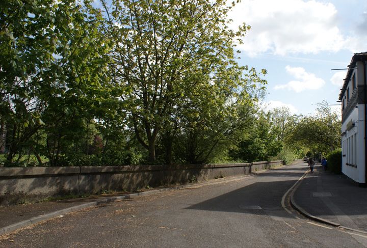
BROADGATE, RIVERSWAY & PENWORTHAM UPDATE
The following sets out the proposed designs for new flood defences and alterations to
existing defences in the Broadgate, Riversway and Penwortham area.
AREA 2A - PENWORTHAM AREA 2A - ENTRANCE TO THE CHURCH:
METHODIST CHURCH: Proposed road ramp to raise existing road levels at the entrance to
Proposed precast concrete flood defence wall Penwortham Methodist Church. The private access road into the
church and the adjacent allotments will be raised by approximately 1m.
Existing Wall Height: 0m
Proposed solid Wall height: 0.65 – 2.20m
AFTER
AREA 2A - GOLDEN
WAY FOOTPATH:
Proposed precast concrete flood defence wall
Existing Wall Height: 0m
BEFORE
Proposed solid Wall height: 0.65 – 2.20m
AREA 2B - RIVERSIDE ROAD: AFTER
Proposed replacement of the concrete flood
defence wall, with precast concrete flood
defence wall and glass panels on top, running
along Riverside Road from the Cadent Gas
Pipe Bridge to Stanley Ave (Upstream end of
Riverside Road).
BEFORE
Existing Wall Height: 1.00 - 1.30m
Proposed solid Wall height: 1.70 - 2.20m (incl.
600-800mm glass panel on top)
AFTER
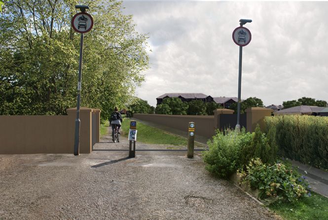
AREA2B - RIBBLE SIDINGS:
Proposed replacement of the 1.7m flood
defence embankment at Ribble Sidings with BEFORE
3.5m high flood defence embankment with a
3m crest width. The existing riverside footpath
(bridleway) route will be maintained with an
access ramp over the proposed flood defences. AREA 2C- ENTRANCE TO THE CHURCH:
A new habitat area will be created on the dry
side of the flood defence embankment. Partial infill of the Network Rail dis-used underpass with
1.5m high solid concrete wall.
*Wall heights are approximate and subject to change
We will be working to remove, replace and repair 9km of flood defences in total, we are working with partners to minimise
disruption. The project will be constructed starting in 2021 and ending in 2024. During this time our communities should
expect disruption in the form of road closures, construction works, footpath and cycle route diversions, increased noise and the
increased presence of contractors. We will continue to update via www.thefloodhub.co.uk/psr and the online engagement
platform for the duration of the project.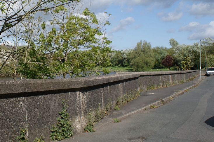
FREQUENTLY ASKED QUESTIONS

                                                     The current flood defences were built between the 1920s and
       Why do we need new flood                       the 1990s and are reaching the end of their design life. New
        defences in this area?                       defences will reduce flood risk to properties and infrastructure
                                                                              in the area.

                                                   The proposed scheme will better protect around 4,778 residential
    How many homes and businesses
                                                     properties as well as over 300 businesses from direct flooding
        will you better protect?
                                                             from the River Ribble and the River Darwen.

                                                      The Environment Agency and Lancashire County Council are
                                                   working closely together and with other partners including United
   Will the proposed scheme increase                Utilities, South Ribble Borough Council and Preston City Council
    my flood risk from other forms                 to ensure that flood risk associated with surface water and sewer
               of flooding?                          flooding is not increased as part of the proposed scheme. This
                                                       means existing pockets of surface water flood risk may still
                                                                         remain after construction.

                                                   The proposed scheme is currently expected to cost around £49m to
                                                       deliver the flood defences. £6.525m in funding is coming from
                                                 the European Regional Development Fund (ERDF) with further funding
     How much will this scheme cost?           from other sources such as the Environment Agency Flood Defence Grant
                                                in Aid and from the Regional Flood and Coastal Committee. The project
                                              team continues to seek further funding for the scheme and will do so for the
                                                  life of the project to ensure we deliver the most for our communities.

                                                      European Regional Development Fund Direct Government
       Who are you working with to                   funding and Flood Defence Grant in Aid Professional partners
            secure funding?                                             and local businesses.

                                                   Initial Ground Investigation works started in March 2019 although
 When are works likely to start and finish?       actual construction is not expected to start until 2021. Construction
                                                     is likely to take place in phases and take 3-5 years to complete.

                                                      We have secured £6.525m European Regional Development
                                                   Funding (ERDF), the contracts have been signed and contracted
    What are the impacts of Brexit on
                                                  subject to expected funding conditions. We don’t currently expect
            the EU funding?
                                                     any Brexit scenario to change this. ERDF will also create 4 full
                                                     time equivalent posts locally and we will employ local people
                                                                and contractors to undertake the works.

                                                               We have provided before and after visuals
      What will the scheme look like?
                                                                of the scheme defences for areas 1 & 2

                                                  We will continually seek to engage with residents, businesses and
                                                 the wider community throughout this project with regular updates
                                                      provided on The Flood Hub website, which can be found at
                                                                     www.thefloodhub.co.uk/psr
     How can I provide feedback and
                                              Whilst COVID restrictions means it’s unlikely we will hold community based
    keep updated about the scheme?
                                                       engagement events in 2020, we are hosting a number of
                                                online events for you to participate in. More details can be found on
                                                             The Flood Hub (www.thefloodhub.co.uk/psr)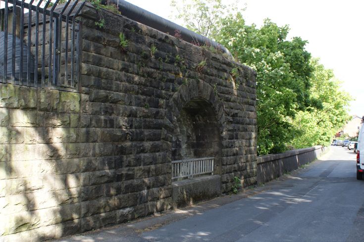
FREQUENTLY ASKED QUESTIONS
                                                We aim to be as inclusive as possible and ensure that everyone has chance to
                                            access key information related to the scheme. If you do not have direct access to the
                                          internet you may be able to access it via your local library. Alternatively you can post any
  What if I don’t have the Internet or                   feedback to: Preston and South Ribble Scheme – PSO Team
   have accessibility requirements?                                   Environment Agency, Lutra House
                                                                      Bamber Bridge, Preston PR5 8BX
                                                                 or email psr@environment-agency.gov.uk

                                            The bed of the river at Broadgate is rock and therefore there is limited material which
                                           could be removed from this area. Additionally, the size of the Ribble Estuary means the
    Why cant you just do dredging
                                            volume of material that would need to be dredged to reduce flooding would be very
     / gravel removal in the river?
                                            large and not cost effective. To be effective dredging / gravel removal would need to
                                                             be done frequently which also has cost implications.

                                                 Natural flood management offers a sustainable approach to managing floods
                                           and is intended to complement traditional “hard engineering” techniques, such as flood
                                          barriers, concrete walls or flood storage areas. Natural Flood Management (NFM) refers to
                                                       measures which can be implemented on a larger catchment wide
                                              scale, that help protect, restore and emulate the natural functions of catchments,
                                                                              floodplains and rivers.
  Have you considered Natural Flood
   Management as an alternative to
                                                NFM schemes rely on a combination of small-scale interventions across the
         building defences?
                                                catchment with the aim of reducing the quantity and speed of the flow of
                                            converging water before it reaches larger rivers and populated areas. Typically, NFM
                                            measures to ‘slow the flow’ of flood waters include woodland planting, leaky dams or
                                                    wood debris barriers, small scale offline storage ponds, floodplain or
                                               wetland restoration. These have the advantage that they could benefit other
                                             areas and ecosystems within a catchment, rather than individual towns and cities.

                                           Some of the most deprived wards in Central Lancashire are located within the scheme
                                              boundaries including within Broadgate and Frenchwood. We are working with
   Would the scheme provide other
                                             partners to understand how the scheme could benefit these areas. The amount of
    benefits to the community?
                                           government funding (Flood Defence Grant in Aid) is calculated and weighted towards
                                                                           areas of deprivation.

                                                 Climate change predictions are included in all our modelling work and the
Future proofing: How is climate change
                                               new guidance is currently being used to guide our scheme design. Our scheme
 built in and will the scheme last long
                                                will be built to last in to the future in line with climate change projections and
                enough?
                                                 we typically make sure we design defences that can be topped up at some
                                                                               future date if need be.

                                          The will protect many homes and businesses at risk of flooding. These figures will change
                                          as modelling improvements are made and the impacts of flooding in Preston and South
Insurance: How will the scheme reduce
                                          Ribble better understood. If this scheme is too big and intrusive to be acceptable to local
  impacts on homes and businesses?
                                           communities, we will try and provide a smaller scheme that will have reduced numbers
                                                                    of homes and businesses benefiting.

                                              We are working with Lancashire County Council, Preston City Council and South
                                            Ribble Borough Council and other partners to look at planning as a whole. We have a
                                           specific group to look at this. The scheme could make future earmarked development
New development: Have we taken new           sites more viable. There may be opportunities to look and extended development
development into account and have all        opportunities in future meetings. Any planned developments cannot be taken into
     new areas been identified?                 account for our economic analysis due to rules set by the government. All new
                                             developments should take place away from areas of flood risk. Development in an
                                               area of flood risk will be subject to planning permission which should ensure the
                                          development only proceeds if it does not increase flood risk or create additional flooding.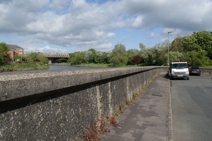
CONTACT US
If you have any questions or queries, please feel free to contact us.
Email: psr@environment-agency.gov.uk
Address: PSR Project Team
Lutra House
Dodd Way Off Seedlee Road
Walton Summit Centre
Bamber Bridge
Preston
Lancashire
PR5 8BX
Please note this office is currently closed, any mail received will take a
significant period of time to reach the intended staff member.
ਜੇ ਤੁਸ& ਇਸ ਦਸਤਾਵਜ਼ੇ ਦਾ ਅਨੁਵਾਦ ਚਾਹਦੰੁ ੇ ਹ ੋ
ਤਾਂ ਿਕਰਪਾ ਕਰਕ ੇ ਸਾਨੰ ੂ ਇਸ ਤ ੇ ਈਮੇਲ
ਕਰੋ:
psr@environment-agency.gov.uk
!ે તમને અા દ)તાવેજ ભાષાંતર કરાયેલ
!ેઈતાે હાેય , તાે કૃપા કરીને અમને અહ8
ઈમેઈલ કરાે.
psr@environment-agency.gov.uk
Tłumaczenie tego dokumentu
można uzyskać przesyłając wiadomość
psr@environment-agency.gov.uk
راکرد ہمجرت اک زیواتسد سِا وک پآ رگا
لیم یا رپ لیذ ںیمہ ینابرہم ہارب وت وہ
ںیرکpsr@environment-agency.gov.uk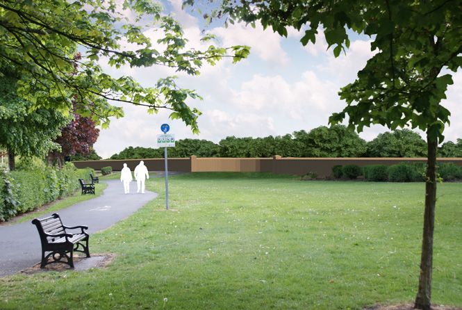
You can also read