Sackville Lakes Provincial Park - Trail Linkages & Connections Plan
←
→
Page content transcription
If your browser does not render page correctly, please read the page content below
Sackville Lakes
Provincial Park
Trail Linkages &
Connections Plan

Final Plan

Prepared by
Acknowledgments
UPLAND would like to thank the Sackville Lakes Park
and Trails Association for their feedback and support,
and for embedding themselves into the vision of
continuously improving and maintaining Sackville Lakes
Provincial Park.

Final Plan
May 14, 2019

All right reserved, 2019.

This report was prepared by
UPLAND Planning and Design.
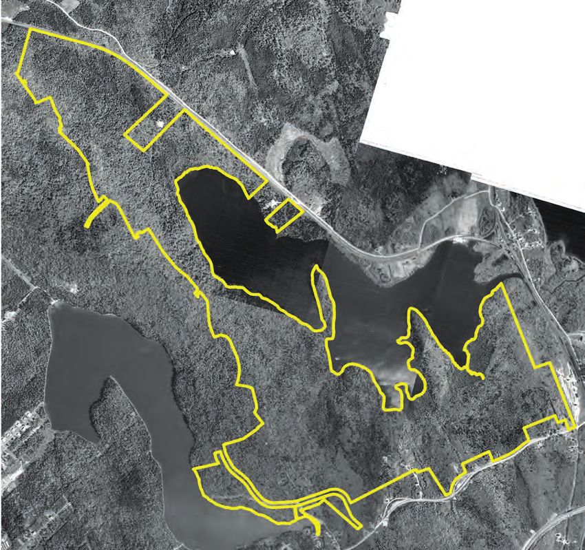
Table of Contents

Introduction
Page 1

Existing Conditions
Page 8

Network Connections
Page 21

Park Amenities
Page 39

Conclusion
Page 42
1 Introduction

Trail Linkages & Connections Plan   Introduction
Sackville Lakes Provincial Park                1
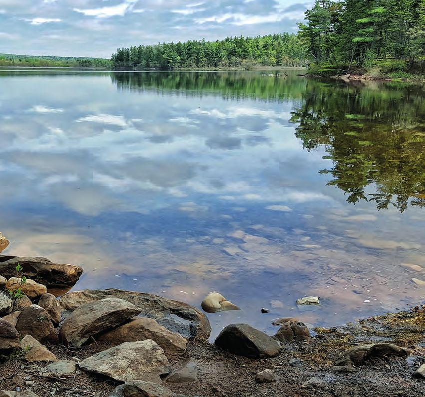
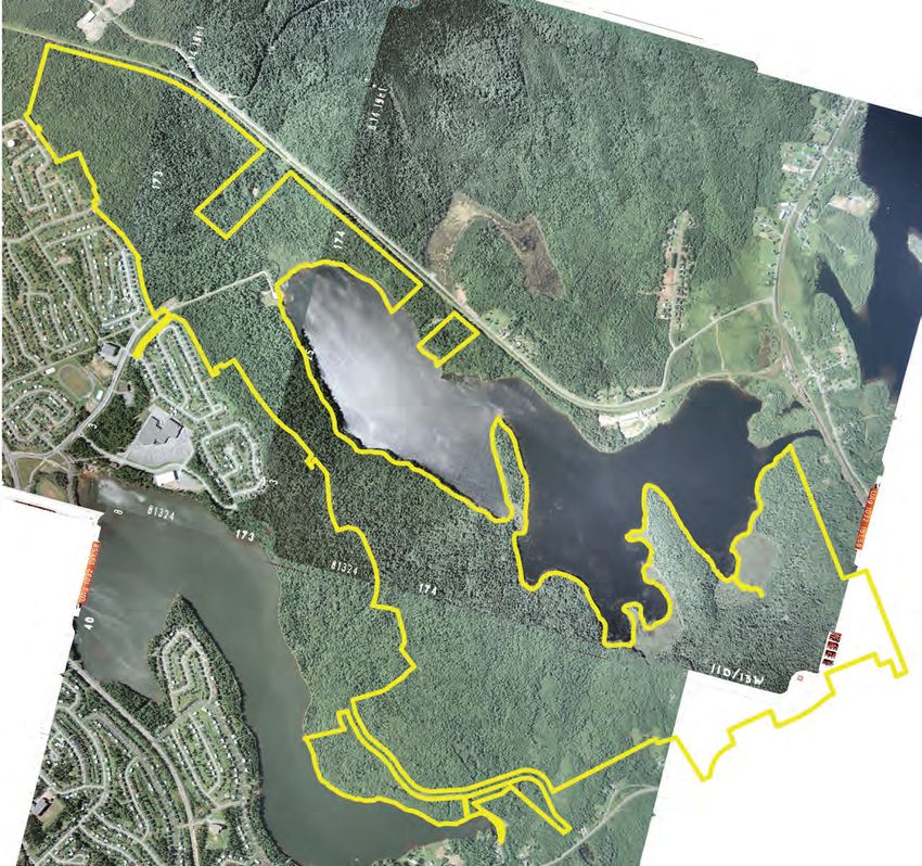
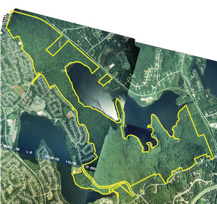
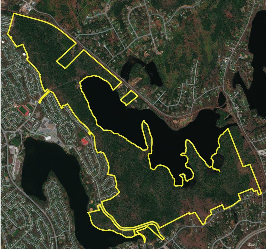
1.1 About this Project

Sackville Lakes Provincial Park is a 305 hectare (754 acre)
protected area situated in the heart of Sackville. The Park is
nestled in a valley between Sackville and Windsor Junction
and includes a majority of lands surrounding Second Lake
as well as a portion of lands on First Lake. The communities
adjacent to the Park have a population base of over 50,000
people.

The vision for the Park is to maintain a natural setting
while providing passive recreation trails that, where
feasible, are accessible to all segments of society.

Active transportation trails have been constructed in the
western half of Sackville Lakes Park and aspects of plans are
in place to link those with regional trails to the south and west
but planning for trail linkages to the east or the north have not
been explored.

The goal of this project is to explore options on how to
develop trail linkage in the northern and eastern areas of the
Park that will help expand the regional Active Transportation
network, while protecting the natural integrity of the Park.

Introduction
2

1.2 Development History

Second Lake and its watershed remained isolated from major settlement and
development throughout most of its recent history. Referred to on some early
maps as “Middle Lake”, “Double Lake”, and “Kehoe’s Lake”, Second Lake
was protected by geography and the positioning of roads and settlement
patterns from the rapid development of the 1970s and 1980s.

Road from Halifax to Truro
The Park as it is today, flanked an old road that
connected Halifax and Truro. The roads from Halifax
to Windsor and from Halifax to Truro forked near
Fultz’s Inn in Sackville, just south of the Park
boundary. When the 9th Earl of Dalhousie was
governor of Nova Scotia, he brought with him
John Elliott Woolford to survey and sketch the
key roads of the colony at the time. In 1817,
there were two principal roads in Nova Scotia –
one from Halifax to Windsor, and another from
Halifax to Truro.

This section of map identifies Park area
along the road from Truro to Halifax,
featuring many lakes, Sucker Bridge,
“midling good land,” and “rocky and barren
land.” The map also identifies Great Beech
Hill as “To high for any Carriage” and an
alternate route that is “almost level” which
was used by stagecoaches at the time.
Old property descriptions in the Park also
describe references to an “old wood road”
running between the watersheds of First
and Second Lakes.

Windsor Branch Line
Another significant development around the
park was the construction of the Windsor
Branch line in 1858. This rail corridor
connected Windsor Junction to Windsor
and the Annapolis Valley beyond.

Trail Linkages & Connections Plan                                              Introduction
Sackville Lakes Provincial Park                                                           3
Windsor
                                                                                             Junction
                                                                                             Station

                                       Second Lake

               First Lake

                                                                                                                                ?
                                                                                                                            d
                                                                                                                       oa
                                                                                                                  hR
                                                                                                               oac
                                                                                                           c
                                                                                                       age
                                                                                                     St
                                                                                                le
                                                                                            ssib
                                                                                         Po

                            Unlike Second Lake, First Lake was heavily developed
Sackville Lakes             in the 1970s under the provincial government’s land
Provincial Park             assembly project which created a satellite community
                            for the Halifax and Dartmouth areas. The result of this rapid
1964                        development was a serious degradation of the water quality of
                            the First Lake watershed, which has since improved.

                            The Windsor Junction rail station was staffed until 1978, when Canadian National
                            closed the station, offering it for sale for a dollar if the building was removed from
                            the site. The Historical Society of Fall River and Windsor Junction tried to save
                            the station, acquiring land near the station where it could be moved to serve as a
                            museum and craft store, however, fundraising efforts fell short and the station was
                            demolished in the summer of 1984.

Introduction
4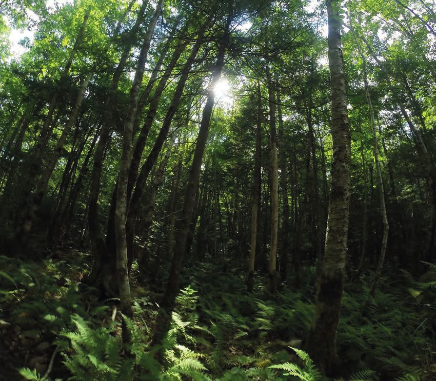
Second Lake

                 First Lake

Sackville Lakes                     As substantial development occurred in the 1970s and 1980s, Second Lake
                                    became the main water supply source for early central services in Sackville
Provincial Park                     and Bedford. A pumping station was located at the western end of the lake and
1981                                capacity was believed to be sufficient to support a community of more than 20,000
                                    people. In 1970, however, the Halifax Pockwock system became the main water
                                    supply source for the area, which meant Second Lake was no longer needed for
                                    its water supply, which created the opportunity to develop the land as a Provincial
                                    Park.

                                    First lake Drive was built in1982/3, connecting Cobequid Road to Lower Sackville
                                    between First and Second Lake.

Trail Linkages & Connections Plan                                                                          Introduction
Sackville Lakes Provincial Park                                                                                       5
Second Lake

               First Lake

                                                     Sackville Lakes
                                                     Provincial Park

Sackville Lakes             The value of the land for use as a park had long been recognized because of the
                            landscape type, forest cover, clear lakes, and proximity to large-scale planned
Provincial Park             developments. The collective actions of several regional community groups
2003                        resulted in the formation of the Second Lake Regional Park Association in 1998.

                            The mandate of this group was the protection of the Second Lake lands for use
                            as a regional green space. In 1999, approximately 281 hectares (694 acres) of
                            the Second Lake land assembly was transferred to the Department of Natural
                            Resources and assigned to the Provincial Parks program for management as
                            provincial park reserve. In December, 2004, an additional 24 hectares (60 acres)
                            of Provincially-owned land was added to the park. A majority of this parcel is
                            located within the First Lake watershed.

Introduction
6
Second Lake
First Lake
Sackville Lakes
Provincial Park
Sackville Lakes
Provincial Park
2016
Trail Linkages & Connections Plan Introduction
Sackville Lakes Provincial Park 72 Existing Conditions Existing Conditions 8
Third Lake

                                             Second Lake

                  First Lake

Elevation                           The topography of the Park is located between two watersheds, and as a result,

                                                                        °
                                    is quite undulating. This undulating topography,0   characterized
                                                                                           240     480 by drumlins
                                                                                                           720     and
                                                                                                                   960 m
                                    hummocks, results in well drained soils and moderate slopes in areas. The highest
                                             Legend
      90                            point in the Park is an area near Cobequid Road known as Great Beech Hill, which
                                             dem_2m_utm
      80
                                    rises nearly one hundred metres above sea level and provides panoramic views

                                    of the First and Second Lake watersheds. The Hill once featured a stagecoach
      70                                           -9.020000458 - 40
                                    diversion to the north of the hill to avoid the steep grade of Cobequid Road.
                                                  40.00000001 - 50
      60
                                                  50.00000001 - 60
      50
                                    First Lake and Second Lake sit at 48 and 35 metres above sea level, respectively.
                                                  60.00000001 - 70

      40 m                                        70.00000001 - 80
                                                  80.00000001 - 90
                                                  90.00000001 - 200

Trail Linkages & Connections Plan                                                                     Existing Conditions
Sackville Lakes Provincial Park                                                                                         9
Third Lake
Second Lake
First Lake
Slope The steepest areas of the Park are the drumlin ridges in the east.
Legend
°
The east-west linear nature of 0the Park
240is fortunate
480 considering
720 960 m
that the slope direction is north-south, meaning that trail corridors
% Area
can lead through the majority of the Park following contour lines to
slope_2m
of Park % Grade maintain a stable elevation.
90 °
0% >100
80 °
1
1:
0-1
70 °
or
50-100 When considering different types of development, slope changes present the following issues:
0%
°
1%
60
1.000000001 - 4
10
°
5% 25-50
50
• Slopes under 1% do not drain well unless they are paved well;
° 4.000000001 - 10
1:2
40
9% 17-25 or • Slopes under 4% seem flat and are usable for all kinds of activity;
° 50% 10.00000001
• Slopes-between
17 4 and 10% are workable grades and present few obstacles to development for
20% 10-17 30
roads and buildings;
17.00000001 - 25
29% 4-10 20 °
or 1:4 • Trails and roads are ideally kept between 1 and 10%;
25%
1:6.25 25.00000001
• A 16% -slope
50 approaches the limit that an ordinary loaded vehicle can climb for sustained period;
27% 1-4 16% or
10 ° • The limit of climb for pedestrians is 20 to 25% without resorting to stairs.
4% or 1:2 5 50.00000001 - 100
10%Duck
Lake
Brook
Wilson’s Third Lake
Brook
Second Lake
First Lake
Drainage The majority of the Park drains predominantly into Second Lake either directly or
Waterbody
via one of many streamsSucker
Brook
Park along First Lake Drive °
that feed into it from0 the south
240 side. A small720
480 area of960
drains south into First Lake. The western half of the
them
park slopes steadily toward Second Lake and Wilson’s Brook; the southern and
Wetland eastern areas of the park have more varied topography due to drumlins in this
24 acres
area and the flow pattern is more complex as water is shed from the tops of these
River mounds into several creeks before reaching the lake.
Direction
of Flow There are several areas of the park where the land is flat and drainage is poor
(indicated as wetlands on the map above). Most of the Park however slopes
Sackville Lakes steadily and is well-drained.
Provincial Park
Trail Linkages & Connections Plan Existing Conditions
Sackville Lakes Provincial Park 11Third Lake
Second Lake
First Lake
softwood ° 0 240 480 720
mixed
Landscapes hardwood
°
Hardwood (5%)
0 240 480 720 960 m
softwood wind throw Softwood
Wetland (3%)
Land Cover Type (54%)
Area within park
mixed alders Treed Bog (Forest Wetland Waterbody
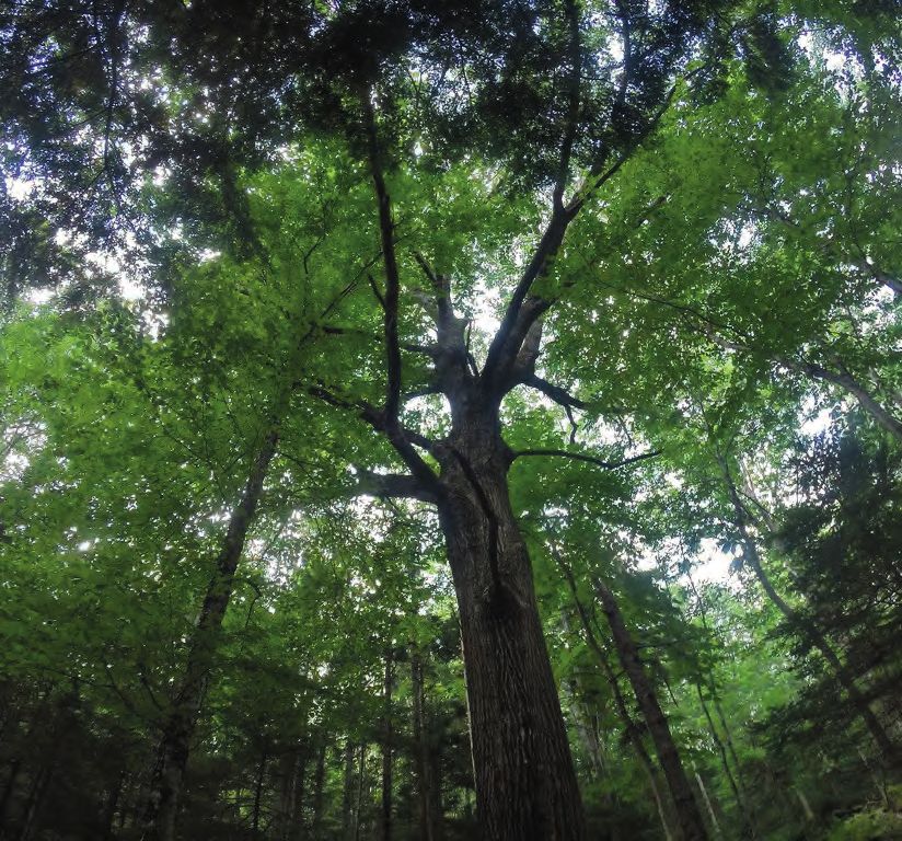
Sackville Lakes Provincial Park There are several wetlands in the Park, Second Lake is a 121 hectare body
features a wide diversity of land cover located at the mouths of the streams of water (exclusive of wetlands) and
and forest types in the 713 acres it that feed into Second Lake, where the receives drainage from a watershed
covers. Just over half of the Park (209 topography flattens and water can approximately 610 hectares in size. The
acres) is a softwood forest, consisting pool. Making up 3% of the Park, these longest axis, roughly east-west, is about
predominantly of red spruce or mixed areas are defined by their saturated, 2.4 km. The lake is a headwater lake
red and black spruce stands, with acidic soils and less than 25% tree of the Shubenacadie River system into
pockets of white pine, eastern hemlock, cover. There is also one pocket of which drain several small intermittent
or balsam fir. Another third of the park treed bog, with vegetation consisting streams. There is a single outflowing
is mixed wood forest, dominated by primarily of heathers, mosses (including stream into Third Lake. The lake has
red maple and white birch, with some sphagnum), and stunted trees. a relatively long undulating shoreline
stands of eastern hemlock and yellow that provides multiple features for Park
birch, and a lower representation of fir, appeal. Two of the drumlins on the site
spruce and tamarack. There are also a are associated with peninsulas that
few high elevation, well drained areas subdivide the lake into three basins.
of the park where hardwood species Lake depth is variable but maximum
dominate. Stands in these areas consist depth is approximately equal in the
of red maple, beech and birch. three basins at about 9 to 11 metres.
The Park has some notably mature Geoglogy Water quality is suitable for swimming
hardwood and hemlock stands, The surficial geology of the Park is and other recreational uses. Second
nearing old-growth. The majority of the largely defined by the last glacial Lake was used as the water supply for
area however is mid-aged and has a period and is comprised of ground the community of Sackville prior to the
moderate crown closure averaging moraines, which are till-covered Pockwock water system coming on line.
around 60%. Forest stands dominated areas created at the base of a
by shade-intolerant species such as glacier or at the ice edge as it The lake supports a variety of fish
red maple and white birch indicate retreats. Surficial materials are species, the most notable being white
that the forest is in an early stage of primarily composed of stony and silty sucker, smallmouth bass, brook trout,
succession indicating that these areas glacial tills and are expressed in the and brown bullhead.
were relatively recently logged, burned types of soils found in this landscape
or wind-damaged. Red spruce is one of - well drained, fine-textured Wolfville
the most dominant softwood species of soils on the drumlins and hilly terrain,
and poorly drained, medium-textured
the region, and indicates rich soils, and
crossed with black spruce as it often isMahone soils on flat terrain. Another
in Nova Scotia, has a tolerance for the glacial feature within the park are the
wet areas found in the lower-lying partsdrumlins located in the east. These
of the park. mounds create the irregular tear-drop
shaped hills, and are made of well
While there are no human-cleared areas drained, finely textured soils.
of the Park’s forest, there are several
stands that are now regenerating Three major types of bedrock
following significant damage by wind are featured beneath the park -
events. There is also one stand at the greywacke, slate and quartzite.
far southeast end of the Park which,
having been recently cleared, has
regenerated into a stand of alders and
other brush.
Trail Linkages & Connections Plan Existing Conditions
Sackville Lakes Provincial Park 13Future trailhead
C
Tr ano
ail p
Ex y C
te re
ns ek
ion
Third Lake
Second Lake
First Lake
Park Trails + Access Points
n schools
° 0 320 640 960 1,280 m
Existing Primary Access Node Multi-Use Trail Sackville Lakes Park
Proposed Primary Access Node Proposed Trail Connection Provincially Owned Land
Secondary Access Node Other Community Trails
Existing Conditions
14Vehicular Access Trails Planned Trails
The primary access points to the Sackville Lakes Park has three main In 2018, the Sackville Lakes Park and
Sackville Lake Park is a trailhead trails. The longest trail is the Lakeside Trails Association finalized a plan
located off First Lake Drive, where there Trail which passes through the length to extend the Canopy Creek Trail to
is a parking lot, outhouse (wheelchair of the park in an east-west direction, Beaver Bank Road (see below for a link
accessible), park information kiosk following the south shore of Second to the plan). The plan proposes a new
including trail maps, and access to Lake. This trail joins with the Great Oak 1,100 metre long, 3 metre wide multi-
the trails leading north toward Second Trail, which begins at the First Lake use trail between Canopy Creek Trail
Lake and south toward First Lake. Drive trailhead and meets the Lakeside and Beaver Bank Road along the rail
There is also a trailhead located at the Trail in two locations, forming a loop. corridor. The trail would intersect the
end of Metropolitan Avenue, which The Glen Slaunwhite Trail also begins at Canopy Creek Trail and travel along
offers a parking area, but minimal park the First Lake Drive trailhead, but on the the rail corridor for 900 metres before
information. south side of the road. This trail follows terminating at a new proposed trailhead
the shore of First Lake until it exits the and entrance node along Beaver Bank
The park can also be accessed from park at the Eddie LeBlanc Memorial Road.
the Eddie LeBlanc Memorial Ballpark Ballpark. From here the trail continues,
near First Lake (via the Glen Slaunwhite linking Sackville Lakes Park with several
trail or by crossing the street to the other smaller trails along the shore of
White Pine Trail), from Cavalier Drive First Lake, ending near the Sackville
(via a short connector to the Lakeside Sports Stadium.
Trail), from the end of Armcrest Drive at
the far north-west end of the park (via There are a number of shorter
Lakeside Trail). connector trails within the park,
including the Metropolitan Avenue
Park Use connector which creates a linkage from
The Lakeside Trail, Great Oak Trail and the Metropolitan Avenue trailhead to
Glen Slaunwhite Trail are wide and Lakeside Trail. The connector that links
have a crusher dust surface, making Cavalier Drive to Lakeside Trail is the
them accessible to most users. Trails shortest trail in the park and provides
are open to active transportation uses the quickest route to access the shore
such as walking and cycling; motorized of Second Lake from within the park.
vehicles are prohibited. The trails are
not cleared in the winter, and are used The Lakeside Trail, Great Oak Trail and
for winter recreation activities such as Glen Slaunwhite Trail are wide and
snowshoeing and cross country skiing. have a crusher dust surface, making
them accessible to most users. Trails
Dogs on-leash are permitted in the are open to active transportation uses
park, and fishing in the lakes is such as walking and cycling; motorized Canopy Creek Trail Extension and
Entrance Node Design
also permitted although a licence is vehicles are prohibited. The trails are
2018, UPLAND.
required. Boating is permitted in the not cleared in the winter, and are used
for winter recreation activities such as Click here to read the report:
lake, but a vehicle accessible boat tiny.cc/canopycreek
launch is not currently provided. snowshoeing and cross country skiing.
The park is not designed for and does
not permit camping or camp fires.
Trail Linkages & Connections Plan Existing Conditions
Sackville Lakes Provincial Park 15Rd
ion
nct
r Ju
W
ind
dso
ga
02
te
Win
Dr
y1
Hw
Rd
a nk
rB
ave Gl
Be en
da
le
Dr
H
w
y d
1 id R
qu
be
o
C
02
y1
Hw
Population Density The population in the area surrounding Sackville Lakes Park is to the south of the
People per Acre
park, where lot sizes are smaller than the surrounding
area between
0 540
°
area,1,080
which 1,620
is dominated
2,160 m
single-family homes, resource land and large lots. There is a densely populated
schoolsDr and the west end of the park, where there are three
n Glendale
by
0
elementary schools and a junior high school, and another next to the Milwood
0 to 1 Common Park, Milwood High School and Elementary Schools. While there are
some multi-unit residences in the study area, the most dense neighbourhoods,
1 to 5
with up to 30 people per acre, have achieved this density due to lot size (under
5 to 10 0.1 acre) and duplexes, rather than multi-storey residential developments.
10 to 20
The population densities shown on this map are based on the dissemination
20 to 30 blocks and population numbers from the 2016 Census.
Existing Conditions
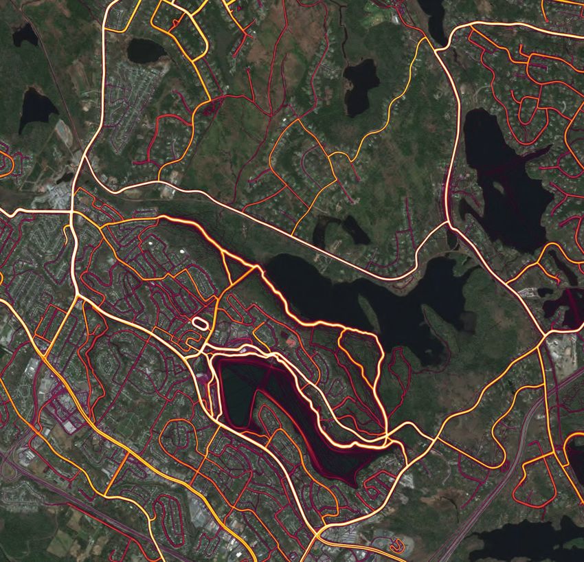
16The popular mobile app Strava allows users to track their active transportation and
recreation activities using GPS, to compare speeds and routes with other users
in their area. The map above is the compilation of this data, showing a gradient
of colour indicating the amount of traffic any given route receives from cyclists,
runners, walkers and boaters. There are several unofficial trails in Sackville Lakes
Park, mostly used by mountain bikers and some by hikers, that are visible here.
The map also shows several locations where users commonly enter the park,
despite there being no official entrance node or trail connection.
Trail Linkages & Connections Plan Existing Conditions
Sackville Lakes Provincial Park 17Fall River
118
Waverley
Sackville Lakes
Provincial Park
Riverlake
Sackville Greenway
Greenway
101
Lower
Sackville
102
Bedford
Sackville
Greenway Burnside
Expressway
Bedford
Regional Trails Sackville Lakes Provincial Park sits at a crossroads between the Windsor
Hantsport Rail line and three major regional trails. The Bedford Sackville
and AT Corridors Greenway is an 8 km active transportation trail that connects Bedford to Sackville.
The trail terminates near the intersection of Sackville Drive and Cobequid Road.
Existing Trail or AT Route The Riverlake Greenway is a regional trail proposed by the Shubenacadie
Watershed Environmental Protection Society (SWEPS) that connects Carrolls
Planned Trail or AT Route Corner (near Shubenacadie) to downtown Dartmouth along the old Shubenacadie
Canal corridor. The Burnside Connector Trail is in the planning stages and will
eventually connect Sackville and Bedford to Burnside Industrial Park. The trail
is currently being planned to end at the intersection of Duke and Rocky Lake
Road.Finally, the Sackville Greenway is a planned trail that would connect Fultz
House to Feely Lake near the rail line. A section of the trail already exists between
Sackville Drive and Glendale Drive.
Existing Conditions
18Grand
Pré
Harvest
Moon
Trailway
Hantsport
Windsor - Hansport
Section
Windsor
Enfield
CN Rail-
Windsor Branch Mount
Uniacke
Riverlake
Greenway
Fall River
Waverley
Sackville Lakes
Provincial Park
Portobello
Dartmouth
Rail Line The existing railway corridor is a 90 km rail line that connects Windsor Junction to Kentville. All
rail operations ceased in 2011 and, since then, large segments of the rail bed have deteriorated
to a point where the railway line is inoperable. Without any rail customers, the cost of restoring
the track to the required standard for railway operations will be significant. The 51.5 km (32 mile)
Windsor Branch Line is currently owned by CN and was leased to the Windsor & Hantsport Railway
Company until December 2012. CN has been negotiating the sale of that corridor to the Windsor
and Hantsport Railway Company (WHRC) since 2013. Community groups and municipalities
are increasingly recognizing the opportunity to convert this corridor into a regional trail that could
eventually connect Sackville directly to Windsor and connect to the Harvest Moon Trailway that
runs throughout the entire Annapolis Valley. If the railway corridor is not used for continued railway
operations, the corridor will be available for purchase by government. The adjacent municipalities
have formally expressed their interest in purchasing the corridor if it becomes available.
Trail Linkages & Connections Plan Existing Conditions
Sackville Lakes Provincial Park 19Existing Conditions 20
3 Network Connections

Trail Linkages & Connections Plan   Network Connections
Sackville Lakes Provincial Park                      21
3.1 Objectives

Project Goal          The goal of this project is to explore options on how to develop trail linkages in the
                      northern and eastern areas of the Park that will help expand the regional Active
                      Transportation network, while protecting the natural integrity of the Park.

                      Objective #1: Connect the Park to the rail corridor
                      The railway corridor that flanks the northern boundary of the Park offers an
                      enormous opportunity to create a regional trail that could connect Sackville to
                      Windsor. If the Windsor and Hantsport Railway line became available for public
                      use the regional trail could tie into the existing Harvest Moon Trail (which connects
                      Grand Pré to Annapolis Royal).

                      Objective #2: Connect the Park to Waverley and the Riverlake Greenway
                      The Park is near several communities to the east of its boundaries, but there are
                      currently no active transportation routes to connect them. An AT route to Waverley
                      could improve these connections, while also providing a regional connection
                      between the future rail trail and the future Riverlake Greenway, which (when
                      completed) will provide a connection between Enfield and Dartmouth.

                      Objective #3: Complete a loop around Second Lake
                      Once Objectives 1 and 2 are complete, there will be an opportunity to complete
                      a loop around Second Lake by connecting a small one kilometre gap between
                      Windsor Junction and Cobequid Road.

                      Objective #4: Connect the Park to the Bedford Sackville Greenway
                      Plans are in the works to develop active transportation pathways along Sucker
                      Brook Road and Cobequid Road which will provide useful corridors between the
                      Park and nearby communities to Bedford.

Network Connections
22
Fall River
Lower
Sackville Waverley
Riverlake
Greenway
(Proposed)
Bedford/
Sackville
Greenway
Future
Burnside
Trail
Bedford
Trail Linkages & Connections Plan Network Connections
Sackville Lakes Provincial Park 233.2 Rail Trail Connection
Overview The rail corridor presents an enormous opportunity to develop a 90 kilometre
regional active transportation route connecting Sackville to Grand Pre and the
Annapolis Valley. Trail groups are eager to develop official trails along the corridor
but are unable to do so because CN and WHRC are negotiating a transfer of
the line for continued railway operations. Previously WHRC had a lease with CN,
which expired in 2012. The line from CN has not been finalized due to land issues
in court. If the rail corridor is not sold for continued railway operations, or sold and
not operated as a railway, it must be offered to government.
Recognizing that the WHRC is not currently complying with Provincial legislation or
the WHRC licence agreement, a community group has filed an official complaint
with the Nova Scotia Utility & Review Board asking them to revoke the licence
to operate a railway. In late 2018, the Board decided that there was enough
evidence to hold a paper hearing on this matter. If required a public hearing will
be scheduled in October 2019. If it is determined future railway operations are
unlikely this process could result in the discontinuance and abandonment of the
railway lines and allow trails to eventually be developed.
If this process results in the rail corridor ending up in provincial hands as an
abandoned rail corridor, it would allow municipalities and trail groups to develop
trails along it by obtaining a Letter of Authority from the province.
In this scenario, the Sackville Lakes Park and Trails Association could apply for a
Letter of Authority to develop a 4.5 kilometre Active Transportation Trail along the
abandoned rail corridor between Beaver Bank Road and Windsor Junction Road.
This would be a convenient route that would connect communities, bring in new
users to the Park, and offer opportunities to complete a trail loop around Second
Lake.
If the rail corridor is developed as a trail, the active transportation route could
continue as an on-road bicycle facility (signed route) along Windsor Junction
Road and Fall River Road. This would provide a direct and convenient
connection between the Rail Trail and the Park to the community of Fall River. The
development of the on-road facility would be the responsibility of Halifax Regional
Municipality.
Network Connections
24Fal
l Riv
er R
oad
F
oad
nR
ctio
Jun
r
dso
Win
Ra
il T
ra
il Co
nn
ec
tio
n
Lower
Sackville
Proposed Trail Connections
Regional Trails
Rail Trail Connection
On-Road Signed Bike Route
Trail Linkages & Connections Plan Network Connections
Bedford
Sackville Lakes Provincial Park 25Trail Details Description
• 4.5 kilometre Active Transportation Trail (Rails Under Trails) between Beaver
Bank Road and Windsor Junction Road
• Minimum 3.0 metres wide
• Crusher dust surface
Opportunities:
• Off-road AT connection between Beaver Bank Road and Windsor Junction
Road
• Offers a AT loop around Second Lake by tying into the Park trail network
(requires additional trail segments)
• Offers new access points into the Park
Constraints:
• Uncertain ownership/leasehold situation
• Railbed surface has deteriorated in certain areas.
Estimated costs:
$450,000 - $500,000
Estimated time to complete:
2-5 years
Implementation Timeline
2019 2020
April July October April July October
Negotiate a lease with WHRC Design and Construction
Negotiate a short term lease with the Work with the WHRC to design and build
WHRC to build and maintain a trail the trail.
Timeline: 3-6 months Timeline: 3-6 months
Cost: ~$10,000 per year Cost: ~$450,000
Rail corridor remains privately Trail opens
owned by WHRC
Monitor rail corridor ownership
Monitor the CN/WHRC purchase negotiations which will determine the future Rail corridor becomes
ownership of the rail corridor between Windsor Junction and Windsor. publicly available
Timeline: ~1 year
Cost: Time and effort
Construction Plan and Letter of Authority Apply for funding
Hire a trail designer to prepare a Trail Construction Apply for funding
Plan in order to obtain a letter of authority to build and to build trail.
maintain a trail along the abandoned rail corridor.
Timeline: 3 months
Timeline: 6-9 months Cost: Time / effort
Cost: ~$10,000
Network Connections
26
PlanningTrail Cross Section
201
April July
Monitor rail corridor ownership
Monitor the CN/WHRC purchase negotiatio
ownership of the rail corridor between Wind
Timeline: ~1 year
Cost: Time and effort
2021 2022
April July October April July October
Ongoing Annual Maintenance
Ensure the trail is kept clean and well
maintained. Planning
Timeline: Ongoing
Cost: Covered by annual lease Design
Construction
Maintenance
Trail opens
Build the trail Ongoing Annual Maintenance
Hire a contractor to build the trail. Ensure the trail is kept clean and well
maintained.
Timeline: 3-6 months
Cost: ~$450,000 Timeline: Ongoing
Cost: ~$5,000 per year
Trail Linkages & Connections Plan Network Connections
Sackville Lakes Provincial Park 273.3 Great Beech Hill Trail
Overview Large portions of Cobequid Road follow an old historic road that once connected
Truro to Halifax. Today, it is still an important arterial road connecting the
community of Waverley to downtown Sackville and flanks the border of Sackville
Lakes Provincial Park. For cyclists commuting along Cobequid Road, there is a
section between Windsor Junction Road and First Lake Drive where a steep-sided
drumlin called Great Beech Hill presents grades that are extremely challenging
to bike up. The hill is so steep, in fact, that old stagecoaches had to travel along
a bypass route in the Park that circumnavigated the hill on land to get through
efficiently.
Although the stagecoach bypass road has since overgrown, it would be useful
to revitalize the route as an active transportation trail that would run parallel
to Cobequid Road. This trail would provide an alternative off-road option with
reasonable grades for people instead of travelling along Cobequid Road.
The proposed trail will be a 3 metre wide active transportation trail that would
travel east-west, linking up with the Great Oak Trail near the First Lake Trailhead
in the west and terminating near the intersection of Cobequid Road and Windsor
Junction Road in the east. The trail will run along the rear side of private lots that
front onto Cobequid Drive to prevent intruding into the interior of the Park, where
undisturbed forests and natural areas exist. It will also be set back a minimum of
50 metres from the rear lot lines to ensure a sufficient privacy buffer for private
residential dwellings.
If the active transportation trail is developed, the route could continue after it exits
the Park as an on-road bicycle facility (signed route, bike lane or multi-use path)
along Cobequid Road. This would provide a direct and convenient connection
between the Park and the community of Waverley. This would also provide a direct
connection between the Park and the Riverlake Greenway. The development of
the on-road facility along Cobequid Road would be the responsibility of Halifax
Regional Municipality.
Network Connections
28Ra
il T
ra
il Co
nn
ec
tio
n
Waverley
il
Tra
ll
Hi
e ch
G re a t B e
Riverlake
Greenway
(Proposed)
Proposed Trail Connections
Regional Trails
Rail Trail Connection
Great Beech Hill Trail
Cobequid Road Bike Route
Trail Linkages & Connections Plan Network Connections
Sackville Lakes Provincial Park 29Trail Details Description
• 2.0 kilometre Active Transportation Trail between Great Oak Trail and
Cobequid Road and Windsor Junction Road
• Minimum 3.0 metres wide
• Crusher dust surface
Opportunities:
• Provides a more accessible and safe off-road active transportation route
• Offers an active transportation loop around Second Lake
• Offers new access points into the Park
Constraints:
• Potential
2019 privacy issues with private residences along Cobequid Road 2020
April July October April July
Estimated costs:
$400,000 - $500,000
Negotiate a lease with WHRC Design an
Estimated time to complete: Negotiate a short term lease with the Work with t
2-3 years WHRC to build and maintain a trail the trail.
Timeline: 3-6 months Timeline: 3
Cost: ~$10,000 per year Cost: ~$45
Rail corridor remains privately
owned by WHRC
Implementation Timeline
Monitor rail corridor ownership
Monitor the CN/WHRC purchase negotiations which will determine the future Rail corridor becomes
ownership of the rail corridor between Windsor Junction and Windsor.
2019 publicly available
2020
April
Timeline: ~1 yearJuly October April July October
Cost: Time and effort
Trail opens
Construction Plan and Letter of Authority
Hire a trail designer to prepare a Trail Construction
Trail Design and Consultation Build the trail Plan in order to obtain
Ongoing Annuala letter of authority to build and
Work with NS Lands and Froestry, stakeholders and the Hire a contractor to build the trail. maintainMaintenance
a trail along the abandoned rail corridor.
community to develop detailed trail design and delineation.
Timeline: 3-6 months Timeline:Ensure the trail is
6-9 months
Timeline: 6- 9 months kept clean and
Cost: ~$450,000 Cost: ~$10,000
Cost: $ 8-12,000 well maintained.
Timeline: Ongoing
Cost: ~$2,000 per
year
Planning
Design
Construction
Maintenance
Network Connections
30
PlanningTrail Cross Section
• Trail treads must be a minimum of
2.5 m (8 ft) wide
• Preferred width: 3 m (10 ft)
• Both sides of the trail should be
kept clear of branches and brush
for a minimum of 0.8 m (2.5 ft)
• Vertical clearance must be a
minimum of 3 m (10 ft)
• Trail surface consists of 4”
compacted crushed rock base
• Desired Grade: 0 to 5%
• Maximum Grade: 8% (sustained),
12% less than 20 m (60 ft)
• Outslope Grade: 4% (maximum)
Trail Delineation
Culvert or
bridge
Culvert or needed
Culvert or !
bridge bridge
needed needed
!
! !
!
!
Trail Linkages & Connections Plan Network Connections
Sackville Lakes Provincial Park 313.4 Rail Trail Extension
Overview Once the Rail Trail and Great Beech Hill Trail are built, there is an opportunity to
connect the two trails and complete a ~10 kilometre loop around Second Lake.
In order to complete this connection, a one kilometre long multi-use pathway is
proposed to run along the western side of the active rail bed and Windsor Junction
Road. The land adjacent to the rail corridor is not within the Park boundary and
is privately owned by Adare Developments. As such an agreement with the land
owner will be required to develop a trail within their land. Alternatively, if there are
no plans for the 35 acres of land, it may be acquired and added to the Park.
If either of these options are possible, the trail will simply flank the rail corridor. CN
policy states that trails must be a minimum of 15.24 metres from centreline of the
track and must be separated from active rail lines by fencing at least six 6 feet
(1.83 m) in height. Additional setback distances may be required to accommodate
future track expansion.
The trail extension will require a 60 metre bridge or extended culvert over a
watercourse where Third Lake drains into Second Lake.
Alternatives If developing a trail along the private land is not possible, a trail through the Park
may be possible. Alternatively, an on-road route along Windsor Junction Road
would be the last resort to make the connection between Windsor Junction and
Cobequid Road.
Network Connections
32Ra
il T
ra
il Co
nn
ec
tio
n
Ra
Lower
il T
rai
Sackville
Ex l
ten
sio
n
il
Tra
ll
Hi
e ch
G re a t B e
Proposed Trail Connections
Regional Trails
Rail Trail Connection
Great Beech Hill Trail
Rail Trail Extension
Trail Linkages & Connections Plan Network Connections
Sackville Lakes Provincial Park 33Trail Details Description
• 1.0 kilometre Active Transportation Trail between Windsor Junction and
Cobequid Road and Windsor Junction Road
• Minimum 3.0 metres wide
• Crusher dust surface
Opportunities:
• Completes a 10 kilometre active transportation loop around Second Lake
• Offers new recreation opportunities in the Park
Constraints:
• Negotiations with private land owners may restrict trail development
• Active
2019rail bed requires a minimum buffer and a fence separation 2020
April • MajorJuly watercourse between
October Third and Second Lake requires
April a bridge July
Estimated costs:
$400,000 - $500,000
Negotiate a lease with WHRC Design an
Negotiate a short term lease with the Work with t
Estimated time to complete: WHRC to build and maintain a trail the trail.
2-3 years Timeline: 3-6 months Timeline: 3
Cost: ~$10,000 per year Cost: ~$45
Rail corridor remains privately
owned by WHRC
Implementation Timeline
Monitor rail corridor ownership
Monitor the CN/WHRC purchase negotiations which will determine the future Rail corridor becomes
ownership of the rail corridor between Windsor Junction and Windsor.
2019 publicly available
2020
April
Timeline: ~1 yearJuly October April July October
Cost: Time and effort
Construction Plan and Letter of Authority
Hire a trail designer to prepare a Trail Construction
Land Agreements Plan in order to obtain a letter of authority to build and
Work with adjacent property owners to determine if building a trail along their land or acquiring it is possible. maintain a trail along the abandoned rail corridor.
Timeline: 1- 2 years Timeline: 6-9 months
Cost: Time and Effort Cost: ~$10,000
Cost of land, if acquired
Planning
Design
Construction
Maintenance
Network Connections
34
PlanningTrail Cross Section
• Trail treads must be a minimum of
2.5 m (8 ft) wide
• Preferred width: 3 m (10 ft)
• Both sides of the trail should be
kept clear of branches and brush
for a minimum of 0.8 m (2.5 ft)
• Vertical clearance must be a
minimum of 3 m (10 ft)
• Trail surface consists of 4”
compacted crushed rock base
• Desired Grade: 0 to 5%
• Maximum Grade: 8% (sustained),
12% less than 20 m (60 ft)
• Outslope Grade: 4% (maximum)
• Minimum 6 ft high fence must
separate trail and railroad
2021 2022
April July October April July October
Trail opens
Trail Design and Consultation Build the trail Ongoing Annual Maintenance
Work with NS Lands and Forestry, stakeholders and the Hire a contractor Ensure the trail is kept clean and well
community to develop detailed trail design and delineation. to build the trail. maintained.
Timeline: 6- 9 months Timeline: 1-3 Timeline: Ongoing
Cost: $ 8-12,000 months Cost: ~$1,000 per year
Cost: ~$450,000
Trail Linkages & Connections Plan Network Connections
Sackville Lakes Provincial Park 353.5 Connect to Bedford Sackville Greenway
Overview With connections to Windsor and the Annapolis Valley to the northwest via the rail
trail and to Waverley and Fall River to the east via the Great Beech Hill Trail, the
remaining connection left is south to Bedford and Burnside Industrial Park (and
beyond).
Halifax Regional Municipality has recently built a short multi-use path along the
northern side of Cobequid Road between Sucker Brook Road and Judy Anne
Court. Eventually, HRM plans to extend this multi-use path along Cobequid
Road to Sackville Drive, enabling a convenient connection between the Bedford
Sackville Greenway and Sackville Lakes Provincial Park.
Furthermore, the Municipality is
also exploring how to make Active
Transportation connections between
Lower Sackville, Bedford and
Dartmouth, potentially in conjunction
with the Province’s project to extend
Highway 107 from Akerly Blvd. to
Highway 102. One option would be a
facility parallel to the highway extension
that would start at Burnside Industrial
Park and terminate near the intersection
of Duke Street and Rocky Lake Drive.
From there, a multi-use pathway built
alongside Duke Street would connect
to the multi-use pathway on Cobequid
Road.
These connections are outside the
Park boundary, and thus, are not
the responsibility of the SLPTA. The
Park should, however, work with HRM to support important regional active
transportation connections like these whenever possible.
Network Connections
36Ra
Lower
il T
rai
Sackville
lE
xte
ns
ion
il
Tra
ll
Hi
e ch
G re a t B e
Bedford/
Sackville
Greenway
Proposed
Burnside
Trail
Bedford
Proposed Trail Connections
Regional Trails
Rail Trail Connection
Great Beech Hill Trail
Rail Trail Extension
Cobequid Road / Duke Street Multi-Use Pathways
Trail Linkages & Connections Plan Network Connections
Sackville Lakes Provincial Park 37Fall River
Ra
il T
ra
il Co
nn
ec
tio
n
Ra
Lower
il T
rai
Sackville
lE
Waverley
xte
ns
ion
il
Tra
ll
Hi
c h
G re a t Bee
Riverlake
Greenway
(Proposed)
Bedford/
Sackville
Greenway
Proposed
Burnside
Bedford Trail
Proposed Completed Trail Network
Regional Trails
Rail Trail Connection
Great Beech Hill Trail
Rail Trail Extension
Bedford & Burnside Connection
On-Road Segments
Network Connections
384 Park Amenities Trail Linkages & Connections Plan Park Amenities Sackville Lakes Provincial Park 39
Trail Signage              With the development of new trail facilities in the Park, more amenities and
                           attractions will also need to be provided to improve the overall visitor experience.
                           Trail signage, in particular, will be especially useful as the trail network expands
                           and becomes more complicated.

                           Trailhead maps should be placed at major park entrances (First Lake Drive, and
                           eventually Beaver Bank Road and Windsor Junction Road) to help convey a sense
                           of arrival for visitors and to communicate park features and trail regulations. Useful
                           information such as park hours of operation, permitted uses, and emergency
                           contact information should be included on these signs.

                           Directional sign posts should also be placed at important junctions and decision-
                           making points along a trail network. They might direct trail users to nearby
                           destinations or other regional trail connections.

Bicycle Service Stations   In order to encourage cycling through the Park, a
                           handful of maintenance tools for bicycles and other
                           recreational equipment, such as screwdrivers,
                           wrenches, and pumps could be provided at one
                           or more Park entrances. Several off-the-shelf
                           products are available that include tools necessary
                           to perform basic bike repairs and maintenance,
                           including changing a flat, and adjusting brakes/
                           derailleurs. Tools are typically attached to a stand
                           with stainless steel cables and tamper-proof
                           fasteners. Hanging the bike from the hanger arms
                           allows the pedals and wheels to spin freely while
                           making adjustments.

Great Beech Hill Lookout   Great Beech Hill is a beautiful area featuring the highest elevations in the Park,
                           raising to over 90 metres above sea level. The hill is a large drumlin and has the
                           potential to offer a panoramic vista of the Park and the surrounding lakes. This
                           opportunity could be realized by building a new observation tower at the summit
                           of the hill that extends above the treeline and offers spectacular panoramic views
                           of the entire Park. The views from the top of the tower would be a worthy reward
                           for the decent ascent up the hill and tower. The observation tower will also be big
                           attraction for the Park.

Park Amenities
40
Park Brochure / Map As the Park grows and expands its trail network, it is important to remind visitors
of the many opportunities and attractions that are available. A new brochure and
park map aimed at promoting the scenic qualities and new trails can help attract
visitors and newcomers to enjoy these rich opportunities. The map will also help
visitors plan trips and navigate through the Park with ease.
Trail Linkages & Connections Plan Park Amenities
Sackville Lakes Provincial Park 415 Conclusion Conclusion 42
5.1 Looking Forward

Active transportation is rapidly gaining in popularity due       The Sackville Lakes Park and Trails Association recognizes
to the many health, social, environmental, economic, and         it has an important role in developing and advocating
tourism benefits. With the right infrastructure and setting,     for active transportation routes, while at the same time
active transportation can be a wonderful way to connect with     protecting its natural areas.
both the environment and the community, while at the same
time getting useful exercise.                                     Together with community partners, the province
                                                                  and HRM, Sackville Lakes Provincial
Sackville Lakes Provincial Park is an ideal location for local    Park can become a major regional active
and regional active transportation. It is scenic, peaceful        transportation crossroad that offers scenic,
and ideally situated at a crossroads between the Annapolis        accessible and exciting trails that will be
Valley, the Shubenacadie River watershed, and the urban           enjoyed for generations to come.
core of Halifax/Dartmouth.

Trail Linkages & Connections Plan                                                                                 Conclusion
Sackville Lakes Provincial Park                                                                                           43
Conclusion 44
You can also read