Saint-Léonard and Montréal-Nord - REM DE L'EST FACT SHEET - CDPQ Infra
←
→
Page content transcription
If your browser does not render page correctly, please read the page content below
cdpqinfra.com/en

REM DE L’EST
FACT SHEET

Saint-Léonard and
Montréal-Nord
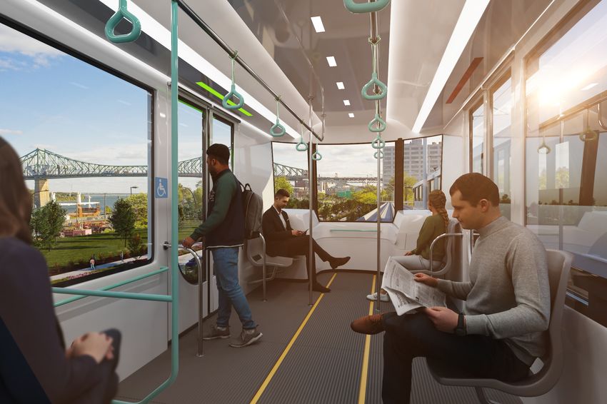
REM DE L’EST
The REM de l'Est is a public transit project that will connect the east and northeast to downtown Montréal
by providing reliable and frequent service to create new, fast and comfortable connections between
residents and neighbourhoods. The REM de l'Est is a fully automated electric light rail system, consisting
of 23 new stations and 32 km of new, dedicated public transit corridors with both elevated and
underground route segments.

  2 to 4 min                7 days/week                7 intermodal               23 universally
  frequency during                                     stations                   accessible stations
  rush hours

cdpqinfra.com/en                                                                                             2
SUMMARY OF PROJECT PROGRESS

After 18 months of study and analysis, the REM     Detailed project planning will continue
de l'Est reference project was publicly            throughout 2021 and 2022 and may include
announced in December 2020, marking the            optimizations subsequent to the Bureau
beginning of the project's detailed planning       d'audiences publiques en environnement
phase.                                             (BAPE) public hearings.
This phase involves detailing and enhancing the
project using input from citizens, stakeholders,
CDPQ Infra's public transit, engineering and
architectural experts, as well as from the
multidisciplinary committee of experts for the
urban and architectural integration of the REM
de l'Est.

cdpqinfra.com/en                                                                              3
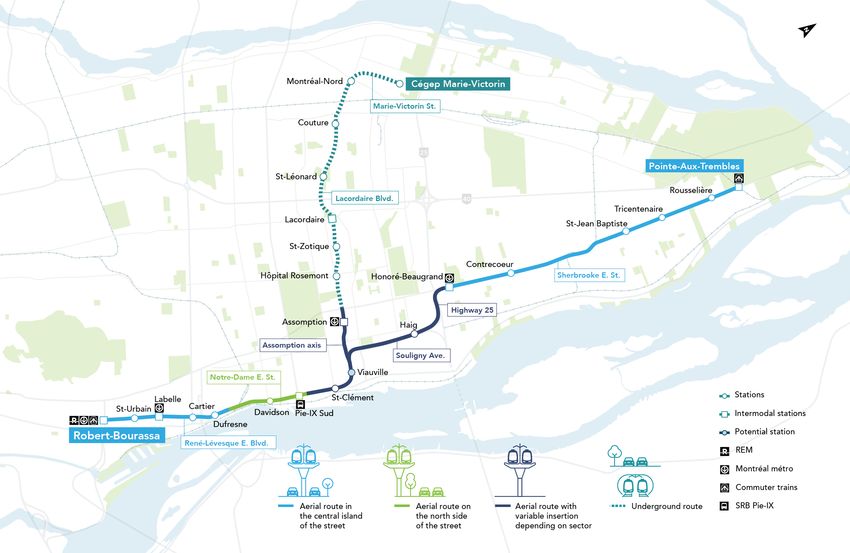
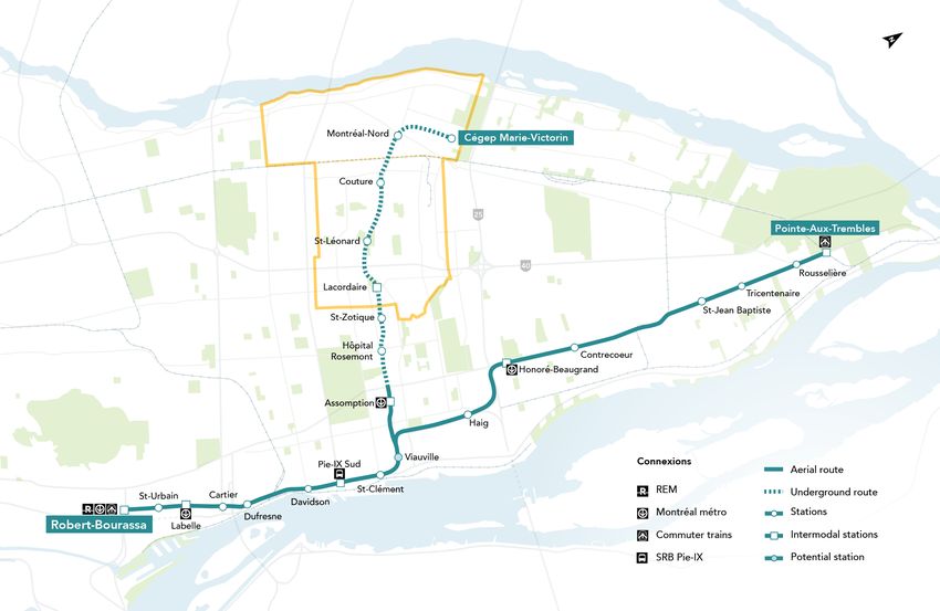
THE REM DE L'EST
IN SAINT-LÉONARD AND MONTRÉAL-NORD
In the sector that links the boroughs of Saint-Léonard and Montréal-Nord, the REM de l'Est will run
underground along Lacordaire Boulevard between Highway 40 and Henri-Bourassa Boulevard,
L'Assomption north of Sherbooke Street, all the way to Cégep Marie-Victorin.

  Why light rail metro?

  Three modes were analyzed for the REM de l'Est: tramway, tram-train and light rail metro. The light
  metro, which runs on a dedicated corridor, was selected because of its high commercial speed and
  flexibility, which promotes the attractiveness of the network and maximizes the transfer between car
  and public transit. In addition, among the modes studied, light rail is the only one that has the
  capacity to meet the mobility needs of the people of the East. In fact, in the central section, the light
  rail system can accommodate up to 12,000 passengers per hour, while the streetcar and tram-train
  can only accommodate 5,100. This capacity is divided by two in each of the branches that feed the
  central section. The light rail system can run up to one train every 90 seconds without any risk of
  traffic disruption. The tramway and tram-train, on the other hand, can only pass every 3.5 minutes in
  the central corridor and every 7 minutes on the branches.
  Similarly, the light rail allows high speed travel up to 45 km/h, while the tramway is limited to a speed
  between 17 and 25 km/h and the tram-train has to vary its speed according to the insertion. This
  greatly affects travel times, with the streetcar mode requiring nearly an hour to travel from Pointe-
  aux-Trembles to downtown.

  This technology also makes it possible to meet the anticipated needs of users for
  decades to come.

cdpqinfra.com/en                                                                                              4
STATIONS
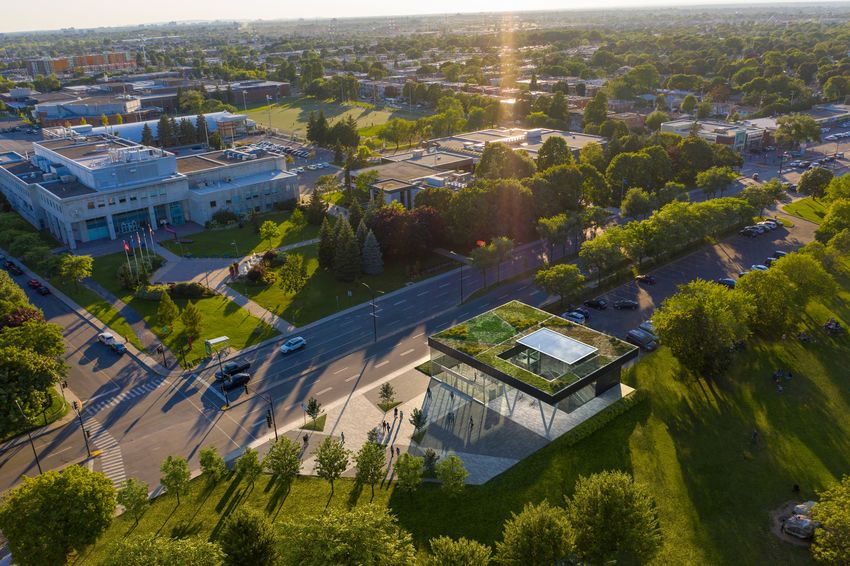
The fundamental character of the stations justifies the care with which they will be designed. The design
assumptions are as follows:
• Focus on active transportation access, particularly from pedestrian and bicycle paths.
• Encourage the use of public transit.
• Provide universal accessibility to system users.
In addition to these general principles, there is also the desire to promote a user-friendly, functional design
that is consistent with the development in current neighbourhoods.
They will feature an entrance on the side of the street where tickets can be purchased and ticket validation
terminals will be located. From the entrance, passengers descend to a mezzanine level, where they will
have access to the platforms.
Why an underground route
along Lacordaire?
Studies have shown that in the section on
Lacordaire Boulevard from Sherbrooke
Street to Couture Boulevard, the built
environment would not allow the height
criteria of an elevated structure to be met.
An additional technical study was
therefore carried out on this sector to
assess the possibility of an underground
route; that analysis proved conclusive. In
fact, in the Assomption and Lacordaire
boulevard sector, there are very few
physical obstacles underground such as
metro lines, sewers or water mains.
Furthermore, the geotechnical conditions
in that sector are favourable for building a
tunnel. The rock is shallow, allowing the
TBM to build the tunnel safely, without
impacting the built environment.
cdpqinfra.com/en 5Five stations are planned in the area: St-Zotique, Lacordaire, St-Léonard, Couture, Montréal-Nord and
Cégep Marie-Victorin.
These stations will be universally
accessible and equipped with platform Clearance required:
screen doors, elevators and escalators.
WiFi will also be available across the 5,3 metres
40 -metre
platforms
entire network.
Lacordaire
Corner of Lacordaire and Jean-Talon Connections available
East. to local bus lines and
proposed Lacordaire metro Underground station
station on the extended blue
line.
St-Léonard
On Lacordaire, in the Wilfrid-Bastien Connections available
Park parking lot. to local bus lines.
Underground station
Couture
(formerly Honoré-Mercier)
Corner of Couture and Lacordaire. Connections available
to local bus lines.
Underground station
Montréal-Nord
(formerly Rolland)
Corner of Lacordaire and Henri- Connections available
Bourassa to local and intercity bus
lines. Underground station
cdpqinfra.com/en 6Cégep Marie-Victorin
On Marie-Victorin Street near Cégep Connections available
Marie-Victorin to local and intercity bus
lines. Underground station
The network architecture is still under development.
Image of Saint-Léonard station for information purposes only.
cdpqinfra.com/en 7PROJECT BENEFITS FOR THE SECTOR
A new public transit option for communities
The project will provide a new public transit option that will open up neighbourhoods, generate greater
fluidity, reduce congestion and improve access to health, education, employment and leisure hubs.
% of time savings
compared to
Current the current
situation With situation
with PT REM de l'Est with PT
Cégep Marie-Victorin
↔ Downtown
70 min.
30 min. 60%
Cégep Marie-Victorin
↔ Promenade Ontario
60 min.
30 min 50%
Discover the area
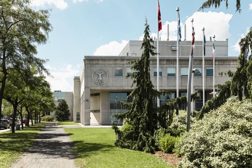
The REM de l'Est in Saint-Léonard and Montréal-Nord makes it possible to discover green spaces,
cultural and educational destinations and local attractions. Indeed, the Ruisseau-De Montigny nature park
and Wilfrid-Bastien Park are both within easy reach of the network stations. In addition, the Leonardo da
Vinci Centre, the Salle de spectacles Désilets and the Cégep Marie-Victorin are located along the
reference route. Beyond the connection with downtown, the REM de l'Est is an efficient public transit
system that offers travelers the opportunity to discover and enjoy the attractions of Montreal's East End.
cdpqinfra.com/en 8ANTICIPATED PROJECT IMPACTS ON THE SECTOR A regulatory framework governing disturbances The project will be governed by an Order in Council and an environmental certificate of authorization, with requirements set by government authorities for the construction and operating periods. During the construction phase, the project will be subject to specific noise, vibration and air quality thresholds. Environmental experts will implement mitigation measures to minimize project noise impact on surrounding residents. Similarly, during the operating phase, strict noise and vibration requirements will be applied by government authorities to ensure that the project does not significantly impact the environments involved. Where appropriate, mitigation measures will be considered in the detailed engineering phase. Environmental monitoring will also take place during the operating phase. Fauna and flora As the project is primarily in a highly urbanized area, impact on the natural environment will be limited. However, the planned approach will be to prevent impacts. If necessary, measures will be implemented to mitigate or compensate for the impacts. Heritage No anticipated impact on heritage assets in the sector. Archaeology The archaeological potential evaluation conducted in 2020 identified a few areas with archaeological potential near certain stations in this sector. CDPQ Infra has committed to conducting archaeological inventories in each of these zones prior to construction work, in accordance with the rules stipulated by the Ministère de la culture et des communications. cdpqinfra.com/en 9
STAY INFORMED
       >   Click here Technical sheet – Project presentation
       >   Click here Project presentation
       >   Click here Presentation video
       >   Click here Public consultations

cdpqinfra.com/en                                               10
You can also read