San Juan Mountains Backpacking Adventures
←
→
Page content transcription
If your browser does not render page correctly, please read the page content below
Dallas Sierra Club’s

                                                     San Juan Mountains
                                               Backpacking Adventures
                                                  Sunday, July 19 – Friday, July 24, 2015
AREA DESCRIPTION: The San Juan Mountains are a range of the Rocky Mountains in southwestern
Colorado. They form the Continental Divide, arcing from near Chama, New Mexico to Silverton and Telluride,
                                                   Colorado. Two Wilderness Areas--the South San Juan
                                                   and the Weminuche--protect significant parts of the San
                                                   Juans from logging, mining and other lasting human
                                                   intrusions. We’ll hike deep into those preserves to
                                                   experience some of the continent’s most scenic
                                                   landscapes.

                                                                   On the Continental Divide

                                                    Weather and vegetation in the San Juans vary with
                                                    elevation. Our itineraries visit altitudes from 8,400’ to
                                                    13,122’ above sea level. The tree line in these mountains
                                                    is typically between 11,000’ and 12,000’. Typical July
high and low temperatures range from high sixties to low thirties. July and August bring prospects of afternoon
thunderstorms.

TRANSPORTATION: All registered participants will gather for lunch on Sunday, July 19 at 1:00 PM at the High
Country Restaurant and Saloon in Chama, New Mexico (elevation 7,871’). At this check-in we’ll make final
confirmations of trip rosters and arrangements for getting to proper trailheads and participants will sign the
Release of Liability. After lunch, backpackers will depart in vehicles to camp near their starting trailheads.

Transportation to Chama and beyond is a responsibility of each participant. You may drive your own vehicle
or car pool. The Sierra Club can collect and distribute information to help you form a car pool, but Sierra
Club leaders won’t assign car pools. Our insurance and attorneys forbid assignment. The Participant
Preferences Form at the end of this description asks whether you prefer to share a ride or not, drive or ride,
etc. The Walmart parking lot at the northwest corner of Midway Road and LBJ Freeway (IH 635), immediately
behind the La-Z-Boy store, may make a convenient rendezvous for car pools. If you park there, neither
Walmart nor the Sierra Club will be responsible for damage, but we have parked cars there while away on
many trips without incident.

To reach Chama from Dallas by 1:00 PM Sunday, we recommend allowing Saturday and Sunday morning for
travel. Chama is 13 hours from Dallas by car, before allowance for stops. The shortest route from Dallas is via
Amarillo and Santa Fe. Consider staying in or near Santa Fe Saturday night, continuing to Chama Sunday
morning. Chama is 2¼ hours beyond Santa Fe. Overnight travel accommodations are your own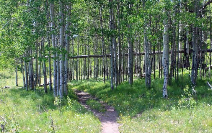
responsibility. See the Participant Preferences Form for inexpensive overnight lodging options. Reservations
are advised for lodging on a Saturday night in July.
This outing ends at the ending trailheads. The time you reach your ending trailhead on Friday will depend on
your trip option. Be flexible. We anticipate that most participants will start to travel home on Friday afternoon,
stay at a motel partway home and arrive in Dallas on Saturday. How, where and when you travel will be up to
you or your car pool.
COST: The Dallas Sierra Club is charging no fee for this trip. If
we charged to participate, most U.S. Forest Service Ranger
Districts in the southern Rockies would require us to secure a
permit to backpack. Red tape, uncertainty of outcome and
USFS fees that we would pass to you make it advantageous to
waive all fees for this trip, avoiding the permit requirement. That
leaves a financial hole for the Dallas Sierra Club, but we’re not
going to suspend outings to Colorado and northern New Mexico.
Instead, participants will arrange and pay for their own
transportation, their lodging during travel and their meals.
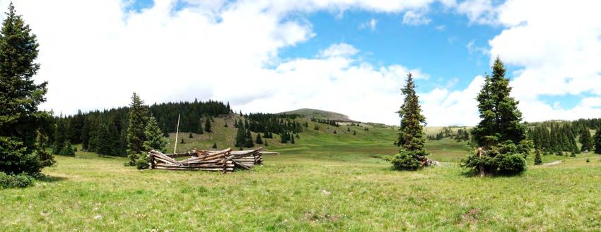
South Fork Conejos Valley Those costs should be less for participants than what we would
need to charge for a bus charter for this distance and duration.
A suggested cost-sharing formula for car pools is to total the actual cost of consumed fuel plus 8 cents per mile
for variable costs (tires, maintenance, depreciation due to mileage, car wash, etc.), then divide equally among
pool members, including the driver. For this trip of 1,700 miles, assuming gasoline at $2.50 per gallon and 20
miles per gallon, the cost would thus be $120 per person if divided three ways, $90 if divided four ways. Pool
participants may use a different formula for sharing expenses. Agreeing how to share costs before the trip is
recommended. Asphalt or gravel roads serve our trailheads. With care, a standard car can probably manage
all road segments.
IF YOU CANCEL for any reason, you should offer to pay your car pool members your share of pool expenses
as if you completed the trip and to pay any other non-refundable expenses paid on your behalf. A cancellation
may adversely impact car pool or lodging arrangements and increase costs others must pay.
REGISTRATION: After carefully reading this complete trip description:
1. Complete the Medical Form.
2. Complete the Participant Preferences Form.
3. Deliver the two forms to Trip Coordinator Mark Stein, 3631 Normandy Ave., Dallas, TX 75205. You may
mail the forms, hand deliver them or print, sign, scan and email them to mark@steinplanning.com. You are
registered after these forms have been received and your participation has been approved by the trip
coordinator and relevant trip leader. The coordinator and trip leaders may find that a trip is unsuitable for a
prospective participant, based on your physical condition, experience, equipment or other factors. If your
acceptance has not been confirmed, you may contact the trip coordinator or a trip leader to inquire.
All participants will be required to sign a Release of Liability on Sunday, July 19. If you want to read the form
in advance, contact the trip coordinator. Minors (under eighteen years) may participate only with a special
consent form (inquire) and if accompanied by their parent or legal guardian.
FIVE TRIP OPTIONS: Our trip menu has five backpacking itinerary options. Two are rated “Moderately
Strenuous” and three are “Strenuous.” Difficulty differences are subtle compared to our usual menus. The
options are “A” through “E,” not “1” through “5.” Trip A does not equate to our usual Trip 1. For safety, we
require a backpacking group to include at least five participants (four if two qualified Sierra Club trip leaders
participate). If registration for a trip option is insufficient, trip rosters may be adjusted or the number of trips
may be reduced so that each trip has enough participants. Transportation capacity to trailheads may also
prompt regrouping. We’ll try to honor trip option preferences in chronologic order of registration, but with
consideration for a minimum number of participants and for transportation capacity to and from the various
trailheads. Each registrant should indicate two or three preferred trip options on the Participant Preferences
Form. Weather and the trip leader’s assessment of group ability may affect routes and schedules.
Page 2
“Day 1” in the following descriptions refers to Monday, July 20, the first day of hiking, not Sunday, July 19,
when each group will camp near its starting trailhead.

Trip A: Poison Park, Elk Park, Divide Lakes, Pine River and Granite Lake                                                           Moderately Strenuous
                   Trip A is in the Weminuche Wilderness Area, San Juan and Rio Grande National Forests
                                         Miles                                                     Altitude             Gross Climb
                   Day       Pack         Day      Sum                 Camp                     Sleep      Max.       w/o Day        w Day
                                                     Starting trailhead: Poison Park (9,200')                          Hikes         Hikes
                       1           4.6     0.0       4.6              Elk Park                  9,400       9,400       1,000         1,000
                       2           4.4     0.0       4.4            Divide Lake                 9,900       9,900         700          700
                       3           0.0     9.4       9.4            Divide Lake                 9,900      10,300              0       700
                       4           4.4     0.0       4.4              Elk Park                  9,400       9,900         200          200
                       5           4.6     0.0       4.6                                                    9,200         700          700
                   Sum            18.0     9.4      27.4                                                                2,600         3,300
                                                     Ending trailhead: Poison Park (9,200')
This scenic trip starts and ends at the Poison Park Trailhead, 80 miles north of Chama via Pagosa Springs.
                                                On Day 1 the trail descends to Hossick Creek and then
    Trail near Elk Park                         climbs steeply to Elk Park, a garden of grasses and
                                                wildflowers. Next day, more woods, stream crossings and
                                                meadows await you. Make camp for two nights near the
                                                western and largest of the Divide Lakes. Day 3 is a long, but
                                                rewarding day hike up the Pine River to a waterfall at
                                                Snowslide and Pine Creeks, continuing to a spring at Rincon
                                                La Osa.      Reverse course, heading south along the Pine
                                                River Trail, following a switchback spur trail up to the west
                                                shore of Granite Lake before returning to camp. On Day 4,
                                                break camp and return to Elk Park. Exit to Poison Park on
                                                Day 5. This trip maintains the lowest elevations of our five
options, breaking above 10,000’ for only a short while near Granite Lake. Leader: Greg Holman,
214.398.8061 greghol937@sbcglobal.net

Trip B: Red Lake, Dipping Lakes and the Continental Divide Trail to Cumbres                                                        Moderately Strenuous
 Trip B is in the South San Juan Wilderness Area, Rio Grande National Forest
                  Miles                                             Altitude                        Gross Climb

 Day    Pack     Day       Sum                      Camp                    Sleep       Max.
                                                                                                    w/o
                                                                                                              w Day
                                                                                                                               Flat Mountain,
                                                                                                    Day                    Continental Divide Trail
                              Starting trailhead: Red Lake (11,000')                               Hikes      Hikes
  1      3.0     1.0       4.0                     Red Lake                11,500      11,700       700        700
  2      7.5     0.0       7.5                   Dipping Lakes             11,300      11,800       300        300
  3      6.0     0.0       6.0               Lake below CDT                11,400      12,187       900        900
  4      6.2     0.0       6.2                    Wolf Creek               10,200      11,600       200        200
  5      2.8     0.0       2.8                                                          9,100       200        200
 Sum     25.5    1.0       26.5                                                                    2,300      2,300
                            Ending trailhead: Cumbres Pass (10,000')
After leaving a shuttle car at the Cumbres Trailhead, the hike begins 24 miles from Chama at the Red Lake
Trailhead. The route starts high and stays high, but the high altitude is offset by relatively modest climbs. The
route flirts with the tree line, affording alpine thrills and great vistas. Day 1 follows a tread and cairns to a camp
near Red Lake before descending to a day hike loop around the lake. Day 2 is a trek on an alpine plateau with
tremendous views north to Conejos Peak and much of the South San Juan Wilderness before the route dips to
the Dipping Lakes and a possible rendezvous with Trip E. The trek pivots east and south on the Continental
Divide Trail on Day 3, passing around Flat Mountain before camping at a tiny lake below the CDT. Day 4
descends gradually on the CDT to water at Wolf Creek. Day 5 is a short hike to the Cumbres Trailhead and
our shuttle to our other vehicle. With luck, we can watch the historic Cumbres & Toltec steam train wind up the
mountain from Chama. Leader: Mark Stein, 214.526.3733 mark@steinplanning.com
                                                                                                                                                  Page 3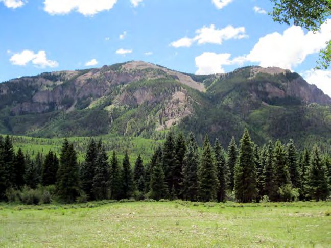
Trip C: Williams Creek, Palisade Meadow, Knife Edge and Squaw Pass to Cimarrona                                                         Strenuous
                Trip C is in the Weminuche Wilderness Area, San Juan and Rio Grande National Forests
                                Miles                                                        Altitude              Gross Climb
                Day    Pack      Day     Sum                    Camp                      Sleep      Max.        w/o Day       w Day
                                            Starting trailhead: Cimarrona (8,400')                                Hikes        Hikes
                                                   meadow near Indian Creek
                 1       3.0      0.6     3.6                                              8,900      9,000          600         800
                                                           Trail junction
                 2       3.8      2.0     5.8           Palisade Meadows                  10,900     10,900        2,000        2,300
                 3       3.7      0.0     3.7              Cherokee Lake                  11,600     11,900        1,000        1,000
                 4       7.6      0.0     7.6               Squaw Pass                    11,200     12,400        1,600        1,600
                 5       8.1      0.0     8.1                                                        11,800        1,000        1,000
                Sum     26.2      2.6    28.8                                                                      6,200        6,700
                                            Ending trailhead: Cimarrona (8,400')
This hike has the most miles on the actual Continental Divide,
superb vistas and the most ascent and descent. The Cimarrona                Moose near Squaw Pass
Trailhead is 77 miles north of Chama. Day 1 starts with a jaunt by
road to the Williams Creek Trailhead, eliminating 0.8 mile from the
end day of the hike. Hike uphill to make an early camp in the
meadow where the Indian Creek Trail and Williams Creek Trail join.
Explore the meadow and nearby Williams Creek. On Day 2, ford
Williams Creek and ascend the Indian Creek Trail, steeply at times,
crossing Indian Creek twice, then camping in Palisade Meadow.
Take an afternoon day hike east to Pistol Park and back. In the
first 1.7 miles of Day 3 you’ll ascend 1,000 feet to the Continental
Divide, joining the CD Trail. Continue 2 miles to camp near
Cherokee Lake. Skies permitting, an alternative to making camp at Cherokee Lake would be continuing north
across open tundra to Knife Edge, a narrow rock promontory offering incredible views, then onward before
dropping to Williams Lake, a total extension of 2.5 miles and 400 feet of climb for the day. All except the
detour from the CD Trail to Williams Lake is otherwise part of Day 4. From the Night 3 camp, resume travel on
the CD Trail, gaining excellent views, taking care to avoid exposed ridges by early afternoon. Descend to
camp nestled in trees at Squaw Pass. The Day 5 descent on the Cimarrona Creek Trail is at least 3,400’,
following a morning climb of 800’ from Squaw Pass.                 Leader: Arthur Kuehne, 214.608.3210
arthur@akuehne.com

Trip D: South Fork Conejos, Conejos Peak, Timber Lake and Roaring Gulch Loop                                                            Strenuous
                Trip D is in the South San Juan Wilderness Area, Rio Grande National Forest
                                 Miles                                             Altitude                         Gross Climb
                                                                                                                    w/o
                Day     Pack      Day     Sum                    Camp                      Sleep        Max.               w Day
                                                                                                                    Day
                                                Starting trailhead: South Fork (9,100')                            Hikes   Hikes
                 1        6.0      0.0     6.0          S. Fork at Canon Verde               9,600       9,600       600         600
                 2        5.4      0.0     5.4                 Twin Lakes                  11,700       11,700      2,200      2,200
                 3        0.0      7.7     7.7                 Twin Lakes                  11,700       13,122             0   1,600
                 4        0.0      5.0     5.0                 Twin Lakes                  11,700       11,700             0     700
                 5       10.6      0.0    10.6                                                          11,800       700         700
                Sum      22.0     12.7    34.7                                                                      3,500      5,800
                                                Ending trailhead: South Fork (9,100')
This hike lured us for the first Dallas Sierra Club trip in the South San Juan wilderness in 2011. We’ve added
layover days near Twin Lakes for two loop hikes. The South Fork Trailhead is 38 miles from Chama. The first
day is gradually uphill, following the South Fork Conejos Valley to an excellent campsite at Cañon Verde. Day
2 continues upriver and then follows Cañon Rincon steeply up to a three-night camp near Twin Lakes. For
Day 3, anticipate a day hike to Conejos Peak, highest point in the South San Juan Wilderness and a looping
return to camp via an unofficial ridge trail via Glacier Lake, weather permitting. An easier day hike for Day 4 is
through scattered trees to seldom-seen Timber Lake. (See it with “Justin T” himself!) Day 5 is for the long

                                                                                                                                            Page 4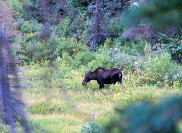
descent via Roaring Gulch to the South Fork trailhead, a drop of 2,700’.                              Leader: Justin Taliaferro,
214.534.6606 just1byte@gmail.com

Trip E: Elk Creek, Continental Divide Trail, Valle Victoria Loop                                                       Strenuous
                Trip E is in the South San Juan Wilderness Area, Rio Grande National Forest
                                 Miles                                              Altitude           Gross Climb
                                                                                                       w/o
                Day    Pack     Day    Sum                  Camp                    Sleep    Max.             w Day
                                                                                                       Day
                                           Starting trailhead: Elk Creek (8,800')                     Hikes   Hikes
                 1        7.0    0.0     7.0          Second Meadow                  9,900    9,900    1,100   1,100
                 2        8.0    0.0     8.0            Dipping Lakes               11,300   11,400    2,100   2,100
                 3        6.9    0.0     6.9       Laguna Venado Creek.             11,400   12,100     900     900
                 4        7.9    0.0     7.9      Valle Victoria Trail camp         11,000   11,400     700     700
                 5        6.8    0.0     6.8                                                 11,100     200     200
                Sum      36.6    0.0   36.6                                                            5,000   5,000
                                           Ending trailhead: Elk Creek (8,800')
The Elk Creek Trailhead is 29 miles from Chama. This elongated loop covers more miles than any other
                                            option, but with regular daily bites and less climbing than the
                                            other strenuous hikes. Serenity, possible wildlife sightings
                                            (beavers, pika, ptarmigan, elk, ducks) and stunning views
                                            justify the effort. The grand circuit ramps west through a
                                            series of meadows and forests beside Elk Creek for two days,
                                            eventually climbing onto the Continental Divide Trail to camp
                                            at Dipping Lakes with Trip B. Moving north on the CD Trail on
                                            the morning of Day 3, the route soon turns east and downhill
                                            via the long Valle Victoria Trail and a detour to Victoria Lake
                                            and spectacular views across the South Fork Conejos Valley
                                            to Conejos Peak. Skirt the north edge of boggy Alverjones
                                            Lake to reach a camp by a pond and view of the Continental
   Second Meadow                            Divide before rejoining the Elk Creek Trail to the starting
                                            trailhead.        Leader:    Clay     Morton,     214.914.4780
claymorton@ymail.com

PREPARATIONS, RULES AND CAUTIONS:
Experience and Conditioning: The San Juan Mountains outing is for people who have backpacked before.
You and your trip leader should be confident of your ability to complete a five-day hike. Backpacking at high
altitude is more difficult than backpacking at elevations near sea level or even at elevations in the Arkansas
mountains. Contact the trip coordinator or one of the trip leaders if you have a question about your readiness.

Gear: Each person is responsible for bringing his or her own equipment and food. Arranging to share with a
friend is fine. Contact trip leaders before departure if you’d like advice about gear. If your loaded pack weighs
more than 25 or 30 pounds before water, you should probably lighten your load.

  Basic Equipment: Tent and ground cloth. Sleeping bag rated to 20 degrees. Ground pad to insulate you
  from cold ground. Backpack with hip belt. Water containers and water treatment tablets (or filter).
  Headlamp (more satisfactory than a flashlight). Whistle. Sunscreen. First-aid kit, including moleskin or
  burn pads for blisters. Lightweight trowel, toilet paper and plastic bags for used toilet paper. Garbage bag.
  Personal items. 20 to 40 feet of cord and a waterproof sack so you can bear-bag your food, trash and
  toiletries. If your trip includes day hikes, plan to use your backpack or bring a day pack to carry all your ten
  essentials, lunch and personal items you may need.

  Clothing: Lightweight, versatile layers are key to comfort, given the probable temperature range from 30 to
  70 degrees. Five layers for your torso are recommended (including a rain/wind shell) and two layers for
  your legs. (One of those layers should be rain pants, which can double as thermal protection.) Cotton and
  denim are chilly and heavy when wet. Wear tested boots and two layers of socks (thin synthetic sock on the
  inside to preclude blisters), gloves and a cap to keep your head warm at night. You’ll need a hat,
                                                                                                                           Page 5
sunglasses and sunscreen for UV protection. Bring lightweight water shoes (Crocs or similar) for wet
  crossings on some itineraries.

  Food: Bring enough for five breakfasts, five no-cook lunches and five dinners in camp. Your first camp
  meal will be the evening meal on Sunday, July 19, after you’ve left Chama. Bring a lightweight burner with
  fuel for cooking unless you plan to share cooking with a friend. We don’t build fires except in emergencies.
  This makes leave-no-trace camping easier and avoids ember burns on clothing.

  Water: We’ll find water every day for every hike, but you’ll need to treat it with tablets, filtration or boiling.
  Containers for four liters should be ample, although you’ll carry some of those containers empty much of the
  time. Don’t fill your containers until near Chama, as spills can spoil a trip.

  Maps: If you’d like your own map of the area, National Geographic Trails Illustrated Maps are available from
  several web sources. Map 140 covers the Weminuche Wilderness. Map 142 covers the South San Juan
  Wilderness.

Leave No Trace: Low-impact wilderness ethics are expected of all participants. All trash must be packed out;
human waste buried, and used toilet paper packed out (so bring a zip-lock bag for that purpose). Campfires
are not allowed, so bring a small camp stove if you plan hot meals. Smoking, pets and firearms are not
allowed.

Medical: Our trip leaders are not medical professionals. Participants are encouraged to bring first aid supplies
and a basic knowledge of how to deal with medical emergencies. If you have medical training, tell the leaders
so he or she can use your skill in an emergency. Inform the leaders if you have a medical condition that could
require special treatment (controlled diabetes, heart problems, allergic reactions, etc.) in an emergency. Carry
any necessary medications for those conditions on your person at all times and tell others where you store
them. If you are extremely allergic to bee stings, poison ivy or anything else we could encounter, ask your
doctor if you should carry an antidote kit. If you are blind without your glasses, bring a spare. We will be hiking
in a wilderness area, where rescue is difficult and time-consuming. Medical help could be days in arriving. Air
evacuations are extremely expensive, and the injured will be responsible for payment of costs. If you have a
health condition that could require immediate medical treatment, you should not go on this trip.

Group = Safety: It’s important for safety to follow the leaders’ directions. By failing to obey the leader’s
instructions, you assume the risks that result. The group should stay together to minimize the chance of
someone getting lost or an injured person going unaided. Sierra Club prohibits individuals from leaving the led
group (the leader and those participants with the leader) for separate day hiking or other activity. If you leave
the group, you do so at your own risk. Participants who leave the led group against leader advice will be asked
to sign out of the trip and are no longer part of the trip. Don’t expect the group or the leader to do more than
notify the authorities if you do not return. The leader’s responsibility is to those who are following him or her,
not to those who choose to follow a different route and put themselves at risk.

Most deaths in the wilderness occur when a solo hiker becomes incapacitated and dies of hypothermia or
dehydration before being found. If someone is injured while away from the led group, leave one or two people
and all of the party’s food and warm clothing with the injured person, and send all of the others for help at the
trailhead.

If you do get lost, stop and wait on a trail; don’t wander aimlessly. When day hiking, bring a jacket, raingear,
warm hat, space blanket or bag, food, water, map, compass, flashlight, first-aid kit, matches and whistle. If you
twist an ankle or get lost, these essentials could save your life if you end up spending the night away from
camp. Potential nighttime lows in the 20’s make hypothermia a threat.

Leaders are not allowed to search for missing persons at night. They may not put others in the group at risk to
look for a lost participant. When leaving camp for even a moment, especially at night, be careful to stay
oriented and not lose your way back. Getting lost near camp could create a life-threatening situation if the
weather is foul or if not dressed for the cold.

                                                                                                             Page 6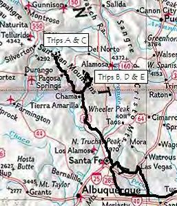
Bears: The San Juan Mountains are black bear country.
Bring food that doesn’t have strong aromas.
Prepare meals away from your sleeping area.
Each night, pack your food and trash in either a bear canister or a water-tight bag to be suspended
from trees where a bear cannot reach. Don’t store these items in your tent.
Don’t pour oils used in cooking onto the ground. Eat them or pack them out. Take care not to spill
liquids when cooking.
Disperse cooking water over a wide area, away from camp.
Carry out all garbage, leftover food, and waste cooking oils and grease. Don’t bury your trash.
If you encounter a bear or mountain lion, group together, make lots of noise, waive your arms, and look mean.
Don’t run. Do not turn your back to a mountain lion – keep facing it. Give the animal an escape route if you
have accidentally cornered it. If you are between a bear and her cubs, slowly move away from both.
Keep Calm: The Dallas Sierra Club has conducted trips such as those described above for 35 years without
any serious injuries. If you are in reasonably good physical condition, have the necessary experience and
skills, and select a trip matching those abilities (and of course, don’t do anything stupid), these trips are
reasonably safe. The above cautions and disclosures of risk are intended to give you the information
necessary to make an informed decision as to whether you should participate. Hopefully, they will also
encourage those who do participate to be safe and careful; so we can all have a good time.
CST 2087766-40: Registration as a seller of travel does not constitute approval by the State of California.
(California has a law called the California "Seller of Travel" Law. (Since Sierra Club is a California non-profit
corporation, we are required to post this notice.)
QUESTIONS about the trip or your acceptance may be directed to the trip coordinator, Mark Stein,
214.526.3733, mark@steinplanning.com or any trip leader.
Keep scanning down to the Medical Form and Participant Preferences Form.
Cabin ruin on Roaring Gulch Trail
Page 7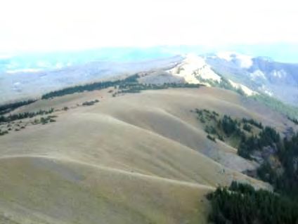
Dallas Sierra Club
Medical Form
Please fill in this form as accurately as possible. It is essential for leaders to evaluate individual and group health needs as
part of trip planning, and for use during emergencies. After reviewing this form, the leader may contact you to discuss
whether the trip will be safe and enjoyable for you considering your medical history.
We will keep the information on this form confidential. It will be seen only by leaders, medical personnel, or others who
know and understand its confidential nature. This form will be destroyed following the trip. If you choose not to go on the
trip, this form will be destroyed immediately.
General Information
First Name: Last Name: Nickname:
Address: Gender:
City: State: Zip:
Home Phone: Work Phone: Mobile Phone:
Email Address: Date of Birth:
Height: Weight: Blood Pressure: / Resting Heart Rate: bpm
Emergency Contact: Relationship:
Home Phone: Work Phone: Mobile Phone:
Secondary Emergency Contact: Relationship:
Home Phone: Work Phone: Mobile Phone:
Evacuation and Medical Insurance Information
We strongly encourage you to have medical and evacuation insurance and to bring your insurance card or other
documentation with you on the trip.
Evacuation Insurance Medical Insurance
Company Name: Company Name:
Policy Number: Policy Number:
Contact Phone Number: Contact Phone Number:
Allergies
Include medicines, foods, animals, insect bites and stings, and environment (dust, pollen, etc.). NONE
Allergy Reaction Medication Required (if any)
Continued on next page . . .
Page 8(Medical Form – Page 2)
Medical History
Please list all prescription, over-the-counter, and natural medications you are taking. Use a separate sheet if necessary.
Medication Name Dosage Frequency Side Effects (known & potential) Reason for Taking
Do you currently have, or have a history with, the following conditions (explain in blank and use separate sheet if necessary):
Yes No Respiratory problems, Asthma, Do you smoke
Yes No Diabetes
Yes No Gastrointestinal problems
Yes No Cardiac problems, Hypertension
Yes No Neurological problems, Seizures
Yes No Vision or Eye problems
Yes No Hearing problems
Yes No Bone, Joint, Muscle problems
Yes No Head trauma, Traumatic Brain Injury
Yes No Substance Abuse, Anxiety, Depression
Yes No If female: Are you pregnant
Yes No Have you had an illness within the last 12 months
Yes No Have you had surgery or been hospitalized in the last 12 months
Yes No Have you ever had problems related to exposure to altitude
Yes No Any other health complaint or medical issue that would affect your participation in this trip
If YES, please explain
Date of last tetanus immunization: Date of most recent physical:
Physician's name: Phone number:
Address:
Please have physician sign if your leader requires a physical prior to trip
Physician's signature: Date:
The information provided here is a complete and accurate statement of any physical and psychological conditions that
may affect my participation on this trip. I realize that failure to disclose such information could result in serious harm to
myself and other participants. I agree to inform my trip leader should there be any changes to my health status prior to
the start of the trip. I understand the outing may require vigorous activity that is both physically and mentally demanding
in isolated areas without medical facilities. I am fully capable of participating on this trip.
Trip Name: San Juan Mountains Trip Trip Dates: July 19-14, 2015
Signature (required): Date:
Print Name:
Rev. 9/2013
Page 9PARTICIPANT PREFERENCES FORM
Dallas Sierra Club San Juan Mountains Trip
July 19 - 24, 2015
Return this form and your Medical Form to the trip coordinator, Mark Stein, 3631 Normandy Avenue, Dallas, TX 75205.
PARTICIPANT NAME (Please print.):___________________________________________________________________
BACKPACKING OPTION PREFERENCES (Trip A, B, C, D or E): 1st choice: _____ 2nd choice: _____ 3rd choice _____
Subject to leader approval, we’ll try to honor preferences in the order registrations are received. If fewer than five
participants opt for an itinerary (four if the group includes two leaders), the trip coordinator may consolidate trips or assign
a different trip. Availability of transportation to and from a trailhead may also impact
TRANSPORTATION PREFERENCES (Check ALL that apply.):
I plan to drive my own vehicle to Chama and my trailhead.
I plan to ride to Chama with: ____________________________ (Note that the various trips use different
trailheads and may finish at different times on Friday, July 24. Depending on trip rosters and vehicles, we may regroup for
rides to trailheads from Chama or revise trip assignments to fit available transportation.)
I might be willing to drive my vehicle for a car pool if needed: My vehicle is a ____________________________
and I could possibly carry up to ____ people and their gear (counting the driver). I understand that car pool arrangements
are between people in the pool and that neither the Sierra Club nor its leaders will make car pool assignments.
I could ride in a car pool. It’s okay to share my contact information (name, email, phone and home city) with
prospective backpackers on this trip. I understand that car pool arrangements are between people in the pool and that
neither the Sierra Club nor its leaders make car pool assignments. Transportation will be my own responsibility.
LODGING FOR SATURDAY, JULY 18: You’ll need to stay near enough to our check-in location at the High Country
Restaurant and Saloon in Chama that you’ll arrive Sunday by 1:00 PM MDT. Where you sleep the previous night is your
choice. Reservations at campgrounds and motels throughout New Mexico are highly advisable for a Saturday in July.
Your Trip Coordinator has paid for four air-conditioned “camping cabins” at the KOA on Old Pecos Trail, midway between
Pecos and Santa Fe, for Saturday night. Each cabin has bunk beds, a double bed, an air conditioner, electric lights and a
covered porch. Occupants need their own sleeping bag and towel. Bathrooms and showers are in a separate building.
At $65.82 per cabin, split three or four ways, the price per person is a good value according to Dallas backpackers who
have stayed there. To claim one of these sixteen spaces, send a check for $20 payable to Mark Stein, 3631 Normandy
Ave, Dallas 75205 and make sure you’ll have transportation to get there. Another good value in recent experience is the
Super 8 Motel in Las Vegas, New Mexico, ($80 double for July 18). Saturday is not part of the Sierra Club trip.
GENERAL INFORMATION:
How did you learn about this trip? ______________________________________________________________
When was your most recent overnight backpacking trip? ________ Where was the trip? _________________
Have you backpacked at high altitude (over 10,000’)? ________
By signing below, I certify that I have read the attached trip descriptions, restrictions and cautions, and understand the
described difficulties and risks associated with the trip(s) that I have selected above. I understand that immediate medical
assistance will not be available if I become ill or injured while on this trip, that evacuation could take several days. I am
responsible for any evacuation and medical costs that may be incurred should I need medical attention.
Signature of Adult Participant __________________________________________ Date _______________
Page 10You can also read