SIMAtlantic Final Conference Achieving cooperation and coherence in European Atlantic MSP - Niccolò Bassan
←
→
Page content transcription
If your browser does not render page correctly, please read the page content below

SIMAtlantic Final Conference
                    Achieving cooperation and coherence in
                            European Atlantic MSP

                                  Niccolò Bassan
                              “Marine Planners” - President

                                niccolo.bassan@gmail.com
                                 info@marineplanners.eu

Online 15th September 2021
_background Bachelor in Naval and Nautical Architecture, Univeristy of Genova (Italy) Erasmus Mundus Joint Master Degree in Maritime Spatial Planning (EMMCMSP), Università IUAV di Venezia (Italy), Universidad de Sevilla (Spain) and Universidade dos Açores (Portugal) Researcher & teaching assistant at Università IUAV di Venezia (Italy) Consultant & project manager at CORILA (Consortium for coordination of research activities concerning the Venice lagoon system) – Italy Founder & president of Marine Planners (non-profit association) – Italy JPO Associated Expert at UNEP (UN environment programme) - Kenya

_MSP related projects
Supporting Maritime Spatial Planning in the Eastern Mediterranean
Supporting Maritime Spatial Planning in the Western Mediterranean
Geoportal of tools & data for sustainable management of coastal and marine environment
Marine education and communication network on the Mediterranean
Toward the operational implementation of MSP in our common Mediterranean Sea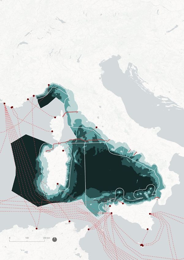
_MSP implementation Italy’s National MSP implementation process Technical assistance to the national competent authority Technical assistance to the national Technical Committee, Sub- Committees and Maritime Regional authorities Numerous activities also with external partners: - MSP Challenge Board Game (UNESCO-IOC) - MSP Challenge Adriatic Edition (Breda University)
Non-profit Association of young (or still young) researchers,
practitioners and friends passionate about oceans, seas, coasts
and everything with a marine prefix.

The Association is a platform to exchange practices and
experiences, a legal institution to work on projects
independently, a place to showcase our skills and works, a place
to jointly work on research, an established international network
involving experts, research institutes, NGOs, universities etc.

                                                 @MarinePlanners    www.marineplanners.eu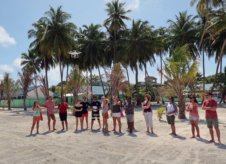
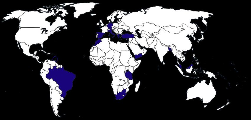
_where are we?

14 Countries
_past activities Training Workshop in the Maldives – January 2020 SSRC Call for proposal – March/April 2020 Marine_Ecomed project – June 2020 Maldives Marine Science Conference – December 2020 Early Career Marine Planner Webinar Series – April 2021 MSP Global Consultation – May 2021 SMILO Call for proposal – May 2021 Erasmus+ Call for proposal – June 2021 Communication Plan – July 2021
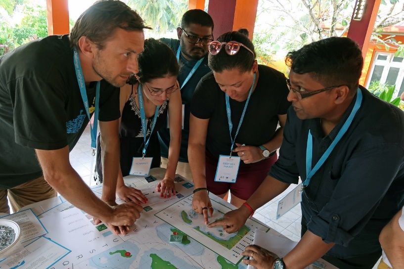
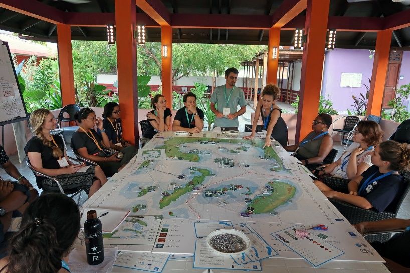
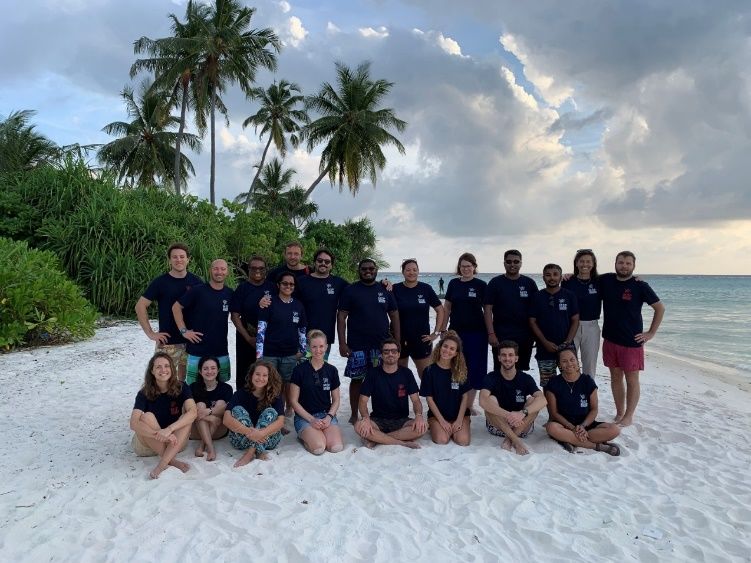
_training workshop in the Maldives

 A 7-days intensive MSP training
 workshop took place in Magoodhoo,
 Faafu Atoll, at the premises of the MaRHE
 Center.

 The training involved MSP practitioners
 belonging to diverse research fields (e.g.
 oceanography, marine biology, planning,
 environmental management) from all
 over the world.
_why MSP?

View of the pacific
ocean from space

Source: Nasa
_why transboundary MSP?
The need for a transboundary approach when planning is widely acknowledged as much stronger in the
marine space than on land, by many authors (Foley et al., 2010; Zaucha, 2015; Flannery et al., 2015).
Adopting a transboundary approach when planning in the sea is imperative in order to:
avoid user – user conflicts, and therefore, to ensure viability of marine economic activities;
avoid overexploitation of marine living and non-living resources (fishes, fossils, etc);
avoid habitat fragmentation of (transnational) marine natural ecosystems and achieve efficient
preservation of valuable marine ecosystems;
effectively tackle pollution, deriving from sea activities (and technological disasters related to them)
as well as from land-based activities.
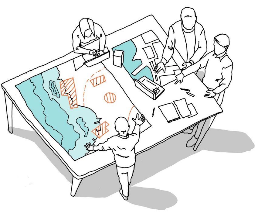
Highly dynamic Exchange of substances Borderless Political demarcation_planning interactions
Author: A. Innocenti, PhD,
University Iuav of Venice_planning interactions
Author: A. Innocenti, PhD,
University Iuav of Venice_planning interactions
MSP + ICZM + Land
Planning
Author: A. Innocenti, PhD,
University Iuav of Venice_a multi-scalar approach Planning at proper spatial scales (multi-scalar approach – strategic vs high resolution) for full coherence and concrete applicability, responding to real needs Integrated planning and coherence of plans and policies: coherence with large-scale vision, wider strategic plans, planning on land (LSI), wide range of policies Ecosystem-Based Approach (EBA) – Ecological coherence of analyses and measures: i.e. need to take into account “functional boundaries of the ecosystems” and impact / effectiveness of measures at larger scale
_some data gaps Knowledge gaps in the fine scale distribution of high valuable benthic habitats (e.g. coralligenous formations, rocky bottoms) for high resolution planning Knowledge gaps in the distribution of high valuable pelagic species (e.g. megafauna) Data gaps on the soundscape and potential impacts Spatial knowledge of the distribution and intensities of all the fisheries activities (i.e. small scale, recreational) Fine scale maps of maritime traffic with average routes intensities for each vessel type Improvement and integration of land-sea interactions (LSI) models, including Land-based sources and pollutant loads
_conclusions Problem scoping, different needs and different planning scales guide the planning process Best available knowledge is not a limit, but an opportunity to collect meaningful information, and not the readily available data Multiple types of planning actions and measures at multiple scales need for operational planning at finer scale for more «crowded areas» Learning-by-doing process and knowledge sharing approach
Thank you! Merci! ¡Gracias! Obrigado!
Go raibh maith agat! Grazie!

Niccolò Bassan

niccolo.bassan@gmail.com
niccolo.bassan@un.org
info@marineplanners.eu

@MarinePlanners www.marineplanners.eu
You can also read