Staffordshire County Council GIS Locality Analysis for the city of Lichfield in Lichfield District Council area: Specialist Housing for Older ...
←
→
Page content transcription
If your browser does not render page correctly, please read the page content below
Staffordshire County Council
GIS Locality Analysis for the city of
Lichfield in Lichfield District Council area:
Specialist Housing for Older People

December 2018

GIS Locality Analysis: The City of Lichfield   Page 1
Contents
1    Lichfield City Mapping ........................................................................................................ 3
    1.1    Lichfield City Population Demographics ..................................................................... 3
    1.2    Summary of demographic information ..................................................................... 11
    1.3    Lichfield Locality Analysis .......................................................................................... 12
    1.4    Access to Local Facilities and Services ...................................................................... 12
    1.5    Access to local care facilities/age appropriate housing in Lichfield ......................... 23
2    Lichfield summary............................................................................................................. 30
    2.1    Lichfield Locality Population Demographics ............................................................. 30
    2.2    Access to retail, banking, health and leisure services ............................................... 31
    2.3    Access to specialist housing and care facilities ......................................................... 32

GIS Locality Analysis: The City of Lichfield                                                                                Page 2
1 Lichfield City Mapping
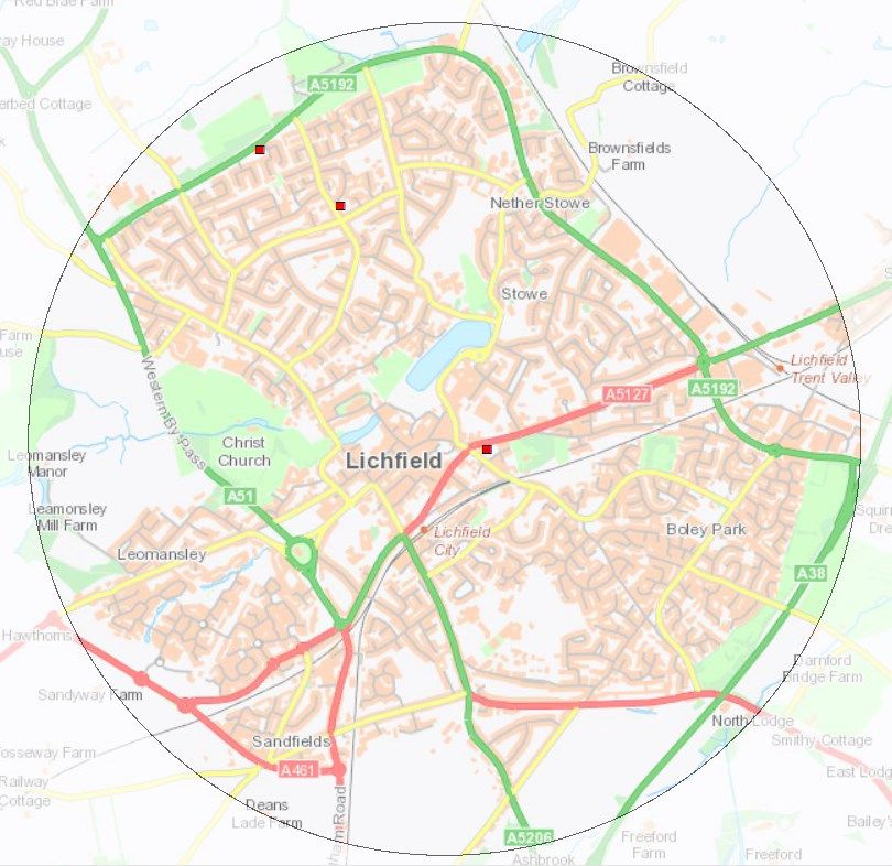
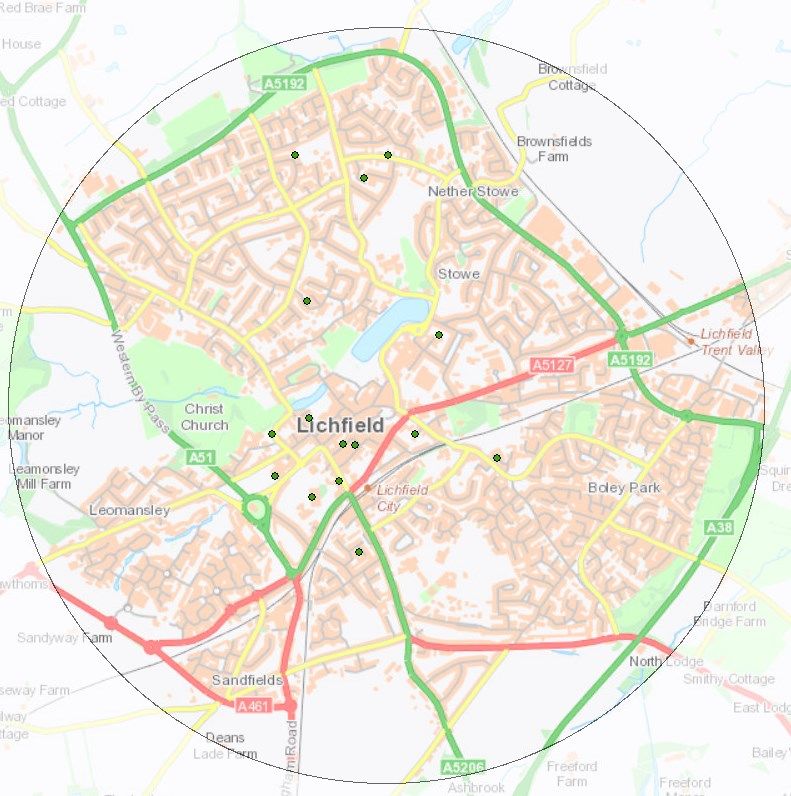
A 2km radius from the post code WS13 6JW has been set for the locality analysis which
includes the whole of Lichfield city centre. The post code, which falls on Tamworth Street,
Lichfield, was chosen as it is a central point of the radius.
1.1 Lichfield City Population Demographics
Table 1: Lichfield LSOAs in the first quintile for population
LSOA number Location Number Demographics that are flagging as high
of concentrations first quintile
residents
E01029483 A largely residential LSOA which 1507 Aged 65 – 74. 311 people = 21%
incorporates part of the Boley Park
housing estate and the green space
of Darnford Park. It is located in the
south east of the analysis area
bordered by the Eastern Bypass.
E01029484 This LSOA to the east of the analysis 1861 Aged 75+. 215 people = 12%.
area is bordered to the north by the
A5127. It contains residential areas
around Rowan Close and Witley
Drive as well as an industrial area on
Crossfield Road.
E01029499 To the north of the analysis area, in 1765 Single household 65+ = 17%
the Curborough ward, this LSOA
contains residential areas around
Weston Road, Curborough Road and
Purcell Avenue.
E01029500 Residential areas around Curborough 1665 Aged 50 – 64. 429 people = 26%
Road are located in this LSOA to the Aged 65 – 74. 252 people = 15%
north of the city centre. It is partly
bordered by Eastern Avenue to its
eastern boundary.
E01029511 Bordered by Eastern Avenue to the 1610 Aged 75+. 206 people = 13%.
north and straddling the Western
Bypass, this LSOA contains
residential areas around Stafford
Road. It is to the north west of the
town centre
E01029518 Residential areas around Sandfields 2944 Aged 50 – 64. 523 people = 18%
are included in this LSOA which lies Aged 65 – 74. 288 people = 9%
to the south west of the analysis Aged 75+. 227 people = 8%
area.
E01029519 This LSOA is located just to the south 2235 Aged 50 – 64. 395 people = 18%
of Lichfield city centre, and includes
the residential areas around Mesnes
Green, Beech Garden and Ivanhoe
Road. It straddles the A51 and
Lichfield City Centre railway station
lies on the northern boundary.
E01029520 A largely residential LSOA which 1598 Aged 65 – 74. 266 people = 17%
incorporates part of the Boley Park
housing estate. It is located to the
south east of the city centre and is
bordered by the A38 to the south.
GIS Locality Analysis: The City of Lichfield Page 3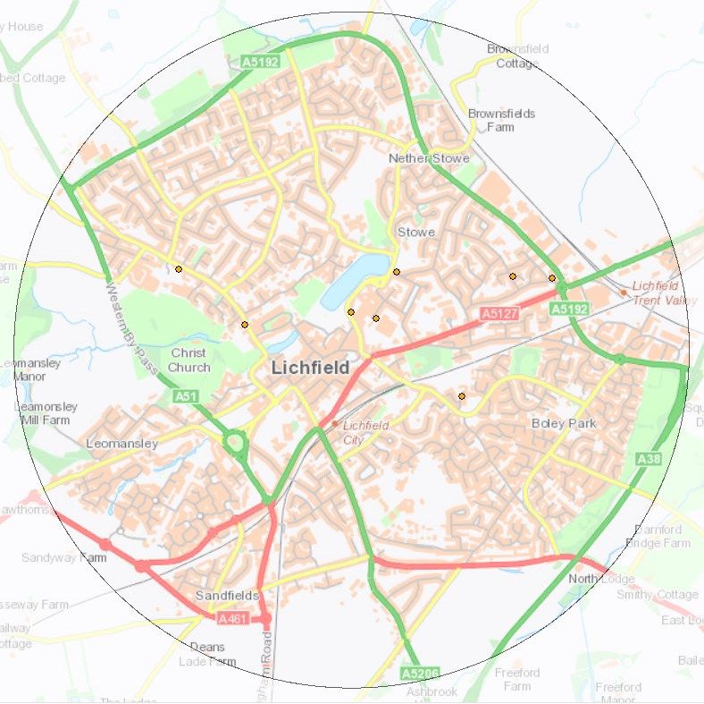
LSOA number           Location                                Number        Demographics that are flagging as high
                                                              of            concentrations first quintile
                                                              residents
E01029524             The A5127 forms the southern            1754            Aged 75+. 212 people = 12%.
                      boundary of this LSOA which lies to
                      the east of the city centre. The LSOA
                      includes St Michael’s Hospital in the
                      west, Vulcan Road retail area to the
                      east and residential areas around
                      Valley Lane and Scotch Orchard.
E01029525             This LSOA is to the north east of the   1683            Aged 65 – 74. 274 people = 16%
                      city centre, it contains residential                    Aged 75+. 283 people = 17%.
                      areas around Stowe and York Close.
                      It also includes part of the Vulcan
                      Road retail site and the Ringway
                      Industrial Estate.
E01029526             Lichfield city centre falls into this   1689            Aged 75+. 244 people = 14%
                      LSOA in the centre of the analysis                      Single household 65+ = 25%
                      area. It contains Lichfield retail
                      centre, Lichfield Cathedral and Stowe
                      Pool. It is in the Stowe Ward.
E01032899             This LSOA in the Leomansley ward is     1620            Aged 75+. 346 people = 21%.
                      to the west of the city centre. It                      Single household 65+
                      contains Beacon Park and the golf
                      course to the north and residential
                      areas around Friary Avenue. It is
                      bordered to the west by the Western
                      Bypass.
Source: 2016 mid-year population estimates, Office for National Statistics, Crown copyright

GIS Locality Analysis: The City of Lichfield                                                                    Page 4
Population of people aged 50 - 64
LSOA E01029500
429 people 50 - 64 (26%)
Town centre
LSOA E01029519
395 people 50 - 64 (18%)
LSOA E01029518
523 people 50 – 64 (18%)
Source: 2016 mid-year population estimates, Office for National Statistics, Crown copyright
Note: Three LSOAs (E01029488, 508, 509 and 530) which are on the periphery of the 2km
radius have their largest geographical part and majority of population outside the analysis
area. They are not included in this analysis as their impact on the Lichfield demographic
and deprivation characteristics are minimal.
Within a 2km radius of Lichfield city centre there are 3 LSOAS where the number of
people aged 50 - 64 plus falls within the highest quintile. One of these is just to the
south of the city centre.
There are a further 7 LSOAs within the 2km radius where the number of people aged
50 - 64 falls into the second highest quintile. These LSOAs are located across more
residential areas including Boley Park, Leomansley and Nether Stowe and suggest a
moderate number of people in this age group. These can be seen in the graphic
above in orange.
GIS Locality Analysis: The City of Lichfield Page 5
Population of people aged 65 – 74
LSOA E01029500
252 aged 65 - 74 (15%)
LSOA E01029525
274 aged 65 - 74 (16%)
City centre
LSOA E01029483
311 aged 65 - 74 (21%)
LSOA E01029518
288 aged 65 - 74 (9%) LSOA E01029520
266 aged 65 - 74 (17%)
Source: 2016 mid-year population estimates, Office for National Statistics, Crown copyright
There are 5 LSOAs within the 2km radius where the 65 - 74 population
demographic falls into the highest quintile; these are located to the north and across
the south cover Nether Stowe and Boley Park.
There are a further 9 LSOAs within the 2km radius that fall into the second highest
quintile for the 65 – 74 aged group suggesting that there are high numbers of this
age group. These LOSAs are concentrated in a band which runs across the centre of
Lichfield city.
GIS Locality Analysis: The City of Lichfield Page 6
Population of people aged 75 plus
LSOA E01029525
283 people = 17%
LSOA E01029511
206 people = 13% LSOA E01029524
212 people = 12%
LSOA E01029484
City centre
215 people = 12%
LSOA E01032899
346 people = 21% LSOA E01029526
244 people = 14%
LSOA E01029518
227 people = 8%
Source: 2016 mid-year population estimates, Office for National Statistics, Crown copyright
There are 7 LSOAs, concentrated across Lichfield city centre, where the aged 75 plus
population demographic falls into the highest quintile, which suggests a high number
of this age group.
There are a further 2 LSOAs, around Leomansley and north west Lichfield that fall
into the second highest quintile for people aged 75 plus.
GIS Locality Analysis: The City of Lichfield Page 7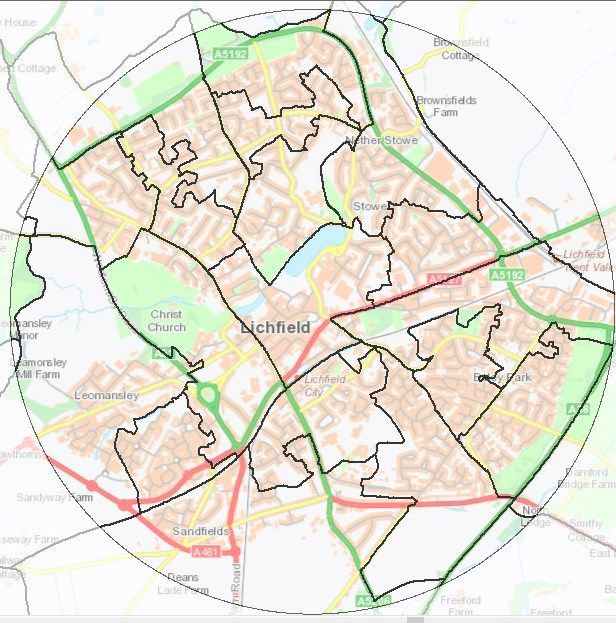
Single Households 65+
LSOA E01029499
17% single
households 65+
City centre
LSOA E01029526
25% single
LSOA E01032899 households 65+
33% single
households 65+
Source: 2011 Census, Office for National Statistics, Crown copyright
Within the 2km radius there are 3 LSOAs where the percentage of single households
65+ is ranked in the highest quintile. Two of these in the city centre have high
percentages of 25% and 33%.
There are a further 2 LSOAs where the number of single households 65+ are ranked
as being in the second highest quintile.
GIS Locality Analysis: The City of Lichfield Page 8
Table 2: Demographics flagging as high concentrations
   LSOA Numbers          Location                                            Demographics that are flagging as high
                                                                             concentrations first Quintile
   E01029492            Lying to the north of the analysis area this LSOA is Health Deprivation and Disability
                        largely residential. It is bordered by Eastern       Index of Multiple Deprivation
                        Avenue to the north.
   E01029499            To the north of the analysis area, in the            Health Deprivation and Disability
                        Curborough ward, this LSOA contains residential
                        areas around Weston Road, Curborough Road
                        and Purcell Avenue.
   Source: Single Person Households - 2011 Census, Office for National Statistics, Crown copyright;
   Populations - 2016 mid-year population estimates, Office for National Statistics, Crown copyright
   Indices of Deprivation 2015, Communities and Local Government, Crown copyright 2016
   Increased risk of needing adult social care support, Staffordshire County Council

   Health deprivation and disability (National Quintiles)

LSOA E010129492

  Town centre

   Source: Indices of Deprivation 2015, Communities and Local Government, Crown copyright 2016

   Within the 2km radius 1 LSOA is in the highest quintile for health deprivation and disability.
   There is a further LSOA which is in the second highest quintile for this demographic.

   GIS Locality Analysis: The City of Lichfield                                                                   Page 9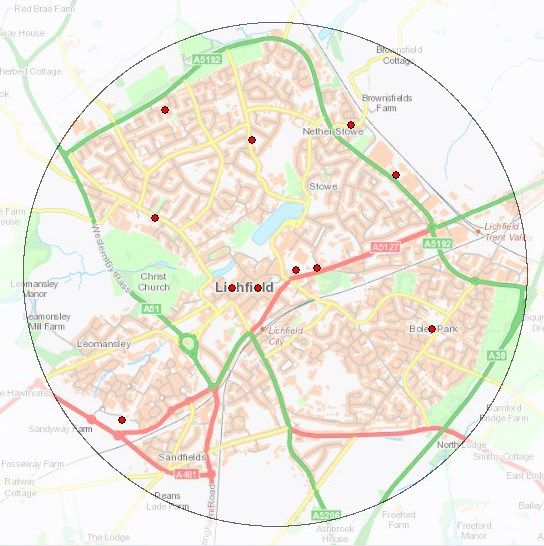
Income deprivation affecting older people (National Quintiles)
LSOA E010292499
City centre
Source: Indices of Deprivation 2015, Communities and Local Government, Crown copyright 2016
1 LSOA falls within the highest national quintile for income deprivation affecting
older people, shown in red.
There are a further 4 that fall into the second highest quintile; three of these are
located across the central part of the city.
Index of Multiple Deprivation (National Quintiles)
LSOA E01029492
City centre
Source: Indices of Deprivation 2015, Communities and Local Government, Crown copyright 2016
There is 1 LSOA where the index of multiple deprivation falls into the highest
national quintile.
GIS Locality Analysis: The City of Lichfield Page 10 There are a further three LSOAs, including part of Lichfield city centre, where the
index of multiple deprivation falls into the second highest national quintile.
1.2 Summary of demographic information
Six LSOAs fall into the highest quintile for multiple demography and deprivation indicators.
Table 3: LSOAs which fall into multiple highest quintiles
LSOA Highest quintile
E01029492 Health Deprivation and Disability
Index of Multiple Deprivation
E01029499 Single Pensioner Households
Health Deprivation and Disability
E01029518 Aged 50 – 64.
Aged 65 – 74.
Aged 75+.
E01029525 Aged 65 – 74.
Aged 75+.
E01029526 Aged 75+. 244 people
Single household 65+
E01032899 Aged 75+.
Single Pensioner Households
Map 1: LSOAs which fall into multiple highest density quintiles
LSOA E01029492
LSOA E01029499
LSOA E01029525
LSOA E01029526
LSOA E01032899
LSOA E01029518
Source: Indices of Deprivation 2015, Communities and Local Government, Crown copyright 2016; 2016 mid-year
population estimates, Office for National Statistics, Crown copyright; 2011 Census, Office for National Statistics, Crown
copyright
GIS Locality Analysis: The City of Lichfield Page 111.3 Lichfield Locality Analysis
Lichfield is a civil parish with city status and is the principal settlement of Lichfield District.
Lichfield District Council states in its ‘Economic Development Strategy 2016 – 2020’ that
“The City of Lichfield is an important historic centre, with a major conservation area based
around the Cathedral, a medieval street pattern and historic city centre buildings. As well as
being a popular visitor destination, it is an important centre for jobs, services and facilities
and housing”.1 The historic nature of the city means that some streets in the central retail
area are cobbled however most of these are modern cobbles so are not uneven and may
not affect the accessibility of services and facilities for people with limited mobility.
There are two recent build housing estates in Lichfield: the large housing estate at Boley
Park in the south east of the city was constructed during the late 1970s and early 1980s, and
Darwin Park to the south west of the city centre was developed in the 2000s.
Lichfield has two train stations: Lichfield City Centre and Lichfield Trent Valley Station.
1.4 Access to Local Facilities and Services
Bus routes
Map 2: Main bus routes in Lichfield City Centre.
Trent Valley Train
Lichfield bus Station
station
Lichfield City
Centre Train
Station
Source: Staffordshire County Council
Bus routes are displayed as follows:
1
Lichfield District Council ‘Economic Development Strategy 2016 – 2020’ accessed online on 14/9/18 at
https://www.lichfielddc.gov.uk/Business/Economic-Development-Strategy-2016-2020.pdf
GIS Locality Analysis: The City of Lichfield Page 12Lichfield’s bus station is located to the south of the centre on Birmingham Road,
approximately 220m from the shopping areas on Bore Street. Arriva Midlands, Diamond
Bus and Midland Classic all operate services from the station. The 821 and 822 are the
circular town services which run up to every 30 minutes throughout the day to late
afternoon.
Full details of Lichfield and Rugeley Route Maps and Timetables can be found on the
Staffordshire County Council website.
Taxi services
There are numerous taxi services operating within city centre according to yell.com. Taxi
ranks are located outside Lichfield City Station and near to the junction of Tamworth Street
and Lombard Street, however we do not have information on their operating hours.
Community Transport
Lichfield and District Voluntary Car Scheme, operated by Support Staffordshire, provides
transport for people who need to make essential journeys but have no other transport and
are unable to access public transport. It is available for people who pay their council tax to
Lichfield District Council. It will provide journeys for the purposes of:
Medical appointments
Personal business
Visiting friends/relations in hospital
Social events.
Some voluntary sector groups who focus on the needs of specific client groups have access
to their own minibuses.
Supermarkets
It has been assumed that larger supermarkets will enable people to access all of their food
shopping needs. A corner shop, express or convenience store will only partially meet
people’s needs, will potentially be more expensive and be used more for top up shopping
rather than full shops.
There are 10 large or medium sized supermarkets within a 2km radius of Lichfield centre
with a good spread in the centre and to the north of the city. Access to supermarkets is
more restricted in the area to the south of the centre between Boley Park residential estate
and Sandfields.
GIS Locality Analysis: The City of Lichfield Page 13Map 3: Supermarket locations in Lichfield Coop
WS13 7NR
Co-op
Tesco Express
WS13 7QG
WS13 6BA
Morrison’s
Lidl
B&M Retail
Aldi
Store due to Tesco
close in early WS13 6DZ
2019
Co-op
Waitrose
WS14 9XU
Source: Staffordshire County Council
Table 4: Public transport accessibility for supermarkets
Supermarket and Most frequent bus service Bus details Walking time distance from bus
postcode stop to amenity (approx.)
Aldi Every 30 minutes 12, 810, 811, 812, 1.5 minutes
WS13 6EB 822, X12 50 metres
Midland Classic
B&M Retail Every 30 minutes 10A, Under 5 minutes
WS13 6JX National Express 155 metres
West Midlands
35,
Diamond Bus
60, 61, 61A, 61S,
62, 62S
Arriva Midlands
821, 825
Midland Classic
Co-op Operate twice a day (school 819 6 minutes
WS13 7QG days only). Midland Classic 192 metres
829
Arriva Midlands
Co-op Every 30 minutes 812, 819, 822 Under 1 minute
WS13 7NR Midland Classic 20 metres
829
Arriva Midlands
Co-op Hourly 765 2.5 minutes
WS14 9XU Arriva Midlands 86 metres
Lidl Every 30 minutes 821 3.5 minutes
WS13 6UZ Midland Classic 118 metres
Morrison’s Every 30 minutes 812, 822 5 minutes
WS13 7QP Midland Classic 160 metres
825
Arriva Midlands
Tesco Express Every 30 minutes 821 3.5 minutes
WS13 6BA Midland Classic 117 metres
GIS Locality Analysis: The City of Lichfield Page 14Supermarket and Most frequent bus service Bus details Walking time distance from bus
postcode stop to amenity (approx.)
Tesco Every 30 minutes 821, 822 Under 1 minute
WS13 6DZ Midland Classic 23 metres
Waitrose Every 2.5 hours 35B 1 minute
WS13 6RX Diamond Bus 31 metres
Source: bustimes.org and Staffordshire County Council
Co-op WS13 7QG appears to be outside a reasonable walking distance for an older
independent individual from a bus service.
Three of the larger stores are located centrally to the area, and there is good access
to medium and large stores to the north of the analysis area, which have bus stops
within acceptable walking distances with regular and frequent services.
There is more limited access to supermarkets in the south of the analysis area, as the
bus services which serve Waitrose and the Co-op WS14 9XU store are less frequent
(around every 2.5 hours for the Waitrose store and every hour for the Co-op store).
There is no access to supermarkets between Boley Park and Sandfields.
Post Offices
Using information from postoffice.co.uk and the manual mapping tool it appears there are 4
post offices within the 2km radius.
25 – 27 Bakers Lane, Lichfield WS13 6NF
46 – 48 Wheel Lane, Lichfield WS13 7EA
4 Boley Park Shopping Centre, Lichfield WS14 9XU
17 Eastern Avenue, Lichfield WS13 6TE
Of these, the Bakers Lane post office is above an acceptable walking distance of a bus stop,
and Wheel Lane, Boley Park and Eastern Avenue are all within acceptable walking distance
for an older independent person of the nearest bus stop.
GP Surgeries
There are 3 GP practices located within the 2km radius:
GIS Locality Analysis: The City of Lichfield Page 15Map 4: GP practice locations in Lichfield
The Langton
Medical Group
Darwin Medical
Practice
The Westgate
Practice
Source: www.digital.nhs.uk and Staffordshire County Council
The Westgate Practice is located close to the town centre, and the Langton Medical Group
and Darwin Medical Practice are in residential areas to the north of the city centre. There
appears to be limited access to GP surgeries in the south of the city, in the large Boley Park
residential estate and Sandfields. The Langton Medical Group has disabled car parking
spaces and wheelchair access facilitated by lowered kerbs and lowered desks in the
reception area. The Westgate Practice has disabled car parking according to the NHS
website. The Darwin Medical Practice has wheelchair friendly parking spaces.
Two of the practices are within acceptable walking distance of a bus stop with a regular and
frequent service, and the third practice, the Langton Medical Group, is not considered
accessible by public transport as the nearest bus stop is served by twice daily services which
operate during school term time only.
Table 5: Public transport accessibility for GP practices
GP Practice and Most frequent bus service Bus details Walking time/distance from bus
postcode stop to amenity (approx.)
Darwin Medical Practice Up to every 12 minutes 821, 822 Under 1 minute
WS13 7HT Midland Classic 10 metres
The Langton Medical Two daily services (school 819 3 minutes
Group WS13 7FA days only) Midland Classic 103 metres
829
Arriva Midlands
The Westgate Practice Hourly 765 1.5 minutes
WS13 6JL Arriva Midlands 41 metres
Source: bustimes.org, www.digital.nhs.uk and Staffordshire County Council
GIS Locality Analysis: The City of Lichfield Page 16GP out of hours
Out of hours cover for the three surgeries is provided by NHS 111.
Pharmacies
There are 7 pharmacies located within the 2km radius of Lichfield town centre.
Map 5: Pharmacy locations in Lichfield
Boots
WS13 7FA
Jhoots Pharmacy Tesco Pharmacy
WS13 6DZ
Boots Co-operative
WS13 6JJ Pharmacy
WS13 6JL
Co-operative Pharmacy
Boots WS13 9XU
WS13 6RX
Source: www.digital.nhs.uk and Staffordshire County Council
Three of the pharmacies are in medical centres alongside a GP practice making it convenient
to visit the GP and pharmacy in the same journey: Boots WS13 7FA is in The Langton
Medical Practice, the Co-operative WS13 6JL is located in the Greenhill Centre alongside the
Westgate Practice and Jhoots is based in the St Chad’s Health Centre. Two pharmacies are
in supermarkets: Boots WS13 6RX is located in Waitrose and Tesco has its own pharmacy.
Five pharmacies are within an acceptable walking distance of a bus stop with a regular and
frequent service.
Table 6: Public transport accessibility for pharmacies
Pharmacy and postcode Most frequent bus service Bus details Walking time/distance from bus
stop to amenity (approx.)
Boots UK Ltd Two daily services (school 819 3 minutes
WS13 7FA days only) Midland Classic 103 metres
829
Arriva Midlands
GIS Locality Analysis: The City of Lichfield Page 17Pharmacy and postcode Most frequent bus service Bus details Walking time/distance from bus
stop to amenity (approx.)
Boots Up to every 20 minutes 35, 35B, 9 minutes
WS13 6JJ Diamond Bus 300 metres
810, 811, 812,
819, 822, X12
Midland Classic
60, 765, X65
Arriva Midlands
(Bus station)
Boots Every 2.5 hours 35B 1 minute
WS13 6RX Diamond Bus 31 metres
The Co-Operative Hourly 765 Under 2 minutes
Pharmacy Arriva Midlands 54m
WS13 9XU
Co-operative Pharmacy Hourly 765 1.5 minutes
WS13 6JL Arriva Midlands 41 metres
Jhoots Pharmacy Up to every 12 minutes 821, 822 Under 1 minute
WS13 7HT Midland Classic 10 metres
Tesco Pharmacy Every 30 minutes 821, 822 Under 1 minute
WS13 6DZ Midland Classic 23 metres
Source: bustimes.org, www.digital.nhs.uk and Staffordshire County Council
Dentists
There are 8 dental practices within 2km radius of Lichfield town centre.
Map 6: Dental practice locations in Lichfield
Dam Street Dental
Practice
Lichfield Family
Dental Surgery
Guys Dental Practice
Bore Street Dental
Practice Asquith House Dental
Practice
Spires Dental Practice
Pickering House Dental
Practice
Lichfield Dental Care
Source: www.digital.nhs.uk and Staffordshire County Council
GIS Locality Analysis: The City of Lichfield Page 18Table 7: Public transport accessibility for dental practices
Dental practice and Most frequent Bus details Walking time distance from bus
postcode bus service stop to amenity (approx.)
Asquith House Dental Every 30 minutes 10A Under 8 minutes
Practice National Express West 185 metres
WS13 6HL Midlands
35
Diamond Bus
60, 61, 61A, 61S, 62, 62S, 825
Arriva Midlands
821
Midland Classic
Bore Street Dental Every 30 minutes 10A Under 4 minutes
Practice National Express West 123 metres
WS13 6LL Midlands
35
Diamond Bus
60, 61, 61A, 61S, 62, 62S, 825
Arriva Midlands
821
Midland Classic
Dam Street Dental Every 30 minutes 821 10 minutes
Practice Midland Classic 332 metres
WS13 6AE 825
Arriva Midlands
Guys Dental Practice Every 30 minutes 821, 822 2 minutes
WS13 6DZ Midland Classic 70 metres
Lichfield Dental Care Up to every 20 X65 Under 16 minutes
WS14 9BU minutes Arriva Midlands 513 metres
Lichfield Family Dental Every 30 minutes 812, 822 4.5 minutes
Surgery Midland Classic 148 metres
WS13 7AA 825
Arriva Midlands
Pickering House Dental Up to every 20 X65 Under 1 minute
Practice minutes Arriva Midlands 22 metres
Spires Dental Practice Every 30 minutes 10A 5 minutes
WS13 6QD National Express West 163 metres
Midlands
35
Diamond Bus
60, 61, 61A, 61S, 62, 62S, 825
Arriva Midlands
821
Midland Classic
Source: bustimes.org, www.digital.nhs.uk and Staffordshire County Council
There appears to be good access by public transport to 4 dental practices in Lichfield, which
have bus stops with frequent services within an acceptable walking distance for an
independent older person. Four of the practices are located close to the city centre. There
is more limited access to dentists in the north of the city and in Boley Park.
Hospitals
Samuel Johnson Community Hospital on Trent Valley Road, Lichfield is operated by the
University Hospitals of Derby and Burton NHS Foundation Trust. It does not have an A&E
department but does have a walk in minor illnesses and injuries unit which operates daily
between 8 a.m. – 9 p.m., plus a range of outpatients’ services including diabetes, tissue
GIS Locality Analysis: The City of Lichfield Page 19viability and occupational therapist. It is located approximately 1 km to the east of the town
centre.
The nearest acute hospital with an A&E department is the Good Hope Hospital in Sutton
Coldfield, located approximately 15km away. It is run by University Hospitals Birmingham
NHS Foundation Trust. A little further away Queen’s Hospital Burton, 22km to the north
east, is an acute hospital operated by the University Hospitals of Derby and Burton NHS
Foundation Trust.
Opticians
There are 8 opticians within 2km of Lichfield town centre:
Boots Opticians, Three Shires Centre
David Arthur, 9 Market Street
Colin Lee, 33 Market Street
Lichfield Factory Specs, 49A, Tamworth Street
Scojo New York, 9 London Road
Specsavers Opticians, 43 Market Street
Tesco Opticians/Lichfield Church Vision Express, Church Street
Vision Express, Three Shires Centre, 35 Baker Street
Google Maps shows that all the opticians are in the town centre, except Scojo New York.
The manual measuring tool in GIS shows that the opticians at Tesco and David Arthur are in
acceptable walking distance of a bus stop with a frequent service.
Chiropodists/podiatrists
According to Google, there are 7 chiropody and podiatry services in a 2km radius of the
town centre:
Chiropody services are offered by Samuel Johnson Hospital and Westgate GP
Practice, Greenhill Medical Centre.
Fortey CJ, 1 Chatterton Avenue
Foot Kindness
The Chiropody Practice, 6 Sandford Street
Thompson PJ, 24 Bore Street
Friary Chiropody Clinic, 3 Church Street
Using Google and the measuring tool in GIS it appears that the Friary Chiropody Clinic,
Thompson PJ and the Chiropody Practice as well as the chiropody services at Samuel
Johnson Hospital and Westgate GP Practice are within acceptable walking distance of bus
stops with frequent services.
GIS Locality Analysis: The City of Lichfield Page 20Banks, building societies and cash machines
According to a Google search, six banks have branches in Lichfield: Barclays, Halifax, HSBC,
Lloyds, NatWest and TSB Bank. All six banks have 24-hour cash machines. None of the
banks appear to be within a reasonable walking distance of a bus stop for an older
independent person.
Table 8: Public transport accessibility for banks
Bank and post code Most frequent bus service Bus details Walking time/ distance
from bus stop to amenity
(approx.)
Barclays Every 30 minutes 10A 6 minutes
National Express West 193 metres
Midlands
31
Diamond Bus
60, 61, 61A, 61S, 62, 62S, 825
Arriva Midlands
821
Midland Classic
Halifax Every 30 minutes See under ‘Barclays’ 9 minutes
295 metres
HSBC Every 30 minutes See under ‘Barclays’ 9.5 minutes
306 metres
Lloyds Every 30 minutes See under ‘Barclays’ Under 10 minutes
315 metres
NatWest Every 30 minutes See under ‘Barclays’ 8.5 minutes
270 metres
TSB Bank Every 30 minutes See under ‘Barclays’ Under 9 minutes
285 metres
Source: bustimes.org and Staffordshire County Council
Using link.co.uk and the manual measuring tool in GIS there appear to be 20 free to use
ATMs within the 2km radius. Some of those that are within a reasonable walking distance
of a bus stop for an independent older person are as follows:
Aldi
Co-op Supermarket WS13 7NR
Co-op Supermarket WS14 9XU
Morrison’s supermarket
Post office, 17 Eastern Avenue
Tesco supermarket
Walkabout, 13 Bird Lane
Access to Leisure and Recreational Opportunities
Lichfield has a vibrant and diverse retail area, centred on Bore Street, Market Street, Dam
Street and Bakers Lane. There is a wide range of shops which includes butchers and
bakeries, and services such as hairdressers as well as many cafes, restaurants and pubs.
General markets are held on the Market Square on Tuesdays, Fridays and Saturdays.
Farmers markets are held on the first Thursday of the month.
GIS Locality Analysis: The City of Lichfield Page 21The area around the market place and the corner of Market Street, Bore Street, and Conduit
Street (where many of the banks are located) is around 280 metres from the nearest bus
stops on The Friary, which is above an acceptable walking distance for an independent older
person. Access to these areas from the bus station is also restricted, with distances from
the bus station (via Tudor Row) to Bore Street of 214 metres, to Market Street of 306m and
the corner of Conduit Street and Bore Street of 321m.
As Lichfield Library is situated on the Market Square access to it from the nearest bus stops
will be above reasonable walking distances for older people as described above.
The Garrick Theatre on Castle Dyke hosts visiting performances and makes its own
productions. It is 125 metres from the bus station.
The Boley Park residential area to the south of the city centre has a small retail area on
Rynkild Street which includes a medium sized supermarket, a newsagent’s shop, a café and
a pub, post office, community centre and a petrol station.
There are four community centres within the analysis area:
Curborough Community Centre in the north of the analysis area, which is used by
many groups including Live at Home Lunch and Friendship Groups, bingo, Friends 2
Friends. This appears to be above a reasonable walking distance for an independent
older person from a bus stop.
Boley Park Community Hall is located next to the Co-op supermarket and post office
in the retail area of Boley Park residential estate, and it is in easy walking distance of
a bus stop. Yoga and Pilates classes are held here as well as an exercise class for
older people.
Darwin Hall in Darwin Park residential area in the south west of the city, hosts
Pilates, yoga and faith groups. It appears to be above a reasonable walking distance
for an independent older person from a bus stop.
A large variety of groups including yoga and tai chi meet at Martin Heath Hall on
Christchurch Lane, to the south of Beacon Park, which is 341m from the nearest bus
stop and therefore above an acceptable walking distance for an independent older
person.
Friary Grange Leisure Centre is situated on Eastern Avenue on the north side of the city,
approximately 2km metres north of the town centre. It is not considered to be accessible by
bus as the service stops approximately 276 m from the leisure centre and is served only by
twice daily term time services. It has a swimming pool and a range of fitness activities
including 50+ aerobics, gentle circuits and aqua aerobics.
Lichfield has several centrally located parks and other open green spaces including Minster
Pool and Walk, Stowe Pool which has tarmac paths, some of which are sloped, the Garden
of Remembrance and Beacon Park.
GIS Locality Analysis: The City of Lichfield Page 22Beacon Park is located to the west of the city centre; it has two areas of formal gardens, a
café and accessible public toilets. There is a bus stop within an acceptable walking distance
of the entrance onto Bird Street which is served by several frequent services including the
822 Lichfield circular route. According to information from the Lichfield Historic Parks
website, paths are wide enough for mobility scooters and wheelchairs, some of the paths
are sloping.
Further from the centre are Shortbutts Lane Park and Darnford Parks in the south and
Curborough Park in north Lichfield.
1.5 Access to local care facilities/age appropriate housing in Lichfield
Extra care schemes
Beacon Park Village is the only extra care scheme in Lichfield. It is located to the south side
of Beacon Park, approximately 475m from the end of Bore Street and the retail centre.
Table 9: Extra care schemes
Name Needs catered for Units Services & facilities Tenure Build date
provided
Beacon Park New residents 135 flats with 1, On site care staff, 24/7. Social rent, 2005
Village accepted from 55. 2 or 3 bedrooms. Non-resident leasehold and
WS13 6JN Priority is given to management staff, shared
people with a local Careline alarm service. ownership
connection to Jacuzzi, bar/pub,
Lichfield. community centre,
assisted bathing suite.
Source: Care Quality Commission and housingcare.org
Map 7: Extra care schemes in Lichfield
Beacon Park Extra
Care Scheme
Source: Staffordshire County Council
GIS Locality Analysis: The City of Lichfield Page 23Sheltered housing
There are 15 sheltered housing complexes within 2km of Lichfield centre, with a further
scheme by McCarthy and Stone at Cross Keys, WS13 6DW near to the town centre planned
to open in 2019. This gated community scheme for the over 60s will have 17 one-
bedroomed and 25 two-bedroomed apartments for retirement living available on leasehold.
It will have non-resident management staff and a community alarm system.
Table 10: Sheltered Housing Schemes in Lichfield
Name Needs catered Units Services & facilities provided Tenure Build date
for
Andrews Retirement 59 flats, one Non-resident management staff Leasehold 1990
House housing. New bedroomed and community alarm service.
WS13 6QY residents Mobility standard properties,
accepted from wheelchair access. Community
age 60. centre.
Chapter House Retirement/ 30 flats, one Ground floor lounge. Gardens. Leasehold 2016
WS13 6QG sheltered and two
housing. New bedroomed.
residents
accepted from
age 55.
Copperfields Retirement/ 28 cottages, Part time resident management Leasehold 1989
WS14 9YQ sheltered one and two staff, community alarm, wheelchair
housing bedroomed. access. Includes mobility and
wheelchair standard properties.
David Garrick Retirement 63 flats, one Resident management staff and Social rent 1990
Gardens housing and two community alarm service.
bedroomed.
Franciscan Retirement 54 flats, one Visiting management staff. Social rent 2013
View housing. New and two
WS13 6QE residents from bedroomed
age 55 years.
Homelodge Retirement 44 flats, one Community alarm, wheelchair Leasehold. 1985
House housing. New bedroomed. access. Resident management
WS13 6XD residents staff. Whole site accessible by
accepted from wheelchair.
age 60 years.
Houlbrooke Retirement 27 flats, one Includes mobility standard Social rent. No
House housing. New bedroomed. properties, community alarm, information.
WS13 6SH residents support worker and Community
accepted from Connector both on site twice per
age 55 years. week.
Ivanhoe Retirement/ 34 Resident management staff, Social rent No
WS14 9DP sheltered bungalows, community alarm, wheelchair information.
housing one access
bedroomed.
Mercian Court Retirement. New 32 flats, one Resident management staff. Leasehold 1984
WS13 6TZ residents from bedroomed Community alarm
55 years.
Minster Court Retirement 19 flats. One Non-resident management staff Leasehold 2008
WS13 6AB housing. New bedroomed (part-time). Community alarm.
residents from and two Whole site accessible by
55 years. bedroomed. wheelchair.
GIS Locality Analysis: The City of Lichfield Page 24Name Needs catered Units Services & facilities provided Tenure Build date
for
Pearce Court Retirement 23 flats and Non-resident management staff Social rent. 1977
WS13 7PF housing. New bungalows. and community alarm service.
residents from Studio, one
age 60. bedroomed
and three
bedroomed.
.
Samuel Close Retirement 11 Visiting management staff and Leasehold 1983
WS13 7RZ housing. New bungalows, community alarm service. Access
residents two to site easy but less so for less
accepted age bedroomed. mobile.
55+. Bus stop: 10 yards, town centre 2
miles.
Sarah Siddons Retirement 31 flats, one Non-resident management staff Leasehold, 1990
House housing. New and two (part time.) Community alarm,
WS13 6HL residents bedroomed. lounge, community centre
accepted from
55 years.
St John’s Elderly men and 29 flats, one Resident management staff and Social rent 1976.
within the married couples. and two community alarm service. Renovated
Close bedroomed. in 2017.
WS13 6PB
St John’s Retirement 13 flats, 1 Resident management staff and Social rent Built in 1495
without the housing. An and 2 community alarm service. and
Barrs almshouse bedroomed. renovated
charity catering in 2001.
for elderly single
males and
married couples,
living in the
Diocese of
Lichfield in good
health.
Source: housingcare.org
NB Distances indicated to local amenities have been taken from the housingcare.org
website.
In total there are 497 self-contained units of accommodation in sheltered housing
schemes within Lichfield. These offer a range of one, two and three-bedroomed
studios, flats and/or bungalows.
Eight schemes state they have resident management staff, including part time
arrangements. Four schemes state they have non-resident management staff and
there is no information for the other 3 schemes. Thirteen state they have a
community alarm service.
Seven schemes offer social rent, eight schemes offer leasehold, and none offer a
mixture of both, private rent or freehold.
For the purpose of this report it has not been possible to comment on the physical
states of the housing or whether they are fully occupied or not. This information
may be available directly from the housing associations which own them.
GIS Locality Analysis: The City of Lichfield Page 25Map 8: Sheltered housing scheme locations in Lichfield
Samuel Close
WS13 7EZ
David Garrick
Gardens
Pearce Court
Houlbrooke House
Minster Court
Sarah Siddons House
Andrews House
Mercian Court
Franciscan View Copperfields
Chapter House Homelodge House
St John’s within the
Ivanhoe Close and St John’s
without the Barrs
Source: Staffordshire County Council
GIS Locality Analysis: The City of Lichfield Page 26Age Exclusive Housing
There are 8 age exclusive housing developments within 2km of Lichfield city centre.
Table 11: Age exclusive housing in Lichfield
Name and Needs Units Services and facilities provided Tenure Build date
postcode catered for
Dr Milley’s Hospital Almshouse 10 flats, Visiting management staff, Social rent Built in 1400.
WS13 7AA charity caters studio and community alarm Renovated in
for women of one 1987
all ages bedroomed
Maryvale Court Age exclusive 30 one and Community alarm Freehold 1990
and Boley Lodge housing two
bedroomed
bungalows
Pavillion Court Age exclusive 12 flats, No information Social rent 1982
WS13 7DE housing studio and 2
bedroomed
Penny’s Croft Age exclusive 14 flats, one Community alarm Social rent No
WS13 6SA housing bedroomed information
Scotch Age exclusive 12 flats, one Community alarm Social rent No
Orchard/Manley housing bedroomed information
Road
WS13 6TG
Smithfield Rise Age exclusive 5 one Community alarm Social rent No
WS13 6SG housing bedroomed information
bungalows
Tanyard Age exclusive 16 one and Community alarm Social rent No
WS13 6BN housing two information
bedroomed
bungalows
Wissage Croft Age exclusive 6 one Community alarm Social rent No
WS13 6TQ housing bedroomed information
bungalows
Source: housingcare.org
The developments provide 105 units of self-contained accommodation, of which at
least 47 (46%) appear to be either studio or one-bedroomed.
57 units (54%) are in bungalows.
One scheme with 10 units caters for women only.
The developments are located across the centre of the analysis area, menaing there
is more restricted access to age exclusive housing in Darwin Park and Boley Park and
residential areas to the north of the centre.
GIS Locality Analysis: The City of Lichfield Page 27Map 9: Age exclusive housing locations in Lichfield
Wissage Croft
Scotch
Orchard/Manley
Pavillion Court Road
Penny’s Croft
Dr Milley’s
Hospital Smithfield Rise
Tanyard
Maryvale Court
and Boley
Lodge
Source: Staffordshire County Council
Care homes – Residential Care only
There are 2 residential care homes within a 2km radius of Lichfield town centre.
Table 12: Residential care homes in Lichfield
Name CQC Location Specialist Care Beds Services & Facilities
Categories
Hawthorn House 1-135551798 Learning Disabilities 29 No information
Burton Old Road
West WS13 6EN
Rosemary Lodge 1-118001152 Caring for adults over 32 Longer stay, short
191 Walsall Road 65 yrs stay and respite.
WS13 8AQ Close to local shops,
near to public
transport. Garden.
Source: Care Quality Commission, housingcare.org and carehome.co.uk
Within the 2km radius of Lichfield city centre there are 2 residential care home beds,
containing a total of 61 care beds. Neither has a dementia specialist category.
One of the two homes has a specialist care category of adults aged 65 plus.
1 homes, containing 32 beds (52%), has a learning disability specialist category.
The Spires Residential Care Home WS13 8JD is located just outside the northern
edge of the analysis area, off the A51 and near to the Friary Community Centre. It
was purpose built and completed in 2018. It has 70 beds and has specialist care
categories for dementia, adults over 65, adults under 65, and physical disabilities.
GIS Locality Analysis: The City of Lichfield Page 28Map 10: Residential care home locations in Lichfield
The Spires (just outside
the analysis area)
Hawthorn House
Rosemary Lodge
Source: Staffordshire County Council
Residential Care – Nursing Care only
Table 13: Nursing homes in Lichfield
Name CQC Location Specialist Care Categories Beds Services & Facilities
Beechfields Nursing 1-143853121 Caring for adults over 65 35 Physiotherapy, near
Home Ltd Accommodation for people who to local shops, close
1 Wissage Road require nursing care or personal care to public transport.
WS13 6EJ Treatment of disease, disorder or injury
Diagnostic or screening procedures
Darwin Court Care 1-3069386829 Caring for adults over 65 yrs 112 Longer stay. Purpose
Centre Caring for adults under 65 yrs built.
Wissage Road Dementia Garden
WS13 6SP Mental health conditions
Physical disabilities
Sensory impairments
Source: Care Quality Commission and housingcare.org
Within the 2km radius of Lichfield city centre there are 2 nursing homes with a total
of 147 beds, of these 112 (76%) have a dementia specialist care category.
One home has a specialist care category of dementia and physical disabilities.
Both have specialist care categories of adults over 65 years
GIS Locality Analysis: The City of Lichfield Page 29Map 11: Nursing home locations in Lichfield
Darwin Court Care
Centre
Beechfields
Nursing Home
Ltd
Source: Staffordshire County Council
Supported living schemes
Information held by Staffordshire County Council shows there are no supported living
schemes within 2km of the Lichfield centre. These schemes are typically for younger people
with learning disabilities, although some may be for people with physical disabilities.
Planned specialist housing developments in the area
A planning application for a 750 unit development including a care village for up to 150 units
in Streethay to the east of the city centre has received approval. Work has begun on the
housing development but we have no information on estimated completion of the care
facility.
A further large scheme in Curborough, just outside the northern boundary of the analysis
area, has been given outline planning consent, for C2 uses for up to 200 bed spaces within a
development called The Lakes at Curborough, which will also incorporate 750 houses.
Proposals for the site include the development of bus routes.
2 Lichfield summary
2.1 Lichfield Locality Population Demographics
In Lichfield city the following numbers of LSOAs are in the first and second quintiles for
demography or deprivation.
GIS Locality Analysis: The City of Lichfield Page 30Table 14: Numbers of LSOAs in first and second quintiles
Indicator Number of LSOAs Number of LSOAs in
in first quintile second quintile
Aged 50 – 64 3 7
Aged 65 – 74 5 9
Aged 75+ 7 2
Single Person Households aged 65+ 3 2
Health, deprivation and disability 1 1
Income Deprivation Affecting Older People 1 4
Index of Multiple Deprivation 1 3
2.2 Access to retail, banking, health and leisure services
Lichfield has a busy retail area with many shops, cafes and bars alongside leisure
opportunities in parks, museums and a theatre. The areas around Bore Street, Market
Street and Dam Street are pedestrianised and there is no access by public transport to this
area. From the nearest bus stops the distances to be traversed around the centre would be
above the acceptable walking distance for an independent older person but it could be
easily accessible by motor scooter.
Access to banks is limited as they are above the acceptable walking distance for an
independent older person from a bus stop, however there are numerous accessible
ATMs, including several at supermarkets, and there are 3 post offices which offer
basic banking services within acceptable walking distance of a bus stop for an
independent older person.
There is good access to supermarkets in the city centre and in the north; access to
supermarkets in Boley Park and Sandfields is more restricted as there are fewer
facilities served by less frequent bus services.
Of the three GP surgeries in the analysis area, two are in north of the analysis area
and one in the city centre. This means there is more restricted access to GP
surgeries in Boley Park, Darwin Park and Sandfields residential areas. There are
frequent bus services to two GP surgeries.
Three pharmacies are co-located within GP surgeries, and two are based within
supermarkets. There is good access by public transport to pharmacies across the city
using frequent bus services.
Dental practices are largely based in the city centre, with one in the south of the
analysis area. There is good access by public transport to 4 dental practices.
There is public transport access to opticians and chiropodists.
GIS Locality Analysis: The City of Lichfield Page 312.3 Access to specialist housing and care facilities
Within the analysis area there are the following specialist sheltered housing and age
exclusive housing schemes:
One extra care facility in the 2km radius of Lichfield city centre, containing 135 flats,
with one, two and three bedroomed accommodation available. It’s located near to
Beacon Park in the city centre and offers a choice of social rent, leasehold and
shared ownership tenures.
15 sheltered housing schemes which provide 497 self-contained units of
accommodation with a further scheme of 42 units planned to open in 2019. Eleven
of these schemes offer flats only. There is a mixture of tenure types available but
not private rent or freehold.
8 age exclusive housing schemes, seven of these offer social rent and one freehold.
None offer private rent.
Sheltered housing and age exclusive schemes are mainly found near to the city centre.
There is limited provision of both these types of accommodation in the Boley Park and
Darwin Park areas, and to sheltered housing in the residential areas around Weston Road
and Grange Lane to the north west of the city centre.
Within the 2 km radius of Lichfield city centre there are two residential care homes with a
total of 61 care beds.
One of the homes is registered for people with a learning disability.
32 beds (48% of the total beds available) are registered for people aged 65 plus.
No beds in residential care homes are registered for dementia care category.
One of the residential homes is located near to the city centre on Burton Old Road,
in close proximity to two nursing homes. The other is located to the west of the
analysis area in Leomansley.
A residential home which has recently opened just outside the northern edge of the analysis
area, has 70 beds with a dementia care category.
The two nursing homes within the analysis area contain a total of 112 beds; they both have
specialist care categories of dementia and adults over 65, and they are located
approximately 350m apart to the east of the city centre around Wissage Road.
GIS Locality Analysis: The City of Lichfield Page 32You can also read