STONEHENGE DECODED Buried treasure The big picture - AHRC Archaeology 2019 - Arts and Humanities ...
←
→
Page content transcription
If your browser does not render page correctly, please read the page content below
D ISCOV ER           AHRC Archaeology 2019

STONEHENGE DECODED
Revealing the mysteries of Britain’s most iconic archaeological monument

                                      Buried treasure
                                                  Unearthing coin hoards

                                       The big picture
                                       Creating a digital atlas of hillforts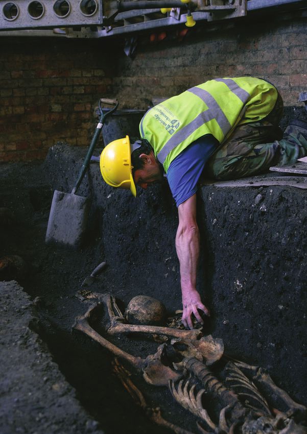
D ISCOV ER          AHRC Archaeology 2019

 Welcome by Alice Roberts                                                        3

 Decoding the stones                                                             4

   Temple of life, temple of death                                                5

   A place of feasting                                                            6

   Home is where the hearth is                                                   8

   Down in the valley                                                             9

 Buried treasure                                                                 10

 The big picture                                                                 12

 Around the world                                                                14

 New ways of seeing                                                              16

 Strength in numbers                                                             18

 The future of archaeological research                                           21

 In numbers: AHRC archaeology research                                           22

                         COVER: Stonehenge – Andre Pattenden, English Heritage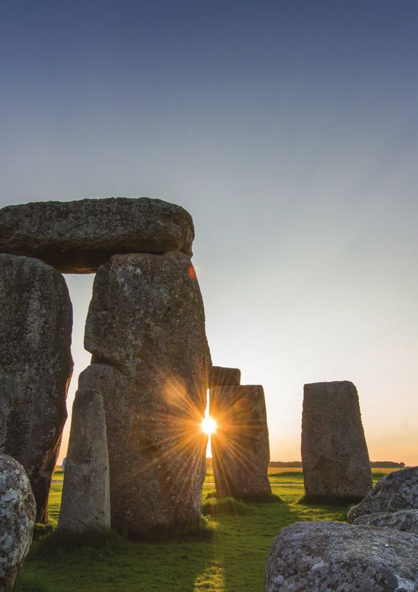
Welcome
by Professor Alice Roberts
    @theAliceRoberts

E
      arlier this year, I walked up onto the ramparts of           Many of these investigations are funded by British taxpayers
      Maiden Castle. I marvelled at the vast earthworks            – via the Arts & Humanities Research Council (AHRC) – and
      and wondered at the human effort that had thrown             this magazine covers some of the most exciting AHRC-funded
up these banks. A huge enterprise that must have brought           projects of recent years. There’s a new analysis of the iconic
people together from across this landscape. How many               Stonehenge landscape, with insights into how monumental
generations did it take to create this monument? I imagined        architecture evolved as an overblown reimagining of a simpler
parents and grandparents telling their children how they’d been    house, to evidence of midwinter feasts and connections across
part of this enterprise – making a mark on the landscape that      the wider countryside. Some projects take us far away – to
they must have known would last for generations, even if they      Alaska, Jordan and South America, while others explore, on
couldn’t imagine how impressive it would look to us, more than     the one hand, the impact of digital technology in capturing
two millennia on. The creation of the hillfort brought people      information across landscapes, and on the other, the crucial
together, and it’s still drawing us today. It’s that very human    role that members of the public can play in helping to amass
urge to make a mark – writ large.                                  and interpret large volumes of data. Professor Carenza Lewis
  Archaeology provides us with a tangible, physical link to        urges a new view of archaeological research, not as a niche
the past. Walking in places where we know our ancestors            discipline, always looking back, but as a 21st century science
walked, dwelt, fought and forged alliances – we feel closer to     that provides us with astonishing and useful insights into how
the people who inhabited these islands before us. Archaeology      human populations have interacted with their environments
also provides a counterpoint to history. The interrogation of      through time.
archaeological evidence allows us to test interpretations based      All of these projects open up archaeological discoveries and
on historical documents. And as we journey even further back in    research to wider audiences and encourage us to connect with
time, into prehistory, when written records run out, archaeology   our heritage in new ways. Amongst them – in a project led by
offers us the only means of understanding past lives. It’s also    archaeologists from Oxford and Edinburgh universities, teaming
a source of endless fascination and new surprises. Every year,     up with citizen scientists – is a brand new atlas of hillforts. In
archaeologists unearth new evidence which fleshes out the          1891 Sir Hugh Munro published his atlas of Scottish mountains,
picture we had before, or even challenges it. Documenting          spurring on walkers and mountaineers to climb as many as they
some of these stories each year on Digging for Britain, I am       possibly could, a pursuit which has become known as ‘Munro-
always entranced by that visceral excitement of discovery,         bagging’. How many people, I wonder, will join me in using the
and always intrigued by new finds which prompt us to revisit       new atlas of Iron Age monuments to help them ‘bag’ hillforts?
and revise old ideas.

                                                                                                      Welcome                       3
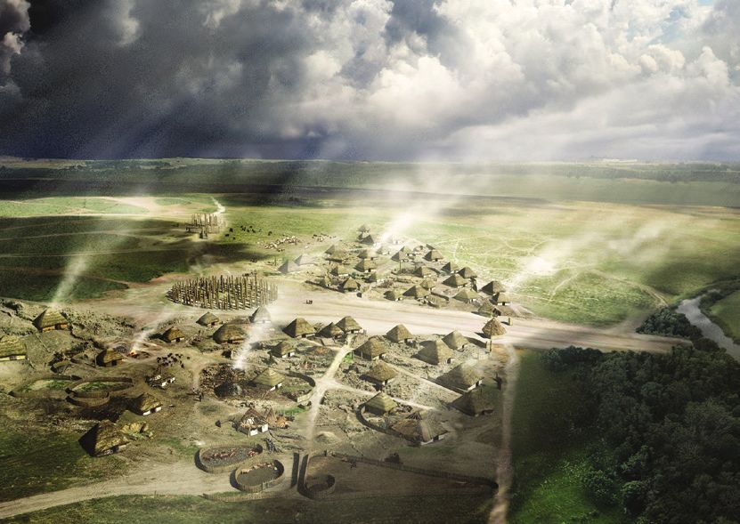
Until recently, the origins of Stonehenge have remained largely a mystery
Photo by Aerial-Cam Ltd

Decoding the stones
Stonehenge is one of the most iconic archaeological
monuments in the world attracting more than a
million visitors every year. But until recently much
about the site – its origins and purpose – remained
mysterious. Now the AHRC has funded major
fieldwork to post-excavation analysis that has
revealed many new secrets about this remarkable
site and its fascinating landscape.

4                           Stonehenge: Wrap up of work funded by the AHRC
Temple of life, temple of death
T
        he Arts & Humanities Research Council (AHRC) has            Stonehenge’s purpose had to lie – especially as the stones were
        funded multiple research projects in and around             coming from so far away. A great deal of care and effort had
        Stonehenge in recent years.                                 been invested in bringing them all that distance to build this
  “We started off with the Stonehenge Riverside Project,            unique stone circle.”
which was primarily excavation-based and focused not only on          The presence of stones from such a great distance is indicative
Stonehenge itself, but other sites in the surrounding landscape,    of another discovery to emerge from the recent work: the sheer
particularly at Durrington Walls,” says Professor Michael Parker    scale of Stonehenge’s sphere of influence.
Pearson, UCL Institute of Archaeology.
  The project was an attempt to develop a better understanding        “The site was clearly a massive undertaking,
of the Stonehenge landscape in the Neolithic and Bronze Age,            requiring the labour of thousands to move its
and in particular the relationship between the stones and other         stones, shape them and erect them...”
surrounding monuments. The aim was to explore the hypothesis
that several of the sites in this rich archaeological landscape       Far from being a local monument for local people, it is now
were somehow related.                                               clear that Stonehenge was at the centre of a vast hinterland,
  “We had the hypothesis that Stonehenge was a place of             and part of a network of communication, revealed by shared
ancestors, associated with death, which was symbolised              styles of architecture, pottery and other material culture
in stone,” says Professor Parker Pearson. “While the site of        extending from Orkney in the north of Scotland to the south
Durrington Walls, just down the road, which featured a timber       coast of England.
henge, was associated with life. And we’ve proved that in           “We were particularly interested in looking at the place of
spades.”                                                            Stonehenge within the wider context of Britain at the time it
  The AHRC also funded the Consuming Prehistory and Feeding         was in use,” says Professor Parker Pearson.
Stonehenge projects, which looked at what the remains of food         “It had previously been thought that the monument was at
at the sites – such as animal bones – might reveal.                 the centre of some kind of political territory. But now we have
  “We now know that Stonehenge was the largest cemetery             a better understanding of the settlement geography from that
in the third millennium BC in Britain,” says Professor Parker       period, we can see that it is actually situated on a boundary
Pearson. “And we now know that Durrington Walls was the             between different archaeological ‘cultures’ to east and west.
largest settlement at that time as well.”                           Part of its purpose may have been to unify these two regions.
  In addition, the project was also able to prove that Durrington     The site was clearly a massive undertaking, requiring the
Walls was in use at the same time as Stonehenge, further            labour of thousands to move its stones, shape them and erect
emphasising the link between the two sites. “What we can say        them, a communal effort that further emphasises the site’s role
now is that the second phase of Stonehenge – when it broadly        as a unifying focus for wider society.
took the form that we see it in today – was contemporary              “Avebury may be the largest stone circle but its stones aren’t
with the settlement at Durrington Walls,” says Professor            shaped; and neither are they put on top of each other,” says
Parker Pearson.                                                     Professor Parker Pearson.
  Interestingly, the two sites are connected by the River Avon,       “Stonehenge is a truly remarkable place at the heart of a
which flows north-south between them, with both Stonehenge          fascinating and remarkably well preserved prehistoric landscape.”
and Durrington Walls connected to the river by solstice-aligned
ceremonial avenues.                                                                                                    Photo by Aerial-Cam Ltd

  “Until we started work, no one knew whether or not the
Stonehenge avenue actually reached the river and whether
there was an avenue from Durrington Walls down to the river,”
says Professor Parker Pearson.
  “But having carried out our excavations we were able to
confirm that both avenues exist thus linking the two sites.
Our results – Stonehenge for the dead and Durrington
Walls for the living – were particularly exciting because
archaeology hypotheses are often falsified as soon as the spade
hits the soil. That is when you find out what you thought was
going on certainly wasn’t!”
  Stonehenge is also the only stone circle that we know was
built from stones imported from a long distance away. While
the larger stones, known as sarsens, are thought to have come
from 20 miles away, Stonehenge’s bluestones came from the
Preseli Mountains 180 miles away in South West Wales.
  “What we thought was important was the association of
stone with the ancestors and wood with the living,” says
Professor Parker Pearson. “It was in the ‘meaning’ of stone that    The Stonehenge Riverside Project

                                                                      Stonehenge: Wrap up of work funded by the AHRC                             5
Durrington settlement
© Historic England, drawing by Peter Lorimer

Recreated Neolithic houses                                                           An example of prehistoric food
based on the remains of those                                                        © English Heritage / Andre Pattenden

discovered during excavations
at Durrington Walls
© English Heritage

6                                   Stonehenge: Wrap up of work funded by the AHRC
A place
of feasting
J    ust under two miles from Stonehenge lies the site of
     Durrington Walls, which in the Neolithic and Bronze
     Age was a massive timber henge – some 480 metres
across – which while linked to its stone neighbour, had a
                                                                      interesting to find out how what was going on at Durrington
                                                                      Walls relates to that process.”
                                                                         In addition, analysis of the animal bones has confirmed
                                                                      the importance of the area around Durrington Walls and
very different purpose.                                               Stonehenge as a central place within a huge territory.
   “It has a totally different character to it,” says Oliver Craig,      “When we look at the animal bones we see that many of the
Professor of Archaeological Science at the University of York         animals that were slaughtered here had been brought from
and co-investigator of the Feeding Stonehenge project.                some considerable distance away,” says Professor Craig.
   While Stonehenge seems to have been closely associated                Trace chemical elements in animal bones teeth reveal the
with burial, excavations funded by the AHRC at Durrington             geography of the area in which they were raised and it’s clear
Walls have revealed thousands of animal bones and ceramics            that many of those eaten at Durrington Walls did not spend
that together indicate a high level of human activity at the site,    their lives on the Wessex chalk.
which seems to be closely associated with mass consumption               “Our theory is that they were brought by people who were
of food.                                                              travelling to participate in events in the Stonehenge landscape,”
   “One seems to have been about feasting and celebration –           says Professor Craig. “There was a large catchment area –
life – the other focused on the dead,” says Professor Craig.          people seem to have been coming from as far away as Scotland.”
   “Given that fact, we wanted to understand the nature of the           It’s not yet clear how unique Stonehenge was in this regard –
feasting at Durrington Walls. How unusual was it? And how did         people may have travelled great distances to other sites as well
it relate to Stonehenge?”                                             – but the research is so far only just beginning and others are
                                                                      replicating elements of what has been done here and applying
  “…people tend to think of Neolithic prehistoric food               it to other sites. While to the modern mind Stonehenge is a
    as being very basic and functional. But in reality                unique, iconic monument. It was only one of many ‘henges’
    there was much more going on; food was just as                    present in Britain at the time.
    socially important then, just as it is now.   ”                      “It would be fascinating, for example, to see if people
                                                                      from Wessex were travelling north to Britain and Ireland’s other
   Post-excavation analysis of finds has revealed that the            great Late Neolithic monuments as well as vice versa,” says
feasting that took place seems to have been seasonal and most         Professor Craig.
of the animal bones came from pigs that seem to have been                But there was more to Feeding Stonehenge than finding out
killed in midwinter. This was not the type of bone assemblage         about what prehistoric populations ate and what this can tell us
that you would expect in a ‘normal’ village where people were         about their society and culture. Understanding the role of food
living there all year round carrying out routine daily activities.    in the Neolithic world is also a powerful way of helping to build
   The pottery was unusual as well: chemical analysis has             a link between the modern world and the past. After all, we all
revealed that the pots were all full of animal products at a time     eat, and thinking about how ancient people ate is one way of
when we think the daily diet was largely plant based.                 bringing their world closer to ours.
   “There was lots of pig fat, which indicates food eaten most           “We want to use the research we have done about food
likely in the winter, and in another area of the site we found the    to connect with a wider audience and we have done a lot of
remains of pots that contained a lot of dairy products, which         outreach to the public and in schools to show how science has
we think indicates activity during the early summer months.           a role in archaeology through an AHRC Follow-on Fund for
Although, the more important of these seems to be in the              impact and engagement,” says Professor Craig.
winter when most of the feasting took place.”                            “We have had upwards of 20,000 people through the
   Interestingly, there is a bigger question about the consumption    various events and exhibitions that we have organised from
of dairy at the site. According to Professor Craig most of            popular music festivals to a large weekend ‘feast’ event at
the population at this time probably couldn’t digest dairy            Stonehenge itself.
and were probably lactose intolerant. But by turning raw milk            “We want to make people think about the role of food in
into milk, yoghurts or cheese, they would have made it much           the past.
more digestible.                                                         “I think people tend to think of Neolithic prehistoric food as
   “In the bronze age we know through DNA analysis that a             being very basic and functional. But in reality there was much
greater proportion of the population became more lactose              more going on; food was just as socially important then, just as
tolerant,” he says. “We think this is due to a large immigration      it is now, for all sorts of reasons and can tell us so much about
into Britain from continental Europe and all the way down into        how our ancestors lived as a result.”
south east Asia.
   “These people were from pastoral communities that were
heavily reliant on cattle and dairy and had already developed
lactose tolerance, which they brought with them. It will be

                                                                       Stonehenge: Wrap up of work funded by the AHRC                 7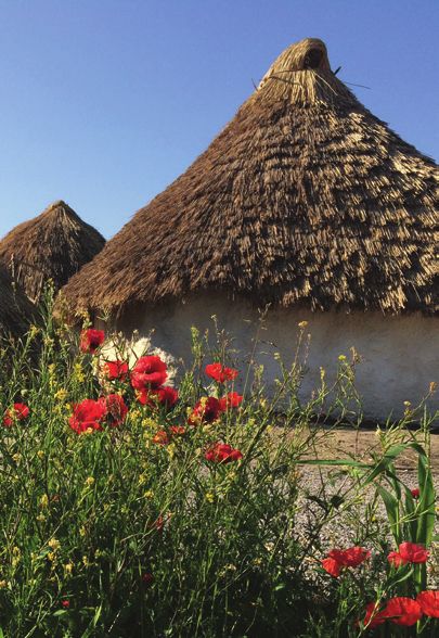
Home is where
the hearth is
The remains of a huge settlement
was discovered at Durrington
Walls. But what can the remains
of the houses tell us about
                                                                         Professor Michael Parker Pearson, UCL Institute of       Photo courtesy of
Neolithic society?                                                       Archaeology pictured in front of one of the hearths at
                                                                                                                                    Aerial-Cam Ltd

                                                                         Durrington Walls

“
      he houses found during the excavations at Durrington
     T                                                                     “For me, the interesting thing about them is how heavily
     are very telling of why Stonehenge takes the form it                focused everything is on the hearth. And as we know [from the
     does,” says Joshua Pollard, Professor in Archaeology at             food remains], they were inhabited in deep midwinter, so you
     the University of Southampton.                                      can imagine why.
  “The focus is a large hearth at the centre of a square floor             “The hearth was where you can imagine people gathered.
set within a circular wall. What’s really interesting is the way         Interestingly, we can see from the Orkney examples that the
that this architectural template is then replicated in much              hearths themselves were sometimes mobile – they could be
larger monuments.”                                                       taken up and moved from old to new buildings – and so it is
  For example, at Durrington, archaeologists found larger, more          quite literally a case of home is where the hearth is.”
elaborate versions of these buildings with the same square                 The chronology of the sites in the Stonehenge landscape
central hearth, this time marked out by four internal posts.             seems to indicate that there was a huge upscaling in monument
  Elsewhere, around Durrington Walls and Woodhenge, remains              building within a generation or so around 2500 BC.
of similar timber structures were found, but on a monumental               “We used to think that monument construction was constant
scale. Not just houses, but massive halls or free-standing               during the late Neolithic but now we know all the really
wooden shrines. One of these, the first phase of a structure             big monuments were created around the middle of the 3rd
known as the Southern Circle, was massively enlarged by adding           millennium BC,” says Professor Pollard. “We can also see a
outer rings of posts. It is this construction that provides the          series of regional centres emerging.”
timber ‘blueprint’ for the sarsen and bluestone monument of                Why did people suddenly feel the need to gather and build
Stonehenge. The implications are profound.                               these great monuments at this time? “This was a period when
                                                                         Britain was drawn into networks that stretched deep into
    “…the hearths themselves were sometimes mobile –                    Europe and we start to see evidence here of new people and
     they could be taken up and moved from old to new                    cultures – the so-called ‘Beaker People’,” says Professor Pollard.
     buildings – and so it is quite literally a case of home               This trickle of migrants arrived about 4,500 years ago and
     is where the hearth is. ”                                           brought with them new customs, new burial practices, and
                                                                         beautiful, distinctive bell-shaped pottery.
   “You can see within the architectural format of Stonehenge a            “Perhaps the development of Stonehenge at this time
trail back to more humble dwellings”, says Professor Pollard.            represents some millenarian-style thinking?” says Professor
   “This perhaps tells us something about the key role of houses         Pollard. “Perhaps there was an upscaling of traditional religious
as focal points. Stonehenge is an extrapolation of domestic              practices in response to the presence of new ideologies? It
architecture. It’s taken the form of the house and enclosed it in        seems feasible. We see a similar upswing of activity around
rings of stone which highlight its sacred nature.”                       Avebury, for example, and other sites.
   With well-made chalk floors and traces of internal timber               “It was in many ways a time of social and ideological
furniture, the houses found at Durrington Walls are unique for           experimentation.”
domestic settings in southern Britain. There are parallels though
with similar buildings in Orkney, but in stone.
   “At Durrington the level of preservation is really remarkable
and we have got a really good idea about how the houses were
built and used,” says Professor Pollard.

8                       Stonehenge: Wrap up of work funded by the AHRC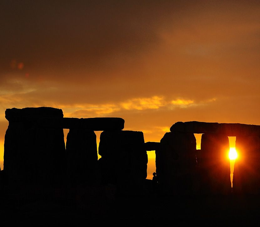
Down in
the valley
Could there be more to the
Stonehenge landscape? One scholar
argues that we can only really
understand its place and purpose by
looking further afield.                                                 The trench with the building surface revealed             Photo courtesy of
                                                                                                                             Vale of Pewsey Project

T
        he major sites of Neolithic Wiltshire are on the high             “It looks as if there was a settlement there first which underlies
        ground. But while places like Avebury and Stonehenge            the henge,” says Dr Leary. “The settlement seems to have
        have been studied for decades, very little attention            been demolished and a henge built over it, exactly as at
has been focused on what was going on down in the river                 Durrington Walls.”
valleys that divide the landscape – until recently.                       In addition to excavating specific sites, the archaeologists
   “My research is in the Vale of Pewsey, which is between              also undertook a major programme of soil coring along the
Avebury and Stonehenge,” says Dr Jim Leary, University of York.         River Avon. This project is an attempt to better understand the
   While Avebury and Stonehenge are on upland, chalk areas,             history of the Neolithic-era river, where it flowed and how high
the bit in between them is a flat valley with an underlying             the water level was.
Greensand geology.                                                        “The really key thing for me is that these river valleys are an
   “This is quite important,” says Dr Leary. “The valley is very        important part of the landscape,” says Dr Leary.
fertile, but also soft and fragile. This means that throughout            “The site of Silbury Hill sits at the top of the River Kennet
history the area has been heavily ploughed and a lot of the             and I suspect there were monuments all the way down the
above-ground archaeology has been destroyed and is just not             Kennet, and that links up with the Thames, which we know was
as visible as, for example, the archaeology on the uplands,             an important river in the Neolithic.
which has historically been a peripheral agricultural area.”
   As a result, archaeologists have focused their attention on the        “I think the Vale of Pewsey is the heart of the area
uplands – where monuments are more visible – at the expense                 and this fact has been skewed by the research
of the valley floor.                                                        focus and overlooked by archaeologists. The Vale is
   “I think the Vale of Pewsey is the heart of the area and this            where the bulk of the people would have lived.          ”
fact has been skewed by the research focus and overlooked by
archaeologists,” says Dr Leary. “The Vale is where the bulk of the         “These monuments recognise the importance of these
people would have lived.”                                               valleys: Marden Henge, Durrington Walls; these monuments
   In 2008 English Heritage (now Historic England) mapped a             are embellishments of the natural world. And the head of the
large section of the Vale of Pewsey using aerial photography.           river valleys seem to be really key points. Marden is at the top of
This provided almost continuous data for the area between               the Avon, and Silbury and Avebury are at the top of the Kennet.”
Stonehenge and Avebury.                                                    Post-excavation work is ongoing, but already many of Dr
   With AHRC funding Dr Leary was later able to begin a                 Leary’s finds seem to indicate that the sites down in the Vale of
programme of fieldwork across the Vale of Pewsey.                       Pewsey also had long distance links with other parts of Britain.
   “We spent three years excavating in the Vale and looking at             “Some of the flint looks like it has come from as far away as
a variety of sites, particularly Marden Henge, which is a very          East Anglia, possibly from Grime’s Graves in Norfolk,” he says.
large site that sits at the head of the River Avon,” he says. “This     “The evidence clearly indicates these sites drew people from a
is also the river that flows past Durrington Walls and links that       very large area.
site with Stonehenge.                                                      “There is some really lovely archaeology down there in the
   “I see these sites and others as a series of important interlinked   valley, if you look for it.”
monuments along the River Avon, which functions as some kind
of pilgrimage route between them.”
   Many of the finds at Marden Henge were very similar to those
unearthed at Durrington Walls.

                                                                          Stonehenge: Wrap up of work funded by the AHRC                        9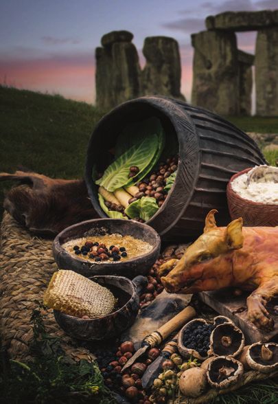
In the Iron Age and Roman period people buried thousands of coins in
hoards across Britain. Was it an attempt to protect the family silver in
times of trouble? The truth may actually be more complex, according
to a major AHRC-funded study.

Buried treasure
T
        here are few archaeological finds that have the magic       Institute for Archaeological Research, University of Cambridge.
        of a hoard of coins.                                        “So we looked at hoards from across Britain.”
           Not only do they hold the promise of new information       With AHRC funding, Professor Bland and his team from the
about our ancestors, they deliver the thrill that can only come     University of Leicester, together with the British Museum,
from discovering buried treasure.                                   compiled a complete and up-to-date database of the
   While thousands of such hoards have been found across            approximately 3,300 known hoards. This is now online and
Britain, until recently the reasons why coins were stashed away     people can query the data in all sorts of ways that wouldn’t
in this fashion have remained mysterious.                           have been possible before.
   The general consensus was that they represented an attempt         “Of course, the big question in all of this is – why are there
to keep wealth from falling into the hands of thieves or raiders,   so many hoards?” says Professor Bland. “And because of that,
a very real risk reflected in the fact that so many hoards were     we were interested in the context in which the hoards were
never recovered because, it was believed, the owners were killed    found. We hoped that this would give us more information.
or carted off as slaves.                                              “We wanted to know why and how they were placed in the
   But a major new study has revealed that the truth may be         ground, in buildings and why they weren’t recovered.
more complex.                                                         “The conclusion that we’ve come to is that there
   “We have known for quite some time that there are a very         are a whole range of reasons. The conventional reason is that
great number of hoards but there was no real contextual             they were buried in times of crisis when people wanted to
overview,” says Roger Bland, a visiting Professor at the            put their valuables in the ground because they were afraid
University of Leicester and Senior Fellow of the McDonald           of criminal attack.” However this wasn’t always the case and

The Hallaton Iron Age hoards                                             A map of all Iron Age
showing the position of 14 separate                                      and Roman coin
deposits buried in the entrance way                                      hoards from Britain
                                                                         and Ireland

10                         New research into hoards
Professor Bland now believes there were a whole range of “I think the most interesting aspect of it all is in the detail
reasons and a significant number were placed in the ground for we are now able to provide. Through the study we were able
ritual purposes. to physically locate where these hoards were found in the
“We know this through a better understanding of [hoard] landscape. In a few cases, we were also able to do geophysical
positions in the landscape,” he says. surveys at the site .”
“The majority were not placed in ‘hidden places’. They were One of the largest hoards found in the UK was the Frome
placed in quite conspicuous places instead.” Hoard: a collection of more than 52,500 Roman coins found in
For example, there are a whole range of hoards from the Iron a field in Somerset by a metal detectorist. He reported his find
Age from Leicestershire that date from roughly the same period without digging it up which meant that archaeologists could
and were found very close to each other. “There’s no way that excavate it and find out more about how it was deposited.
14 different hoards could have been buried together in roughly “What we were able to do is look at the context, and once
the same place over a short period of time for safe keeping. again it was on the side of a hill and not a ‘hidden place’,” says
It just doesn’t make sense,” says Professor Bland. Professor Bland. “There was a wooded valley below which
“There’s no way the person who deposited one couldn’t would have been a better place to hide something, if that was
have known there were others; so they must have known other the aim.
people were doing it. My conclusion is that it was a sacred place. “We were also able to do a geophysical survey at the site.
“We have also been able to demonstrate that quite a Our investigations revealed a previously unknown settlement
significant number of hoards were buried near watery places, nearby. All of which go to help us understand where these
such as rivers, which we have long-known were at the time hoards were located and what that can tell us about why they
regarded as ‘special places’. were deposited.
“Hoards are a very conspicuous phenomenon from the Roman
“There’s no way that 14 different hoards could have period and there is a great deal of public interest in them – they
been buried together in roughly the same place are buried treasure, after all.
over a short period of time for safe keeping. It just “But they also tell us quite a bit about life in the Roman period
doesn’t make sense. ” and they are our main source of coins for the period. They show
us the scale of coin production in the Roman period and reveal
“What we have got out of this project is a much better something of the religious life of people in Britain at the time.
understanding of what hoards mean; no other country has done “There was clearly a lot of borrowing and lending of money.
this and looked at the context of hoards in this way. We have a huge number of documents referring to debts being
“In addition, coin hoards have usually been studied by paid or not paid.
experts in numismatics [the study or collection of currency and “Money was very important in Roman and Iron Age Britain
related objects], rather than archaeologists, and this project has and the way they used that money reveals much about life at
been important in bringing the archaeological perspective into that time.
the frame.
The Frome hoard of
52,500 coins of the 3rd
century AD in the pot
in which it was buried
before excavation
© Somerset
County Council
The archaeologist’s
drawing of the pot in
the ground and the
layers in which the
coins were recovered
New research into hoards 11They are iconic elements in our historic landscape: many are lonely
hills, looming and visible for miles around. However until recently,
surprisingly little was known about the thousands of so-called hillforts
that are scattered across the UK and Ireland.
The big picture
F
or a start, even the name ‘hillfort’ is misleading. of the team, we initially only had funding for three years, but we
Many of these sites aren’t actually on hills and needed them for longer. It’s easy to underestimate the scope
most probably aren’t even forts. It’s now thought and scale of a project like this.”
unlikely that their primary purpose was military and they were There was also a big citizen science element to the project,
probably some kind of central place where a dispersed rural which Professor Lock describes as “very rewarding”.
population could gather at significant moments. But quite “The whole team is very grateful to the AHRC,” he says. “They
when, and what for, remains unknown. were fairly hands–off, which is good. But when the project came
But now a detailed online atlas funded by the AHRC, has for to an end they picked it up as something of public interest and
the first time, drawn together the locations and details of the organised a massive publicity campaign, which was brilliant.
UK and Ireland’s 4,147 hillforts. “We were featured across the media and that got the public
The research project was led by Professor Gary Lock, interested and engaged. The web stats for the first week were
Emeritus Professor of Archaeology at the University of Oxford, really incredible. It was a wonderful feeling to see the public
and Professor Ian Ralston from the University of Edinburgh. engaging with our work.”
“The first reason we decided to compile this atlas was because To access the hillforts atlas visit: https://hillforts.arch.ox.ac.uk/.
these are popular monuments in the public mind,” says
Professor Lock.
“A lot of people visit them, they walk their dogs there, and
play with their children on them. They are often located in
beautiful places.
“The second reason is that these are monuments that
are integral to Iron Age studies. We need to know more
about them. The third reason is simply that it is very hard to
access information about them at the moment. If you want to
look at any scale larger than an individual site then it’s very hard
to do so.”
Professor Lock says that while there were some national
records, they weren’t in a form that was easy to use, and it was
very difficult to get access to comparable information across
national borders.
The new atlas is built on a colossal collection of data.
Lurking behind the URL is information harvested from
pre-existing sources, site surveys and library research – all
carefully formatted so that it is coherent and broken down into
the same characteristics.
“One of the really great potential uses of the dataset is that
it is easily downloaded as a CSV file meaning that you can
run it through whatever database you are using, or through
Geographic Information Systems (GIS),” says Professor Lock.
“It is the beginning of a whole new era of research and will
allow us all to compare work on a local, national and even
international scale.”
Professor Lock says that one of the most important lessons
he has learned from undertaking a project at this scale is that
it’s essential to allow plenty of time.
“It takes a lot longer than you think it will,” he says. “For some
Professor Gary Lock, Emeritus Professor of Archaeology
at the University of Oxford
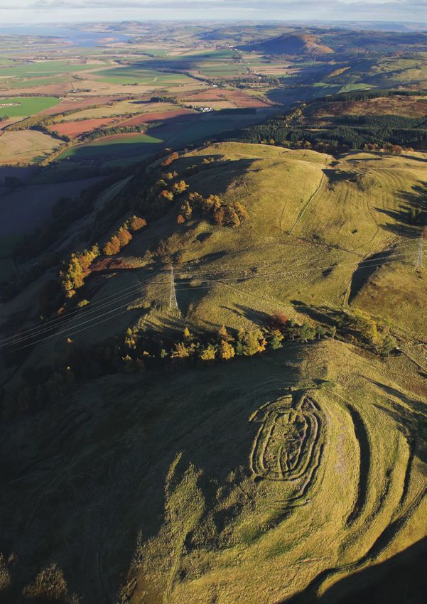
12 Atlas of hillfortsCastle Law hillfort in Midlothian, one of
the thousands of hillforts in the UK
Photo courtesy Kieran Baxter
Atlas of hillforts 13The AHRC has funded pioneering 1
archaeological research all over the 2
world, from Sudan to Scotland. Here 4
are some of the most fascinating
examples told from the Principal
Investigators (PI).
3
Around the world
1 Alaska 2 Scotland’s Rock Art Project
Our AHRC funded project has been undertaken in constant Prehistoric rock carvings are a unique aspect of
consultation with community elders and tradition bearers of Britain’s heritage. Almost 3000 ‘cup and ring’ marked
the Yup’ik Eskimo descendant community near Quinhagak, rocks are known in Scotland, and new discoveries
Alaska. Excavations at the Nunalleq archaeological site have are made every year. The carvings, which probably date
yielded an extraordinary collection of over 75,000 pieces: full- to c.4000-1800 BC, are arguably our most fascinating and
sized wooden masks, human and animal figurines, hafted tools, enigmatic prehistoric monument, yet they are neglected and
leather clothing, grass baskets, bowls, kayak parts, weapons, poorly understood.
game pieces and much more, all in nearly pristine condition. The Scotland’s Rock Art Project is the first major research
It is likely the largest such collection ever recovered from a programme to focus on prehistoric carvings in Scotland.
single site in Alaska and perhaps from arctic North America. Our aim is to raise knowledge and awareness of the carvings
Bioarchaeological remains: fur, hair, feathers, seeds and insects through community co-production and research. We have
have also shed light on climate change in the Yup’ik past that ten trained Community Teams gathering detailed information
inform community decisions today. In the summer of 2018 the and creating 3D models of rock art across the country.
collection was returned to the newly constructed Nunalleq Information co-produced with our teams forms the basis of our
Culture and Archaeology Center in Quinhagak, where a research, and is publicly accessible via our dedicated website:
conservation lab has been operational since 2017. A number of www.rockart.scot.
spin-off projects have continued to build on this project, most We are fostering wider understanding of the rock art by
recently a Major Research Grant which will fund publication of sharing our research outcomes with professional and public
the results of this very successful project. audiences. Increasing knowledge, empowering communities,
and enhancing social value have immense potential for inspiring
Dr Rick Knecht research and creativity, improving sustainability, and promoting
University of Aberdeen the international profile of Scotland’s rock art.
Tertia Barnett
University of Edinburgh
3 Je Landscapes
The Je Landscapes project revealed how the expansion of South American forests dominated by the iconic
monkey puzzle tree (Araucaria), thought to be a pristine wilderness, were actually spread by the ancient
southern proto-Je communities around 1,000 years ago. In a region that was previously considered marginal to cultural
developments, our excavations also showed how these groups built sophisticated sacred landscapes characterised by burial mound
and enclosure complexes, following principles of social dual organisation, that lived in large, permanent pit house villages while
practising a mixed economy combining foraging and agriculture. The results of the project have implications for conservation
showing that the very biodiversity that we want to preserve in this critically endangered forest is not just the result of millions of
years of natural evolution and climate change, but they have an important human footprint that should be taken into account.
Professor José Iriarte
University of Exeter
14 Around the world5 Sudan
The Sustainability and subsistence systems in a changing
Sudan project explored how comparisons of present-day
and ancient crop choices can inform risk management
within agricultural strategies along the middle Nile Valley.
6 Archaeobotanical analyses at the ancient island town of Amara
West and ethnoarchaeological research, focused on nearby
5 Ernetta Island, provided insight into cultivation practices and
the impact of environmental change. Interviews with Nubian
farmers revealed changing agricultural practices since the mid-
twentieth century. Several crops that were important until
recent decades are more arid tolerant than newer cash crops
and have long histories in the regional archaeobotanical record,
suggesting their environmental suitability. A community-
orientated book Nubia Past and Present, Agriculture Crops and
Food was created and distributed as part of AHRC-GCRF Follow-
on Funding for an impact and engagement project, which aims
to preserve local agricultural histories and ecological knowledge
for future generations.
4 Glastonbury Abbey
Dr Philippa Ryan
Glastonbury Abbey is internationally renowned as the British Museum
site of the earliest church in England and the legendary
burial place of King Arthur. 36 seasons of archaeological
excavation took place between 1904-79, but the results
were never published. This impeded academic understanding 6 Jordan
of the significance of Glastonbury but also limited public
interpretation at a heritage site visited by around 100,000 Wadi Faynan is a remarkable archaeological landscape that
people each year. AHRC funding enabled full analysis of the has been explored by research teams from Germany, the
entire archive of antiquarian excavations in a collaborative US and the UK during the last half century. This has made
project led by Roberta Gilchrist of the University of Reading, a significant contribution to our understanding of the Levant,
and the trustees of Glastonbury Abbey. The project included with particular regard to the origin of farming, the development
the full analysis of the archaeological collections by 31 leading of metallurgy and desert-based Roman farming systems.
specialists, including scientific analysis of glass, metal, pottery Recent AHRC-funded research has made this work available
and tile, radiocarbon dating and a comprehensive geophysical to the local community and ensured that it is used to support
survey. The aim was to set aside previous assumptions based on economic development via heritage-related eco-tourism. It
the historical and legendary traditions and to provide a rigorous supported the development of a local museum by constructing
reassessment of the archive of antiquarian excavations. a model of the landscape with archaeological sites located,
The research provided new evidence for the scale and providing museum displays and a guidebook, as well as a film
significance of the Anglo-Saxon monastery and the later about the Neolithic archaeology.
medieval abbey. Among the most important findings are new Further work has explored the various associations with
evidence for occupation dating to the 5th or 6th centuries birds in the region, particularly in the Neolithic: as sources of
and the re-dating of the unique glass furnace complex to the food, symbols of power, and as inspiration of art and music.
late 7th century (previously believed to be 10th century). The This involves the analysis and interpretation of bird bone
research refutes previous claims for a pre-Conquest cloister assemblages from two early Neolithic sites and a review of
that was allegedly the earliest in England, and the reputed all evidence relating to people-bird relationships from the
exhumation site of the grave of King Arthur. It also revealed Neolithic to the modern era, as contained in archaeological
distinctive features associated with the abbey’s legends, notably material and historical documents. The projects involve close
a sustained ritual focus on the presumed site of the ‘old church’, collaboration between UK-based archaeologists and Jordanian
believed to have been founded by Joseph of Arimathea, and the ornithologists, and will help support bird conservation in Jordan
associated burial ground connected by legend to King Arthur. by bringing attention to the value of people-bird relationships
These combined findings have immediate implications for the and the current depletion of avifauna in the region.
public presentation of the site.
Follow-on funding from the AHRC enabled digital Professor Steven Mithen
reconstructions based on the research findings, together University of Reading
with a new guidebook and educational resources. The
research is fully open access.
Dr Roberta Gilchrist
University of Reading
Around the world 15New ways W
hile in the popular imagination being an
archaeologist is all about the dig, in many ways
the real work only begins when they return
from the field to make sense of all the bags and boxes of
of seeing
ceramics, soil samples, bones, lithics and other detritus of
human civilization.
This has always been a painstaking, labour intensive process.
But now digital technology is changing the way sites are
recorded and how post-excavation analysis is conducted,
giving archaeologists new tools to find out more about the lives
of our ancestors.
The AHRC-funded Fragmented Heritage project introduces
new technology that dramatically improves the analysis
of sites and fragmentary materials seen through a number of
Digital technology is case studies.
This includes new ways of refitting artefacts within sites and
revolutionising the way the wider landscape to identify and connect widely-spread sites
and material.
archaeologists and heritage “Across a wide range of applications, the Fragmented Heritage
project has been providing new capacity to work at an increased
scientists work by giving them level of detail, scale – and with greater efficiency. And because
it is more efficient, we can do more,” says Professor Andrew
the capacity to operate at an Wilson, Co-Director of the research group Visualising Heritage,
who is leading this work from the School of Archaeological &
increased level of detail, scale – Forensic Sciences, University of Bradford.
The project aim was to develop multi-scalar applications
and with greater efficiency. of digital technologies in support of greater efficiencies in
archaeology. “And a lot of that was embodied in what we
see with lithics and lithic technology [stone tools],” says
Capture of high resolution drone imagery (as part of the FossilFinder Professor Wilson.
project) examined by citizen scientists for bone fragments, lithics and The analysis of lithics has potential to become bogged
other environmental evidence down by the sheer volume of finds. For example, at the Lower
Palaeolithic site of Boxgrove in southern England, the finds
went through traditional analysis in the 1980s and 1990s.
This yielded evidence of animal processing using stone tools
– butchery practices by some of the earliest occupants of the
British Isles.
“This told us an awful lot about the site and what went on
there, but was obviously also very labour intensive”, says Dr
Adrian Evans, Co-Investigator and Project Manager.
“When we scanned this assemblage in collaboration with
the British Museum and applied both automated and semi-
automated digital refitting to the same finds, we were able
to find more refits and derive additional meaning from the
assemblages than was previously known. And this is something
we have found time and time again: by looking back at
previously-analysed assemblages using new technology, we
see and learn far more than we have historically been able to
identify using more traditional methods.”
Similar exciting results have been made possible when
the project team collaborated with archaeologists and
palaeoenvironmentalists based at the Turkana Basin Institute in
northern Kenya.
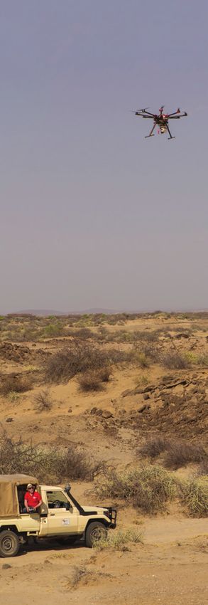
The project team used an octocopter drone to take high
resolution photographs of the landscape and invited the public
to help the team interpret these as part of the FossilFinder
citizen science component to the project.
“We can provide a more systematic approach to traditional
archaeological techniques such as field walking,” says Dr
Adrian Evans. In this part of Kenya the terrain is challenging for
conventional field walking, with a lot of dry river valleys and
scrub vegetation. But the drone enabled us to map the ground
16 Fragmented heritage: digital reconstructionVaried image coverage seen in the first 6,500 web-scraped images, taken both inside and outside Notre-Dame de Paris prior to the 2019 fire, is shown relative
to the present-day street plan of Paris and pointcloud data for the Cathedral
Camera positions frame the original locations and different camera/lens characteristics seen in web-scraped imagery, enabling digital reconstruction of
heritage sites damaged in the 2015 earthquake in Kathmandu, Nepal
surface and then, with the aid of citizen scientists, look at structures and archaeological landscapes, or at the micro
scouring this surface for rocks and fragments of bone that were scale and studying the surface of stone tool fragments, digital
out of place, as key indicators of the ancient environment. technology presents a huge suite of new capabilities.
“With the discovery of fragments as small as tiny fish “Given that each heritage site and archaeological assemblage
bones and small teeth, we have learnt more about the has different requirements, we need to build flexibility into
ancient environment.” our toolkit, and that’s what Fragmented Heritage has been
The related Curious Travellers component to the project about: developing capabilities and extending reach,” says
draws on collaborations with St Andrews, Birmingham, UNNC Professor Wilson.
and Durham universities. It was stimulated by destruction in “There is no one-size-fits-all approach when it comes to digital
2015 by ISIS forces of parts of the ancient city of Palmyra and heritage, and that’s what we have sought to develop within the
by the catastrophic earthquake in Kathmandu the same year, team: a wide-ranging toolkit that can be adapted as needed to
but is also seen with the dramatic fire that more recently took best serve the conservation, interpretation, presentation and
hold at Notre-Dame de Paris. access needs for heritage.
“These terrible events prompted us to look at how, with the “With this digital legacy comes huge potential for gaining
help of crowd-sourced imagery and web-scraped imagery, we new insight into the past and for impactful new ways of using
could repurpose extant photographs to reconstruct lost detail,” this knowledge alongside present-day need.”
says Professor Wilson.
But the project was not simply concerned with visual
recording, the team also wanted to ensure that these
images coming from disparate sources produced good,
accurate measured 3D data as well, to ensure that the value
of digital documentation serves as an important pillar of
conservation practice.
“We obviously want to move beyond simply having visually
interesting 3D models to having something that we can really
learn from, something that can provide remote access to places
that are hard or unsafe to visit,” says Professor Wilson. “And
where heritage is at risk from, or has suffered from human
destruction or natural disaster, we can also aid reconstruction Seen in virtual reality a meshed 3D model using crowd-sourced/ web-
work and support sustainable development.” scraped imagery has been used to reconstruct the Temple of Bel that was
So, whether working at the macro scale and looking at destroyed by ISIS in 2015
Fragmented heritage: digital reconstruction 17How can archaeologists make sense of the huge
amount of raw data now available to them about our
ancestors’ lives? The answer, according to one AHRC
funded project, is through the power of citizen science.
Strength in numbers
A
rchaeology, like a lot of subjects, has been them – we were able to create something genuinely useful.”
experiencing a surge of new information and data The database, which is a collaboration between University
over the last five to ten years. College London, the British Museum, the Fitzwilliam Museum
“It started earlier, in the 1990s, when it became a condition and the University of Stirling in Scotland, complements and
of planning permission that developers fund archaeological extends existing records such as the UK Portable Antiquities
research, if necessary, which led to an absolute flood of Scheme, allowing researchers to map finds. They can also
reports from commercial archaeologists,” says Andrew Bevan, compare types of finds and the scale of finds.
Professor of Spatial and Comparative Archaeology at University For example, it’s possible to look at gold items versus
College London. bronze items and compare high status finds with more
“But more recently, technological advancements, such as utilitarian metalwork.
databases and more efficient geophysical equipment, have
created a whole new tranche of data.” “We didn’t want to ask members of the public to
This huge mass of data clearly has huge relevance for help with just one project, we wanted to create a
academics; the challenge is how on earth to make sense of it all platform where researchers from large and small
while faced with limited time and resources. organisations could put up some kind of small
“While traditionally you might suggest a PhD student or project and ask for help with some aspect of
post-doctoral student might research, collect and synthesise data collection. ”
evidence on a topic on their own, that is not always viable,” says
Professor Bevan. “A lot of people have got involved, and they seem to have
“However, in the wider academic world, citizen science and enjoyed themselves – to the extent that many seem to have
public involvement at scale is increasingly being seen as a way of been inspired to further involve themselves in local groups or
making sense of large datasets, and it’s against this background take archaeology courses and degrees,” says Professor Bevan.
that the AHRC-funded ‘MicroPasts’ work took place.” Many institutions and community groups have now got
Professor Bevan was sure that there was a place for citizen involved in various citizen science projects, including the Mary
science in archaeology, particularly as it has such a long history Rose Trust and the Egypt Exploration Society. There’s even a
of volunteering. project currently running looking at the links between Iron Age
“We didn’t want to ask members of the public to help and Roman history and its links to current events, such as Brexit.
with just one project, we wanted to create a platform where In addition, one of the understandings of all of these projects
researchers from large and small organisations could put up is that, if people are offering their time for free, what they
some kind of small project and ask for help with some aspect of discover should be publicly-available, for free, for all researchers
data collection,” he says. to use.
The project began in late 2014 with a grant from the AHRC “We’ve been trialling different ways of doing things – different
and the remit to explore crowd-sourcing and crowd-funding. ways of recording, georeferencing, tracing images…” says
The aim was to explore if there was a platform that could help Professor Bevan.
community groups find help with things like transcription or “Over the coming year we are hoping to get help with coin
digital model creation. recording, which is interesting because traditionally this is a
Each project template was meant to be reusable for similar highly specialised task requiring a high level of expertise.
projects in the future and the platform also needed to be “But we think that there are ways to supplement that
self-sustaining. specialist effort with enough people looking at the data and
“We have now completed some core projects, including a cross referencing what they see. It’s early days as an idea, but it
big one to assist the British Museum by transcribing a huge old might lead to some really good, novel conclusions.”
card catalogue containing a massive 20,000 - 30,000 records
detailing all the Bronze Age artefacts found in Britain,” says
Professor Bevan.
“By putting these into a database – and not just scanning
18 ‘Micropasts’: Crowd- and Community-fuelled Archaeological ResearchChecking objects in the Reference cards courtesy of the Department of Britain,
British Museum Collections Europe and Prehistory at The British Museum
Dr Adi Keinan-
Schoonbaert
worked on the
crowdsourcing
initiative
MicroPasts as
a postdoctoral
researcher
‘Micropasts’: Crowd- and Community-fuelled Archaeological Research 19Excavation of a skeleton from the cemetery of the medieval Hospital of St. John, Cambridge Photo courtesy the Cambridge Archaeological Unit 20 The future of archaeology research
The future of
archaeological
research
Carenza Lewis
Professor for the Public Understanding of Research, University of Lincoln

A
        rchaeology is well-suited to 21st century research.               Refining dating techniques such as luminescence or
        Its interdisciplinary scope and capacity to advance            rehydroxylation may provide increasingly accurate dates for
        understanding of the human condition and                       features and artefacts ranging from flood deposits and irrigation
processes of change over different scales and timespans                systems, to bricks and even single sherds of pottery. Knowing
render its insights increasingly important in a changing               more precisely the order of past events would illuminate long-
globalised world, and it is certainly a subject of high public         term patterns of cause and effect, advancing our understanding
interest. But archaeological research is also more expensive           of human responses to phenomena such as epidemics,
than most humanities subjects and less self-evidently socially         urbanism, migration or climate change.
beneficial than many science subjects, so it will need to be able         We should hope that future research will encompass
to demonstrate its value.                                              previously overlooked areas. Archaeologists have been thinly
  Heritage research is likely to be particularly important in          spread across much of Africa and Asia, and urgently in Polar
the future. Recognising the need for responsible research and          Regions; climatic warming is destabilising deposits frozen for
nurturing the current trend for co-produced, publicly engaged          millennia. Less remote but often equally overlooked, are lands
research, archaeologists will surely want to prioritise the            swamped by today’s cities, towns and villages over the last 200
exploration of new and better ways of beneficially connecting          years; and also the lives of people outside a narrow spectrum of
people with the past, of protecting heritage assets and of             gender, class, ethnicity, age and ability.
protecting society from abusive use of the past.                          Digital technology will have a profound impact. Using new
  Future archaeological investigation is likely to be less invasive.   approaches, including artificial intelligence, to collect, manage
Harnessing increasingly sophisticated remote sensing methods           and interrogate ‘big data’ generated by archaeological research
to record fractional variations in colour, moisture, temperature       to elicit reliable, nuanced understanding, ranging from sub-
and electromagnetism entirely invisible to the human eye,              atomic to planetary, as well as to store information and to share
caused by remains ranging from single burials to entire cities         outcomes with wider society, will surely be at the forefront of
now shrouded by vegetation, water or overlying landforms, has          archaeological research.
potential to revolutionise our understanding of past human use            Overall, intelligent, connected and interdisciplinary
of apparently virgin landscapes.                                       archaeological research should be increasingly able to
                                                                       address fundamental questions, advancing knowledge and
  “Knowing more precisely the order of past events                    understanding of the character and consequence of human
    would illuminate long-term patterns of cause and                   life on our planet, from the long-term perspective that only
    effect, advancing our understanding of human                       archaeology can offer – to help build resilience for the future.
    responses to phenomena such as epidemics,
    urbanism, migration or climate change.       ”
  Likewise, the increasing sophistication of other scientific
techniques will help advance knowledge while causing minimal
damage to archaeological evidence, especially if exploring
existing archives, many of which contain material yet to be
analysed or synthesised. Techniques from biology, chemistry
and physics such as dental, isotope or DNA analysis could
transform our understanding of past identity, disease, contact,
exchange, innovation and mobility at scales ranging from
individual life-courses to continent-wide change over centuries.
Improving understanding of how pathogens such as plague
have developed and mutated in the past, might even help arm            Professor Carenza Lewis
us for the future.

                                                                                       The future of archaeology research             21
You can also read