SUBGLACIAL ACCESS WORKING GROUP
- GLACIAL HISTORY
←
→
Page content transcription
If your browser does not render page correctly, please read the page content below
SUBGLACIAL ACCESS WORKING GROUP - GLACIAL HISTORY

SUBGLACIAL ACCESS WORKING GROUP

GLACIAL HISTORY SUBGROUP
▸ Detection of exposure events (i.e., marine based ice sheet collapse, large-scale
  melting)

▸ Recovery of rock core for cosmogenic nuclide and luminescence
  measurements

▸ Dating of basal ice

▸ in situ observations (e.g., heat flow)

▸ Underlying geologic and geophysical properties, including rock collection
SUBGLACIAL ACCESS WORKING GROUP

TARGETS - ANTARCTICA
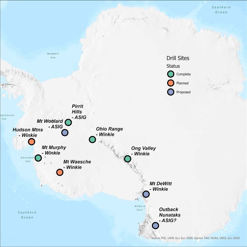
▸ Mt Waesche (active)
▸ Wilkes Subglacial Basin/Outback Nunataks (reconnaissance
field season planned)
▸ Mt Woollard
▸ Mt Murphy/Hudson Mtns (active)
▸ Ohio Range (complete)
▸ Mt Resnik (dreaming)
▸ Dronning Maud Land (dreaming)
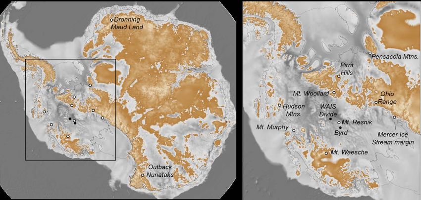
Figure 1. Map of the subglacial topography of Antarctica (Fretwell et al., 2013). Grays represent areas
▸ Mercer Icebelow
StreamseaMargin
level; oranges represent areas above sea level. Circles represent sites mentioned in the text.
(dreaming)
From Spector et al., 2019
▸ PensacolaWas
MtnsWAIS
(dreaming
smallerand
than present during the Holocene? The recent discovery of radiocarbon in till from
Brits)
beneath the Siple Coast ice streams (Kingslake et al, 2018) and evidence of Holocene grounding-line
fluctuations in the Weddell Sea (e.g. Siegert et al., 2013) have focused attention on grounding-line
stability and the ability of the WAIS to recover from a reduced state. Further afield, there is evidence
Figure 1. Map of the of
subglacial topography of Antarctica (Fretwel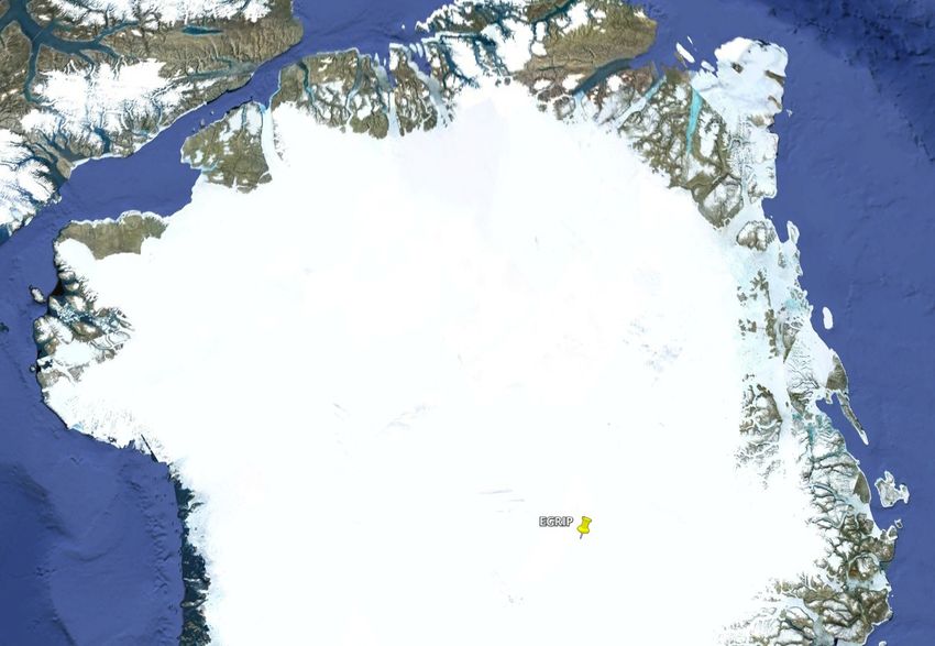
SUBGLACIAL ACCESS WORKING GROUP TARGETS - ANTARCTICA
SUBGLACIAL ACCESS WORKING GROUP

TARGETS - GREENLAND
                                              Camp Century
▸ Northern GIS Margins

  ▸ NW Greenland (active?)
                                                       GISP2
▸ Iceland Hotspot track

▸ Northeast Greenland Ice Stream region

▸ west flank of eastern ranges (initial ice
  inception?)
Station Nord

                                                                                                   AISG Drill site:
                                                                                                   500-300 m ice
                                                                                                   thickness.
                                       3: Victoria Fjord,
                                       C.H. Ostenfeld Glacier                                      Winke Drill
                                                                                                   site: 100 m ice
        2: Near Hiawatha Crater                                                                    thickness
  1: Prudhoe “Dome”
                                                                                                   Shaw Drill
                                                                     4: Dronning                   sites: pro-
                                                                     Louise Land
                                                                                                   glacial
Thule
                                   GreenDrill                                                      landscape
                                   4 Transects
                                  (at each: ASIG, Winke, Shaw)
                                                                                                  We will target
                                                                                                   4+ m-long
                                                                 EGRIP
                                                                                                   rock cores

                                                                                                   Courtesy: Joerg Schaefer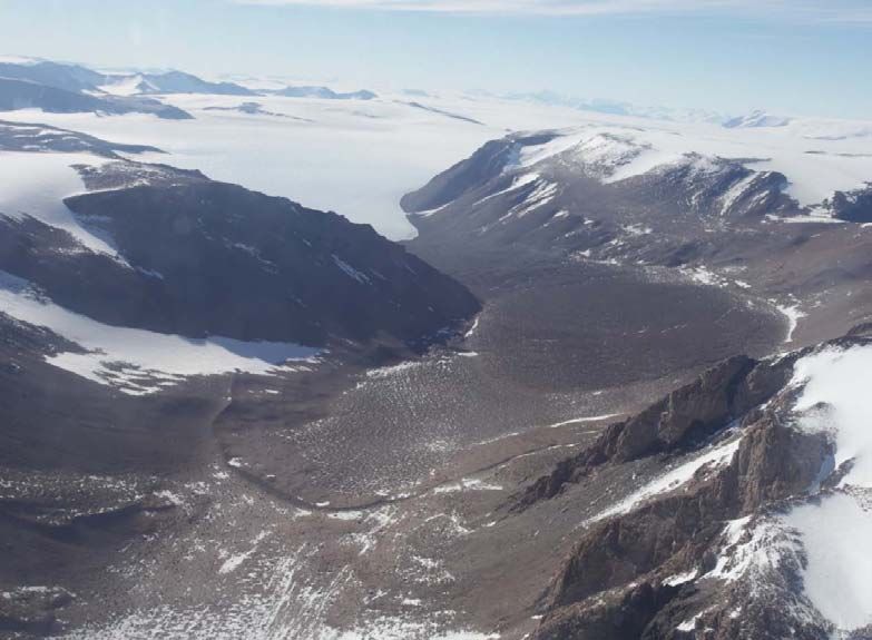
ASIG

                      nt                        cene        e
                    se                     -Holo        IS 5
                 Pre                    Mid            M
  Winke

Shaw

   14C    36Cl   26Al   10Be   21Ne

                                                           Courtesy: Joerg Schaefer
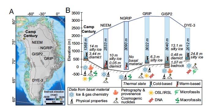
SUBGLACIAL ACCESS WORKING GROUP

CAMP CENTURY - CHRIST ET AL., 2021

SUBGLACIAL ACCESS WORKING GROUP

UPDATES FROM THE FIELD (HA!) AND LAB
▸ Mt Murphy, West Antarctica

▸ Pirrit Hills

▸ Ohio Range

▸ Ong Valley
SUBGLACIAL ACCESS WORKING GROUP

MT MURPHY
SUBGLACIAL ACCESS WORKING GROUP

MT MURPHY
▸ Initial measurements underway, with some early results

  ▸ in situ ¹⁴C, ¹⁰Be, ²⁶Al, 36Cl

  ▸ IRSL

▸ Ice core analyses planned for summer 2021

▸ Till analyses TBD
SUBGLACIAL ACCESS WORKING GROUP

PIRRIT HILLS

               Credit: John Stone
SUBGLACIAL ACCESS WORKING GROUP
OHIO RANGE
▸ Measurements complete
▸ Results somewhat inconclusive, but suggests relatively recent exposure (ice
thinning) and more exposure than burial
▸ in situ ¹⁴C measurements planned
▸ Manuscripts in preparationabout ancient life forms and atmospheric chemistry of To obtain additional constraints on the age, origin, and sublimation rate of the ice, we
We want to know: 10
measured concentrations of the cosmic-ray produced nuclides Be, Al, and Ne in 26 21
million-year-old atmosphere. englacial sediment in one core. These nuclides are produced by cosmic-ray
• Age of the ice interactions with minerals near the Earth’s surface. As the production rate decreases
SUBGLACIAL ACCESS WORKING GROUP rapidly with depth below the Earth’s surface, nuclide concentrations can yield
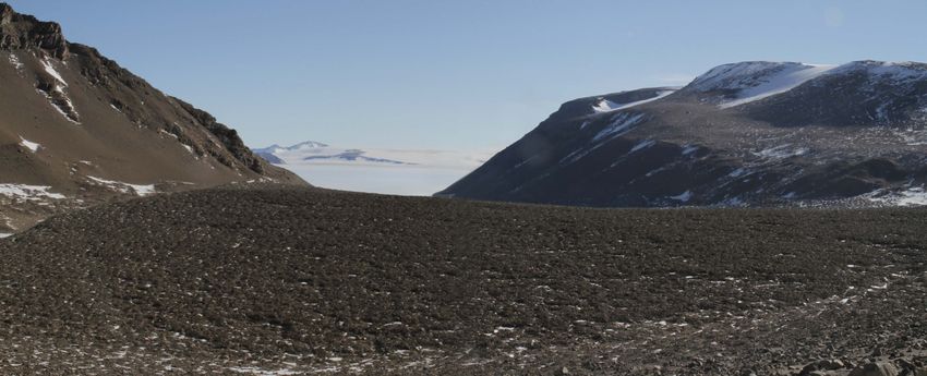
Ong Valley
information about the sediment source (e.g., subglacial or supraglacial), the age of Argosy Glacier
• Ice sublimation rate the ice, and the rate at which the till is forming due to ice sublimation.
Large downcore variations in nuclide concentrations and ratios show that englacial
Ong Valley Argosy Glacier
• Till erosion rate sediment includes both subglacially derived sediment and sediment that was
previously exposed at the surface and most likely incorporated into Over the past million years, Argosy glacier has
the ice during
glacier advance into Ong Valley. Nuclide ratios in this recycled surface sediment are
advanced and expanded into Ong Valley leaving
• History of the ice mass 3
ONG VALLEY
well below production ratios but vary among different sediment horizons, indicating
Over the past million years, Argosy glacier has that englacial sediment has a complex origin involving multiple episodesbehind debris and till during deglaciation. Three
of recycling
advanced and expanded into Ong Valley leaving 3 and mixing. We will discuss constraints on the age, origin, and sublimation rate of the
periods of advancement have previously been 2
behind debris and till during deglaciation. Three buried ice derived from these observations.
periods of advancement have previously been 2 observed 1
observed 1
• Youngest < 0.2 Ma
• Youngest < 0.2 Ma
• Middle > 1.1 Ma
HOW? 4m 5m
• Middle > 1.1 Ma
• Oldest > 2.6 Ma • Oldest > 2.6 Ma
eing COSMOGENIC NUCLIDES are rare isotopes that are being
high produced in rock near or at Earth’s surface through high
pact energy cosmic rays. These high energy particles impact
uces COSMOGENIC NUCLIDE CONCENTRATION
in the ice and producesAT DEPTH COSMOGENIC NUC
21Ne
used
e of
RESULTS minerals such as quartz suspended
the cosmogenic nuclide isotopes 10Be, 26Al and 21Ne
Therefore the concentration of these nuclides can be used RESULTS
In THEORY, if the ice mass has been Till
to determine the age, sublimation rate and erosion rate of
exposed in Ong valley for > 1.1 Ma, Ice
the ice and till In THEORY, if the ice mass has been Till
rate
into
thin
with sublimation and erosion occurring we A KEY to this method is that the cosmic rays only penetrate exposed in Ong valley for > 1.1 Ma , Ice
expect a decrease in nuclide concentration a few meters through Earth’s surface and in this case into
epth with sublimation and erosion occurring we
tion with depth following the simple model the overlaying till as well as the suspended materials within
line (blue line). expect a decrease in nuclide concentration
the buried ice. Isotopic concentrations decrease with depth
and provides a mean for estimating age and sublimation with depth following the simple model
eep)
well rate of the ice. line (blue line).
l. So BUT we see an increase in cosmogenic
and nuclide concentrations at the bottom of We collected one ice cores of the buried ice (~ 10 m deep)
the ice core, which is incompatible with the from two separate drill sites for a total of two core, as well
simple model as samples of the thin (< 1 m) overlaying sublimation till. So BUT we see an increase in cosmogenic
far, we have measured the concentration of 10Be, 26Al, and nuclide concentrations at the bottom of
21Ne in the englacial sediment in one of the ice cores
the ice core, which is incompatible with the
Mixing of previously exposed surface till simple model
with englacial sediment in ice during glacial
advancement into Ong Valley can explain
the observed concentration better than the Quartz grains
simple model
in buried ice
Mixing of previously exposed surface till
Potentially >> OLDER ICE with englacial sediment in ice during glacial
advancement into Ong Valley can explain
at the bottom 16O 10Be
the observed concentration better than the
26Si 26Al , 21Ne simple modelSUBGLACIAL ACCESS - PAST ICE EXTENTS
FUTURE TARGET? - MT RESNIK
environments in the past, and may continue to harbor subglacial microbial life in an environment more
extreme than the recently-explored habitats near the present-day grounding line (Christner et al., 2014).
The possibility of active volcanism also suggests an elevated geothermal heat flux, which may affect ice
flow and water production at the base of the present-day WAIS. These scenarios can be tested with an
interdisciplinary project that combines (i) analyses of subglacial bedrock and basal ice to search for
evidence of past exposure; (ii) petrologic and geochronologic measurements to determine the lithology
and eruption age of presumed volcano; (iii) clean-access sampling designed to reveal whether a microbial
ecosystem persists beneath the ice; and (iv) geophysical measurements to determine the geothermal
heat flux and detect seismic activity.
Figure 2. Radargram showing subglacial Mt. Resnik. Ice flow is from right to left. Credit: University of
Courtesy UTIG
Texas Institute for Geophysics.
Dronning Maud Land: F or over two decades, measurements of in situ cosmogenic nuclides from bedrock
and erratics exposed at a range of altitudes on nunataks in both West and East Antarctica have enabled
constraints on past ice thickness fluctuations across the continent. Western Dronning Maud Land (DML)
has been a conspicuous hole in the spatial distribution of measurements to date, yet ice sheet models
predict distinctive ice thickness differences between coastal and inland sites in western DML over
Pliocene to Holocene time frames. Current NSF funding as part of an international collaboration is starting
to remedy that data gap, through analyses of multiple nuclides along coast-inland and coast-parallel
Figure 1. Map of the subglacial topography of Antarctica (Fretwell et al., 2013). Grays represent areas
transects of nunataks. As these data accumulate, suggestions of potential Holocene or earlier exposure
of currently subglacial bedrock surfaces could motivate subglacial drilling studies in key locations using a
below sea level; oranges represent areas above sea level. Circles represent sites mentioned in the text.
Winkie drill.TEXT
WINKIE MODIFICATIONS
‣ FLUID CHILLER
‣ Details to be determined. Warm ambient temps
‣ ASIG style liquid-air system
‣ Salt Bath with liquid-liquid chiller
‣ Dedicated Eclipse borehole for fluid storage
‣ Filter Tank and Mud Pump
‣ Multi-stage filter tank with settling chamber
‣ Rebuild triplex pump and verify flow rate
‣ Eclipse Cutters
‣ Sufficient spare cutters for minimum of one set per borehole
‣ Packer
‣ Determine cause of packer failure - mitigate cause and repair/replace
‣ Hose reel for nylon inflation line
‣ Chip Transport
‣ Drill Runs were hampered by lack of particle transport - across the bit and up the drill string.
‣ CAN THIS BE THE RESULT OF ICE IN THE PRESENCE OF THE HYDROPHOBIC DRILL
FLUID? DOES THE CLAY NATURALLY FLOCCULATE IN THE DRILL FLUID?
‣ Limited testing with surfactants is scheduled prior to the the 2020-21 drill season Icebits NewsletterYou can also read