TEMPEST NEWS | AUGUST 2020 - MENU
←
→
Page content transcription
If your browser does not render page correctly, please read the page content below
MENU

  Posted by Weatherflow ● August, 2020

  TEMPEST NEWS | AUGUST 2020
Today in Tempest Ne ws: A talk with meteo ro lo g ist a nd hurrica ne specia list Br ya n
Norcross about th e s ca riest h u rrica ne mo ment he's e ver ha d, e va cu ati ng du ri ng a
pandemic, and th e da n ger o f a s suming a nyo ne knows how a hurri ca ne w i ll be h a ve .
P lus a look at the ra g in g wildf ires in the West a nd Hurrica ne Lau ra a s th e storm
approaches.

WHERE THERE'S SMOKE

Deadly California wildf ire s have burned over 1 millio n a cres with no end in sig ht a s
13,000 firefighters stru g g le to co nta in the bla zes while mo re conti nu e to e m e rge .
Meanwhile, Colorado is experiencing a do u ble cris is , a s smo ke f ro m the f ires there
combine with particles s pe wed f ro m Ca lifo rnia’s f ires, wo rsening a i r qu a li ty a cros s
the state.

HURRICANE LAURA

Tropical Storm Ma rco wa s downg ra ded to a tro pica l depressio n, bu t Hu rri ca ne
Laura's approach h a s sparked evacuat ion s in parts of Texas a n d Lo u is ia n a a s the
storm rapidly in ten s if ies .

…..with Meteorologist an d Hurricane Sp ecialist Bryan Norcross.

Br yan Norcross is well k n own for his fa ct-ba sed, no -no nsense hu rri ca ne re porti ng . He
has analyzed hurrica n es fo r a n umber o f ne ws o utlets, includin g CBS Ne w s , Th e
Weather Channel, a n d WFOR in Mia mi. Br ya n beca me a beloved fi g u re i n nati ona l
ne ws after his empath etic a n d in-depth covera ge o f Hurrica ne Andre w i n 1 9 9 2 .

We sat down with h im to ta lk a bo ut his sca riest hurrica ne mo me nt , h u rri ca ne
forecasting, and wh y h u rrica n es seem to be getting mo re se vere .
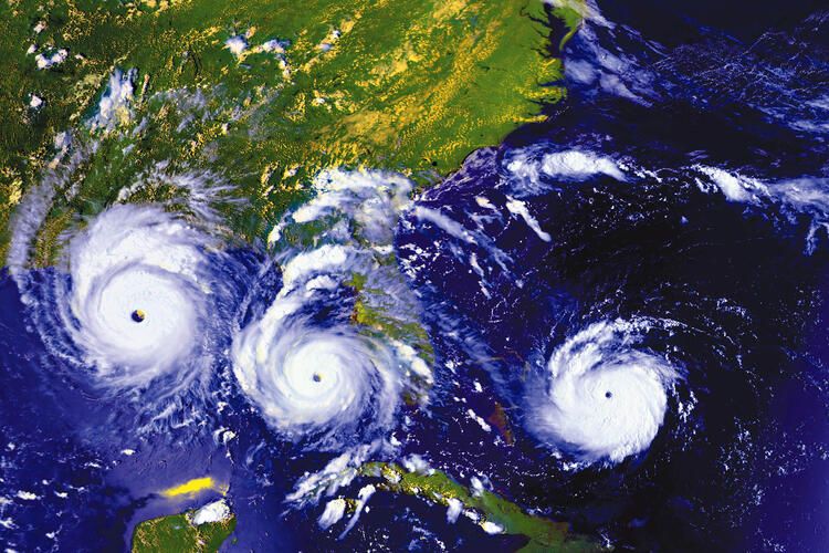
[A timelapse shows Hurricane Andre w from right to left on August 23, 24, and 25,
 1992. One weather station at a private home clocked winds blowing up to 177 mph.
                                 Courtesy of NASA.]

Q : Hurricane And rew took p lace 2 8 years ago. A s Trop ical Stor m L aura an d Marco
are about to make land fall, are the re any similaritie s?

A: Hurricane Andre w mis s ed Miami by 1 2 miles. It wa s a n a ma zing ly clos e ca ll for th e
heart of Miami. Peo ple still live with that memo r y to da y.
Thankfully, Laura is expected to ma ke la ndfa ll late Wednesda y or ea rly Th u rs da y -
some where between Lo u is ia n a a nd Texa s. And it's been downg ra de d to a Categor y 2 .
Still, you have to wo rr y a bo u t h ea vy ra in a nd f lo o ding .

Q : Scientists are p re d icting this could b e the most active sea son on re cord . D o
more hurricane s als o mean hu rricane s are getting worse?

A: Climate scien tists a re mea s u ring a slig ht increa se in the inte ns i ty of powe rfu l
storms, and meas u rin g mo re ra infa ll — so the sto rms a re mo re li ke ly to produ ce
floods. The effect o f in ten s ity cha nge is sma ll co mpa red to the e ffe ct of th e
de velopment of th e coa stlin e. We've hyper-de velo ped the coa stli ne , pu tti ng s o m a ny
people in harm's wa y, a pro blem that ha s gotten pro g ressively wors e .

Storms are in sing le - dig it percent stro nger o n a vera ge, so yes, storm s a re dete cta bly
stranger. But with h u n dreds o f tho usa nds o f peo ple moving here a nd li v i ng i n h i g h
rises on the coa st , th at's th e mo re sig nif ica nt public sa fety issu e th at we don't h a ve
a way to handle pro perly.

The other issue is with climate. Na mely, the sea le vel is rising - th at's a fa ct . A nd th at
makes hurricanes wo rs e n ow th a n in the pa st . When yo u a re sta rti ng w i th h i g h e r
water already, flo o din g is mu ch mo re likely. We a re specta cula r ly m ore v u lne ra ble
now, so when sto rms do co me, the y do mo re da ma ge.

Q : Is it getting eas ie r ( or more accurate?) to p re d ict b ig storm s?

A:Hurricane foreca sts a re better now, the best the y've e ver bee n. Bu t th at's m a i nly
because we have mo re co mpu ting power behind them. Better fo re ca sts a re di re ctly
related to compu ter power a n d getting mo re data . WeatherFlow i s one of th os e
invaluable sources o f s u rfa ce weather data , especia lly since we're getti ng le s s data
from airplanes du rin g COVID .
Forecasts are ne ver go in g to be perfect . We will a lwa ys be pred i cti ng extre m e e ve nts
with a certain le vel o f u n certa in ty. It's the nature o f the atmo sp h e re —i t's
fundamentally un predicta ble.
Q :What do you ad v is e p e op le to d o? Move?
A:Ever ybody needs a pla n , wh ich is e ven ha rder in these COVID da y s . Th e re a re th re e
way s to e vacuate: G ettin g o u t o f town o ug ht to be doa ble, but w i th fe we r a i rpla ne s
flying, it will be a ch a llen ge if yo u wa nt to lea ve by a ir. Other p e ople dri ve a nd go to
hotels, but most peo ple wo u ld typica lly sta y with f riends in a s a fe r locati on. Gi ve n
the desire to rema in s o cia lly dista nt , ma ny peo ple a re relucta nt to sta y w i th
extended family o r f rien ds . It's impo rta nt that yo u a nswer the bi g qu e sti ons : Wh e re
will you and you r fa mily ride o u t a sto rm? How will yo u protect you r prope rty ? How
will you have en o u g h water to drink a nd wa sh a nd f lush the to i let? A nd w h o i s you r
family's point of co n ta ct o u t o f town? A little ef fo rt now will save you a lot of g ri e f
after a storm.
Q :Last question: w hat was the scarie st hurricane mome nt you eve r had ?
A: By far the scariest wa s Hu rrica ne Andre w. I kne w that peo ple we re dy i ng i n D a de
County that nigh t ; th ere wa s n o questio n. That wa s a terrif ying expe ri e nce for m y s e lf
and my city. The co n cern I felt sha ped my repo rting , a nd I wa s i nte nti ona lly ve r y
clear about what wa s h a ppen in g so the co mmunity co uld prepare , or at th e ve r y
least , anticipate. I o f fered s u g gestio ns to help citizens sta y sa fe , a nd I a m h a ppy th at
so many people were a ble to do j ust that . To this da y, peo ple s a y, 'You s a ve d m y li fe .
You said to get un der a mattres s , a nd a f ter I did, the winds bro u g h t dow n m y
bedroom wall.'
Nobody knows wh at's go in g to h a ppen when a hurrica ne a pproa ch e s . Eve r y h u rri ca ne
is different . The fo u r stro n gest hurrica nes e ver to hit the U.S. i n th e 2 0 th ce ntu r y
were all tropica l sto rms j u st th ree da ys befo re impa ct . So metim e s we 'll s e e a
Categor y 1 that wrea k s h a vo c; other times, we'll get a Catego r y 3 th at fi zzle s ou t . You
have to treat e ver y h u rrica n e a s if it ha s a unique perso na lity.
With a hurricane, never assume, "Oh this one is going to be just like that last." By
nature, they end up being different. Ever y single one is different.
DOWNLOAD .PDFInter vie w by Ann Ma rie G a rdn er. Find her o n Insta g ra m @thenewweathe r
Back to: Ne wsletter
Share
© 2020 WeatherFlowYou can also read