THE BUILDING OF infinite landscapes infinite possibilities
←
→
Page content transcription
If your browser does not render page correctly, please read the page content below
infinite landscapes   infinite possibilities

                               THE BUILDING OF

                         W H E AT L A N D
                                     a brief history
                                     with overview of our
                                                                   County
                                     hamlets and localities

W H E AT L A N D C O U N T Y

C O M M U N I T Y
                           profile
W H E AT L A N D C O U N T Y
C O M M U N I T Y
welcome profile
from Reeve
AMBER LINK
As a long time resident and elected representative of Wheatland County, I
welcome you to our story. Our story is one of the discoveries of our infinite
landscapes and infinite possibilities. This region has provided for millennia
to our indigenous people everything that they needed to flourish and
build a foundation of culture and life. To the peoples who came here over
the last few centuries to the present, that belief in possibility has provided
additional fabric to the culture and prosperity of Wheatland County.
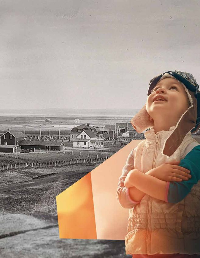
Agriculture is a foundational sector of our economy and has now diversified
into oil & gas, green energy, manufacturing, tourism and more. Emerging
industries through time have found a way to thrive here. It is the people
and the land that seems to make this happen. Through respect of both, it
is the secret to our infinite possibilities.
This Community Overview provides a snapshot of our path and the
data to show where we are today. We hope through our story, you see
possibilities and understand the opportunities in your future as a business
or resident of this place.
Our Community & Development Services brand of the WC and its
promise of infinite landscapes and infinite possibilities is our mantra.
Many innovations and hard work within this community have designed
our municipality and the quality of life we treasure within it. We welcome
you to share in this experience and opportunity.
Reeve, Amber Link
Wheatland County
infinite landscapes infinite possibilities 2
I N T R O D U C T I O N
    Welcome to Wheatland County

     The information in this document is subject
       to change without notice and as data is
     obtained this document will be updated and
                     reproduced.

       It is advised that the reader verify all data
      before making any decisions or conclusions
     based on any of the information contained in
                      this document.

      This version was compiled and produced in
     September 2020. For the most recent version
     of the Community Profile and it supplement
           booklets, visit: www.infinitewc.ca.

                                                                         2. . . . . . . . . . . . . . . . . . . . . . . . . . . . . . . . . Welcome from the Reeve
                                                                         3. . . . . . . . . . . . . . . . . . . . . . . . . . . . . . . . . . . . . . . . . . . . . . .  Introduction
                                                                              4-8 . .. .. .. .. .. .. .. .. .. .. .. .. .. .. .. .. .. History and the Hamlets
        For further information, please contact:
      Economic Development, Wheatland County
                      403-361-2163
                wc@wheatlandcounty.ca
                    Volume 1, Edition 1
                     September 2020

 Wheatland County has a population of 8,788 residents. The
 County is bordered on the west by Rocky View County, the
 south by Vulcan County and Siksika Nation, the east by the
 County of Newell and Special Areas 2, and on the north by
 Kneehill County and the Town of Drumheller. The prairie’s
 natural beauty fills the eye in all parts of Wheatland County.
 From the golden fields near Standard to the badlands of the                                                ALBERTA
 northeast, to the tranquility of the Bow River near Carseland,
 Wheatland County is an ideal blend of rural and urban
 lifestyles; we are next door to the city of Calgary, the fastest
 growing city in the most vibrant province of Canada.

                                          infinite landscapes       infinite possibilities                                                                                        3
H I S T O R Y
Welcome to Wheatland County
On January 1, 1955, Improvement District No. 41, part The Hamlets
of Improvement District No. 42, part of the Municipal
Districts of Bow Valley No. 40, Serviceberry No. 43, and Carseland
Kneehill No. 48, were merged into one new municipal Carseland is located on Highway 24, approximately 23 km (14
district to be known as the Municipal District of mi) south of the Hamlet of Cheadle, Alberta and 26 km (16 mi)
south of Strathmore.
Wheatland No. 40.
The advent of the cattlemen in the late 1800s to the Bow
The Municipal District of Wheatland No. 40 and the
River country, west of the Blackfoot Indian Reserve brought
Wheatland School Division No. 40 joined together on
men like: Major General Thomas Bland Strange (1881), Charlie
January 1, 1961, and became known as the County of Hawks, Colonel Arthur Goldfinch, Felix McHugh (1886), and
Wheatland No. 16. Colonel Arthur Wyndham (1887) to the Carseland area.
On March 6, 1996, the name was changed from the When the Military Colonization Company, which Strange had
County of Wheatland No. 16 to the name currently founded ceased to exist, the Canadian Pacific Railway (CPR)
used, Wheatland County. permitted free grazing on their 3,000,000 acres (12,000 km2)
on the north side of the Bow and it attracted many new settlers
The communities within Wheatland County have a to the area.
long and proud agricultural history and there are many
century farms still in operation. The Addemans, Moffats, and McGregors purchased the
Horsetrack from the Goldfinchs and started the Horsetrack
Cattle Company in 1901. Others such as Groves, Moorhouse,
Brown, McHughes, McKinnon, and Newbolts soon followed.
When the open range came to an end, most of the areas
cattlemen became the first grain farmers of the district.
In 1903, the CPR brought irrigation to its large land acquisitions
in the Carseland area.
As the land prospered and more product was being shipped
by rail to market, the CPR began construction of the Gleichen/
Shepard cut-off in 1913. These rails carried troops to the First
World War in 1914.
Due to its proximity to the river crossing and railway, Carseland
grew rapidly into a prosperous community during the 1920s
Today, Wheatland County is a diverse and growing through 1940s. It boasted six grain elevators, a railway station,
school, general store, barber shop and pool-room, post office,
region consisting of nine hamlets (urban areas) that
restaurant, garage and Ford car dealer, well house, lumber yard,
the County governs and the three villages of Hussar,
hardware store, meat market, bank, stock yards, two churches,
Rockyford, and Standard, as well as the Town of hotel, and community centre. Only three original buildings
Strathmore. The villages and Strathmore are governed remain standing on Railway Avenue. They are the hotel, former
by their own elected councillors and mayors. Carseland Meat Market owned by the Bonitz family and the
former hardware store - all of which were built in 1916.
Chancellor
Irrigation brings settlement and the Canadian
Chancellor is a hamlet in southern Alberta, Canada within
Pacific Railway across southern Alberta
Wheatland County. It is located approximately 26 kilometres (16
The Western Irrigation District’s roots are firmly planted in mi) north of Highway 1 and 86 kilometres (53 mi) east of Calgary.
the history of Alberta. The federal government agreed to Chancellor originally was built up chiefly by Germans, who
grant arable land to the Canadian Pacific Railway in payment named the hamlet after the office of Chancellor of Germany.
for the construction of a railroad joining Canada from coast
to coast. Included in this grant was land previously described Cheadle
as fit for homestead only if an irrigation system could be Cheadle is located 2.6 kilometres (1.6 mi) south of Highway 1,
supplied. With the mountains in the background and the approximately 30 kilometres (19 mi) east of Calgary.
vast prairies to the east, the slope of the ground was ideal to
construct a gravity irrigation system. The Canadian Pacific Railway named the community Cheadle
for Dr. Walter Butler Cheadle of Milton and Cheadle explorers
infinite landscapes infinite possibilities 4H i s t o r y
In order to attract settlers to the area, the CPR began
construction of a network of irrigation canals and reservoirs The Hamlets
starting with a diversion weir across the Bow River in Calgary
in 1904. With the construction of Main Canal, water was who traveled across the prairies and Rocky Mountains in the
carried from the Bow River into Reservoir #1 (Chestermere 1860s. Dr. Cheadle and Lord Milton were co-authors of the
Lake) and in 1905 it was filled for the first time. By 1910 book “The North-West Passage by Land” (London, 1865),
which described their expedition in considerable detail.
secondary canal systems were constructed and settlers had
already received delivery of irrigation waters. A record was made when laying the railroad tracks between
Strathmore and Cheadle when the railway was built. In one
Following the collapse of the economy in 1929, the CPR
hour a mile of steel was laid. At the end of the ten-hour
planned to divest itself of the two irrigation districts working day, the rails were laid to Cheadle, nine miles and 300
which had been developed. On May 1, 1935, the Eastern feet for a record. The ties had been strung the night before.
Irrigation District (EID) was formed. Originally the CPR
had planned on closing the western section but after two There was just one minor building in Cheadle when the early
years of meetings between the farmers and the CPR, the ranchers and homesteaders began to arrive in the late 1890s.
Western Irrigation District (WID) was born on May 1, 1944. It was a post office, store, and boarding home, run by Mrs.
Florence Belwer for the CPR section-men. Cheadle began to
(from the Western Irrigation District website www.wid.net) grow in the years 1906-1916 to a hardware store, barbershop,
blacksmith, restaurant, pool hall, dance hall, three grocery
stores, water tank, CPR station and section houses, stockyards,
Rich Indigenous History lumberyard, two grain elevators, and several residences. The
CPR had once planned to locate Ogden Shops in Cheadle.
Blackfoot Crossing, located near the hamlets of Cluny and
Gleichen, has been a focus of human activity for many At one time, grain was hauled to Cheadle from Carseland. The
generations and a meeting place for many peoples and transport teams ate and rested in Cheadle before returning.
aboriginal cultures. For this reason the site is of integral This all brought much of the business to Cheadle and raised
importance to the traditions of the Siksika Nation. At the the total number of grain elevators to 3. By 1971, Cheadle’s
cultural and geographic centre of traditional Blackfoot post office and grocery store closed.
territory, it was one of the few places where the Bow River
Cluny
could be forded safely. Consequently, it was the site where
Cluny is located 3 kilometres (1.9 mi) south of Highway 1 on a
representatives of the five First Nations of the Blackfoot
Canadian Pacific Railway line and Highway 843, approximately
Confederacy (Kainai, Siksika, and Piikani) met Canadian
87 kilometres (54 mi) southeast of Calgary. It has an elevation
treaty commissioners in September 1877 to sign Treaty of 570 metres (1,870 ft).
No. 7. Tsuu Tina, Dene and Nakoda are Souix who where
in transition through the territory at the time of the treaty. The hamlet at Cluny is similar to earth lodge villages found
along the Missouri River in what is now North and South
The rich variety of the archaeological resources at Dakota. This is why archaeologists first thought that the hamlet
Blackfoot Crossing reflects the long history of the site and had perhaps been occupied by the ancestors of the historic
its importance in the traditions of the Siksika. The social Crow and Hidatsa, who came from this region. These peoples
and cultural values of the site for the Siksika Nation are would have fled from their traditional territory along the
enhanced by the rich variety of the archaeological resources Missouri River to escape the ravages of a Smallpox epidemic.
that reflect the long history of Blackfoot Crossing.
Archaeologists have found pottery very similar to that found
The remains included medicine circles, boulder effigies, at Cluny at a number of other archaeological sites throughout
cairns, buffalo and antelope jumps, Sundance sites, and southern Alberta and Saskatchewan, and in northern Montana.
tobacco planting fields. Nearby are the earthworks of the This suggests that the region was inhabited by the same or closely
Earthlodge Village built circa 1740 by an, as yet unidentified related peoples. Cluny and the other sites with similar pottery might
Aboriginal people, which bears witness to the interaction represent the expansion of a group of native peoples into those
of different native cultures at the Crossing. In more recent areas. These were possibly the ancestors of the historic Assiniboine.
history, the grave of Crowfoot and his last campsite and
Gleichen
the monument to the Cree Chief Poundmaker are of Gleichen is located 2.5 kilometres (1.5 mi) south of Highway 1
especial importance to the Siksika Nation. In addition, and approximately 80 kilometres (50 mi) east of Calgary.
the sites of the first Oblate mission, a whisky trading post,
and an Indian Agency post, are evidence of more recent Gleichen was named after Lord Edward Gleichen in 1884. Gleichen
interaction of native and white cultures. was originally incorporated as a village on January 24, 1899 and
then incorporated as a town on May 6, 1910. After nearly 100 years
Sources: Historic Sites and Monuments Board of Canada, as a municipality however, Gleichen dissolved to hamlet status
Minutes, November 1992; July 2009. under the jurisdiction of Wheatland County on March 31, 1998.
infinite landscapes infinite possibilities 5H i s t o r y
Brief History of Canadian Pacific Railway Supply
Farm No. 1 at Strathmore The Hamlets
The Canadian Pacific Railway (CPR or C.P. Rail) was During the formation of the province, Gleichen was large
incorporated in 1881 for the purpose of constructing enough to have its own seat in the Legislative Assembly of
railroad west from Winnipeg to Vancouver, thereby Alberta (see Gleichen provincial electoral district). Its population
encouraging and attracting settlers to establish peaked at 668 according to the Canada 1921 Census.
homesteads across the west in a band along the railroad.
Due to its proximity to the railroad, Gleichen was readily
Initial plans were to construct the railroad west from accessible to farmers and ranchers living in the area. Its
Winnipeg to Edmonton, then on to Vancouver; thus mostly wooden structures however posed an increased risk of
widespread fires. After the community burned a second time in
avoiding the Palliser Triangle, a large tract of treeless,
1912, many of its residents moved elsewhere, mostly to Calgary.
arid land deemed unsuitable for intensive agriculture
and therefore unlikely to generate a transportation Lyalta
services demand sufficient to warrant the cost of Lyalta is located 8 kilometres (5.0 mi) north of Highway 1,
establishing a railroad. approximately 32 kilometres (20 mi) east of Calgary.
Canadian Federal Government wished to have the railroad Namaka
established relatively close to the 49th parallel in order to Namaka is located approximately 10 kilometres (6.2 mi) south of
secure a strong Canadian presence on the prairies and Highway 1 and 55 kilometres (34 mi) east of Calgary. Its name means
thereby minimize American interests in the area. “near the water” in Blackfoot. The first school was built in 1909.
The Canadian Federal government and CP Rail, reasoned Nightingale
that irrigation services would make the Palliser Triangle Nightingale is located 4 kilometres (2.5 mi) west of Highway
sufficiently productive to sustain intensive agricultural 21, approximately 53 kilometres (33 mi) east of Calgary.
practices. In turn, the increased productive capacity
would attract thousands of settlers thereby increasing Rosebud
demand for CP Rail services as well as securing the area Rosebud is located on Highway 840, 10 kilometres (6.2 mi)
south of Highway 9, and approximately 83 kilometres (52 mi)
as a part of Canada.
east of Calgary. It sits in a sheltered valley on the Rosebud
CP Rail agreed to develop large scale irrigation projects River near the edge of the Canadian Badlands. This area was
if the Canadian Federal Government would consolidate called Akokiniskway by the Blackfoot people, which translates
the company’s land grants into an area of three million roughly to “by the river of many roses.”
acres north of the Bow River and running between The hamlet was founded in the 1885 by James Wishart. While
Calgary and Medicine Hat. following the Gleichen Trail to Montana with his family, they awoke
to the river valley covered by wild roses, Alberta’s official flower.
Three irrigation projects were proposed by the CP Rail
and named Western Section, Central Section, and Eastern Previously an incorporated municipality, Rosebud dissolved
Section. The Western Section was first to be developed from village status on January 1, 1946 to become part of the
under the direction of the Canadian Pacific Irrigation Municipal District of Grasswold No. 248.
Division. Project offices were established at Strathmore;
construction started in 1903 and was completed in 1910. Over the years, farming and coal mining have been the primary
industries. In 1972, the Severn Creek School was shut down
In conjunction with the new irrigation project and as part of an Alberta wide education consolidating process
further encourage settlement of company lands, CP and local children were bused to Standard and Drumheller.
Rail established a demonstration and supply farm at This resulted in many of the local businesses being closed
Strathmore in 1908. and the hamlet population dropped to under a dozen people.
However, the farming community of around 400 still support
(from the Western District Historical Society)
a seed cleaning plant.
In the 1980s, the Rosebud School of the Arts began to run
theatre, which eventually developed into Rosebud Theatre and
The distinct municipalities within Wheatland County the school shifted its emphasis to post-secondary education.
The Town of Strathmore and the Villages of Hussar, Today, the Rosebud Theatre runs as a fully professional company
that offers programming year round and is a tourist attraction
Rockyford and Standard are their own self-governed
drawing patrons from Calgary and Drumheller.
municipalites within the Wheatland County boundaries
and have, and continue to be part of the community
development within the region along with the County.
infinite landscapes infinite possibilities 6H i s t o r y
Hussar pop. 190 (2016) The Communities / Localities
Hussar was unofficially founded in 1913 when the of Wheatland County
Canadian Pacific Railway (CPR) established a station
and named it Hussar. A community grew up around the
• Ardenode • Dalum • Rosebud Creek
station and was incorporated as a village in 1928. The
• Baintree • Duck Lake • Stobart
name Hussar was used in honour of a group of German • Bartstow • Eagle Lake • Strangmuir
soldiers who belonged to a German Hussar (cavalry) • Crowfoot • Makepeace • Tudor
regiment who earlier had established a large farm • Redland • Wintering Hills
near Hussar. With the start of World War I most of the
soldiers returned to Germany and those who remained Dalum was settled as a Danish colony in 1917 with land
were interned for the duration of the war. The land, bought of from the Canadaian Pacific Railway. The community
which was part of this German Canadian Farming Co. is south of the Red Deer River and the Town of Drumheller
Ltd., was purchased after the war. Following the war, the along Highway 56.
community, both the village and the surrounding area,
Land was offered at 10 per cent down and 20 year agreement
began to grow with an influx of settlers from around the
sat $14-$18 per acre. Due to difficulty in the agriculture
world. English, Irish, Scots and Danes made up the bulk
industry at that time, the agreements were renegotiated and
of the settlers. Many of those settlers’ descendants still most of the land was eventually purchased for four to five
reside in or around the community. dollars an acre.
Rockyford pop. 316 (2016) The area is a very positive mixed farming area with numerous
The Village of Rockyford was first settled in 1913 4th and 5th generation farms. The residents very proud
and takes its name from a “rocky ford” that crossed of their Danish ancestry and support an active Lutheran
Serviceberry Creek a half mile south of the village Christian community. The original homesteaders built and
and was incorporated as a village in March 1919. We still maintain a lovely replica church similar in design as those
celebrated our Centennial in 2019, and while our history that exist in Denmark. In 2017 they celebrated a large 100 year
is rich in agriculture, we look forward to a strong, diverse homecoming event.
future. We welcome new business and residents and
look forward to the next 100 years. Between Hussar and Dalum in the eastern part of the County,
oil and gas is active as well as wind power generation in the
Standard pop. 353 (2016) Wintering Hills area.
Standard is a village located in the southern part of
There is a five section shallow lake just north of Hussar that goes
the province of Alberta, Canada. It is situated within
dry every 40 -50 years and take 10 - 20 years to refill. Reflective
Wheatland County, approximately 80 kilometres (50
of the wet and dry cycles of the global weather patterns.
mi) east of the city of Calgary. The village was originally
settled by Danish immigrants. Standard’s economy is The surrounding communities of Duck Lake, Wintering Hills,,
based on the surrounding farming community and the Chancellor, Makepeace utilize Hussar as a focal gathering point
energy industry, with a number of oil and gas rigs in within Wheatland County. Many of the rural communities and
operation in the vicinity. localities utilize the villages and Town of Strathmore are their
urban service points depending on where they are located
Strathmore pop. 13,756 (2016) within Wheatland County.
The Town of Strathmore is the largest urban community
within the region. Located on the Trans-Canada Highway,
it is home to over 11 schools, a regional hospital, a brand- More history on the other communities and localities can be
new field house sports centre, and more. The annual found in a number of publications such as Flow Beyond the
Strathmore Stampede is Canada’s third largest rodeo and Weir, Where We Crossed the Creek and Settled - Rockyford,
is famous for the Running of the Bulls event. Strathmore - The Village that Moved.
Strathmore had its beginnings as a small hamlet for
the Canadian Pacific Railway (CPR) lines that were built
in the area in 1883. Since then, the town has become
a regional service hub and recently celebrated it’s
centennial in 2011.
(from the Western District Historical Society)
infinite landscapes infinite possibilities 7W H E AT L A N D C O U N T Y
C O M M U N I T Y
profile
infinite landscapes infinite possibilitiesYou can also read