THE CONVECTIVE WATCHER - SPC Departures, Arrivals and Promotions - Storm Prediction Center
←
→
Page content transcription
If your browser does not render page correctly, please read the page content below
Issue 4 Winter 2017-2018
THE CONVECTIVE WATCHER
SPC Departures, Arrivals and Promotions
Operations Staff Departures
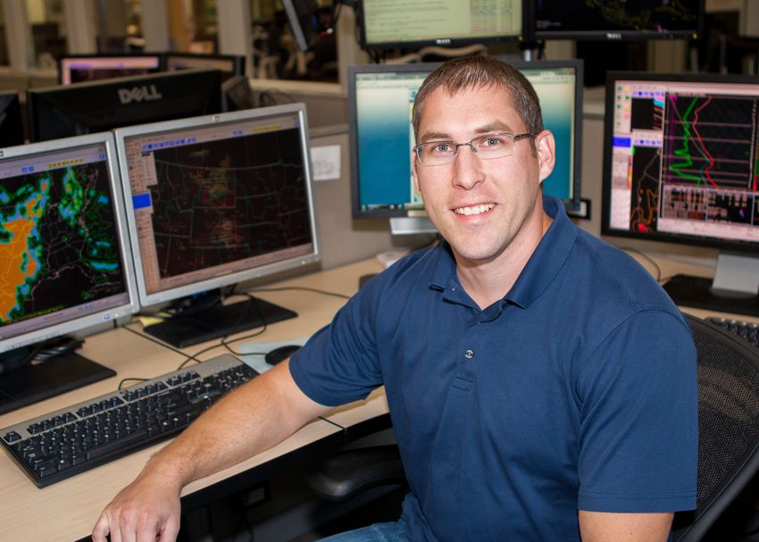
The SPC wishes farewell to Jaret Rogers,
who departed the SPC to become a Lead
Forecaster at the National Weather Service
Forecast Office in Phoenix, Arizona. At the
SPC, Jaret served as a Mesoscale
Assistant/Fire Weather Forecaster from
2010 through 2016. Previously, Jaret was
a Meteorologist Intern at the NWS Phoenix
office before his tenure at SPC. Jaret’s
contributions to enhancing SPC products
and services, along with operational
meteorology, are numerous. He is known
for his developmental work on the SPC
Sounding Climatology (http://
Jaret Rogers, former SPC Mesoscale Assistant/Fire www.spc.noaa.gov/exper/soundingclimo/),
Weather forecaster, is now a Lead Forecaster at NWS which contextualizes data from individual
Phoenix. observed atmospheric soundings within the
broader period of record. Jaret also served
as fire-weather focal point, a position in which he led efforts to enhance the SPC fire-
weather program and to build relationships with fire-weather agencies. Furthermore, Jaret
was responsible for leading the SPC Career Experience Program, which offers University of
Oklahoma meteorology students an opportunity to perform research under the supervision of
SPC meteorologists. He also was a key contributor to collaborative research regarding
www.spc.noaa.gov 1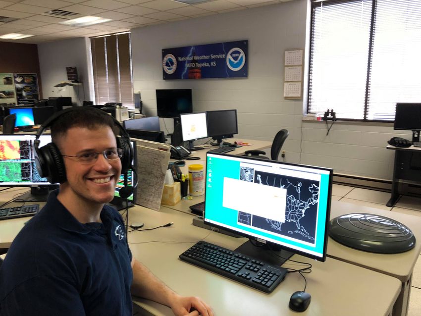
Issue 4 Winter 2017-2018
thunderstorms and severe weather affecting central and southern Arizona associated with
the North American monsoon. Jaret has undoubtedly provided meaningful contributions to
the Storm Prediction Center and the field of operational meteorology, and the SPC wishes
him all the best in his new position in the NWS.
Dr. Ariel Cohen, former SPC Mesoscale
Assistant/Fire Weather Forecaster, became
the Science Operations Officer (SOO) at
the National Weather Service Forecast
Office in Topeka, KS in September 2017.
Arriving at SPC in the spring of 2011, Ariel
concurrently worked toward and completed
his Ph.D. in Meteorology from the
University of Oklahoma. While at SPC,
Ariel’s contributions were many. Ariel
published several research papers in the
American Meteorological Society journals.
This body of research, along with research
collaborations with other SPC and NWS
Dr. Ariel Cohen, the new Science and Operations forecasters has helped to advance forecast
operations over the years. As a natural
Officer at National Weather Service Topeka, KS,
teacher and collaborator, Ariel helped to
broadcasts live on NOAA Weather Radio.
create and teach the Applications of
Meteorological Theory to Severe-
Thunderstorm Forecasting course for the University of Oklahoma School of Meteorology.
Ariel enjoyed serving as a mentor for many student’s research projects through the OU/SPC
Career Experience program as well as the REU (Research Experience for Undergraduates)
and NOAA Hollings Scholar programs. Additionally, Ariel regularly contributed to the SPC
newsletter and social media platforms. Finally, Ariel provided stellar severe convective and
fire weather forecasts. Prior to his time at SPC, Ariel worked at the National Weather Service
Forecast Offices in Great Falls, MT and Jackson, MS as well as at the National Hurricane
Center in Miami, FL. Ariel’s top-notch work ethic and enthusiastic attitude will be missed at
SPC and we wish him good luck in his new position at NWS Topeka!
Operations Staff Promotions
Matt Mosier, former SPC Mesoscale Assistant/Fire Weather Forecaster, was promoted to the
SPC Mesoscale/Outlook Forecaster position in September 2017. Says Matt of his time at
SPC, "I'm honored to be able to continue working at the Storm Prediction Center. I have
enjoyed my past 5 years here and am looking forward to many more years forecasting
severe weather and researching topics such as violent tornadoes, lightning, and model
verification.” Matt arrived at SPC in the winter of 2012 from the National Weather Service
Forecast Office in Fort Worth, TX.
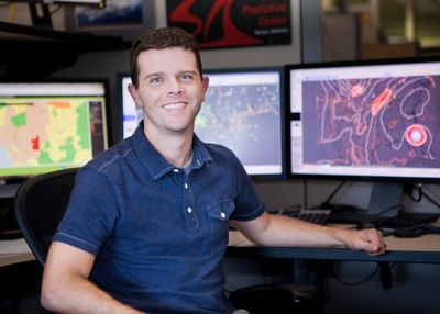
Joey Picca, former SPC Mesoscale Assistant/Fire Weather Forecaster, was promoted to the
SPC Mesoscale/Outlook Forecaster position in September 2017. Joey says, “Having
www.spc.noaa.gov 2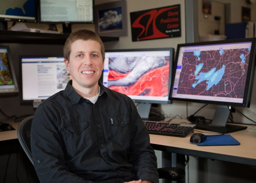
Issue 4 Winter 2017-2018

 Matt Mosier (left) and Joey Picca (right) were recently promoted to the position of Mesoscale/Outlook
 forecaster at SPC. Matt and Joey are responsible for composing mesoscale convective discussions and the
 Days 1-8 Convective Outlooks.

originally specialized in dual-polarization radar in graduate school, my work in the NWS has
focused on the advancement and implementation of new radar algorithms and analysis
techniques. Additionally, I’ve gained an appreciation for translating complex topics (such as
radar analysis) via clean, effective visualizations, making these topics suitable for a wide
range of audiences.” Joey arrived at SPC in the fall of 2014 from the National Weather
Service Forecast Office in New York City, NY.

Science Support Branch
Dr. Chris Karstens joined the SPC Science Support Branch as a Techniques Development
Meteorologist in August 2017. Before arriving at SPC, Chris was a Research Scientist at the

 Dr. Chris Karstens (left) and Matt Elliot (right) joined the SPC Science Support Branch as Techniques
 Development Meteorologists in August 2017. Their main tasks are to aid in developing new guidance, tools
 and infusing research to operations into daily SPC forecasting processes. Additionally, Chris and Matt have
 been trained to fill in at the Mesoscale Assistant and Fire Weather forecaster desks in SPC operations.

www.spc.noaa.gov                                                                                               3
Issue 4 Winter 2017-2018

Cooperative Institute for Mesoscale Meteorological Studies/National Severe Storms
Laboratory (CIMMS/NSSL) at the University of Oklahoma, conducting research and
development for the Forecasting a Continuum of Environmental Threats (FACETs) project.
Before that, Chris attended Iowa State University where he earned a B.S., M.S., and Ph.D.
in Meteorology and a Graduate Certificate in GIS. His research interests are in probabilistic
forecasting and verification of severe convective hazards, and the application of GIS to
short-term high-impact severe convective hazards (real-time and post-event).

Matt Elliot joined the SPC Science Support Branch as a Techniques Development
Meteorologist in August 2017. Prior to coming to the Storm Prediction Center, Matt spent
nearly three years as a forecaster at the National Weather Service Weather Forecast Office
in Sterling, VA. While there, he was responsible for issuing watches and warnings and
forecasting daily weather conditions for nearly 10 million people within the forecast area. He
worked several notable weather events including the record-breaking January 2016 blizzard,
which crippled the Washington D.C. and Baltimore metro areas for almost a week. Matt's
meteorological interests include severe weather and lightning, improving visualization of
meteorological data, and enhancing techniques to improve weather forecasting. He also
enjoys playing sports, photography, traveling, and spending time with his wife and family.

SPC Meteorologists Honored at the 42nd Annual National
Weather Association Meeting in Garden Grove, California
Each year, SPC meteorologists attend
scientific conferences to present research
findings, give updates on operational
practices, and learn about ongoing research
in the field of meteorology. This year, several
current and former SPC meteorologists were
recognized for exceptional service at the
2017 Annual Meeting of the National
Weather Association.

Special Lifetime Achievement Award
Steven J. Weiss
NOAA-NWS Storm Prediction Center

Steve was selected for the Special Lifetime
Achievement Award for contributions to
operational meteorology, specifically
forecasts of severe convective storms, that
includes science-centered leadership within
forecast operations, mentorship of students       Steve Weiss’ career at SPC has spanned more than
and young scientists, and supreme                 40 years.
dedication to the transition of scientific

www.spc.noaa.gov                                                                                     4
Issue 4 Winter 2017-2018

research to forecast operations, that have advanced our enterprise and helped protect
society.

Steve began his career at the SPC in 1974. During this time, the SPC was located in Kansas
City, MO and known as the National Severe Storms Forecast Center. Steve has served as a
Lead Forecaster, Science and Operations Officer and is currently the Science and Support
Branch Chief. Steve’s leadership, contributions to the field of meteorology and strong work
ethic have helped shape the SPC into the premier severe storms forecasting center that it is
today.

Stephen Corfidi
NOAA-NWS Storm Prediction Center - retired
OU CIMMS (Cooperative Institute for Mesoscale Meteorological Studies) with WDTD
(Warning Decision Training Division)

For his commitment to public service, unmatched record of operational meteorology
research, advancement of convective forecasting through research, mentoring and
leadership. Stephen retired from the SPC in the summer of 2016.

T. Theodore Fujita Research Achievement Award
                                                  Richard Thompson
                                                  NOAA-NWS Storm Prediction Center

                                                  Rich was selected for the T. Theodore Fujita
                                                  Research Achievement Award for over two
                                                  decades of severe storms forecasting,
                                                  prolific scientific publication, devoted
                                                  mentorship, education, and development of
                                                  operational forecasting techniques used
                                                  worldwide.

                                             Rich began his career at SPC in the 1990s
                                             as a Mesoscale/Outlook forecaster and
                                             currently holds the Lead Forecaster position.
                                             Many are likely familiar with the Significant
                                             To r n a d o a n d S u p e r c e l l C o m p o s i t e
                                             Parameters used in severe weather
                                             forecasting. Rich was instrumental in
                                             conducting the research and verification
                                             related to these parameters in the early
                                             2000s. More recently, Rich has worked on
 Richard Thompson, SPC Lead Forecaster.
                                             compiling climatologies of near-storm
                                             environments based on convective mode
and tornado-producing storms. From this work, innovative probabilistic guidance for tornado
damage intensity has been derived. Rich’s passion for research and improving forecast

www.spc.noaa.gov                                                                                  5
Issue 4 Winter 2017-2018 operations is sure to keep the SPC on the cutting-edge of severe storms science for many years to come. American Association of State Climatologists Recognize SPC Meteorologist’s Research at 2017 Annual Meeting Dr. Ashton Robinson Cook, SPC Mesoscale Assistant and Fire Weather forecaster, receives the 2017 Dissertation Award for Outstanding Climate Research. Mesoscale Assistant and Fire Weather Forecaster Dr. Ashton Robinson Cook was recognized this year by the American Association of State Climatologists at their annual meeting Asheville, NC. Ashton was presented the 2017 Dissertation Award for Outstanding Climate Research. His dissertation, titled “The Impact of El Niño Southern Oscillation on U.S. Winter and Early Spring Tornado Outbreaks” takes an in-depth look into ENSO phase and potential implications for seasonal severe weather forecasting. Atlantic Basin Experiences Active Tropical Cyclone Season, Most Tropical Cyclone Tornadoes Since 2008 By Roger Edwards, Lead Forecaster The Storm Prediction Center forecasts the tornado threat from tropical cyclones (TCs) that affect the contiguous U.S. Our outlooks, mesoscale discussions and watches for TC tornadoes begin with National Hurricane Center (NHC) predictions of cyclone track, size and intensity. Those factors influence the very same four favorable ingredients that we examine for tornado-producing supercells in other settings: moisture (usually not a question in TCs), lift, instability, and vertical wind shear. www.spc.noaa.gov 6
Issue 4 Winter 2017-2018

Most TC tornadoes occur north through southeast of center, in the outer parts of the
circulation. This sector of TCs usually contains the most favorable combination of the four
key ingredients. Still, the tornado threat can vary a lot from system to system. Every TC has
a different “personality” in terms of its structure and behavior, which can change over time
from its landfall approach until it dissipates inland. The whole time, we must do careful
surface and upper-air analysis of each TC to fine-tune the forecasts.

TCs can vary wildly in their tornado yield, from none to a record of 118 (Hurricane Ivan in
2004). Most have fewer than 25 tornadoes, typically small, brief and weak, with over 90%
rated EF0 or EF1 on the Enhanced Fujita scale. Still, strong tornadoes of EF2 or greater
can occur in TCs, and any tornado can kill. Several TC tornadoes in earlier years have
caused multiple deaths and injuries. For more on the science of TC tornadoes and how we
predict them, see this formal review article on the SPC Publications website.

The 2017 hurricane season has been the most active in this decade for the U.S., and that
includes tornadoes. The preliminary total count of 119 tornadoes probably will change
somewhat, until data are finalized in spring 2018. Still, 2017 should rank as the most active
for TC tornadoes since 2008. This was the fourth busiest in the modern era of Doppler radar
(1995 onward), when TC tornado information is the most reliable.

Five systems—Cindy, Harvey, Irma, Nate, and Philippe—produced tornadoes this season.
The preliminary map of this season’s TC tornadoes (image on next page) spans a vast area
from Texas to the Mid-Atlantic region and Florida, based on a combination of post-storm
reports and public information statements provided by local NWS forecast offices.

In mid to late June, Tropical Storm Cindy formed over the Gulf and moved inland near the
mouth of the Sabine River. The remnant circulation slowly weakened on a long trek across
the eastern U.S., then interacted with a cold front, spawning 18 tornadoes from the central
Gulf Coast to the central Appalachians and even New Jersey.

www.spc.noaa.gov                                                                            7
Issue 4 Winter 2017-2018

                                                        Hurricane Harvey will be
                                                        remembered most for its record
                                                        rains and catastrophic, wide-area
                                                        flooding in southeast Texas.
                                                        Amidst that disaster, it also
                                                        spawned 27 known tornadoes in
                                                        Texas and 57 overall. The last
                                                        TC with more total tornadoes was
                                                        Rita in 2005, at 98. Although
                                                        some of Harvey’s tornadoes hit
                                                        the Houston metro area, they
                                                        caused no deaths and just EF0 to
                                                        EF1 damage.           The most
                                                        substantial of Harvey’s tornadoes
                                                        yielded spectacular video and
                                                        carved a 31-mile-long, 400-yard-
                                                        wide path in and near Reform,
                                                        AL, with six injuries and an EF2
                                                        rating (NWS Birmingham site).

                                                        Irma in September was a
                                                        massive and powerful “Cabo
                                                        Verde” hurricane that devastated
                                                        several northeastern Caribbean
                                                        islands at category-5 intensity.
                                                        By the time it reached Florida,
                                                        Irma was less intense but still
                                                        was a major hurricane, with
                                                        numerous strongly rotating
                                                        supercells detected by radar over
                                                        the Atlantic Ocean. The number
                                                        of tornadoes they had over water
                                                        will never be known. Some of
                                                        the supercells did survive cooler
                                                        inland air long enough for 21
                                                        Florida tornadoes, most near the
                                                        East Coast, then four more near
                                                        Charleston, SC. One late-night
                                                        supercell near Fernandina
                                                        Beach, FL, already had two
tornadoes going at the same time as it moved ashore from the Atlantic. Both tornadoes’
inland debris plumes showed up brightly on Doppler radar (image lower left). Though not
counting in our records, Bahamian news agencies also reported tornado damage on Grand
Bahama from Irma, and at least one tornado there was caught on video.

www.spc.noaa.gov                                                                        8
Issue 4 Winter 2017-2018
Fast-moving Hurricane Nate crossed the Mississippi River mouth and the Mississippi coast
on the night of October 7–8. This landfall stage yielded six tornadoes in Mississippi and
Alabama, all rated EF0 or EF1. By the next afternoon, a series of northward-moving
supercells formed in a very moist, well-heated air mass over the western Carolinas. Ten
tornadoes resulted, one crossing the state line. A 38-mile path in Laurens and Spartanburg
Counties, SC, is the third longest on record for a TC tornado in the 1995–2017 era, with EF2
damage to one house. A separate EF2 tornado struck Norris, SC. The last tornado from
Nate was the first tornado of any kind in Ashe County, NC, since records began in 1950.
Finally, despite being messy and disorganized, Tropical Storm Philippe produced three EF0
tornadoes over Miami-Dade and Palm Beach Counties, FL, on October 28.
New Generation of Weather Satellites Make Long-Awaited Debut
GOES-16, formerly known as GOES-R, was
launched on Nov. 19, 2016 at 6:42pm EST
from Cape Canaveral, Florida. The first
images from the satellite were sent back to
Earth on January 15, 2017.
This particular image (left) is a composite
color full-disk visible image and was
captured at 1:07pm EST on January 15,
2017. In the image, you can see the full
Western Hemisphere, including North and
South America, the eastern Pacific Ocean
and the western Atlantic Ocean. GOES-16
observes Earth from an equatorial view
approximately 22,300 miles high, creating
full disk images like these from the coast of
West Africa, to Guam, and everything in
between.
The first image from GOES-16 on January 15, 2017.
Some exciting new features of the satellite
include higher temporal resolution data. It can
provide a full disk image of the Earth every 15
minutes, one of the continental U.S. every five
minutes, and has the ability to target regional
areas where severe weather, hurricanes,
wildfires, volcanic eruptions or other high-impact
environmental phenomena are occurring as often
as every 30 seconds. The GOES-16 Imager
covers the Earth five-times faster than the Hurricane Maria makes landfall in Puerto Rico,
previous generation GOES imagers, and has September 20, 2017.
www.spc.noaa.gov 9Issue 4 Winter 2017-2018 four-times greater spatial resolution. The GOES-16 satellite began maneuvers in early December to move to its permanent orbit, replacing the aging GOES-13 satellite (GOES- EAST). Nominal operations resumed on December 18, 2017. 2017 saw many events which allowed the new instruments on GOES-16 to shine, including the busiest Atlantic Basin hurricane season in nearly a decade. For more information on the GOES family of satellites, including photos and video, visit the website http://www.goes- r.gov. The next spacecraft in the series, GOES-S, successfully launched from Cape Canaveral, FL on March 1, 2018. Now dubbed GOES-17, testing and orbital maneuvers will occur over the next several months. Once the satellite arrives at its final orbit, it will replace the aging GOES-15 satellite and officially become GOES-West. New HREF Data Available on SPC Forecast Tools Web Page In November 2017, the new HREF (High-Resolution Ensemble Forecast) system replaced the SSEO (Storm-Scale Ensemble of Opportunity) system. A new and improved web interface to view the HREF was designed by SPC/NSSL CIMMS contractor Dr. Brett Roberts. HREF data is available under the “Forecast Tools” tab on the SPC website, or by following this link: http://www.spc.noaa.gov/exper/href/. The HREF has a total of 8 members, which are indicated in the table below, along with parameterization schemes and other info. Modeled after the SSEO, the HREF performs similarly but is run at 3 km grid spacing rather than 4 km. Calibrated severe probabilities are created for tornadoes, severe hail and wind hazards in 4-hr and 24-hr bins for each hazard. For more information on the calibrated probabilistic guidance from the HREF, visit http:// www.spc.noaa.gov/exper/href/documentation/HREF_SPC_Guidance_FAQ.pdf. www.spc.noaa.gov 10
Issue 4 Winter 2017-2018

Severe Convection Unusually Quiet to Start 2018
Typically by mid-March, SPC will have issued about 43 watches (severe and tornado
combined). So far in 2018, as of this writing on March 12, only 8 watches have been issued.
Six of those watches have been tornado watches, with two severe thunderstorm watches.

www.spc.noaa.gov                                                                         11
Issue 4 Winter 2017-2018

Since 1980, the only year that has had a slower start was 2015, when only 4 cumulative
watches had been issued by March 12.

It is hard to say how this will translate to severe weather across the nation through the spring
and summer. However, from a climatological perspective, there could be some clues.
Currently, a weak La Niña event is ongoing across the equatorial Pacific. The Climate
Prediction Center is forecasting the ENSO phase become neutral during the spring and
persist into summertime. Recent research indicates that tornado and severe weather in
general may be increased across the southern and parts of the southeastern United States
during a La Niña. However, the current La Niña event is weak, which increases uncertainty.
Furthermore, with the ENSO phase expected to become neutral, any correlation becomes
tenuous. Stay tuned to see how this spring evolves!

              Visit us on Facebook and Twitter or the Web!
                           https://www.facebook.com/NWSSPC/
                               https://twitter.com/NWSSPC
                                    www.spc.noaa.gov

www.spc.noaa.gov                                                                              12
You can also read