The potential for UAS in Agricultural, Environmental and Forestry Monitoring Alan Gay
←
→
Page content transcription
If your browser does not render page correctly, please read the page content below
The potential for UAS in Agricultural,
  Environmental and Forestry Monitoring

                             Alan Gay
                            abg@aber.ac.uk

For ESA UAS Workshop, Space Expo, Noordwijk, The Netherlands, 11 May 2010
The Land-use Sector

Agriculture UK
        Gross output £15 billion (1% of UK economy)
        4.3% growth in 2006
        300,000 farmers

Forestry UK
        Gross output £300 million (0.4% of UK economy)
        Employs 29,000 people

Environmental Monitoring UK
       £82 million annual spend on terrestrial & fresh water monitoring
       Environmental consulting worth £1.23 billion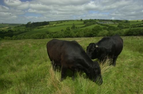
UK Land Area Coverage:

 Agriculture                    170,776 km²
 Forestry                        28,252 km²
 Environmental monitoring       199,028 km²
 TOTAL                          427,056 km²

 The European Picture
 Arable and other crops 110 million ha         Jobs: 9 million
 Grassland and Woodland 77 million ha

 Output value € 373 billion    Cost of inputs € 23 billion
 Holdings: 7.3 million         Fertiliser use 18 million kg

An important and valuable sector –
So why would managers use UAS?
An example of why: Economics of UK Wheat 2007
                                                           Split of Variable costs
                       Income and Costs
                                                                                        Seed
                                   Variable costs
                1400                                                                    Fertilizer
                                   Cultivation & harvest
                1200
£ per hectare

                                                                                        Herbicide
                1000               Rent
                 800               Subsidy                                              Fungicide

                 600               Straw                                                Others
                 400               Grain
                 200
                   0
                                                                                     Data from Nix,
                                                                                     2005, Farm
                        e

                       ts
                      m

                     os

                                                                                     management
                   co

                   C

                                                                                     pocketbook
                 In
Economics of UK Wheat 2010
Split of Variable costs
Income and Costs
Seed
Variable costs
1400 Cultivation & harvest Fertilizer
1200
£ per hectare
Rent Herbicide
1000
Subsidy Fungicide
800
600 Straw Others
400 Grain
200
0
e
ts
m
os
co
C
In
Too little fertilizer, fungicide and herbicide = reduced yield, less profit
But too much fertilizer, fungicide and herbicide = less profit, but also
environmentally bad, don’t forget, GEAC*, NVZ§ and bans!
Can we improve the way we assess farm inputs?
This is when we became interested in using aerial hyperspectral measurements
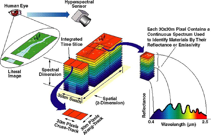
*Good agricultural and environmental conditions, §nitrate vulnerable zonesHyperspectral imaging
A complete spectrum is
associated with each pixel
t
Definition of hyperspectral measurementsHyperspectral measurements can be
used to:
1. Detect disease
2. Distinguish varieties
3. Separate types of grassland
4. Estimate fertiliser requirements
5. Determine herbicide needs
6. Estimate biomass (for grazing or conservation)
7. Determine biodiversity
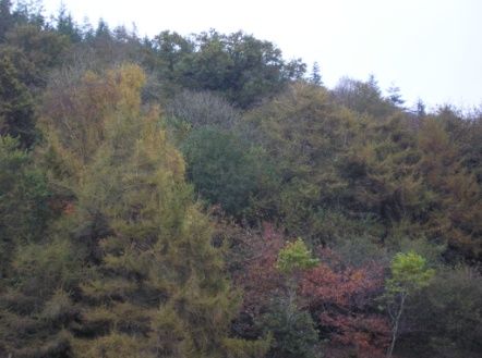
8. Differentiate tree species
9. Map upland vegetation
And in the live talk examples of all were presented,
they can be seen on request.• If right sensing can be provided data looks promising
• Will it become practical?
– Can we get the data more reliably and cheaply?
This is when we became interested in UAS
Comparison of sunshine hours and daylength
20
18 Sunshine
Daylength
16
14
Hours per day
12
10
8
6
4
2
0
Jan Feb Mar Apr May Jun July
MonthPayloads for UAS in the Land use Sector
in priority order
• NDVI (normalised difference vegetation index)
• Hyperspectral
• LiDAR /Radar
• ThermalOperational aspects
• Deployment – beyond line of sight: Often a range of up to 3 km
from base would be useful, but not always essential
• Extent and range of operation. Ideally ability to cover a 5 km by
5 km area would be useful, ideally from a local launch and
recovery with minimal equipment
• Altitude. Since the forte of UAV is detailed assessment
probably 100 to 200 m altitude would be useful
• Real time data: Some information useful but rarely essentialA practical example – U-MAP project
– No off the shelf solution
– Aerospace partners - QinetiQ
– UAV mapping of NDVI -for crop nitrogen management
– Successful mapping achieved in about 30 minutes per
site
– Processing of data was challenging, particularly
mosaicing.
– Plan is to develop hyperspectral UAV
– Streamline processing
– And to develop further access to airspace
• Funding applied for....Conclusions: don’t forget!
• Sector requirements quite specific, sensing must be right.
• Cost effectiveness vital.
• How many end users have you talked to? Unless the outputs
are in the form required by the end users they will have little
value
• In the environmental/agricultural/forestry markets, concentrate
on applications where timeliness and detail is valuable.
• Premium for light, simply deployed systems.
• Can we develop simple airspace access for small UAS over
areas of low population density?Thank you for listening and to:
The UAS team
Tim Stewart, Rod Angel, Mark Easey, Adrian Eves, Neil Thomas, Dan Pearce and Alex Kemp
Richard Lucas, Johanna Breyer and Mark Jarman
Allan Edwards, Rob Appleby and David Jones
Supported by the
European Union
Project co-financed
Everybody involved in
by the ERDF
PIMHAI, both in setting up
the project, image
collection and processing
and also in discussing
possible analyses of our
results
Llywodraeth Cynulliad Cymru
Welsh Assembly GovernmentYou can also read