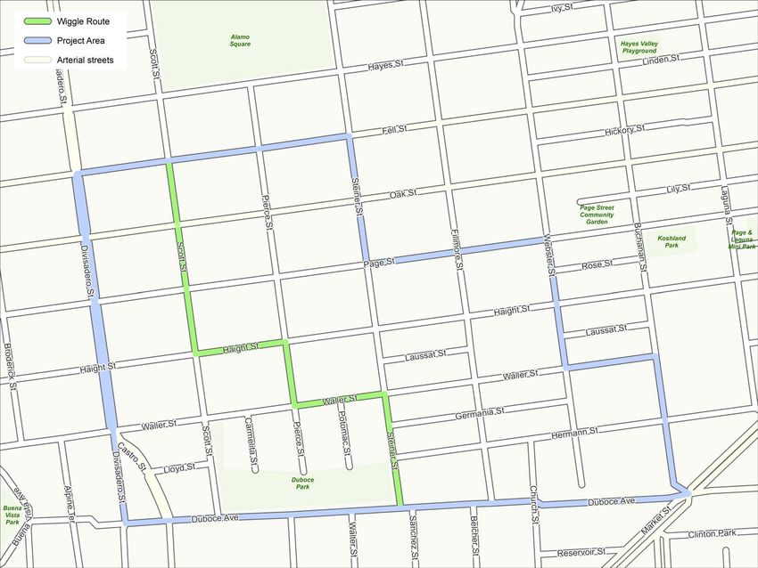
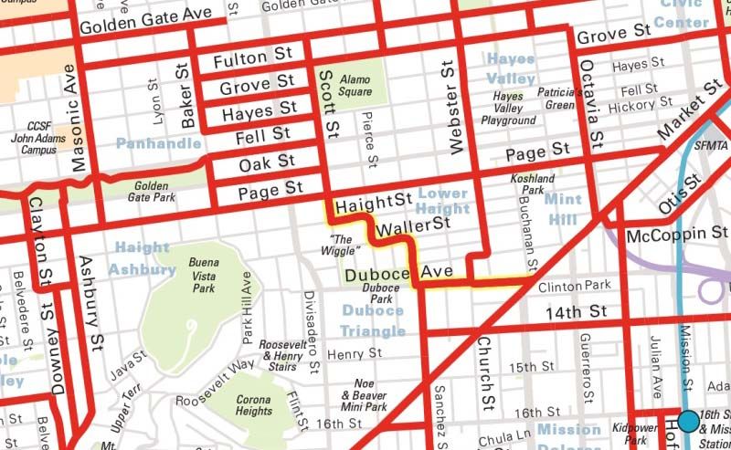
The Wiggle Route in Context
←
→
Page content transcription
If your browser does not render page correctly, please read the page content below
WIGGLE NEIGHBORHOOD GREEN CORRIDOR

The Wiggle Route in Context
In a city of hills, the “Wiggle” is an important route because it winds its
way along the flattest streets from Market to the Panhandle, bringing
residents to local parks and linking bicyclists between downtown and the
City’s western neighborhoods.
San Francisco Bicycle Network                          Proposed Green Connections Network

How Do You Wiggle?
Do you use this route or do you have a different favorite way through the area? Draw a line on your preferred
route below!

                                                                                                  Project Area
                                                                                                  Official Wiggle
                                                                                                  Bike
                                                                                                  Walk
                                                                                                  Drive
                                                                                                  Muni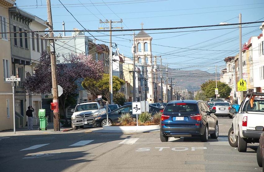
WIGGLE NEIGHBORHOOD GREEN CORRIDOR

Streets for People
The SFMTA’s goal for the Wiggle Neighborhood Green Corridor is to create
a route that is comfortable and safe for all who walk, bike, and live along
the Wiggle.
Whether taking your dog to the park, biking with your children, or chatting with a neighbor
outside your home, there are a few key roadway characteristics that the SFMTA can address to
preserve the residential nature of the Wiggle streets:

• Ensure that pedestrians feel safe crossing the street
• Minimize congestion from motor vehicles
• Encourage slow, safe speeds from all roadway users

Traffic Calming Toolbox
The SFMTA’s traffic calming toolbox uses a variety of physical treatments which signal to roadway users that
they should go slowly and expect pedestrians and bicyclists of all abilities. Read on to learn how these
features can address specific issues in this neighborhood!

                                      Portland                        17th and Shotwell, San Francisco   Hayes Valley, San Francisco

Education and Enforcement
Through this project, the SFMTA will be able to make physical changes to the roadway. However, there are
other ways to improve behavior that are not part of the built environment, such as police enforcement of
those who don’t stop, education of why yielding is important, etc. Feel free to let us know about your
thoughts and ideas that pertain to education and enforcement as well.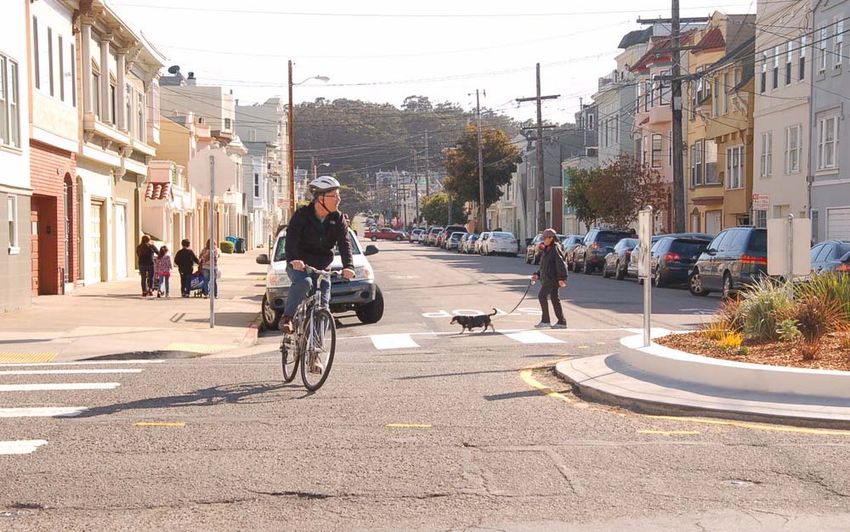
WIGGLE NEIGHBORHOOD GREEN CORRIDOR

          What We’ve Heard from You
          The SFMTA has heard from neighbors, businesses, stakeholder groups
          and commuters who have ideas for ways to improve the Wiggle
          corridor. As you review the next few boards, consider:

          • Are there other issues we should be aware of?
          • Do you like or dislike any of the potential traffic calming tools?
          • Should we continue to explore these design concepts?

          Hot Spots
          Here are some of the hot spots we’ve been hearing a lot about -- use the large map or your questionnaire to
          let us know where else we should focus our efforts.

                                                                                                         Attendees of the May 29, 2013 Lower
                                                                                                            Haight Merchants and Neighbors
                                                                                                          Association meeting let SFMTA and
                                                                                                       SFPUC staff know that they are interested
                                                                                                        in seeing traffic calming features along
                                                                                                          the Wiggle, especially on the inside
                                                                                                             corners where bicyclists turn.
                                                   Heavy vehicle
                                                  congestion from
                                               drivers using Scott as
                                                a cut-through to Fell
                                                      and Oak

  With intersecting bike
routes and heavy vehicle
volumes, this intersection
is confusing for everyone

                                                                          Bicyclists don’t yield to
                                                                        pedestrians, particularly in
                                                                          the downhill direction

                                                                                                                                  Opportunity for
                                                                                                                                 gateway drawing
        Haight street has buses                                                                                                people into the Wiggle
        and commercial activity,
        and is less comfortable
                for biking                                                         Opportunity for
                                                                                  placemaking and
                                                                                  area information

                                    Potential shared
                                   street opportunity                          Need better
                                                                             markings to guide
                                                                                 cyclists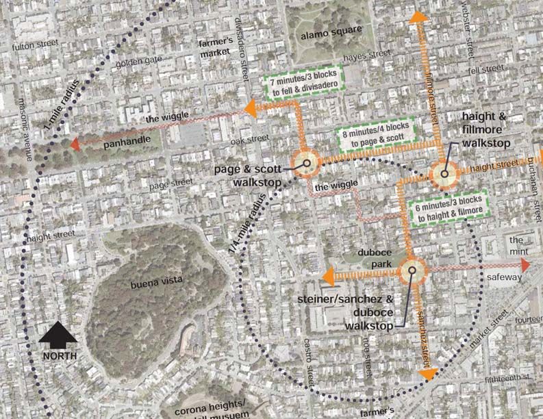
WIGGLE NEIGHBORHOOD GREEN CORRIDOR

Stopping for Pedestrians
Throughout the neighborhood and especially along the Wiggle route,
pedestrians want to feel confident that drivers and bicyclists will yield to
them when crossing the street – especially with children and puppies in
tow! Physical measures that enhance visibility at crosswalks and reduce
speeds approaching intersections help ensure that roadway users will see
pedestrians entering intersections with plenty of time to stop.

                                       Leland Ave, San Francisco                                     17th and Shotwell, San Francisco

Bulb-Outs (aka Curb Extensions)                                    Raised Crosswalks
Bulb-outs extend the sidewalk into the parking lane                Raised crosswalks bring the level of the roadway to
to narrow the roadway, increasing pedestrian                       that of the sidewalk, forcing roadway users to slow
visibility, shortening crossing distances, and                     before passing over the crosswalk, and providing a
slowing turns. Simply restricting parking at                       level pedestrian path of travel from curb to curb.
intersections also improves visibility.

Improved Visibility Coming this Summer!                                              Continental Crosswalks
“Red Visibility Curbs” or “Daylighting” keeps parked cars away from                  In 2012, the SFMTA added high
crosswalks, making it easier for roadway users to see pedestrians                    visibility “Continental” or
ready to cross the street. Some daylighting is already planned for key               “Ladder” crosswalks at all
intersections along the Wiggle Route in the near future; keep an eye                 intersections along the Wiggle.
out for posted notices announcing the public hearing this summer.

   Driver’s view is blocked by cars.       Improved view of pedestrians.

                                                                                                                Haight and Pierce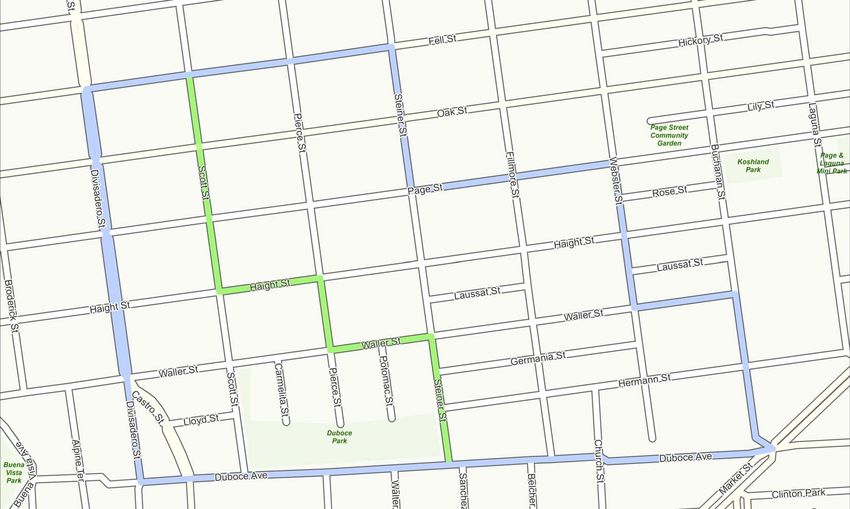
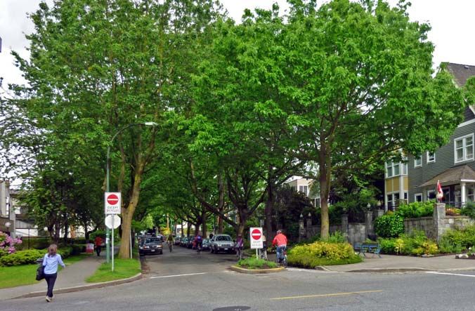
WIGGLE NEIGHBORHOOD GREEN CORRIDOR
Cut-through Traffic
Motorists who drive through the neighborhood – rather than to a local
destination – can cause congestion on residential streets, detracting from
the neighborhood feel. Furthermore, on a street that is otherwise nice to
bike on, vehicle volumes and speeds make a big difference in how
comfortable the street is for biking.
Vancouver
Photo by Payton Chung Austin
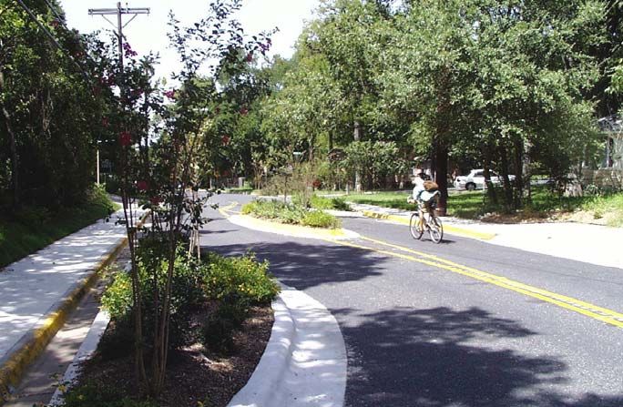
Partial Diverter Chicane
Diverters reduce traffic volumes by limiting through- A chicane uses mid-block curb extensions or islands
traffic on neighborhood streets. Pedestrian and to require roadway users to follow a curving path,
bicycle access is maintained. discouraging speeding.
Addressing Scott Street Congestion
The issue of cut-through traffic on Scott Street has been raised many times – in comments related to the Fell
and Oak Improvement Project, through traffic calming applications, and by the Alamo Square Neighborhood
Association. The ThinkBike presentation has more details on ideas for improving Scott Street.
N
Do you agree? Let us know what you
think about proposals to divert traffic
off of Scott Street.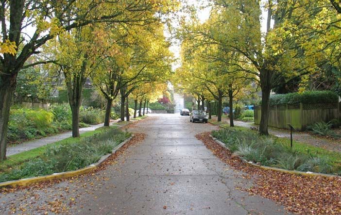
WIGGLE NEIGHBORHOOD GREEN CORRIDOR

 Navigating Intersections
 The “Wiggle” gets its name from the frequent turns bicyclists must make
 to follow the flattest route through the neighborhood. Intersections that
 also have high levels of motor vehicles and pedestrians can be stressful
 to navigate due to the lack of predictability.

                                    23rd and Anza, San Francisco                                                                 Vancouver
                                                 Photo by Aaron Bialick                                                    Photo by Joel Mulligan

 Traffic Circle                                                           Forced Turns
 A traffic circle is a raised island located in the                       In addition to reducing cut-through traffic, diverters
 center of an intersection which can help drivers                         can force or restrict turns, reducing the number of
 and bicyclists negotiate an intersection.                                directions to watch out for.

 Traffic Circles Then & Now
 In 2003, the SFMTA experimented with removing stop signs and installing traffic circles at several locations
 along Page Street. Many residents complained that the circles were unsightly and deprioritized pedestrians,
 and they were removed. However, in recent years the SFMTA has installed traffic circles with success and
 community support, using improved outreach, design, and signage.

   Are there places in the
Wiggle where you’d like to
 see traffic circles today?

                                                                                                             23rd and Anza, San Francisco
                                                                                                                          Photo by Aaron Bialick
          Photo by Gina Gay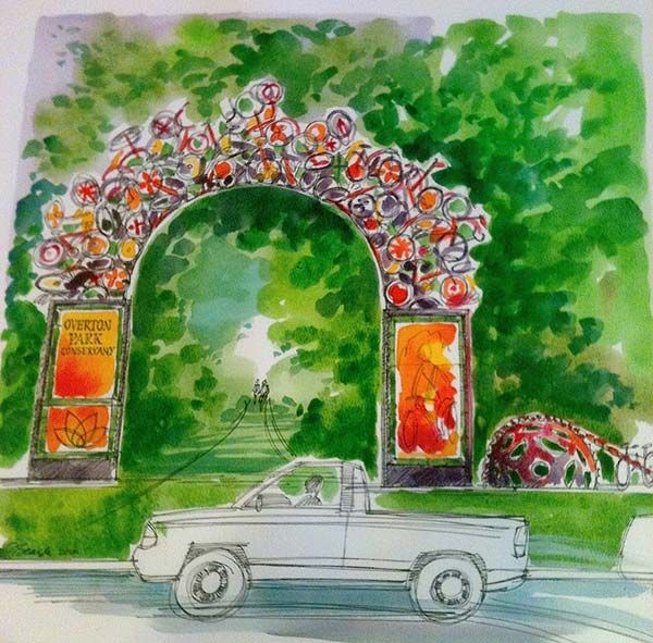
WIGGLE NEIGHBORHOOD GREEN CORRIDOR

 Route Identity and Wayfinding
 The SFMTA added green-backed sharrows to the Wiggle in 2012 to help
 new cyclists navigate this confusing route. What other features would you
 like to see that create a unique character, educate visitors about the
 neighborhood, and help people find their way?

In-Pavement Features                           Gateways                        Signs and Information

 Walk Stops
 Walk Stops is a community-led effort to create distinctive yet unified streetscapes that encourage walking
 and connect communities. Read more in the Walk Stops presentation.

 Should identity and education be a priority for the neighborhood?
You can also read