Towards a digital dataset of the Antarcc geosphere - SCAR GeoMap project and progress
←
→
Page content transcription
If your browser does not render page correctly, please read the page content below
Towards a digital dataset of the
Antarc)c geosphere
SCAR GeoMap project and progress

S.C. Cox1, P. Morin2                            GeoMAP
1 GNS Science, New Zealand s.cox@gns.cri.nz   Ac)on Group
2 PGC, University of Minnesota, USA
                                                            GeoMAP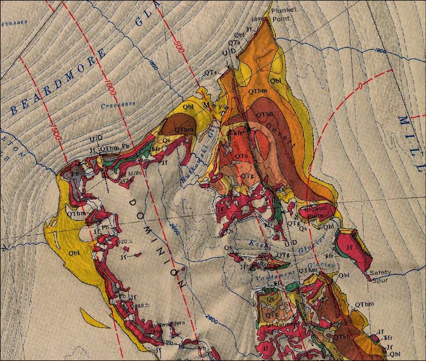
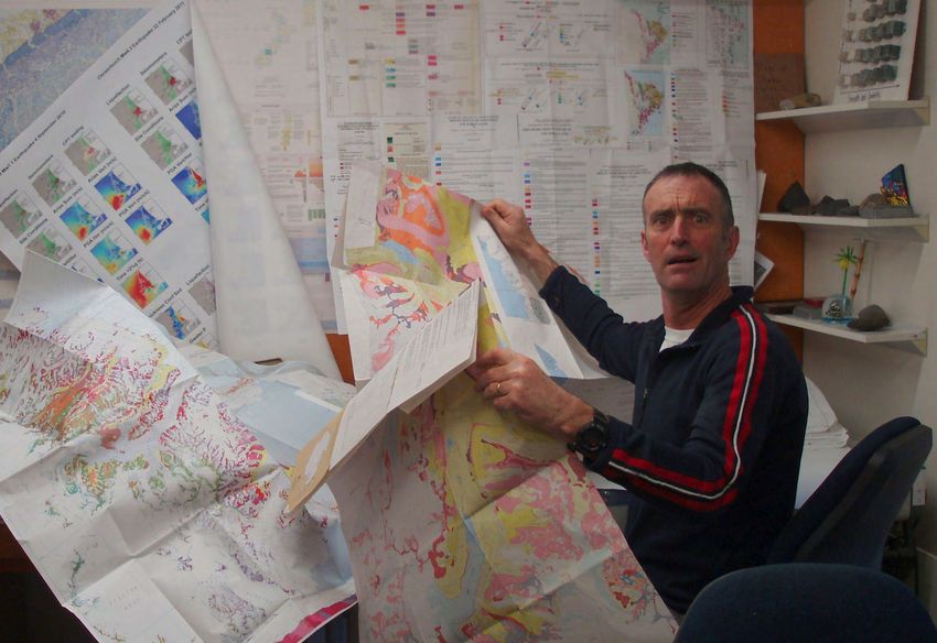
There are numerous,
hard-copy geological
maps, developed last
century……..

                       GeoMAP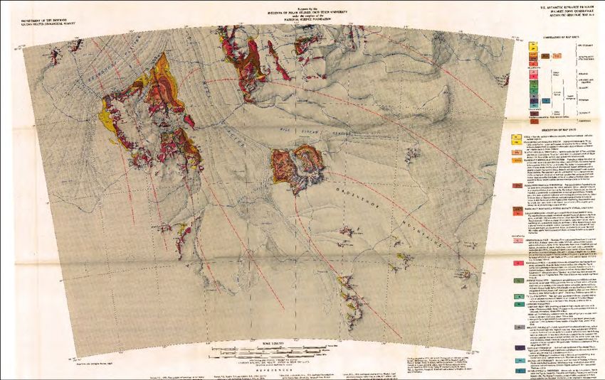
0 50 100   200   300     400      500
                                    km

                                                         HAVE
                                           Lots of old, hard-copy geological maps,
                                           developed last century, mostly represen8ng
                                           ‘deep 8me’.
                       SCALE
                               1,000,000
                               500,000
                               250,000
                                           Poor spa8al reliability.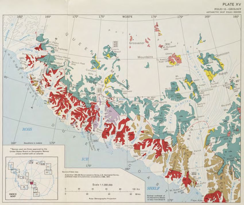
0 50 100   200   300     400      500

                                           Example: McGregor & Wade (1969)
                                    km

                                           Queen Maud Mountains
                                           1:1 million Folio Series

                       SCALE
                               1,000,000
                               500,000
                               250,000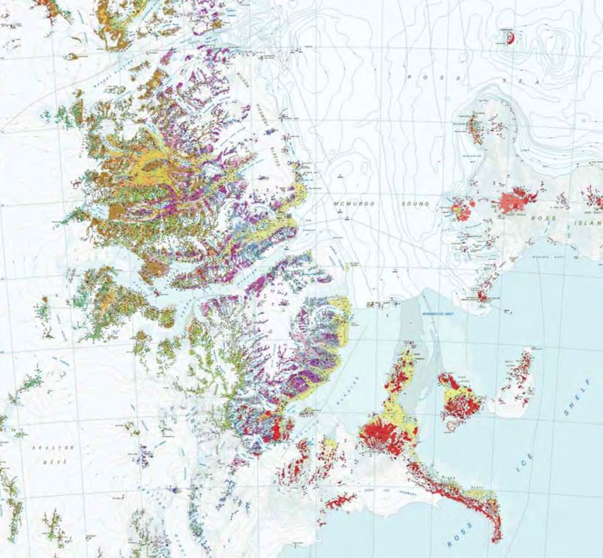
0 50 100   200   300   400   500

                                    Commonwealth Trans-Antarc)c
                               km

                                    Expedi)on
                                    IGY Gunn & Warren (1962)

                                                               GeoMAP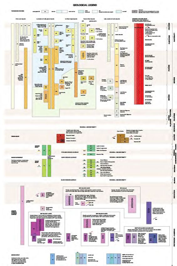
0 50 100   200   300     400      500

                                           Example: Elliot et al. (1974)
                                    km

                                           Plunket Point
                                           Reconnaissance 1:250 k Geology

                       SCALE
                               1,000,000
                               500,000
                               250,000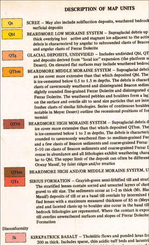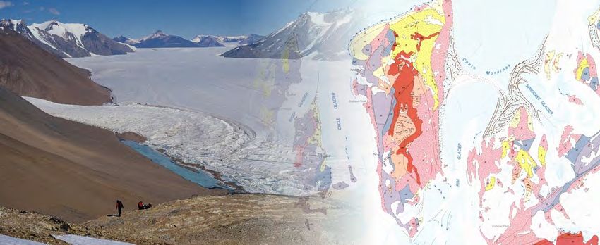
WANT
                                                                         Spa8ally accurate, holis8c overview of
                                                                         deposits and landforms formed by the waxing
                 CODE & UNIT
                     QTms - Quaternary-Tertiary glacials                 and waning of Antarc8ca’s ice masses.
                     Czv - Quat.-Miocene volcanics
                     DJ - Jurassic Ferrar Gp & Dev.-Perm. Beacon S.grp

                                                                         Dataset pinpoin8ng the loca8ons of deposits
                     Pal - Mes.-Paleozoic granitoid & metamorphics

                                                                         and indica8ng their mode of forma8on, age,
                                                                         and likely source.

                                                                         Dataset to provide key underpinning
                                                                         informa)on on the Antarc)c geosphere
                                                                         and its history!

                                                                         For constraining biological and ecological
                                                                         research, iden8fy geoindicators of climate
                                                                         change, improved understanding of
0   50   100   200         300
                                                                         Antarc8ca’s climate role.
                             km

                                                                                                                GeoMAP
TAM Record of           • EAIS
Three Glacial Systems   • WAIS
                        • Local

                                  GeoMAP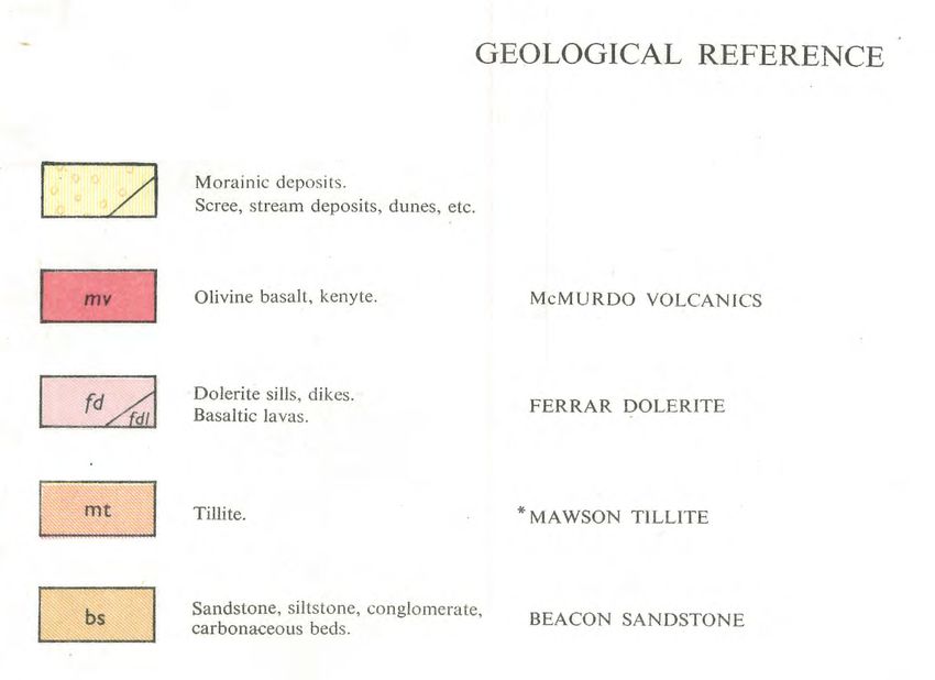
QMAP
Legends                    2012
                     > 70 units

South Victoria Land
 2 surficial units
Gunn & Warren 1962

                                  GeoMAP
Example: Simplified Tradi)onal Display
GeoMAPExample: Non-traditional display utilising GIS
GeoMAPNow Yet to
Involved welcome
GeoMAP Ac)on Group
Integrated programme to capture exis)ng
geological map data, update its spa)al reliability,
improve representa)on of glacial & cover
sequences, and deliver data via web-feature
services.
Proposed and accepted at SCAR 2014.
Interna8onal representa8on solicited.
First workshop to held in Goa at
ISAES XII mee8ng, 12 July 2015.
More people/countries welcome!
GeoMAPGeoMAP
GOAL
Granite
Seasonal Provide a dataset aimed at cross-discipline
water use, or for con)nent-wide perspec)ves,
using a mixed chronostra8graphic- and
‘Unknown’ lithostra8graphic-based classifica8on.
Local
till Migmatite CHALLENGE
Gneiss
Collabora8vely build the first modern
geological dataset to classify and describe
Ice
Antarc8ca's exposed bedrock and surficial
sheet
geology.
till
Orthogneiss Classify and describe around 72,000
dis8nct polygons that cover 51,000 km2.
Basalt Luckily its0 50 100 200 300 400 500
Philosophical Change
km
Conventional “bottom up” construction
QMAP SVL built from 72 sheets @1:50,000
GeoMAPPhilosophy
Rock
“Top down” construction starting from a
continent-scale, low density, attribute-poor
dataset that is added to and improved
CODE & UNIT through multiple iterations
QTms - Quaternary-Tertiary glacials
Czv - Quat.-Miocene volcanics
DJ - Jurassic Ferrar Gp & Dev.-Perm. Beacon S.grp
Pal - Mes.-Paleozoic granitoid & metamorphics
Attributes increasingly
complex
geo01 dataset (Version 1 2014)
0 50 100 200 300
km based on ADD (Version 6) rck01 polygon
GeoMAPGeoMAP Process Stages 1,2
(1)Adjust rock & moraine
polygons (ADD00 ->
LIMA)
Map of Bibliographic (2)Scan and georegister
Sources maps, build source
bibliography
GeoMAPGeoMAP Process Stage 3
(3) Assign each polygon
with map classifica)on
and source info
Unit: Kb
Name: Kirkpatrick Basalt
Source: Capponi et al. 1997b
North Victoria Land
GeoMAPGeoMAP Process Stage 4
(4)Legend Building
The HARDEST PART where
we need local exper8se,
knowledge & help
GeoMAPGeoMAP Process Stage 5
(5)Review
QTm Glacial Geology &
Cover Sequences
CODE & UNIT
QTms - Quaternary-Tertiary glacials
Czv - Quat.-Miocene volcanics Integrate remote sensing,
aerial photos, detailed
DJ - Jurassic Ferrar Gp & Dev.-Perm. Beacon S.grp
Pal - Mes.-Paleozoic granitoid & metamorphics
local studies, to improve
precision of regional
geology and improve
depic8on of glacial
sequences.
Improve classifica8on of
age, composi8on and
source of 8lls and other
0 50 100 200 300
km
surficial deposits.
GeoMAPGeoMAP Process Stage 5
By Source
(5)Review
Local glacier
QTm Glacial Geology &
EAIS Cover Sequences
CODE & UNIT
WAIS
QTms - Quaternary-Tertiary glacials
Czv - Quat.-Miocene volcanics
DJ - Jurassic Ferrar Gp & Dev.-Perm. Beacon S.grp
Pal - Mes.-Paleozoic granitoid & metamorphics
Colluvium Local Ice Ross Lake,
Scree alpine sheet Ice coastal
& valley margin sheet and
glacier tills tills marine
tills deposits
COLDER DRY-BASED GLACIERS
AGE
WARMER WET-BASED GLACIERS
0 50 100 200 300
km
GeoMAPGeoMAP Process Stages 6,7
(6)Assign polygons with
informa)on using GeoSciML
standard
SVL
(7) Develop unified legend
and coding into seamless
MBL
con)nent-wide dataset,
(+peer review, checking)
Version 1.1 in 2019?
Towards a digital
representation of the
Antarctic geosphere: NVL
classification of exposed
rock and sediment outcrops
GeoMAPGeoMAP Achievements 2014-16
DML
Peninsula
1
2
East Ant
3
CTAM 4
MBL
5
SVL
6
NVL
~35% of outcrops 7
now have some form of
digital representation ≥Stage 4
suitable for use at 1:250,000 scale
GeoMAPGeoMAP: Like a spa)al Wikipedia
of the exposed Antarc)c geosphere
Uses: interpreta8on of sub-ice geology,
Seasonal
source characterisa8on of 8lls, ice modelling, water
explora8on for geoindicators of climate change,
biological and ecological studies, ??????
(and maybe even geology!)
Local
till
Help Us! The GeoMap team welcomes
anyone interested in capturing their geological
or geomorphological data, or historical data, Ice
from a par8cular region. sheet
till
Visit the S20 posters in Ballroom 2 @ 14:00
Contact: s.cox@gns.cri.nz
GeoMAPYou can also read