Uluṟu-Kata Tjuṯa National Park - Commercial Image and Media Capture Handbook - Parks Australia
←
→
Page content transcription
If your browser does not render page correctly, please read the page content below
Uluṟu–Kata Tjuṯa National Park
              Commercial Image
              and Media Capture
                     Handbook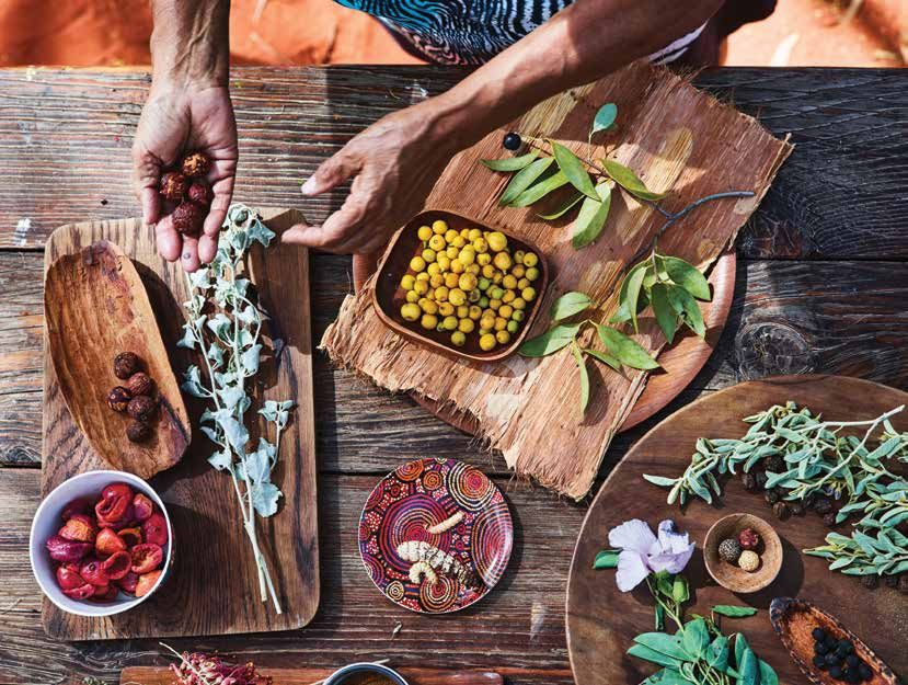
Contents
         Welcome _____________________________________________________________ 4
         Introduction ___________________________________________________________ 5
         About the Media Industry Guidelines ______________________________________ 6
             How to apply the Guidelines ___________________________________________________________8
             Tips for working within the Guidelines ___________________________________________________8
             Further resources __________________________________________________________________10

         About Uluru-Kata Tjuta National Park _____________________________________ 11
             Joint management _________________________________________________________________11
             Cultural values _____________________________________________________________________11
             Tjukurpa – the foundation of Anangu life ________________________________________________12
             Natural values _____________________________________________________________________13
             Non-Aboriginal history ______________________________________________________________14
             Climbing Uluru ____________________________________________________________________16

         Working in the Park ____________________________________________________ 17
             Getting to the park _________________________________________________________________17
             Maps ____________________________________________________________________________17
             Park opening times _________________________________________________________________19
             Seasons __________________________________________________________________________20
             Temperature and rainfall _____________________________________________________________21
             Sunlight __________________________________________________________________________22
             Cultural Centre ____________________________________________________________________24
             Viewing areas and the colours of Uluru __________________________________________________24
             Getting close to Uluru and Kata Tjuta, and not capturing sacred sites __________________________25
             Getting shots of flora and fauna _______________________________________________________32
             Enjoy your visit safely! _______________________________________________________________34
             Road Rules _______________________________________________________________________35
             Where am I allowed to go in the park? __________________________________________________36
             Working with Anangu _______________________________________________________________37
             Mutitjulu community _______________________________________________________________38
             Cross cultural awareness _____________________________________________________________38
             Languages of Uluru _________________________________________________________________40
             Frequently used words in Pitjantjatjara __________________________________________________40

         Contact ______________________________________________________________ 41
         Glossary _____________________________________________________________ 42

2   Commercial Image and Media Capture Handbook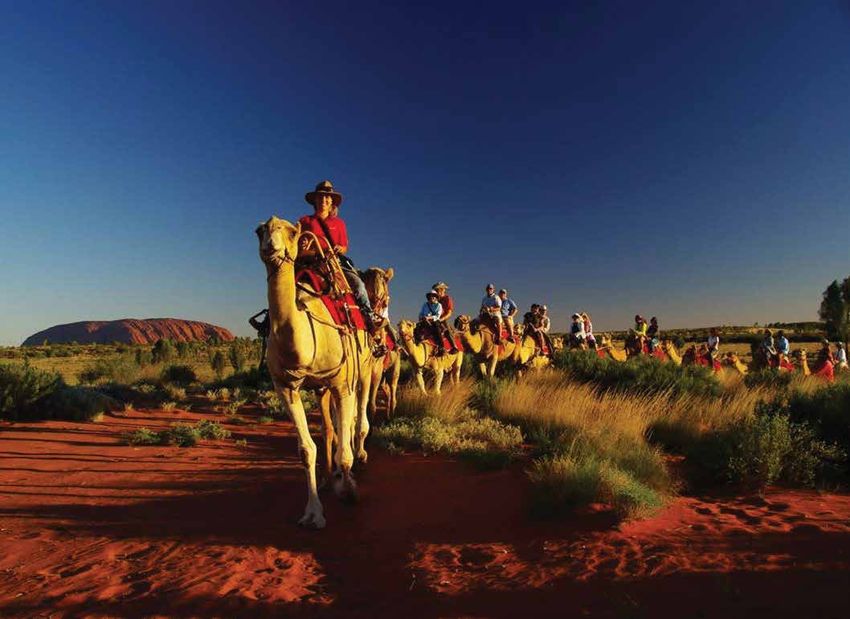
Commercial Image and Media Capture Handbook 3
Welcome
         This is Anangu land and we welcome you
         here to film, write stories and take photos.
         Look around and learn so that you can
         know something about Anangu and
         understand that Anangu culture is
         strong and really important. We
         want you to pass this on through
         your filming, writing and
         photographs so that visitors learn
         about our place and listen to us
         Anangu. However, stay on the right
         path and don’t stray!
         Uluru-Kata Tjuta National Park Film
         and Photography Consultative Committee

4   Commercial Image and Media Capture Handbook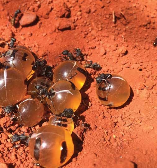
Introduction
This handbook has been developed as a companion to the Media
Industry Guidelines for Commercial Image, Footage, Recording and
Likeness Capture and Use (the Guidelines). The information in the
handbook can be used as a tool for planning film, photography
and other media projects at Uluru-Kata Tjuta National Park (the
park). The handbook has been developed to help you get the best
out of your work in the park’s stunning World Heritage landscape
while producing a product that fits within the values of the Anangu
traditional owners.

                                             Commercial Image and Media Capture Handbook   5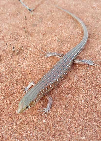
About the Media Industry Guidelines
         The Guidelines detail the rules and requirements for using or capturing images,
         footage, recording or likeness of the park for commercial purposes.
         The Guidelines have been developed to help commercial operators carry out their work and promote this significant
         place, in line with its cultural and natural values. They have been developed in collaboration with Anangu and
         representatives from the tourism, media, film and photographic industries.

         If you are an organisation, group or individual wanting to film, photograph, paint, draw, record sound or capture any
         other likeness in or of the park, or use existing images or footage of the park for commercial purposes, you must follow
         the Guidelines and apply for a permit, licence or accredited licence.

         There are four different types of permits and licences:
         1. Permit – for existing or third-party images or footage. This might include use of a professional photo on tour
            brochure.
         2. Permit – for one-off projects to capture new images or footage, that are generally smaller in scale and present a low
            risk to the park and its values. This might include a photoshoot for a tourism product.
         3. Licence – for larger and more complex projects, such as a multi-day film shoot that might require cultural
            supervision.
         4. Accredited licence – for key stakeholders or locally-based professionals who frequently work in or use images or
            footage of the park.

         The Guidelines explain each of these four permits and licences and what is allowed, what the requirements are and the
         application process to obtain the permit or licence.

         The Guidelines are in place to protect Anangu against inappropriate use and benefits to others from the commercialisation
         of their Indigenous Cultural Intellectual Property (ICIP). ICIP can include elements of cultural knowledge, inma (traditional
         ceremony incorporating song and dance), art, design and other elements of culture. This also incorporates Tjukurpa stories
         (creation time stories) and their associated ancestral beings.

         The system underpinning the Guidelines gives Anangu the right to control use, dissemination and reproduction of their ICIP
         for commercial purposes by ensuring that an authorised agreement describing appropriate use has been entered into.

         If you are an amateur photographer or visitor taking or sharing images or footage in or of the park for personal use
         and not for commercial purposes, you do not have to follow the Guidelines.

6   Commercial Image and Media Capture Handbook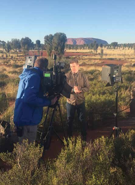
Guide to the application process

   Do I want to use an image of                                                                                          No permit or
                                         NO
  Uluru-Kata Tjuta National Park?                                                                                      licence required

               YES

                                                                                                                     Apply for an image
                                                                                                                     use permit. Please
       Is the use defined as                                                                                         contact the Media
       commercial? (please               NO                                                                                Office
   refer to definitions page 42)

               YES

                                                                                                                       Contact Media
                                                                    Existing image
                                                                                                                       Office to assess
                                                                  (stock library etc)
                                                                                                                     and approve image

                                                                                EXISTING

  Does the image use meet the                                     Is the image/media               NEW
 criteria in regards to acceptable                                                                                    Shooting outside
                                                                 existing, or do I want
   uses of images of Uluru-Kata                                                                                        the park (ie from
                                         YES                      to enter the park to
         Tjuta National Park                                                                                          Ayers Rock Resort)
                                                                   shoot new images
 (see Media Industry Guidelines)

             NO                                                                    NEW

                                                           Shooting inside the National Park,
                                                                   including aerial

                                                                                                              You are a frequent visitor
                                       Shooting stills                                                        or local professional who
                                         and video                                                             accesses the park on an
   You may not use images of                                                                                        ongoing basis
 Uluru-Kata Tjuta National Park
   for this proposed purpose
  (contact the Media Office to
 discuss other potential uses).                                  Shooting video for a
                                                                  more complex or
                                                               longer project, that may
                                                              have Anangu involvement

                                                                      Apply for a
                                     Apply for a Permit,            Accreditation,                               Apply for a Licence,
                                     please contact the             please contact                               please contact the
                                        Media Office               the Media Office                                 Media Office

                                                                                                Commercial Image and Media Capture Handbook   7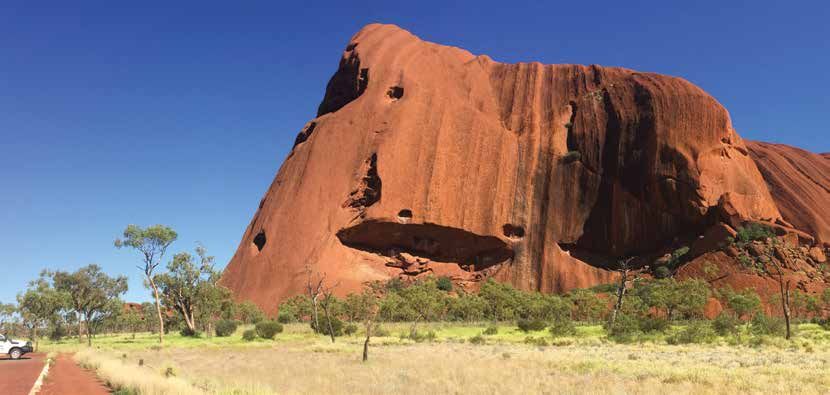
How to apply the Guidelines
         See the Guidelines, Section 5 ‘Permits, licences, accreditation licences and approvals’
         for more information on what permit or licence you need and how to apply.
         Journalists and news photographers, camera operators or recordists do not need to apply for a permit or licence to
         cover news of the day. News of the day is declared by the Director of National Parks or a nominated representative.
         For coverage of events that are not classified as news of the day, media organisations need to apply for a permit,
         licence or accreditation.

         Commercial social media account holders wanting to post images or footage of the park need to apply for a permit,
         licence or accreditation. For more information on social media use in Uluru-Kata Tjuta National Park, refer to the
         Guidelines, Section 5.6 ‘Social Media.’

         Once you have obtained the necessary permit or licence, you must ensure you follow all other rules and requirements
         outlined in the Guidelines. This includes not capturing sacred and sensitive sites as outlined in this Handbook under
         ‘Working in the park – Getting close to Uluru and Kata Tjuta, and not capturing sacred sites’ and in the Guidelines,
         Section 4.1 ‘Sacred and Sensitive Sites.’ Capturing images of such sites is offensive to Anangu and are not considered
         appropriate for commercial use.

         Your permit, licence or accreditation will be subject to conditions requiring you to comply with the Guidelines.
         A Parks Australia staff member may ask to see your permit and any breach of conditions may lead to Parks Australia
         taking compliance action including the possible cancellation of your permit, licence or accreditation.

         Tips for working within the Guidelines
         • Ensure you start the application process well in advance, especially if your project is complex.
         • Ensure you only take or use images or footage for the purpose/s stated in your permit or licence.
         • Proposals that involve Anangu are encouraged and will be positively considered.
         • Proposals that enhance the cultural and natural values of the park are encouraged and will be positively considered.
         • Ensure you follow the protocols for working in the park, otherwise your image or footage may not be approved for use.
         • Be prepared to be flexible if your project requires Anangu involvement as talent or for cultural supervision purposes.
         • If in doubt, or you would like further information, or to discuss the particulars of your project, contact the Media Office
           on +61 08 8956 1113 or +61 08 8956 1114.

8   Commercial Image and Media Capture Handbook
Commercial Image and Media Capture Handbook 9
Further resources
          The following resources can be found at www.environment.gov.au/resource/media-and-artists:

          • Media Industry Guidelines
          • application forms
          • talent release forms.

10   Commercial Image and Media Capture Handbook
About Uluṟu–Kata Tjuṯa National Park
The Uluru-Kata Tjuta landscape is a significant place of knowledge and learning. All the plants, animals, rocks, and
waterholes contain important information about life and living here now and for all time, especially for Anangu. Anangu is
the term that Pitjantjatjara and Yankunytjatjara Aboriginal people, from the Western Desert region of Australia, use to refer
to themselves. Pitjantjatjara and Yankunytjatjara are the two principal dialects spoken in Uluru-Kata Tjuta National Park.
Uluru-Kata Tjuta National Park is a living cultural landscape representing the combined works of Anangu and nature
over millennia. The park is inscribed on the World Heritage List under the World Heritage Convention for its outstanding
natural and cultural values. It is one of the few sites that are listed under the World Heritage Convention for both cultural
and natural values.
The park is owned by the Uluru-Kata Tjuta Aboriginal Land Trust. It covers about 1,325 square kilometres and is located
335 kilometres by air or about 446 kilometres by road to the south-west of Alice Springs. The Ayers Rock Resort at Yulara
adjoins the park’s northern boundary. Both the park and the resort are surrounded by Aboriginal freehold land held by
the Petermann and Katiti Land Trusts.
Joint management
Anangu have looked after, and in turn been looked after by, the land for thousands of years. Joint management is the
term used to describe the working partnership between Anangu and the Director of National Parks as lessee of the park.
Joint management brings together cultural and scientific knowledge and experience, different governance processes,
and interweaves two law systems – Piranpa (white person/western) law and Tjukurpa (traditional law). Working together
means learning from each other, respecting each other’s cultures and finding innovative ways to bring together different
ways of seeing and interpreting the landscape and its people.
Cultural values
According to Anangu, the landscape was created and shaped at the beginning of time by ancestral beings. Anangu
are the direct descendants of these beings and they are responsible for the protection and appropriate management
of these lands. The knowledge necessary to fulfil these responsibilities has been passed down from generation to
generation through Tjukurpa.
Tjukurpa unites Anangu with each other and with the landscape. It embodies the principles of religion, philosophy and
human behaviour that are to be observed, in order to live harmoniously with one another and with the natural landscape.
‘The Uluru-Kata Tjuta landscape is and will always be a significant place of knowledge and learning. All the plants,
animals, rocks, and waterholes contain important information about life and living here now and for all time. Anangu
grandparents and grandchildren will always gain their knowledge from this landscape. They will live in it in the proper
way. This is Tjukurpa’ – Anangu traditional owner.
Commercial Image and Media Capture Handbook 11Tjukurpa – the foundation of Anangu life
Tjurkurpa has many complex but complimentary meanings. There is no simple translation into English. Tjukurpa
embodies the principles of religion, philosophy and human behavior that are observed for people to live harmoniously
with each other and the land. Tjukurpa encompasses Anangu law, lore, cultural, morality, ceremony, inma, creation time
stories, art and cultural knowledge. It sets out rules for living, rules for social interacting and how to care for country.
It refers to the past, present and future.
Tjukurpa and creation
Tjukurpa tells of how creation ancestors erupted from the featureless surface of earth and travelled across it, having
adventures and leaving their mark on the landscape in many forms. The features of the park tell this story.
Tjukurpa as a world view
Tjukurpa details how important parts of social behaviours and the proper ways of doing things originated. It contains
the way the social and physical worlds came into being, as well as the form which the land and human relationships
took in the beginning. It provides the basis for the world view of Anangu.
Tjukurpa as an ethical belief system
Tjukurpa contains propositions for what is right and wrong. Like other systems of morality and justice, it provides Anangu
with an ethical system for what should and shouldn’t be. Tjukurpa could be understood as metaphors and symbolic
stories, much as the parables of Jesus Christ serve as ethical guides for Christians.
Tjukurpa as law
Tjukurpa is a legal system containing rules to guide correct procedures for dealing with problems. It sets out the nature
of possible problems, as well as penalties for breaking rules. Tjukurpa also establishes rules to manage the land.
Passing on Tjukurpa
Tjukurpa is an oral tradition and there are obligations to pass on this knowledge to the right people.
Ceremonies play an important role in passing on knowledge to specific people. Groups in the kinship system have
responsibility to maintain different parts of Tjukurpa. There are many interrelated ways for remembering Tjukurpa, such
as specific verses of inma, site-related stories, ritual dances or art.
Tjukurpa is extremely important to Anangu, who can share some information with non-Aboriginal people but have an
obligation to protect sacred information.
Tjukurpa is the foundation of Anangu life. It encompasses:
• Anangu religion, law and moral systems
• the past, the present and the future
• the creation period when ancestral beings, Tjukaritja/Waparitja, created the world as it is now
• the relationship between people, plants, animals and the physical features of the land
• the knowledge of how these relationships came to be, what they mean, and how they must be maintained in
daily life and in ceremony.
12 Commercial Image and Media Capture HandbookNatural values
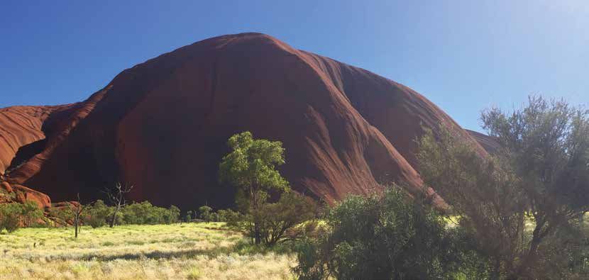
The park’s landscape is dominated by the iconic formations of Uluru and Kata Tjuta. Uluru is made from sedimentary rock
called arkose sandstone. It is 9.4 kilometres in circumference and rises about 340 metres above the surrounding plain.
Kata Tjuta comprises 36 rock domes of varying sizes made from a sedimentary rock called conglomerate. One of the
domes, rising about 500 metres above the plain (or 1,066 metres above sea level), is the highest feature in the park.
The park is home to a particularly rich and diverse number of arid environment species, most of which are unique
to not only Australia but the habitat of the park. Uluru and Kata Tjuta provide runoff water which finds its way into
gorges and drainage to support flora and fauna in an otherwise arid environment.
Common fauna that you might encounter include: Common flora that you might come across include:
• red kangaroo (Macropus rufus) • four species of spinifex:
• thorny devil (Moloch horridus) – soft spinifex (Triodoa pungens)
• perentie (Varanus giganteus) – hard spinifex (Triodia basedowei)
• spinifex hopping mouse (Notomys alexis) – feathertop spinifex (Triodia schinzii)
• dingo (Canus lupus dingo) – porcupine grass (Triodia iriitans)
• echidna (Tachyglossus aculeatus)
• common mulga (Acacia aneura) and Uluru mulga
• Stimson’s python (Liasis stimsoni) (Acacia ayersiana)
• Western brown snake (Pseudonaja nuchalis) • many specifies of eucalyptus, including desert
• Black breasted kite (Hamiristra melanosternon) bloodwood (Eucalyptus terminalis), river red gum
• budgerigar (Melopsittacus undulates) (Eucalyptus camaldulensis) and blue mallee (Eucalyptus
gamophylla)
• crimson chat (Epthianura tricolor).
• desert oak (Allocasuarina decaiseana)
• honey grevillea (Grivillea eriostachya).
The park’s ecological zones include the following recordings:
619 plant species
26 native including eight rare or
mammal endangered species
species
including several species of small marsupials
and native rodents and bats and the recently
reintroduced mala
74 species of reptiles
including a newly described species in 2006
176 native bird species
4 amphibian species
Commercial Image and Media Capture Handbook 13Exerpt from I am Uluru: A family’s story
Jen Cowley with the Uluru Family, 2018. (Commonwealth Department of Communications and the Arts) p. 17, 27 and 30.
The following excerpt is taken from I am Uluru: A family’s story, and describes the 1934 shooting of an Anangu man near
Mutitjulu Waterhole.
Excerpt 1:
With the help of an Anangu man who spoke a little stories that spread across country like a storm of dust – tales
English, the four had pieced together both the charge of Anangu bound and whipped and killed without mercy
against them and their coming fate. by skittish piranpa who needed but feared the ancient ways
of the black skinned people with whom they shared a quest
The creature they had speared, thinking it was mamu,
for survival in the central deserts of Australia.
belonged to the piranpa station owner – a milking cow
– and Imalyangu, his brother and their two companions With Imalyangu’s ill-fitting new name, Paddy, came an
stood accused of trying to kill and eat the creature, which equally ill-fitting sense that a swift and dangerous shift was
had instead found its way back to the station with two coming to bring change to an ordered Anangu world that
tell-tale spears dangling from its side. had remained unbroken since the creation beings formed
the land and its laws. And this man, Paddy, knew that as
Piranpa looked unkindly, to say the least, on what they
surely as the blazing sun would soon dip below the horizon,
called “stealing”, a term foreign to Anangu who had
he and his three fellow captives would not see it rise again
no concept of ownership beyond sacred traditional
if they could not escape the chains that held them.
knowledge. For Anangu, everything – from the sky to the
land and all the people and plants and animals on it – Excerpt 2:
belonged to Tjukurpa, and therefore to everyone. Anangu Reggie Uluru:
way was to share. Not so for piranpa whose wrath knew “So they ran. They were so frightened for their lives. And
no bounds when it came to the appropriation, intentional they ran and ran and ran. They left Uluru and the Mutitjulu
or otherwise, of what they considered their property. waterhole and they ran away.
Imalyangu knew he and Yukun and their friends would The men just fled in fear. But this was Paddy’s homeland
soon feel the full force of that fury and, without English and it would have been very hard for him to leave.
words, could do little to defend themselves.
People would say, “Come back to your home country
He wondered what difference a grasp of this strange (Uluru) but they would say, “No, I’m still frightened.”
language would make, anyway. The men had heard the That’s because of what happened.”
Recent history
1870s Expedition parties headed by explorers Ernest Missionary EE Kramer is the first non-Aboriginal
Giles and William Gosse were the first Europeans person to record Uluru as a sacred place.
to visit the area. Uluru was named ‘Ayers Rock’
The expansion of pastoralism south and west
and Kata Tjuta ‘Mt Olga’ or ‘The Olgas’ by these
of Alice Springs leads to conflict between
explorers to honour political figures of the day.
non-Aboriginal and Aboriginal people over
1920s The Commonwealth, South Australian and resources such as water and hunting grounds.
Western Australian Governments declared the
1930s Police patrols in the area increase, and an Anangu
great central reserves, including the area that
man is shot near Mutitjulu waterhole after
is now the park, as sanctuaries for a nomadic
escaping custody resulting in many Anangu
Aboriginal people who had virtually no contact
leaving the area (see excerpt above).
with white people.
14 Commercial Image and Media Capture Handbook1940s In 1948 the first vehicle track to Uluru was Land Trust in an event known as ‘Handback’.
constructed, responding to increasing tourism Anangu traditional owners lease the park to the
interest in the region. Director of National Parks for a period of 99 years.
Traditional patterns of land use end, but Anangu The inaugural Board of Management was
continue to have strong ties with the land. gazetted on 10 December 1985 and held its first
meeting on 22 April 1986.
1950s Tour bus services began and later an airstrip,
several motels and a camping ground were built In 1987 the park is internationally recognised
at the base of Uluru. by the United Nations Educational Scientific
and Cultural Organisation (UNESCO) as a World
Due to increased tourism to the region, the area
Heritage Area for its spectacular geological
that is now the national park is excised from the
formations, rare plants and animals and
Petermann Aboriginal Reserve.
exceptional natural beauty.
1960s In 1962, 5,462 tourists are recorded visiting the park.
1990s In 1993, at the request of Anangu and the Board
The Wave Hill walkoff results in many Anangu of Management, the park’s official name was
leaving pastoral stations and returning to Uluru. changed to Uluru-Kata Tjuta National Park.
In 1994, the park becomes only the second place
1970s All accommodation and tourism-related facilities are
in the world to be recognised for its cultural
reestablished outside the park to prevent adverse
values as well as its natural values as a dual-listed
environmental impact. The new site is located 18
World Heritage Area.
kilometres from Uluru and is known as Yulara.
In 1995 the park won the Picasso Gold Medal, the
The Aboriginal Land Rights (Northern Territory)
highest UNESCO award, for outstanding efforts to
Act 1976 (Land Rights Act) is introduced and the
preserve the landscape and Anangu culture and
Central Land Council is established to represent
for setting new international standards for World
traditional owner views to government.
Heritage management.
In 1977 the park becomes the first area declared
under the National Parks and Wildlife Conservation 2000s The NPWC Act is replaced by the Environment
Act 1975 (NPWC Act), under the name Uluru (Ayers Protection and Biodiversity Conservation Act 1999
Rock-Mount Olga) National Park. (EPBC Act) in 2000.
The Ininti store was established, employing The park hosts the start of the Sydney Olympic
14 Aboriginal people and providing a vital outlet Games in 2000.
for supermarket items, fuel and a power station.
2010s onwards
This was a venture that was symbolically seen as
a return of Aboriginal people to Uluru, but this In 2012 the park took out the top prize at the
time, as commercial operators. Qantas Australian Tourism Awards.
1980s At a major ceremony at the park on 26 October In 2017, visitor numbers reach 303,015.
1985, the Governor-General formally granted title
In 2017 The Board of Management unanimously
to the park to the Uluru-Kata Tjuta Aboriginal
vote to close ‘the climb’ from October 2019.
-60000 -30000 0 (years)
2000
Earliest evidence of Aboriginal occupation of Australia
Archaeological evidence of Aboriginal existance in Central Australia
European contact with Anangu in Central Australia
Commercial Image and Media Capture Handbook 15Climbing Uluru
In November 2017, the Board of Management unanimously voted to close the climb from 26 October 2019. The Uluru-Kata
Tjuta National Park Management Plan 2010-2020 stated that the Uluru climb would be closed once one of three
preconditions had been met. These included that less than 20 per cent of visitors climb and that the cultural and natural
experiences on offer are the main reasons why people visit the park.
The number of people climbing each year fell from 74 per cent of all visitors in the 1990s, to 16.2 per cent in 2015, and
today there are more than 150 alternate tours and experiences provided by Anangu, tour operators, Ayers Rock Resort
and park rangers.
Between 2002 and 2009 there were 74 rescues of climbers requiring medical attention, with a typical major rescue
costing around $900,000. More than 30 people have died attempting to climb the very steep path.
The ‘climb’ is the traditional route taken by the ancestral Mala (Rufous hare-wallaby men) on their arrival at Uluru and is
of great spiritual significance. Tjukurpa requires that Anangu take responsibility for looking after visitors to their country
and each time a visitor is seriously or fatally injured at Uluru, Anangu share in the grieving process.
Message from Uluru-Kata Tjuta National Park Board of Management
chairman and senior traditional owner Sammy Wilson
Anangu have always held this place of Law. Other people have found it hard to understand what this means;
they can’t see it.
But for Anangu it is indisputable.
So this climb issue has been widely discussed, including by many who have long since passed away.
More recently people have come together to focus on it again and it was decided to take it to a broader
group of Anangu. They declared it should be closed. This is a sacred place restricted by law.
Some people, in tourism and government for example, might have been saying we need to keep it open but
it’s not their law that lies in this land. It is an extremely important place, not a theme park like Disneyland.
If I travel to another country and there is a sacred site, an area of restricted access, I don’t enter or climb it,
I respect it. It is the same here for Anangu. We welcome tourists here. We are not stopping tourism, just
this activity.
After much discussion, we’ve decided it’s time.
The government needs to respect what we are saying about our culture in the same way it expects us to
abide by its laws. It doesn’t work with money. Money is transient, it comes and goes like the wind.
In Anangu culture Tjukurpa is everlasting.
It’s about protection through combining two systems, the government and Anangu.
Over the years Anangu have felt a sense of intimidation, as if someone is holding a gun to our heads to keep it
open. Please don’t hold us to ransom….
This decision is for both Anangu and non- Anangu together to feel proud about; to realise, of course it’s the
right thing to close the ‘playground’.
The land has law and culture. We welcome tourists here. Closing the climb is not something to feel upset
about but a cause for celebration.
Let’s come together; let’s close it together.
16 Commercial Image and Media Capture HandbookWorking in the Park
Getting to the park
Distance and travelling times
To From Distance Time
Road
Alice Springs Yulara 446 km approx. 5 hours
Ayers Rock Resort Uluru 18 km approx. 20 minutes
Ayers Rock Resort Kata Tjuta 53 km approx. 45 minutes
Uluru Ring Road 16 km approx. 25 minutes
Ayers Rock Resort Talinguru Nyakunytjaku (TN) 23 km approx. 30 minutes
Uluru Kata Tjuta 43 km approx. 45 minutes
Air
Alice Springs Ayers Rock Airport – 50 minutes
Melbourne Ayers Rock Airport – 3 hours
Sydney Ayers Rock Airport – 3 hours 30 minutes
Maps
Regional map of Central Australia, including Alice Springs
and Uluru–Kata Tjuta National Park
Ikuntji
Haasts Bluff
to Darwin
Arltunga
Glen Helen Ross River
Tylers Pass
Tnorala
(Gosse Bluff) ALICE SPRINGS
Ntaria Mbantua/Mparntwe
Palm Valley (Hermannsburg)
© Director of National Parks Watarrka
Map: In Graphic Detail Kings Canyon
Titjikala
Chambers Maryvale
Pillar
Erldunda
to Kaltukatjara Kata Tjuta
Yulara/Resort
and WA border Mt Ebenezer
(Docker River) Curtin Springs Kulgera
Uluru to Adelaide
Commercial Image and Media Capture Handbook 17Area map of Uluru–Kata Tjuta National Park
CONNELLAN AIRPORT
VALLEY OF
THE WINDS
CARPARK Sealed road
Unsealed road LASSETER HIGHWAY
National park boundary
ALICE SPRINGS 443 KM
Yulara/Resort area YULARA/RESORT
SUNSET
VIEWING PARK ENTRY STATION
AREA
Kata Tjuta
TO
KALTUKATJARA
AND WA
BUSES CARS Uluru
ALLOW 110 KM RETURN TO KATA TJUTA
BORDER MUTITJULU 5 10 km
FROM CULTURAL CENTRE OR YULARA 0
(DOCKER
RIVER) SUNRISE VIEW AREA
WALPA KATA TJUTA TALINGURU NYAKUNYTJAKU
SUNSET VIEWING
GORGE DUNE VIEWING AREA AREAS
CULTURAL CENTRE © Director of National Parks,
CARPARK (SUNRISE AND SUNSET) Australian Government
Designed by In Graphic Detail
Uluru, showing walks and sunrise and sunset viewing areas
18 Commercial Image and Media Capture HandbookKata Tjuta, showing walks and sunrise and sunset viewing areas
Karu (1st) Lookout
Track closed here at 36 degrees Celsius or above
Valley of the Winds Walk
sunset viewing area
Karingana (2nd) Lookout
only toilet facilities
at Kata Tjuta
Walpa Gorge
to Kaltukatjara Walk
and WA border
(permit required)
Sealed road
Unsealed road
Walking track 0 1 km
Kata Tjuta dune viewing area
sunrise and sunset
Drinking water
to Yulara/Resort/
Picnic area Cultural Centre/Uluru
Toilets
Emergency radio alarm
Park opening times
Month Open Close
Dec, Jan, Feb 5:00am 9:00pm
March 5:30am 8:30pm
April 5:30am 8:00pm
May 6:00am 7:30pm
June, July 6:30am 7:30pm
Aug 6:00am 7:30pm
Sept 5:30am 7:30pm
Oct 5:00am 8:00pm
Nov 5:00am 8:30pm
The park closes overnight. Astrophotography may be undertaken in the park outside opening hours under a licence.
There is no camping available within the park.
Commercial Image and Media Capture Handbook 19Seasons
Different seasons for different light.
Anangu have a different way of classifying the seasons of the year, with different
names and indicators for each season. You can use this information to help you plan
the best time of year to visit, if you are after a specific shot. For example, you are most
likely to see the wildflowers in bloom after winter rain, during Piriyakutu.
Piriyakutu/piriya piriya (usually August to September)
5-28o +
Temperatures of around 25 degrees Celsius during the day, but still cool at night, with little
to no rainfall. This is when the piriya comes – the name for the warm steady wind that arrives
from the north and west. Animals breed, food plants flower, fruit and seed. Hibernating reptiles
NW come out and the honey grevillea is in bloom. This is a good time for hunting kangaroo.
20-40o + Mai wiyaringkupai/kuli (around December)
The hottest time of the year with daytime temperatures regularly reaching over 40 degrees
Celsius. There is not much food around at this time. There are storm clouds and lightning,
but little rain. Lightning strikes can start fires.
Itjanu/inuntji (usually January to March)
22-36o +
Storms and rain come, with the region receiving its highest rainfall for the year. Temperatures
remain hot, with daytime temperatures staying over 35 degrees Celsius. This is when
overcast clouds usually bring rain. During this season the food plants flower. If the rains are
good there is plenty of fruit and seed. The general flow of the weather is from west to east,
though storms can come in from other directions, frequently steering from the northwest
with an approaching change. Puffy stratocumulus clouds appear on the western horizon
W to E and move east quickly covering the sky. About ten minutes before a storm hits the wind
picks up and the temperature drops.
Wanitjunkupai (usually April to May)
10-29o +
Cold weather starts. This is when the park’s reptiles start to hibernate. Tjuntalpa (clouds)
start around April but usually don’t bring rain. They come from the south, mainly by
westerly winds. Tjuntalpa sit low over the hills until late in the day. Daytime temperatures
W
start to cool to between 20 and 30 degrees Celsius and nighttime temperatures cool off.
Wari (late May, June and July)
This is the cold time, when there is nyinnga (frost) and kulyar-kulyarpa (mist or dew) every
morning but little rain. Frosts are common during winter when high pressure systems move
through the area combining cooler dry air with nocturnal radiation. The frosts cure the
0 and below-20o +
grasses, drying and preserving them and this dry fuel feeds fires ignited during the early
summer. The air is very dry and there is little to no rain. Daytime temperatures are between
10 and 20 degrees Celsius.
20 Commercial Image and Media Capture HandbookTemperature and rainfall
Average temperatures and rainfall – Yulara airport
50
40
30
20
10
0
J F M A M J J A S O N D
Average temperature Average lowest temperature
Average highest temperature Average rainfall (ml)
Statistics Jan Feb Mar Apr May Jun Jul Aug Sep Oct Nov Dec Annual
Average maximum 38.4 36.9 34.5 29.8 24.3 20.4 20.5 23.7 28.7 32.3 35.1 36.5 30.1
temperature (°C) for
years 1983 to 2017
Statistics Jan Feb Mar Apr May Jun Jul Aug Sep Oct Nov Dec Annual
Highest temperature 46.4 45.8 42.9 39.6 35.7 31.4 31.1 35.0 38.7 42.3 45.0 47.0 47.0
(°C) for years 1983
to 2017
Statistics Jan Feb Mar Apr May Jun Jul Aug Sep Oct Nov Dec Annual
Average minimum 22.8 22.1 19.3 14.4 9.4 5.7 4.5 5.9 10.7 14.9 18.4 20.8 14.1
temperature (°C) for
years 1983 to 2017
Statistics Jan Feb Mar Apr May Jun Jul Aug Sep Oct Nov Dec Annual
Lowest temperature 12.7 12.1 8.0 1.3 1.1 -1.8 -3.6 -2.2 -1.0 3.7 6.5 9.9 -3.6
(°C) for years 1983
to 2017
Statistics Jan Feb Mar Apr May Jun Jul Aug Sep Oct Nov Dec Annual
Average rainfall (mm) 27.3 38.9 33.8 16.3 14.8 18.9 18.2 5.0 9.0 21.1 33.1 45.5 284.3
for years 1983 to 2017
Statistics Jan Feb Mar Apr May Jun Jul Aug Sep Oct Nov Dec Annual
Average number of 5.0 4.5 2.9 2.3 2.9 2.8 2.7 1.3 2.3 3.9 5.7 6.4 3.6
days of rain for years
1800 to 3000
Commercial Image and Media Capture Handbook 21Sunlight
Sun trajectory mid-summer
Summer solstice – 22 Dec
05:27 – dawn
05:53 – sunrise
12:45 – solar noon
19:36 – sunset
20:02 – dusk
= centre of Uluru
Noon
N
Sunset Sunrise
Sun trajectory mid-autumn
Autumnal equinox – 20 March
06:27 – dawn
06:50 – sunrise
12:54 – solar noon
18:59 – sunset
Noon 19:21 – dusk
= centre of Uluru
N
Sunset Sunrise
22 Commercial Image and Media Capture HandbookSun trajectory mid-winter
Winter solstice – 21 June
07:07 – dawn
Noon 07:32 – sunrise
12:48 – solar noon
18:05 – sunset
18:30 – dusk
Sunset Sunrise
= centre of Uluru
N
Sun trajectory mid-spring
Spring equinox – 22 September
06:14 – dawn
06:37 – sunrise
12:40 – solar noon
18:42 – sunset
Noon 19:05 – dusk
= centre of Uluru
N
Sunset Sunrise
Commercial Image and Media Capture Handbook 23Cultural Centre
The Cultural Centre will introduce you to Anangu culture in a very special cultural and natural environment. There is an
opportunity to add depth to the visitor experience here through learning about Tjukurpa, the traditional law guiding
Anangu, and the foundation of Anangu culture.
Viewing areas and the colours of Uluru
There are viewing areas built specifically for experiencing and photographing this beautiful landscape.
One of the most spectacular things to witness is the ever-changing colours of Uluru. The colour of the rock from one
location can change throughout the day to be shades of black, grey, purple, red, ochre, orange or blue, depending on
the light, the weather and your location. For the iconic shot of Uluru, the best place to do this is at the sunset viewing
areas. During peak season, you’ll want to get there early to reserve your spot, as the car park can fill up quickly.
If you want to get the colours of the sunset with Uluru as a silhouette, go to the opposite location. For example, go to
the Sunrise Viewing platform while the sun is setting (Talinguru Nyakunytjaku) or the sunset car park as the sun rises
in the morning.
24 Commercial Image and Media Capture HandbookGetting close to Uluru and Kata Tjuta, and not capturing sacred sites
While you can capture stunning landscapes and iconic shots of the magnitude of the rock formations from a distance,
you can get equally exciting shots up close. Getting closer means you can immerse yourself in the myriad of different
environments, moods, details and textures that reveal themselves, which cannot be experienced from a distance.
Be careful that you do not inadvertently capture detail of sites of significance in your shots. Examples of images that are
taken in locations where it is possible to capture sacred sites are shown on pages 26 and 27. By obscuring these behind
a bush, tree, person or subject, the detail of the sacred site is then hidden and would be approved. Another trick is to
focus on a subject in the foreground with a long lens and a shallow depth of field and use in-camera techniques to
avoid the detail of the sacred site.
Why are there restrictions on shooting the sacred or sensitive sites?
Tjukurpa establishes the rules used to govern society and manage land. It also dictates correct procedures
for dealing with problems and sometimes severe penalties for breaking the rules. Although these penalties
have been adapted over time, Anangu still ask that Tjukurpa is respected. Under Tjukurpa certain elements of
the landscape may only be viewed or understood by certain people. These may be restricted by gender, age
or other. When Tjukurpa forbids someone to see a site or an object, it is also wrong for this person to see an
image or video of this site. Such images would be seen as bad, immoral or taboo. It may be inappropriate for
visitors to Uluru to view a site with cultural significance. It may be inappropriate for females to view a site that
holds significance for Anangu males, or vice versa.
Tjukurpa is an oral tradition and there are cultural obligations that the right information only be passed on
to the appropriate person.
Commercial Image and Media Capture Handbook 25Examples of concealed sensitive sites
Pulari
The climb
Mala Puta
Warayuki
Mala Puta
26 Commercial Image and Media Capture HandbookCompositing or photoshopping images is not permitted – you must represent the
features of the landscape true-to-life.
Why is this?
In the beginning, Anangu believed that creation beings roamed this area, and their adventures and activities
created the landscape that we see today. The physical evidence of their stories can be seen in the features of
Uluru, in the cracks, caves, folds, trees, rocks and everything else. This is referred to as Tjukuritja. To alter these
details in an image changes the story, alters the evidence and goes against Tjukurpa. These details have stood
here since the creation time and haven’t changed, they should stay this way for future generations to come.
Pulari
Walpa Gorge (showing both sides)
Image courtesy of Tourism NT
Commercial Image and Media Capture Handbook 27The north-east face of Uluru
The highlighted areas below are the north-east face of Uluru and contain many culturally sensitive details that may not
be filmed or photographed. Please take care when filming or photographing these areas and ensure they are naturally
obscured (for example by shadow, a bush, sand dune, a person(s) or camel(s) or not in clear view. The best time to shoot
from this location is in the hour or two before sunset on a clear day, so the shadows naturally obscure the sacred site.
This is the side of Uluru most commonly seen from Ayers Rock Resort, the Camel Farm, Field of Light, Sounds of Silence,
Longitude 131 and when flying in or out on a commercial flight (see the map on page 30). Some examples are shown here.
Lisa Evans/ Uluru Camel Tours
NE Face
28 Commercial Image and Media Capture HandbookField of Light, Uluru, Bruce Munro 2016
Photo by: Mark Pickthall
NE Face
Ayers Rock Resort’s Sounds of Silence
NE Face
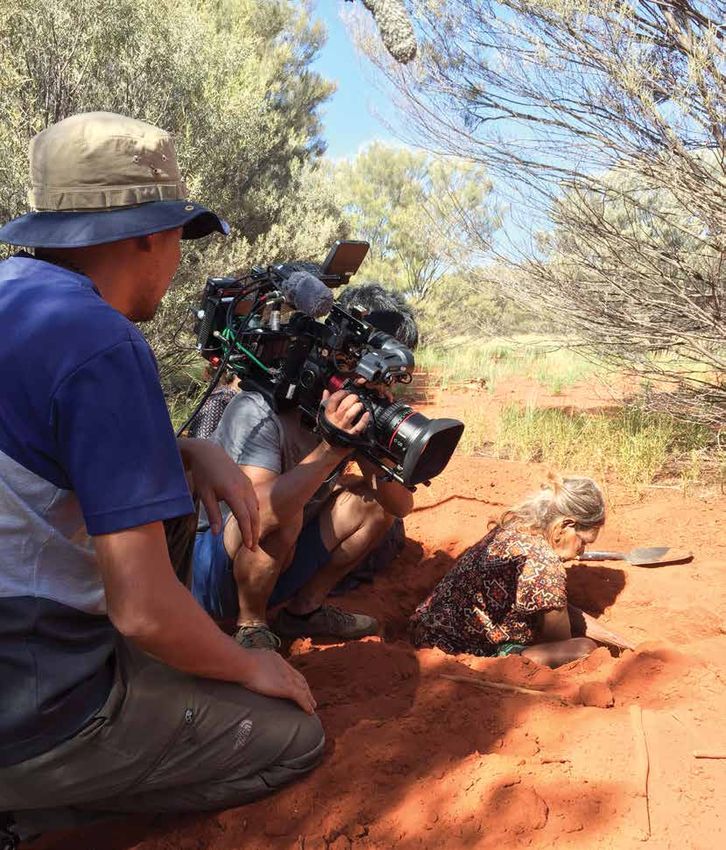
Commercial Image and Media Capture Handbook 29The below table shows the map locations of where the images in the document were taken.
Image Map ref number Page location
Aerial shot of Uluru 1 Front cover
Live cross at the Field of Light 2 4
Mutitjulu Waterhole 3 4 and 5
Sunrise over the spinifex at Car sunset 4 6
Mutitjulu Waterhole 5 8 and 9
Kuniya Piti through LCD monitor 6 9
Walpa Gorge with photographer 7 9
Clapping sticks 8 9
Camera operator with stabiliser 9 9
Aerial shot of the south face of Uluru 32 10
Drone operator 33 10
Sunset at Car Sunset 10 24
Sunset at Car Sunset 11 24
Sunset at Car Sunset 12 24
Lungkata at sunset 13 25
Lungkata at sunset 14 25
Liru Track, Pulari Obscured 15 26
Toilets near base of climb, Mala Puta, Climb and Warayuki obscured 16 26
Side of the road near Mala Carpark, Mala Puta obscured 17 26
Mutitjulu Waterhole, Pulari obscured 18 27
Walpa Gorge 19 27
Uluru Camel Farm 20 28
Field of Light, Uluru, Bruce Munro 21 29
Ayers Rock Resort’s Sounds of Silence 22 29
Ayers Rock Resort’s Bush Food Experience and Garden Walks 23 33
Ayers Rock Resort’s Bush Food Experience and Garden Walks 24 33
Talinguru Nyakunytjaku Sunrise 25 34
Driving car with signage in background 26 35
Permitted image (on track) 27 36
Un-permitted image (off track) 28 36
Ikari Cave on southern side 29 37
Kata Tjuta Sunset viewing 30 40
Uluru Bus sunset viewing 31 41
Waterfalls over Kantju Gorge 34 43
CONNELLAN AIRPORT
LASSETER HIGHWAY
ALICE SPRINGS 443 KM
YULARA/RESORT
Uluru
CULTURAL CENTRE SUNRISE VIEW AREA
TALINGURU NYAKUNYTJAKU
30 Commercial Image and Media Capture Handbook
                                                                                                             (Aerial)


                                                                                        (Aerial)

            Valley of the Winds Walk

sunset viewing area


                Walpa Gorge
                   Walk


                                                          Kata Tjuta dune viewing area
                                                                   sunrise and sunset

                                                                                             Commercial Image and Media Capture Handbook    31
Getting shots of flora and fauna
Please minimise your environmental impact by not disturbing flora or fauna. Please do not break branches or venture
into the bushes to get a close up.
To capture images of particular details of the park, chose your time of year carefully. The breathtaking vista of desert
wildflowers in bloom only occurs in the Piriyakutu/piriya piriya season – and only after winter rains. The sweeping seas
of native grasses grow tall after summer rains.
If you are looking to shoot detail of mai (bush tucker) and it is the wrong season or you are finding it difficult to find,
consider sourcing images through the Ayers Rock Resort’s Bush Food Experience and Garden Walks held frequently
at Ayers Rock Resort. Resort landscapers work year-round to foster the growth of flora that would otherwise appear
seasonally inside the park.
It is not permitted to bring foreign plant material into the park to preserve its pristine natural features.
If you are lucky or patient enough to encounter wildlife, please do not touch or move it.
32 Commercial Image and Media Capture HandbookAbove and below: Ayers Rock Resort’s Bush Food Experience and Garden Walk
Commercial Image and Media Capture Handbook 33Enjoy your visit safely!
Uluru-Kata Tjuta National Park provides a memorable experience to visit and shoot, but its harsh desert environment
means you’ll need to be prepared in order to safely execute your shoot. Heat exhaustion and dehydration are very real
dangers. You can take some very simple steps to ensure you stay safe while working in the park. Some tips to help you
stay safe are:
carry and drink 1L wear sturdy, wear sun protection take frequent breaks in warm weather,
of water per person appropriate footwear – a hat with a secure to consume healthy plan your shoot
per hour in small strap, a shirt and snacks around the cooler
regular portions sunscreen parts of the day
– before 11am
obey all safety familiarise yourself consider your health stay on the track work with another
directions, notices with the symptoms and fitness when person if possible,
and warning signs of heat stroke and choosing a location not by yourself
heat stress or activity
emergency radio to contact ensure your mobile
rangers during park opening service carrier
times are indicated on the provides coverage
map on pages 18 and 19 of the park
34 Commercial Image and Media Capture HandbookRoad rules
Stay on roads and signposted walking tracks at all times.
Observe speed limits and other Northern Territory road laws.
Only park your vehicle in areas which have parking signs.
Do not park your vehicle where “No Parking” signs are present.
Do not stop your vehicle where “No Stopping” signs are present.
Do not stop your vehicle where double or a single yellow line/s are present on the road edge.
Commercial Image and Media Capture Handbook 35Where am I allowed to go in the park?
Please stay on track
The Media Industry Guidelines ask that you work in a way that preserves the pristine natural environment. For example,
Guideline 5.8 asks that you do not shoot off-track unless you have explicit permission. This means you can’t venture into
the bushes to get that “lost in the wilderness” shot, and you can’t take your picture in a location that is not accessible or
permitted to the public.
Permitted
Not Permitted
Why is this important?
Staying on-track means that you’ll help to protect endangered vegetation and prevent damage and erosion.
You’ll also be setting an example to those who see your images or footage. The advice to stay on track also
takes into account the risk of venomous snakes in the warmer months. Only shooting from marked tracks
and roads means you’ll also have a greater chance of your images being approved.
36 Commercial Image and Media Capture HandbookWorking with Anangu
When working with Anangu in Uluru-Kata Tjuta National Park you will have the privilege of experiencing the traditional
owners’ knowledge of and relationship with the land. With this comes the responsibility to be aware of the park’s
cultural heritage.
Relationship: Recognise the unique relationship and connection to the land. The heritage of its people is entwined
with the essence of their country. This relationship embraces a responsibility to look after the spiritual and environmental
wellbeing of country.
Responsibility: Acknowledge the ongoing responsibility that Anangu share to care for country according to traditional
law. Recognise your own responsibility to be thoughtful — the choices you make while working in the park do make a
difference.
Respect: Respect Aboriginal beliefs associated with country and culture and the need for Anangu to retain their privacy,
customary laws and traditions, to use their land for hunting and ceremony and to protect and hold private their scared
stories and sites.
There may be places that are closed to the public due to their cultural significance. Funerals and cultural ceremonies are
times of special privacy – use extra sensitivity in communities around this time.
For more information, see the ‘Working with Anangu’ fact sheet found in the links on page 10.
Commercial Image and Media Capture Handbook 37Mutitjulu community
The Mutitjulu community lies within the park, 1.5 kilometres from the eastern side of Uluru. Mutitjulu community
is home to Anangu who live within the park. Mutitjulu is a closed community and you need permission to enter it.
Please extend the same courtesy that you would expect if a media organisation were to visit your home. Access to the
Mutitjulu community is by permit only and must be organised in advance through the Mutitjulu Community Aboriginal
Corporation (MCAC).
Cross cultural awareness
There are no hard and fast rules when interacting with Aboriginal and Torres Strait Islander peoples. Every community
is unique. The approach you will take will be different depending on the location. There are remote communities, rural
communities, communities in provincial towns and major cities and each need to be recognised as culturally distinct.
There are cultural protocols that should be observed as a general rule.
• Please do not film or take photographs of Anangu without their permission – an arrangement should be in place
prior to your shoot to ensure prior informed consent.
• For many Aboriginal communities, the reproduction of names and images of deceased people is offensive to
mourning practices. It is against traditional law to show images or use the name of a recently deceased person.
The length of period of mourning is determined by the family and/or the community.
• If appropriate, include a warning at the beginning of your program advising Aboriginal and Torres Straight Island
people of the use of images, voices or names of deceased person.
38 Commercial Image and Media Capture HandbookConduct
• Speak in a manner that can be easily understood as English is often a second, and sometimes, a third, fourth or even
fifth language for many remote Aboriginal communities. If necessary, use an interpreter.
• Be sensitive to the use of non-verbal communication cues such as hand signals, which are a natural part of Aboriginal
communication patterns.
• Use of silence does not mean Aboriginal people do not understand. They may be listening, remaining non-committal
or waiting for community support.
• Use indirect eye contact (which is a sign of respect in Aboriginal culture).
• Time delays (sometimes lengthy) before communities impart requested information, or a less direct communication
style, is common within Aboriginal communities.
• To be direct may be seen as confrontational.
• The question “why” is virtually absent from the language of remote Aboriginal communities. Instead, observation is
used as a learning device.
• It’s offensive to question the ‘amount’ of Aboriginal or Torres Strait Islander blood an Indigenous person has.
• The labels ‘half caste’, ‘quarter caste’, ‘full blood’ are racist and unacceptable.
• Do not use acronyms to refer to Indigenous people, such as ‘TOs’ for traditional owners.
• Most Aboriginal people prefer not to be called an Aborigine, and it’s preferable to say Aboriginal person or peoples.
Source: Protocols for Consultation and Negotiation with Aboriginal People (1998) Qld Department of Families,
Youth & Community Care.
Resource for filmmakers
Pathways & Protocols; A filmmakers guide to working in Indigenous people, culture and concepts (2009), Terri Janke,
http://www.terrijanke.com.au/pathways-protocols or www.bushready.nt.gov.au
Commercial Image and Media Capture Handbook 39Languages of Uluru
Many Anangu speak one or more of the western desert languages of Pitjantjatjara, Yankunytjatjara,
Ngaanyatjarra and Luritja. These are all dialects of what linguists term the Western Desert language,
Aboriginal Australia’s largest language group (Dixon 1980). Western Desert dialects are sometimes
grouped together and labelled Pitjantjatjara. Anangu who speak Western Desert dialects can be found
from Halls Creek and Balgo, in the north of Western Australia, to Oodnadatta and Yalata in South Australia.
As well as being familiar with Western Desert dialects, some Anangu speak different Aboriginal languages,
for example Arrernte and Walpiri.
A relatively small percentage of Anangu speak English regularly or fluently – which is also the case with many
other Central Australian Aboriginal people.
Anangu may have difficulty pronouncing some English words, due to the great differences between the
Western Desert and English sound systems.
Like most other Aboriginal languages, Western Desert dialects don’t include the sounds ‘s’, ‘z’, ‘v’, ‘sh’, or ‘th’, and
do not distinguish between a ‘b’ and a ‘p’, or a ‘d’ and a ‘t’. Keep this in mind when you talk to Anangu, it will help
you appreciate why many Anangu may have difficulty speaking English.
Frequently used words in Pitjantjatjara
Pitjantjatjara word Pronunciation English Meaning
Anangu arn-ang-oo Aboriginal people of western desert
Palya pul (like cull)-ya Hello, goodbye, thanks
Uluru ool-or-roo Name of monolith
Kata Tjuta kar-ta choo-ta Many heads
Uwa oo-wa Yes
Wiya wee-ya No
Tjukurpa chook-orr-pa Traditional law and creation stories
Tjukuritja chook-orr-icha Physical evidence of Tjukurpa
Nguraritja ngoo-rrar-i-ja Traditional owner
Piranpa peer-an-pa Non-Aboriginal people, (literally white)
Kungka koong-ka young woman
Wati wotti Man
40 Commercial Image and Media Capture HandbookContact
Media Office CLC
PO Box 119 Yulara NT 0872 Phone: +61 08 8951 6215
Phone: +61 08 8956 1113 Email: media@clc.org.au
+61 08 8956 1114
Email: uluru.media@environment.gov.au
Maruku
Phone: +61 08 8956 2558
Aboriginal Interpreter Service Email: punu@maruku.com.au
Phone: +61 800 334 944
Email: ais@nt.gov.au
Walkatjara Art Uluru
Phone: +61 08 8956 2537
Voyages Indigenous Tourism Australia Email: art@walkatjara.com.au
Phone: +61 08 8957 7388
Email: ARRPublicRelations@voyages.com.au
MCAC
Phone: +61 08 8956 3247
Email: coordinator@mutitjulu.com.au
Image courtesy of Maree Clout
Commercial Image and Media Capture Handbook 41Image courtesy of Maree Clout
Glossary
Aboriginal means a person who is a member of the Aboriginal EPBC Regulations means the Environment Protection and
race of Australia Biodiversity Conservation Regulations 2000 and includes
reference to any Regulations amending, repealing or replacing
Aboriginal land means the EPBC Regulations
(a) land held by an Aboriginal Land Trust for an estate in fee
simple under the Land Rights Act; or Land Rights Act means the Aboriginal Land Rights (Northern
Territory) Act 1976
(b) land that is the subject of a deed of grant held in escrow by
an Aboriginal Land Council under the Land Rights Act. Land Trust means the Uluru-Kata Tjuta Aboriginal Land Trust
established under the Land Rights Act
Aboriginal tradition means the body of traditions, observances,
customs and beliefs of Aboriginals generally or of a particular Lease or Park Lease means the lease agreement between the
group of Aboriginals and includes those traditions, observances, Uluru-Kata Tjuta Aboriginal Land Trust and the Director in respect
customs and beliefs as applied in relation to particular persons, of the park, shown as Attachment A to this plan
sites, areas of Uluru-Kata Tjuta National Park, things and
relationships Management plan or plan means this management plan for
the park, unless otherwise stated
Anangu means an Aboriginal person or people generally
(and more specifically those Aboriginal people with traditional Nguraritja means the traditional Aboriginal owners of the park
affiliations with this region)
NT means the Northern Territory of Australia
Australian Government means the Government of the
Commonwealth of Australia Park means Uluru-Kata Tjuta National Park
Board of Management or Board means the Board of Parks Australia means the Director of National Parks and the
Management for Uluru-Kata Tjuta National Park established agency that assists the Director in performing the Director’s
under the NPWC Act and continued under the EPBC Act by the functions under the EPBC Act. At the time of preparing the plan,
Environmental Reform (Consequential Provisions) Act 1999 the agency assisting the Director is the Parks Australia Division of
the Department of the Environment, Water, Heritage and the Arts
CLC or Land Council means the Central Land Council
established under the Land Rights Act Commonwealth reserve Piranpa means non-Aboriginal people (literally white)
means a reserve established under Division 4 of Part 15 of the Traditional owners means the traditional Aboriginal owners as
EPBC Act Community means the Mutitjulu Community defined in the Land Rights Act (see also Nguraritja)
Director means the Director of National Parks under s.514A of Uluru–Kata Tjuta National Park means the area declared as a
the EPBC Act, and includes Parks Australia and any person to national park by that name under the NPWC Act and continued
whom the Director has delegated powers and functions under under the EPBC Act by the Environmental Reform (Consequential
the EPBC Act in relation to Uluru-Kata Tjuta National Park Provisions) Act 1999
EPBC Act means the Environment Protection and Biodiversity UNESCO means the United Nations Educational, Scientific and
Conservation Act 1999, including Regulations under the Act, and Cultural Organisation
includes reference to any Act amending, repealing or replacing
the EPBC Act
42 Commercial Image and Media Capture HandbookYou can also read