Wongaling - South Mission - Beach Habitat Linkages July 2009
←
→
Page content transcription
If your browser does not render page correctly, please read the page content below
Wongaling - South Mission
                           Beach
                     Habitat Linkages

                                July 2009

Report No:      ter9.2.01

Prepared for:   Terrain NRM

Prepared by:    © BIOTROPICA Australia Pty
DOCUMENT CONTROL SUMMARY

REPORT AND CLIENT DETAILS

 Title:                      Wongaling - South Mission Beach Habitat Linkages

 Client:                     Terrain NRM Ltd

 Client Contact:             Tony O’Malley

 Status:                     Final

 Project Manager:            Nigel Tucker

 Author/s:                   N. Tucker, S. Offner and L. Kazmeier

 REVISION/QUALITY ASSURANCE

  REVISION        DATE             CHECKED BY                  ISSUED BY                    DISTRIBUTION – NO. OF COPIES
  NUMBER                                                                              Client           Other          Biotropica
                                                                                                                       Library
      3          13-07-09        LK             √        N. Tucker         √            1                                  1

 © BIOTROPICA Australia Pty Ltd
 PO Box 866
 MALANDA QLD 4885
 Telephone: 07 40 951 116
 Fax:               07 40 951 296
 Email: info@biotropica.com.au

 Web: www.biotropica.com.au                                                                        Certificate #: AJA07/12056

 Biotropica Australia Pty Ltd Quality Management System has been certified to ISO 9001:2000 by AJA Registrars Ltd. Use of
 the AJA Registrar and Accreditation Marks is in accordance with AJA Registrars grant of licence to a registered company.
 This document may contain confidential or privileged information and is intended for the sole use of the person(s) to whom it is
 addressed. This document is copyright. Biotropica Australia is not liable if this document is altered without its written consent.
 This document is and shall remain the property of Biotropica Australia. It may only be used for the purpose for which it was
 commissioned and in accordance with the terms of engagement.

Wongaling – South Mission Beach Habitat Linkages                                                                          July 2009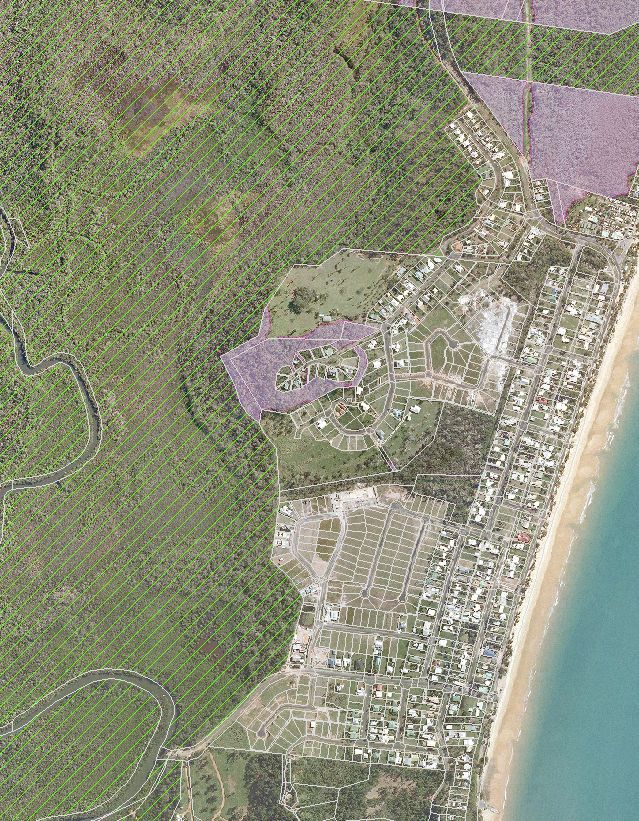
TABLE OF CONTENTS

1   EXECUTIVE SUMMARY                                                  1

2   REPORT FOCUS                                                       4

3   METHODOLOGY                                                        4

4   SITE CONTEXT                                                       6

5   PLANNING FRAMEWORK                                                 9

6   DETAILED DESCRIPTIONS OF HABITAT LINKAGES - OVERVIEW              25

7   HABITAT LINKAGE 1:
    TAM O’SHANTER NP TO WONGALING BEACH AND THE HULL RIVER NP        27

8   HABITAT LINKAGE 2:
    HULL RIVER NATIONAL PARK TO WONGALING BEACH                       35

9   HABITAT LINKAGE 3:
    WONGALING BEACH INTERNAL LINKAGES                                 39

10 HABITAT LINKAGE 4:
   HULL RIVER NATIONAL PARK TO SOUTH MISSION BEACH                    43

11 HABITAT LINKAGE 5:
   HULL RIVER NATIONAL PARK TO SOUTH MISSION BEACH                    44

12 REFERENCES                                                         49

13 APPENDIX 1 – REGIONAL ECOSYSTEMS (DETAILED DESCRIPTIONS)           50

Wongaling – South Mission Beach Habitat Linkages                July 2009
LIST OF TABLES

TABLE 1:        REGIONAL ECOSYSTEM STATUS - SUMMARY .........................................................................11

TABLE 2:        PROPERTIES FORMING LINKAGE 1 – SE ROUTE .....................................................................30

TABLE 3:        PROPERTIES FORMING LINKAGE 1 – W-ROUTE ......................................................................33

TABLE 4:        PROPERTIES FORMING LINKAGE 2.........................................................................................37

TABLE 5:        PROPERTIES FORMING LINKAGE 3.........................................................................................41

TABLE 6:        PROPERTIES FORMING LINKAGE 4.........................................................................................45

                                                   LIST OF FIGURES

[FIGURE 1: MAP1 -               A3 EXECUTIVE OVERVIEW MAP]                                                                         [3]

FIGURE 2:     MAP 2 -           REGIONAL OVERVIEW                                                                                    8

FIGURE 3:     MAP 3 -           CASSOWARY AND MAHOGANY GLIDER HABITAT                                                              10

FIGURE 4:     MAP 4 -           REGIONAL ECOSYSTEMS                                                                                12

FIGURE 5:     MAP 5 -           STATE LANDS RELEVANT TO HABITAT LINKAGES                                                           14

FIGURE 6: MAP 6 -               REGIONAL LANDUSE CATEGORIES                                                                        16

FIGURE 7: MAP 7 -               AREAS OF ECOLOGICAL SIGNIFICANCE                                                                   18

FIGURE 8: CARDWELL SHIRE PLANNING SCHEME                                                                                           20

FIGURE 9:     MAP 8 -           HABITAT LINKAGES - OVERVIEW MAP                                                                    26

FIGURE 10: MAP 9 -              HABITAT LINKAGE 1 - OVERVIEW                                                                       28

FIGURE 11: MAP 9A -             HABITAT LINKAGE 1 – SOUTH-EASTERN ROUTE                                                            32

FIGURE 12: MAP 9B -             HABITAT LINKAGE 1 – W ESTERN ROUTE                                                                 34

FIGURE 13: MAP 10 -             HABITAT LINKAGE 2                                                                                  38

FIGURE 14: MAP 11 -             HABITAT LINKAGE 3                                                                                  42

FIGURE 15: MAP 12 -             HABITAT LINKAGE 4                                                                                  46

FIGURE 16: MAP 13 -             HABITAT LINKAGE 5                                                                                  48

Wongaling – South Mission Beach Habitat Linkages                                                                            July 2009
1    Executive Summary

This report identifies the location and quality of habitat linkages between Wongaling and South
Mission Beaches, north Queensland. The report focuses on potential linkages for the
Southern Cassowary (Casuarius casuarius johnsonii). It replicates a previous report by
Biotropica Australia (2008) for the Wongaling Creek area to the north. Further background
information is detailed in the 2008 report regarding linkages and their role in reducing the
effects of habitat fragmentation.

Mapping for this report includes the identification of “Potential Cassowary Habitat” based on
GIS data supplied by the Queensland Department of Natural Resources and Water (DNRW)
and the Queensland Environmental Protection Agency (EPA). Due to the limited scope of the
field assessments, and as private properties were not surveyed, this recommendation is of
potential habitat only at the time of the aerial photography (2006). Further clearing or
regeneration may have occurred since that time.

Five linkages were identified and these are described in Sections 6 to 11 (see Maps 1, 2 and 8
for overviews and Maps 9 to 13 for detailed depictions). The five linkages described are: -

    •    Habitat Linkage 1:                    Tam O’Shanter National Park
                                               to Wongaling Beach and the Hull River National Park

    •    Habitat Linkage 2:                    Hull River National Park to Wongaling Beach

    •    Habitat Linkage 3:                    Wongaling Beach Internal Linkages

    •    Habitat Linkage 4:                    Hull River National Park to South Mission Beach

    •    Habitat Linkage 5:                    Hull River National Park at South Mission Beach

Habitat Linkage 1: Tam O’Shanter National Park to Wongaling Beach and the Hull River
National Park across the Tully Mission Beach Road. There are two routes; one east and one
west of the South Mission Beach Road turn-off. The main barrier to movement is the Tully
Mission Beach Road.

Habitat Linkage 2: Hull River National Park to Wongaling Beach is a linkage across the South
Mission Beach Road joining the National Park with large rural lots behind Wongaling Beach.
The main barrier to movement is the South Mission Beach Road.

Habitat Linkage 3: Wongaling Beach Internal Linkages joins Linkages 1, 2 and 4.                      This
linkage is reliant on Lot 7 SP197640 which is a large rural freehold property.

Habitat Linkage 4: Hull River National Park to South Mission Beach joining the Hull River
National Park on either side of the South Mission Beach Road. The main barrier to movement
is the South Mission Beach Road.

Habitat Linkage 5: Hull River National Park at South Mission Beach joining the Hull River
National Park south of the study area with Habitat Linkage 4. The linkage is constrained
between the residential lots of South Mission Beach and the mangroves and watercourses of
the North Hull River.

Wongaling – South Mission Beach Habitat Linkages                                                 July 2009
                                                        1
The study area is generally distinguished by relatively large blocks of habitat in good
ecological condition and in state ownership. It supports one of the main habitat linkages from
the coast to the highlands, in the Wet Tropics bioregion. The network of habitat linkages in the
study area enables cassowaries to access a diversity of habitat types and resources, including
coastal and hinterland resources, thereby enhancing the ecological viability of the important
Mission Beach cassowary population.

Conservation of these linkages would have significant benefits for cassowaries and other
wildlife. Linkage conservation would protect significant lowland rainforests, including littoral
rainforests, and link coastal forests to the Wet Tropics World Heritage Area and highland
forests. The restoration of riparian vegetation would also be expected to contribute to an
improvement in water quality entering the adjacent Great Barrier Reef Marine Park.

Subject to Native Title Claim outcomes and provisions, State Land supporting habitat linkages
should be protected for conservation. Moreover, the valuable contribution of private
landholders who have maintained habitat on their property should be acknowledged. Owners
of freehold land supporting habitat linkages should be offered voluntary incentives (e.g.
funding) to encourage ongoing conservation of the habitat linkages. The ecological functions
of habitat linkages would generally be enhanced by protecting existing native vegetation,
revegetating strategic cleared or degraded areas, excluding domestic animals, managing pest
species, in addition to providing a low traffic speed environment. Cassowary roadkill in the
study area is significant.

[ Figure 1: MAP1 A3 EXECUTIVE OVERVIEW MAP (Page 3 fold-out) ]

Wongaling – South Mission Beach Habitat Linkages                                        July 2009
                                                   2
2    Report Focus

This report follows the Biotropica (2008) study examining habitat linkages in the area between
Mission Beach and Wongaling Beach, and uses an identical methodology combining desktop
and on-ground survey. The focus of this report is the Southern Cassowary (Casuarius
casuarius johnsonii) and the maintenance of ecological connectivity for this species. No
formal survey of local Cassowary populations has been undertaken, and it is reasonably
assumed that birds are using all habitats within the study area that can be considered to meet
their ecological needs, including sources of fresh water. It should not be assumed that birds
are necessarily following indicative routes shown on the accompanying maps. Nor should it
be assumed that all areas are used at all times, clearly seasonality and social structures will
dictate differential utilisation. However, it is reasonably assumed that where resources are
available and accessible they will be utilised, at some time. The focus of this report is
therefore to identify where suitable habitats exist, their tenure, and their spatial relationship to
significant adjacent habitats. It should be noted that cassowaries may utilise open/cleared
areas as well as habitat linkages to travel between habitat areas.

Whilst Cassowaries are the focus of this report it is emphasized that habitat linkages
supporting Cassowary movement are very likely to support all other wildlife species commonly
associated with that habitat. Of note, much of the identified potential Cassowary habitat is
also mapped as Mahogany Glider (Petaurus gracilis) habitat. The species is listed as
Endangered under both the Queensland Nature Conservation Act 1992 (NCA) and the
Commonwealth Environment Protection and Biodiversity Conservation Act 1999 (EPBC) and
has a very limited distribution.

Similarly, habitat linkages may benefit littoral rainforest by ensuring it remains ecologically
connected to other native forests including other sections of the Wet Tropics World Heritage
Area. Littoral Rainforest and Coastal Vine Thickets of Eastern Australia are listed as “Critically
Endangered” under the Commonwealth Environment Protection and Biodiversity Conservation
Act 1999.

3    Methodology

The study area for this report includes Wongaling and South Mission Beaches and areas to
the west (see Map 2). The northern boundary of the study area, directly borders the southern
boundary of a previous Biotropica report (2008) detailing habitat linkages in the Wongaling
Creek area.

The Hull River and Tam O’Shanter National Parks make up a substantial portion of the
western side of the study area. Other tenures within the study area include: freehold, state
lands, leasehold, unallocated state lands (USL), reserve, covenants, and road reserves. This
report identifies potential habitat on each lot regardless of tenure.

Potential habitat was identified using ArcView 9.3 GIS software, aerial imagery and field
verification.

Produced by EPA/QPWS in April 2007 are maps detailing locations of cassowary deaths.
Deaths are known to be due to vehicle collisions and were reported to QPWS between 1992

Wongaling – South Mission Beach Habitat Linkages                                            July 2009
                                                   4
and early 2007. Records of three additional cassowary roadkills in late 2008 were provided by
Community for Coastal and Cassowary Conservation (C4), and all sites of recorded
cassowary deaths are shown on the accompanying habitat linkage detail maps.
Representatives from Cassowary Coast Regional Council, James Cook University and C4
provided anecdotal observations of cassowary movements in the study area. For interpretive
purposes, information on cassowary roadkill and crossings is referred to in this document as
“EPA 2007”.

Mapping for this report includes the identification of “Potential Cassowary Habitat outside
National Park tenure”. This was developed by Biotropica based on the following GIS datasets:
Regional Ecosystems of Queensland (EPA 2005), Essential Cassowary Habitat (EPA 2006),
aerial photography taken post-Cyclone Larry (DNRW 2006, supplied by Terrain NRM Ltd), and
some field assessment. Due to the limited scope of the field assessments and as private
properties were not able to be surveyed, this recommendation is of potential habitat only at the
time of the aerial photography (2006). Further clearing or regeneration may have occurred
since that time. Field assessments for Mahogany Gliders or other threatened species or
communities were not undertaken.

In the context of this report linkages were considered to be continuous native vegetation,
providing existing habitat between the more intact (core) habitats represented by Tam
O’Shanter National Park and the Hull River National Park and other areas of suitable
Cassowary habitat. While most of the linkages are mapped by the Environmental Protection
Agency (EPA) as a remnant Regional Ecosystem (RE), some are mapped as “Disturbed”.
This does not preclude use by Cassowaries as a habitat linkage. Some vegetation previously
mapped as an RE by the EPA in 2005, has been subsequently cleared. There are also areas
where revegetation projects are underway, and some have reached a level where they provide
suitable linkage habitat. These factors result in anomalies between the REs as mapped by the
EPA and the linkages identified in this report.

Linkage surveys included an examination of the level of connectivity within each linkage to
determine:

    •    Spatial extent / configuration (wider, continuous vegetation vs. fragmented patches)
    •    Degree of legislative protection (habitat protected vs. unprotected)
    •    Number and location of connectivity gaps (few points vs. many)
    •    Resource diversity (heterogeneous vs. homogeneous habitats}
    •    Quality of linkage habitat (intact vegetation vs. disturbed)
    •    Proximity to high density settlement (distant vs. directly adjacent)

Five potential linkages were identified. These may or may not be utilised by Cassowaries and
therefore are suitable habitat linkages rather than confirmed Cassowary linkages. Additional
research may determine the degree to which each may or may not be utilised.

Connectivity gaps have been identified, and each of these is discussed separately in Sections
6 to 11. A connectivity gap is defined as any location where habitat is fragmented and birds
would need to cross structures (such as roads) or cleared lands. The South Mission Beach
and Tully Mission Beach Roads are considered to be continuous linear barriers to wildlife
movement for their entire length. Their effect is outlined further in Biotropica 2008.

Wongaling – South Mission Beach Habitat Linkages                                         July 2009
                                                   5
4    Site Context

The study area covered by this report includes the area between Wongaling Beach and South
Mission Beach, and encompasses sections of the Hull River National Park (NP) and the Tam
O’Shanter NP (see Map 2). This is a complex habitat mosaic comprising sclerophyll and
mesophyll/notophyll vegetation in large blocks of intact habitat, occurring in conjunction with
smaller fragments. Much of the area has been intensively developed for agriculture and
settlement, although the diversity of resources available within this matrix continues to attract
and sustain a subset of the original wildlife that is still present. This includes Cassowaries
which are the principal focus of this report.

The study area is surrounded by two World Heritage properties, the Wet Tropics World
Heritage Area and the Great Barrier Reef World Heritage Area (see Map2). The Tam
O’Shanter NP is within the Wet Tropics World Heritage Area, though the Hull River National
Park is not included within this tenure. Other properties on the northern side of the Tully
South Mission Beach Road border the Wet Tropics World Heritage Area, however none of the
other properties in this report are included within its boundaries. The Great Barrier Reef
World Heritage Area borders the eastern study area boundary.

The southern part of the study area also falls within the boundaries of the Hull River Fish
Habitat Area (FHA-046) – Management Area A. All of this part of the Fish Habitat Area is
within the Hull River National Park (see Map 2).

The North Hull River is the major catchment for the study area. The river is fed by a number
of streams that rise in the ranges of the Tam O’Shanter NP (including the North Hull River),
coalescing into a large mangrove system at the southern end of the study area. With the
exception of Wongaling Creek in the north, all watercourses in the study area flow into the Hull
River and in this way the system provides a hierarchical network of interconnected habitats
with most riparian zones retaining some native vegetation. The Hull River terminates in
Rockingham Bay and the forests of the north-eastern section of Rockingham Bay contain high
quality cassowary habitat. Forests flanking the Hull River NP are therefore significant regional
linkages, given that they are an integral part of the Mount Myrtle massif to the west of the
study area.

The Mount Myrtle massif is a portion of relatively intact forest which forms part of a major area
of east-west connectivity remaining between Cairns and Townsville. Through the area
colloquially known as Smiths Gap adjacent to Mt. Myrtle, broad ecological connectivity
remains between the littoral zone and the highlands east of Ravenshoe (Biotropica 2005).
There are parts of the study area in this report which contribute directly to this landscape scale
connectivity. Their long term protection is the chief means by which this landscape scale
connection will remain in place.

Infrastructure, settlement and agriculture are embedded within this matrix of forests and
interconnected catchments. Whilst agriculture remains relatively static, the development of
new residential areas continues with a number of housing subdivisions either approved or
under construction in this area. Associated clearing for powerlines and roads further
contributes to the fragmentation of habitat. However, the Far North Queensland Regional
Plan 2009-2031 now limits urban development to the Urban Footprint (see Maps 1 & 6).

Wongaling – South Mission Beach Habitat Linkages                                          July 2009
                                                   6
Habitat blocks are larger through this area when compared to the more fragmented areas to
the north between Wongaling and Mission Beach, and most settlement is confined to the
township of South Mission Beach. The diversity of resources available in the matrix, and their
relatively high level of connectedness suggest conservation outcomes in this area are
eminently achievable.

Vegetation of the study area
The area contains significant heterogeneity of vegetation types, including notophyll/mesophyll
vine forests, mangroves, open woodlands, palustrine wetlands and vine forest shrublands.
Mesophyll vine forests dominate much of the study area, occurring as complexes, with
Feather Palm (Archontophoenix alexandrae) and Fan Palm (Licuala ramsayi) conspicuous in
areas of impeded drainage. Mangroves are similarly extensive particularly adjacent to the
North Hull River. Sclerophyllous emergents of Corymbia, Melaleuca and Eucalyptus are
common, more so on ridges, poorly drained areas and the littoral zone. There are also
significant areas of wetland in areas of lower relief and these are important seasonal water
sources for a number of species, including cassowaries. Appendix 1 contains a full
description of all Regional Ecosystems occurring within the study area. All Regional
Ecosystems are represented in the extensive protected areas occurring within the study area.
Littoral Rainforest and Coastal Vine Thickets of Eastern Australia in the study area are
discussed in Section 5.1.

Edge effects are prominent in most notophyll/mesophyll vine forests, particularly on Acacia
dominated edges. Acacias were particularly affected by Cyclone Larry and their loss of limbs
has resulted in surrounding disturbance and proliferation of a number of disturbance-adapted
vines including Blackfellow Wire (Lygodium reticulatum) and Captain Cook Vine (Merremia
peltata). Generally, weeds are restricted to edges only and are not a conspicuous issue,
although exotic palms such as Royal Palm (Syagrus romanzoffianum) and non-local natives
such as Foxtail (Wodyetia bifurcata) can be seen germinating in fragments within the study
area. These have almost certainly been dispersed by Cassowaries.

Wongaling – South Mission Beach Habitat Linkages                                      July 2009
                                                   7
Figure 2: MAP 2 - Regional Overview
397464 399464 401464 403464 405464
8021838
8021838
WONGALING
BEACH
TAM O'SHANTER
8019838
8019838
NATIONAL PARK
D
SION BEACH R
HRD
BEAC
IS
R
IVE
8017838
8017838
M
R
H
HULL
ST
N
SI O
RTH
IS
NO
M
Y
LL
TU
SOUTH MISSION
BEACH
8015838
8015838
HULL RIVER
NATIONAL PARK
8013838
8013838
HULL RIVER
397464 399464 401464 403464 405464
LEGEND MAP 2: REGIONAL OVERVIEW
Study Area Boundary Urban Footprint (FNQ 2009-2031) Reference: Wongaling - South Mission Beach Habitat Linkages
River Major Road
Arterial and Residential Roads Site: Wongaling and South Mission Beaches, Qld
National Park Client: Terrain NRM Ltd
Great Barrier Reef World Heritage Area (Marine Park)
Wet Tropcis World Heritage Area Project Manager: N.Tucker GIS Platform: ArcGIS 9.3
Fish Habitat Area (Hull River - FHA-046)
Date: July 2009 Datum: GDA 94 MGA 55
DATASET SOURCE: Scale: 1:50,000
FNQ 2009-2031 Data - © The State of Queensland (DERM) [2009]
World Heritage Areas & Roads – Wet Tropics Management Authority [2006].
0 500 1,000 1,500
Fish Habitat Area - © The State of Queensland
(Department of Primary Industries and Fisheries) [2005].
Aerial Imagery – captured 2006 post-Cyclone Larry - supplied by Terrain NRM Ltd Meters
Wongaling – South Mission Beach Habitat Linkages July 2009
85 Planning Framework
Land use and conservation on public and private tenures in the project area are regulated by
various national, state and local government legislations and plans.
5.1 Environment Protection and Biodiversity Conservation Act 1999
Matters of National Environmental Significance (NES) are triggers under the Environment
Protection and Biodiversity Conservation Act 1999 (EPBC Act). A number of NES triggers are
present in the study area, including Wet Tropics World Heritage Area, Great Barrier Reef
World Heritage Area (see Map 2) and a range of endangered and vulnerable plants and
animals. “Critically endangered” Littoral Rainforest and Coastal Vine Thickets of Eastern
Australia (LR&CVToEA) are likely to occur in the study area due to the presence of two REs
(7.2.1 and 7.2.5a) that “equate wholly” to the listed community (see Maps 9 & 9A). Rainforest
vegetation within two kilometres of the coast (Listing Advice - Section 3) is potentially
LR&CVToEA, subject to fieldwork.
5.2 Nature Conservation Act 1992
The large majority of remnant vegetation in the study area is mapped by the Environmental
Protection Agency as Essential Cassowary Habitat (EPA 2006; see Map 3). Some of the
vegetation is also identified as Essential Mahogany Glider Habitat (EPA 2006; see Map 3).
Both these species are listed as “Endangered” under Commonwealth and State legislation.
Wongaling – South Mission Beach Habitat Linkages July 2009
9Figure 3: MAP 3 – Cassowary and Mahogany Glider Habitat Map
400574 401574 402574 403574 404574
8021548
8021548
WONGALING
BEACH
BEACH RD
8020548
8020548
TAM O'SHANTER
M I SSION
NATIONAL PARK
Y
8019548
8019548
LL
TU
D
8018548
8018548
CH R
BEA
ON
ST
H
R M
VE
SSI
IS
SI
I
O
RTH HULL R
N
Y MI
BE
AC
H
RD
L
8017548
8017548
TUL
NO
HULL RIVER
NATIONAL PARK
8016548
8016548
SOUTH MISSION
BEACH
400574 401574 402574 403574 404574
MAP 3: CASSOWARY & MAHOGANY GLIDER HABITAT
LEGEND
Reference: Wongaling - South Mission Beach Habitat Linkages
Cadastral Boundaries Major Road
Study Area Boundary Arterial and Residential Roads Site: Wongaling and South Mission Beaches, Qld
Watercourse
Client: Terrain NRM Ltd
Potential Cassowary Habitat (Biotropica)
Project Manager: N.Tucker GIS Platform: ArcGIS 9.3
Cassowary Habitat (EPA)
Mahogany Glider Habitat (EPA) Date: July 2009 Datum: GDA 94 MGA 55
Scale: 1:30,000
DATASET SOURCE: 0 500 1,000
Cassowary & Mahogany Glider Habitat – © The State of Queensland (EPA) [2005].
Cadastral Boundaries – © The State of Queensland (DNRW) [2008]. Meters
Roads and Watercourses – Wet Tropics Management Authority [2006].
Wongaling – South Mission Beach Habitat Linkages July 2009
105.3 Regional Ecosystems
Twenty-one Regional Ecosystems (REs) were identified within the study area (refer to Map 4).
Of these, a number were found only in the National Parks to the west and north of the area.
Fifteen Regional Ecosystems occur within the boundaries of the other lots detailed in Section
6 to 11 and are listed under the Vegetation Management Act 1999 as Endangered, Of
Concern, or Not of Concern (see Table 1 and Map 4). In addition, they are further listed for
biodiversity planning purposes by the Environmental Protection Agency as Endangered, Of
Concern, or of No concern at Present, depending on the condition of the remaining
ecosystems.
Table 1 below, summarises the status of REs within the linkages identified. A detailed
description of each RE is given in Appendix 1. Detailed locations by lot number are provided
in the tables in Section 6 to 10.
Table 1: Regional Ecosystem Status - Summary
Regional Ecosystem EPBC Status VMA Status Biodiversity Status
7.1.1 - Not of Concern No Concern at Present
7.2.1 Critically Endangered Endangered Endangered
7.2.3 - Of Concern Of Concern
7.2.7 - Of Concern Endangered
7.2.8 - Of Concern Endangered
7.2.9 - Of Concern Endangered
7.3.3 - Of Concern Endangered
7.3.5 - Not of Concern Endangered
7.3.7 - Endangered Endangered
7.3.8 - Not of Concern Endangered
7.3.10 - Of Concern Endangered
7.3.19 - Of Concern Of Concern
7.3.25 - Of Concern Of Concern
7.12.1 - Not of Concern No Concern at Present
7.12.23 - Of Concern Endangered
Wongaling – South Mission Beach Habitat Linkages July 2009
11Figure 4: MAP 4 - Regional Ecosystems
400705 402705 404705
8021553
7.2.8
8021553
7.3.10a
7.3.10a 7.2.5a
dist
dist 7.2.5a
7.12.1a 7.12.1a dist
dist 7.3.10a
7.2.3b
non-rem
M ISSI ON BCH RD
7.12.1b
7.12.1b WONGALING
7.12.1b BEACH
7.12.1b non-rem
7.12.1b
7.3.25a
7.3.10a 7.12.1a
7.3.10a 7.2.8
L LY
7.12.1b
8019553
7.3.10a
TU
8019553
7.12.1a 7.3.25a
7.12.1b
dist 7.2.1i 7.2.3e
7.3.4 7.3.5a 7.3.25a
7.3.10b
7.12.1b 7.3.10b 7.2.9a
7.12.1b 7.2.7a
non-rem
non-rem
7.12.1a
7.3.10a 7.3.10a 7.3.25a
dist 7.3.3a
7.3.4 dist
7.12.1a dist 7.2.8
7.3.10b 7.12.1a
7.12.23b 7.12.1b
7.3.10a 7.3.5a
non-rem dist
7.3.19e dist 7.2.3c
7.3.10c 7.2.8
ST
R 7.12.1a dist
VE 7.12.5b plant
H
M 7.1.1
RI
I S 7.3.3a dist dist
7.3.8a 7.3.7a dist S IO plant
RTH HULL
7.3.10a 7.3.7a
7.3.8a N dist 7.3.7b dist
BC
7.3.7a dist 7.3.5a 7.2.3c
8017553
7.3.20a
8017553
H
7.3.20b 7.3.10a dist 7.3.5a 7.12.23b
RD
7.12.23b
7.11.1a 7.3.8a 7.2.3e 7.2.3c
NO
7.3.5a 7.3.19e
dist 7.3.5a
7.3.5a 7.2.7a
7.11.5b 7.3.7a
7.3.8a 7.3.5a
7.3.20b dist 7.3.19e
7.3.8a 7.1.3a
7.3.7a dist 7.3.8a 7.3.5a 7.2.9a
7.3.5a 7.3.25a
7.2.9a
7.3.20a 7.3.20b 7.12.23b
7.3.3a 7.3.7b
7.3.7b 7.3.7b
7.11.5b 7.3.7b 7.1.1 dist
7.3.5a 7.12.5b
dist
7.12.1a
7.3.5a 7.3.46
7.3.25a non-rem SOUTH MISSION
7.3.20b 7.1.3a
dist BEACH
7.3.5a
7.3.25a
7.1.2a
400705 402705 404705
LEGEND MAP 4: REGIONAL ECOSYSTEMS
Watercourse Major Road Reference: Wongaling - South Mission Beach Habitat Linkages
Study Area Boundary Arterial and Residential Roads
Site: Wongaling and South Mission Beaches, Qld
Regional Ecosystems
Vegetation Management Act Status Biodiversity Status
Client: Terrain NRM Ltd
Endangered - Dominant Endangered
Of Concern - Dominant Of Concern
Project Manager: N.Tucker GIS Platform: ArcGIS 9.3
Not Of Concern No Concern at Present
Non-remnant / regrowth
Date: July 2009 Datum: GDA 94 MGA 55
Plantation forest
Water
Scale: 1:30,000
DATASET SOURCE: 0 500 1,000
Regional Ecosystems of Queensland – © The State of Queensland
(Environmental Protection Agency) [2005]. Meters
Roads and Watercourses – Wet Tropics Management Authority [2006].
Wongaling – South Mission Beach Habitat Linkages July 2009
125.4 Cardwell-Hinchinbrook Regional Coastal Management Plan
The Cardwell-Hinchinbrook Regional Coastal Management Plan (CHRCMP) is a statutory
instrument under the Coastal Protection and Management Act 1995 and describes how the
region’s coastal zone is to be managed. The study area is wholly within “Key Coastal Site 1:
Hull” in the CHRCMP. Desired coastal outcomes for the Hull Key Coastal Site include the
following:
• High quality interconnected habitats are conserved to support viable
populations of southern cassowary, mahogany glider, ant plant, Apollo
jewel butterfly and estuarine crocodile.
• The Walter Hill Range wildlife corridor is managed as the major
ecological link between the coast and the Walter Hill Range.
• Development in Wongaling Beach and South Mission Beach is
managed to conserve endangered regional ecosystems and coastal
wetlands, and retain the mosaic of lowland rainforest and associated
forests.
Additionally, part of the study area is within “Key Coastal Site 1.1:Wongaling Beach to South
Mission Beach”. Desired coastal outcomes for this locality are [for lot locations see Map 5]:
• Future use of the following State land on the coast conserves the high
environmental values and features, including remnant lowland native
vegetation and critical habitat for the Southern Cassowary, and avoids
significant impacts on coastal processes, through the implementation of
an appropriate management regime:
– USL Lots 1 and 2 on Plan SP125434;
– USL Lot 2 on Plan SP125433;
– USL Lots 3, 38 and 39 on Plan USL42219; and
– Land Lease Lot 634 on Plan CWL3519.
• Future use of the listed reserves is consistent with their dedicated
purpose and includes the community purposes of ‘beach protection and
coastal management’ and ‘environmental purposes’. The reserves are
properly and effectively managed in accordance with an approved
management plan:
– Reserve Lots 3, 4, 5 and 7 on Plan SP125434; and
– Reserve Lot 109 on Plan CWL3519.
• The wildlife corridor for the Southern Cassowary is retained and
managed as a major link between the coast at Wongaling Beach and
the Walter Hill Range.
(The State of Queensland 2003, p 100)
Under the CHRCMP, sections of the study area are also identified as Fish Habitat Areas,
Areas of State Significance for Significant Coastal Wetlands, Significant Coastal Dune
Systems, Endangered Regional Ecosystems, and Coastal Management District, triggering
certain CHRCMP policies.
Wongaling – South Mission Beach Habitat Linkages July 2009
13Figure 5: Map 5 - State Lands Relevant to Habitat Linkages
400598 401598 402598 403598 404598
8021582
8021582
8020582
8020582
WONGALING
TAM O'SHANTER BEACH
NATIONAL PARK
8019582
8019582
CH RD
BEA
ON
SI
IS
M
Sth Mission Be ac h R d
L LY
TU
8018582
8018582
ER
V
RI
HU L L
8017582
8017582
TH
OR
N
HULL RIVER
NATIONAL PARK
8016582
8016582
SOUTH MISSION
BEACH
8015582
400598 401598 402598 403598 404598
LEGEND MAP 5: PUBLIC LANDS (RELEVANT TO HABITAT LINKAGES)
Reference: Wongaling - South Mission Beach Habitat Linkages
Study Area Boundary Major Road
Arterial and Residential Roads Site: Wongaling and South Mission Beaches, Qld
Public Land
referred to in CHRCMP Client: Terrain NRM Ltd
TENURE
(Coastal Locality 1.1)
National Park Project Manager: N.Tucker GIS Platform: ArcGIS 9.3
Public Land Reserve
identified by Biotropica as Date: July 2009 Datum: GDA 94 MGA 55
Lands Lease
relevant to Habitat Linkages
(complementing the CHRCMP) State Land
Scale: 1:30,000
DATASET SOURCES: 0 500 1,000
Cadastral Boundaries © The State of Queensland (DNRW) [2008]
Roads – Wet Tropics Management Authority [2006]
Meters
Aerial Imagery – captured 2006 post-Cyclone Larry - supplied by Terrain NRM Ltd
Wongaling – South Mission Beach Habitat Linkages July 2009
145.5 Far North Queensland Regional Plan 2009-2031
The FNQ Regional Plan is the pre-eminent plan for the FNQ region and takes precedence
over all other planning instruments made under state legislation. Local governments must
amend their planning schemes to reflect the FNQ Regional Plan. The FNQ Regulatory
Provisions allocate all land into regional land use categories. Map 6 shows the extent of the
Urban Footprint, Rural Living and Regional Landscape and Rural Production Area in the study
area. Regional Landscape and Rural Production Areas are protected from future urban or
rural residential development. The Urban Footprint is intended to provide for urban
development. FNQ Regional Plan Biodiversity Conservation Policies (S1.1) regulate
development within Areas of Ecological Significance, including in the Urban Footprint. Map 7
shows Areas of Ecological Significance in the study area. It should be noted that for
interpretive reasons, the “areas of general ecological significance”-layers of the source-dataset
have been omitted in Map 7 (terrestrial and wetland areas of general ecological significance
are virtually identical with remnant vegetation extents in this area, whilst there are no local
conservation corridors depicted in this area). Other relevant sections of the FNQ Regional
Plan include S7.1 (Protection of waterways, wetlands and water quality). The large majority of
remnant vegetation in the study area is outside the Urban Footprint and/or within Areas of
Ecological Significance.
Wongaling – South Mission Beach Habitat Linkages July 2009
15Figure 6: MAP 6 – Regional Landuse Categories (FNQ 2009-2031 Regional Plan)
400598 401598 402598 403598 404598
8021582
8021582
8020582
8020582
WONGALING
TAM O'SHANTER BEACH
NATIONAL PARK
8019582
8019582
C H RD
NB
I O
I SS
M
Sth Mission Bch Rd
Y
LL
TU
8018582
8018582
ER
IV
H H UL L R
8017582
8017582
RT
O
N
HULL RIVER
NATIONAL PARK
8016582
8016582
SOUTH MISSION
BEACH
8015582
400598 401598 402598 403598 404598
MAP 6: REGIONAL LANDUSE CATEGORIES -
LEGEND FNQ REGIONAL PLAN 2009-2031
Reference: Wongaling - South Mission Beach Habitat Linkages
Cadastral Boundaries Major Road
Study Area Boundary Arterial and Residential Roads Site: Wongaling and South Mission Beaches, Qld
Client: Terrain NRM Ltd
FNQ 2009-2031 Regional Landuse Categories
Urban Footprint Project Manager: N.Tucker GIS Platform: ArcGIS 9.3
Rural Living Area
Regional Landscape and Rural Production Area Date: July 2009 Datum: GDA 94 MGA 55
Scale: 1:30,000
DATASET SOURCES:
Landuse Categories - © The State of Queensland (DIP) [2009] 0 500 1,000
Cadstral Boundaries © The State of Queensland (DNRW) [2008]
Roads – Wet Tropics Management Authority [2006]
Meters
Aerial Imagery – captured 2006 post-Cyclone Larry - supplied by Terrain NRM Ltd
Wongaling – South Mission Beach Habitat Linkages July 2009
16-- This page has been intentionally left blank --
Wongaling – South Mission Beach Habitat Linkages July 2009
17Figure 7: MAP 7 - Areas of Ecological Significance (FNQ 2009-2031 Regional Plan)
400598 401598 402598 403598 404598
8021582
8021582
8020582
8020582
WONGALING
TAM O'SHANTER BEACH
NATIONAL PARK
8019582
8019582
B CH RD
I ON
S
IS
M
Sth Mission Bch Rd
Y
LL
TU
8018582
8018582
ER
V
RI
H UL L
8017582
8017582
TH
OR
N
HULL RIVER
NATIONAL PARK
8016582
8016582
SOUTH MISSION
BEACH
8015582
400598 401598 402598 403598 404598
MAP 7: AREAS OF ECOLOGICAL SIGNIFICANCE -
LEGEND
FNQ REGIONAL PLAN 2009-2031
Study Area Boundary Major Road Reference: Wongaling - South Mission Beach Habitat Linkages
Cadastral Boundaries Arterial and Residential Roads
Site: Wongaling and South Mission Beaches, Qld
FNQ Regional Plan 2009-2031 - Areas of Ecological Significance Client: Terrain NRM Ltd
State & Regional Conservation Corridors (original symbology: ) Project Manager: N.Tucker GIS Platform: ArcGIS 9.3
Strategic Rehabilitation Areas
Wetland Areas of High Ecological Significance Date: July 2009 Datum: GDA 94 MGA 55
Terrestrial Areas of High Ecological Significance
Scale: 1:30,000
DATASET SOURCES:
FNQ 2009-2031 Data - © The State of Queensland (DERM) [2009]
0 500 1,000
Cadstral Boundaries © The State of Queensland (DNRW) [2008]
Roads – Wet Tropics Management Authority [2006]
Aerial Imagery – captured 2006 post-Cyclone Larry - supplied by Terrain NRM Ltd Meters
Wongaling – South Mission Beach Habitat Linkages July 2009
185.6 Local Government Planning Scheme
The study area is within the Cassowary Coast Regional Council area under the recent
amalgamation of local councils, being previously part of the Cardwell Shire Local Government
Area. The Cardwell Shire Council Planning Scheme (2007) continues to have effect in the
area. It identifies zones within the study area for conservation and habitat linkages (see Figure
8). Habitat Linkages 1 and 5 (see Section 6, 7 & 11) are identified in the planning scheme.
Previously, the Mission Beach Coastal Area Development Control Plan was developed jointly
by the Johnstone and Cardwell Shires in 1997 to coordinate planning for the Mission Beach
Area, which was at the time split between the two shires. Within the study area, it identifies
Habitat Linkages 1, 4 and 5 (see Section 6, 7, 10 & 11) as Habitat Linkage areas,
demonstrating a long-held statutory intent for habitat linkage conservation in the study area.
Wongaling – South Mission Beach Habitat Linkages July 2009
19Figure 8: Cardwell Shire Planning Scheme
Wongaling – South Mission Beach Habitat Linkages July 2009
20-- This page has been intentionally left blank --
Wongaling – South Mission Beach Habitat Linkages July 2009
21Wongaling – South Mission Beach Habitat Linkages July 2009
225.7 Recovery Plan for the Southern Cassowary
The State-approved and Australian Government-funded "National recovery plan for the
Southern Cassowary Casuarius casuarius johnsonii" (Latch 2007) recognises that major
threats to Cassowaries in the Wet Tropics include habitat loss from clearing (more than 80 per
cent of coastal lowland habitat has been cleared) and habitat fragmentation, which isolates
populations and disrupts movement. The overall objective of the recovery plan is to protect
Cassowaries, habitats and corridors from threats through better planning, monitoring and
community involvement. The recovery plan requires actions including the following:
• complete the mapping of essential Cassowary habitat
and identify areas and corridors to protect,
restore and manage;
• develop and implement Cassowary Conservation
Local Area Plans as part of local planning;
• study the Cassowary population at Mission Beach.
State Land Planning Studies and Native Title Claims
The Dept of Environment and Resource Management (DERM) undertakes planning studies to
consider the most appropriate use for unallocated state land. Two planning studies have
considered various land parcels in the study area; Wongaling-South Mission Beach State
Land Strategy and Djiru People #3 Native Title Claimant Application QC03/06 (QUD6006/03)
Planning Study.
Djiru Traditional Owners are currently negotiating native title claims with the Queensland
government for certain Lots of state land in the study area, including Lot 3 SP171843, Lot 38
USL 42219, Lot 2 SP125434 and Lot 2 SP125433. The outcomes of these studies and claims
are not yet finalised. Djiru aspirations for some of the Lots include Aboriginal freehold (with
some development) and reserves including traditional owner purposes and conservation.
Planning regulations will apply to freeholded Lots.
Wongaling – South Mission Beach Habitat Linkages July 2009
23-- This page has been intentionally left blank --
Wongaling – South Mission Beach Habitat Linkages July 2009
246 Detailed Descriptions of Habitat Linkages - Overview
The five linkages described are (see Map 8 for an overview): -
• Habitat Linkage 1: Tam O’Shanter National Park
to Wongaling Beach and the Hull River National Park
• Habitat Linkage 2: Hull River National Park to Wongaling Beach
• Habitat Linkage 3: Wongaling Beach Internal Linkages
• Habitat Linkage 4: Hull River National Park to South Mission Beach
• Habitat Linkage 5: Hull River National Park at South Mission Beach
Wongaling – South Mission Beach Habitat Linkages July 2009
25Figure 9: MAP 8 - Habitat Linkages - Overview Map
400657 401657 402657 403657 404657
8019962
WONGALING
8019962
BEACH
TAM O'SHANTER 1
NATIONAL PARK 1
1
1
CH RD
BE A 1
N 1 1
O
St h Mis sio n Be
SI 1
IS
M
Y
8018962
8018962
LL
TU 1
1 3
ach Rd
2
3 3
2
R
E
8017962
8017962
IV
3 3
3
H H LL R
2
2
2
U
2
4
RT
4
O
N
4
8016962
8016962
HULL RIVER
NATIONAL PARK 4
5
SOUTH MISSION
BEACH
8015962
5 8015962
8014962
400657 401657 402657 403657 404657
LEGEND
MAP 8: HABITAT LINKAGES OVERVIEW
Potential Cassowary Habitat outside NP (Biotropica)
Study Area Boundary Cadastral Boundaries Reference: Wongaling - South Mission Beach Habitat Linkages
National Park
Indicative Movement Corridors Site: Wongaling and South Mission Beaches, Qld
(coulor-coded for Habitat Linkage Unit)
Recorded
Cassowary Death Client: Terrain NRM Ltd
Habitat Linkage 1
X Linkage Number
Habitat Linkage 2 Project Manager: N.Tucker GIS Platform: ArcGIS 9.3
Watercourse
Habitat Linkage 3
Major Road Date: July 2009 Datum: GDA 94 MGA 55
Habitat Linkage 4
Arterial and
Residential Roads Habitat Linkage 5 Scale: 1:25,000
DATASET SOURCE:
Cassowary Deaths - © The State of Queensland (EPA) [2008] 0 200 400 600 800
Cadastral Boundaries – © The State of Queensland (DNRW) [2008]
Roads and Watercourses – Wet Tropics Management Authority [2006] Meters
Aerial Imagery – captured 2006 post-Cyclone Larry - supplied by Terrain NRM Ltd
Wongaling – South Mission Beach Habitat Linkages July 2009
267 Habitat Linkage 1:
Tam O’Shanter NP to Wongaling Beach and the Hull River NP
This linkage traverses from the Tam O’Shanter National Park through freehold lots across the Tully
Mission Beach Road to the Wongaling Beach urban area, and south into the Hull River National
Park. There are two main routes: the South-Eastern Route projects south-east across the Tully
Mission Beach Road to the east of the South Mission Beach turn-off; and the Western Route
projects south across the Tully Mission Beach Rd to the west of the South Mission Beach turn-off
(see Map 9 for an overview and Maps 9A & 9B for detailed presentation). Cassowaries have been
observed crossing at a number of points along this stretch of road and Cassowary deaths have
been recorded in this area (EPA 2007). Freehold Lot 113 CWL3232 is critical to both routes and
vital to ongoing utilisation by Cassowaries. The property also has significant wildlife habitat values.
Regional Ecosystems (REs) 7.3.10a & b, 7.12.1a & b and 7.3.25a constitute most of the native
vegetation in this section. There are also areas of 7.2.1i, 7.2.8 and 7.2.9a towards the beach in the
eastern portion of the area. This habitat linkage is dissected by the Tully Mission Beach Road.
Several properties within this linkage are privately owned lands. Lot 3 SP171843 and Lots 38 & 39
USL42219 (State Land) and Lot 998 & 999 RP893464 (Reserve) are public land. Adjacent land
uses are unlikely to place Cassowaries at risk, with the exception of dogs wandering from adjacent
residences.
7.1 Linkage 1 - Connectivity Gaps
The crossing of the Tully Mission Beach Road is the main ‘connectivity gap’ to be considered for
Habitat Linkage 1, although given its length, it is more appropriate to consider it a linear barrier
along this section. Internal gaps in vegetation cover are present at a number of points, however
the low level of human presence counters this effect. C4 and others have undertaken tree planting
works along the roadside, adding to its scenic amenity. Cassowary Coast Regional Council has
undertaken amenity plantings at the South Mission Beach/Tully-Mission Beach Road intersection
as per DMR guidelines for visibility. Plantings that reduce driver visibility may increase roadkill.
7.2 Linkage 1 - Recommendations
Remnant vegetation cover within this section is relatively high, however it may be threatened by
development of larger freehold lots. Protection of existing high quality habitat should be a higher
management priority than restoration of cleared lots. Lot 113 CWL3232 is critical to the linkage
and as habitat in its own right. Voluntary acquisition for National Park or incentives for secure
voluntary conservation agreements should be investigated as a matter of priority. State Lands and
Reserves including Lot 3 SP171843, Lots 38 & 39 USL 42219 and Lots 998 & 999 RP893464
should also be included in secure conservation tenure, subject to Native Title Claim outcomes.
Internal movements between Linkage 1 and 2 are dependent on Lots 998 & 999 RP893464 and
Lot 996 SP111626 / Lot 362 SP131225, and these lots should also be included in secure
conservation tenures or agreements.
To the west, Lots 3 & 4 RP747499 are critical for linking National Park tenures and should be a
high priority for voluntary conservation incentives.
Wongaling – South Mission Beach Habitat Linkages July 2009
27Figure 10: MAP 9 - Habitat Linkage1 - Overview
402270 402770 403270 403770 404270
8021408
8021408
G B CH
IN R
L D
A
G
N
O
W
TAM O'SHANTER
8020908
8020908
NATIONAL PARK
WONGALING
BEACH
MISSION BEACH RD
8020408
8020408
W E B B
R D
8019908
8019908
1
LY
1
L
TU
1
1
8019408
8019408
1
1 1
RV
O N BEACH RD
LL
1
T H HU
R
O
N
8018908
8018908
ISSI
1
S TH M
1 3
HULL RIVER
NATIONAL PARK
2
402270 402770 403270 403770 404270
LEGEND
MAP 9: HABITAT LINKAGE 1 - Overview
Potential Cassowary Habitat outside NP (Biotropica)
Study Area Boundary Cadastral Boundaries
Reference: Wongaling - South Mission Beach Habitat Linkages
National Park X Linkage Number
Recorded Site: Wongaling and South Mission Beaches, Qld
Cassowary Death
Indicative Movement Corridors
(coulor-coded for Habitat Linkage Unit)
RE types consistent with Client: Terrain NRM Ltd
Coastal Littoral Rainforest Habitat Linkage 1
Watercourse Habitat Linkage 2 Project Manager: N.Tucker GIS Platform: ArcGIS 9.3
Major Road Habitat Linkage 3
Arterial and Date: July 2009 Datum: GDA 94 MGA 55
Habitat Linkage 4
Residential Roads
Habitat Linkage 5 Scale: 1:15,000
DATASET SOURCE:
Cassowary Deaths - © The State of Queensland (EPA) [2008]
Cadstral Boundaries © The State of Queensland (DNRW) [2008] 0 100 200 300 400 500
Roads and Watercourses – Wet Tropics Management Authority [2006]
Regional Ecosystems - © The State of Queensland (EPA) [2005] Meters
Aerial Imagery – captured 2006 post-Cyclone Larry - supplied by Terrain NRM Ltd
Wongaling – South Mission Beach Habitat Linkages July 2009
287.3 Linkage 1 Detail: South-Eastern Route
Table 2 and Map 9A detail properties within the south-eastern section of this linkage. This
section is characterised by high quality habitat in larger lots with good connectivity. The Tully
Mission Beach Road is the major barrier to movements in this section. Increasing subdivision
of freehold lots forms a major threat to smaller linkages.
Of these properties, Freehold Lot 113 CWL3232 is of key importance. It has generally high
quality habitat, mainly comprised of Complex Mesophyll Vine Forest, with patches of Feather
Palm and Fan Palm reinforcing the low-lying nature of the property. The mesophyll vine forest
sections include emergent Ficus sp to 35m whilst poorly drained areas closer to the Hull River
are dominated by Narrow-leaf Paperbark (Melaleuca leucadendra). It is however, dissected
by powerlines in the southern part of the property and a number of common weed species
were observed within this cleared corridor. Rehabilitation of this corridor with low growing
species would benefit the ecological values of the area.
Small areas of Lot 113 CWL3232 are more heavily disturbed with Brown Salwood (Acacia
mangium), Blue Quandong (Elaeocarpus grandis) and Butterfly Tree (Melicope elleryana)
indicative of past clearing. The native Captain Cook Vine (Merremia peltata) is also common
and indicative of both natural and anthropogenic disturbance. Acquisition for inclusion in the
adjacent Tam O’Shanter National Park, or a secure conservation covenant would ensure
continued habitat linkage in this area.
The adjacent Lot 603 RP881736 is directly adjacent to the Tully Mission Beach Road and
vegetation is generally well developed, although edge effects are prominent on three
boundaries. The wedge-shaped Lot 603 RP881736 is important for cassowary movement
patterns across the Tully Mission Beach Road.
A habitat linkage also exists between the State Lands of Lot 3 SP171843 and Lot 38
USL42219. These lots also contribute significantly to connectivity at a local scale, and both
retain significant biodiversity values (see Map 9A)
Birds are known to move south-east from Lot 113 CWL3232 across the Tully Mission Beach
Road and into USL Lot 38 (EPA 2007). One crossing point appears to be through Complex
Mesophyll Vine forest vegetation around a bend in the Tully Mission Beach Road. Cassowary
deaths have previously been recorded at this location (EPA 2007, see Map 9A). The road
reserve also includes important habitat along both the southern side of the Tully Mission
Beach Road and the eastern side of the South Mission Beach Road.
Birds are also known to cross the Tully Mission Beach Road from Lot 603 RP881736 into Lot
2 SP196190 (EPA 2007, see Map 9A). This Freehold Lot has three areas of conservation
covenant over the remnant vegetation (A, B & C). A revegetation project is also planned to
connect roadside patches (A & B) through to the existing covenanted vegetation (C) to the
east and south of the property (Biotropica 2007), using the existing drainage line through Lot 2
SP196190. The covenanted section of road-side vegetation makes an important contribution
to habitat in this area, although remnant vegetation is both linear and disturbed. This patch
does however contain a number of high value Cassowary food plants and the restoration of
Cassowary habitat along the waterway through Lot 2 SP196190 should improve permeability
through this area. Vegetation on Lot 2 SP196190 also includes a small patch of vine forest
with Feather Palm (Archontophoenix alexandre) which has been little impacted by stock or
weed invasion. As noted, this patch and the roadside remnant are protected under covenant.
Wongaling – South Mission Beach Habitat Linkages July 2009
29Lot 2 SP196190 also contains stands of Melaleuca leucadendra in poorly drained areas
following the existing drainage line.
The protection of Lot 113 CWL3232 (Freehold) should be encouraged through conservation
incentives. Protection of Lots 3, 38, 39, (all State Land) and Lots 998 & 999 RP893464
(Reserve) is suggested and it is appropriate that all be included in a secure conservation
covenant or similar tenure, subject to negotiations with Native Title claimants. Freehold Lots
996 SP111626 & 362 SP131225 and Reserve Lots 998 & 999 RP893464 form a crucial
linkage corridor and are habitat in their own right. They contain high quality habitat (littoral
rainforest in eastern part of Lot 362 SP131225) and a total corridor width of around 160m at
the narrowest point. Lots 998 & 999 RP893464 are around 50-70m wide and the Freehold
Lots 996 SP111626 & 362 SP131225 make an important contribution to habitat in this linkage.
This linkage is significant, being the only remaining linkage in this area which retains
ecological integrity. It joins northern areas of Linkage 1 to the Hull River National Park and
Linkage 2, allowing birds several movement options in and out of the Wongaling Beach area.
It contains areas of “Of Concern” RE 7.3.25a and is also one of the last remaining patches of
Mahogany Glider Habitat in the area.
Habitat connectivity between Lots 994 SP111626 and Lot 1 SP106832 is tenuous. Habitat
quality and vegetation cover in Lot 1 SP106832 is poor and provides a barrier to movement
from the south, pushing movement to the west.
The following blocks can be considered the highest value areas, combining fresh water with
higher quality habitat: Lot 113 CWL3232, Lot 3 SP171843, Lot 603 RP881736, Lot 362
SP131225, Lot 996 SP111626, Lot 998 & 999 RP893464, Lots 38 & 39 USL42219, Lot 994
SP111626 and Lot 999 RP862629. All of these properties should be considered for a higher
level of protection incentive.
Table 2: Properties forming Linkage 1 –South-Eastern Route
Lot & Plan Tenure* Area Comment
Mapped Cassowary Habitat (EPBC). REs
7.12.1a and 7.12.1b. Contains high quality
habitat. Borders the Tam O’Shanter NP.
Lot 22 RP747220 FH 47.9Ha
Approx. 80% remnant vegetation cover
remains, cleared area towards eastern part of
block.
Mapped Cassowary Habitat (EPBC). REs
7.12.1a, 7.12.1b and 7.3.25a. Crucial linkage
Lot113 CWL3232 FH 62.6Ha property for known movements to east and
south. Southern part of block dissected by
powerlines, otherwise vegetation cover intact.
Mapped Cassowary Habitat (EPBC). REs
Lot 3 SP171843 SL 10.4Ha 7.12.1a. High quality habitat. Subject to Native
Title Claim.
Minor disturbance evident. Small road reserve
Road Reserve Road 0.5Ha between Lots 603 and 4. Mapped as a
“Disturbed” RE.
Mapped Cassowary Habitat (EPBC). RE 7.3.25
however mapped as “Disturbed”. Habitat quality
Lot 603 RP881736 FH 1.1Ha high. Small unformed road dissects property.
Crucial linkage property. Southern border is
Tully Mission Beach Rd. Small riparian area.
Wongaling – South Mission Beach Habitat Linkages July 2009
30Lot & Plan Tenure* Area Comment
Mapped Cassowary and Mahogany Glider
Habitat (EPBC). REs 7.3.10b, 7.12.1b, 7.3.25a.
Small linear fragment along road. Important
approx. total
Road Reserve Road linkage along the southern side of the Tully
3Ha
Mission Bch Rd and along the eastern side of
the Sth Mission Bch Rd (up to NP boundary).
High quality habitat.
Mapped Cassowary and Mahogany Glider
Habitat (EPBC). REs 7.3.5a, 7.3.10b and
7.3.25a. Conservation covenant over vegetated
Lot 2 SP196190 FH 8.5Ha
portions of the property. Habitat restoration
(incl. Lots A, B,C) (CV) (1.6Ha)
underway between remnant vegetation patches.
Lot mostly cleared with approx. 28% vegetation
cover remaining (mostly under covenant).
Mapped Cassowary and Mahogany Glider
Habitat (EPBC). REs 7.12.1a and b, 7.310b,
7.3.25a. Lot mostly cleared. Borders Hull River
Lot 3 SP196190 FH 18.8Ha National Park to south. Small fragments of
habitat along property boundary adjacent to Sth
Mission Beach Rd form linkage from north to
south along the road.
Mapped Cassowary and Mahogany Glider
Habitat, Coastal Littoral Rainforest (EPBC).
REs 7.3.10a, 7.12.1a, 7.3.25a, 7.2.1i, 7.2.8 and
Lots 38 & 39 USL42219 USL 27.9 & 0.7Ha 7.2.9a. Crucial linkage - known movements.
High habitat quality. Small linear clearing in
western part of lot 38. Subject to Native Title
Claim.
Mapped Cassowary and Mahogany Glider
Habitat, Coastal Littoral Rainforest (EPBC).
Lot 362 SP131225 FH 5.3Ha REs 7.3.25a (west), 7.2.1i east). High quality
(& Lot K RP893464) (EA) (0.5ha) habitat. Crucial linkage block. Small linear
clearing through middle of block. Easement
along southern boundary of western section.
Mapped Cassowary and Mahogany Glider
Habitat (EPBC). RE 7.3.25a. Small drainage
Lot 998 RP893464 RE 3.3Ha
reserve. High quality habitat. Crucial linkage
property.
Mapped Cassowary and Mahogany Glider
Habitat (EPBC). RE 7.3.25a. Small drainage
Lot 999 RP893464 RE 1ha
reserve. High quality habitat. Crucial linkage
property.
Mapped Cassowary Habitat (EPBC). RE 7.2.8.
Drainage Reserve. Connectivity Gap across
Lot 999 RP862629 RE 0.8Ha
Pacific View Drive between this lot and Lot 1 to
the south.
Mapped Cassowary and Mahogany Glider
Lot 996 SP11626 FH 8.1Ha Habitat (EPBC). RE 7.3.25a. High quality
habitat. Crucial linkage property.
Mapped Cassowary and Mahogany Glider
Lot 994 SP111626 FH 7.1Ha Habitat, Coastal Littoral Rainforest (EPBC). RE
7.2.1i, 7.2.9a, 7.2.8. High quality habitat.
Mapped Cassowary and Mahogany Glider Habitat
(EPBC). RE 7.2.8. Property mostly cleared.
Lot 1 SP106832 FH 3.7Ha Remnant vegetation along drainage lines (along
(& Lot C RP862630) (EA) (0.9Ha) boundary). Habitat degraded. Drainage easement
on southern boundary of property. Possibly no
longer used by Cassowaries.
* FH = Freehold; SL = State Land; USL = Unallocated State Land; RE = Reserve; EA = Easement; CV = Covenant
Wongaling – South Mission Beach Habitat Linkages July 2009
31You can also read