Upper Dromore River Catchment - NFGWS - Source Protection Pilot Project Phase II - Surface Waters - Water and Communities
←
→
Page content transcription
If your browser does not render page correctly, please read the page content below
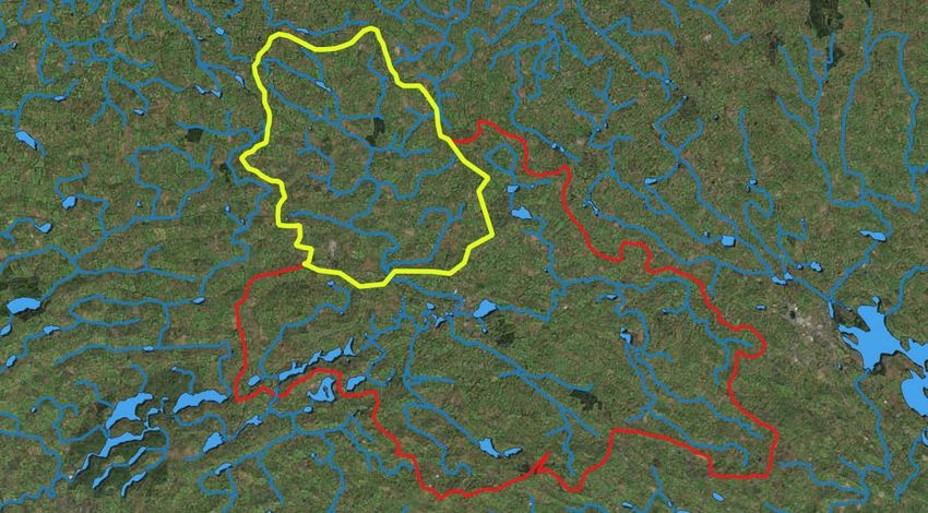
Upper Dromore River Catchment
    NFGWS - Source Protection Pilot Project
         Phase II – Surface Waters

                  17th January 2019
                Tullamore Court Hotel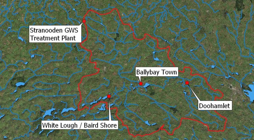
Background
• Stranooden GWS one of the largest in Ireland.
1,100 domestic connections; and
400 agricultural & commercial connections.
• Abstracts water from White Lough, Ballybay, Co. Monaghan.
• Phase I – Preliminary Source Protection report completed in 2012.
• Catchment delineated at 125km2.
• Pressures perceived from both urban and rural sources.
• MCPA issues identified in 2017.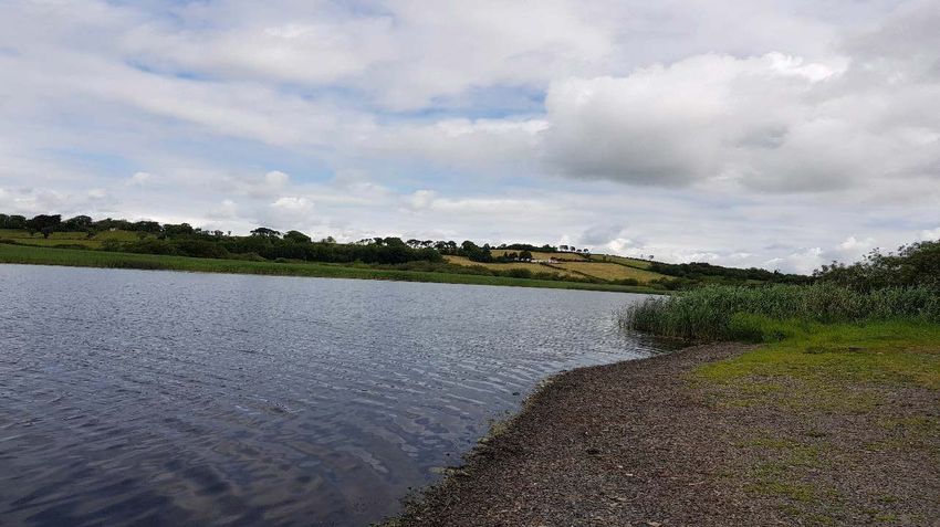
White Lough Catchment
Objectives
• Increasing local awareness of the delineated White Lough catchment and current health of the
  Upper Dromore system

• Create an understanding of the pressures impacting on the catchment

• Highlighting behavioural changes & measures that could improve the water quality

• Building an appreciation of the social, economic & environmental benefits

• Develop detailed source protection plan with local participation
Key Phases of Road Map
1.   Build partnerships

2.   Characterise the catchment (i.e. build upon Phase I Assessment)

3.   Further catchment characterisation

4.   Identify possible mitigation strategies
                                                   } In Conjunction
5.   Production of an Integrated Catchment Management Plan

6.   Ongoing implementation, monitoring, feedback & effectiveness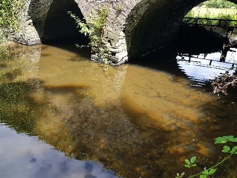
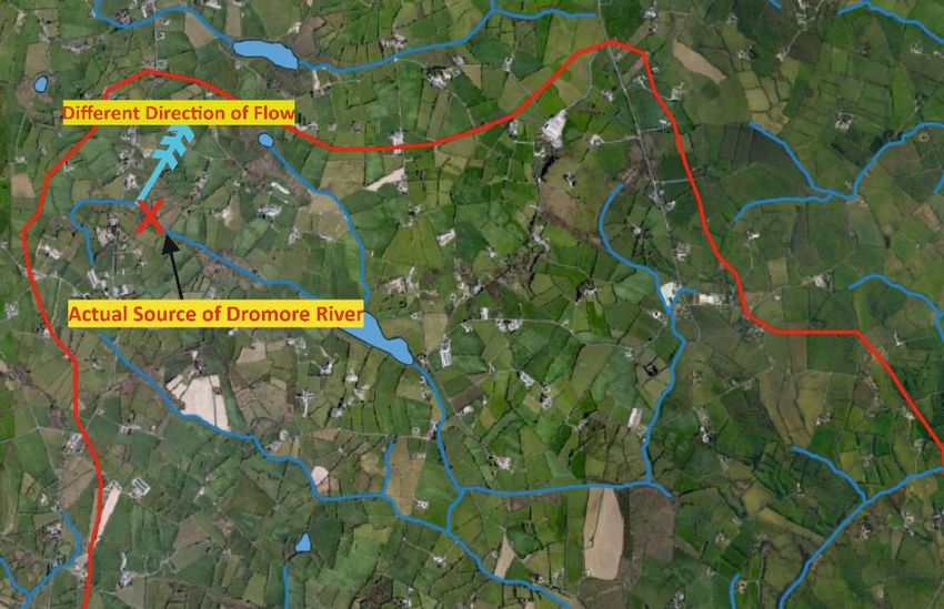
Upper Dromore River / White Lough Sub-Catchments
2. Catchment Characterisation
                       European Union Drinking
                        Water Regulations 2014
                           Parametric Value
   WATERBODY             S.I. No. 122 of 2014  04.05.18 11.05.18 29.05.18 08.06.18 12.06.18 14.06.18 18.06.18 21.06.18

                             MCPA (µg/l)

 Bannaghbane Stream              0.1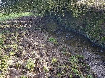
Comparison of Phosphate Susceptibility Areas
                  Between Sub-Catchments

Derryvalley Sub-Catchment – Higher % of   Lough Major Sub-Catchment – Higher % of
‘Class 2’ soils                           ‘Class 4’ soils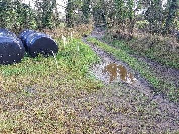
2. Catchment Characterisation
                                      DERRYVALLEY SUB-                    LOUGH MAJOR SUB-
   SELECTION CRITERIA
                                        CATCHMENT                            CATCHMENT
                                    2013: Q3-4 ‘Moderate Status’            2013: Q4 ‘Good Status’
Ecological Water Quality Status
                                    2017: Q3-4 ‘Moderate Status’         2017: Q3-4 ‘Moderate Status’
                                    2015: Phosphate ‘Poor Status’
Nutrient Conditions                                                                    -
                                    2017: Phosphate ‘Poor Status’
                                   Highest MCPA concentration of        Highest MCPA concentration of
Results of MCPA Monitoring
                                             4.6ug/l                              0.1ug/l
                                  Higher percentage of ‘Near Surface   Lower percentage of ‘Near Surface
Nutrient Susceptibility Maps
                                      Phosphate Susceptibility’            Phosphate Susceptibility’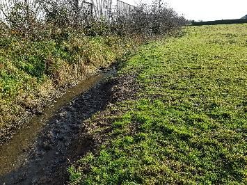
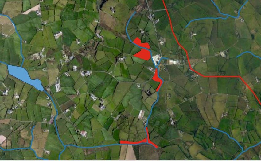
Upper Dromore River / White Lough Sub-Catchments
3. Further Catchment Characterisation
• 45km of surface water courses in Derryvalley Sub-Catchment

• Approx. 75% of landowners adjacent to water channel identified (circa 79
  farmers)

• Good correlation with Monaghan County Council ‘Derryvalley Project’ records

• Have been contacted by letter and follow up phone call and / or face to face
  conversation
Importance of ‘Ground Proofing Maps’
Example of Catchment Walk Mapping
4. Further Catchment Characterisation
Consequence of erosion / poaching / bare soils during heavy rainfall !!!
4. Identify Possible Mitigation Strategies
• Proposed to trial Weed Wiping Programme in Derryvalley Sub-Catchment in
  2019;

• Similar Approach to NI Seagahan Weed Wiping Trial Project (using Glyphosate);

   • Demonstrated MCPA residual reduction of more than 50%;

• Rush mapping used to identify landowners willing to participate in pilot;

• Project launch also used to allow landowners to sign up to the scheme.
4. Identify Possible Mitigation Strategies

Prime candidate for fencing   Prime candidate for Aquamat   Prime candidate for simple cost
(note elevations)             nose pump drinking system     free solution with farmers co-
                                                            operation
4. Identify Possible Mitigation Strategies
Upstream monitoring point from Ballybay UWWTP – ‘Poor Status’ as a consequence of Phosphate
Downstream monitoring point from Ballybay UWWTP – ‘Bad Status’ as a consequence of Phosphate
2018 Low Flow: Upstream – 0.11 P mg/l
Downstream – 0.24 P mg/l4. Identify Possible Mitigation Strategies • Plan to expand the NFGWS ‘On-Site Waste Water Pilot Project’ in 2019; • Bundled septic tank De-Sludging approach; • Hoped price reduction will encourage participation.
4. Identify Possible Mitigation Strategies Communication as a Mitigation Strategy!!! • Northern Sound – Agriview 8th November 2018; • Cavan Monaghan Science Festival: Corduff Agricultural Catchments Programme; Exploring Citizen Science on the Dromore River Corridor. • WISDOM Project; and • Green Flags Programme – Corcaghan Primary School
5. ICM Plan & Implementation
• Integrated Catchment Management Plan to be issued at the beginning of
March 2019;
• Contents to include:
Completed initial catchment characterisation (desktop study);
Further characterisation of Derryvalley Sub-Catchment (seasonal assessment);
Mitigation proposals & schedule of works for 2019; and
Communication strategy for 2019.
• Monthly circulars – sampling results / mitigation installation etc.You can also read