WALKING THE JURASSIC COAST
←
→
Page content transcription
If your browser does not render page correctly, please read the page content below
WALKING THE JURASSIC COAST
                                        DORSET AND EAST DEVON:
                                    THE WALKS, THE ROCKS, THE FOSSILS
                                              By Ronald Turnbull

                                         JUNIPER HOUSE, MURLEY MOSS,
                                    OXENHOLME ROAD, KENDAL, CUMBRIA LA9 7RL
                                               www.cicerone.co.uk

741 Jurassic Coast Text 2021 Rpt.indd 3                                       20/05/2021 16:30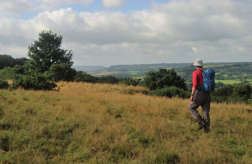
© Ronald Turnbull 2015
                    First edition 2015
                    ISBN: 978 1 85284 741 8
                    Reprinted 2017, 2019, 2021 (with updates)

                    Printed in Singapore by KHL using responsibly sourced paper
                    A catalogue record for this book is available from the British Library.

                                    This product includes mapping data licensed from Ordnance
                                    Survey® with the permission of the Controller of Her Majesty’s
                                    Stationery Office. © Crown copyright 2015 All rights reserved.
                                    Licence number PU100012932.

                    All photographs are by the author.

                                                  Updates to this Guide
                        While every effort is made by our authors to ensure the accuracy of guide-
                        books as they go to print, changes can occur during the lifetime of an edi-
                        tion. Any updates that we know of for this guide will be on the Cicerone
                        website (www.cicerone.co.uk/741/updates), so please check before plan-
                        ning your trip. We also advise that you check information about such
                        things as transport, accommodation and shops locally. Even rights of way
                        can be altered over time. We are always grateful for information about any
                        discrepancies between a guidebook and the facts on the ground, sent by
                        email to updates@cicerone.co.uk or by post to Cicerone, Juniper House,
                        Murley Moss, Oxenholme Road, Kendal LA9 7RL.
                             Register your book: To sign up to receive free updates, special offers
                        and GPX files where available, register your book at www.cicerone.co.uk.

                    Front cover: Layered Bridport Sandstone at East Cliff (Walk 13)

741 Jurassic Coast Text 2021 Rpt.indd 4                                                               20/05/2021 16:30
Walk 7 – Hartridge and Dumpdon
downhill below a phone wire to a gate, and a woodland
path down to a footbridge. Keep ahead through a small
swamp, and up to left of a stream to a driveway corner.
Take the tarmac track bearing up right, with the
stream to its right. After a stiff climb, the lane bends
left but turn right on a gravel track above Malthayes Here the footpath
Farm.4Keep ahead below the hedge at the top of the has been diverted:
steep slope, with great views. The farm just below is also you don’t now drop
the Otter Brewery, smelt rather than seen. to Malthayes Farm.
Follow the slope top along the top edges of several
fields (one of them has a fine pile of chert lumps col-
lected off the fields). Keep ahead along a strip of grass-
land above woods. At the next gate, a waymarker points
slightly down right. Slant down the field to a driveway
above Hillend Farm, and exit to the corner of a lane.
Keep ahead along this lane. After 50 metres, there
has sometimes been a cleared path up left through the Alternative parking
bracken, and turning right along the slope top. Otherwise, place here,
in 300 metres along the lane turn up left on a right-of-way ST 180 067.
path. Either way, you reach a lane at the slope top.
Cross slantwise, onto a path along the top of the On Hartridge, looking
steep Hartridge scarp, with a fence on its left. At the hill south towards Luppitt
67
741 Jurassic Coast Text 2021 Rpt.indd 67 20/05/2021 16:30Walking the Jurassic Coast
WALK 12
Bridport to Seatown
Start/Finish West Bay SY 465 905 or small pay and display at Chideock
SY 423 928
Distance 15km (9 miles); or shorter version 13km (8 miles)
Ascent 450m (1500ft); or shorter version 400m (1400ft)
Approx time 4½hrs; or shorter version 4hrs
Terrain town and village, inland hill, deeply sunken hollow way;
grassy cliff tops
Maps Explorer 116 Lyme Regis; Landranger 193 Taunton
Parking long-stay pay and display at West Bay former station east of
B3157; or small pay and display beside river in Chideock
Note Two cliff falls in April 2021 affect this route, although neither
has caused radical diversion of the Coast Path. One is east of
Seatown, on the ascent to Thorcombe Beacon. The other is
east of Eype’s Mouth. Look out for signs and be aware that the
cliff falls may develop further.
A good 5km of airy cliff tops, and rock face investigations at Seatown, Eype’s
Mouth and West Bay – at least one of them ought to yield an ammonite or
two. But that’s just the walk’s return leg. The old town at Bridport is pretty
in the same golden-stone way as the Cotswolds. Fuddle your brains at the
Palmers’ Brewery and then sharpen them up again with the intellectual
rigours of the Bridport Museum.
But what really sets this one apart is an out-of-world experience
arising from being sunken below it by 10m. Shutes Lane, at the back of
Symondsbury, is Dorset’s slot canyon, an eroded road or hollow-way with a
green and faded-orange Jurassic atmosphere.
GREENSAND
Leave the car park at its southwest corner, and head
middle Jurassic
west to West Bay harbour. Cross the river bridge at
Forest Marble the back of the harbour, and turn right into a large
Inferior Oolite caravan park. Head up between the caravans alongside
Bridport Sands the River Brit, with a tarmac path leading to a gate at the
upper Lias north corner of the site.
Charmouth Mdstn
96
741 Jurassic Coast Text 2021 Rpt.indd 96 20/05/2021 16:30Walking the Jurassic Coast
The coast path crosses the faultline itself at a stile. Here you look ahead
across the River Brit (see diagram). North of Bothenhampton, the Warren
is a plateau of tough Inferior Oolite above Bridport Sands and the softer
Thorncombe Sands and Eype Clay. South of Bothenhampton, North Hill is
a plateau of tough Forest Marble above softer Frome Clay. So the stuff to
the south is a whole lot higher up the rock sequence. It’s the same displace-
ment as at Fault Corner, but carried 1km to the north by the wrench faultline
north–south through Bridport.
Cross stepping stones above the beach, for the con-
tinuing path up the cliff rim. Cliff erosion means a short
diversion left into a holiday park, then back to the right
to pass through lumpy quarry workings. The path swings
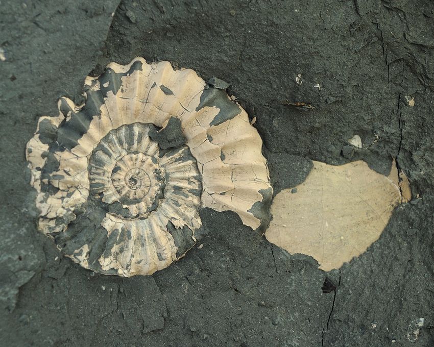
Ammonite from back right to the cliff tops, then heads easily down to the
Green Ammonite seafront at West Bay. Pass around the harbour to re-cross
Beds, Seatown the river bridge at its back.
104
741 Jurassic Coast Text 2021 Rpt.indd 104 20/05/2021 16:30You can also read