Whakaraupō/Lyttelton Harbour Catchment Management Plan
←
→
Page content transcription
If your browser does not render page correctly, please read the page content below
Te Hapū o Ngāti Wheke, Canterbury Regional Council (Environment
   Canterbury), Lyttelton Port Company Limited, Christchurch City Council,
          and Te Rūnanga o Ngāi Tahu with Tāngata Tiaki present:

                     Whakaraupō/Lyttelton
                      Harbour Catchment
                       Management Plan
                                March 2018

A Catchment Management Plan to restore the ecological and cultural health of
Whakaraupō/Lyttelton Harbour as mahinga kai – wrapping our environment in a
            protective korowai for us, and our children after us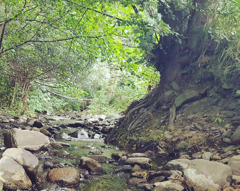
Whakataua, whakataua
          Whakatau a Rangi e tū nei
        Whakatau a Papa e takoto nei
               Kia wātea, kia māmā
            Te wairua i te ara takata
        O te mauri a Tāne-nui-ā-rangi
         A Haumia-tiketike me Rongo
          Ko Tiki i ahu mai i Hawaiiki
          Ko te mauri tēnā i kawea ai
             Te toko mauri o te tapu
      He mauri nō Rongo ki te whaiao
                    Tipua-ā-nuku
                   Tipua-ā-Rangi
             Kia whakamaua ki tina
                          Tina
                       Haumi e
                         Hui e
                          Tāiki

A karakia used to clear the way in preparation for weaving.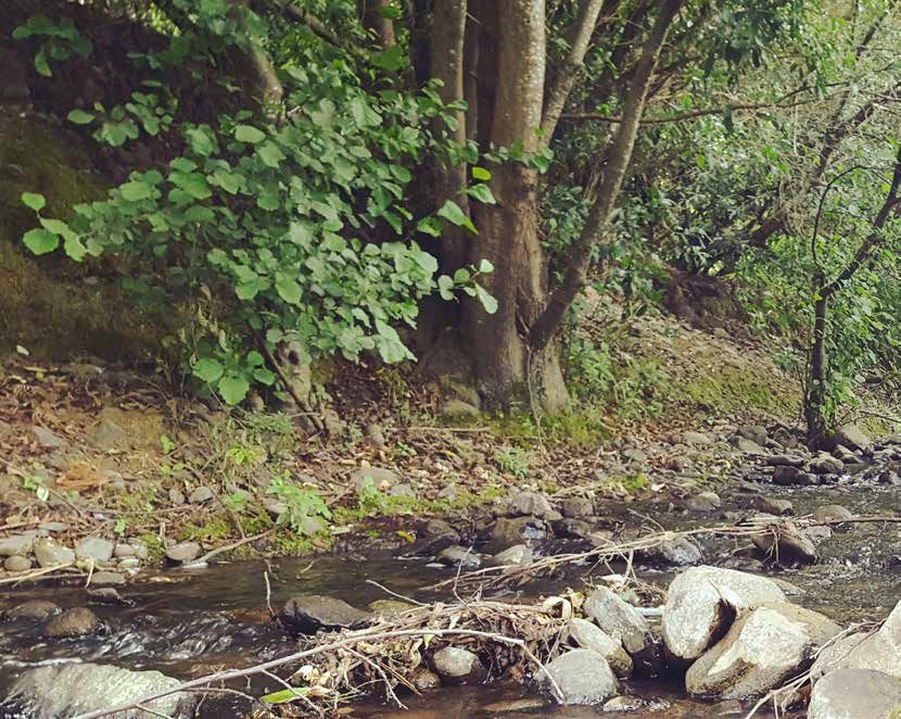
Contents
Karakia ........................................................................................................................................................................ 2
Executive Summary ................................................................................................................................................. 4
Introduction .............................................................................................................................................................. 6
Part I .................................................................................................................................................................................................... 8
Kaupapa/Purpose of Plan – Mahinga Kai ..................................................................................................... 8
Whāinga/Goals ................................................................................................................................................... 8
Pou/Guiding Principles ..................................................................................................................................... 9
The Partners ........................................................................................................................................................ 9
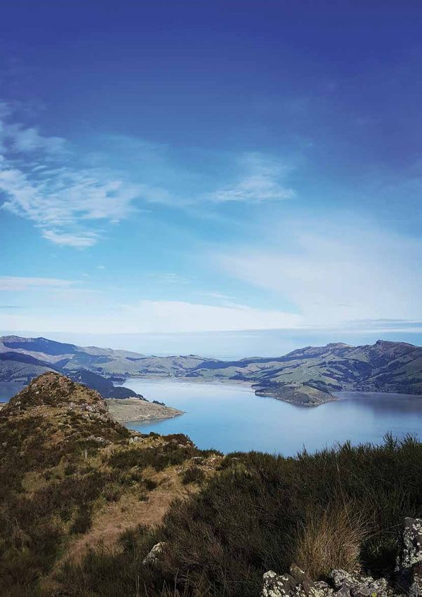
The Whakaraupō/Lyttelton Catchment ..................................................................................................... 11
Part II ............................................................................................................................................................................................... 12
Rocky Outcrops and Indigenous Forests ................................................................................................... 12
Hills and Lowlands .......................................................................................................................................... 14
Streams .............................................................................................................................................................. 16
Wetlands and Saltmarsh ................................................................................................................................ 18
Taihua/Foreshore ............................................................................................................................................ 20
Harbour .............................................................................................................................................................. 22
Part III .............................................................................................................................................................................................. 26
Priority Projects ............................................................................................................................................... 26
Complete List of Actions ............................................................................................................................... 28
Accountability and Review ............................................................................................................................ 40
Maps ........................................................................................................................................................................ 42
Glossary ................................................................................................................................................................... 44
Whaka-Ora, Healthy Harbour 3
Executive Summary
       Whakaraupō/Lyttelton Harbour is an important place for many different people: the mana whenua of Ngāti Wheke,
       the residents of all of Whakaraupō/Lyttelton Harbour’s bays, the employees and wider Lyttelton Port community,
       the tourists and visitors that visit our parks and walkways and take a break at Lyttelton’s great eateries, and the
       business owners working within the harbour. We all share a love for this special place, and a love for engaging with
       it. This engagement can look like gathering seafood in the shallows and streams, walking our favourite tracks in
       the hills with our children, showing our family and friends our favourite beaches, or sailing and paddling out in the
       harbour to get to our favourite fishing spots.

       Mahinga kai is important to the whole Whakaraupō/Lyttelton Harbour community – although we all may call it
       different things. It is a term that is used by mana whenua to represent their customary harvesting practices, and
       all activities, places and relationships related to this, but it also speaks about things done by everyone who calls
       Whakaraupō/Lyttelton Harbour home. We all have a desire and a responsibility to ensure that Whakaraupō/
       Lyttelton Harbour is looked after so that those who come after us can also engage in these mahinga kai activities
       into the future.

       Whaka-Ora, Healthy Harbour sets out a way forward for all of us as a community to ensure that the ecological and
       cultural health of Whakaraupō/Lyttelton Harbour as mahinga kai is restored for us and our children after us. The key
       purpose of this plan is to ensure that Whakaraupō/Lyttelton Harbour is a healthy, abundant, and interconnected
       environment for people to practice mahinga kai – however that may look to them.

       We look across the whole harbour from the rocky outcrops to the deep harbour waters – “ki uta ki tai”- and set
       aspirational goals for where we want Whakaraupō/Lyttelton Harbour to be in the future. After comparing this
       aspirational state with the current state of the environment we have then identified some key focus areas in which
       we can undertake actions to move us toward where we want to be. These actions focus on some key areas: erosion
       and sedimentation, pollution, terrestrial indigenous biodiversity, and marine indigenous biodiversity; and are being
       addressed in multiple ways including through practical projects, research projects, monitoring programmes, changes
       to regulation, and education initiatives. The actions will be tracked annually to ensure that we are doing what we
       said we would, and will be reviewed every three years so that we are continually moving toward a better future for
       our harbour.

                                                         Change-Making
                                                 Mō tātou, ā, mō kā uri ā muri ake nei
                                                            Collaboration

                                                                                                            Science
                         Kaupapa/Purpose                                                                    Advice
                                 Mahinga Kai

                                                                                                    Community     Tangata
                                                                                                    Engagement     Tiaki
                           Whainga/Goals
                           Abundant, Healthy,
                              Connected

                         Aspirational Future                 Key Focus Areas                        Current State of
                                                       Sedimentation & erosion, pollution,
                          State of Harbour         terrestrial biodiversity, marine biodiversity
                                                                                                       Harbour

                                                                   Actions
                                                       Sedimentation & erosion, pollution,
                                                   terrestrial biodiversity, marine biodiversity,
                                                         research & monitoring, general

                                                                                                                 Figure 1: Document Structure Diagram.

4   Whaka-Ora, Healthy Harbour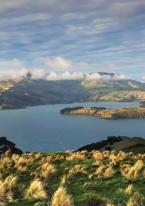
Three key pou – or guiding principles – were chosen for this plan. They have influenced the decisions made
throughout this document. These pou are:

          Change-making                           ‘Mō tātou, ā, mō kā uri ā              Collaboration
          The idea that everyone can              muri ake nei’ (for us and              The idea that we must all
          be a change-maker with the              our children after us)                 work together to achieve our
          power to influence the future of                                               lofty goal of restoring the
                                                  The idea that in this first version
          Whakaraupō/Lyttelton Harbour,                                                  cultural and ecological health
                                                  of the plan we need to focus on
          and that we all must change                                                    of Whakaraupō/Lyttelton
                                                  laying a foundation for those
          our habits for the sake of our                                                 Harbour for mahinga kai
                                                  who will be protecting our
          harbour
                                                  harbour in the future

We have also used the imagery of a korowai (traditional cloak) throughout this plan to represent the way we are
caring for and protecting our harbour through our actions.

We acknowledge that many groups and individuals who already have, and are, working hard to restore and protect
our harbour, and we hope that Whaka-ora, Healthy Harbour supports them to continue their great work. We also
hope that it helps to build a strong relationship between the different groups including mana whenua, the wider
Whakaraupō/Lyttelton Harbour community, the Port, and councils so that we can work together to achieve more
than we ever could working alone.

                                                                                              Whaka-Ora, Healthy Harbour   5
Introduction
       Whakaraupō/Lyttelton Harbour is a taonga (treasure) to those that live, work, and play in its waters, on
       its beaches, and along its ridges. Like all treasures, it is important to care for and protect the harbour
       and its wider catchment so that it can be enjoyed by us and our children after us. In Māori culture,
       when something is wrapped in a korowai (a beautiful hand-woven cloak), it indicates the importance
       of the item and also acts as a layer of protection. This plan enables the Whakaraupō/Lyttelton Harbour
       community to weave a korowai that will protect and support this special place to thrive and grow in the
       future.
       The Lyttelton Port Recovery Plan (CERA, 2015) records a commitment by Canterbury Regional Council (Environment
       Canterbury), Lyttelton Port Company Limited, Te Hapū o Ngāti Wheke, Christchurch City Council and Te Rūnanga
       o Ngāi Tahu with Tāngata Tiaki (the Partners) to “work together to develop a catchment management plan for
       Whakaraupō/Lyttelton Harbour in accordance with the philosophy ki uta ki tai (from the mountains to the sea)”.
       The Partners have committed that the plan will aim to “restore the ecological and cultural health of Whakaraupō/
       Lyttelton Harbour as mahinga kai”, whilst also addressing “other environmental, cultural and social concerns,
       including the needs of recreational users, as well as the needs of a working port” (LPRP 5.1).

       This plan is non-statutory, and has been written with the community of Whakaraupō/Lyttelton Harbour – both
       those who call it home, and those for whom it is a home away from home – in mind. For this reason we have chosen
       to write it in a way that allows you – the community - to pick up, read, understand, and take ownership of this plan
       – not to sit on the shelves of council planners. First, we highlight the key kaupapa (or purpose) of this plan: mahinga
       kai. Mahinga kai is broken down into the three clear goals (or whāinga) of ensuring we have a healthy mahinga kai
       environment, an abundant mahinga kai environment, and one we are all interconnected to so that we can share
       in its treasures. We have then identified three pou – our guiding principles – that will help us decide how to reach
       these goals, and then shared some of the stories and histories that make Whakaraupō/Lyttelton Harbour such a
       special place.

       Next we have identified what a healthy, abundant, and interconnected mahinga kai environment will look like in
       the future, from the rocky outcrops at the top of the catchment all the way to the middle of the harbour – ki uta, ki
       tai. Now that we have set our sights on the future we want, we are able to look at what is standing in our way. Four
       Key Focus Areas are identified; erosion and sedimentation, pollution, terrestrial indigenous biodiversity, and marine
       indigenous biodiversity – and a suite of priority actions and other actions show how we will restore the ecological
       and cultural health of Whakaraupō/Lyttelton Harbour as mahinga kai.

       This whole plan is the nestled within the metaphor of weaving a korowai, with each step linked to a different step
       in the process of making a traditional korowai, from harvesting and working the raw materials, to weaving different
       natural fibres and feathers from throughout the catchment into our korowai, creating the patterns upon it that
       represent key focus areas for us, and finally wrapping it around our Harbour and maintaining it for generations to
       come.

6   Whaka-Ora, Healthy Harbour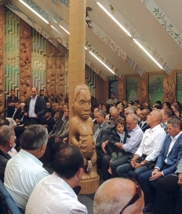
Whaka-Ora, Healthy Harbour 7
Part I
       Before we can start to weave our korowai we must harvest the materials we will need. Part of harvesting
       is understanding the history of the materials, the process we are about to embark on, and sharing the
       experience of harvesting with others. We must also work these raw materials to create the resources we
       need to start the weaving process. For this plan, this means understanding the history of the catchment
       and genesis of this plan, and taking the wealth of information received from the community and
       partners and working this into key strands to weave throughout this plan.

       Kaupapa/Purpose of Plan – Mahinga Kai
       Mahinga kai is important to the whole Whakaraupō/Lyttelton Harbour community – although we may all call
       it different things. Mahinga kai is a term that is used by mana whenua to represent their customary harvesting
       practices, but it also speaks about things done by everyone who calls Whakaraupō/Lyttelton Harbour home.
       Spending time in the environment and building an intimate knowledge of the tides, the best walking tracks, the
       winds, and where different species can be found (including the best fishing spots) is mahinga kai. Teaching your
       children to thread their first fishhook, how to dig in the sand for pipi, and how to cut flax for arts and crafts is also
       mahinga kai. At the same time, taking action to preserve these experiences for future generations through only
       taking what you need, supporting species to breed or regenerate, and being aware of your own impact on the
       environment is an important part of mahinga kai.

       The Lyttelton Port Recovery Plan states that the key objective of the catchment management plan is to “restore the
       ecological and cultural health of Whakaraupō/Lyttelton Harbour as mahinga kai” (LPRP, 5.1). We have taken this
       directive and chosen it as the key purpose for this plan – to restore Whakaraupō/Lyttelton Harbour so that all those
       who call the area home can engage in mahinga kai practices, from the mana whenua of Ngāti Wheke, through to the
       locals living in the harbour and those who visit from elsewhere either for work or leisure, through to the Port and its
       community of workers.

       Whāinga/Goals
       To meet our purpose of restoring the ecological and cultural health of Whakaraupō, three whāinga/goals have been
       chosen to help articulate an environment that supports mahinga kai. It is our desire that in the future mahinga kai in
       Whakaraupō will be described as abundant, healthy, and interconnected .

       Abundant                                  Healthy                                    Interconnected
       In the future there will be an            A healthy Whakaraupō/Lyttelton             The community will continue to be
       abundance of native species within        Harbour means that people do not           interconnected and engaged with
       the Whakaraupō/Lyttelton Harbour          have to think twice about eating           Whakaraupō/Lyttelton Harbour, and
       catchment. This will be both in           kai that they have caught from the         locals and visitors of all abilities are
                                                                                            able to easily access natural recreation
       terms of the diversity of native          harbour or sourced from the land.
                                                                                            and mahinga kai sites. People can
       species present, and the size of          It means that we can see fish as
                                                                                            be found walking on the beach,
       these populations. People of all          they swim past the jetties, flocks of      swimming in the harbour, or out on
       ages and abilities will be able to        fat birds flying across the harbour,       the water in boats and watercraft of
       go down to the shore and gather           and native plants growing lush             all kinds. Locals take pride in their
       shellfish, and fishermen will always      and green. Our waterways will be           roles as active guardians of the
       come home with enough for their           planted, thriving ecosystems, and          harbour and come together through
       families. Native birdsong will be an      sedimentation, pest species and            many grassroots initiatives. They are
       everyday sound, and penguins and          pollution will not be stunting the         passionate about the future of their
       dolphins will be commonplace in the       growth of species.                         home – ensuring that visitors and
       harbour. Native plants will cover the                                                future generations can experience
                                                                                            what makes this place special.
       landscape from giant tōtara, through
       to harakeke and raupō.

8   Whaka-Ora, Healthy Harbour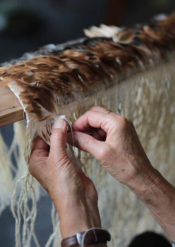
Pou/Guiding Principles
Pou were originally placed on the environment to guide people to key locations, and just like traditional pou, these
pou will guide decisions that are made in this document. They are the foundations of the agreed way forward
for Whaka-Ora, Healthy Harbour. These pou are based on conversations held with community groups through
engagement workshops, and the work of the Whakaraupō Catchment Management Plan Partners Working Group.
The three pou are:

            Change-making                            Mō tātou, ā, mō kā uri ā                 Collaboration
           This plan adopts the idea that            muri ake nei                             Working together is
           everyone can be a change-                 for us and our children                  important to creating real,
           maker with the power to                   after us                                 sustained change for our
           influence the future state                                                         harbour. Different groups
           of Whakaraupō/Lyttelton                   Restoring the harbour                    within our community bring
           Harbour. It is agreed that                and wider catchment is a                 different strengths, from our
           the status quo is no longer               lofty vision that will take              older members who help
           acceptable in Whakaraupō/                 more than one generation.                us understand change over
           Lyttelton Harbour and                     Whaka-Ora, Healthy Harbour               time, to people in positions
           we must set a course for                  is the foundation that will              of influence who can run
           the better future we are                  set some things in place                 projects, and our youth who
           envisioning. Whaka-Ora,                   that will not be completed               suggest innovative ways
           Healthy Harbour aims to guide             by those of us working                   to support Whakaraupō/
           and support us as change-                 on this kaupapa/purpose                  Lyttelton Harbour. By bringing
           makers in actions that will               today – the job is too big               skill sets together we will be
           have a positive impact on our             for just one generation. It is           in a strong place to reach our
           harbour.                                  accepted that not all projects           goals. In developing future
                                                     or actions will immediately              actions, preference will be
                                                     spark change, rather some                given to actions and ideas
                                                     will provide a platform for              that involve or bring together
                                                     future gains which will then             multiple groups to achieve
                                                     be taken forward by the next             outcomes.
                                                     generation of people invested
                                                     in the future of Whakaraupō/
                                                     Lyttelton Harbour.

The Partners
Everyone who feels connected to Whakaraupō/Lyttelton Harbour has an important part to play in protecting and
supporting it into the future. This includes the seniors and kaumātua within our communities, our children and
their schools and playcentres, mana whenua, our community groups and clubs, local boards and representatives,
business owners, landowners, and visitors. Five specific groups within our wider community were tasked with the
responsibility of writing Whaka Ora, Healthy Harbour (as per the commitment within the Lyttelton Port Recovery
Plan). These five key partner organisations are Te Hapū o Ngāti Wheke, Te Rūnanga o Ngāi Tahu, Lyttelton Port
Company Limited, Canterbury Regional Council, and Christchurch City Council. They each have a key stake in the
harbour for various reasons, and have a responsibility for restoring its ecological and cultural health, alongside the
rest of our community. The map on page 42 shows the context for land and harbour management.

Te Hapū o Ngāti Wheke & Te Rūnanga o Ngāi Tahu
Ngāti Wheke are the Ngāi Tahu hapū based in Rāpaki, with deep roots throughout Whakaraupō. They hold mana
whenua and mana moana over Whakaraupō which is expressed through place names, tribal histories, and their
marae at Rāpaki. Mahinga kai is a vital aspect of Ngāti Wheke’s cultural identity and as mana whenua, they have an
intergenerational responsibility to act as kaitiaki for our environment. Māori and the natural world share whakapapa,
therefore the welfare of the natural world and Ngāti Wheke’s own welfare are intertwined.

In 1998 Ngāti Wheke established the first mātaitai reserve in the country, The Rāpaki Mātaitai. It provides certain
legal powers to Te Hapu O Ngāti Wheke for the management of fisheries resources of cultural significance in Rāpaki.
A second mātaitai has recently been established across two thirds of the harbour. Ngāti Wheke are also heavily
involved in environmental issues through council relationships, Department of Conservation, education providers,
and community groups, and are supported by Te Rūnanga o Ngāi Tahu with technical advice in planning, policy, and
scientific matters. Ngāti Wheke play an important leadership role in ensuring a sustainable future for the Harbour.
They commit to working in good faith alongside others to improve the health of their takiwā based on impacts upon
the cultural association with Whakaraupō, preservation of our community resources, and potential economic benefit
for our current and future generations within our Lyttelton Harbour community.

                                                                                                  Whaka-Ora, Healthy Harbour   9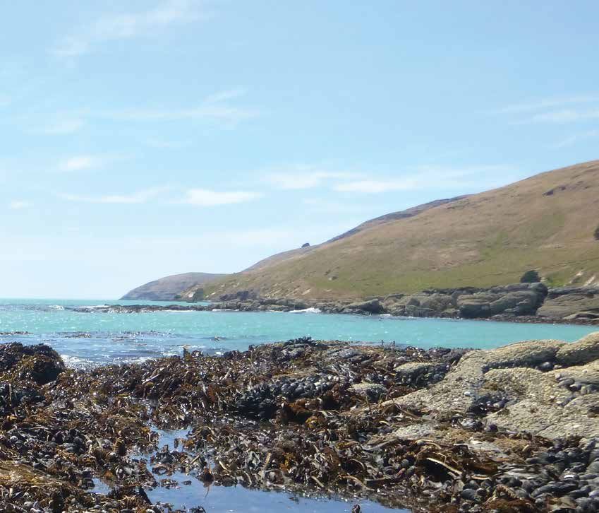
Lyttelton Port Company Limited
        Lyttelton Port Company run the South Island’s largest Port, situated in the heart of Lyttelton Township – and
        have done since its humble beginnings in 1849. The Port is the gateway to the world for South Island exporters
        and importers and the entry point for all the goods that keep our region moving. The Port is a significant piece
        of strategic infrastructure underpinning important economic drivers of the Canterbury regional economy i.e.
        agriculture and manufacturing (including agricultural product processing) and playing a role in tourism as well.

        Lyttelton Port Company considers the Port to be part of the fabric of the harbour environment and see themselves
        as having an obligation to make sure the harbour is healthy now and into the future. They invest heavily in science
        and technical information to ensure they manage their operations and development to support a healthy harbour.
        Lyttelton Port Company is committed to continuous improvement in their environmental management and
        partnering to get great outcomes as they develop the Port’s world-class services to ensure they provide the facilities
        and worldwide connections that keep our Port, our city and our region thriving.

        Canterbury Regional Council (Environment Canterbury)
        Environment Canterbury is the regional council for the Canterbury region and has a statutory responsibility to
        manage the cumulative environmental effects of activities within Whakaraupō/Lyttelton Harbour. Environment
        Canterbury also works with communities, mana whenua, businesses, industry sectors and groups on the
        management of natural resources – air, coasts, water, land and biodiversity - to achieve environmental and economic
        development outcomes.

        Environment Canterbury monitors the state of the environment in Whakaraupō/Lyttelton Harbour, including
        freshwater flows and quality and coastal water quality, and issuing, monitoring and enforcing resource consents
        against the framework set out in its land, water, air and coastal regional plans and the Lyttelton Port Recovery
        Plan. Environment Canterbury is committed to adopting a collaborative ‘ki uta ki tai’ approach to these statutory
        functions in Whakaraupō, and to using Whaka-Ora, Healthy Harbour to guide investment in scientific monitoring
        and investigations within Whakaraupō, and to report results to the community. It has responsibilities for navigation
        safety of commercial shipping and recreational boating, and responding to marine oil spills. Environment Canterbury
        will continue to seek opportunities to work collaboratively for shared outcomes for Whakaraupō/Lyttelton Harbour
        by supporting practical projects, including direct funding for biodiversity projects through the Canterbury Water
        Management Strategy, and providing advice on environmental risk management through tools such as farm
        environment plans and the builders pocket guide.

        Christchurch City Council
        Christchurch City Council is the district council for Christchurch, including Banks Peninsula and has a responsibility
        to manage the effects of activities and development on land within Whakaraupō/Lyttelton Harbour through the
        Christchurch District Plan. Christchurch City Council is a significant landowner in the catchment and provides and
        maintains infrastructure, including public roads, water, wastewater and stormwater along with parks, reserves, jetty,
        and community facilities. This is done alongside communities, mana whenua, business sectors and conservation
        groups. They also provide funding for biodiversity improvements and community groups.

        In providing infrastructure, Christchurch City Council must ensure that it meets all relevant resource management
        rules at the district and regional level. This applies to things such as stormwater discharges which need consent
        from Environment Canterbury. Christchurch City Council commit to ensuring that any effects of infrastructure,
        including discharges, are minimised and will not contribute to the degradation of the harbour and surrounds. They
        also commit to adopting a ki uta ki tai approach to planning and managing the effects of infrastructure, to working
        collaboratively to achieve the shared outcomes of Whaka-Ora, Healthy Harbour.

10   Whaka-Ora, Healthy Harbour
The Whakaraupō/Lyttelton Catchment
Early History of Whakaraupō Lyttelton Harbour
The South Island of New Zealand is seen by Ngāti Wheke as Te Waka o Aoraki. Whakaraupō - and the wider
Banks Peninsula - was created as Tūterakiwhānoa (Aoraki’s relation who came in search of him and his brothers)
raked rubble from their crashed waka into a heap to clear what is now the Canterbury Plains. Generations later
the harbour was given its name of Whakaraupō – the reed-filled harbour – by the great explorer Tamatea-Pōkai-
Whenua. He also gave his name to the prominent peak Te Poho o Tamatea (the peak overlooking Rāpaki Bay)
which is the ancestral mountain of this area.
Whakaraupō was first settled by Waitaha and Ngāti Māmoe, with Ngāi Tahu assuming mana whenua of the area in
the 18th century through both conquest and intermarriage. Ngāi Tahu asserted their mana whenua status through
the actions of the chief Te Rakiwhakaputa who threw his rāpaki (waistmat) upon the beach which is now known as
Te Rāpaki o Te Rakiwhakaputa – or Rāpaki for short. Te Rakiwhakaputa’s son, Wheke, remained at Rāpaki and his
descendants are now known as Ngāti Wheke.
Ngāti Wheke developed a culture based around mahinga kai – interactions with the natural environment to provide
for and sustain their people. Whakaraupō and its catchment were teeming with mahinga kai species such as pioke
(dogfish), kererū, and shellfish which Ngāti Wheke took great pride in protecting and fostering. This ensured
that they upheld their mana and responsibilities as kaitiaki so that mahinga kai species were always healthy and
abundant so as to feed both their families and visitors.
The earliest Pākehā in and around Banks Peninsula were whalers, sealers and flax traders, with the most significant
contact between Māori and European beginning with the whalers in the 1830’s. These whalers were the first to
explore the coasts of the Peninsula and to establish relationships between Pākehā and Māori, sharing knowledge
and ideas about the land and sea and each other’s culture, and trading possessions such as tools, food, blankets and
land. They worked together to thrive and to improve their livelihood.
In the 1840’s Pākehā settlers arrived in Whakaraupō/Lyttelton Harbour to establish communities and lease land
for farms. In 1849 the Port Cooper Deed was signed and Pākehā settlement expanded throughout the harbour,
resulting in Ngāti Wheke - who originally had settlements throughout the harbour, particularly at Purau - being
pressured to consolidate at the Native Reserve at Rāpaki due to land sales and other pressures from settlers.
In 1850 the Canterbury Associations First Four Ships landed in what is now Lyttelton, with their passengers climbing
up the Bridle Path over the Port Hills to establish the settlement of Christchurch. Lyttelton Port was established in
1877 through the establishment of the Lyttelton Harbour Board, and has become a defining feature of the harbour;
growing with Canterbury to become what is now the third largest port in New Zealand. Generations of locals have
worked at the Port, and its industrial aesthetic and hum of activity have become an intrinsic part of Lyttelton’s identity.
Harbour Communities
The communities of Whakaraupō/Lyttelton Harbour are engaged and active, and many are drawn to the area for
its natural environment. Locals have been this way for generations which can be seen in the areas rich history,
including links to Antarctic exploration endeavours, and development of new nautical crafts such as the now iconic
Optimist children’s yacht. Rāpaki is also the location of New Zealand’s first mātaitai (customary fishing reserve). This
was established in 1998, and allows Tangata Tiaki – Crown appointed customary fishing officers - to use bylaws to
manage customary food gathering as a way to protect and foster mahinga kai species within Rāpaki.
Many locals – and visitors - pride themselves on their ability to engage with the harbour through fishing, sailing and
paddling, swimming, and walking the various tracks. Many are also involved with maintaining and restoring areas of
the harbour that have become degraded over time, due to the responsibility they feel to ensure that Whakaraupō/
Lyttelton Harbour is protected and maintained for them, and the generations after them. Along with the mātaitai,
community groups are busy with activities such as planting days to help protect and restore local streams and
habitats, beach clean ups, and education initiatives, as well as establishing a variety of environmental trusts, groups,
and actively participating in zone and reserve committees, and community boards and workshops.
Genesis of this Plan
In 2010 and 2011 Whakaraupō/Lyttelton Harbour communities were struck hard by the Canterbury Earthquake
Sequence. Lyttelton Port was severely damaged. To expedite recovery the Lyttelton Port Recovery Plan began to be
drafted. In November 2015, the Lyttelton Port Recovery Plan came into effect. One of the commitments that came
out of this plan was to create the Whakaraupō/Lyttelton Harbour Catchment Management Plan. The Catchment
Management Plan was aimed at restoring the ecological and cultural health of the harbour as mahinga kai, and was
to be developed in accordance with the philosophy of ki uta ki tai.
Te Hapū o Ngāti Wheke, Te Rūnanga o Ngāi Tahu with Tangata Tiaki, Canterbury Regional Council, Christchurch City
Council and Lyttelton Port Company Limited have worked together alongside the local community to develop this
catchment management plan.
Whaka-Ora, Healthy Harbour 11Part II
Now that all of our materials have been harvested we can begin weaving our korowai. Into this korowai
we weave the Whakaraupō/Lyttelton Harbour catchment from the harbour itself, out to the different
bands of vegetation and the streams that run through them, up to the rocky outcrops that run along
the top of the hills. This korowai can only be created if all of the harbour, ki uta ki tai, is thriving and
providing an environment for the species in each ecological band to grow. If one band is unhealthy,
the whole catchment is unhealthy and there will be a hole in our korowai - meaning that we are not
succeeding in keeping our catchment protected and cared for.
This section of the plan focuses our thoughts on the future. Here, we describe how we want the six ecological bands
that span the catchment, ki uta ki tai, to be in a future where Whakaraupō/Lyttelton Harbour is a place that provides
healthy, abundant, and interconnected mahinga kai opportunities. These bands are rocky outcrops and forests, hills
and lowlands, streams, wetlands and saltmarsh, taihua/foreshore and harbour. Refer to the map on page 43. We
will talk about the abundance of plants and animals that we want to see in each ecological band, including birds,
fish, and reptiles – some of which we highlight as ‘touchstone species’. These are species that we especially want
to see thriving in Whakaraupō/Lyttelton Harbour. We describe the health of these species and the way we would
like to see them established within the harbour, and also highlight the way that people are interacting and being
integral parts of the harbour through their engagement and impact on the landscape. We then take a step back to
the present day and take an honest look at what each ecological band looks like now. This includes our current land
uses and practices and how they are impacting on our environment, as well as the health and abundance of different
species important to us ecologically, culturally, and as a community. By comparing where we want to be in the future
with where we are now, we are able to see any gaps, and can start to identify what roadblocks are stopping us from
closing those gaps. We can use this information to choose actions to undertake in each ecological band (or across
multiple bands) to remove those roadblocks and enable us to reach the future we are aspiring for within our harbour.
Ecological Bands
Streams
(passing through
multiple bands)
Rocky outcrops
and forests
Hills and
lowlands Wetlands and Taihua/
Harbour
saltmarsh foreshore
Rocky outcrops and Indigenous Forests
From the rocky outcrops and forests we source the feathers of the kāhu (harrier hawk). The kāhu is our kaitiaki
for the highest bluffs and summits of the Port Hills, and high slopes, summits and gully heads of Te Ahu Pātiki/
Mt Herbert area. The kāhu shares this area with a number of important species. These include the pipit, copper
butterfly, pōhuehue (muhlenbeckia), thin-barked tōtara, kārearea (falcon), Canterbury tree weta, prostrate kowhai
and native tussocks, which are key touchstone species for us in this area.
Future state
When the kāhu soars over the rocky outcrops we want it to see native tussocks, taramea (golden spaniard) and
mountain flax prevailing over introduced grasses and weeds in these cooler, and more exposed areas, whilst tōi
(mountain cabbage tree) are abundant in the sheltered cool wet forest on Te Ahu Pātiki/Mt Herbert. As it flies across
the upper valleys, gullies and ridges our kāhu will be able to perch among the thin barked tōtara and mātai, which
will dominate this area, along with horopito (pepperwood), mountain five finger and native holly.
12 Whaka-Ora, Healthy HarbourThese upper bush gullies will have many small patches of different activities such as pasture, sustainably managed
plantation forest and tussock landscapes, interweaving with native forest and linking the high ridges and valley
heads with the rest of the Harbour environment. Thriving populations of pipit, kārearea (NZ falcon), will join
our kāhu in the rocky tussock and shrub land of the crater rim, and fly above the boulder-dominated ridges and
outcrops. These species will be supported not just by the increased vegetation, but by predator control measures
as well. Rare herbs such as myosotis have expanded in numbers and range and take over from the invasive weeds
that used to dominate. High forest connections across the crater rim consisting of pōhuehue (muhlenbeckia),
prostrate kōwhai and porcupine bush support geckos, skinks, copper butterflies and many other insects including
the Canterbury tree weta. They also provide improved bird and invertebrate corridors and food resources between
the harbour basin and the surrounding catchments.
Dense native forests now sit below the rocky outcrops. An abundance of native climbers, shrubs and herbs can also
be found in the rocky outcrops, which help stabilise steep slopes, rock faces, cliffs, and boulder fields, making them
more resilient in the face of natural disasters. This also helps safeguard the Crater Rim Walkway which continues
to be a popular recreation and tourism activity that links Te Ahu Pātiki/Mt Herbert, the Summit Walkway/Te Ara
Pātaka, The Monument, Charteris Bay and Diamond Harbour and provides stunning views across the harbour, Port
and outer northern bays – similar to the views our kāhu sees as it flies over these rocky outcrops and forests.
Current state
Today, this kāhu sees large tracts of exotic species – particularly grasses – populating the rocky outcrops. Whilst
there are some native plants that are starting to take hold (particularly in the south facing rocky gullies along the
upper Port Hills) and providing homes for small populations of native species, weeds such as gorse, broom, and bone
seed are more commonplace. This means that there aren’t as many places for our native birds, reptiles, and insects
to call home. They are therefore limited to small patches of native bush occupying gaps between the outcrops and
boulder fields. Many of our rock faces are bare, meaning that they can pose a higher rock fall risk including the walking
tracks which are extremely popular with our harbour community, and visitors from Christchurch and further afar.
Below the rocky outcrops most of the land is covered in tussock, grasses, shrubs and weeds such as gorse, turning
the once green hill faces yellow. There are small areas of regenerating native vegetation which are providing
homes for small native and introduced bird populations – although these patches are isolated from each other in
many cases, which restricts these populations from growing. Our kāhu does not have many places to call home.
Plantation forestry extends into this band, with associated earthworks, track and harvesting increasing sediment
flows into streams. In some places, houses have started to be built in this band, increasing human footprints on the
landscape and detracting from its natural look, as well as contributing to erosion issues through roads, and increased
hardstand.
Action needed
The main gaps between what we want for this area, and what we currently have is a lack of indigenous terrestrial
biodiversity and issues with pollution, particularly soil loss. To achieve our future aspirations for the rocky outcrops
and forests ecological band, Whaka-Ora, Healthy Harbour will focus on developing a programme to target erosion
and sedimentation, identifying and managing key pollution sources and contaminants, developing a landscape
scale biodiversity plan to guide habitat protection, restoration, planting and pest and weed management priorities,
support community planting initiatives, and support the preparation of a mahinga kai habitat map.
Specific actions that will be implemented that will affect this band include:
• Key Focus Area - Erosion and sedimentation: Actions 4, 1.5, 1.6, 1.7, 1.8, 1.9, 1.10, 1.12
• Key Focus Area – Pollution: Actions 2.5, 2.7.
• Key Focus Area – Terrestrial indigenous biodiversity: Actions 3.2, 3.4, 3.5, 3.6, 3.7, 3.8, 3.9, 3.10, 3.11, 3.13.
• Research and Monitoring – 5.7, 5.11, 5.12, 5.13, 5.15, 5.16.
Whaka-Ora, Healthy Harbour 13Hills and Lowlands
The hills and lowlands are home to the kererū which will also add its feathers to our korowai. The kererū is
our kaitiaki for the area between the foreshore, and the rocky outcrops and forest. The hills and lowlands are
intersected by many streams, both permanent and ephemeral, and are also where many of the people that call
Whakaraupō/Lyttelton Harbour home live. The majority of the homes, roads, and commercial areas are concentrated
around Lyttelton, Governors Bay, Teddington, Charteris Bay to Diamond Harbour, and Purau. Lyttelton Port can also
be found within this ecological band.
The kererū shares this area with both residents, and a number of important species. These include the tōtara,
mānuka and kānuka, kāhu, jewelled gecko, rūrū (morepork), whauwhaupaki (five finger), and the red admiral
butterfly, which are key touchstone species for us in this area.
Future state
Our kererū will be able to perch among large lowland tōtara and mataī forests which will dominate upper areas not
needed or desirable for agricultural production (especially on fertile, steep, erodible slopes, and along gullies and
streams). Patches of mataī, lowland tōtara and kahikatea forest will create a network linking lowland agriculture,
plantation forestry, park lands, and lifestyle-blocks. This extensive network will support not just our kererū, but
also the korimako (bellbird), kāhu, miromiro (tomtit), pīpipi (brown creeper), rūrū (morepork) and tūī to grow to
abundant numbers, as they are able to move freely throughout the catchment via these networks of vegetation.
These mid and lower forests are large enough to provide food all year round, and provide refuges for our kererū
and other species during winter cold periods. Tōtara, houhere (narrow leaved lacebark), kōwhai, whauwhaupaki
(five finger), and mānuka and kānuka enrich agricultural landscapes, providing a safe home for the jewelled gecko,
and ongaonga (tree nettle) on forest margins support red admiral butterflies. As our kererū flies across to the inner
harbour headlands he will see coastal forest species such as akeake, ngaio, native passion vine, and leafless clematis
- especially on the more shaded Lyttelton side.
As well as an abundance of birdlife, our kererū will see thriving communities of people living within the carrying
capacity of the harbour. Locals are aware of their impact on the environment and actively look for ways to reduce
their footprint; including through best practice stormwater management, erosion controls, and pest and weed
control. Sediment washing across the road after wet weather is no longer a common site. Residential areas support
native birds and insects so that birds such as our kererū will be able to fly between native planting in backyards,
public open spaces, and vegetated riparian margins easily, making them a common site in Whakaraupō/Lyttelton
Harbour.
Infrastructure, waterway margins, forestry and subdivisions are well maintained and continually adapted to make
sure that all steps are taken to reduce pollutants entering our harbour. Businesses put thought into their operation
and development so that native wildlife habitats are retained and enhanced where possible. This includes The Port,
which will realise its growth potential while setting the standard nationally through its environmental management
and community partnerships.
Communities are strong and interconnected – with each other, and the easily accessible shoreline and native
bush. New park/habitat areas are developed in strategic locations around the harbour basin. Walkway and cycle
connections to mid elevation areas and the crater rim are developed. The Head to Head Walkway connects the
harbour communities which combined with jetties, provides improved resident and visitor experience of beaches,
bays, and headlands for mahinga kai activities such as fishing, shellfish collecting, and other marine recreation
pursuits, all whilst ensuring birds and other species are protected. Residents and visitors see themselves as part of
the environment and are almost outnumbered by the different birds, reptiles, and insects that live alongside them in
the native bush.
14 Whaka-Ora, Healthy HarbourCurrent state
Our kererū currently lives within an ecological band experiencing many different pressures. Agricultural, rural,
lifestyle, and urban living environments dominate. Because of this, the kererū is sharing its home with the majority
of the people who live within Whakaraupō/Lyttelton Harbour. As our kererū flies, it sees large areas of active
and historic erosion within this band - especially at the head of the harbour. Erosion along waterways, road
margins, tracks, quarry sites, forestry and subdivisions contribute to harbour siltation. Erosion from road cuttings
is particularly noticeable, with sediment running across the roads after wet weather. Stormwater from the built
environment contains pollutants including sediment, heavy metals and nutrients. Areas of native vegetation cover
are largely restricted to outcrops, steep rocky slopes, gullies, and parks. Small refuges of coastal shrub land including
pōhuehue (muhlenbeckia), matagouri, prostrate kōwhai, cabbage trees, and small leaved coprosmas still occupy
these areas and headlands around the inner harbour. These provide some habitat for our kererū and other species
such as the miromiro (tomtit), tūī, and jewelled gecko.
The human presence in this area has also attracted many predators such as rats and cats which make it difficult for
our native species to thrive. The coastal margins of some residential areas are also heavily infested with potentially
invasive weed species. Communities are taking positive steps to improve the quality of their environment, including
planting native species in their gardens, managing run-off from their properties and controlling weeds and predators.
The Port is also being rebuilt with modern infrastructure capable of capturing and treating pollutants and minimising
effects on the environment, but although this conversion is underway, it will take around a decade before the full
port area is upgraded to these standards.
Although many of the residents are attracted to Whakaraupō/Lyttelton Harbour for its harbour environment,
recreation access to the coastline and upper areas of the harbour is limited, and parks around the harbour and
through the flatter areas are irregularly located and disconnected. Apart from Orton Bradley Park, recreation
opportunity is largely limited to a few high elevation areas on the south-eastern side of the harbour and the upper
Port Hills. This gives people limited places to enjoy Whakaraupō/Lyttelton Harbour – a problem shared by our
kererū in this band.
Action needed
The main gaps between what we want for this area, and what we currently have are related to waterway pollution
and sedimentation, issues with erosion, and a lack of indigenous terrestrial biodiversity. To achieve our future
aspirations for the hills and lowlands ecological band, Whaka-Ora, Healthy Harbour will focus on developing a
programme to target erosion and sedimentation which will include best management practices for a range of land
use and activity types, identifying and managing key pollution sources and contaminants, developing a landscape
scale biodiversity plan to guide habitat protection, restoration, planting and pest and weed management priorities,
supporting community planting initiatives, supporting the preparation of a mahinga kai habitat map, and considering
how regional and district planning processes can better support the goals of Whaka-Ora, Healthy Harbour.
In the built environment, Whaka-Ora, Healthy Harbour will also focus on a stormwater management plan for
settlements and public land, implementing stormwater and wastewater infrastructure upgrades, and on site
stormwater treatment.
Specific actions that will be implemented that will affect this band include:
• Key Focus Area - Erosion and sedimentation: Actions 1.1, 1.3, 1.4, 1.5, 1.6, 1.8, 1.9.
• Key Focus Area – Pollution: Actions 2.1, 2.2, 2.5, 2.6, 2.7, 2.8.
• Key Focus Area – Terrestrial indigenous biodiversity: Actions 3.2, 3.3, 3.4, 3.5, 3.6, 3.7, 3.8, 3.9, 3.11, 3.13.
• Research and Monitoring; Actions: 5.6, 5.11, 5.12, 5.13, 5.15 and 5.16.
Whaka-Ora, Healthy Harbour 15Streams
Pūkeko are found along the streams and provide us with their iconic blue feathers. The pūkeko is our kaitiaki for the
many permanent and ephemeral streams that weave throughout Whakaraupō/Lyttelton Harbour from the crater
rim and the peaks to the harbour – ki uta, ki tai. There are five permanent flowing streams that enter the harbour:
Purau, Te Wharau, Waiake, Te Rapu (Teddington) and Living Springs (Allandale), and numerous other small streams
that flow during the wetter months but are dry over summer (ephemeral).
The pūkeko shares this area with a number of important species. These include the tuna (eel), caddisfly, stonefly,
mayfly, pūhā (watercress), kōkopu (galaxiids), kōura (freshwater crayfish), sedges, kākahi (freshwater mussel) and
kanakana (lamprey), which are key touchstone species for us in this area.
Future state
We will see the pūkeko’s blue feathers weaving in and out of the planted stream edges and riparian vegetation.
This planting shades the water, provides habitat, filters nutrients, and provide support to the stream banks. The
banks will be stable which helps create stream beds that are predominantly stony in nature and not smothered
in sediment. These clean, clear waters provide a great environment for tuna (eel) who fill these rivers, along with
healthy populations of native species such as kōura (freshwater crayfish), kōkopu (galaxiids), kākahi (freshwater
mussel) and kanakana (lamprey).
The pūkeko shares this area with abundant kōtare (kingfisher) populations which are attracted by the healthy stocks
of fish. Insects such as caddisfly, stonefly and mayfly are also present; drawn to the streams high water quality.
Our pūkeko will also be used to the sounds of mana whenua and other locals laughing as they swim and play in the
streams, whilst further along families engage in mahinga kai practices to harvest pūhā (watercress), and tuna (eel).
Along with the pūkeko, our community no-longer need to be worried about the health of the food they eat from
these streams as they know that stock haven’t been in the water, due to effective riparian control, development of
suitable stockwater schemes in the agricultural areas of the Harbour, and actions to address erosion and pollution.
Current state
The pūkeko currently sees many different things as it traverses the permanent and ephemeral streams of
Whakaraupō/Lyttelton Harbour. Despite often being unprotected and unfenced, our pūkeko experiences headwater
springs and upper stream reaches that are mostly healthy and clean. Monitoring undertaken in the higher reaches
of the catchment show a good result which tells us that if sediment and contamination can be controlled there is
potential for the areas streams to support a diverse and healthy aquatic ecosystem all along their length.
However, as the streams get closer to the harbour they start to deteriorate. Monitoring shows high levels of
sedimentation and phosphorus, at times high E. coli, and nitrogen being present in these waters. Many of the
lowland streams within farmland are unplanted and unfenced, meaning that stock often are able to enter them.
This increases erosion of their banks and causes pollution from animal effluent entering the water. As the streams
enter the more urban areas polluted run-off from roads and roofs becomes an issue, as well as pollution from poorly
maintained septic tanks, and stormwater run-off. This affects the quality of our waterways, which in turn has a direct
impact on the health of species that depend on a fully functioning ecosystem, such as pūkeko, īnanga and tuna.
16 Whaka-Ora, Healthy HarbourFortunately, the natural form of the streams in Whakaraupō/Lyttelton Harbour makes them resistant to many
exotic fish species such as trout. This means that there is less predator pressure from exotic fish species impacting
the abundance of our native species. Community groups, mana whenua, and councils have been working hard
to improve water quality by establishing riparian planting on public land, and landowners have been working to
do the same on private land. Despite this, the effects of the pollution and sedimentation on the streams within
Whakaraupō/Lyttelton Harbour can still be seen through poor water quality and sediment covering the river beds
reducing habitat quality, which restrict the abundance of aquatic life in them such as kōura (freshwater crayfish),
kōkopu (cockabullies) and kanakana (lamprey), insects such as caddisfly, stonefly and mayflies, and birdlife such as
our pūkeko and the kōtare (kingfisher).
This also affects the ability of mana whenua and other locals to gather food such as pūhā (watercress), whitebait
(inanga), and fish from these streams for their families, as well as making them unhealthy to swim and play in. Te
Hapū o Ngāti Wheke and the wider community have indicated concern over the state of the areas perminant and
ephemeral streams. There is a general concern that the state of our streams is declining and maintaining the status
quo is not acceptable.
Action needed
The main gaps between what we want for this area, and what we currently have relate to waterway pollution and
sedimentation, issues with erosion, and a lack of indigenous terrestrial biodiversity. To achieve our future aspirations
for the streams in this ecological band, Whaka-Ora, Healthy Harbour will focus on waterway pollution (with the main
pollutant being sediment), issues with bank erosion, and stock access. Specific actions that will be implemented in
this ecological band will initially focus on the five permanently flowing streams and will build on the considerable
riparian fencing and planting that has already occurred thanks to engaged community groups, landowners and their
efforts. Promoting Whakaraupō as a sediment sensitive catchment and all other work to reduce sediment will also
contribute.
The long term objective of the work on these streams is to enhance riparian margins and water quality to a state
where sensitive species such as kōura (freshwater crayfish), kākahi (freshwater mussels) and kanakana (Lamprey) are
again present and that the whitebait fishery is significantly enhanced. In addition to a focus on the five permanent
streams there will also be a focus on ensuring that activities that effects streams are suitably controlled, appropriate
signage is in place to ensure road crossing over named streams include both Te Reo and English language, and
the development of an education programme to inform the community about streams in our catchment and to
encourage increased interaction. In the longer term, the focus will shift from the permanently flowing streams to the
ephemeral ones.
Specific actions that will be implemented in this band include:
• Key Focus Area - Erosion and sedimentation: Actions 1.1, 1.6, 1.9, 1.12.
• Key Focus Area – Pollution: Actions 2.4, 2.5, 2.7, 2.9.
• Key Focus Area – Terrestrial indigenous biodiversity: Actions 3.2, 3.3, 3.4, 3.5, 3.6, 3.7, 3.8, 3.9, 3.11, 3.13,
3.14.
• Research and Monitoring – Actions: 5.7, 5.9, 5.10, 5.11, 5.12, 5.14, 5.16.and 5.17.
Whaka-Ora, Healthy Harbour 17Wetlands and Saltmarsh
From the wetlands and saltmarshes we source the fibres of the raupō – the reeds that give Whakaraupō its name.
Raupō are our kaitiaki for the low-lying areas around the Head of the Bay/Teddington area, and grow alongside a
number of important species. These include the pūkeko, inanga (whitebait), harakeke (flax), kahikatea and seagrass,
which are key touchstone species for us in this area.
Future state
In the future, raupō will grow thick within the extensive, re-established wetlands and saltmarsh on the flatter areas
near the coastline - especially around the Head of the Bay/Teddington. It will grow alongside harakeke (flax) bushes
which will be well used by local weavers and artists, who will engage in mahinga kai practices to harvest these fibres.
A labyrinth of watercourses wind their way through extensive and healthy stands of our raupō and harakeke, with
kahikatea trees on the higher islands. Closer to the shore the wetlands transition into saltmarsh. These make perfect
homes for pūkeko who can be found among the vegetation. The winding, slow moving nature of these watercourses
help trap sediment; preventing it discharging into the harbour. The wetland provides habitat for inanga (whitebait)
to spawn and for juvenile pātiki (flounder) to grow. Our raupō grows amongst a thriving wetland ecosystem
with an abundance of insect, bird, aquatic and plant life. It - along with seagrass - dominates the saltmarsh area,
providing homes and feeding grounds for crustaceans, molluscs, bird, and fish species such as tuaki (cockles), tōrea
(oystercatcher), mud crab and karoro (seagull).
Along with providing this habitat, our raupō - now well established back in the head of the harbour - is culturally
significant as it reminds us of the meaning of Whakaraupō: the harbour of reeds (a site that had not been seen for
many years until now). While the low lying nature of the area makes it susceptible to the effects of sea level rise and
climate change, a healthy functioning wetland and saltmarsh system will help buffer those effects. As the sea level
increases, the wetland and saltmarsh areas will naturally move further inland, and our raupō will continue to thrive.
Current state
Our kaitiaki, raupō, has not yet re-established its presence in the harbour. The very few reeds that are there see
straight drainage ditches, little remaining wetland, and very limited harakeke. It also sees reclamations, extensive
areas of predominately exotic plant species, and in some cases stock grazing close to the shoreline. Erosion of the
surrounding hills leads to high sedimentation rates with the intertidal mudflat area (measured from the shoreline to
the level of average low tide) at the Head of the Bay increasing from 700 meters before 1900 to 2,000 meters in 2007.
18 Whaka-Ora, Healthy HarbourYou can also read