What is the Accounting for Nature Framework? - ppwcma
←
→
Page content transcription
If your browser does not render page correctly, please read the page content below
What is the Accounting for Nature Framework?
The Accounting for Nature Framework can be used to
measure the condition of environmental assets such as
native vegetation, waterways, soils and fauna at a property
scale.
The framework compliments other standards and
certification systems such as carbon offset projects.
The framework offers a system of rules and processes
designed to ensure the integrity and transparency of
environmental accounts, no matter the environmental
assets being measured.
The Accounting for Nature Framework measures two
indexes:
•   Econd is an index that describes the condition of any
    environmental asset at any scale, enabling scientific
    information to be placed into an accounting framework.
•   Pcond is an index that describes the condition of soil
    productivity, enabling scientific information to be
    placed into an accounting framework.

                                  This presentation will focus on Econd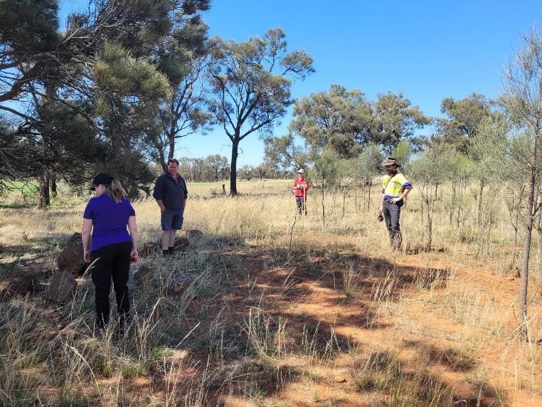
We gratefully acknowledge the 3 farmers
that have kindly given us their time and
properties to test and improve these
methods.

Sharkey Farm Balliang East- mixed
broadacre cropping and livestock

Domaine Chandon, Coldstream- vineyard

Barragunda Farm, Cape Schanck- livestock
and market garden
Accounting for Nature Assessment Confidence Methods
Level 1 – for entry into environmental markets
Level 2 – supports your public sustainability credentials
Level 3 - understanding environmental change over time

Methods approved in Victoria to date:
https://www.accountingfornature.org/methods
Level 3 Native vegetation method

“Level 3 Method is intended to provide a tool for farmers and other land managers to
measure the condition and track the change in the condition of native vegetation (including
restoration/rehabilitation) over time.”

Accounting for Nature Native Vegetation Method v 1.4 (Feb 2021), in partnership with
Landcare Australia.

Trialled on 3 farms by PPWCMA
Reference benchmarking-
      In order to compare present state with pre-cleared ecological condition.

Essentially this is Bioregion, Ecological Vegetation Classes (EVC) and land use for the
                           accounting area, produced as maps

                  In Victoria, these sites contain this information:
                                      NatureKit:
            https://www.environment.vic.gov.au/biodiversity/naturekit

                          Visualising Victoria’s Biodiversity:

                       http://www.vvb.org.au/vvb_map.php

                              EVC Benchmarks:
https://www.environment.vic.gov.au/biodiversity/bioregions-and-evc-benchmarks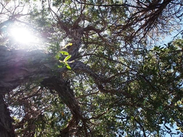
Stratify sub-assets into assessment units and identify sampling sites
                        *page 8 in the method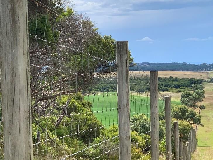
Understand indicators and determine reference benchmarks
                                 *page 9 in the method

Mapping
in Google
MyMaps

Field
measurements
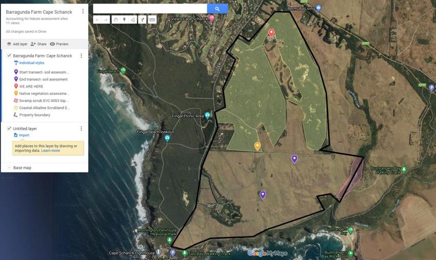
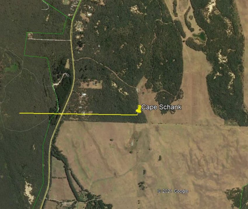
Worked example- Cape Schanck, using Google MyMaps

                                                               EVC 858 extent =148ha
                                                               10 field assessments are required

EVC 053 extent = 7.63ha. 2 field
assessments are required.

                             Configuration as a % 1km radius
                             from assessment site
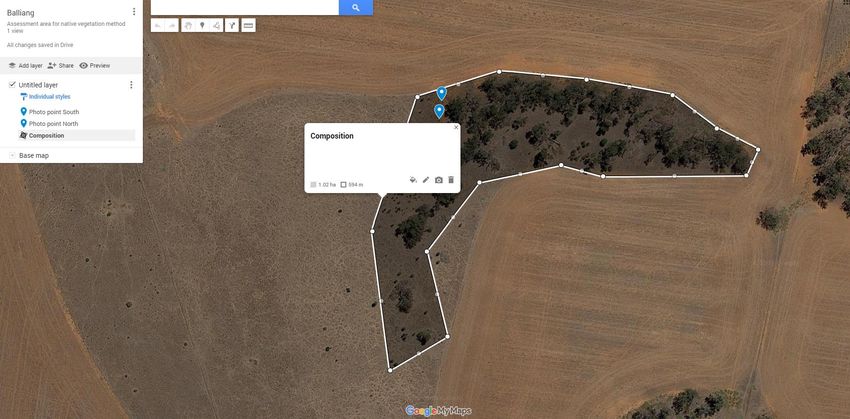
Worked example- Balliang East, using Google MyMaps
EVC 55-62
Extent = 1.02ha
1 field assessment required
Getting started

1. Select assessment area on your farm ( shelterbelt, remnant, re-vegetation etc)

2. Collect reference benchmarking data

3. Use an easy online mapping program such as Google MyMaps to generate polygons
around the assessment area/s
Set up field monitoring photo points
*page 11-14 in the method
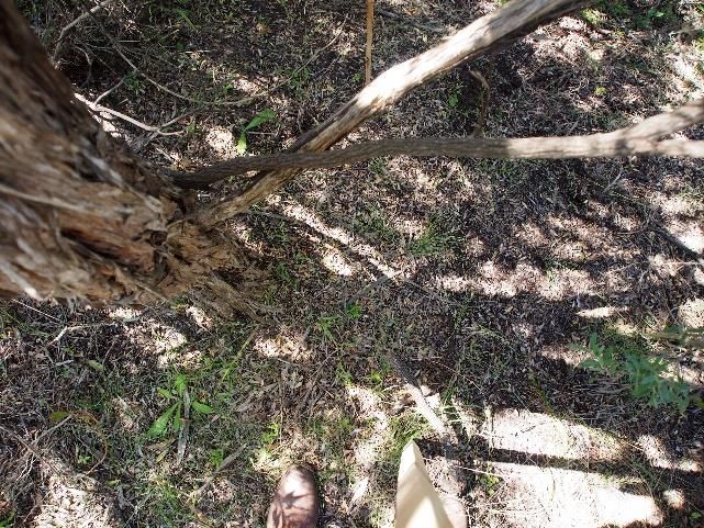
Collect data in the field using a combination of photos and field measurements
Establish a permanent monitoring siteField measurements: • Follow Appendix D and complete the recording sheets • Download apps such as Seek iNaturalist • Have on hand your local field guide books • Take photos to assist with plant ID- particularly weeds and perennial native grasses We will have regionally specific field collecting data sheets and a manual available to support farmers in Port Phillip and Western Port Region to complete their own field measurements. Plus those who are super keen, we’ll run some workshops.
Calculate Indicator Condition Scores (ICS)
                                *page 15-18 in the method

Scoring:
A qualified or expert person in local flora and ecology should complete this section. This can
be a Landcare project officer, ecologist or experienced landholder.
Step 7: Calculate Econd
*page 19-21 in the method
“The Econd TM is an index between 0 and 100, where 100 describes the ‘ideal’ or
‘undisturbed’ reference condition of an environmental asset, and 0 indicates the asset is
completely degraded”.
Accounting for Nature Native Vegetation Method v1.4 (Feb 2021)Econd result for Barragunda Farm- as we only tested the method with a single
assessment, the true Econd would average out the scores across the 10 assessments
One site assessment had an Econd = 45.1/100
To achieve an accurate Econd for theEcond result for Balliang East Assessment site = 44.8/100
So what?
• The Econd reflects present condition from pre-settlement condition

• We aren’t always trying to restore land to a pre-settlement condition

• But; landholders can use the score to consider management options to improve the
  condition of the assessment area and demonstrate trends in improvement over time

• This is where opportunities exist for evidence based eco-credentials and incentive
  markets
Our observations on the method

• Once you have followed the instructions once to set up the photo points and gather
  your benchmarking data, this becomes clearer and easier to follow
• Leave your photo point stakes in position for assessments in following years to track
  long term trends
• Read the photo point instructions in full before you begin ☺
• Have someone with you that can identify weeds and perennial native grasses, or a field
  book or app
• Don’t stress about the scoring, I muddled through it so plenty of landholders would be
  able to become local experts with some practice too
• Accounting for Nature are updating the method with some of our suggestions after we
  ground-truthed the method for them with these 3 trial sites.
What might be in this for me?

• Track the trends for soils and biodiversity

• Adjust or maintain management practices according to
  trends

• Participate in future incentive schemes (Local
  government, NFF Australian Agriculture Sustainability
  Framework, Carbon farming markets, biodiversity
  payments, local government rate rebates etc)

• We will be part of the broader Landcare Farming
  benchmarking project

• Region specific handbook developed on the methods

• Case studies from the 3 demonstration farms
Observer group- PPWCMA region

Any landholders that would like to have a go at using this method on their
property, please let me know, we will collate data for your property:
• Level 3 property mapping and reference benchmarks
• How to do the photos and field monitoring
• Scoring- for those who are keen to do this themselves
• Regional accredited experts with Accounting for Nature

Commitment:

• Attend a small group workshop to develop your own baseline maps
  and reference benchmarking data, followed by a field assessment
  (2.5hrs)
• For those wanting to do their own Econd scoring, a follow up workshop
  (2hrs)
• Support from accredited experts to assist you apply the scoring and
  create Econds to submit to Accounting for Nature.
Relevant links

Accounting for Nature

Use Google MyMaps to develop your property maps and layers

Use Visualising Victoria's Biodiversity layers to determine your bioregion, relevant EVC’s
and land use

Use EVC benchmarks to determine benchmarking specifications

Accounting for Nature and Landcare Native Vegetation Method (Level 3)

Guide to indigenous plants and weeds of the Nepean Peninsula
Landholders in PPW region can contact

           Karen Thomas
    Regional Agriculture Facilitator
  karen.thomas@ppwcma.vic.gov.au
You can also read