Connecting the Skies Air-To-Ground connectivity - a breakthrough for professional UAV/AAVs - SkyFive
←
→
Page content transcription
If your browser does not render page correctly, please read the page content below
Connecting the Skies

Air-To-Ground connectivity –
a breakthrough for professional
UAV/AAVs

SkyFive GmbH
Im Birkenwald 25
D-70435 Stuttgart
info@skyfive.world

1 | UAV connectivity Ed.1-0 | © 2020 s k y f i v e . w o r l d
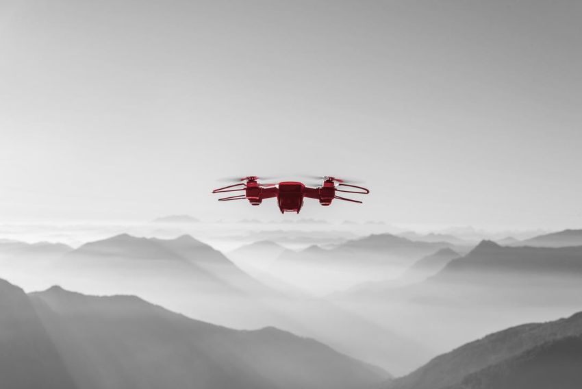
Connectivity for unmanned and autonomous aerial vehicles
Unmanned Aerial Vehicles (UAV), often called “drones”, Remotely Piloted Aircraft (RPA), and
Autonomous Aerial vehicles (AAV) rely on wireless connectivity for control and payload data. A great
prospect is anticipated for Urban Air Mobility (UAM), with thousands of passenger drones already in the
next few years, adding new demands on safety critical communications.

The requirements vary drastically between different types of UAV, RPA, and AAV:

 •    Safety critical, safety critical with restrictions, non-safety critical
 •    Line-of sight operation (LOS), non-line of sight operation (NLOS, also referred to as beyond
      visual line-of-sight, BVLOS)
 •    Subject to traffic control (due to flight height) versus not subject to traffic control
 •    Low speed (< 100 km/h), medium speed (100 … 300 km/h), high speed (>300 km/h)
 •    Short distance (in sight), medium distance (few kilometers ... within one country), long distance
      (across continents)

UAV, RPA, and AAV connectivity is mostly realized

 •    using license exempt bands (for example, Wi-Fi)
 •    connecting to existing mobile networks (mainly 4G LTE-A and 5G)
 •    linking via satellite
 •    relying on Air-to-Ground (A2G)

In this paper we investigate the different possibilities to provide connectivity, the pros and cons for each
of the possibilities, and map out a matrix to help selecting the most appropriate technology for each of
the scenarios above.

Please also refer to the corresponding SkyFive article in the news magazine “Air Traffic Management”,
issue 2/2020 (can be found here: https://airtrafficmanagement.keypublishing.com/).

2 | UAV connectivity Ed.1-0 | © 2020 s k y f i v e . w o r l d
License-exempt bands
Some parts of the Radio Frequency (RF) spectrum are not regulated and open for everyone without the
need to obtain a license. These bands are called license-exempt bands. Anyone can use these bands
subject to stringent requirements, for example, on maximum RF power and spurious emissions.
The requirements deviate from country to country. Mainly the 2.4 GHz band is used, as it is available
worldwide and most requirements are standardized by international bodies. This band is used by all Wi-
Fi devices, Bluetooth, NFC, and ZigBee, to name just a few of the applications.
As no one controls this band, the devices must be able to look for spectrum resources in a collaborative
way and sustain in-band interference. To allow as many devices as possible to use the band, the allowed
RF power is low, therefore the possible range is low as well. There is no guarantee of coverage, spectrum
availability, and performance.
The pros: The cons:
• No spectrum license required, no spectrum • Limited range due to low RF power, mainly
fees, therefore fast to deploy Line-of-Sight and Near-Line-of-Sight
• Low latency • Many use cases sharing the same spectrum
• Many products available (Wi-Fi, Bluetooth, …), therefore no
guaranteed service and availability
• Potentially high capacity
• Low cost
• Low power consumption
Target market:
• Non-safety critical use for amateurs and semi-professionals for short distance between control
station and UAV, low UAV altitude and low UAV speed.
Typical applications:
• Private usage for hobby activities, for example, photographer using a camera drone to take
wedding pictures from an unusual angle
3 | UAV connectivity Ed.1-0 | © 2020 s k y f i v e . w o r l dExisting cellular networks
Terrestrial cellular networks are designed to cover mobile subscribers on the ground and in buildings.
Their main antenna lobe is tilted downwards to minimize interference between neighbouring base
stations. Still, a certain amount of RF energy is transmitted towards/received from above. The reason
are imperfections of the antennas (unwanted side lobes) as shown below:
Additionally, RF energy is reflected from obstacles on the ground, partially towards the sky. Results from
different trials suggest a good mobile network coverage at heights of up to 600 m (2000 ft) above
ground.
This makes mobile cellular networks a good candidate for UAV, RPA and AAV support at lower heights
and beyond line of sight conditions. This is especially true for LTE and 5G. For GPRS/EDGE (2G) and UMTS
(3G), the delay of control messages is much higher due to the frame structure used; these standards
are therefore less favoured for UAV/AAV support.
The pros: The cons:
• No own infrastructure, no own spectrum • Subscription to mobile network operator
required required, fees
• Wide area coverage, Non-Line-of-Sight • No control over the radio network planning,
operation possible not possible to rely on coverage at different
• Low latency for 4G and 5G altitudes
• Broadband and high capacity • As mobile networks permanently evolve and
are being optimized for terrestrial coverage
• Depending on network and condition,
(remote tilting of antennas, …) and are re-
altitudes up to 600 m feasible
planned for extensions, even trial results
• LTE and 5G modems for UAVs are low cost from one day can’t be replicated another
• Low power consumption. time
• Capacity and performance depend on
network load (busy hour versus low traffic
time).
4 | UAV connectivity Ed.1-0 | © 2020 s k y f i v e . w o r l dTarget market:
• Non-safety critical professional use under Non-Line-of-Sight conditions, potentially for long
distance operation. Limited to low and medium UAV speed.
Typical applications:
• Delivery drone for pizza-service, traffic supervision via camera drone by police, agriculture use
cases for large and dispersed farms
5 | UAV connectivity Ed.1-0 | © 2020 s k y f i v e . w o r l dUse of satellite transmission
Satellites provide wide area coverage; some
operators provide even worldwide services. Modern
high-throughput satellites (HTS) multiply their
capacity by using comparatively narrow spot beams.
Satellites have been used for many years to provide
data services to commercial and military aircraft.
Today, communication satellites use a geostationary
orbit (referred to as GEO satellites) roughly 36,000
km above ground. The large distance and the need
of the radio waves to travel first form a ground
station to the satellite and then back to the receiver
leads to a very long latency.
This will improve with low-earth orbit (LEO) satellites that are presently being launched. Such satellites
are much nearer to the ground leading to much shorter delays. Such satellites are not stationary
anymore, instead a large network of many (hundreds to thousands) satellites is required. The high
number of satellites lead to a higher performance for the users.
Satellites, whether GEO or LEO, are not dedicated to aviation but also provide services to terrestrial and
maritime users.
The pros: The cons:
• Very wide area coverage (some satellite • Expensive, big and heavy equipment at the
operators offer worldwide service) UAV/RPA/AAV, high power consumption
• Can be operated in regions without ground • Long latency for existing GEO satellites, no
infrastructure real-time data exchange
• Non-Line-of-Sight operation possible • No coverage underneath bridges, in hangars
• Can be used from ground to very high etc.
altitudes • Even narrow spot beams of GEO satellites
• Suitable for high-speed UAVs and spots of LEO satellites are comparatively
large, so the capacity is shared between
many users
• Capacity is shared between use cases
(terrestrial, maritime, aviation)
Target market:
• Large UAVs, often for military use, where coverage from ground is not feasible. Safety critical
with restrictions (latency, requires a minimum of autonomy of UAVs).
6 | UAV connectivity Ed.1-0 | © 2020 s k y f i v e . w o r l dTypical applications:
• Military drones for observations deep inside enemy areas.
7 | UAV connectivity Ed.1-0 | © 2020 s k y f i v e . w o r l dUse of Air-to-Ground (example EAN)
Air-to-Ground (also referred to as Direct Air-to-Ground, DA2G) is a rather new development. The first
Air-to-Ground network was a 3G-based low bandwidth - low performance system in the United States.
The modern variant is based on 4G technology and provides a high-performance solution up to 100
Mbps with very low latency. It is deployed today across 41
countries in Europe.
The network in Europe is called “European Aviation
Network” (EAN) and a hybrid satellite - Air-to-Ground
solution. The major capacity is provided by the Air-to-
Ground segment over land and up to 150 km out to the
sea, while the satellite segment closes the holes farther
out to the sea (the Bay of Biscay, or the North Sea between
the UK and Norway, for example).
Regarding UAV/AAV, there are two major differences between a dedicated Air-to-Ground network and
a standard terrestrial mobile network:
• Air-to-Ground uses a spectrum dedicated for aviation purposes. It is the only solution not
shared with other users (neither terrestrial nor maritime users). This allows a higher availability
and quality of service.
• Air-to-Ground uses antennas specifically made for this purpose. These antennas provide
coverage towards the horizon up to directly above the base station and therefore a controlled
and reliable connection independent from network configuration for terrestrial coverage:
Other countries and regions have shown a strong interest in this technology. There are talks to extend
the EAN network to neighbouring geographies. Spectrum assignment application are running in the
Middle East. Active interest comes from, for example, Australia, New Zealand, Indonesia, Vietnam and
India. In China, activities for a 5G-based Air-to-Ground solution in the 4.9 GHz band were started early
in 2019, and the first rollout is envisaged for 2021.
The Air-to-Ground technology is highly reliable and secure, following the same design rules as for public
safety networks used in volumes already all around the world. Both together (low latency and high
availability) are crucial when considering use cases for unmanned aircraft system traffic management
(UTM).
8 | UAV connectivity Ed.1-0 | © 2020 s k y f i v e . w o r l dThe pros: The cons:
• Dedicated network exclusive for aviation • New technology, new eco-system
• Quality of Service (QoS) control
• Low latency
• Low power consumption
• Good even for high-speed UAVs and
altitudes of more than 50.000 ft / 16,000 m
• Can be complemented by standard
commercial Ground networks.
Target market:
• Air-to-Ground covers most market requirements: From mass market up to safety critical and
professional use cases under Non-Line of-Sight conditions, potentially long range, and high UAV
speed.
Typical applications:
• Remote control and supervision of passenger drones, high altitude drones for wide area
monitoring like pollution control, camera and surveillance drones for public safety. Overcoming
most shortfalls of other technologies, the possible applications are virtually unlimited.
9 | UAV connectivity Ed.1-0 | © 2020 s k y f i v e . w o r l dConclusion
A variety of connectivity requirements for different UAV, RPA and AAV classes exist, for which different
technologies are available. The table below provides a typical mapping:
Application class license-exempt Mobile networks Satellite Air-to-Ground
bands (Wi-Fi, …) (LTE, 5G)
Non-safety critical,
amateur and semi-
professional use, + O - o
very low cost, line-
of-sight
Non-safety critical,
(semi-)professional
use, low cost, Non-
- + - +
Line-of-Sight
Safety critical, + (but requires
professional use, not + (where
some autonomy
cost sensitive, wide - - coverage is
due to long
area provided)
latency)
Extremely safety
critical (manned
UAV), professional
use, not cost
- - o +
sensitive, known
flight areas
+ appropriate
o possible
- not suitable
None of the means to connect UAV/RPA/AAVs is universal. Some use cases can be covered by ubiquitous
and shared technology like Wi-Fi, but safety-critical connectivity as required for example for passenger
drones requires professional and dedicated solutions.
With Air-to-Ground deployments going on around the world, a technology disruption is ongoing, in
which enables the smooth integration of traditional and new aerial vehicles on a single, highly reliable
broadband network. Commercial Air-to-Ground networks are being increasingly considered for many of
the UAV, RAP and AAV use cases, with first trials starting in 2020.
10 | UAV connectivity Ed.1-0 | © 2020 s k y f i v e . w o r l dAcronyms Definition 4G 4th Generation 3GPP network, also referred to EUTRAN for RAN or LTE A2G Air-to-ground AAV Autonomous Aerial Vehicles BVLOS Beyond Visual Line Of Sight DA2G Direct Air-to-Ground EAN European Aviation Network GEO Geostationary Orbit HTS High-Throughput Satellites IFC In-Flight Connectivity LEO Low-Earth Orbit LOS Line Of Sight LTE Long-Term Evolution Mbps Mega Bits Per Second NFC Near-Field Communication NLOS Non Line Of Sight OBE On-Board terminal Equipment QoS Quality of Service RAN Radio Access Network RF Radio Frequency RPA Remotely Piloted Aircraft SLA Service Level Agreement UAM Urban Air Mobility UAS Unmanned Aircraft System (UAV plus control station) UAV Unmanned Aerial Vehicles UTM Unmanned Aircraft System Traffic Management 11 | UAV connectivity Ed.1-0 | © 2020 s k y f i v e . w o r l d
You can also read