Dartford Local Plan Development Policies Document: Publication Version - Habitat Regulations Assessment Dartford Borough Council
←
→
Page content transcription
If your browser does not render page correctly, please read the page content below

Dartford Local Plan
Development Policies
Document: Publication
Version
Habitat Regulations Assessment

Dartford Borough Council

January 2021
Dartford Borough Council

Quality information
Prepared by                        Checked by                 Verified by                        Approved by

Isla Hoffman Heap                  James Riley                Max Wade                           James Riley
Senior Ecologist                   Technical Director         Technical Director                 Technical Director

Georgia Stephens
Graduate Ecologist

Revision History
Revision              Revision date         Details          Authorized            Name                 Position

01                    16/12/2020            2020 Update      JR                    James Riley          Technical Director

02                    12/01/2021            Final            JR                    James Riley          Technical Director

Distribution List
# Hard Copies         PDF Required          Association / Company Name

Prepared for: Dartford Borough Council                                                                                 AECOM
Dartford Borough Council

Prepared for:
Dartford Borough Council

Prepared by:
Georgia Stephens

AECOM Infrastructure & Environment UK Limited
Midpoint, Alencon Link
Basingstoke
Hampshire RG21 7PP
United Kingdom

T: +44(0)1256 310200
aecom.com

© 2021 AECOM Infrastructure & Environment UK Limited. All Rights Reserved.

This document has been prepared by AECOM Infrastructure & Environment UK Limited (“AECOM”) for sole use
of our client (the “Client”) in accordance with generally accepted consultancy principles, the budget for fees and
the terms of reference agreed between AECOM and the Client. Any information provided by third parties and
referred to herein has not been checked or verified by AECOM, unless otherwise expressly stated in the
document. No third party may rely upon this document without the prior and express written agreement of
AECOM.

Prepared for: Dartford Borough Council                                                                        AECOM
Dartford Borough Council

Table of Contents
1.           Introduction...................................................................................................... 6
Background to the Project....................................................................................................................................... 6
2.           Methodology .................................................................................................... 8
3.           Pathways of impact ........................................................................................11
Introduction ........................................................................................................................................................... 11
Recreational pressure ........................................................................................................................................... 11
Atmospheric pollution............................................................................................................................................ 11
Water resources .................................................................................................................................................... 13
Water quality ......................................................................................................................................................... 14
4.           Test of Likely Significant Effects .................................................................... 16
Background to Dartford Borough........................................................................................................................... 16
Physical Scope of the HRA ................................................................................................................................... 16
Recreational Pressure........................................................................................................................................... 20
Water quality ......................................................................................................................................................... 20
Air quality .............................................................................................................................................................. 20
5.           The ‘in combination’ scope ............................................................................ 22
6.           Appropriate Assessment................................................................................ 23
Introduction ........................................................................................................................................................... 23
Recreational Pressure........................................................................................................................................... 23
Bird Disturbance Study and North Kent Visitor Survey ......................................................................................... 24
7.   Conclusions................................................................................................... 27
Appendix A European Designated Sites within 20km of Dartford Borough............... 28
The Thames Estuary and Marshes SPA/Ramsar Site........................................................................................... 29
Introduction ........................................................................................................................................................... 29
Thames Estuary & Marshes Ramsar site.............................................................................................................. 29
Thames Estuary & Marshes SPA .......................................................................................................................... 29
The Medway Estuary and Marshes SPA/Ramsar site........................................................................................... 30
Medway Estuary & Marshes SPA.......................................................................................................................... 30
North Down Woodlands SAC ................................................................................................................................ 32
Peters Pit SAC ...................................................................................................................................................... 32
Appendix B Policy Specific Impacts for European Sites........................................... 34
Policy .................................................................................................................................................................... 35
S1 - Borough Spatial Strategy............................................................................................................................... 36
S2: Infrastructure Planning Strategy ..................................................................................................................... 38
S3: Climate Change Strategy................................................................................................................................ 39
S4: Borough Development Levels......................................................................................................................... 40
D1: Central Dartford Strategy................................................................................................................................ 41
D2: Central Dartford Development Principles ....................................................................................................... 42
D3: The mix of uses in Dartford Town centre........................................................................................................ 43
D4: Westgate Allocation........................................................................................................................................ 43
D5: East of Lowfield Street Allocation ................................................................................................................... 44
D6: Priory Centre Allocation.................................................................................................................................. 45
D7: Station Surrounds/ River Darent Area ............................................................................................................ 46
E1: Ebbsfleet Garden City Strategy ...................................................................................................................... 47
E2: Ebbsfleet Garden City Development Principles .............................................................................................. 48
E3: Swanscombe .................................................................................................................................................. 48
E4: Ebbsfleet Central Allocation............................................................................................................................ 49
E5: Ebbsfleet South and West Area...................................................................................................................... 50

Prepared for: Dartford Borough Council                                                                                                                           AECOM
Dartford Borough Council

E6: Land North of Swanscombe Area ................................................................................................................... 51
M1: Good Design for Dartford ............................................................................................................................... 52
M2: Environmental and Amenity Protection .......................................................................................................... 54
M3: Sustainable Technology, Construction and Performance .............................................................................. 55
M4: Flood Risk and Riverside Design ................................................................................................................... 56
M5: Designated Heritage Assets........................................................................................................................... 57
M6: Historic Environment Strategy........................................................................................................................ 58
M7: Affordable Housing......................................................................................................................................... 59
M8: Housing Mix ................................................................................................................................................... 59
M9: Sustainable Housing Locations ...................................................................................................................... 60
M10: Residential Amenity Space .......................................................................................................................... 60
M11: Extensions, New Dwellings and Garden Land ............................................................................................. 61
M12: Gypsy, Traveller and Travelling Showpeople Accommodation .................................................................... 62
M13: Green belt .................................................................................................................................................... 63
M14: Green and Blue Infrastructure and Open Space Provision........................................................................... 65
M15: Biodiversity and Landscape ......................................................................................................................... 66
M16: Travel Management ..................................................................................................................................... 67
M17: Active Travel Access and Parking................................................................................................................ 68
M18: Community Uses.......................................................................................................................................... 69
M19: Sustainable Economic Locations ................................................................................................................. 70
M20:Provision for Local Business and Skills......................................................................................................... 70
M21: Identified Employment Areas ....................................................................................................................... 71
M22: Bluewater ..................................................................................................................................................... 72
M23: District and Local Centres ............................................................................................................................ 73
M24: Food and Drink Establishments ................................................................................................................... 73

Tables
Table 1. Main sources and effects of air pollutants on habitats and species ......................................................... 11
Table 2. Screening of Impact Pathways from development in Dartford Borough to European Designated Sites
(impacts highlighted in green are screened in for appropriate assessment, impacts highlighted in orange are
screened out of further assessment)..................................................................................................................... 17

Prepared for: Dartford Borough Council                                                                                                                     AECOM
Dartford Local Plan Development Policies
Document: Publication Version

1. Introduction
Background to the Project
1.1       AECOM was appointed by Dartford Borough Council to assist in undertaking a Habitats Regulations
          Assessment (HRA) for the Dartford Local Plan. This is to inform Dartford Borough Council of the potential
          effects of development within the borough on internationally designated wildlife sites and how they are being
          addressed in the Local Plan.

1.2       The objectives of the assessment are to:

      •      Identify any aspects of the Local Plan that would cause an adverse effect on the integrity of international
             sites (Special Areas of Conservation (SACs), Special Protection Areas (SPAs)) including, as a matter of
             Government policy, Ramsar sites, either in isolation or in combination with other plans and projects, and

      •      To advise on appropriate policy mechanisms for delivering mitigation where such effects were identified.

1.3       The HRA of the Dartford Local Plan is required to determine if there are any realistic linking pathways
          present between an international site and the Local Plan and where Likely Significant Effects cannot be
          screened out, an analysis to inform Appropriate Assessment to be undertaken to determine if adverse effects
          on the integrity of the international sites will occur as a result of the Local Plan alone or in combination.

1.4       AECOM produced the HRA of previous Local Plans for Dartford. The following European sites were
          considered in the HRA that AECOM produced for the Dartford Local Plan Development Policies Document
          in 2015/2016:

      •      Thames Estuary and Marshes Ramsar/SPA

      •      Medway Estuary and Marshes Ramsar/SPA

      •      North Downs Woodlands SAC

      •      Peter’s Pit SAC

Legislation
1.5       The UK left the EU on 31 January 2020 under the terms set out in the European Union (Withdrawal
          Agreement) Act 2020 (“the Withdrawal Act”). This established a transition period, which ended on 31
          December 2020. The Withdrawal Act retains the body of existing EU-derived law within our domestic law.
          The most recent amendments to the Habitats Regulations – the Conservation of Habitats and Species
          (Amendment) (EU Exit) Regulations 2019 – make it clear that the need for HRA continues after the
          Transition Period ended.

1.6       Under the Regulations, an appropriate assessment is required, where a plan or project is likely to have a
          significant effect upon an international site, either individually or in combination with other projects. The
          Directive is implemented in the UK by the Conservation of Habitats and Species Regulations 2017 (as
          amended) (the “Habitats Regulations”).

                Conservation of Habitats and Species Regulations 2017 (as amended)
                The Regulations state that:
                “A competent authority, before deciding to … give any consent for a plan or project which
                is likely to have a significant effect on a European site … must make an appropriate
                assessment of the implications for the plan or project in view of that site’s conservation
                objectives… The competent authority may agree to the plan or project only after having
                ascertained that it will not adversely affect the integrity of the European site.”

Prepared for: Dartford Borough Council                                                                         AECOM
                                                                                                                   6
Dartford Local Plan Development Policies
Document: Publication Version
1.7 As ‘competent authority’, the legal responsibility for ensuring that a decision of ‘likely significant effects’ is
made, for ensuring an ‘appropriate assessment’ (where required) is undertaken, and for ensuring Natural
England are consulted, falls on the local planning authority.
1.8 The Habitats Regulations applies the precautionary principle 1 to international sites SAC, SPA, and Ramsar.
For the purposes of this assessment candidate SACs (cSACs), proposed SPAs (pSPAs) and proposed
Ramsar (pRamsar) sites are all treated as fully designated sites.
1.9 Plans and projects can only be permitted having ascertained that there will be no adverse effect on the
integrity of the site(s) in question. This contrasts with the SEA Directive which does not prescribe how plan
or programme proponents should respond to the findings of an environmental assessment; merely that the
assessment findings (as documented in the ‘environmental report’) should be ‘taken into account’ during
preparation of the plan or programme. In the case of the Habitats Directive, plans and projects may still be
permitted if there are no alternatives to them and there are Imperative Reasons of Overriding Public Interest
(IROPI) as to why they should go ahead. In such cases, compensation would be necessary to ensure the
overall integrity of the site network.
1.10 In 2018, the ‘People Over Wind’ European Court of Justice (ECJ) ruling 2 determined that ‘mitigation’ (i.e.
measures that are specifically introduced to avoid or reduce the harmful effects of a plan or project on
international sites) should not be taken into account when forming a view on likely significant effects.
Mitigation should instead only be considered at the appropriate assessment stage. Appropriate assessment
is not a technical term: it simply means ‘an assessment that is appropriate’ for the plan or project in question.
As such, the law purposely does not prescribe what it should consist of or how it should be presented; these
are decisions to be made on a case by case basis by the competent authority.
1.11 Over the years the phrase ‘Habitats Regulations Assessment’ has come into wide currency to describe the
overall process set out in the Conservation of Habitats and Species Regulations from screening through to
Imperative Reasons of Overriding Public Interest (IROPI). This has arisen in order to distinguish the process
from the individual stage described in the law as an ‘Appropriate Assessment’. Throughout this report we
use the term Habitats Regulations Assessment for the overall process.
Report Layout
1.12 Chapter 2 of this report explains the process by which the HRA has been carried out. Chapter 3 explores
the relevant pathways of impact. Chapter 4 summarises the Test of Likely Significant Effects of the policies
and site allocations of the Plan considered ‘alone’ and ‘in-combination. (The Test of Likely Significant Effects
itself is undertaken in Appendix B). Chapter 5 contains the Appropriate Assessment for any linking impact
pathways that could not be screened out from potentially resulting in a Likely Significant Effect. Chapter 6
contains the conclusion and a summary of recommendations.
1
The Precautionary Principle, which is referenced in Article 191 of the Treaty on the Functioning of the European Union, has been defined by the
United Nations Educational, Scientific and Cultural Organisation (UNESCO, 2005) as: “When human activities may lead to morally unacceptable
harm [to the environment] that is scientifically plausible but uncertain, actions shall be taken to avoid or diminish that harm. The judgement of
plausibility should be grounded in scientific analysis”.
People Over Wind and Sweetman v Coillte Teoranta (C-323/17)
2
Case C-323/17
Prepared for: Dartford Borough Council AECOM
7Dartford Local Plan Development Policies
Document: Publication Version
2. Methodology
Introduction
2.1 Figure 1 below outlines the stages of HRA according to current Ministry of Housing, Communities and Local
Government guidance. The stages are essentially iterative, being revisited as necessary in response to
more detailed information, recommendations and any relevant changes to the Plan until no significant
adverse effects remain.
Evidence Gathering – collecting information on relevant European
sites, their conservation objectives and characteristics and other
plans or projects.
HRA Task 1: Screening for Likely Significant Effects
Identifying whether a plan is ‘likely to have a significant effect’ on a
European site.
HRA Task 2: Appropriate Assessment
Ascertaining the effect on site integrity – assessing the effects of the
plan on the conservation objectives of any European sites ‘screened
in’ during HRA Task 1.
HRA Task 3: Avoidance and Mitigation
Mitigation measures and alternative solutions – where adverse effects
are identified at HRA Task 2, the plan should be altered until adverse
effects are cancelled out fully.
Figure 1 Four Stage Approach to Habitats Regulations Assessment (GOV.UK, 2019)
HRA Task 1: Test of Likely Significant Effects (LSE)
2.2 Following evidence gathering, the first stage of any HRA is a Likely Significant Effect (LSE) test; essentially
a risk assessment to decide whether the full subsequent stage known as Appropriate Assessment is
required. The essential question is:
2.3 ”Is the project, either alone or in combination with other relevant projects and plans, likely to result in a
significant effect upon European sites?”
2.4 The objective is to ‘screen out’ those plans and projects that can, without any detailed appraisal, be said to
be unlikely to result in significant adverse effects upon European sites, usually because there is no
mechanism for an adverse interaction with European sites. This stage is undertaken in Chapter Error!
Reference source not found. of this report.
HRA Task 2: Appropriate Assessment (AA)
2.5 Where it is determined that a conclusion of ‘no likely significant effect’ cannot be drawn, the analysis has
proceeded to the next stage of HRA known as Appropriate Assessment. Case law has clarified that
‘Appropriate Assessment’ is -not a technical term. In other words, there are no particular technical analyses,
or level of technical analysis, that are classified by law as belonging to Appropriate Assessment rather than
determination of likely significant effects.
Prepared for: Dartford Borough Council AECOM
8Dartford Local Plan Development Policies
Document: Publication Version
2.6 During July 2019 the Ministry of Housing, Communities and Local Government published guidance for
Appropriate Assessment 3. Paragraph: 001 Reference ID: 65-001-20190722 explains: ‘Where the potential
for likely significant effects cannot be excluded, a competent authority must make an appropriate
assessment of the implications of the plan or project for that site, in view of the site’s conservation objectives.
The competent authority may agree to the plan or project only after having ruled out adverse effects on the
integrity of the habitats site. Where an adverse effect on the site’s integrity cannot be ruled out, and where
there are no alternative solutions, the plan or project can only proceed if there are imperative reasons of
over-riding public interest and if the necessary compensatory measures can be secured’.
2.7 As this analysis follows on from the screening process, there is a clear implication that the analysis will be
more detailed than undertaken at the Screening stage and one of the key considerations during Appropriate
Assessment is whether there is available mitigation that would entirely address the potential effect. In
practice, the Appropriate Assessment takes any policies or allocations that could not be dismissed following
the high-level screening analysis and analyses the potential for an effect in more detail, with a view to
concluding whether there would be an adverse effect on integrity (in other words, disruption of the coherent
structure and function of the European site(s)).
2.8 A decision by the European Court of Justice 4 concluded that measures intended to avoid or reduce the
harmful effects of a proposed project on a European site may no longer be taken into account by competent
authorities at the Likely Significant Effects or ‘screening’ stage of HRA. The UK is no longer part of the
European Union. However, as a precaution, it is assumed for the purposes of this HRA that EU case law
regarding Habitat Regulations Assessment will still be considered informative jurisprudence by the UK
courts. That ruling has therefore been considered in producing this HRA.
2.9 Also, in 2018 the Holohan ruling 5 was handed down by the European Court of Justice. Among other
provisions, paragraph 39 of the ruling states that ‘As regards other habitat types or species, which are
present on the site, but for which that site has not been listed, and with respect to habitat types and species
located outside that site, … typical habitats or species must be included in the appropriate assessment, if
they are necessary to the conservation of the habitat types and species listed for the protected area’
[emphasis added]. This has been taken into account in the HRA process, although no areas within the
borough have been identified as being necessary for any European sites to achieve their conservation
objectives.
HRA Task 3: Avoidance and Mitigation
2.10 Where necessary, measures are recommended for incorporation into the Plan in order to avoid or mitigate
adverse effects on European sites. There is considerable precedent concerning the level of detail that a
Local Plan document needs to contain regarding mitigation for recreational impacts on European sites. The
implication of this precedent is that it is not necessary for all measures that will be deployed to be fully
developed prior to adoption of the Plan, but the Plan must provide an adequate policy framework within
which these measures can be delivered.
Confirming Other Plans and Projects That May Act ‘In Combination’
2.11 It is a requirement of the Regulations that the impacts of any land use plan being assessed are not
considered in isolation but in combination with other plans and projects that may also be affecting the
European site(s) in question.
2.12 When undertaking this part of the assessment it is essential to bear in mind the principal intention behind
the legislation; i.e. to ensure that those projects or plans (which in themselves may have minor impacts) are
not simply dismissed on that basis but are evaluated for any cumulative contribution they may make to an
overall significant effect. In practice, in-combination assessment is therefore of greatest relevance when the
plan or policy would otherwise be screened out because its individual contribution is inconsequential.
3
https://www.gov.uk/guidance/appropriate-assessment#what-are-the-implications-of-the-people-over-wind-judgment-for-
habitats-regulations-assessments [Accessed: 07/01/2020].
4
People Over Wind and Sweetman v Coillte Teoranta (C-3.23/17).
5
Case C-461/17.
Prepared for: Dartford Borough Council AECOM
9Dartford Local Plan Development Policies
Document: Publication Version
The Scope
2.13 There is no guidance that dictates the physical scope of an HRA of a plan. Therefore, in considering the
physical scope of the assessment we were guided primarily by the identified impact pathways rather than
by arbitrary “zones”, i.e. a source-pathway-receptor approach. Current guidance suggests that the following
international sites be included in the scope of assessment:
• All sites within the Local Plan Area (the area covered by the Local Plan); and
• Other sites shown to be linked to development within the Local Plan Area through a known “pathway”
(discussed below).
2.14 Briefly defined, impact pathways are routes by which a change in activity within the plan area can lead to
an effect upon an international site. In terms of the second category of international site listed above,
MHCLG guidance states that the AA should be “proportionate to the geographical scope of the [plan policy]”
and that “an AA need not be done in any more detail, or using more resources, than is useful for its purpose”
(MHCLG, 2006, p.6).
2.15 Note that the inclusion of an international sites or pathway below does not indicate that an effect is expected
but rather that these are pathways that will be investigated.
Prepared for: Dartford Borough Council AECOM
10Dartford Local Plan Development Policies
Document: Publication Version
3. Pathways of impact
Introduction
3.1 In carrying out an HRA it is important to avoid confining oneself to effectively arbitrary boundaries (such as
Local Authority boundaries) but to use an understanding of the various ways in which Land Use Plans can
impact on European sites to follow the pathways along which development can be connected with European
sites, in some cases many kilometres distant. Briefly defined, pathways are routes by which a change in
activity associated with a development can lead to an effect upon a European site. It is also important to
bear in mind CLG guidance which states that the AA should be ‘proportionate to the geographical scope of
the [plan policy]’ and that ‘an AA need not be done in any more detail, or using more resources, than is
useful for its purpose’ (CLG, 2006, p.6 6).
3.2 The following pathways of impact were considered relevant to the HRA of the Dartford Local Plan. All
European sites discussed in this report are shown on Figure 2 in Appendix A.
Recreational pressure
3.3 A number of European designated sites within 20km of Dartford Borough boundary have environmental
sensitivities to disturbances as a result of recreational pressure. Consultation for the HRA of the (now
revoked) South East Plan revealed that potentially damaging levels of recreational pressure are already
faced by many European sites. Recreational use of a site has the potential to:
• Cause disturbance to sensitive species such as wintering wildfowl;
• Prevent appropriate management or exacerbate existing management difficulties;
• Cause damage through erosion, trampling and fragmentation; and
• Cause eutrophication as a result of dog fouling.
3.4 Different types of European sites (e.g. coastal, heathland, chalk grassland) are subject to different types of
recreational pressures and have different vulnerabilities. Studies across a range of species have shown
that the effects from recreation can be complex.
Atmospheric pollution
Current levels of understanding of air quality effects on semi-natural habitats are not adequate to allow a rigorous
assessment of the likelihood of significant effects on the integrity of key European sites.
Table 1. Main sources and effects of air pollutants on habitats and species
Pollutant Source Effects on habitats and species
Acid deposition SO2, NOx and ammonia all contribute to acid Can affect habitats and species through
deposition. Although future trends in S both wet (acid rain) and dry deposition.
emissions and subsequent deposition to Some sites will be more at risk than
terrestrial and aquatic ecosystems will others depending on soil type, bedrock
continue to decline, it is possible that geology, weathering rate and buffering
increased N emissions may cancel out any capacity.
gains produced by reduced S levels.
Ammonia (NH3) Ammonia is released following Adverse effects are as a result of
decomposition and volatilisation of animal nitrogen deposition leading to
wastes. It is also emitted from the exhausts eutrophication. As emissions mostly
of some vehicles. It is a naturally occurring occur at ground level in the rural
trace gas, but levels have increased environment and NH3 is rapidly
considerably with expansion in numbers of deposited, some of the most acute
agricultural livestock. Ammonia reacts with problems of NH3 deposition are for small
acid pollutants such as the products of SO2
and NOX emissions to produce fine
6Department for Communities and Local Government. 2006. Planning for the Protection of European Sites:
Appropriate Assessment. http://www.communities.gov.uk/index.asp?id=1502244
Prepared for: Dartford Borough Council AECOM
11Dartford Local Plan Development Policies
Document: Publication Version
ammonium (NH4+) - containing aerosol that relict nature reserves located in intensive
may be transferred much longer distances agricultural landscapes.
(can therefore be a significant trans-
boundary issue.)
Nitrogen oxides Nitrogen oxides are mostly produced in Deposition of nitrogen compounds
combustion processes. About one quarter of (nitrates (NO3), nitrogen dioxide (NO2)
NOx the UK’s emissions are from power stations, and nitric acid (HNO3)) can lead to both
one-half from motor vehicles, and the rest soil and freshwater acidification. In
from other industrial and domestic addition, NOx can cause eutrophication
combustion processes. NOx concentrations of soils and water. This alters the
have been falling for decades due to species composition of plant
improvements in abatement and vehicle communities and can eliminate sensitive
emissions technology and are expected to species.
continue to do so.
Nitrogen (N) The pollutants that contribute to nitrogen Species-rich plant communities with
deposition deposition derive mainly from NOX and NH3 relatively high proportions of slow-
emissions. These pollutants cause growing perennial species and
acidification (see also acid deposition) as bryophytes are most at risk from N
well as eutrophication. The Joint Nature eutrophication, due to its promotion of
Conservation Committee has recently competitive and invasive species which
published the results of the Nitrogen Futures can respond readily to elevated levels of
project 7. That project investigated whether a N. N deposition can also increase the
net improvement in nitrogen deposition risk of damage from abiotic factors, e.g.
(including expected development over the drought and frost.
same period) was expected to occur to 2030
at a national scale, under a range of
scenarios. The report predicted a fall in
nitrogen deposition by 2030 under every
modelled scenario.
Ozone (O3) A secondary pollutant generated by Concentrations of O3 above 40 ppb can
photochemical reactions from NOx and be toxic to humans and wildlife, and can
volatile organic compounds (VOCs). These affect buildings. Increased ozone
are mainly released by the combustion of concentrations may lead to a reduction
fossil fuels. The increase in combustion of in growth of agricultural crops,
fossil fuels in the UK has led to a large decreased forest production and altered
increase in background ozone concentration, species composition in semi-natural
leading to an increased number of days plant communities.
when levels across the region are above
40ppb. Reducing ozone pollution is believed
to require action at international level to
reduce levels of the precursors that form
ozone.
Sulphur Main sources of SO2 emissions are electricity Wet and dry deposition of SO2 acidifies
Dioxide generation, industry and domestic fuel soils and freshwater, and alters the
combustion. May also arise from shipping species composition of plant and
SO2 and increased atmospheric concentrations in associated animal communities. The
busy ports. Total SO2 emissions have significance of impacts depends on
decreased substantially in the UK since the levels of deposition and the buffering
1980s. capacity of soils.
3.5 The main pollutants of concern for European sites are oxides of nitrogen (NOx), ammonia (NH3) and sulphur
dioxide (SO2). NOx can have a directly toxic effect upon vegetation in very high concentrations or in the
presence of equivalent amounts of sulphur dioxide. In addition, greater NOx or ammonia concentrations
7 https://hub.jncc.gov.uk/assets/04f4896c-7391-47c3-ba02-8278925a99c5
Prepared for: Dartford Borough Council AECOM
12Dartford Local Plan Development Policies
Document: Publication Version
within the atmosphere will lead to greater rates of nitrogen deposition to soils. An increase in the deposition
of nitrogen from the atmosphere to soils is generally regarded to lead to an increase in soil fertility, which
can have a serious deleterious effect on the quality of semi-natural, nitrogen-limited terrestrial habitats.
3.6 Sulphur dioxide emissions are overwhelmingly influenced by the output of power stations and industrial
processes that require the combustion of coal and oil. Ammonia emissions are dominated by agriculture,
with some chemical processes and vehicle exhausts also making notable contributions at a local scale. As
such, material increases in SO2 will not be associated with Local Development Frameworks. NOx emissions,
however, are dominated by the output of vehicle exhausts (more than half of all emissions). Within a ‘typical’
housing development, by far the largest contribution to NOx (92%) will be made by the associated road
traffic. Other sources, although relevant, are of minor importance (8%) in comparison 8. Emissions of NOx
could therefore be reasonably expected to increase compared to a situation with no growth, as a result of
greater vehicle use as an indirect effect of the Local Plan although a net decrease over time compared to
2020 levels is still the most likely outcome.
3.7 According to the World Health Organisation, the critical NOx concentration (critical threshold) for the
protection of vegetation is 30 µgm-3; the threshold for sulphur dioxide is 20 µgm-3. In addition, ecological
studies have determined ‘critical loads’ 9 of atmospheric nitrogen deposition (that is, NOx combined with
ammonia NH3) for key habitats within European sites.
3.8 According to the Department of Transport’s Transport Analysis Guidance, “Beyond 200m, the contribution
of vehicle emissions from the roadside to local pollution levels is not significant” 10 (see Figure 3).
50 100 150, 200
Distam:e froo, road centre (m)
Figure 3: Traffic contribution to concentrations of pollutants at different distances from a road (Source:
DfT)
3.9 This is therefore the distance that has been used throughout this HRA in order to determine whether
European sites are likely to be significantly affected by development under the Dartford Local Plan.
Water resources
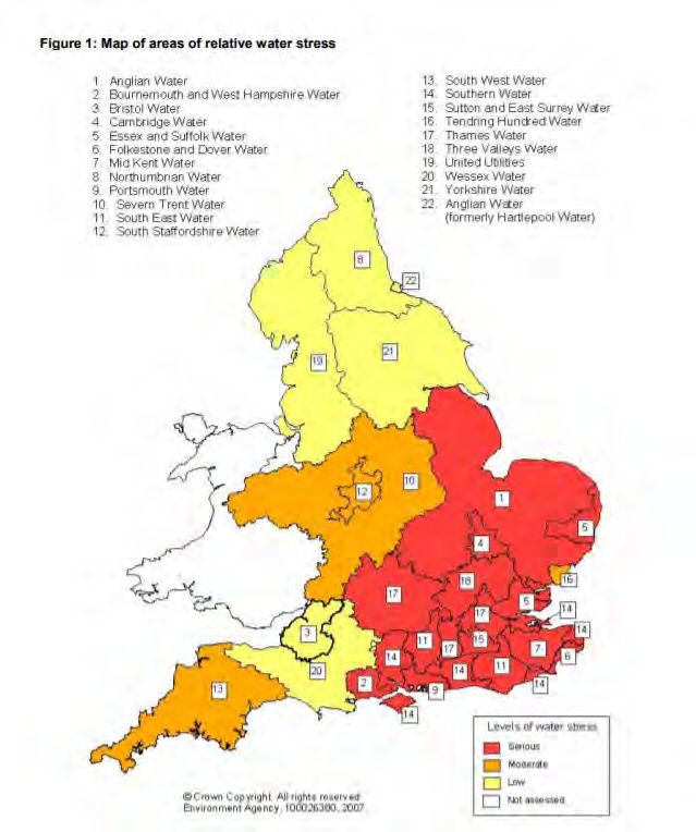
3.10 Dartford is generally an area of serious water stress (see Figure 4).
8 Proportions calculated based upon data presented in Dore CJ et al. 2005. UK Emissions of Air Pollutants 1970
– 2003. UK National Atmospheric Emissions Inventory. http://www.airquality.co.uk/archive/index.php
9 The critical load is the rate of deposition beyond which research indicates that adverse effects can reasonably
be expected to occur
10 www.webtag.org.uk/archive/feb04/pdf/feb04-333.pdf
Prepared for: Dartford Borough Council AECOM
13Dartford Local Plan Development Policies
Document: Publication Version
1: Map of areas of relative water stress
! Anglian Water 13 South West Wal..er
2 Boornemolfh and We& Hampshire Water 14 Southern Watar
3 E!nstol Water 15 9.Jtton and East Stirrey Wd..er
4 CamtrK:lge Weter 16 Tendnng HunO'ed WatBt
5 Essex aodSullolkWacer 17 Thames Water
5 Folkestone end Dover Water 18 1nree Vall8'(s wai:ef
7 Mid Kent Waler 19 l.X11tecf U1»11Ues
8 Nonhumbnan Wat8f 20 WesselC Weter
9 Portsmouth Wat&f 21 Yorkshire Water
10 S8vern Trent Waw '12 .AllghaoWaer
11 South Ea5t Water (formerly HaftlepoolWater)
12 South StaffOf'dshwe Waler
';
t
\
. . ..!Gut
• MOOINJI•
r:l ....
"4:1111••·
Figure 4: Areas of water stress within England
3.11 Development within Dartford Borough over the plan period will increase water demand. According to the
Environment Agency’s Darent and Cray Abstraction Licensing Strategy (January 2013) and Medway
Abstraction Licence Strategy (February 2013), the catchment is groundwater dominated.
3.12 The Water Companies relevant to Dartford are Thames Water and Southern Water. Both companies provide
wastewater treatment and supply water within Dartford Borough. Thames Water serves roughly the west of
the borough and Southern Water serves roughly the east of the borough.
Water quality
3.13 Increased amounts of housing or business development can lead to reduced water quality of rivers and
estuarine environments. Sewage and industrial effluent discharges can contribute to increased nutrients on
European sites leading to unfavourable conditions.
3.14 The quality of the water that feeds European sites is an important determinant of the nature of their habitats
and the species they support. Poor water quality can have a range of environmental impacts:
3.15 At high levels, toxic chemicals and metals can result in immediate death of aquatic life, and can have
detrimental effects even at lower levels, including increased vulnerability to disease and changes in wildlife
behaviour. Eutrophication, the enrichment of plant nutrients in water, increases plant growth and
consequently results in oxygen depletion. Algal blooms, which commonly result from eutrophication,
increase turbidity and decrease light penetration. The decomposition of organic wastes that often
accompanies eutrophication deoxygenates water further, augmenting the oxygen depleting effects of
eutrophication. In the marine environment, nitrogen is the limiting plant nutrient and so eutrophication is
associated with discharges containing available nitrogen.
3.16 Some pesticides, industrial chemicals, and components of sewage effluent are suspected to interfere with
the functioning of the endocrine system, possibly having negative effects on the reproduction and
development of aquatic life.
Prepared for: Dartford Borough Council AECOM
14Dartford Local Plan Development Policies
Document: Publication Version
3.17 For sewage treatment works close to capacity, further development may increase the risk of effluent escape
into aquatic environments. In many urban areas, sewage treatment and surface water drainage systems
are combined, and therefore a predicted increase in flood and storm events could increase pollution risk.
3.18 However, it is also important to note that the situation is not always simple. While nutrient enrichment does
cause considerable problems on the south coast (particularly in the Solent) due to the abundance of
smothering macroalgae that is produced, it is not necessarily a problem in other areas where the
macroalgae are broken up by tidal wave action and where colder and more turbid water limit the build-up in
the first place. Nonetheless, at this screening stage water quality impacts are considered to be an issue that
requires investigation.
Prepared for: Dartford Borough Council AECOM
15Dartford Local Plan Development Policies
Document: Publication Version
4. Test of Likely Significant Effects
Background to Dartford Borough
4.1 The Local Plan describes the context of Dartford Borough as follows: “Dartford Borough covers an area of
7,600 hectares, the smallest, but most densely populated, Borough in Kent. Situated within the Thames
Estuary, Dartford stands at the pivotal point between Greater London and Kent. Dartford has major national
and international connections via the strategic road network, including the M25; Dartford crossing and the
A2; and rail services, including from Ebbsfleet International Station (a 17 minute journey time to London St
Pancras International).
4.2 Dartford Borough has two distinct areas. North of the A2 is a largely built-up area, containing 70% of the
population, which stretches from Dartford town in the east (adjoining Bexley London Borough) through to
the growing communities at Ebbsfleet (adjoining Gravesham Borough). To the south lies an area of open
countryside with 12 villages and a number of small hamlets.”
Physical Scope of the HRA
4.3 Further details regarding the interest features and vulnerabilities of the European site included within the
scope of the HRA are given in Figure 2 and in Appendix A. All baseline data relating to the European site
presented is taken from the Natural England Conservation Objectives and Site Improvement Plans for all
European sites, identifying the key threats and pressures for those sites; unless otherwise stated.
4.4 For the Screening assessment (Table 2) green shading in the final two columns indicates that no impact
pathway exists between the European site and any likely significant adverse effects due to the absence of
any mechanism for this. Orange shading indicates that a pathway of impact exists and further discussion is
therefore required. The main issues for investigation identified are recreational pressure, air quality and
water quality.
Prepared for: Dartford Borough Council AECOM
16Dartford Local Plan Development Policies
Document: Publication Version
Table 2. Screening of Impact Pathways from development in Dartford Borough to European Designated Sites (impacts highlighted in green are screened in for appropriate
assessment, impacts highlighted in orange are screened out of further assessment)
International Location Current and possible Discussion
Designated Site pressures/threats that
could result from
development in Dartford
Borough
Thames Estuary and Within 6.3km of Dartford Recreational Pressure Increased development within Dartford Borough could lead to higher numbers of visitors to coastal
Marshes SPA/ Ramsar Borough boundary European Sites which can be a major recreational draw for some potentially very disturbing
activities such as dog-walking. For example, the nature, scale, timing and duration of some human
activities can result in the disturbance of birds at a level that may substantially affect their behaviour,
and consequently affect the long-term viability of the population.
Due to the well documented wintering bird population for which this Site is designated, likely
significant effects in the absence of mitigation can be concluded for this European Site as a result
of recreational pressure and will be discussed further.
Air Quality Increased residential development within Dartford Borough will lead to a greater number of vehicles
within the borough. As such, increased air pollution is expected from vehicles emissions compared
to a situation with no growth. Pollutants released from vehicles may be carried directly by wind
currents and deposited to at European Sites or pollutants may become soluble and taken up during
evaporation and deposited to European Sites at precipitation.
Two interest features of Thames Estuary & Marshes SPA/Ramsar site have some limited sensitivity
to nitrogen deposition on their habitats (black-tailed godwit and pied avocet). However their principal
habitat is naturally relatively nitrogen rich and has a high critical load of 20-30 kgN/ha/yr. According
to the UK Air Pollution Information System (www.apis.ac.uk) the maximum background deposition
at the SPA/Ramsar site is 17 kgN/ha/yr which is significantly below the minimum part of the critical
load range. As such no adverse effect on the SPA/Ramsar is expected to occur as a result of any
increase in nitrogen deposition, particularly since (as already stated in Table 1) the JNCC Nitrogen
Futures project expected background nitrogen deposition to fall to 2030 rather than increase, even
allowing for growth. There is therefore negligible risk of the background nitrogen deposition rate at
this SPA/Ramsar site exceeding its critical load.
Water Quality Increased residential development within Dartford Borough could lead to the loss of previously
undeveloped land and therefore increased surface water runoff to nearby European Sites. An
increase in the local population can also result in an increase in the discharge of treated sewage
effluent into the River Thames.
However, the European site is too far from Dartford for there to be a realistic surface water pathway
connection. Moreover, the estuaries of the Greater Thames have a high sediment load, low water
temperatures and high wave action. As such, smothering macroalgal growth, which has caused
Prepared for: Dartford Borough Council AECOM
17Dartford Local Plan Development Policies
Document: Publication Version
issues for European sites on the south coast, is not considered a threat to achievement of
conservation objectives for these European sites. The lower water temperatures and high sediment
load restrict algal growth rates such that large algal mats tend not to develop, while the high wave
action breaks up those mats that do accrete.
Medway Estuary & Within 14.3km of Dartford Recreational Pressure Increased development within Dartford Borough could lead to higher numbers of visitors to
Marshes SPA/Ramsar Borough boundary European Sites. For example, the nature, scale, timing and duration of some human activities can
result in the disturbance of birds at a level that may substantially affect their behaviour, and
consequently affect the long-term viability of the population. The North Kent coastal European sites
(and coastal and estuarine European sites generally) are known to have a relatively large core
catchment compared to smaller inland European sites. Therefore this pathway to this site is
screened in as a precaution.
Air Quality Increased residential development within Dartford Borough will lead to a greater number of vehicles
within the borough. As such, increased air pollution is expected from vehicles emissions, relative to
a situation of no growth. Pollutants released from vehicles may be carried directly by wind currents
and deposited to at European Sites or pollutants may become soluble and taken up during
evaporation and deposited to European Sites at precipitation. However, a zone of 10km is typically
used to screen in European sites vulnerable to reductions in air quality. This is based on the average
UK car journey being approximately 10.6km 11. Medway Estuary & Marshes is well outside this zone.
Water Quality Increased residential development within Dartford Borough could lead to the loss of previously
undeveloped land and therefore increased surface water runoff to nearby European Sites. An
increase in the local population can also result in an increase in the discharge of treated sewage
effluent into the River Thames.
However, the estuaries of the Greater Thames have a high sediment load, low water temperatures
and high wave action. As such, smothering macroalgal growth is not a threat to the achievement of
the conservation objectives for these European sites.
North Down Woodlands Within 5.3km of Dartford Recreational Pressure Increased development within Dartford Borough could lead to higher numbers of visitors to
SAC Borough boundary European Sites. For example, the nature, scale, timing and duration of some human activities can
result in the disturbance of birds at a level that may substantially affect their behaviour, and
consequently affect the long-term viability of the population. However, the Site Improvement Plan
for this European Site specifies the nature of recreational pressure at this SAC refers to off-road
vehicles and all-terrain bikes, not footfall andsteps are already being taken to secure site access
points to curb this issue. Moreover, while Dartford borough is about 5.3km away at its closest, the
main population centres are well over 10km away and thus well beyond the typical core recreational
catchment of a small inland European site.
Therefore, there are no likely significant effects of recreational pressure on this European Site and
11
GOV.UK (2019). Average number of trips made and distance travelled. https://www.gov.uk/government/statistical-data-sets/nts01-average-number-of-trips-made-and-distance-travelled, accessed 13/03/2020
Prepared for: Dartford Borough Council AECOM
18Dartford Local Plan Development Policies
Document: Publication Version
can be screened out of further assessment.
Air Quality Increased residential development within Dartford Borough will lead to a greater number of vehicles
within the borough. As such, increased air pollution is expected from vehicles emissions compared
to a situation with no growth. Pollutants released from vehicles may be carried directly by wind
currents and deposited to at European Sites or pollutants may become soluble and taken up during
evaporation and deposited to European Sites at precipitation. However, traffic-related air quality is
only an issue where significant roads pass within 200m of a site. The nearest point at which a
significant road (the A229) lies within 200m of this SAC is almost 15km from Dartford borough and
is very unlikely to be a significant journey to work route for residents of Dartford. Therefore, likely
significant effects in the absence of mitigation can be ruled out for this European Site as a result of
air quality.
Peters Pit SAC Within 10.1km of Dartford None No Threats identified in the Site Improvement Plan – Screened out of further assessment
Borough boundary
Prepared for: Dartford Borough Council AECOM
19Dartford Local Plan Development Policies
Document: Publication Version
Recreational Pressure
4.5 There is already a considerable body of evidence available to inform the HRA including:
• The HRAs undertaken for the Local Plans produced by surrounding authorities and the previous Dartford
Core Strategy;
• Conservation Objectives and Site Improvement Plans for all European sites, identifying the key threats
and pressures for those sites;
• Natural England Impact Risk Zones for each SSSI and, in particular, guidance that underlies those
impact risk zones; and
• Detailed visitor survey work and recreation mitigation work for other similar European sites.
4.6 The main issue for investigation identified in that HRA report was recreational pressure on Thames Estuary
& Marshes SPA/Ramsar site, although the Medway Estuary SPA/Ramsar site was also screened in for
further discussion as a precaution. This will be discussed further in Section 6.
Water quality
4.7 The features of Thames Estuary & Marshes SPA/Ramsar site are arguably indirectly sensitive through
changes to their habitat (Further details on the features of this European Site can be found in Appendix A).
Relevant pollutants include non-toxic chemicals such as phosphorus and nitrogen which both come from
treated sewage effluent. They are essential nutrients for plant growth but in excess can affect the nutrient
status of the waterbody and may cause eutrophication (excessive microbial and vegetative growth) if other
environmental conditions are suitable, such as sufficiently low suspended sediment load to allow light
penetration for growth, sufficiently warm water temperatures to allow rapid growth during the summer and
sufficiently low wave action or adequately sheltered conditions to prevent the breakup of smothering algal
mats during the winter. In coastal waters nitrogen is generally the primary growth-limiting nutrient. Aquatic
nitrogen comes from various sources such as treated sewage effluent, agricultural fertiliser and animal
waste. Some forms of nitrogen, such as ammonia, are both directly toxic and contribute to eutrophication.
4.8 However, the estuaries of the Greater Thames have a high sediment load, low water temperatures and high
wave action. As such, smothering macroalgal growth is not an issue for these European sites.
4.9 Therefore, water quality is screened out of further assessment for Dartford Local Plan HRA.
Air quality
4.10 The other possible issue of relevance is air quality. A zone of 10km is typically used to screen in European
sites vulnerable to reductions in air quality. This is based on the average UK car journey being approximately
10.6km 12. The only air quality-sensitive European site within 10km of Dartford is North Downs Woodlands
SAC (see Appendix A). However, traffic-related air quality is only an issue where significant roads pass
within 200m of a site. The nearest point at which a significant road (the A229) lies within 200m of the SAC
is almost 15km from Dartford borough and is very unlikely to be a significant journey to work route for
residents of Dartford. For example, Dartford residents would only need to use the A229 past the North
Downs Woodlands SAC if they were travelling to Maidstone borough for work. Based on scrutiny of 2011
census data, Maidstone is a negligible work destination for residents of Dartford. It is not included in the top
ten work destinations 13 and only 346 Dartford residents travel to Maidstone at all for work by car, van or
motorbike. This is just 1% of the 27,235 Dartford residents who commute out of the borough for work and
is considerably less than 1% of the entire working population of Dartford, including those who both live and
work within the borough.
4.11 Two interest features of Thames Estuary & Marshes SPA/Ramsar site have some limited sensitivity to
nitrogen deposition on their habitats (black-tailed godwit and pied avocet). However their principal habitat
is naturally relatively nitrogen rich and has a high critical load of 20-30 kgN/ha/yr. According to the UK Air
12
GOV.UK (2019). Average number of trips made and distance travelled. https://www.gov.uk/government/statistical-data-
sets/nts01-average-number-of-trips-made-and-distance-travelled, accessed 13/03/2020
13
https://www.nomisweb.co.uk/census/2011/WU03UK/chart/1132462387
Prepared for: Dartford Borough Council AECOM
20You can also read