Development Map Instructions - Created: 5/14/2021 - City of Chesapeake ...
←
→
Page content transcription
If your browser does not render page correctly, please read the page content below
Development Map
      Instructions
              Created: 5/14/2021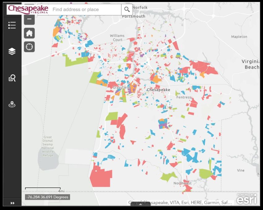
Planning Application Tracking Map                                   There are a variety of ways to access the
                                                                    map. Click on either the map or link below or
                                                                    type www.cityofchesapeake.net/pc in your
                                                                    web browser to access the City’s Planning
                                                                    Commission webpage and learn more.

                                                                                                    This website
                                                                                                  works best on a
                                                                                                  desktop, laptop,
                                                                                                     or tablet.

 Map Link:
  https://chesva.maps.arcgis.com/apps/webappviewer/index.html?id=093a937804884ab790d4484c5adeabaa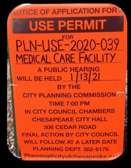
Get to Know Your Icons
Legend: The legend explains the meaning of the colors on the map.
Layers: Provides a list of operational layers and their symbols, and
allows you to turn individual layers on and off.
Query: The query tool helps narrow down a search by case name,
type, number, or status.
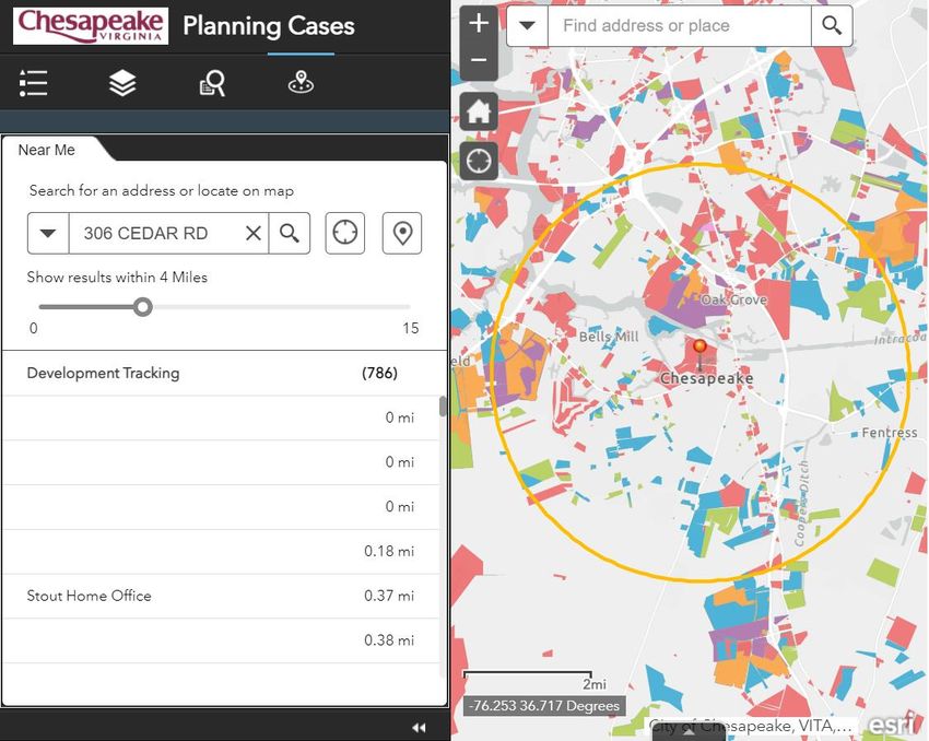
Near Me: This icon is used to pinpoint a precise location and track
projects within a 15 mile radius.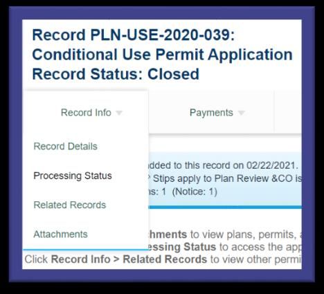
Legend

•   Use Permit – Required for certain land uses that need special review on a case-by-case basis to determine
    whether or not the use is appropriate in specific situations.
•   Subdivision – A preliminary subdivision plan is required when a parcel of land is subdivided into more than
    50 lots. This review ensures that the subdivision meets all design criteria established by the Chesapeake
    Subdivision Ordinance.
•   Rezoning – Required when a property owner proposes to use his or her land for purposes other than those
    permitted in the current zoning classification.
•   Site Plan – A preliminary site plan is required for new construction and additions located on land zoned
    commercial (exceeding 50,000 cumulative square feet) or multi-family residential.
•   Planned Unit Development (PUD) – The establishment of PUD districts are for specialized purposes
    where tracts are in a suitable location, area, and character for the uses and structures proposed to be
    planned and developed in a unified manner.
•   Street Closure – Required when an owner of property located adjacent to a street or other public right-of-
    way seeks to close the street or other public right-of-way and convert it to private property.
•   Special Exception – Offers relief of specific Zoning Ordinance requirements only under special
    circumstances.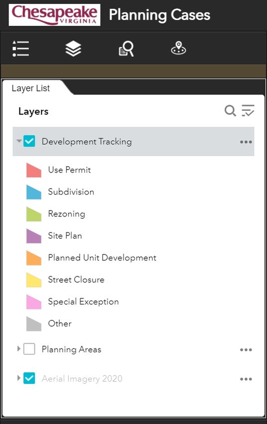
Layers

Click for dropdown

                                                                              For planning
                                                                               purposes,
                                                                             Chesapeake is
                                                                           composed of nine
                                                                            Planning Areas.
                                                                           Turn on this layer
                                                                           to see which area
                                                                              a project or
                                                                           development is in.

                              2020 aerial imagery is only available when
                                 the map is zoomed in close enough
Case Type
Query                                                                 Case Number

        •   Each Planning application is sorted by Case Type and then it is assigned a
            Case Name and Case Number.
        •   Rezoning, PUD, Use Permit, Street Closure, and Special Exception
            applications are subject to public hearings by the Planning Commission
            and City Council. Public notice for public hearing applications include:
                1. A legal advertisement in the Chesapeake Clipper
                2. Mailings to adjacent property owners
                3. Signs posted on the property
        •   Preliminary subdivisions and preliminary site plan applications do not require a legal advertisement,
            but a sign is posted on the property.
        •   The Planning Department utilizes eBuild for the application process. To view documents related to
            an application, you will need to register for an eBuild account. After you are logged in, enter the
            application number in the search bar. After the application is loaded select Attachments from the
            Record Info drop down list.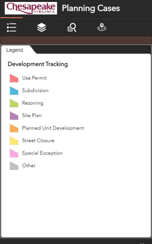
Near Me

1.   Enter an address or parcel number.
2.   Click
3.   Slide the “Show Results” bar to find
     projects within a 15 mile radius.
4.   Click on a specific project to learn
     more:

                                            Find my location   Set location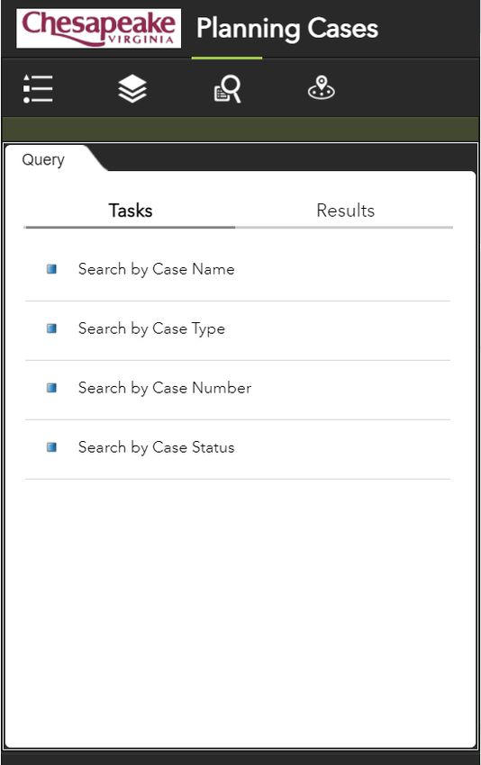
Chesapeake Planning Department
306 Cedar Road, City Hall, 2nd Floor
     Chesapeake, Virginia 23322
O: 757-382-6176 | F: 757-382-8356
 E: planning@cityofchesapeake.net

www.cityofchesapeake.net/planning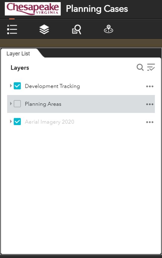
You can also read