Exploring the State of Water in Jordan and Oman - Fulbright-Hays Seminar Abroad Jordan and Oman 2009
←
→
Page content transcription
If your browser does not render page correctly, please read the page content below
Fulbright-Hays Seminar Abroad
                   Jordan and Oman 2009

  Exploring the State of Water in
         Jordan and Oman

Bryant Evans
Geography Faculty
Houston Community College – NW
Houston, Texas
Telephone: 713.718.5828
Email: bryant.evans@hccs.edu
Table of Contents

Acknowledgements                                                         Page 3
Summary of Unit/Project                                                  Page 4
Application and Key Questions                                            Page 5

Background Notes                                                         Page 6
    I.     Introduction to Water at Different Scales
    II.    History of Water in Oman and Jordan
    III.   Contemporary Water Situations
    IV.    Comparing Jordan and Oman‟s Water Profiles
    V.     Future Outlooks
    VI.    Concluding Thoughts

Standards and Objectives                                                 Page    38
Materials, Strategies, and Assessment                                    Page    39
Follow Up Activities                                                     Page    40
Additional Resources and References                                      Page    41

                                             2
       Fulbright-Hays Seminar Abroad: Exploring the State of Water in Jordan and Oman
                         Bryant Evans – Houston Community College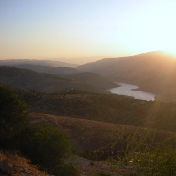
Exploring the State of Water in Jordan and Oman
Acknowledgements

I would like to take a moment to express my gratitude to the Fulbright Commission.
Any medium like the Fulbright Commission which has the explicit goal of enhancing
cross-cultural education, understanding, and empathy is one worth celebrating. I am
extremely grateful for the opportunity that the Fulbright Commission provided me.
Every step of our five week experience, from our first days at the pre-departure
orientation in Washington, DC to our two weeks in Oman and final three weeks in
Jordan, was memorable. Our hosts at the AMIDEAST Organization were very
knowledgeable and hospitable, making our group of educators truly feel at home and
providing us with ample opportunities to experience the sights and sounds of the
wonderful and diverse countries we visited. I would like to offer special thanks to Jerry
Bookin-Weiner, Dina Al-Khalili, Barbara Al-Nouri and Subhi Abu Abbas at AMIDEAST
for organizing and facilitating a wonderful itinerary and program for our group while we
were in Oman and Jordan. I would also like to give many thanks to our group leader
Calvin Allen as well as Ibtesam Attiyat, who both provided us with outstanding expertise
and guidance about Oman and Jordan during the course of the travel seminar. I would
like to extend a special “shukran” to our very kind and talented Arabic instructors
(Buthaina in Oman and Khulood in Jordan), who imparted valuable knowledge and
insights about Omani and Jordanian cultures that extended well beyond language. Last
but not least, I would like to extend my appreciation to the thirteen fellow educators
that I had the privilege of spending five weeks with. It was truly an enjoyable and
warm-hearted group of people to travel with and they enhanced my Fulbright-Hays
journey immeasurably. Thanks to one and all who were involved in making this travel
seminar so educational and special.

                                               3
         Fulbright-Hays Seminar Abroad: Exploring the State of Water in Jordan and Oman
                           Bryant Evans – Houston Community College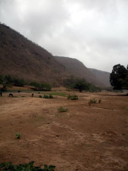
Exploring the State of Water in Jordan and Oman
Summary of Unit/Project
Water scarcity is a topic that geographers and many others take a keen interest in
given the fact that water is a vital and life-sustaining element. In geography, we are
(among other things) interested in spatial patterns – in this case, the spatial patterns of
water. One distinct geographic pattern that emerges is the unequal amount of fresh
water that is dispersed from place to place. Only 2.5% of the world‟s total water supply
is fresh water, so proportionally, there is a very small amount of fresh water to begin
with. The term “scarcity” refers to an insufficiency or shortness of supply. Currently,
around one-third of the world‟s population lives in water-stressed regions where scarcity
is a very real issue. As the population of the world continues to grow, it is anticipated
that the strain on the Earth‟s limited fresh water supply will grow correspondingly.
Another geographic complexity tied to fresh water is the fact that over 260 of the
world‟s river basin watersheds are shared by at least two countries. This has created a
political dimension to water, sometimes referred to as “hydropolitics”, and fresh water
has been the source of both tension and cooperation between countries over the course
of time. Two countries where water scarcity is a modern reality are Jordan and Oman.
Situated in the Middle East, Jordan and Oman are rich in many ways, but in terms of
fresh water, the two have been historically impoverished.

The study of water scarcity is useful because it provides insights as to how countries
contend with and adapt to the challenging issues that coincide with a lack of fresh
water. Oman and Jordan share a number of similarities, but their geographic contexts
are quite distinct in terms of important water sources, historical relations with
neighbors, displaced populations, and economic opportunities. In a typical geography
course, the concept of water scarcity is introduced along with some examples of water-
scarce countries. However, providing a more detailed case study of two countries within
the same region that are largely devoid of fresh water resources can be particularly
useful in elucidating the history, development, politics and adaptations centered around
scarcity. It can also be beneficial by making the concept of water scarcity more tangible
for students. Throughout the seminar, there were three specific dimensions researched
in developing this unit. The dimensions included:

   1. gaining a better understanding of the history of Jordan and Oman through
      lectures, tours, books, and web-based research;
   2. learning more about the contemporary water-issues of Oman and Jordan
      through interactions with Omani and Jordanian residents and scholars; and
   3. developing a more complete knowledge of contemporary and future Jordanian
      and Omani strategies in approaching the issue of water scarcity.

The central strategy in this curriculum unit focuses on developing a greater
understanding of water scarcity in a geographic context for postsecondary students.

                                                4
          Fulbright-Hays Seminar Abroad: Exploring the State of Water in Jordan and Oman
                            Bryant Evans – Houston Community College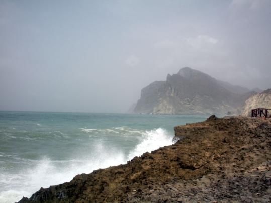
Exploring the State of Water in Jordan and Oman
Application and Key Questions
This curriculum project has been developed for use as a unit in an introductory college-
level geography course. Though it is designed for this audience, the project can be
adapted or modified for other social science courses and for different grade and skill
levels.

The project was developed and organized with the intent of addressing the following
key questions:

   1. Why is water considered such a valuable resource, especially in regions like
      Southwest Asia?

   2. How has water historically been viewed and utilized in Oman and Jordan?

   3. What are Jordan and Oman‟s contemporary situations and outlooks when it
      comes to water, and how have the two countries responded to changing/growing
      demands for water as populations have grown?

   4. How are Oman and Jordan‟s water situations distinctive from one another?

   5. What does the future hold as it relates to water in Jordan and Oman?

                                               5
         Fulbright-Hays Seminar Abroad: Exploring the State of Water in Jordan and Oman
                           Bryant Evans – Houston Community College
Exploring the State of Water in Jordan and Oman
Background Notes

I. Introduction to Water at Different Scales

“Water links us to our neighbor in a way more profound and complex than any other.”
- John Thomson (United Nations Water Development Report, 2006)

1. Key Question: Why is water considered such a valuable resource,
   especially in regions like Southwest Asia?

An Introduction to H2O
As a molecule consisting of two hydrogen atoms and one oxygen atom, water initially
appears to be a seemingly simple and plentiful resource on our planet. However, upon
closer examination, we find that the vast majority of the world‟s water is not fresh
water. Additionally, the limited fresh water resources that do exist are not evenly
distributed, nor are they necessarily devoid of complex relationships associated with its
usage and distribution. Water is absolutely vital to our livelihood and well-being. Put
simply, without water, life on our planet would not exist. Therefore, the importance of
this life-sustaining element merits our attention and respect. A full understanding of
water is integral if we as humans are to maximize its wide-ranging benefits in a
thoughtful, cooperative, and sustainable way.

Water on a Global Scale
Although water covers approximately 70% of our planet‟s surface, 97.5% of the
hydrosphere (the realm of water in all its forms) is encompassed by ocean salt water.
The remaining 2.5% (an estimated 35,000,000 km3) is fresh water. Over two-thirds of
the world‟s fresh water is stored in the Earth‟s glaciers and permanent snow cover,
followed by groundwater, which makes up about 30% of the world‟s fresh water
storage. While groundwater makes up a sizeable share of the world‟s fresh water
reserves, it only accounts for 0.75% of the total hydrosphere. Much of our groundwater
is drawn from underground aquifers, which are vast water reserves critical to the
survival of human populations. Aquifers contain more than 100 times the amount of
water that all of the planet‟s surface reserves have combined, but they are renewed
only slowly, by rainwater percolating down through soil and rock (Clarke and King
2004). Other surface fresh water sources such as lakes and rivers make up a tiny sliver
of the total hydrosphere, accounting for less than 1% of the world‟s fresh water
storage. Despite the relatively minute shares of fresh water resources that exist, these
are the very reserves that are most essential and accessible for important
considerations like drinking water.

                                               6
         Fulbright-Hays Seminar Abroad: Exploring the State of Water in Jordan and Oman
                           Bryant Evans – Houston Community College
The most important variety of water is renewable fresh water. This is water that can be
found above or below the surface and is replaced naturally each year by precipitation. It
is also suitable for easy conversion into drinking water. Some countries around the
world have copious amounts of this resource – these are often large countries with
many lakes or rivers and/or climates that produce an abundance of precipitation. Other
countries are very water poor – they might be small in area, possess non-porous
subsurface rock layers and soils, and have climates that receive limited precipitation
(LEMA 2009).
While the total volume of water in the Earth‟s hydrosphere has remained consistent for
millennia, the population and amount of water usage has not. Whereas the planet had
an estimated population of around 200 million people in the year 1 A.D., and about 2.5
billion in 1950, the population in 2009 was estimated to be at 6.71 billion and still
growing rapidly. Over the last 60 years alone, the Earth‟s human population has grown
by over 150%. While the population has grown rapidly, so has the water usage.
Approximately twice the amount of water was used globally in 2000 than in 1960
(Clarke and King 2004). The rapidly propagating population and water usage has put an
increased strain on our planet‟s limited fresh water reserves, as evidenced by the
growing number of countries around the world facing water scarcity and concerns
today. “About one-third of the world‟s population lives in countries with moderate-to-
high water stress, defined by the United Nations to be water consumption that exceeds
10 percent of renewable freshwater resources. By 2020, water use is expected to
increase by 40 percent, and 17 percent more water will be required for food production
to meet the needs of the growing population.” (Gleick et al 2009)
Water is a resource that is often shared by neighbors, communities, and countries
around the world. There are a wide variety of competing demands on water for
different uses, and these demands are not always in sync with one another. What‟s
more, over 260 of the world‟s river basin watersheds, with over 50 percent of Earth‟s
land surface and 40 percent of the global population, are shared by one or more
countries (United Nations 2006; USAID 2009). With such a vast amount of the existing
water resources shared by different components within society (agriculture, industry,
domestic use, etc.), not to mention multiple countries in many instances, it creates an
environment in which cooperation, understanding, and agreements between different
parties become a priori. By 2050, it is projected that some 4 billion people – close to
half of the world‟s population – will be living in countries that are chronically short of
water (Clarke and King 2004). The urgency of anticipating and addressing global water-
related issues now is more apparent than ever.
Water on a Regional Scale: Middle East
The Middle East is defined here as stretching from Syria, Lebanon, and Israel along the
Eastern Mediterranean coast through Jordan and Iraq and ultimately to the countries of
the Arabian Peninsula. The Middle East has the distinction of being one of the most arid
areas of the world. The Middle East is occasionally linked with the countries of North
7
Fulbright-Hays Seminar Abroad: Exploring the State of Water in Jordan and Oman
Bryant Evans – Houston Community CollegeAfrica, with whom it shares a number of physical and cultural characteristics. For
example, the Middle East and North Africa (or MENA) is collectively the driest inhabited
region on our planet, housing 12 of the world‟s 15 most water-scarce countries. The
MENA countries are home to approximately 6.3% of the world‟s population, but only
possess about 1.4% of the planet‟s renewable fresh water (Roudi-Fahimi et al 2002).
The vast majority of the region receives less than 5 inches of precipitation annually.
Figure 1. Water-Scarce Countries in the Middle East and North Africa
Note: The countries on the map that are shaded are defined as being water-scarce, receiving less than 1,000 cubic
meters of renewable fresh water per person annually. Source of Map: Peter Gleick, The World's Water 2000-2001,
The Biennial Report on Freshwater Resources and Carl Haub and Diana Cornelius, 2001 World Population Data Sheet.
Within the Middle East, there are expansive areas of extreme aridity. A steppe climate
prevails in the northern reaches of the region, characterized by hot summers and cool
winters. Along the Mediterranean Sea is a narrow zone that possesses a Mediterranean
climate, characterized by wet and mild winters and dry summers. The majority of the
Arabian Peninsula experiences extremely dry, hot summers and moderate temperatures
in the winter. With the exception of modest summer rains in the southern part of the
Arabian Peninsula, most of the Middle East‟s precipitation occurs in the winter, and the
summer dry period lasts between 6-10 months. “Droughts, desertification, and water
shortages are permanent features of life in most of the countries in the region. Their
native plants and animals are adapted to coping with sequences of extreme climatic
conditions.” (Hotzl 2008) Recent and future climate changes are expected to adversely
affect populations in this part of the world when it comes to water resources. The
region is particularly vulnerable to climate change because of its low water availability
and significant dependence upon agriculture that is sensitive to climate. The
Intergovernmental Panel on Climate change is predicting that temperatures will rise and
that the amount of precipitation will diminish by up to 30% by 2050 (World Bank 2008).
If this forecast ends up being anywhere close to accurate, it will place considerable
pressure on regional governments and populations.
8
Fulbright-Hays Seminar Abroad: Exploring the State of Water in Jordan and Oman
Bryant Evans – Houston Community CollegeStress on the region‟s water resources is compounded by a rapidly growing population.
The population of the MENA region more than doubled between 1970 and 2001,
increasing from 173 million people to 386 million people. This had the effect of reducing
the average amount of per capita fresh water available by more than half. Experts
consider a country to be “water-stressed” when its renewable freshwater resources
range between 1,000 and 1,700 cubic meters per person per year. A country is deemed
to be “water-scarce” if it averages less than 1,000 cubic meters of renewable fresh
water per person per year (Roudi-Fahimi et al 2002). Population growth in recent years
has pushed the MENA region into the water-stressed category, with average water
availability region-wide at around 1,200 cubic meters per person per year. Half of the
region‟s population already lives under conditions of water-stress. To put this all in
perspective, the worldwide average water availability currently stands at about 7,000
cubic meters per person per year (World Bank 2009). The continued population growth
in the MENA region, which is the currently the fastest in the world outside of Sub-
Saharan Africa, is expected to drop the annual per capita availability of water even
further between now and 2050.
Islam and Water
The Islamic faith traces its roots to the Middle East and has been a dominant belief
system in this part of the world since the 7th century A.D. It is important to take Islam
into consideration here because over the past 1,400 years, Islamic water principles and
philosophy have influenced perceptions, utility, and allocation of water. The importance
of water is a common value to many religions and worldviews, but because Islam
emerged out of the water-scarce Middle East, the rules governing water management
were likely more detailed and specific than most other belief systems. “Water is of
profound importance in Islam. It is considered a blessing from God that gives and
sustains life, and purifies humankind and earth…The Arabic word for water, ma‟, occurs
sixty-three times in the Quran…It seems that in the Quran, the most precious creation
after humankind is water.” (Faruqui et al 2001) Equity and social justice are considered
cornerstones within Islam, and the Prophet Muhammad set the example for Muslims in
these regards. Water is frequently recognized as a vital resource and a gift from God,
therefore no one individually owns it and everyone should have a fair share of it.
Humans are viewed merely as stewards of water and other common resources that
belong to the community as a whole. Traditions that are very much steeped in Islam
further reinforce the importance of water. “All human beings rely on water for life and
good health but, for Muslims, it enjoys special importance for its use in wudu (ablution,
that is, washing before prayer) and ghusl (bathing). The benefit of the daily prayers,
one of the Five Pillars of Islam, has itself been compared by the Prophet to the
cleansing action of water.” (Faruqui et al 2001)
9
Fulbright-Hays Seminar Abroad: Exploring the State of Water in Jordan and Oman
Bryant Evans – Houston Community CollegeIntroduction to Jordan and Oman
Thus far, we have focused on water on a global and regional scale, but the heart of this
project focuses two specific Middle Eastern countries: Jordan and Oman. While many
outstanding cultural and physical characteristics can be found within each country, one
very apparent commonality between the two is the challenge associated with a general
lack of renewable fresh water resources. Before exploring that topic further, however, it
would be prudent to provide a further introduction into Jordan and Oman.
The Hashemite Kingdom of Jordan lies east of
the Jordan River and possesses a total area of
34,495 square miles, or an area comparable in size
to the U.S. state of Maine. It shares a 233 mile
northern border with Syria, a 112 mile eastern
border with Iraq, a 462 mile eastern and southern
border with Saudi Arabia, a 148 mile western
border with Israel, and a 60 mile border with the
West Bank. The country is mostly landlocked, with
the exception of a small but important 16 mile
stretch of coastline along the Gulf of Aqaba. Less
than 5% of Jordan‟s land is arable, and the bulk of
the country (around 90%) is arid desert.
Figure 2. Map Highlighting Jordan
Source: Food and Agriculture Organization
(FAO) of the United Nations, 2008.
Jordan has four main physiographic regions. The first region is encompassed by the
Jordan Rift Valley. The rift stretches along the western border of the country, beginning
at Lake Tiberias (just outside of Jordan‟s boundary) and continuing south through the
Jordan River Valley and into the Dead Sea. The Jordan River has been an incredibly
important river historically despite its relatively diminutive size. The Dead Sea, which
has been shrinking in recent years due to insufficient inflow, is famed for its high
salinity and for being the lowest point on the Earth‟s surface at about 1,300 feet below
sea level. From the Dead Sea southwards, the Rift Valley is occupied by Wadi Araba
before making its way to the Gulf of Aqaba and the Red Sea. The second region
includes a highland zone to the east of the Jordan Rift Valley that runs from north to
south. It consists of interspersing mountains and plains that range in elevation between
1,900 and 5,200 feet above sea level. It is in this region where Jordan receives most of
its precipitation, and it is also where the vast majority of Jordan‟s population lives
today. The third region is a series of plains tucked between the Jordan‟s western
highlands and eastern deserts and covering about 11% of the country‟s total area. The
desert region, known as Al-Badiah, is an extension of the Arabian Desert and dominates
the eastern ¾ of Jordan‟s total territory. Not surprisingly, the eastern desert region is
one of Jordan‟s most sparsely populated areas.
10
Fulbright-Hays Seminar Abroad: Exploring the State of Water in Jordan and Oman
Bryant Evans – Houston Community CollegeJordan‟s climate is characterized by warm, semitropical conditions in the Jordan River
Valley, a small area of mild Mediterranean climates in its highlands, and a mostly hot,
continental climate in its eastern deserts and plains. Most of the rain occurs in Jordan
between October and May, with a winter peak. The precipitation in the country ranges
between 2 inches in the eastern and southern desert regions to 24 inches in the
northern highlands (FAO 2008). However, the vast majority of Jordan is arid. Over 91%
of the country receives less than 8 inches of precipitation a year, and only 3.2% of
Jordan receives more than 12 inches of precipitation annually (Stiftung 1992).
From ancient times until 1922, the lands to the east of the Jordan River were culturally
and politically connected with the lands to the west. Under Persian and Roman control
in ancient periods of its history, the area known as the Trans-Jordan was conquered by
the Arabs in the 7th century. The Ottomans took control over the area in the 16th
century. Prior to the First World War, there existed little potential for a Jordanian state,
as there was “no significant urban concentration to act as an embryonic power centre
around which political and economic power might coalesce; indeed, Amman was a
deserted village until the 1870s.” (Robins 2004) Following World War I, Britain
established a Palestine Mandate that covered both sides of the Jordan River, and in
1921, Abdullah, the son of a Hejaz ruler in Arabia, was installed by the British to be the
emir of an autonomous Transjordan. In its infancy in 1922, the Emirate of Transjordan
had a population of 225,000 people (Salameh and Haddadin 2006). In 1946, an
independent kingdom was proclaimed, led by King Abdullah. After Abdullah was
assassinated in Jerusalem in 1951, his son, Prince Talal, was proclaimed king. Talal‟s
reign as king was short-lived due to health reasons, and by 1953, King Hussein formally
ascended to the kingdom‟s leadership role. King Hussein was very influential in shaping
the second half of Jordan‟s 20th century history, weathering through a couple of very
notable wars with Israel in 1948 and again in 1967, absorbing an influx of Palestinian
refugees following those conflicts, and ultimately signing a formal peace treaty with
Israel in 1994. Hussein led from 1953 until his death in 1999. During this period,
Jordan‟s population grew more than seven times larger, from around 600,000 in the
early 1950s to over 4.5 million people by the late 1990s. Since 1999, King Abdullah II,
the son of the late King Hussein, has led Jordan. Abdullah II has consolidated power
and undertaken an aggressive economic reform program (CIA World Factbook 2009).
During his time in power, Jordan has received hundreds of thousands of additional
refugees from its neighbor Iraq, a country that has been engulfed by recent conflict.
Today, Jordan has a primarily urban (79%) population of an estimated 5.9 million. “The
demographic composition of the population of Jordan consists mainly of original
Jordanians (East Bankers), Palestinians (West Bankers and refugees), Syrians, and
people in other, smaller communities with origins from Hijaz, Iraq, and the Caucasus.
This demographic mix affects the policies of the kingdom in regard to its stand toward
peace in the Middle East and potential water relations with its neighbors, particularly
Syria and the Palestinian Authority.” (Salameh and Haddadin 2006)
11
Fulbright-Hays Seminar Abroad: Exploring the State of Water in Jordan and Oman
Bryant Evans – Houston Community CollegeThe Sultanate of Oman is situated on the
southeastern corner of the Arabian Peninsula and
encompasses a total area of 119,498 square miles,
or an area slightly larger than the U.S. state of
Arizona. Oman shares a 420 mile western border
with Saudi Arabia, a 255 mile northwestern border
with the United Arab Emirates, and a 179 mile
southwestern border with Yemen. The country has
an extensive 1,300 mile coastline adjacent to the
Arabian Sea, Gulf of Oman, and the Persian Gulf.
Less than 1% of the Sultanate‟s land is arable, and
much like Jordan, Oman largely consists of desert
environments.
Figure 3. Map Highlighting Oman
Source: Food and Agriculture Organization
(FAO) of the United Nations, 2008.
Oman can be divided into three primary physiographic regions. The first region is a
narrow coastal plain that reaches up to 10 miles in width. The most important stretches
of this coastal strip are the Batinah Plain in the north, which is Oman‟s principal
agricultural area and home to the majority of the country‟s population today, and the
Salalah Plain in the south. The second region consists of a series of mountain ranges
that cover about 15% of the country‟s total area. The Hajar Mountains form two distinct
ranges in Oman‟s north and is the country‟s most expansive range. As a unit, the Hajars
stretch from the Musandam Peninsula - the Omani enclave strategically located along
the Persian Gulf – to the southeastern tip of the Arabian Penisula. The highest peak in
the Hajars, Jebel Shams, is also the highest point in the Sultanate at approximately
9,800 feet above sea level. The Dhofar Mountains represent another important
mountainous area in southwestern Oman and have peaks ranging from 3,300 to 8,200
feet in elevation. Oman‟s third physiographic region can be described as the internal
zones. Most of the internal zones consist of a stony, wide, and largely waterless plateau
and desert that averages about 1,000 feet in elevation. This region covers
approximately 82% of Oman and includes part of the Arabian Desert, also known as the
Rub‟ Al Khali, or “Empty Quarter”.
Oman‟s climate is generally arid, with hot and humid conditions along the coastal
regions and a particularly hot, dry interior region with the exception of some of the
higher elevations within the Sultanate‟s southern Dhofar region, where the climate
remains moderate throughout the year. In northern and central Oman, most of the
rainfall occurs between November and April. One of the country‟s climatic anomalies
exists along its southwestern coast around the Salalah area. In this “microclimate”, the
peak annual rainfall occurs in conjunction with the summer monsoon and is known as
the “khareef”. The summer monsoon in the Salalah area produces more moisture and
cooler temperatures than in other parts of Oman, as well as surprisingly verdant
landscapes (in parts of the Dhofar Mountains, for example) when it reaches its peak in
12
Fulbright-Hays Seminar Abroad: Exploring the State of Water in Jordan and Oman
Bryant Evans – Houston Community CollegeJuly and August. Overall, annual precipitation in Oman ranges from less than 1 inch in
some of its interior regions to a maximum of around 14 inches in some of the northern
mountain regions and in the Dhofar region of the southwest (FAO 2008). In terms of
temperature, much of Oman is characterized by mild conditions in the winter, but in the
peak of summer, many parts of the country experience average daytime high
temperatures of 104° Fahrenheit and above.
Archaeological evidence suggests that there has been civilization in Oman for five
thousand years (Bouji 2003). Oman was one of the first areas to voluntarily and openly
embrace Islam, beginning around the 7th century A.D. The predominant form of Islam
that developed in Oman is a branch of the faith known as Ibadism. Oman has a long
and well-documented history of seafaring and prospering on Indian Ocean trade routes.
In the early 16th century, the Portuguese, who were seeking to expand their powerful
trading empire and to capitalize upon Oman‟s flourishing sea trade routes, managed to
take control of large stretches of the Omani coast. The Portuguese maintained control
of the area for about 150 years. Later, Oman was briefly occupied by the Persians, but
by 1744, they had been expelled and no foreign power has invaded Oman since. By the
early 19th century, Oman had become a strong regional power, controlling much of the
Persian and Pakistan coasts, and even had rule over Zanzibar in East Africa. The early
19th century also marked the beginning of a close and long-standing relationship with
the British, who were initially interested in Oman‟s role in protecting the route to India
(Owtram 2004). By 1900, the estimated population of Oman had reached approximately
214,000 (Lahmeyer 2003). The economic and political conditions of the country
remained somewhat stagnant for much of the 20th century, but a distinct shift was
brought forth with the discovery of oil in Oman in the 1960s. By 1967, Oman was
exporting petroleum to the outside world. A dramatic political shift soon followed. In
1970, Qaboos bin Said al-Said overthrew the restrictive rule of his father. Sultan Qaboos
has served as the country‟s leader ever since and has set forth an extensive
modernization program that has opened the country to the outside world (CIA World
Factbook 2009). Under Sultan Qaboos‟ leadership, Oman has maintained a moderate,
independent policy, which has enabled it to maintain good relations with Western
countries like the United States and the United Kingdom while also sustaining
harmonious relations with countries within the Middle East. Oman has also successfully
balanced further international integration with maintenance of its rich cultural and
Islamic traditions. Petroleum has been the driving force within Oman‟s economy
throughout the reign of Sultan Qaboos. However, it‟s economic configuration and
approach is much different than neighboring Gulf States such as Saudi Arabia and the
United Arab Emirates. For starters, Oman has never had the tremendous oil reserves
and corresponding income surpluses as Saudi Arabia or the U.A.E., so the Sultanate‟s
government has always had to act within greater financial constraints. Secondly, Oman
possesses a variety of other resources, such as minerals, agriculture and fisheries.
Though these resources are limited, they provide some hope for future diversification of
the economy. Lastly, the power and influence of Oman‟s merchant class was never
usurped by the royal family, which consequently has led to internal pressure to keep
13
Fulbright-Hays Seminar Abroad: Exploring the State of Water in Jordan and Oman
Bryant Evans – Houston Community Collegethe economy “open” (Allen and Rigsbee 2000). Today, Oman has a population of close
to 3 million, of which approximately 78% is urban.
When it comes to renewable water resources, Jordan and Oman are in similar positions
in that their finite water reserves are diminishing and being placed under greater
pressure by their respective societies. The balance of this project will explore the state
of water, specifically as it pertains to Jordan and Oman, in greater depth.
II. History of Water in Jordan and Oman
Key Question: How has water historically been viewed and utilized in
Oman and Jordan?
“They take refuge in the desert using this as a fortress; for it lacks water and cannot be
crossed by others, but to them alone, since they have prepared subterranean reservoirs
lined with stucco, it furnishes safety.” - Diodorus Siculus, 1st Century B.C. (Biblioteca
Historica, XIX.94.6-9)
The civilization and area being described here by the notable Greek historian Diodorus
is the ancient Nabateans and Petra, which is arguably the most famous site within the
country of Jordan today. At least throughout the course of much of human history,
fresh water was not a bountiful resource in the Middle East. However, historical
evidence suggests that perhaps because of its scarcity, water was always an especially
valued and appreciated commodity in this region of the world.
Regional Context
This segment is not intended to provide a
comprehensive history of water for Jordan, Oman and
the region. Rather, the primary goal here is to
illuminate a few historical dimensions of water utility
and perceptions by residents of the Middle East in
general, with a particular emphasis on historical
perspectives and uses within Jordan and Oman.
Historically, the Bedouins were among the most
important groups of inhabitants to reside in areas of the
Middle East and the Arabian Peninsula, including large
parts of modern-day Jordan and Oman. The term
Bedouin is drawn from the Arabic term “bedu”, which
means “desert dweller” (Office of King Hussein I 2009).
The water-scarce regions that the Bedouin lived within
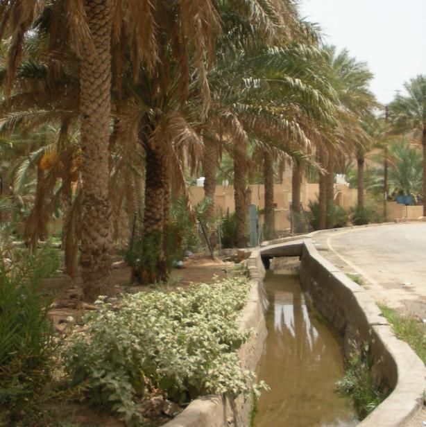
undoubtedly influenced their perceptions and utility of Figure 4. An old, lined water
water. “The cultural values and social customs shaped channel (at bottom right of photo)
in Petra, Jordan.
14
Fulbright-Hays Seminar Abroad: Exploring the State of Water in Jordan and Oman
Bryant Evans – Houston Community Collegeby the needs of Bedouins in the desert provided a set of customary rules pertaining to
water rights and water consumption patterns. Water resources were regulated by
collective interests rather than given over to unbridled private ownership and the
patterns were user-focused, intending to influence the users‟ behavior, to reallocate
existing supplies, to encourage more efficient use, and to promote more equitable
access.” (Dolatyar and Gray 2000) Evidence suggests that Bedouin tribes maintained a
strict order of priority in the use of a spring or well based on traditional rules that grew
out of the customs of the desert. Priority was first afforded to human needs, then to
animals, and the surplus could be utilized for irrigation. These Bedouin customs were
reinforced and complemented by the advent of Islam. “The connection between the
shari‟a as the „law of water‟ and as a generic term for „Islamic law‟ was not a matter of
coincidence. It was a deliberate choice that illustrates the centrality of water of the
Arabs – a centrality which has continued from pre-Islamic times right down to the
present day.” (Dolatyar and Gray 2000) These outlooks on water were reflected in
traditional water management systems that developed within the region – systems that
remained prominent up until the 20th century, when population growth, urbanization,
and the discovery of oil wealth throughout much of the region altered water utility and
placed new pressures on the region‟s limited fresh water resources. With that in mind,
traditional water management systems are still in use and preserved within parts
(especially rural areas) of Oman, Jordan, and the greater Middle East to this day.
Jordan: Petra and Amman
Though populations have lived in the region for thousands of years, a good starting
point is with the Nabateans, who are believed to have migrated from parts of Arabia to
parts of southern Jordan in the 6th century B.C. Interestingly enough, the word “nabat”
is drawn from an Arabic term meaning water that “percolates from underground to the
surface.” (Jordan Watch 2007) Gradually, the Nabateans became less nomadic and
began establishing urban centers. The most famous of these was the ancient Nabatean
capital city of Petra. The city, which was magnificently carved into the spectacular red-
rose stone environs, is today justifiably one of Jordan‟s most famous historic sites, a
UNESCO World Heritage Site, and was recently voted in as one of the World‟s New
Seven Wonders. But perhaps what Petra showcases better than anything else is the
ingenious ancient water technologies that were developed by the Nabateans. “The
gifted Nabateans managed to adapt to their harsh environmental conditions and
discovered how to maximize the harnessing potential of rainwater to develop their
livelihoods. They dug cisterns and reservoirs, built dams and diversion walls, laid out
terraces and engineered channels and aqueducts which brought water from distant
springs to the heart of the city.” (Jordan Watch 2007) The water channels and
aqueducts were utilized to help collect water, and the Nabateans built the underground
cisterns to help store it. Additionally, they developed sophisticated ceramic pipelines
and reservoirs using gravity feeds (siphons or inverted siphons), that served Petra and
other developing urban centers (Nabatea.net 2002). Although Petra and the Nabatean
civilization began to decline around the 4th century A.D., the legacy of their skillful
management of water is still apparent today.
15
Fulbright-Hays Seminar Abroad: Exploring the State of Water in Jordan and Oman
Bryant Evans – Houston Community CollegeAmman, Jordan‟s largest city and contemporary capital, was founded thousands of
years ago near a water source in the form of a perennial spring. Amman acquired a
reputation as a “place of water” and was already a well-developed urban center by the
3rd century B.C. (LEMA 2009). Amman was renamed Philadelphia by the ancient Greeks
and this name was retained during the Roman Empire. It was during this time that the
Romans built up the city along the spring in what is now the heart of Amman‟s
downtown area (LEMA 2009).
Jordan: The Dead Sea and Jordan River
While Petra and Amman represent a couple of the country‟s most influential historic and
contemporary urban centers, respectively, the Dead Sea and the Jordan River best
symbolize the historical significance of water in Jordan. The Dead Sea is in the heart of
an area of noted geographical, historical, and Biblical significance. This sea is shared
today by Jordan, the West Bank, and Israel. The Dead Sea is an important water
feature in the region even though it is not a supplier of fresh water. In fact, the Dead
Sea is famous for being the saltiest large body of water in the world, in addition to
being the lowest point on the surface of the planet at approximately 1,354 feet below
sea level. It is also the terminus of the Jordan River, which has been Jordan‟s
penultimate symbol of water historically.
The Jordan River begins at the confluence of three upper tributaries – the Hasbani,
Dan, and Banyas rivers. The Jordan then flows south through Lake Tiberias (also known
as Lake Kinneret and the Sea of Galilee). The lower course of the Jordan River meets
up with the Yarmouk River and flows through the Jordan Valley until it empties into the
Dead Sea. The Jordan River system drains parts of Lebanon, Syria, Israel, the West
Bank, and Jordan, and as such, is an incredibly important international water basin. The
river has been at the heart of commercial and agricultural activity for millennia.
Additionally, the Jordan has rich symbolic importance to three of the world‟s major
religions. The river is mentioned a number of times in the Old Testament, is the
traditional site of where Jesus was baptized, and is where many of the esteemed
companions to the Prophet Muhammad are buried (near its banks), making it a very
sacred river to adherents of Judaism, Christianity, and Islam (FOEME 2009). While the
Jordan River is grand in terms of its historical significance, it is surprisingly diminutive in
length. It is the smallest watershed in the Middle East that is shared by more than two
countries (its basin drains an area just under 7,000 square miles), measures only 200
miles in distance, and has an average intact flow that is less than 2% of the Nile River
and 5% of the Euphrates River (Dolatyar and Gray 2000). One can think of the Jordan
River symbolically as a “little giant” – though small in terms of dimensions, it has been
monumentally significant historically and contemporarily for the region.
Oman: The Seas and Wadis
Oman is like Jordan in that it lies within an extremely arid climate overall, but its water-
related history is quite different than its Middle Eastern counterpart based on its
16
Fulbright-Hays Seminar Abroad: Exploring the State of Water in Jordan and Oman
Bryant Evans – Houston Community Collegegeographical location. Oman does not possess any perennial rivers or lakes as Jordan
does, but it does have a vast coastline, particularly along the Arabian Sea. In fact,
Oman‟s 1,300 mile coast along the Arabian Sea, Gulf of Oman, and Persian Gulf has
arguably been the country‟s greatest water-related asset historically. Oman‟s extensive
coastline gave it a window to the outside world and its strategic location served as the
foundation for a historically strong society steeped in a powerful maritime tradition. Of
course, desalination technologies and advancements have altered how seawater is
utilized in a contemporary sense. However, the fact remains that as important as the
seas were for Oman throughout its history, there wasn‟t much value in them for
farmers and other water-dependent populations since they consisted of saltwater.
Topography, climate, human, natural and historical
factors all contributed to the traditional settlement
patterns in what is now Oman. Water is a unifying
element that binds these factors together. Within
Oman‟s rugged landscape, the sources of water were
historically found in wadis and springs. A wadi is a
physical feature that describes a dried up riverbed
found within a mountain valley. Most wadis fill up with
water after heavy rains, at least temporarily, and some
wadis even have year-round running water with deep,
cool pools. (Oman Ministry of Information 2009) Wadis
frequently produce lush, green oases that house a
variety of vegetation. There are well over 300
documented wadis found within Oman (El Baz 2004),
making this a distinctive feature of Oman‟s physical
Figure 5. A wadi within the Dhofar geography. Culturally and economically, agriculture was
Mountains near Salalah, Oman.
traditionally a staple of Omani society – most people living in the area had to rely on
farming as a source of livelihood and income. As has been the case historically in other
parts of the world, the extent of water availability governed where agricultural activities
could take place in Oman. Wadis were one of the key source areas of fresh water within
Oman throughout its history, so it comes as no surprise that many Omani villages
developed within or near these wadis.
The Falaj: Oman’s Mighty Water-Related Symbol
“The falaj is a unique and important water source that has made a major contribution
to Omani society throughout its history. Not only is it regarded as one of the most
historical sites in Oman, but it represents the ability of Omanis to build civilizations in
the face of severe challenges and, at the same time, enriching the world‟s heritage
through their intellectual and creative endeavors." - His Majesty Sultan Qaboos Bin
Said (33rd Session of the General Conference of UNESCO, 2005)
17
Fulbright-Hays Seminar Abroad: Exploring the State of Water in Jordan and Oman
Bryant Evans – Houston Community CollegeThough many wadis dotted the Omani landscape, a reliable and sustainable method for
obtaining and managing the water was necessary to take full advantage of the limited
water resources that existed. While Oman historically lacked fresh water, one thing it
did not lack was exceptional ingenuity and engineering know-how when it came to this
element. This is best exemplified by Oman‟s falaj system (also known by its plural form
of aflaj). The aflaj represent a system for the distribution of water, typically through an
open watercourse, that Omanis historically developed and utilized for the purposes of
irrigation and water sharing. The term falaj itself means to “divide” or “distribute”
(Siyabi 2009), and denotes not only the water canals, but also the irrigation networks
that rely upon them as well as the social system that distributes water to the owners of
water-shares. “The aflaj have helped to shape the history and settlement patterns of
Oman, and they continue even now to tie together each community that draws upon
the falaj's flow…Ancient aflaj still course like arteries beneath the hills and plains of
Oman, twisting along precipitous cliffs and threading villages and date-palm groves,
bringing to the parched land water and coolness and life itself” (Simarski 1992).
Throughout the course of history, many aflaj were constructed within Oman. In 1997, a
National Aflaj Inventory Project in the country recorded a total of 4,112 aflaj, of which
approximately 3,017 were still operational (Oman Ministry of Water Resources 1997).
Most aflaj are found in the foothills, wadis, and lowlands in and around the northern
mountains of Oman. The aflaj were constructed as conduits that were dug into the
ground to convey water by gravity from one place to another. Because falaj systems
used gravity flow, water use never exceeded water supply, making it an extremely
sustainable way to utilize water (Sulaimani et al 2007). In developing aflaj, Oman‟s
ancient planners produced engineering solutions that matched the challenges presented
by Oman‟s rugged topography. “Some aflaj run along the contour lines, tracing the
curves of wadis or valleys… Where a falaj crossed wadis…architects bridged the valleys
with arched aqueducts often more graceful than the sturdy poured-concrete ones built
today. Wherever the torrential flood of a wadi was strong enough to wash away an
aqueduct, engineers built inverted siphons - closed U-shaped tunnels” (Simarski 1992).
There were three basic types of falaj that developed within Oman. The first, and most
common type, was known as a ghaily falaj and means “surface” or “rain”. This type of
falaj collected water from the base flow of a wadi and transported it in an open channel
to the distribution area. Roughly 46% of Oman‟s aflaj were of this variety. A second
type of falaj, known as aini, represented about 33% of the total aflaj, and came from
water that was derived from springs, both hot and cold. The third type, known as
dawoodi falaj, were constructed as underground tunnels that conveyed groundwater
from a mother well to an irrigated area (Sulaimani et al 2007). Though dawoodis were
the least common variety of falaj, representing only about 21% of the total, they are
believed to have historically been the best and most efficient type since the main water
sources in these were attached to an underground aquifer. This allowed for the
dawoodi falaj to provide a more reliable and enduring flow of water to farmers and
residents.
18
Fulbright-Hays Seminar Abroad: Exploring the State of Water in Jordan and Oman
Bryant Evans – Houston Community CollegeThe engineering and construction of the aflaj around Oman represented one impressive
aspect of the system. Another impressive aspect involved how the waters of individual
falaj systems were used and allocated. Once falaj waters reached the populations,
community residents would draw off their needs and the rest would be distributed to
agricultural plots according to an exact system that involved apportioning the hours of
the day that water could be used. This all took place under the supervision of an
elected member of the community. A proportion of the agricultural harvest would then
be allocated as a contribution towards the upkeep of the community‟s aflaj and
irrigation ditches (Oman Ministry of Information 2009). Communal care and
management of the falaj were central components of traditional Omani society,
reinforced by demands for mutual cooperation that helped frame and organize life
within many of Oman‟s interior communities. Without the aflaj, “Oman would never
have been able to achieve nationhood, since only the availability of water made it
possible for nomadic peoples to adopt a settled way of life, which encouraged the
development of agricultural and craft skills” (Sulaimani et al 2007).
When it comes to water, it is evident that the inhabitants of both Jordan and Oman
historically adapted to the scarce resources of water that existed in their respective
areas of the Middle East. It is not too surprising that the few fresh water resources that
did exist in the region (like the Jordan River) were attributed with great meaning and
symbolism ever since ancient times. However, it was the development of innovations
such as the cisterns created by Nabateans in southern Jordan and the falaj by villagers
in Oman that truly serve as testaments to the importance clearly placed on water
historically.
III. Contemporary Water Situations
"Our water situation forms a strategic challenge that cannot be ignored. We have to
balance between drinking water needs and industrial and irrigation water requirements.
Drinking water remains the most essential and the highest priority issue." - His Majesty
King Abdullah II (Statement made on November 7, 1999; found within “Water For Life:
Jordan‟s Water Strategy 2008-2022”)
Key Question: What are Jordan and Oman’s contemporary situations and
outlooks when it comes to water, and how have the two countries responded
to changing/growing demands for water as populations have grown?
The 20th and early 21st centuries provide a contemporary context in which to look at
water-related issues in Jordan and Oman. As populations have grown in both countries
during this time period, increased stress has been placed on the limited fresh water
reserves found within each.
19
Fulbright-Hays Seminar Abroad: Exploring the State of Water in Jordan and Oman
Bryant Evans – Houston Community CollegeJordan’s Contemporary Water Portrait
In a contemporary water-related context, a key consideration to keep in mind in
Jordan‟s case (besides its scarcity) is its relationships with its many neighboring
countries. Jordan shares borders with Syria, Iraq, Saudi Arabia, Israel and the West
Bank, and most of its water resources are shared with its neighbors. Jordan‟s complex
relationship with Israel since 1948 has been a particularly delicate and challenging
dynamic when it comes to water. Not only has water become a politicized issue, but
regional political events (such as the 1967 War and more recently, the war in Iraq)
have had ancillary yet profound impacts on Jordan‟s contemporary fresh water resource
picture.
From the early 1920s until 1946, the Emirate of Transjordan was in the process of
developing its state identity. Legislation in the emirate consisted of a combination of
ongoing laws that were established during the time of the Ottoman Empire as well as
new laws that were borrowed from its neighbor Palestine, which was at the time under
the administration of the British Mandate. Administration of water supply was managed
at the community level. This responsibility was given to municipal councils within towns.
The central government had a minimal role at the time, one that primarily consisted of
legislating for the service of water as well as guaranteeing loans and facilitating the
implementation of water-related projects (Haddadin 2006). Much of the original
Jordanian population (also known as “East Bankers” in reference to the side of the
Jordan River they traditionally lived on) prior to 1946 remained steeped in age-old
Bedouin nomadic and semi-nomadic lifestyles. For these East Bank Arab populations,
water was very important to their nomadic way of life because movements were largely
determined by the search for water and grazing-land for animals. Bedouin camps would
also be set up in close proximity to water holes (Lowi 1993). Jordan was a distinctly
rural society in its early days as an Emirate, with few large towns and cities. Even
Amman, which is today far and away Jordan‟s largest city with an estimated population
of over 2 million residents (and housing around 40% of Jordan‟s total population) was a
small settlement as recently as the 1920s, when it had a population of only around
5,000 inhabitants (Al Asad 2008).
In 1946, the Hashemite Kingdom of Jordan was formally established, and soon
thereafter, the State of Israel was created (in 1948) by United Nations mandate. These
developments, along with a regional war that would pit these newly established
countries against one another, had major effects on Jordan‟s evolving demographic
composition as well as its developing water policies.
In the wake of the 1948 Arab-Israeli War, more than 500,000 Palestinian Arabs fled
their homes, with the majority settling into parts of the West Bank. In April of 1950, it
was decided by Palestinians (also occasionally referred to as “West Bankers”) and East
Bankers to unite, “constitutionally expanding the Hashemite Kingdom of Jordan in order
to safeguard what was left of the Arab territory of Palestine from further Zionist
expansion.” (Office of King Hussein I of Jordan 2009) With this agreed upon
20
Fulbright-Hays Seminar Abroad: Exploring the State of Water in Jordan and Oman
Bryant Evans – Houston Community Collegeincorporation of the West Bank, Jordan had an early 1950s population of close to one
and a half million people, and more than half of that population was of Palestinian
origin. “The Jordanian government, in view of the historical and political relationship
with the West Bank underlined by the Unity Agreement between the two Banks in 1950,
granted all Palestinian refugees on its territory full citizenship rights while protecting
and upholding their political rights as Palestinians.” (Embassy of the Hashemite
Kingdom of Jordan 2009) As Palestinians have since been a very significant part of
Jordan‟s cultural mosaic, it is worth noting a traditional Palestinian outlook towards
water. Traditionally, agriculture was a principal economic activity for Palestinians and
“water, whether in the form of rainfall or surface flow, was vital to the livelihood of the
Palestinian peasant. He was both tied to the land and dependent on water. Water was
perceived as an extension of the land.” (Lowi 1993)
Tensions between Jordan and Israel over water date back to the establishments of their
modern states. In fact, Jordan‟s water policy over the past sixty years has evolved at
least in part as a response to Israeli water policy, particularly in matters regarding the
Jordan River Valley. As the Jordan River and its watershed had historically been the
area‟s most fertile and productive region in the sphere of agriculture, Jordan focused its
efforts on making it the country‟s breadbasket. However, other countries in the region
also were concentrating on the Jordan River and its tributaries as a primary means for
obtaining fresh water. In an effort to develop a regional water-sharing plan for the
countries housing part of the Jordan River system, an agreement at the technical level
was spearheaded by an American presidential envoy, Eric Johnston, between 1953-
1955. The ensuing Johnston Plan had the aim of reducing the potential for regional
conflict over water by promoting cooperation and economic stability. The plan called for
approximately 55% of the Jordan River basin‟s available water to be distributed to
Jordan, 36% to Israel, and 9% each to Lebanon and Syria (FAO 2008). These shares
were based on how much irrigable land each country had. Jordan and Israel therefore
were the beneficiaries within this structured agreement, even though Lebanon and
Syria produced the most water within this basin area. The Johnston Plan “became the
cornerstone of Jordan‟s water policy for several reasons: water was required for the
urgently needed development; exploration and survey of water resources were essential
for proper planning; the Jordan Valley Project was viable on economic, social, and
political grounds; and benefits from the Jordan Valley could accrue almost immediately
after the project, or any part thereof, was completed.” (Haddadin 2006) Right around
this same time period, Israel initiated construction of its National Water Carrier –
construction on this project began in 1953 and was ultimately completed in 1964. The
main goal of Israel‟s National Water Carrier was (and is) to transfer water from Lake
Tiberias in the north to the country‟s larger population concentrations in its central and
arid southern regions and to enable efficient use and regulation of water supply in
Israel. Jordan and other countries like Syria vehemently protested this project,
however, since it tapped into an important part of the Jordan River system. In reaction
to this Israeli development, Jordan and Syria adopted water policies that intended to
divert flows from the upper tributaries of the Jordan River and leave the rest for Israel‟s
21
Fulbright-Hays Seminar Abroad: Exploring the State of Water in Jordan and Oman
Bryant Evans – Houston Community CollegeYou can also read