Flagstaff Regional Trail Strategy - Final - April 2020 - Flagstaff Trails Initiative
←
→
Page content transcription
If your browser does not render page correctly, please read the page content below

Flagstaff Regional
     Trail Strategy

Final - April 2020
Especially in times of crisis, trails are part of what make
Flagstaff what it is.
Trail providers, users, conservation advocates and other stakeholders have come
together to prepare the Flagstaff Regional Trail Strategy, a plan for the region’s
recreational trail system and a set of actions to get there. The Flagstaff Trails
Initiative (FTI) represents the most sustained, broad-based attempt to bring
together everyone who cares about trails to answer the question: how can we
elevate our trails from good to extraordinary?

The completion of this phase of FTI comes during a time of significant crisis. This
will mean substantial changes ahead that cannot be predicted. One thing we can
predict is that people will seek out places to peddle, ride, run and walk for their
physical and mental health.

Our hope is that through collaboration, good faith and a vision for the future, trails
and open space can be part of what gets people through a difficult time.

						- the Flagstaff Trails Initiative Team

Letters of support from all FTI core team organizations can be found at the end
of the document.

   Front Page Photo Courtesy of WH Waters
TABLE OF CONTENTS
NAVIGATING THE TRAIL STRATEGY 4               FLAGSTAFF REGIONAL TRAIL PLAN 25
Updates from the November 2019 Draft      4   Trail Planning Goals and Strategies 27
                                              What’s in the Works Right Now (as of Spring
WHAT IS THE FLAGSTAFF TRAILS INITIATIVE?      2020) 29
5                                             Trailheads and Trail Access    36
Our Purpose     5                             Signs and Wayfinding 38
Scope6                                        Future Planning Needs 38
Partners   7                                  Sustainable Trail Design and Construction 39
                                              Benefits of the Trail Plan 41
STRATEGY HIGHLIGHTS 8
Our Ten Goals     10                          CONSERVATION & RESTORATION          42
Our Near-Term Priorities 11                   Conservation & Restoration Goals and
                                              Strategies 44
HISTORY, BACKGROUND & CONTEXT 12              Conservation Considerations 45
Planning Foundation        13
Why Trails? 14                                EDUCATION & OUTREACH          46
The Current System         17                 The Role of Education & Outreach 48
Brief History of Flagstaff Trails 20          Education & Outreach Goals and Strategies 49
Trail Use    21
Trends and Challenges 22                      FINANCIAL SUSTAINABILITY 51
Ideas from the Trail Community       24       What Do Trails Cost?       52
                                              The Financial Side of Trails    53
                                              Financial Sustainability Goals and Strategies
                                              54

                                              HOW WE PRODUCED THE STRATEGY 56
                                              Forming Up 57
                                              Decision Making 57
                                              Engagement and Outreach     58
                                              Information Gathering 59
                                              Trail Weighting Criteria 60
                                              Preparers and Participants  61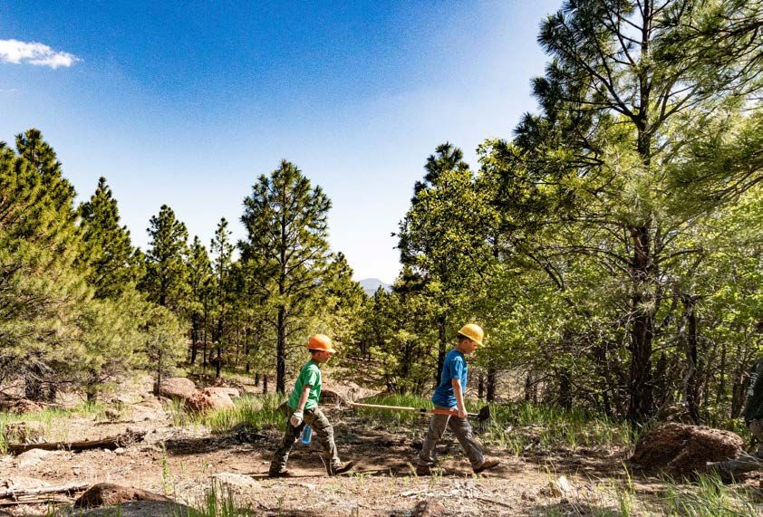
NAVIGATING THE TRAIL STRATEGY
Head to flagstafftrailsinitaitive.org for more information, including the Flagstaff Interactive Trail
Map. This easy-to-naviagate map includes all the trails in the region, recommended projects
included in our plan, and a summary of public ideas received throughout the planning process.

Updates from the November 2019 Draft
 The final Flagstaff Regional Trail Strategy includes several improvements since the November
 2019 draft. The draft version was made available for 65 days, garnering nearly 550 comments
 from 80 unique commenters. During this time it was also presented to a variety of elected officials
 and citizen commissions. The input we received led to the following revisions:

 •   Added the Schultz Creek Trailhead (known as the “Schultz Y”) project as an important near
     term FTI collaborative priority
 •   Added a new Trail Ambassadors program to provide on-trail education
 •   Added new strategies that recognize the link between trails and public transportation, law
     enforcement and wildlife fire
 •   Provided additional information about the process for consideration of unauthorized trails
 •   Provided additional guidelines for sustainable trail design, construction and maintenance
 •   Dropped low priority trail construction projects #89 and #90 near Walnut Canyon, reducing the
     total proposed trail miles by 15%
 •   Dropped project #214, a trail re-route near Fisher Point
 •   Incorporated a variety of formatting suggestions
 •   Included letters of support from all FTI Core Team organizational members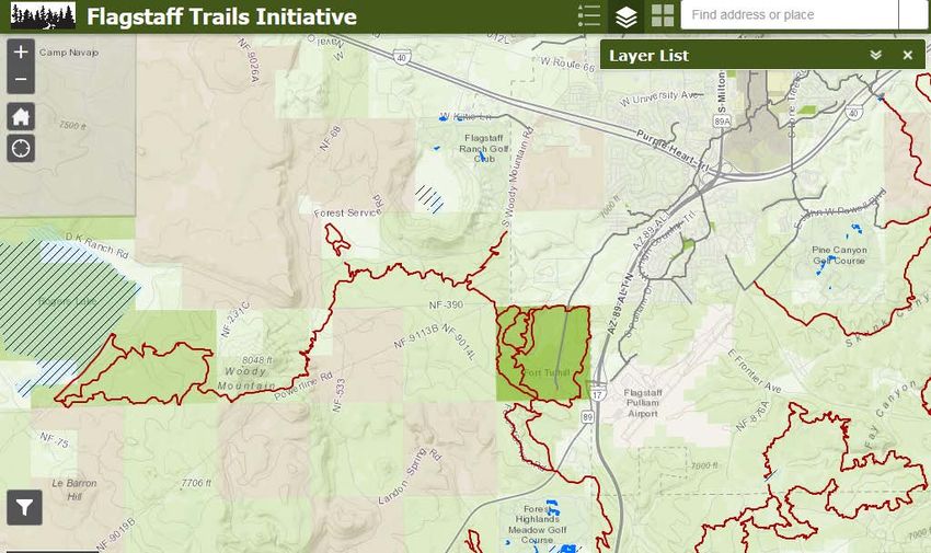
WHAT IS THE FLAGSTAFF TRAILS INITIATIVE?
The Flagstaff Trails Initiative (FTI) is a community building project that’s
looking to take Flagstaff’s trails from good to extraordinary. The diverse
organizations that make up the FTI team have come together as partners to
lay out a shared vision for the region’s recreational trails.

Our Purpose
Develop and implement a collaborative, cross-jurisdictional Flagstaff
Regional Trail Strategy. The strategy will improve the quality, connectivity
and community support for a sustainable trail system that balances the
demand for recreation with the community’s vision for conservation,
development, and health.

                      “The word I think of is
                      adaptive...the strategy should
                      be a living document that
                      changes to reflect what the
                      community wants” - FTI Core Team
                      Member

Á     back to the table of contents                                            5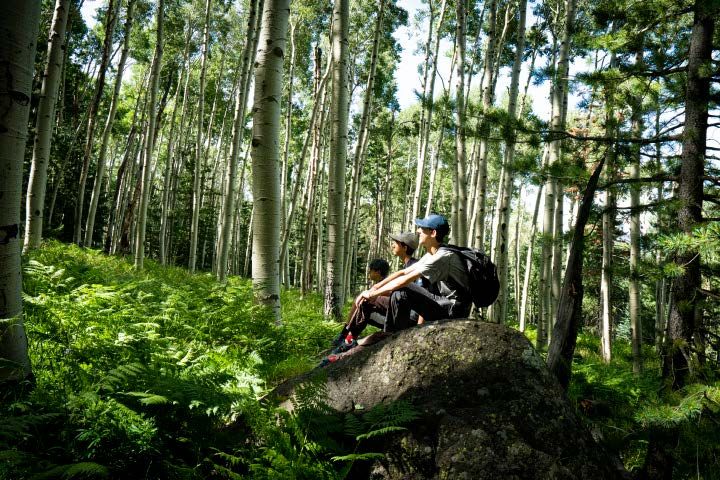
Scope
The Strategy contains proposals for the trails in and around Flagstaff, Arizona. Our study area
includes the area of Coconino County inside the Flagstaff Metropolitan Planning Organization
boundary, which extends from Bellemont to the west, Winona to the east, Sunset Crater Volcano
National Monument to the north and Mountainaire to the south. It includes trails managed by the
City of Flagstaff, Coconino National Forest, National Park Service and Coconino County Parks and
Recreation.
                                                                                                                                                       FMPO boundary
                                                                                                                        Sunset Crater
                                                                                                                       Nat'l Monument
                                                                                                         89

                                                             sco Peaks
                                                      Franci
                                                  San
                                                                                                              Fernwood
                                                                                                              Timberline
                        180

                              Fort Valley                                                                                  Doney Park

       Bellemont

                                                                                 Flagstaff City Limits

                   40                                                                                                                   Cosnino
                                                                                                                                                        Winona
                                                                                                                                                  40

     Camp
     Navajo
                                                        F L A G S T A F F
                                                                                                                      Walnut Canyon
                                                                                                                      Nat'l Monument

                                                         Flagstaff City Limits

                                                  17                                                                                                Flagstaff
                                        Kachina                                                                                                   Metropolitan
                                        Village                                                                                                     Planning
                                                          Mountainaire                                                                            Organization
FMPO boundary

Á          back to the table of contents                                                                                                           6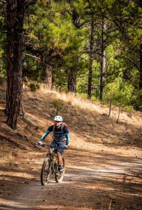
Partners

Flagstaff Trails
Initiative
Core Team

         Agencies
         and Trail
         Providers

         Trail
       Users and
       Advocates
                                      R2R
                                     Hiking
         Conservation                 Club
          Advocates

                     Service
                      Orgs

                                                                                   Working Group
                                                                                   Partners - the
                                              ...and many more                     Flagstaff trail
                                                                                   community

 Anyone and everyone who cares about trails in Flagstaff can be part of FTI.

 The FTI core team includes a diverse mix of public and nonprofit organizations: City of Flagstaff,
 Coconino National Forest, Coconino County, Flagstaff Biking Organization, Coconino Trail Riders,
 R2R Hiking Club, American Conservation Experience, National Park Service Flagstaff Area National
 Monuments, and Sierra Club. The project was launched in fall 2017 after securing technical
 assistance from the National Park Service Rivers, Trails and Conservation Assistance program.

 Á       back to the table of contents                                                    7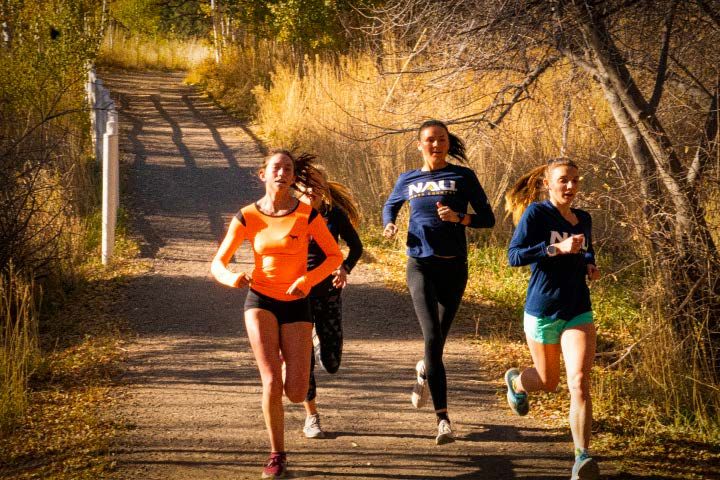
STRATEGY HIGHLIGHTS

Photo Courtesy of WH Waters

                              8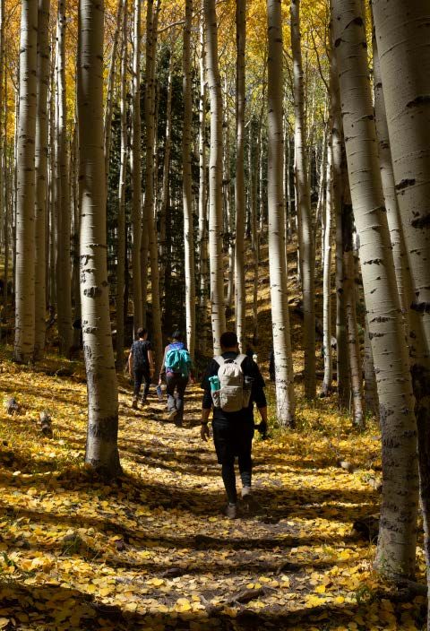
Overall Goal
     Elevate Flagstaff’s trail
      system from good to
         extraordinary
9 Use the Flagstaff Regional Trail Strategy to consolidate
 trail plans, proposals and concepts into a single
 regional document and conceptual map
9 Prioritize a set of shared actions and investments for
 the next 5 years
9 Take a collaborative and integrative approach to trail
 development - “Plan+Build=Balance”

Á   back to the table of contents                   9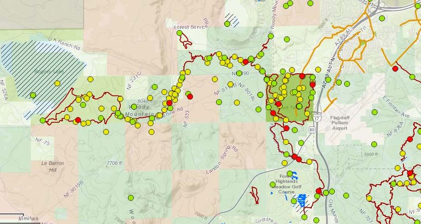
Our Ten Goals
Trail Planning
A Improve trail quality and sustainability
     Address the current and future demand for non-motorized and
B    motorized trail activities
     Improve connectivity between Flagstaff and the Flagstaff Urban Trails
C    System (FUTS), regional open space and outlying Coconino County
     communities

Conservation and Restoration
     Balance trail development and management with community
D    conservation and natural resource goals with an emphasis on
     restoration
     Ensure historic and prehistoric sites, including known American Indian
E    sacred places and traditional cultural properties, are preserved and
     protected for their cultural importance

Education and Outreach
 F Create a safe and fun experience for all trail users
G Educate, inform and involve the community in trail stewardship
H Use trails to build the next generation of youth stewards
Financial Sustainability
 I Improve the financial sustainability of trail management
     Integrate trail planning and management with tourism and economic
 J   goals

                                                                    10
what comes first
Our Near-Term Priorities
9 Complete the trail projects and plans currently in the works
9 Use the new Flagstaff Trail Fund and 501c3 organization to raise funding
and resources
9 Focus on elevating trail quality by launching three projects that realign
unsustainable trail segments: Humphrey’s Trail; Arizona National Scenic
Trail on Anderson Mesa, and Rocky Moto Trail
9 Put the pieces together to build a new Schultz Creek Trailhead
9 Launch a trail etiquette, “share the trails” and Leave No Trace education
campaign that is delivered online, on-site and through face to face
contact with a new Trail Ambassadors program
9 Establish a volunteer restoration program and hold several events in
2020 to rehabilitate closed and unauthorized trails, clean up graffiti, and
remove trash, litter and old fencing
9 Launch formal planning processes for the top two areas in need:
Mount Elden/Dry Lake Hills and Observatory Mesa
All projects contained in the Regional Trail Strategy are subject
to available resources including staff, volunteers and funding.
Á back to the table of contents 11HISTORY, BACKGROUND &
CONTEXT
Photo Courtesy of WH Waters
12Planning Foundation
The Flagstaff Regional Trail Strategy is built directly on a foundation of approved, formal plans
such as the Flagstaff Regional Plan 2030, Flagstaff Climate Action and Adaptation Plan, Coconino
County Comprehensive Plan and Land and Resource Managmeent Plan for the Coconino
National Forest.
Flagstaff Regional
Trail Strategy
Final - April 2020
Outlines concrete steps and projects
to implement these broad visions.
Planning Foundation
Á back to the table of contents 13Why Trails?
Trails help make Flagstaff a better place all ages incorporate exercise into their daily
to live and visit. Every regional plan for routines. The benefits are measurable: over 100
the Flagstaff area including the Flagstaff studies have found a link between improved
Regional Plan 2030 and the Coconino mental health and time spent outside, often
National Forest Management Plan highlights decreasing symptoms of depression and anxiety.
trails as an asset that should be enhanced. Communities that encourage residents to use
Despite their value, there hasn’t been a trails and engage in physical activity often report
holistic effort specific to trails for over 20 substantial health benefits.
years.
Connection with Nature. Trails allow
young and old to indulge in the discovery
of the beauty of nature. They allow us to Want to learn more?
traverse landscapes free from development Headwaters Institute maintains
and experience adventure, exploration or
relaxation. Out-the-back door access from an excellent reference library of
Flagstaff and outlying communities to the studies on the positive impacts of
forest is prized among residents and visitors trails on businesses, public health,
alike. Four out of five respondents to a fall
2018 FTI survey said they value the feeling
and quality of life.
of solitude and peace trails offer. Trails can
serve as more than a way to spend a few
hours in the woods; they inspire a lifelong
connection to nature and a forum for
meaningful education. We believe these
connections are stronger and more likely
when “every doorstep is a trailhead”.
Physical and Mental Health. Trails improve
our quality of life and personal wellness.
A whopping 92% of survey respondents
cited exercise as a reason to value to
trails. Trails provide healthy recreation
Photo Courtesy of WH Waters
and transportation opportunities by
providing people of all ages with attractive,
safe, accessible and environmentally
sustainable places to cycle, walk, hike,
run, or ride a horse. They help people of
Á back to the table of contents 14Why Trails?
A Strong Economy. The economic effects of trails and urban pathways such as the FUTS are
obvious at a business that depends directly on recreation. The effects can be more subtle, like
when an employer moves to a community because of amenities like trails. An inviting trail network
has helped countless communities across America undergo an economic revitalization. Tourists
are increasingly coming to Flagstaff and Northern Arizona to experience nature and spend time
outside. According to a recent NAU/Discover Flagstaff study, over 40% of visitors identified trails
and recreating on the national forest as an important reason for their visit. Studies have also shown
that neighborhoods that are physically connected by urban pathways see increased rates of use for
commuting and transportation, reducing traffic and the strain on the road system.
Conserving Open Space and Wild Places. Trail users know landscapes need to be protected to
safeguard the experience and preserve natural resource character. Urban systems like FUTS help
preserve linear open space and create needed links between fragmented habitats. More people on
trails with an associated decrease in cars on roads leads to the improvement of air and water quality.
Trails help protect plant and animal species and
can also help wetland preservation by keeping Check out our FTI survey report to
people out of sensitive areas. In addition, they
can allow humans to experience nature with
see what hundreds of users said
minimal environmental impact. they value about trails.
Photo Courtesy of Northern Arizona Trail Runners Association
Á back to the table of contents 15“One of the reasons I moved back to
Flagstaff was because of the ability
to interact almost immediately with
nature. I can leave my house on foot
and within ten minutes be on a trail
and then out in nature for hours.” - FTI
Trail Survey Respondent
“It needs to be recognized that
Flagstaff is a destination for millions
of people from across the state and
out of it.” - FTI Trail Survey Respondent
Á back to the table of contents 16The Current System
Trail Miles by Provider
Arizona Game and Fish Department 1.3
National Park Service 5.2
City of Flagstaff - Open Space 7.9
Private 23.5
Coconino County 24.6
City of Flagstaff - FUTS 57.5
Coconino National Forest 292.9
0 50 100 150 200 250 300 350
Total System Trails: 413 Miles
A Diversity of Trail Types
Photos Courtesy of WH Waters
Wider, surfaced trails that link Narrower singletrack Trails in desginated
destinations via the Flagstaff available for multiple uses Wilderness available only for
Urban Trail System (FUTS) non-mechanized use
Á back to the table of contents 17Unauthorized Trails
What is an “unauthorized trail”?
Unauthorized trails are purposefully or Legality
incidentally created by users without the The purposeful construction of trails without
approval of the land manager or owner. They prior authorization is prohibited on all land
can be the result of purposeful construction ownerships in the Flagstaff area including
or through incidental regular use that creates city, county and federal lands. However, it is
a visible travel route for others to follow. Also generally true for non-motorized users that
referred to as “user-created”, “wildcat”, “non- subsequent use of an unauthorized trail by non-
system” or “social” trails. motorized users is not prohibited unless there
is a site-specific regulation or closure. Similarly,
Unlike system trails, unauthorized trails do off-trail incidental and repeated use that creates
not receive regular, formal maintenance a visible travel route, but that does not involve
from the land manager and are not listed purposeful construction, is not prohibited.
on formal trail maps because they are not Many appropriate and desirable recreation
part of the authorized trail system. However, activities such as nature study, fishing or hunting
unauthorized trails are often included in user- necessitate off-trail travel that may create
generated or third party maps, leading to unauthorized trails. For motorized use, users are
confusion among users about the acceptability required to stay on designated routes and use of
of their use. an unauthorized trail could constitute a violation.
The presence of an unauthorized trail often Estimated unauthorized trail mileage in the FTI
reflects a past or present demand for recreation planning area is approximate based on multiple
use or access. An unauthorized trail or system data sources including the tracking app Strava
of trails often serves a recreational function and several inventories that are several years old.
that authorized trails do not. This estimate has not been fully field checked.
Potential Effects of Unauthorized Trails Unauthorized Trail Type Miles
A variety of resource impacts have been tied
to use or presence of recreational trails of
Major trails/high levels of 93
any kind. These include vegetation loss, soil use
erosion/loss, wildlife disturbance, water quality Minor trails/lower levels 241
impacts and the spread of invasive species. of use
Unauthorized trails do not receive the same
level of design and analysis as authorized trails, Total 334
which make these unintended impacts more
likely.
Á back to the table of contents 18The Current System (contd)
Options for Addressing Unauthorized Trails
No action
Adoption in place
Adoption with modifications or re-routes
Closure and naturalization
Considerations and Decision Process for These factors should be studied and analyzed
Unauthorized Trails holistically based on the best available
information. Often, planning about unauthorized
There is no standard formula or set of criteria trails is better undertaken on the trail system
for making decisions about unauthorized scale, rather than trail-by-trail basis.
trails. Trail managers or planning process
participants should carefully weigh a variety of
factors before making the value-laden decision
about unauthorized trails.
• Does the location or condition of the trail
pose a public safety hazard?
• What are the management objectives and
resource conditions of the area where the
trail is located?
• What natural resource impacts are
occurring or likely to occur?
• What cultural resource impacts are
occurring or likely to occur?
• What is the quality of the recreational
experience offered by the trail?
• Does the trail duplicate other available
options, either geographically or terms of
user experience?
• Does the presence of the unauthorized Users often don’t know whether the trail they are
trail(s) negatively impact the experience of using is an official authorized trail or not.
other users?
Á back to the table of contents 19Brief History of Flagstaff Trails
The trail system that surrounds Flagstaff was trailers. The approval of the Fort Valley system in
born for reasons much different than outdoor 2000 and the Kelly Trail system in 2012 marked
recreation. Trails were blazed by generations major steps in providing close-to-home access
of people connecting places of significance for motorized users.
or utility. Later, after the establishment of
what is now the Coconino National Forest, The Flagstaff Area Open Spaces and Greenways
they become critical transportation links for Plan, finalized in 1998, captured a recognition
forest management. Much of the trail system of the intertwined nature of open space
on forest lands is made up of pack and saddle conservation, trails and public access. Successes
routes or closed roads, many of which simply like the acquisition of Picture Canyon and
represented the shortest route between two subsequent trail development endure as a
points, rather than a system of sustainably legacy of this effort.
designed and constructed trails.
The Flagstaff Loop Trail represents another
The Flagstaff Urban Trails System (or FUTS) ambitious vision that became a reality. Nearly
is a point of pride that grew from modest complete at 44 miles, the trail is the “outer wheel”
beginnings. A report prepared by a group of that circumnavigates Flagstaff by using city,
forward-looking citizens in 1988 saw the “… county and forest trails. Connecting trails acting
great potential to enhance the recreational as spokes entering the city and extending to the
opportunities and alternative transportation forest beyond.
options for Flagstaff citizens and visitors.” They
proposed a 3.2 mile system of trails on city More recent projects like the formal designation
land. Their vision has expanded into a nearly of the Arizona National Scenic Trail, development
60- mile system of trails that connect everyday of trails and a bike park at Fort Tuthill and new
destinations like neighborhoods, shopping, trail construction at Sunset Crater National
jobs, schools and parks. A long-term vision for Monument represent yet more chapters in the
FUTS envisions a 130 mile network that will history of trails in the area. These projects help
ultimately comprise a pleasant melding of meet the demand for increasing specialization
recreation and transportation. in trail use, from long distance backpacking to
riding on full suspension mountain bikes, all
The trail system on the National Forest seen while immersing visitors in the unique landscape
a number of important events, including of Northern Arizona.
the designation of the San Francisco Peaks
Wilderness in 1984. The nonmotorized Mount
Elden-Dry Lake Hills system was dedicated
soon after in 1987. Little Elden Spring Horse
Camp, created in 2009 with 15 campsites, now
allows easy access for vehicles pulling horse
Á back to the table of contents 20Trail Use
Understanding how people use recreational
trails helps provide one piece of the puzzle for
decision making - what types of trail activities
do residents and visitors enjoy in Coconino
County? How many people participate and
how frequently do they do so?
This information – when combined with
strong community engagement and common
sense - allows providers and users to make
more informed decisions about community
needs and equitable access in times of scarce
resources.
FTI took two primary steps to better
understand trail use in the area: preparation of
a white paper, Recreation Trail Use in Flagstaff
(March 2018) that reviewed existing regional
surveys and the implementation of a trail
survey specific to FTI that drew approximately
550 responses (October-December 2018).
Photo Courtesy of WH Waters
Our Key Findings:
• Flagstaff is a community of dedicated motorized activities.
trail users. Nearly two thirds of survey
respondents use trails more than twice per • Different trail users - from backpackers to dirt
week. bike riders - place value on different aspects
of the trail experience.
• Over 58% of Coconino County residents
report hiking, backpacking, mountain • Over 40% of respondents to a 2018 Flagstaff
biking, and horseback riding at least once Visitor Survey reported that hiking, biking
each year. Hiking is the most popular trail and recreating on national forest lands was a
activity, accounting for more than half of all reason for their visit to Flagstaff.
trips. • Over 40% of County residents do not utilize
• Over 20% of County residents participate in recreational trails.
motorized trail activities, including driving • The five most commonly used trails
a 4x4 vehicle, side-by-side, dirt bike or according to users are the Arizona National
quad/ATV each year. The vast majority of Scenic Trail, Schultz Creek Trail, Sunset Trail,
motorized users also participate in non- Flagstaff Loop Trail and the Nate Avery Trail.
Á back to the table of contents 21Trends and Challenges
FTI partners undertook an extensive effort to better understand the current
situation and its driving factors. Using a mix of trail surveys, partnership
meetings and public open houses, the team identified some key trends and
challenges for the strategy to address.
Recreation & Trail Trends Challenges for the Trail Community
• Increasing popularity of trail events like > Ensuring equitable use of and access
races and organized walks to the trails by geographic area and
• Growing diversity and specialization in socioeconomic status
trail uses and technology are leading > Ensuring a diversity of trail experiences is
to a desire for new trails intended for available - options for the mobility impaired
certain uses, such as technical mountain were rated the least adequate in the FTI trail
biking survey
• Flagstaff has grown into a trail running > Tackling the trail maintenance backlog
“mecca” > Resolving conflicts and misunderstandings
• Conflict between users can be acute between user groups
in certain locations, but conflict and > Limiting displacement of regular users by
crowding weren’t rated as major trail events
barriers to trail use
> Ensuring accurate trail information is
• Upsurge in social media and online available
information related to trails and
> Providing adequate infrastructure like signs,
recreation
trailheads and restrooms
• New organizations like Latino Outdoors
> Protecting user safety
have formed to expand participation
and promote inclusion
• Capacity to manage recreation
is declining at the federal level,
encouraging a move towards more
partnership-based efforts like the
National Strategy for a Sustainable Trail
System
Á back to the table of contents 22Trends and Challenges (contd)
Environmental Trends Challenges for the Trail Community
• Climate change and its associated effects > Understanding and addressing the
on temperature, precipitation, soils and proliferation of unauthorized trails (nearly
vegetation equal to the total authorized trail miles)
• Concern over wildlife impacts including and associated impacts
habitat fragmentation and displacement > Wildfire leading to limited forest access
due to development, recreation and other and ongoing loss of trails
forest activities > Keeping a minimum impact and Leave No
• Increase in forest wildfire activity Trace ethos alive
• Rising investment in forest treatment and > Effectively coordinating with thinning and
restoration forest management projects
• Pressures on threatened, endangered and > Stopping the impacts of trail widening
rare species and rutting
Community and Economic Challenges for the Trail Community
Trends
• Growth and urbanization of Flagstaff along
> Overcoming jurisdictional challenges
with development in outlying communities
between city, county and federal lands
like Bellemont
> Finding reliable funding for maintenance,
• Increase in visitors, especially international,
construction, and education
many of whom are less centralized due to a
rise in alternative lodging like AirBnb > Recruiting sufficient volunteers, especially
among students and new arrivals
• Increasing racial and ethnic diversity
> Ensuring active community engagement
• Growth in enrollment and the physical
and dialogue
footprint of Northern Arizona University
> Responding to uncertainty surrounding
• Influx of new residents motivated by
the future of State Trust lands
lifestyle factors like recreation
• Increasing competition for limited public
funds from sources like the Bed, Board and
Beverage tax
Á back to the table of contents 23Ideas from the Trail Community
We asked the community: where do you seen opportunity for improvement in the Flagstaff area?
The map below indicates the density of opportunties identified by trail survey and public
meeting participants in 2018. These findings were used to help inform the recommendations
contained in this plan.
Sunset Crater NM
89
Fernwood
Timberline
180
Fort Valley
Doney Park
Bellemont Picture
Canyon
40 Buffalo
Park Cosnino
Observatory
Mesa
40
FL A G ST AF F Winona
NAU
Walnut Canyon NM
Opportunities
Rogers Lake Ft Tuthill
Low density
Kachina
Village High density
Mountainaire
17
3
Miles
Á back to the table of contents 24FLAGSTAFF REGIONAL
TRAIL PLAN
Photo Courtesy of WH Waters
25“The Kelly system has been a great start to
answer motorized needs. The only two options
for dirt biking in the area for single track is part
of the Fort Valley system and the Kelly system.
Fort Valley is packed on the weekends and is
not safe for motorized use. That leaves dirt
bikers the option for Kelly or illegal social trails
on the weekend.” - FTI Trail Survey Respondent
“The primary objective should be to distribute
use throughout the forest. Areas south of I-40
are underutilized, in part because of access, but
also because they lack technically challenging
trails.” - FTI Trail Survey Respondent
“...locals and regular users seeking a more
peaceful experience will turn elsewhere...the
key to success here is diversity.” - FTI Trail Survey
Respondent
Á back to the table of contents 26Trail Planning Goals and Strategies
Below are a series of
trail development and
management goals meant
to provide a well-balanced,
high quality trail system that
offers opportunities for short
meanders or long treks, trails
that connect important sites
and multi-use corridors to
accommodate diverse ways
of moving through nature so
that all can connect to the
great outdoors.
Improve trail quality and sustainability
A Strategies
• Ensure that modern, sustainable trail planning and building techniques are applied
to all trail projects to reduce future maintenance needs
• Prioritize maintenance and realignment efforts based on known backlogs or up-to-
date inventories, increasing the percentage of trails in the system identified as in
good condition
• Re-route, decommission, restore or replace unsustainable trails
Head to the FTI Interactive Trail
Photos Courtesy of WH Waters
Map for an inventory of current
maintenance needs
Á back to the table of contents 27Trail Planning Goals and Strategies (contd)
Address the current and future demand for non-motorized
and motorized trail activities
B
A Strategies
• Develop an inclusive, user friendly trail system that provides valued experiences for
multiple uses and varying skill levels
• Address unauthorized trails through closure and restoration, replacement or
adoption
• Identify the areas or trail systems most in need of comprehensive site-specific
planning
• Minimize the potential for ongoing unauthorized trail creation through targeted
trail development and improvements to trail quality
• Provide a range of trail experiences through trail modification or development and
address gaps in the current system: mobility-impaired/accessible; hiker intended,
multi-use trails that provide opportunities for solitude; technical and flow mountain
biking trails and motorized singletrack
• Consider adaptive management strategies - such as dispersal and segregation of
uses, alternating days for various users, non-exclusive “preferred use” designations
and trail directionality - where appropriate to minimize conflict and address
overcrowding while keeping the vast majority of trails multi-use
Improve connectivity between Flagstaff and the Flagstaff
C
A Urban Trails System (FUTS), regional open space and
outlying Coconino County communities
Strategies
• Complete the Flagstaff Loop Trail
• Connect the regional trail system by working on the connections listed in the
recommendations below
• Implement needed enhancements to existing trailheads, staging areas and
less formal public access points around the perimeter of Flagstaff and other
communities, listed below
• Prevent loss of public access by pursuing legal access to important, legally
unsecured trail access points as development occurs or opportunities arise
• Advocate for public transportation connections to trail access points
Á back to the table of contents 28What’s in the Works Right Now (as of Spring 2020)
The following projects are being led by FTI organizations:
Name Status Scope Trail Provider
Heart Trail and Little Planning and 7.5 miles realigned, 3 miles Coconino
Elden Re-route environmental compliance decommissioned National
completed 2018. Re- Forest
route underway. Expected
completion mid 2020.
Fort Tuthill Bike Park Completed Fall 2019 7 acre park with pump Coconino
tracks and skill development County
areas
Mount Elden-Dry Scoping completed 2013; Mt. Elden-Dry Lake Hills Coconino
Lake Hills Planning to re-initiate 2020. (MEDL) area National
Forest
Kelly Trail System Approved and construction 95 miles of motorized Coconino
Completion progressing through singletrack planned National
Coconino Trail Riders/USFS Forest
partnership
FUTS Master Plan/ Expected completion early Total of 130 miles City of
Active Transportation 2020 Flagstaff
Plan
Related Trail Projects
Arizona Snowbowl operates under a Special Use Permit with the Coconino National Forest. The
resort announced in 2019 it would propose a variety of infrastructure enhancements that promote
year round use including new trails for mountain biking. Since the project is not being undertaken
by an FTI core team member, the collaborative does not take a position for or against the proposed
developments. However, Snowbowl was identified by some FTI meeting and survey participants as
a place to meet demand for advanced mountain biking. The proposals will be evaluated by the US
Forest Service through the Master Development Plan process.
The Sun Corridor Trail is new statewide nonmotorized trail proposed by a variety of local
government agencies. The trail seeks to connect the US/Mexico border to Las Vegas through
Flagstaff and the FTI planning area. A specific alignment has not been identified. Coconino County
Parks and Recreation is the primary point of contact for the region.
Á back to the table of contents 29Regional Trail Recommendations
Flagstaff’s Trail System in 2020 and beyond
The full list of recommendations can help elevate the region’s trail system.
A handful of the recommendations did not receive
be seen on the FTI Interactive Trail consensus from the teams who participated,
Map. Use the filter feature to sort primarily in the Observatory Mesa and Fort Valley
based on project type and priority areas. These projects are indicated as such below
level. and received reduced scores as a result.
How do these recommendations fit in formal How this list was developed?
agency planning and compliance?
The recommendations in the following tables and
The list below serves as a guide for future trail displayed on the interactive trail map were crafted
development and planning across jurisdictions. by a voluntary subcommittee of “citizen planners”,
Each project requires additional planning, volunteers and agency staff. Head to the “How
environmental analysis and on-the-ground We Produced This” for a full description of the FTI
design to ensure the projects are appropriate planning process, the hundreds of trail users who
given the area’s cultural and natural resources weighed in the research that went into crafting
and recreational uses. Inclusion on this list ideas.
does not imply formal approval for any of
the individual projects. Instead, the list of Each of the recommendations was weighted
recommendations represents the view of FTI using a set of criteria that reflect FTI’s overall
partners on where the region should move next purpose and goals. Head here for a full
as a trail community. explanation of the trail scoring criteria.
Criteria Weight
It’s important to note that this does not include
projects within the FUTS or the Mount Elden
Network and Connectivity 12
Dry Lake Hills area. Each of these areas have Environmental Sensitivity and
Beneficial Resource Effects 10
their own, site-specific formal planning process
underway. Both are expected to be completed Level of Public Support 8
in 2020. As these and other future plans are
Demonstrated Demand or Expected
completed, projects identified within them may
Popularity 8
be compared with established priorities as part
of an annual, collaborative review process. Unique or Destination Trail
Experience 6
While the list is prioritized, it doesn’t preclude Cost and Complexity 6
lower priority projects from occurring if the
right opportunity presents itself. Based on what POSSIBLE SCORE 50
we know now, they all have value and would
Á back to the table of contents 30134 215
Sunset Crater NM
74
210 89
136
137 95
147
100 139
140 143
142 Fernwood
Timberline
61
180
64
141
120
144
6
212
211 213
8 62
28 4
5
101 29 7 904
Fort Valley 3
132 9 902 Doney Park
27
47 114 205
206
Bellemont Picture
52 Canyon
40 51
Buffalo
53 Park Cosnino
49
126
Observatory 50
Mesa
901 39 40
FL A G STA F F 43 Winona
208
111
NAU
113
15 112
20 207 Walnut Canyon NM
88
Rogers Lake
16
Ft Tuthill
110 84 80 92
130 83
903 18
13 86 85
70
121
67
905
204
Kachina
Village
131
94
Mountainaire
217 17
216
19 69
Trail projects - priority
In progress
Trail development First projects
and connectivity High priority
3
Medium priority
recommendations Low priority Miles
Proposed trails 31
April 2020
Existing trailsTrail Development and Connectivity Recommendations
This category includes 74 recommendations for new trails, realignments, connections
between existing trails and adoption or restoration of unauthorized trails
Notes: 1) Projects that did not receive consensus from the planning team for that area are indicated by an
asterisk*. 2) Estimated trail miles per priority level are entirely conceptual. If projects move forward additional
on-the-ground design and evaluation are needed.
Priority ID# Trail Recommendation Description
16 Construct a new stacked loop system of directional, mountain bike-preferred trails west of Fort Tuthill to
meet regional need and bolster the site as an event venue
18 Construct a new accessible trail in Fort Tuthill County Park to address a regional shortcoming
49 Construct a new stacked loop system on Observatory Mesa accessible from downtown Flagstaff and Thorpe
Park to help address local demand and unauthorized trails
13 Construct a new shared use trail connection from Fort Tuthill/Soldiers Trail to Rogers Lake to create longer
loop opportunities
15 Connect Woody Mountain Road/Forest Road 532 trailhead and south end of planned FUTS as part of Loop
Trail
27 Connect Fort Valley and Observatory Mesa to help link two popular areas
HIGH
83 Connect Loop Trail and Fay Canyon trail to provide loop opportunties and enhance usability of in area south
of town
130 Connect the Loop Trail and existing, de facto trailhead on Lake Mary Road recommended for development
136 Connect Inner Basin, Lockett Meadow, and Waterline Road to help enable an “around the peaks” loop
opportunity as well as improve access to Lockett Meadow
9 Evaluate unauthorized trails in upper Fort Valley for closure and restoration to reduce impacts
94 Realign the Arizona Trail from the top of Anderson Mesa to just below the rim to improve sustainability
147 Realign Humphreys Trail where grades and conditions are unsustainable to reduce erosion and
accommodate visitor use
211 Realign Rocky Moto Trail off of pipeline between Moto and Secret Trails to improve sustainability
7 Adopt Dogfood Engineer as a shared use nonmotorized system trail to help disperse use in the Schultz/Fort
Valley
Á back to the table of contents 32Trail Development and Connectivity Recommendations (pg 2 of 4)
Priority ID# Trail Recommendation Description
43 Adopt a short segment of unauthorized trail between Sinagua and Walnut Meadows Loop to improve the overall
Campbell Mesa network
50 Encourage Lowell Observatory to consider adoption of unauthorized trails on their property as part of Observatory
Mesa system improvement
88 Adopt Skunk Canyon as a system trail to provide loop opportunties and enhance usability in area south of town
132 Adopt Easter Island as a directional, mountain-bike preferred system trail to provide technical mountain biking
HIGH
opportunities and disperse use
217 Adopt Pumphouse Wash as a system trail and improve sustainability where needed
53 Evaluate unauthorized trails on Observatory Mesa for closure and restoration to reduce impacts and reduce
redundancy
92 Evaluate unauthorized trails in the Walnut Canyon area for closure and restoration to reduce impacts and
redundancy
Estimated Mileage of High Priority Trail Recommendations: 51 miles
Construct new shared use, stacked loops north and west of the Fort Valley Trailhead to easy to access beginner
3
opportunities
131 Construct new trail around Vail Lake primarily though adopting existing road
5 Connect Secret Trail and Fort Valley Trailead to allow more motorized loop opportunities*
MEDIUM
6 Connect Secret Trail and Friedlein Prarie Road to allow more motorized loop opportunities*
67 Connect Highland Trail and the Kelly Trail System with a nonmotorized trail under Interstate 17
74 Connect the Nordic Village and Bismark Lake Trail to link two high elevation systems
85 Connect Hitchin Post Trails with Sandys Canyon Trail to provide loops and enhance usability in area south of town
114 Connect Schultz Creek and Chimney Trail to help disperse use in the Schultz/Fort Valley system
139 Connect Aspen Corner directly to Humphreys Trail to allow for loops
8 Realign the Arizona Trail off of an unsustainable old road bed just west of Schultz Creek Trail
140 Connect Arizona Trail near Aspen Corner and Hart Prairie Road to allow for loops
142 Connect Kachina Trail with Weatherford Trail at Doyle Saddle to improve access and allow for loops
Á back to the table of contents 33Trail Development and Connectivity Recommendations (pg 3 of 4)
Priority ID# Trail Recommendation Description
Connect Arizona Trail and Loop Trail near Walnut Canyon to provide loops and enhance usability of easily access
207
southside area
62 Construct new loop trails east of Doney Park to provide close-to-home access
120 Construct and/or adopt connections from Timberline to Deer Hill Trail to provide close-to-home access
47 Connect Fort Valley to FUTS with a commuter route on Observatory Mesa that partially uses existing roads
204 Connect Mountainire Rd to planned FUTS extension with a commuter route that partially uses existing roads
MEDIUM
206 Connect Doney Park at Townsend-Winona Road to Picture Canyon with a planned FUTS extension
111 Realign Loop Trail north of Walnut Canyon away from old road onto national forest
112 Realign Loop Trail north of Fisher Point off of old roads to enhance user experience
Adopt existing unauthorized trails in and near Kelly Canyon as part of a new shared use system to manage existing
69
and expected demand
126 Adopt unauthorized trail from Campbell Mesa to planned Peaceful Valley FUTS trail to improve neighborhood access
208 Adopt unauthorized trails on eastern Campbell Mesa to expand and improve the system
212 Consider adoption of unauthorized trails such La Bamba to allow for loops and disperse use
143 Evaluate unuathorized trails west of Aspen Corner and the Arizona Trail for closure and restoration to reduce impacts
Estimated Mileage of Medium Priority Trail Recommendations: 84 miles
19 Consider trail construction parallel to the road to Casner Mountain to allow for motorized loops
51 Construct a new FUTS-standard multi use trail along the perimeter of Observatory Mesa*
89 Construct shared use loop trails south of Walnut Canyon to provide new, longer and more remote opportunities
90 Construct a new loop trail around Walnut Canyon to provice new, longer and more remote opportunities
100 Construct a new motorized trail around the perimeter of the Peaks, referred to as the Pines to Prairies project, to
LOW
expand destination motorized opportunities*
137 Construct loop trails in the wilderness near the Inner Basin Trailhead to create new loops and disperse use in the
popular area
4 Connect Fort Valley Trailhead and Rocky Moto Trail with a motorized connection and create new loops*
64 Formalize OHV access from Doney Park to the Cinder Hills
86 Connect Fay Canyon and the Kelly Trail System across Lake Mary Rd to link two existing systems
95 Connect Timberline and Cinder Hills to improve neighborhood access
Á back to the table of contents 34Trail Development and Connectivity Recommendations (pg 4 of 4)
Priority ID# Trail Recommendation Description
134 Connect the Arizona Trail with the Abineau/Bear Jaw Trailhead through the White Horse Hills
210 Connect Deer Hill Trail and Lockett Meadow to create an additional way to access Inner Basin
215 Connect Inner Basin Trailhead/Lockett Meadow with Bear Jaw/Abineau Trailhead to enanble an "Around the Peaks"
nonmotorized opportunity
61 Construct neighborhood loop trails east of Timberline and north of Doney park
84 Construct a neighborhood connection to the Loop near JW Powell Blvd
52 Connect Bellemont to Flagstaff with a commuter route that partially uses existing roads
205 Connect Timberline to North 89 FUTS trail
80 Realign the Loop Trail off of old roads near Walnut Canyon to improve user experience
113 Realign the Arizona Trail off of old roads near Walnut Canyon to improve user experience
LOW
28 Adopt Wing Mountain shooting pit as a hill climb challenge for motorized users
70 Adopt unauthorized trails south of airport to create new shared use nonmotorized system
101 Adopt Wing Mountain unauthorized trails to create a designated motorized system
141 Adopt and realign unauthorized connection from Friedlein Prairie Road to Kachina Trail to create new way to access
high elevation system
216 Adopt unauthorized trail in Howard Draw to recognize ongoing access to this popular climbing area
20 Close and restore unauthorized trail on rim of Dry Lake to reduce impacts and discourage further use
29 Evaluate unauthorized trails at Wing Mountain for closure and restoration to reduce impact
39 Evaluate unauthorized trails on Campbell Mesa for closure and restoration to reduce impacts
121 Evaluate unauthorized trails at Woody Ridge for closure and restoration to reduce impacts
144 Evaluate unauthorized trails in the area of Secret Trail for closure and restoration to reduce impacts
Estimated Mileage of Low Priority Trail Recommendations: 74 miles
Á back to the table of contents 35Trailheads and Trail Access
This category includes improvement of existing trailheads and construction of new ones.
Priority ID# Trailhead and Access Recommendation Description
30 Enhance and expand existing Campbell Mesa Trailhead on Old Walnut Canyon Rd and/or consider nearby
alternatives to help accommodate current and expected demand
HIGH
900 Construct a trailhead at the “Y” intersection of Schultz Pass Road and Elden Lookout Road to access the
popular Schultz Creek area trail system
129 Construct a new trailhead for the Loop Trail along Lake Mary Road immediately south of the water treatment
plant to accommodate current and expected demand
200 Encourage Lowell Observatory to consider trailhead construction to access improved Observatory Mesa trails
1 Enhance Fort Valley Trailhead with toilets and trash service
14 Enhance existing Woody Mountain Rd/Forest Road 532 trailhead with toilets and trash service
151 Enhance existing Humprheys Trailhead with toilets and trash service
MEDIUM
203 Enhance existing Picture Canyon Trailhead with additional parking
2 Construct new trailhead for Rocky Moto Trail along Snowbowl Rd
34 Construct new trailhead for Arizona Trail/Cambell Mesa along Monument Rd
46 Construct new trailhead at the City's Core Services Facilty to access the southside of Observatory Mesa and
Tunnel Springs Trail
79 Construct new trailhead for Fay Canyon Trail access along Lake Mary Rd to improve southside access
201 Construct new trailhead at the end of Babbit Dr to improve Fisher Point access
218 Construct new trailhead at Kelly Pocket along FR 237 to improve access if system is adopted
25 Construct a new trailhead at Wing Mountain to access proposed new trails
33 Enhance and enlarge existing Arizona Trail trailhead just north of Walnut Canyon National Monument
31 Construct a new trailhead along Old Walnut Canyon Road to improve access to Campbell Mesa system
LOW
65 Construct a new trailhead on the east side of Lake Mary Road east of the airport to improve access in
conjunction with a proposed new trail system (#70)
123 Construct a new trailhead north of Bellemont to improve access in this growing area
135 Construct a new trailhead along Schultz Creek Road at the north end of Deer Hill Trail to improve access
Á back to the table of contents 36Sunset Crater NM
89
135
151
Fernwood
Timberline
180
25
2
Fort Valley
Doney Park
123 1
900
Bellemont Picture
203 Canyon
40 Buffalo
Park Cosnino
Observatory 200
Mesa 30
34 40
FL A G STA F F Winona
46
201
NAU 31 33
14
Walnut Canyon NM
Rogers Lake Ft Tuthill
129 65
79
Kachina
Village
218 Mountainaire
17
Trailheads - priority
First projects
Trailheads and High priority
trail access Medium priority 3
recommendations Low priority Miles
Proposed trails
Existing trails
37
April 2020Signs and Wayfinding
These areas were identified as priority needs for signs and wayfinding improvements.
Area Signs and Wayfinding Recommendation
Doney Park Better wayfinding on Old Caves Crater Trail and the Dan Moody Trail through cinder sections
Fort Tuthill - Woody Mountain Improved trailheads and wayfinding at Fort Tuthill and connections with Soldiers Trail and FUTS
San Francisco Peaks More signs are needed for education on Wilderness Act and Leave No Trace
Fort Valley Improved signing for Fort Valley Trails - combination map and wayfinding signs
Kachina - Mountainaire Better wayfinding on Highland Trail through Kachina Wetlands
Observatory Mesa Improved wayfinding and additional interpretive signs
Walnut Canyon Information kiosks with maps and trail signs at junctions
Hochderfer Hills Better wayfinding for trails outside of Nordic Village
Future Planning Needs
These areas were identified as trail systems most in need of site-specific and formal planning.
Area Managing Agency Rationale
Observatory Mesa City of Flagstaff Open Space Proximity to city center; high density of unauthorized trails
Fort Valley Coconino National Forest Potential to meet regional demand and disperse use from high
sensitivity areas; high density of unauthorized trails
San Francisco Peaks Coconino National Forest Regional and statewide importance; high natural and cultural
resources values
Á back to the table of contents 38Sustainable Trail Design and Construction Trail design and construction best practices Many older and historic trail alignments were built without utilizing best practices like proper run- to-rise, grade reversals and tread hardening. Some older alignments are along old road beds that were never intended for recreational trail use and therefore lack the utilization of these design elements and often fail to provide the best user experience. Management policy limits the placement of realignments without the appropriate analysis. In order to make old trail alignments meet the above-mentioned criteria, tread will often need to be substantially adjusted outside currently approved corridors. The lack of best-practice design elements contributes to erosion, a large maintenance backlog and lack of user satisfaction with these trails. Better focus on the guidelines and practices available through the below resources will ensure success with the fundamental goal to elevate Flagstaff ’s trail system from good to extraordinary. US Forest Service Trail Construction and Maintenance Notebook US Forest Service Standard Trail Plans and Specifications US Forest Service National Trails Strategy Bureau of Land Management Guidelines for a Quality Trail Experience National Off-Highway Vehicle Coordination Council Great Trails Guidebook Equestrian Design Guidebook for Trails, Trailheads and Campgrounds International Mountain Bicycling Association’s Trail Solutions Guide to Building Sweet Singletrack Planning Trails With Wildlife in Mind American Trails Resources When designing new trails: • Use current standards and best practices as defined by the U.S. Forest Service, Bureau of Land Management, NOHVCC, IMBA, American Trails and other trail experts to best align new trails on the landscape. • Enlist the best available local experts to flag corridors for analysis, and pin flag alignments for construction. • Use capable leadership in both volunteer and professional trail building projects to ensure the best practices are employed during new construction. Train trail builders to become future crew leaders. • Adjust recently built trails after a couple of seasons as necessary to address erosion issues before they become substantial Á back to the table of contents 39
Sustainable Trail Design and Construction (contd)

Photo Courtesy of WH Waters

When maintaining and realigning existing trails:

•   Consider in-corridor realignments wherever possible rather than less effective tread/drainage
    repair strategies.
•   Create a process to catalog needs for out-of-corridor realignment analysis and approval to
    create a more sustainable, lower-maintenance trail system. Fast-track this approval process
    with Categorical Exclusions wherever possible.
•   Grow a volunteer workforce that is enabled to do standard maintenance work on an at-will
    basis in order to reduce the substantial maintenance backlog.
•   Use current standards and best practices as defined by the US Forest Service, Bureau of Land
    Management, NOHVCC, IMBA and other trail experts to best maintain and realign existing
    problem areas in the trail system.

Á       back to the table of contents                                                    40
Benefits of the Trail Plan
Projects recommended in the trail plan benefit…..
…All trail users by moving towards a more especially on the relatively underutilized
cohesive and connected system that enhances southside, and developing trails to meet the
access from neighborhoods to the forest. It substantial demand for mountain bike-specific
will help consolidate a sometimes confusing experiences while limiting impacts to other
system by adopting certain unauthorized users. It reinforces the role of Fort Tuthill as a
trails and restoring others. An emphasis on riding and event hub to complement the Dry
maintenance and realignment will help ensure Lake Hills by adding longer connections and
trails are in reliably good condition. creating some of the only flow trails in Arizona.
Adoption and realignment of trails in Fort Valley
…Hikers by creating an improved allow for a more technical and challenging
system of connections and trail linkages riding experience.
that allow for loops of varying lengths
and difficulty levels, often in areas of relative …Motorized Dirt Bikers by increasing
quiet and solitude. Several recommended the number of loop opportunities
projects are relatively short segments that in areas like Fort Valley and beginning the
form missing links in the existing system. One process of planning and evaluating the Pines to
the state’s top hiking destinations will be Prairies concept, a destination-level motorized
improved by projects within and near the San singletrack project.
Francisco Peaks Wilderness including a more
sustainable alignment for Humphrey’s Trail …Equestrians by protecting and
and bolstered options from the Inner Basin expanding system access in areas like
Trailhead. The trail plan also looks to mitigate Timberline and Doney Park where horse
conflicts between hikers and mountain bikers ownership is common. The equestrian
by dispersing and distributing use. enjoyment of the Fort Tuthill area will also be
enriched through the creation of a longer loop
….Trail Runners by ensuring that access that incorporates the Rogers Lake connector.
from Flagstaff and other communities
is as seamless as possible, allowing ....the Environment by reducing erosion
runners a myriad of choices of loops and through sustainable maintenance and
training routes. Proposed enhancements to construction techniques, including
Observatory Mesa and the forest areas along realignment of poorly located trails. The chronic
Lake Mary Road will improve already popular issue of unauthorized trails will be addressed by
destinations. pairing any trail improvements or construction
with the restoration of nearby unauthorized
…Mountain Bikers by improving the trails. Diverting recreational use to more
existing inventory of quality beginner resilient, lower sensitivity areas will help reduce
to intermediate cross country riding, effects on wildlife in important activity centers
and movement corridors.
Á back to the table of contents 41You can also read