FLOOD RISK MANAGEMENT PLAN 2016-2021 - DREAL Hauts-de ...
←
→
Page content transcription
If your browser does not render page correctly, please read the page content below
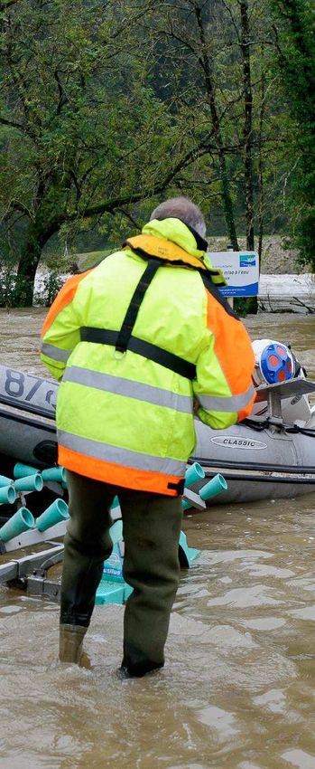
FLOOD RISK
MANAGEMENT PLAN
                            2016-2021

Introduction and summary of objectives

ARTOIS-PICARDIE BASIN
Escaut & Sambre districts
There is already a momentum on the territories to fight again
A co-built document which sets directions to prevent and
• control floods on the Artois-Picardie basin floods and their consequences
In this context, the territories have organised
themselves to fight against this floods and
The Artois-Picardie basin, is exposed to multiple protect high-stakes areas:
hazardsand is crossed by a hydrographical network that is
highly artificialized
330Municipalities benefiting to date
from a flood risk prevention plan
The Artois-Picardie basin covers close to storm fronts can generate fast rising
20,000 km², spread over floods as well as run-offs in sloped and (PPRi) - a regulatory document which
fivedépartements: Nord, Pas-de- urban areas. Finally, the coastal area is monitors urban development in risk
Calais,Somme, Oise (North) and Aisne concerned, mainly in the winter, by areas in order to not increase
(North). It features 2,483 municipalities green seas which can sometime vulnerability - and PPRis are currently
and is crossed by 7,800 kilometres of defeat protection works and let the under study for some 300 more
rivers sea submerge the land. municipalities.
The hydrographic or network is very The high density of population on the A network for the monitoring and
dense, with a steep topography whole of the basin induces significant forecasting of floods, managed by the
upstream - Artois hills and Ardennes damage, spread over a high number state, is in place on 11 sections of river.
foothills - and rather flat plains of municipalities. Over the 1982-2013 The development and water
downstream. The basin also features period, out of 2,483 municipalities in the
management master plans (so-called
Artois-Picardie basin:
particularly low lands reclaimed from SAGE) located on territories exposed
the sea: The Wateringues polder zone, 1,551 municipalities experienced at
include flood sections.
between Dunkirk and Calais, as well as least one event qualified as "natural
Action programs for the prevention of
the Somme bay.With a rich industrial disaster" following a flood caused by
history, the basin is highly artificialized floods (so-called PAPI) have been
the overflowing of a river, of which
and equipped with a number of water designed by the local authorities and
129 have experienced at least 6.
they groups in the Saint Omer region,
management works, both on land and
on the coast (dykes, dams, sea gates, 2,483 municipalities experienced at between the estuary of Bresle and
least one event qualified as "natural
canals, water pumping stations...) Authie, on the Aa Delta, and on the Lys,
disaster" following a flood caused by
As a result of this topography, run-off, of which 203 have Yser&Canche rivers. Programmes are
combined with a prevailing oceanic experienced at least 6. currently officially discussed in the
climate, the basin has been regularly
Boulogne and Valenciennes areas.
hit by different types of floods. In the
Local authorities are initiating and
winter, the sequence of rain
disturbances causes the main floods, developing local approachsuch as
through the rising of the level of the setting up local monitoring networks or
water tables or the overflowing of the implementing programs to control run-
main rivers, whether slow or fast. In the offs and erosion.
summer period, mobile though violent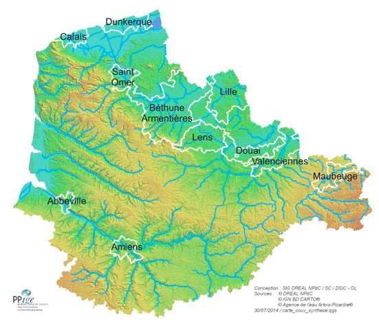
PGRI, a scoping tool at the level of the basin, established by the The development of the Artois-Picardie Adapting to the local context, the
flood directive flood risk management plan (so-called national challenges objectives:
PGRI), initiated in September 2013, isthe
next step in the implementation of the юIncreasing the safety of
flood directive. population exposed.
The flood directive's objective is to reduce the
negative consequences of floods on populations, A preliminary flood risk assessment The PGRI defines the strategic vision of юStabilising in the short term ,
on business and on the environmental and (so-called EPRI), which includes the current
priority actions in terms of prevention of and reducing in the mid-term ,
cultural heritage, and establish a consistent and understanding of hazards, the challenges exposed
shared vision of risks and thus allowing for the and the existing prevention tools, was approved on floods, at the level of the Artois-Picardie the cost of damage.
prioritisation of actions. 22 December 2011. basin and for the next six years (2016- юDrastically shortening the
To achieve these targets, the flood directive has 2021). time it takes for the stricken
11territories with a significant risk of flooding
set a work method and a schedule that Member This formalises the objectives relating to territories to return to
(so-called TRI) presenting major challenges (In terms
States must observe. the management of flood risks and normalcy.
The Artois-Picardie basin, like the five other of population and business) in the areas exposed to
provides a global vision of the basin,
major French hydrographical basins, has already floodswere selected on 26 December 2012. through:
implemented the first steps:
The mapping of river hazardsand coastal floods on Highlighting the great number of In parallel, the development of local
the various TRIs, on the basis of the current existing tools and approaches. strategies for the management of flood
knowledge, were approved on 16 May 2014 and on 12 Complementing the hazard risks (so-called SLGRI) (SLGRI) was
management approach with an engaged in the springof 2014. These
December 2014.
strategies make up the planning
approach to reduce vulnerability,
documents in the river basins around
integrated with the urban the TRIs. They will adapt the Artois-
development policies. Picardie PGRI to the specific challenges
of the various territories
A co-building effort between State and territories, subject
tocontinuous improvement
MAPPING OF THE 11 TRIs
OF THEARTOIS PICARDIE BASIN The Artois-Picardie basin PGRI was
A technical committee, made
developed by closely involving the
up of State departments, and
territory's stakeholders: State departments,
in charge of ensuring that the
local authorities, structures with local
PGRI is successfully
strategies,managers, trade unions,
developed.
neighbourhood associations etc.
The governance for the development of the
PGRI has relied on several bodies, gathered A strategic territorial
at basin level: committee, a collaboration
A steering committee, the flood body gathering structures with
committee of the basin, who define the SLGRIs and SAGEs, as well as
flood risk management policy at basin State public services and
level. establishments.
As a complement to the work of these bodies, a series of interviews has been conducted to develop Objective 1. Sustainably improving the territories and reducing the
the initiating file for the PGRI. Then, two phases of territorial workshops were organised in order to
vulnerability of assets exposed to floods
collect expectations, comments and proposal from local stakeholders involved in the management of
flood risks.These 11 workshops were reorganised between January and May 2014, and over 300
people attended. The exchanges and debates helped progressively draft the document and led to the
version of the Artois‐Picardie PGRI, subjected to public consultation. The PGRI has set three progressive levelsto strengthen the taking into account of the flood risksin
the territories development (Orientation 1):
A continuous improvement approach has now started and will continue up to the sign off of the
document by the Préfet coordonnateur of the Artois Picardie basin,and also during its Observe the principles of prevention of the risk and unbuildability in the most exposed areas:
implementation. As with the SDAGE,with which it is consistent, the PGRI isapproved for six years,and The strict conservation of floodplains, of wetlands and dunal areas, or failing this, observance
then reviewed for a new cycle of implementation. of the principle of "preventing, reducing or offsetting".
The prohibition to build in areas with high hazards or behind dykes, except justified
40 measures to reach 5 objectives, applicable to the whole of the basin
exception
The PGRI sets 5 objectives, which are translated into 16 orientations each grouping several measures. The limitation of sensitive equipment and adapting to the risks of new buildings in flood
areas.
As an introductionto each orientation, an overview of thereasons and principles of the action details
the context and the challenges which have led to proposing the measures. The identification of zones hazardous to human life, accompanied by safety procedures.
The PGRI is enforceable against the public authority. Urban planning documents must be compatible, Control land‐use in flood prone areas available for building, in compliancewith the "preventing,
or made compatiblewithin three years of the sign off of the PGRI, with the provisions of objective 1 reducing or offsetting" principle, via the urban planning documents and development decisions:
and 2 of the Artois‐Picardie PGRI.
The classification of non‐urbanised areas in natural or agricultural areas.
The urban planning documents shall also be made compatible with objectives 3, 4 and 5 of the The guarantee of thecapacity of evacuation,access to emergency services and resilience of
Artois‐Picardie PGRI new facilities.
Thefollow up of devolution of vulnerability in flood‐prone areas.
The 5 objectives of the Artois‐Picardie PGRI are:
Train and support development stakeholders (Municipalities and urban development professionals) to
Objective 1. Sustainably improving the territories and reducing the vulnerability of assets
better take into account the flood risk
exposed to floods
Objective 2.Helping to reduce run‐offs, while ensuring the conservation of aquatic The PGRIpromotes the reduction of the vulnerability of existing structures (Orientation 2) through:
environments
Prescriptions and recommendations introduced in the risk prevention plan
Objective 3. Improving the understanding of flood risks and the sharing of information, in
Technical and administrative support to the implementation of collective actions for local
order to inform decisions and empower stakeholders
work owners.
Objective 4.Prepare for crisis and aid in the return to normalcy of the stricken territories
Organisation of a hierarchy of intervention sectorstaking advantage of major urban
Objective 5. Implement governance
rejuvenation operations.Objective 2. Helping to reduce run‐offs, while ensuring the conservation of aquatic environments Objective 3. Improve the understanding of flood risks and the sharing of
information,in order to inform decisions and empower stakeholders
In line with the SDAGE, the PGRI sets principles for the conservation and the restoration of natural
areas that help with slowing down run‐offs (orientation 3):
The PGRIencourages the sustained approach to acquire knowledge on flooding
phenomena and the challenges of flood prone areas (Orientations 7 and 8):
The conservation and restoration of natural floodplains, including smaller rivers and ditches,
as well as wetlands. The study of the lesser‐known phenomena causing floods: combination of hazards,
The limitation and control of floodplain embankment projects. rising of water table levels, role of water management structures, floods on the
secondary hydrographical network.
The maintenance of rivers reconciling water management and environmental requirements,
via the implementation of multiannual plans and support to residents by local authorities. The taking into account on a systematic basis of several periods of flood recurrence
when mapping out flood prone areas.
The conservation of the water management capacity of ditches via awareness raising for
residents, control, and the organisation of inventories at the level of the local authorities. The development of maps of potential run‐off axes,in particularly exposed areas, via
specific studies conducted for example as part of the establishment or review of
The PGRI promotes the implementationof common strategies forcoastline management and urban planning document.
the fight against coastal floods (orientation 4), and reasserts the great principles of action: Better taking into account of potential consequences of climate changeon the
analyses takinginto account human, naturaland economic challenges, non‐aggravation of therisk coastline, on the possibilities of outlet to the sea and on weather events.
around structures, implementation as a priority of soft methods that allow for natural
The mapping and description of stakes in flood prone areas, and especially networks,
fluctuationsof the coastal area.
sensitive and strategic equipment.
In line with the SDAGE,the PGRI includes measures to limit run‐off, in urban and rural areas. The development of methods for the assessment of damage that are adapted to the
(Orientation 5): territories
The limitation of sealing,putting the priority on infiltrationand alternative rainwater The PGRI envisages the sharing of this knowledge through the creation of a database at the level of
management techniques. the Artois‐Picardie basin, as well as reinforced exchanges between local authorities and State
The development ofrainwater sanitation zonesby local authorities, and awareness raising departments.
on the proper maintenance of structures.
The PGRIstrengthens the culture of risk, to empower stakeholders andcollectively improve safety
The maintenance of landscape elements that contribute to the control of run‐off and in the face of floods, through operations that are diversified and adapted to the territories
erosion (Meadows, hedges, wooded areas). (Orientation 10):
The PGRI supports the global approach in terms of control of hazards (Orientation 6): Raising the awareness of elected members via the States Department and local strategy
structures.
The development of facilities with a dual function: flooding and quality of
Town Council information (DICRIM,flood level marks, public meetings).
environment.
The assessment of the relevance of developments in the light of the risks for human Innovating initiatives to inform and raise the awareness of citizens, involvement of
life and economic andenvironmental criteria. community structures, promotion of safety plans, raising the awareness and training social
Reflection at the appropriate level so that there can be upstream /downstream and economic stakeholders.
solidarity and study of alternative solutions to protection
Sustainable and relevant management of flood protection structures.Objective 4. Prepare for crisis and aid in the return to normalcy of the stricken territories Objective 5. Implement a flood risk governance that establishes solidarity between the territories
In order to anticipate the crisis, the PGRIstrengthens and develops: The PGRI promotes the implementation of global strategies for the prevention of flood risks,that
cover consistent hydrographical river basins (Orientation14), via:
Forecast and monitoring tools(Orientation 11): improvement of the monitoring and alert
scheme managed by the State and development of local systems, continuation of the works The implementationof flood prevention action programmes (So‐called PAPI) and their 7 axes
started on the sites subject to complex or fast phenomena (Storm surges, rising of water (knowledge and awareness of the risk, monitoring and forecast, alert and crisis management,
table levels, wateringues areas, flash floods, mudslides). taking into account ofthe risk in urban planning, reduction of vulnerability, reduction ofrun‐
offs, management of protection structures).
Alert and Crisis Management tools (Orientation 12): establishment of PCS that include true
operational flood sections, organisation of crisis drills,information of newly elected members, Reflection and arbitration involving upstream, downstream, plateau and bottom of the valley
pooling of resources at the intermunicipal level. territories,in a logic of solidarity of the territories and efficiency of the action.
Preparation of the after‐crisis period (Orientation 13): anticipation of the operational
The PGRI enhances the coordination of work owners in terms of flood risks (Orientation 15): The
support missions, of the support to the victims in the compensation procedure,and the
support to, and grouping of, protection work owners,State support for capacity building in the
management of the flood‐related waste.
"management of aquatic environments and prevention of floods" (So‐called GEMAPI) forCity Councils
The PGRI encourages the implementation of coordinated protocols for the management of water and EPCI with own tax systems.
management facilities during floods, and aims at implementing emergency solutions for the most
The PGRI promotes the development of inter‐basin and cross border cooperation spaces
sensitive water management facilities.
(Orientation 16), to develop mutual information and coordination in the management of
interconnected rivers: between local authorities with VoiesNavigables de France, and with Belgian
and Dutch managing authorities.
The objectives, orientations and provisions make‐up part C of the Artois‐ Picardie PGRI.On territories with high risks, specific measures and first milestones for the local translation of the LOCAL STRATEGIES
PGRI
SUMMARY MAP OF THE ARTOIS‐PICARDIE BASIN
All of the provisions of the PGRI areapplicable to all the Artois‐ Picardie basin, and including to future
local strategies for the management of flood risks (so‐called SLGRI). However, the PGRI targets local
strategies in two sections:
Local strategy scope
Local strategies
In part C of the PGRI, 21 provisions out of 40 specifically mention local strategies and
(municipalities)
propose concrete actions on these territories. Local strategies shall select those that are Territory with a significant
relevant In view of the challenges andpriorities identified locally. risk of flooding (TRI)
Département
Part D of the PGRI is dedicated to local strategies. This presents, for each of the basin's
strategies, the first elements for an audit and a diagnosis, and pre‐identified priorities in
terms of flood risk prevention.
The 9 scopes for local strategies and related objectives were decided on 12 December 2014 by the
Préfetcoordonnateurof the Artois‐Picardie basin. The strategies are currently being developed and
will be decided by Préfets de départementin late 2016.The Artois-Picardie flood risk management plan was developed under the steering of:
DREAL (Regional agency for environment, development and housing) - Nord-Pas-de-Calais
DREAL - Artois Picardie basin.
With the collaboration from or participation of:You can also read