Greensborough Activity Centre Transport Masterplan - November 2017
←
→
Page content transcription
If your browser does not render page correctly, please read the page content below
Greensborough
Activity Centre
Transport
Masterplan

November 2017
2

Greensborough Walk
Executive
 Summary
                                                      The Masterplan will guide local transport and
The Greensborough Activity Centre Transport
                                                      movement investment decisions and inform
Masterplan (GTMP) will guide the realisation
                                                      Council’s role in advocating for the best local
of Council’s vision for the activity centre as a
                                                      outcomes in these strategic infrastructure
major public transport hub for the northeast
                                                      projects within the State Government’s control,
region of Melbourne providing regional access
                                                      now and in the future. It will ensure that these
to jobs, education, shopping and services while
                                                      projects provide an outcome which aligns with
supporting a vibrant local community.
                                                      key policy objectives of the City of Banyule and
The GTMP outlines the immediate transport             the GTMP.
challenges facing the Greensborough Activity
                                                      Of particular priority is investment in the
Centre including poorly integrated public
                                                      development of a high quality integrated bus
transport services, lack of cycling access and
                                                      and rail transport interchange, at the heart of the
a lack of pedestrian amenity. It responds to the
                                                      activity centre. Developing an efficient, reliable
continued growth in Greensborough and the
                                                      and attractive public transport interchange will
emergence of a number of significant strategic
                                                      act as a catalyst to improve pedestrian and cycle
city shaping projects being pursued by the
                                                      access as well as reduce reliance on private
Victorian State Government. These key projects
                                                      vehicles.
include the M80 Upgrade, the Hurstbridge Rail
Line Duplication and North East Link.                 The time is right for a coordinated approach
                                                      to planning and investment that provides an
The scale of these projects in such close
                                                      outcome for the activity centre which aligns with
proximity to the Greensborough Activity Centre
                                                      Council’s and the State Government’s objectives
presents a significant opportunity but also a
                                                      of creating vibrant, healthy and economically
potential risk in how the activity centre continues
                                                      successful communities.
to develop. To mitigate this risk and fully respond
to the opportunities afforded by these state
significant projects, there is an immediate
need for the State Government to invest in
transport infrastructure which will safeguard
Greensborough’s role as a major activity centre.
                                                                                                            3
4 Main Street
I

    Contents

    Executive Summary				                     p.3   Where to from here			                                  p.32
                                                    A New Integrated Greensborough Transport Interchange   p.34
                                                    PTV Bus Services Review			                             p.34
    Introduction					                         p.7
                                                    A Movement and Place Investigation for Greensborough   p.36
                                                    Local Transport Infrastructure Projects			             p.39
    The Vision for Greensborough
    Vision						 p.8
    Objectives				                           p.10
                                                    Actions					 p.44

                                                    Implementation Plan		                                  p.46
    Setting the Scene
    Greensborough Activity Centre			         p.12
    Policy and Strategy Framework			         p.14
    Current Transport Issues				             p.16

    State Government Transport Initiatives   p.22

    M80 Upgrade          				 p.24

    Hurtsbridge Rail Line Duplication        p.26

    North East Link				                      p.28

    Community Consultation			 p.30

                                                                                                                  5
6 Greensborough Walk
Introduction
Greensborough Activity Centre is a growing             Government. Council manages the local
employment hub, attracting growth in both              road network while the State Government
commercial and civic employment. It is also well       is responsible for high level land use and
positioned and has capacity for high density           transport planning policy, public transport
development, with a large portion of the activity      and the arterial road network. To ensure the
centre identified for higher density residential       success of the GTMP it is critical that both       To ensure the success of
and mixed use development.                             levels of government work together to deliver     the GTMP it is critical that
                                                       an integrated approach to transport and
Greensborough’s transport and movement
                                                       movement within the activity centre.
                                                                                                         both levels of government
network is currently facing a number of                                                                   work together to deliver
challenges. To date, investment in this critical       The GTMP will guide local transport and
                                                                                                         an integrated approach to
infrastructure has been poor, not reflecting           movement investment decisions and inform
Greensborough’s role as a growing major activity       Council’s role in advocating for the best local   transport and movement
centre that provides important services for            outcomes from strategic infrastructure projects    within the activity centre
the northeast region of Melbourne. Continued           within the State Government’s control, now
growth, as well as the development of a number         and into the future.
of major state significant transport projects in
close proximity to Greensborough, present a
significant opportunity but also a potential risk in
how the activity centre continues to develop.
The Greensborough Transport Masterplan
(GTMP) has been developed to fully respond to
the opportunities afforded by state government
investment in the broader region. It delivers
a plan for Greensborough’s transport and
movement network which envisions the future
Greensborough Activity Centre as a vibrant
local community that is enhanced by its role as
a highly functional public transport hub for the
northeast region.
Responsibility for provision and planning of
transport within Greensborough is shared
between the Council and the Victorian State                                                                                             7
The Vision for
Greensborough
Council’s vision for transport and movement within Greensborough
reflects the wider Banyule Integrated Transport Plan (BITP) which
envisions Banyule to be a city with accessible, sustainable and active
communities, with good access to jobs, education, shopping and
community opportunities within a safe transport network.
This has been refined to give a specific future transport vision for
Greensborough which takes into account its significant location
as a major transport hub in the northeast region of metropolitan
Melbourne. Greensborough needs to be strongly linked into the wider
public transport network as well as have good access to wider cycling
networks. It must also be a vibrant place to be and contain attractive
walk-able spaces within the activity centre where people can safely
access local services along with social and recreational opportunities.
8Vision Statement
Greensborough Activity Centre is a
major public transport hub for the
Northeast providing local and regional
access to jobs, education, shopping and
services while supporting a vibrant local
community.
9Objectives
The objectives for transport and movement to These municipal wide objectives inform the
and within Greensborough are underpinned by objectives of the GTMP as listed in Table 1 below
the strategic transport objectives for Banyule and discussed further on the following pages:
as outlined in the BITP. The strategic objectives
support:
• Transport accessibility and mobility for all
members of our communities; Objective 1 Improve public transport including: a new integrated Greensborough Transport Interchange,
improved bus routes, stop locations, frequency and services within and to Greensborough,
• Land use and development that encourages
duplication of the Hurstbridge rail line between Greensborough and Eltham, and a 10 minute rail
active and public transport use;
service frequency to Greensborough.
• The provision of walking and cycling
infrastructure and facilities; Objective 2 Manage through traffic to facilitate pedestrian, cycling, and public transport priority in the
Greensborough Activity Centre.
• The provision of public transport
infrastructure and services; Objective 3 Improve pedestrian access within the Greensborough Activity Centre.
• A local road user hierarchy that prioritises
walking, cycling, and public transport before Objective 4 Improve cycle access to and within the Greensborough Activity Centre.
private vehicles; and
• Advocacy and leadership on all of these
important transport considerations to ensure
Table 1: . Objectives of the Greensborough Activity Centre Transport Masterplan
the best outcomes for our communities.
10The first objective for transport and movement to and Building on these themes the third and fourth objectives
within Greensborough is the development of an efficient of the GTMP are to improve pedestrian access within and
and reliable public transport system which offers a high cycling access to and within the activity centre. Streets
quality passenger experience. An efficient, reliable and within the activity centre will be places where people live,
attractive public transport network is vital to improving work and play. They will provide priority for pedestrians,
accessibility for those with mobility restrictions, improving cyclists and public transport, with sole occupant private
pedestrian and cycling access, reducing reliance of vehicles and long term on street parking being the lowest
private vehicles as well as developing a street network priorities. They will be accessible to all and provide access
which supports an accessible, safe, healthy and vibrant for a range of uses in order to deliver a safe, integrated
community. and efficient transport system. They will facilitate walking
and cycling which will be encouraged and become a
Central to this objective is the development of a transport
mainstream transport choice for trips to, from and within
interchange with integrated bus and rail connections which
the activity centre, reducing reliance on private vehicles.
link Greensborough to the local and wider region. This
critically important land use development will be supported
by a network of bus routes that operate to enhance the
connectivity to the activity centre along with improved
frequency of both rail and bus services. This objective also
includes the vitally important delivery of the duplication
of the Hurstbridge rail line between Greensborough and
Eltham.
The second objective of the GTMP is to manage through
traffic in the activity centre to facilitate pedestrian, cycling,
and public transport priority. In acknowledgement of
Greensborough being a major destination in its own right,
the transport and movement network will support the
philosophy of ‘to not through’, encouraging trips to and
from the activity centre whilst reducing the impact of
through traffic. Through traffic is to be actively managed
to reduce its impact on pedestrians, cyclist and public
transport users.
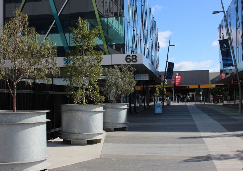
11Setting the Greensborough Activity
Centre
Scene
Located 17 kilometres north-east of Melbourne, Greensborough is
identified within Plan Melbourne as a Major Activity Centre. It fulfils a
diverse range of roles, including housing, retail, commercial and civic
services.
The Greensborough Activity Centre provides the local and wider
community with opportunities to live, work, shop and play. Facilities
include:
• Banyule City Council’s main administrative headquarters, at 1 Flintoff
Street;
• Main Street and Grimshaw Street strip shopping centres, which include
a range of retail stores plus dining opportunities;
• Greensborough Plaza, a large internalised shopping mall;
Greensborough Activity • A multi-screen cinema;
Centre
• A range of specialist medical facilities;
• Key social infrastructure including Centrelink; and
Policy and Strategy
Framework • WaterMarc, an important aquatic and leisure facility for northern
metropolitan Melbourne.
Current Transport Issues 12Greensborough Location Plan 13
Policy and Strategy
Framework
Local Government                                         In 2015 the Greensborough Structure Plan was            document for the state and also sets out strategy for
                                                         updated to include more intense development,            transport infrastructure and facilities.
Council has a number of relevant policy documents        particularly around Flintoff Street and Grimshaw
                                                                                                                 A key principle and direction of the Plan that is of
that support the objectives of the GTMP. These are       Street. This increase in activity will drive the need
                                                                                                                 particular relevance to Greensborough Activity
outlined below.                                          for a transport and movement network which is safe
                                                                                                                 Centre is the opportunity to live locally through the
                                                         and comfortably facilitates movement by foot and
In 2006 Council adopted the Greensborough                                                                        creation of 20-minute neighbourhoods - accessible,
                                                         bicycle.
Structure Plan which provides a framework for                                                                    safe and attractive local areas where people can
the redevelopment of strategic precincts within          In 2016 Council adopted the Northern Regional Trails    access most of their everyday needs within a
the activity centre, and identifies opportunities for    Strategy which was developed in conjunction with        20-minute walk, cycle or local public transport trip.
reshaping the centre and re-establishing pedestrian      six of our neighbouring municipalities in Melbourne’s
                                                                                                                 The recently released (October 2017) Victorian
networks and urban environments. It seeks to             northern region. The Strategy supports the
                                                                                                                 Infrastructure Plan responds to Infrastructure
promote a sustainable traffic and transport network,     provision of important cycling access to the Banyule
                                                                                                                 Victoria’s 30-year Infrastructure Strategy released
maximise mobility for all, and ensure an integrated      municipality and is highly relevant to providing
                                                                                                                 in December 2016. It includes funding details for
centre that is legible, connected and easy to navigate   access for cyclists to the Greensborough Activity
                                                                                                                 the next five years for transport infrastructure
for pedestrians.                                         Centre from surrounding areas via the Plenty River
                                                                                                                 projects that impact on the northeast region
                                                         Trail, the Banyule Shared Trail, the Greensborough
More recently, in 2015, Council adopted the Banyule                                                              including the upgrading of the M80 Ring Road,
                                                         to Eltham Link Trail and the Metropolitan Ring Road
Integrated Transport Plan 2015- 2035 (BITP), a long                                                              the ongoing Level Crossing Removal Program ( to
                                                         Trail.
term strategic plan that guides transport and land                                                               include the duplication of the Hurstbridge rail line
use decisions in the municipality. The BITP provides                                                             from Greensborough to Eltham), the development
an overall framework to address transport issues         State Government                                        of the North East Link, and general bus and rail
and create more accessible, safe, liveable and                                                                   improvements.
sustainable communities within Banyule.                  There are also a number of state government policy
                                                                                                                 The Victorian Infrastructure Plan includes a
                                                         documents that are relevant to the development of
The main strategic objectives of the BITP are                                                                    commitment to updating the Victorian Cycling
                                                         the GTMP.
to support transport accessibility and mobility,                                                                 Strategy and provision of infrastructure to ensure
encourage active and public transport use, prioritise    Plan Melbourne 2017-2050 is the current Victorian       pedestrian and cycling safety. It also advises that
sustainable transport modes before private vehicles      metropolitan planning strategy that defines the         Transport for Victoria (TfV) is currently preparing a
on local streets, and advocate on transport issues to    future shape of the Melbourne metropolitan area and     10 year plan to consider the costs and benefits of
ensure the best outcomes for our communities.            state. Plan Melbourne is a comprehensive planning       transport infrastructure projects in Victoria.
                                                                                                                                                                         14
                                                                                                                 The transport and movement The
15 Main Street / Grimshaw Street
Current Transport Issues

There are many transport issues that currently need
                                                           In addition, many signalised intersections within the
addressing in Greensborough. These include poor
                                                           activity centre prioritise vehicles over pedestrians.
pedestrian and cycling facilities, through traffic
                                                           Pedestrians have to wait for long periods of time to
detracting from local amenity and poor bus to rail
                                                           cross and the intersection layouts result in vehicles
connectivity.
                                                           moving through the intersections at speed.
                                                           The natural undulating topography of Greensborough
Pedestrian Environment
                                                           also impacts the pedestrian experience, particularly
The 20-minute walking catchment for                        for young children, the elderly and those with
Greensborough covers the main retail, employment,          restricted mobility. The topography also restricts line
leisure and commercial core and as well as areas of        of sight to key amenities such as Greensborough
adjacent residential development. St Mary’s Primary        Railway Station, reducing legibility. This is further
School and Greensborough Primary School are                compounded due to the absence of formal
located within a 20 minute walk of the activity centre,    wayfinding to assist pedestrians in locating key
as well as areas of public open space (including           places within the activity centre, including the railway
Whatmough Park and Poulter Avenue Reserve).                station and Centrelink.
The walking catchment highlights the variety of
amenities available to current and future residents,
employees and visitors to Greensborough which can
be easily accessed by foot.
By nature of their design the majority of streets within
the Greensborough Activity Centre prioritise the
movement of cars and other vehicles. As a result the
experience for pedestrians is poor and uninviting.
A lack of places to cross busy roads safely and
comfortably creates severance, isolating land
uses on the fringe of the activity centre including
Greensborough Railway Station.
                                                                                                                      16
Cycle Access The Principal Bicycle Network which provides
connections via arterial roads to the northeast region
Greensborough’s 20-minute cycling catchment
and into the centre of metropolitan Melbourne
extends to areas up to 3 kilometres from the activity
remains incomplete resulting in wider access to
centre, including Greensborough as well parts of
the Greensborough Activity Centre being poor. Of
Bundoora, Watsonia, Briars Hill and Montmorency.
particular concern is the continued lack of access
The catchment highlights the importance of from the Banyule Shared Trail along Greensborough
developing a safe and connected cycling network Highway from Yallambie Road into Greensborough.
to fully realise the potential of Greensborough as a
The activity centre is located adjacent to the Plenty
central shopping, employment and leisure hub for
River Trail which forms part of a northern regional
those wishing to travel by bicycle.
trails network. This network is extensive with
The local bicycle network has been improved over connection to major trails in the region including
the past years with the recent introduction of a new the Main Yarra Trail and it provides a pleasant safe
route to access Greensborough from Watsonia as experience for riders of all abilities. There are,
well as signage and marking of routes from St Helena however, poor connections and missing sections
in the north, and Yallambie in the south. There is, of trail needed as outlined in the Northern Regional
however, a general lack of cycling facilities within the Trails Strategy. This includes a section of the rail trail
activity centre, particularly for those who are less from Greensborough to Eltham which is currently
confident cycling on-road and connections from missing. There is also a need for improvements in the
the activity centre to the wider on-road and off-road quality of the trail which is currently in poor repair
cycling networks remain poor. especially in the section of the Plenty River Trail close
to Greensborough. The connection to the heart of
Within the centre on-road facilities currently offer no
the activity centre is also poor.
level of separation or protection along streets heavily
used by both cars and buses. This is also the case
along Main Street even though it is specified as being
part of the Principal Bicycle Network. This results
in a high stress cycling environment, generally only
accessible to more confident and experienced riders.
17Bus and Rail Access substandard when compared to the wider Metro
area. They do not meet the needs of the growing
Greensborough Railway Station is on the Hurstbridge Greensborough Activity Centre or those of the wider
railway line which runs to Hurstbridge from northeast region.
Melbourne CBD and is an important gateway into
the activity centre, providing the first impression of There are currently nine bus services that operate in
the area for those arriving by rail. The experience for Greensborough. Whilst the number of bus services
passengers is poor however, particularly for those bringing people in the heart of the activity centre has
arriving by foot or bicycle. The current environment grown in recent years (a new bus route 343 between
is considered uninviting and unsafe. Most critically, Greensborough and Hurstbridge via Diamond Creek
the current access does not meet current Disability was added in June 2017) the routes and stops have
Discrimination Act (DDA) requirements. not been fully reviewed to meet the current or future
needs of the local community and surrounding
Greensborough’s current 20-minute public transport region.
catchment highlights clearly the key corridors
served by bus and rail, with the catchment extending Greensborough Railway Station is disconnected
beyond Greensborough to communities including from Main Street and suffers from poor levels of
Montmorency, Briars Hill, Watsonia, Watsonia North, access via Para Road. The current interchange
Bundoora and Macleod. on Para Road between bus and rail is unattractive
and inconvenient, resulting in a poor passenger
The catchment highlights areas currently poorly experience. In addition some bus services do not
served by public transport, including eastern connect directly to the railway station and require
Greensborough, which is located within a relatively a walk from disjointed locations around the activity
short distance from the activity centre. centre to access a rail service. The location of some
A number of major education facilities also currently bus stops within the activity centre is confusing,
fall beyond the 20 minute catchment, including particularly for the route 293, the stops of which are
Parade College, RMIT Bundoora Campus and La located in isolation to other services.
Trobe University, as well as the La Trobe National The Main Street bus boarding and alighting area
Employment and Innovation Cluster. in the town centre is equally of poor quality and
The reliability and frequency of rail services to confusing for passengers. Waiting areas for
and from Greensborough, due to single line track westbound services are narrow and uninviting.
18
between Greensborough and Eltham, is alsoImpact of Through Traffic
The current road network within the Greensborough
Activity Centre does not deter through traffic.
Through traffic is defined as traffic that travels
through the activity centre without stopping. Through
trips are undesirable as they add to congestion,
impact air and noise quality and impact bus access
without contributing to the activity centre in terms of
the local economy and community.
Whilst The Circuit and Para Road is the preferred
route for through traffic, drivers favour Grimshaw
Street due to time and distance savings. In addition
some drivers favour Grimshaw Street and Diamond
Creek Road rather than using Greensborough
Highway and the Greensborough Bypass.
Westbound through traffic accessing The Circuit is
required to do so by using a short section of Main
Street and Hailes Road. This segment is also one
of the main pedestrian routes from Main Street to
Greensborough Railway Station. As a result, the
northern end of Main Street carries high volumes of
traffic, making it difficult to cross and reducing the
quality of the pedestrian experience.
Preferred Transport Movements for the Greensborough Activity Centre
19Summary of Transport Challenges
The summary table below outlines key transport
challenges in Greensborough and gives an indication
of how upcoming State Government projects could
contribute to the vitality of the activity centre through
addressing the current challenges in and around
Greensborough. These State Government projects
are discussed in more detail in the following section.
20Hurstbridge Rail Line
Current Transport Challenges M80 Upgrade North East Link
Duplication (Stage 2)
Pedestrian • Lack of road crossing priority
Facilities
• Poor/narrow footpath provision
• Lack of wayfinding signage
• Lack of walking amenity including lack of rest areas and street landscaping
• Lack of connectivity to open space
Cycling • Lack of safe cycling facilities on and off road within the activity centre
Facilities
• Lack of connection to the Northern Regional Trail Network
• Lack of connection to the Principle Bicycle Network
Public • Poor mobility impaired access to railway station
Transport
• Lack of frequency of trains from Greensborough to Eltham
• Poor bus connectivity to the railway station
• Poor bus to bus connectivity
• Poor connectivity from rail to cycle and walking facilities.
• Lack of bus priority/ poor bus movement
• Improvements needed to bus routes and operations including frequency of services.
Traffic • High levels of through traffic
Management
• High speed environment in activity centre
Table 2: . Current transport challenges in and around Greensborough
21State
Government
Transport The transport and movement network supporting the activity centre is
critical to the development of an accessible, safe, healthy and vibrant
Initiatives community. It is fundamental in connecting people to jobs and goods
to market. However, to date, very little investment in the transport and
movement network has occurred in response to this growth. As a result,
the transport network is facing increasing pressure to service both local
and regional needs.
The development of a number of strategic city shaping projects has the
potential to fundamentally redefine the role that the activity centre’s
transport and movement network plays within the broader region. These
key projects include M80 Upgrade, Hurstbridge Rail Line Duplication
and North East Link. The scale of these proposed projects presents a
significant opportunity but also a potential risk in how the activity centre
continues to develop as travel decisions are shaped by the changes in the
M80 Upgrade
transport network. The projects and their associated opportunities for
Council are outlined in Table 3.
Hurstbridge Rail Line
Duplication
North East Link 22Project Opportunities Business Case Construction
M80 • Managing through traffic. Complete 2019 - 2021
Upgrade
• An improvement of bus movement.
• An improvement to pedestrian and cycling safety and amenity.
Hurstbridge • Provision of a high standard Greensborough Transport Interchange with full End 2017 2019 - 2021
Rail Line access for pedestrians and cyclists including those with mobility impairments.
Duplication
• A full bus review including routes, stop locations and services to
(Stage 2)
Greensborough.
• Provision of adjacent rail cycle trail and connections to the wider bicycle
network.
North East • Managing through traffic. End 2017 2020 - 2026
Link
• Reviewing the function of arterial roads around Greensborough.
• Provision of a fully functioning Greensborough Transport Interchange (if not
achieved through the Hurstbridge Rail Line Duplication).
•Improvements to bus operations including new bus routes and improvements
to existing bus routes and services.
• Provision of cycling infrastructure.
• Provide pedestrian, cycling and bus movement and priority across the North
East Link.
Table 3: . Summary of transport opportunities relating to upcoming state transport infrastructure projects
23M80 Upgrade
The Victorian State and Federal Governments have centre if heading north rather than continuing along In summary the potential benefits of the M80 project
committed $700 million funding over the next 5 years Greensborough Highway. for the Greensborough Activity Centre include:
to widen and upgrade three sections of the M80 Ring
Providing additional capacity for northbound • A reduction of through traffic within the activity
Road including the section between Plenty Road and
movements on Greensborough Highway from centre;
Greensborough Highway. The upgrade of this 2.4
Grimshaw Street passed the M80 interchange
kilometre section is expected to be commence in • An improvement of bus movement into and
will allow traffic to bypass Greensborough rather
early 2019 and be completed by 2021. around the activity centre; and
than opting for a through route. Combined with a
The upgrade will provide significant benefit to reduction of right turning traffic into Grimshaw Street • An improvement to pedestrian and cycling safety
freight and private vehicles. These benefits will it will also lead to improved bus movement into and and amenity within the activity centre.
include improved east-west travel times along the out of the activity centre. It will also improve safety
M80 as well as an improvement to the operation and amenity for pedestrians and cyclists along
of the Greensborough Highway which is currently Grimshaw Street and within the activity centre.
constrained by the operation of the M80 interchange.
As such, Council has the opportunity to advocate for
The upgrade to the Plenty Road to Greensborough VicRoads to consider including the reconfiguration
Highway section will include widening the freeway of the Greensborough Highway-Grimshaw Street
from two lanes to three lanes in each direction, intersection into the M80 scope of works to reduce
and improvements to the Greensborough Highway the capacity afforded to right turning vehicles and
interchange. increase the capacity for northbound traffic.
Opportunities for Greensborough Activity Centre
The M80 upgrade gives Council the opportunity
to gain improvements to traffic conditions in the
Greensborough Activity Centre. At present the
amount of capacity afforded to northbound traffic
at the intersection of Greensborough Highway with
Grimshaw Street is constrained, with significant
capacity provided to right turning vehicles. This,
coupled with current delays at the M80 interchange,
results in drivers favouring travel through the activity 2425
Hurstbridge Rail Line
Duplication (Stage 2)
The $6.6 billion Victorian State Government Level        Opportunities for Greensborough Activity Centre
Crossing Removal program is currently underway
                                                         This further work by the Level Crossing Removal
across metropolitan Melbourne with the aim of
                                                         Authority provides a valuable opportunity for
removing a total of 50 level crossings. In Banyule,
                                                         Council to advocate for enhanced public transport
the Level Crossing Removal Authority are currently
                                                         connectivity and improve pedestrian and cycling
duplicating the Hurstbridge rail line between Rosanna
                                                         facilities including:
and Heidelberg, and in Rosanna are removing the
crossing at Lower Plenty Road and constructing a         •   Provision of a high standard Greensborough
new railway station. These works are expected to be          Transport Interchange including improved
complete in 2019.                                            station facilities with full access for pedestrians
                                                             and cyclists including those with mobility
A second stage of the Hurstbridge Rail Line
                                                             impairments;
Duplication is currently in planning to duplicate the
single track to double track between Greensborough       •   A full bus review including routes, stop locations
and Eltham. The final completion date for this stage         and services to Greensborough;
is yet to be determined. These works will remove a
                                                         •   Provision of adjacent rail cycle trail as outlined.
significant bottleneck in the current rail network and
                                                             in the Northern Regional Trails Strategy
simplify the rail timetable to a more frequent and
                                                             (Greensborough to Eltham Link Trail); and
reliable service to and from Melbourne, increasing
the attractiveness of public transport use to and        •   Connections to the wider bicycle network.
within Greensborough.

                                                                                                                   26
27
North East Link

The Victorian State Government has committed $100         The new interchange at Grimshaw Street is little        •   Reviewing the function of arterial roads around
million to complete planning and pre-construction         more than one kilometre to the west of the heart of         Greensborough;
activities for the North East Link to close the           Greensborough.
                                                                                                                  •   Improved integration of train and bus services
freeway network gap between the M80 Ring Road in
                                                                                                                      at a fully functioning Greensborough Transport
Greensborough and the Eastern Freeway or Eastlink.        The preferred primary route for through traffic
                                                                                                                      Interchange (if this has not already been
The North East Link Authority is developing the           in the Greensborough Activity Centre is via The
                                                                                                                      achieved through the Hurstbridge Rail Line
business case which is expected to be complete by         Circuit and Para Road, safeguarding other streets
                                                                                                                      Duplication scope of works);
the end of 2017. Tendering and detailed development       for pedestrians, cyclists and public transport.
are scheduled for 2018 and 2019 with the start of         The preliminary demand analysis included in the         •   Bus operations including new bus routes and
construction to begin in 2020. Project completion         supporting documentation for the Victorian 30 Year          improvements to existing bus routes and
is expected in 2026. Whilst completion of this state      Infrastructure Strategy shows some increases in             services – particularly to improve access to key
significant infrastructure is some time away, the         traffic in and around the activity centre and some          destinations including tertiary education and to
planning and development of actions to safeguard          decreases on certain road segments in the year 2046         other activity centres;
Council’s transport and movement vision is needed         when compared to a Base Case scenario for these
                                                                                                                  •   Improvement to cycling infrastructure including
now.                                                      two potential routes.
                                                                                                                      completion of the Principal Bicycle Network,
The North East Link Authority has identified a corridor   Opportunities for Greensborough Activity Centre             Strategic Cycling Corridors and implementation
for the Link that will run from the end of the M80 Ring                                                               of the Northern Regional Trails Strategy including
                                                          The proximity of a major freeway interchange at this
Road at Greensborough along the Greensborough                                                                         the missing cycling link to Greensborough
                                                          location has the potential to significantly increase
Highway road reserve to meet the Eastern Freeway in                                                                   (Banyule Shared Trail); and
                                                          demand for through traffic within the activity centre
Bulleen. It is proposed to include:
                                                          without appropriate intervention.                       •   Ensuring pedestrian, cycling and bus movement
•   Three new interchanges in Banyule at Lower                                                                        across the North East Link is given high priority.
                                                          This project provides opportunities for Council
    Plenty Road, Grimshaw Street and the M80 Ring
                                                          to advocate to the State Government to provide
    Road;
                                                          improvements to transport services around
•   A five kilometre, six lane tunnel beneath Banyule     Greensborough to enhance the function of the
    Flats, the Yarra River, and Lower Plenty Road to      activity centre. These include:
    emerge north of Lower Plenty Road; and
                                                          •   Managing through traffic associated with the
•   New and upgraded walking and cycling links from           potential interchange on Grimshaw Street;
    the M80 to the Eastern Freeway and Yarra Trail.
                                                                                                                                                                      28
29
Community
Consultation   Council has undertaken consultation with the
                                                                        Council has also undertaken community consultation
               local community over a number of years and the
                                                                        in the past to ensure that we have heard our
               expectations of the transport network continue to
                                                                        community’s views on transport issues. We have
               rise.
                                                                        held extensive consultation including two large
               Most recently a ‘Greensborough Transport                 community transport forum events in May and
               Opportunities’ consultation was undertaken in            September 2017 to give Banyule residents the
               November 2017. The community and Greensborough           opportunity to have their say on the North East Link.
               traders were provided with information and
                                                                        In particular we offered every household in Banyule
               the opportunity to attend a drop in session
                                                                        the opportunity to respond to a survey on the
               on the upcoming State Government transport
                                                                        proposed alignment of the North East Link following
               infrastructure projects that are likely to impact
                                                                        the State Government announcement of four
               on the Greensborough Activity Centre. Transport
                                                                        corridor options. Out of the around 9000 responses,
               opportunities were discussed including the
                                                                        16% were from residents of Greensborough and
               importance of making sure that improvements to
                                                                        a further 24% from the immediate surrounding
               public transport, cycling and pedestrian services
                                                                        suburbs of Watsonia, Watsonia North, Bundoora, St
               and amenity are included in these projects. Over 70
                                                                        Helena, and Montmorency.
               responses supported these aims.
                                                                        The response to this large transport infrastructure
               Council also undertook a quick snap-shot street
                                                                        project shows that the residents of Greensborough
               level community consultation in the Greensborough
                                                                        and surrounds have a strong interest in transport
               Activity Centre in August 2017. Twenty-six people
                                                                        issues that affect them. These respondents were
               were approached and asked about their transport
                                                                        found to have concerns around traffic congestion
               experience in Greensborough. A common response
                                                                        on main arterial roads and wanted the North East
               was that public transport improvements were
                                                                        Link to be built as quickly as possible while also
               needed. Key concerns related to inconvenient and
                                                                        having significant concerns regarding protecting
               unreliable public transport services, poor integration
                                                                        the environment. They also expressed a desire for
               and interchange between bus and rail, the impact of
                                                                        improved public transport services and improved
               traffic on the enjoyment of the activity centre, and
                                                                        cycling facilities.
               the poor wayfinding and navigation for those on foot
               or arriving by public transport.
                                                                                                                          30
Prior to this community consultation on transport
issues was done in 2015 to inform the development
of the BITP. Over 4000 responses were obtained
at both public forums and via an online survey.
Responses were obtained on a wide variety of
transport issues but a strong desire for public
transport service provision was evident with 94%
of responders agreeing that Council needs to work “If you want to use the train service and the bus service,
closely with State Government agencies to ensure it is difficult with lining up of the timetables, and also
the provision of an accessible and reliable public getting from one to the other because unfortunately
“Trains are so irregular and with cancellations”
transport network. Easing congestion on arterial Greensborough is a very hilly area”
roads, and safe walking and cycling routes and
facilities were also common themes.
The objectives of the GTMP have been developed
in line with the needs and wishes of members of
the local community and traders that have been
expressed consistently across all recent consultation
on transport issues.
“It would be good to just syncronize everything a
“Navigation is not easy”
little bit better (public transport)”
31Where to from
here
It can be seen from the previous sections on current transport challenges
and community concerns that there are many improvements needed to
enhance the functionality of the Greensborough Activity Centre and to
ensure it realises its full potential. The actions and projects set out in this
section describe how this could be achieved.
A New Integrated
Greensborough Transport
Interchange
PTV Bus Services Review
A Movement and Place
Investigation for Greensborough
Local Transport Infrastructure
Projects 3233 Greensborough Walk
A New Integrated                                                                                                  PTV Bus Services Review
Greensborough
Transport Interchange
Bus and rail interchange is currently a challenge due   The construction of an integrated facility would          The activity centre is well served in terms of the
to topography and position of the railway station       also unlock a number of opportunities to improve          number of bus services, however, accessing services
in relation to the local road network. As a result      accessibility and connectivity, including:                is confusing for passengers. There is inconsistencies
interchange between modes is confusing and does                                                                   in terms of the number of services which stop on
                                                        •   Relocating the station, and/or station entrance       Main Street and at Greensborough Railway Station,
not provide a quality user experience.
                                                            further west towards Main Street, improving           and the number of connecting bus/rail services is
The construction of an integrated transport                 the station’s relationship with the heart of the      low. In addition, not all services stop at the same
interchange, achieved through decking over                  activity centre; and                                  location on Main Street.
the railway station, would provide a much
                                                        •   Providing opportunities to include a new north-       A review of bus services is paramount to
improved passenger experience and solution for
                                                            south pedestrian route, linking the activity centre   reconsidering the reconfiguration of Para Road and
Greensborough through:
                                                            with areas to the north including Plenty River        Main Street (see Local Infrastructure Projects) as well
•   Reducing transfer distances;                            parkland.                                             the delivery of an integrated transport interchange.
•   Improving interchange legibility;                   An integrated transport interchange would also            Council wish to work with Public Transport Victoria
                                                        unlock development opportunities on the northern          (PTV) to determine optimal solutions that align with
•   Removing low quality on-street bus stops on Para
                                                        side of Para Road.                                        the needs of the activity centre and local community.
    Road;
                                                        As such, Council strongly advocates for the inclusion
•   Facilitating better coordination between bus
                                                        of an integrated transport interchange as a key
    and rail services, providing seamless transfer
                                                        element of the planning for the track duplication
    between modes;
                                                        between Greensborough and Eltham. The estimated
•   Improving access for those with restricted          cost of developing an integrated transport
    mobility by removing steep pedestrian ramps         interchange at Greensborough would be in the order
    and replacing them with lifts and/or escalators;    of $60M - $80M, depending on the final design
    and                                                 solution.
•   Creating a much improved gateway into
    Greensborough for public transport users.
                                                                                                                                                                      34
35 Greensborough Railway Station
A Movement and
Place Investigation for
Greensborough
In line with the road hierarchy philosophy contained      The following street functionality should be taken        Grimshaw Street currently carries excessive through
within the BITP, all streets within the activity centre   into consideration for Greensborough:                     traffic and provides poor local access functions to
should provide priority for pedestrians, cyclists and                                                               facilitate movement of pedestrians, cyclists, and
                                                          Flintoff Street currently plays an important
public transport, with sole occupant private vehicles                                                               public transport.
                                                          role in facilitating bus and pedestrian access
the lowest priority.
                                                          to Greensborough Railway Station, Plenty River
                                                                                                                    The Circuit currently forms part of the arterial road
Each street within the Greensborough Activity             Parklands, Centrelink and the Medical Precinct which
                                                                                                                    network, controlled by VicRoads, and provides for
Centre provides a different function, facilitating the    could be made more walking friendly. It is lacking in
                                                                                                                    the movement of through traffic at 60 km/h. There
movement of people and vehicles to varying degrees.       cycling facilities.
                                                                                                                    is very little pedestrian amenity and no bus routes
The functionality of these streets will evolve over
                                                          Main Street is the primary shopping strip of the          currently use The Circuit.
time, as the activity centre grows and changes to the
                                                          activity centre, facilitating pedestrian movement
wider transport network occur.
                                                          and activity. Main Street forms part of the Principal
The street functionality needed for Greensborough         Bicycle Network but, although it has some
reflects the Movement and Place framework                 cycling facilities, is not considered a safe cycling
currently being developed by TfV. Movement and            environment. It provides bus and taxi access into
Place considers the role streets play as a destination    the heart of the activity centre, which is particularly
in their own right, as places we visit for leisure and    important given the topographical constraints of the
recreation, not just to move through. Movement and        area and the need to provide safe and easy access
Place is an evolution of Smart Roads which focussed       for all members of the community.
solely on movement and was originally developed by
                                                          Para Road forms part of the arterial road network,
VicRoads.
                                                          controlled by VicRoads, and provides for the
A full Movement and Place investigation is required       movement of through traffic at 60 km/h. It also forms
to fully realise the potential for the Greensborough      part of the Principal Bicycle Network. Para Road
Activity Centre to be an attractive amenable place to     serves an important function in providing pedestrian
be. Greensborough would make an ideal test case           access between Main Street and Greensborough
for TfV to showcase their new Movement and Place          Railway Station and has bus stop facilities.
planning tool.                                                                                                                                                          36
37 Greensborough Walk
Greensborough Local Transport Infrastructure Projects 38
Local Transport
Infrastructure Projects
Para Road and the Para Road/ Flintoff Street               •   Upgraded bus stop facilities to include improved    Improvements to this intersection are needed
intersection                                                   shelter and seating;                                the facilitate pedestrian access and strengthen
                                                                                                                   connections between the railway station and the
Para Road provides the primary pedestrian                  •   Reduced width of traffic lanes;
                                                                                                                   heart of the activity centre.
connection between Greensborough Railway Station
                                                           •   Localised footpath widening; and
and Main Street. Additionally, bus stops providing                                                                 Improvements to this intersection could include
bus/rail interchange at Greensborough Railway              •   Bus lanes in either direction.                      increasing pedestrian storage space and the
Station are located on Para Road.                                                                                  introduction of a pedestrian scramble (‘Barnes
                                                           Para Road is an arterial road, in the control of
                                                                                                                   Dance’) phase to provide all direction crossing.
At present, both the pedestrian environment and bus        VicRoads. Any changes would require approval from
stop facilities are of low quality, and suffer from the    VicRoads, as well as TfV and PTV who are responsible    Para Road forms part of the arterial road network
following challenges:                                      for bus planning and operations.                        and is within VicRoads control. Any changes to
                                                                                                                   the intersection would therefore require their full
•   Para Road is wide and encourages high traffic          The cost of upgrading Para Road, between Main
                                                                                                                   approval. The cost of improving the intersection for
    speeds;                                                Street and Flintoff Street, is estimated to be in the
                                                                                                                   pedestrians is estimated to be in the order of $1M -
                                                           order of $1M – $1.5M, depending on the final design
•   Existing footpaths are narrow; and                                                                             $1.5M.
                                                           solution.
•   Bus stop facilities are poor including lack of
                                                           The Para Road/ Flintoff Street intersection forms
    quality shelter and seating.
                                                           part of the primary south-west pedestrian entrance
Whilst Council considers the development of an             to Greensborough Railway Station, providing the first
integrated transport interchange as key to delivering      impression of Greensborough for rail passengers.
an efficient, reliable and high quality public transport
                                                           The current experience for pedestrians is poor.
system for Greensborough, improvements to Para
                                                           Footpaths on both sides are narrow, including
Road are considered an interim measure to improve
                                                           pedestrian waiting areas. These areas become
access and the experience for pedestrians and
                                                           crowded and pose a safety risk particularly during
public transport users.
                                                           peak times when large numbers of commuters travel
The reconfiguration would apply to Para Road,              from the railway station to the activity centre. In
between Main Street and Flintoff Street, and include:      addition no crossing is provided on the south east
                                                           arm and traffic speeds appear high, due to the width
                                                           of Para Road.                                                                                              39
Main Street - The Circuit - Hailes Street One Way It is proposed that the loop be removed and a • The intersection is considered oversized for a
Loop Reconfiguration standard two-way intersection with The Circuit and standard left in left out arrangement providing
Para Road be created. local access.
Vehicles currently heading westbound via Para
Road and The Circuit do so via Hailes Street. This This will allow for the reconfiguration of Main Street Council has investigated a number of options to
convoluted arrangement discourages through traffic between Hailes Street and The Circuit to better fit the reduce the size of the intersection, whilst banning
from using Para Road and The Circuit, the preferred form and function of the remainder of Main Street, right turns out of Grimshaw Street and discouraging
traffic route. as well potential redevelopment of Hailes Street through traffic to use Grimshaw. Options include:
towards a more place oriented design.
In addition this arrangement bookends the northern • Signalisation; and
end of Main Street, providing in a vehicle dominated The estimated cost of reconfiguring the loop is
• Installation of a reduced size uncontrolled
environment at one of the major gateways into the estimated to be in the order of $1.8M, depending on
left in left out with improved pedestrian
heart of the activity centre. As a result: the final design solution and land acquisition costs.
crossing.
• Pedestrian access to Greensborough Railway Grimshaw Street – Para Road Intersection
Without appropriate intervention these issues are
Station is poor, as pedestrians have to traverse
The current intersection of Grimshaw Street and Para likely to be exacerbated with the addition of North
through a highly vehicle dominated environment;
Road includes uncontrolled left turn lane from Para East Link.
• The parcel of land in the centre of the loop, Road. This arrangement impacts the activity centre in
The cost of providing a more compact left in left
which offers retail and dining, is isolated from the a number of ways.
out intersection is estimated to be in the order of
main shopping strip by high traffic volumes;
• The current left turn lane is sweeping and $500,000 - $800,000.
• The effective length of Main Street as a quality provides a high speed solution for entering
retail, hospitality and place focussed strip is Grimshaw Street. As result the design
reduced by approximately 60m; and encourages vehicles to use Grimshaw Street as
a through route, rather than using Para Road and
• Opportunity for Hailes Street to function as a
The Circuit;
quality place is lost to large volumes of high
speed (60 km/h) traffic. • The intersection arrangement provides a poor
crossing experience for pedestrians travelling
Without appropriate intervention these issues are
along Para Road. The speed of free flow vehicles
likely to be exacerbated with the addition of North
accessing Grimshaw Street also raises safety
East Link.
concerns for pedestrians; and 40Grimshaw Street – Walking, Cycling and Bus Key design features for Grimshaw Street include: Grimshaw Street – Main Street Intersection
Priority (Between The Circuit and Para Road)
• Reducing the cross section to one traffic lane in The intersection of Main Street and Grimshaw Street
Whilst The Circuit and Para Road is the preferred each direction; bookends the southern end of Main Street and is
primary route for through traffic, drivers currently a major pedestrian gateway into the heart of the
• Introducing separated on-road cycle lanes in
favour Grimshaw Street due to time and distance activity centre.
either direction;
savings. Without appropriate intervention this is likely
The current intersection footprint is overly large
to be exacerbated with the addition of North East • Introducing bus lanes between The Circuit
and provides a poor experience for pedestrians.
Link. and Flintoff Street to facilitate public transport
The sweeping left turn slip lanes result in high traffic
access;
In addition, the current cross section prioritises speeds through intersection, reducing perception
vehicles and is a barrier to pedestrian movements. • Utilising design measures to passively calm of safety for pedestrians, despite provision of zebra
Wide traffic lanes, along with a straight alignment and traffic speeds including narrowing lane widths crossings.
long unobscured sight lines, visually communicate a and planting of street trees to create a boulevard;
The signal cycle time is also long, creating lengthy
high speed road environment, while a lack of central and
wait for pedestrians wishing to cross Grimshaw
median makes it difficult for pedestrians to cross,
• Installation of safe uncontrolled pedestrian Street. The amount of time allocated to east and
unless using a signalised crossing facility.
crossings between signalised intersections. westbound traffic also encourages through traffic to
The reallocation of underutilised road space use Grimshaw Street rather than The Circuit.
The cost to downgrading Grimshaw Street through
allocated to cars for new and different functions such
these measures is estimated to be in the order of Removing the left turn slip lane and narrowing the
as landscaping, cycling or walking is proposed.
$4M - $5M, depending on the final design solution. throat to Main Street would provide a much improved
experience for pedestrians and free up space for
allocation other uses, including landscaping.
Grimshaw Street is an arterial road, in the control of
VicRoads. Any changes would require approval from
VicRoads. The cost of reconfiguring the intersection
is estimated to be in the order of $500,000 -
$800,000.
41Main Street Bus Stop Reconfiguration The current bus stop arrangement provides for the Greensborough Activity Centre Pedestrian
addition of on-street car parking bays on Main Street. Wayfinding Strategy
While the existing contra-flow bus facility on
It is recognised that short term on-street car parking
Main Street is efficient from a traffic movement The activity centre is relatively large with key
is critical to the livelihood of many of the businesses
perspective, it does have a number of drawbacks amenities spread out across the area. The lack of a
located on Main Street. As such, it is a priority that
which impact the overall operation and user legible grid street network and reduced sight lines
the future design look to accommodate a similar
experience: due the undulating topography make wayfinding for
number of on-street bays.
pedestrians challenging. In addition, some streets
• The contra-flow arrangement forces dependant
This project would require of review of bus such as Greensborough Walk are elevated due to
bus operation (i.e. one bus cannot pull out
operations, as identified earlier, in order to topography, adding to confusion and reducing the
behind another stationary bus) in the westbound
consolidate bus bays. This project has been attractiveness of walking within the activity centre.
direction;
identified as a stand-alone project but could also
To date Council has installed wayfinding totems at
• The central boarding area is narrow providing for be provided as a package of works to support the
the entrance to Greensborough Walk. The expansion
a poor user experience; development of the integrated transport interchange
of this wayfinding infrastructure throughout the
as it relates to the overall improvement of public
• The contra-flow arrangement is confusing for activity centre will assist pedestrians accessing key
transport access in Greensborough.
pedestrians with the risk that a pedestrian may amenities. The wayfinding strategy also provides
step into the path of a vehicle approaching from Any changes would require approval from TfV and opportunities to sign the most appropriate routes to
the contra-flow direction; and PTV who are responsible for bus planning and destinations, taking into consideration topography
operations. and the pedestrian environment.
• The large extent of pedestrian fencing, necessary
to prevent pedestrians crossing through The cost to replace the current contra-flow system The cost of strategy development and roll out of
the relatively complex traffic management with standard kerbside bus bays is estimated to be signing is estimated to be in the order of $500,000 -
arrangement, is visually unappealing and signals in the order of $3M - $4M, depending on the final $1M.
a vehicle dominant environment. design solution.
A key project is therefore the removal of the contra-
flow arrangement and creation of new standard kerb
side bus bays on south side of Main Street.
This project will see Main Street returned to a single
lane in each direction and reallocation of road space
to pedestrian use. 42You can also read