HELPING SAFEGUARD THREATENED RAPTORS WORLDWIDE - Esri
←
→
Page content transcription
If your browser does not render page correctly, please read the page content below
HELPING
SAFEGUARD
THREATENED
RAPTORS
WORLDWIDE
By Rob Davies
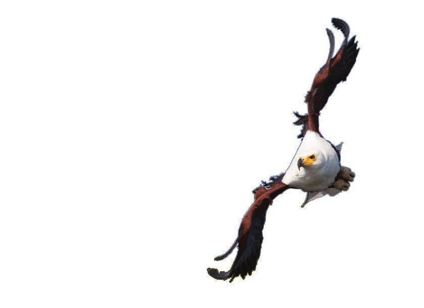
An African Fish Eagle attacking prey at Lake
Naivasha, Kenya. Photo courtesy of Rob Davies
Rob Davies
The author, Rob Davies, is the director of Habitat Info Ltd., a global
technology company that specializes in the capture, management, analysis,
and distribution of spatial data. In 2012, Habitat Info launched a charitable
citizen science project to collect data on the conservation status of African
raptors to determine how much habitat space was left for them.
Initially, the African Raptor Databank Starting with Africa
(ARDB) met with opposition from critics Two people and one organization stood
who said collecting the status of raptors out for their support of Habitat Info’s ho-
across Africa could not be done because listic approach: Dr. Rick Watson and Dr.
Africa was too big. They urged Habitat Info Munir Virani of The Peregrine Fund. [The
to limit efforts to a region of Africa at most, Peregrine Fund is a science-based, project-
focusing on protected areas and coun- driven conservation organization based in
tries. However, raptors range freely, and Boise, Idaho.] Watson and Virani, through
many make annual pilgrimages across and their organization, have done much good
between continents to breed and winter. work for raptors around the world. They
In addition, it is funny that people often supported ARDB from the start by gener-
believe a smaller study area is less work to ously sponsoring ARDB’s Esri software.
map in GIS. It’s not. Esri provided ARDB with a nonprofit grant
66 au Winter 2021 esri.com/arcuser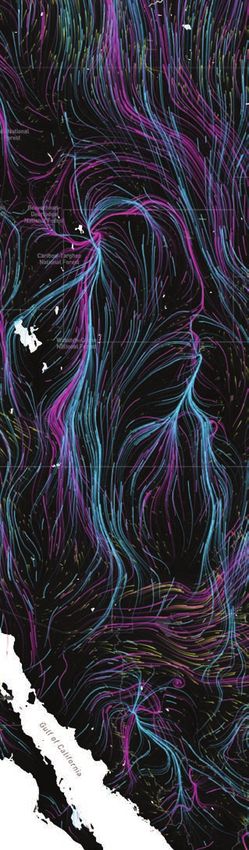
End Notes
scheme that helped launch the project. 200,000 sightings of African raptors. At Peregrine Fund’s approach has facilitated
With access to ArcGIS Server, Habitat the end of this data collection period, the the successful reinstatement of many lo-
Info could pull in data from mobile phones author travelled to Boise to show the re- cally extinct raptors around the world.
from pretty much anywhere across the sults to members of The Peregrine Fund While overcoming the technological chal-
continent because in Africa almost every- and thank them for believing in the project lenges of gathering and collating data on
one carries a mobile phone. First Virani, when others did not. Their response was, raptors, there was convergent evolution in
then later Darcy Ogada, coordinated the “Why stop at Africa? Let’s go global!” the quality and resolution of global, and es-
database for East Africa. Database co- pecially Africa-wide, environmental datasets.
ordination was done by Andre Botha in Going Global The digital elevation models (DEMs), which
southern Africa; by Clive Barlow, Dr. Joost ARDB then entered a new phase. Thanks revealed mountainous Black Eagle habi-
Brouwer and Dr. Ralph Buij in Central and largely to Dr. Chris McClure, Leah Dunn, tat; the global forest cover datasets, which
West Africa; and by Dr. Hichem Azafzaf in Paul Spurling, and Brett Sebring, ARDB represented Crowned Eagle habitat; and
North Africa. With the right team in place, has become fully integrated with The landcover, climate, and human population
data flowed in from hundreds of keen-eyed Peregrine Fund’s existing Global Raptor impact datasets. All showed improvement
raptor observers across Africa. Impact Network (GRIN) and is hosted by a by orders of magnitude. These datasets
After five years, ARDB had more than large database on the Amazon cloud. The were available at resolutions of 1 kilometer
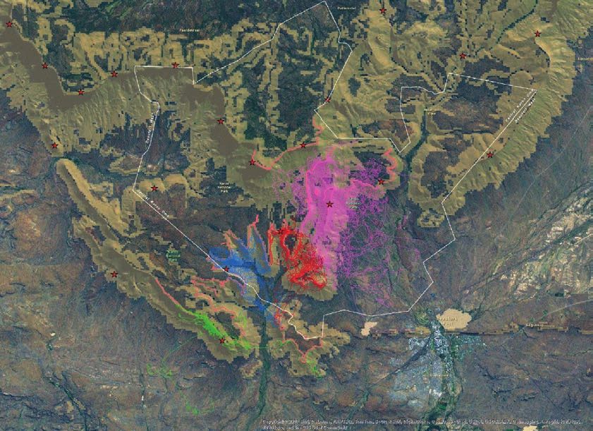
Map showing the coverage of the African Raptor Databank (ARDB) in 2018. Blue dots represent historic records (pre-1977) and red dots
represent recent sightings.
esri.com/arcuser Winter 2021 au 67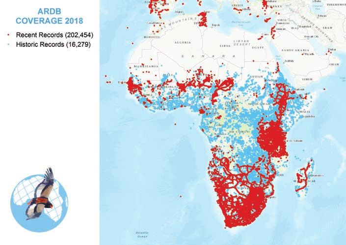
Visualization of the flightpaths recorded for four adjacent pairs of Black Eagles in the Karoo National Park. or even 300 meters, which were scales eco- who worked industriously with interns These efforts attracted a lot of inter- logically meaningful to individual pairs of Sarah Wigley and Zoey Taylor to build the est, including development support from raptors finding territories across Africa. database. Kurt Eckerstrom, Nick Williams, and the Dr. Corinne Kendall joined the team of Battling with the many different formats Convention on Migratory Species. Habitat coordinators towards the end of data gath- in which data was submitted made the team Info is most grateful for their help. ering and she added an entirely new type long for a method that would let observers Ultimately, the Global Raptor Impact of data on African raptors—movement add their own data. Rayner developed a Network App was funded by The Peregrine data. This data from satellites and GPS tags pro forma spreadsheet for bulk loading ex- Fund in conjunction with GRIN using Esri’s fitted to wild birds revealed extraordinary isting data while ensuring data quality and ArcGIS Mobile SDK for Android and iOS. It behaviours and filled many gaps in our verification, but the challenge of automat- is provided by The Peregrine Fund as a free knowledge about where these birds travel. ing the addition of new data remained. tool for conducting raptor research that This data created a much more complete Early attempts to solve this problem with works happily offline—which is essential picture of raptors, one that could only have mobile technology made use of ArcPAD when working in remote parts of Africa— been dreamed of a decade earlier. on an HP iPaq. Subsequently, Habitat Info and seamlessly uploads to the enterprise The project initially started with an staff member Rayner successfully applied database when the device becomes con- Enterprise Geodatabase hosted on a little his clear vision and programming skills to nected to the internet. server housed in Habitat Info’s office. It fulfill Habitat Info’s elaborate requests The app allows both professional and benefited enormously from the enthusi- to produce an intuitive, state-of-the-art citizen scientists to conduct multiple survey asm of Habitat Info staff members Andrew mobile recording app for logging almost types with just a single tap of the screen. Rayner, Tim Wroblewski, and Simon Trice, all aspects of raptors and their behaviour. Simple sightings can be entered, and a 68 au Winter 2021 esri.com/arcuser
End Notes
wide array of morphological and behavior identify the most important habitat strong- an anti-inflammatory drug given to cattle
data appended. The app avoids tedious holds for vultures across Africa. This knowl- beginning in the 1990s. The decrease in
data entry by securely uploading data di- edge has helped conservationists focus ef- vultures led to an increase in feral dogs that
rectly to the GRIN database. forts on the most important places instead has been associated with an increased inci-
With the GRIN app developed and avail- of spreading efforts too widely across the dence of rabies and other diseases, accord-
able, Habitat Info is turning its attention vast continent. The culmination of the pro- ing to an article published in the scientific
back to Africa and intends to gather sup- ject is a series of maps and an educational journal Nature in 2004.
port to publish the ARDB and produce a poster to promote awareness and under- Strongholds for vultures are also strong-
hardcopy of the Conservation Atlas for standing of the threats to vultures. holds for most other wildlife, especially vul-
African Birds of Prey. The decimation of the vulture popula- nerable large carnivore populations, such
tions from the Indian subcontinent has as lions and wild dogs, as well as a host
The Value of Vultures been attributed to the use of diclofenac, of other species that are less visible than
One group of raptors brought the need
for the ARDB into acute relief—Africa’s
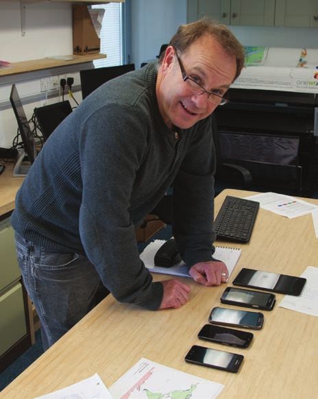
Andrew Rayner, a programmer with Habitat Info
vultures. Vulture populations have been
spiralling downward in the last couple of
decades.
The decline is clearly caused by the il-
legal use of poison. Poachers in southern
Africa lace elephant carcasses with poison
to eliminate tell-tale soaring birds that give
away the location of their crimes. A 40 per-
cent decline in vulture populations has
been attributed to poisoned carcasses. In
Eastern Africa, a 60 percent decline in the
vulture population was caused mainly by
farmers who were trying to poison preda-
tors that were killing their livestock. A single
carcass laced with poison can easily kill all
the vultures in the surrounding area. This
practice has been causing local extinctions.
In West Africa, a 90 percent decrease in
vulture populations was linked to the illegal
trade in vulture body parts. These parts are
used in traditional medicine and play a part
in superstitious practices used to predict
soccer scores.
With such a precipitous decline, some-
thing needed to be done quickly. Buij, with
support mainly from the Dutch govern-
ment, stepped in and coordinated a pro-
ject that pulled together everything then
known about vultures and the threats to
them. This project was the first significant
use of ARDB and the clearest example of
why these knowledge management sys-
tems are needed to enable more efficient
conservation.
Sightings, habitat suitability models, and
the movement patterns of vultures helped
esri.com/arcuser Winter 2021 au 69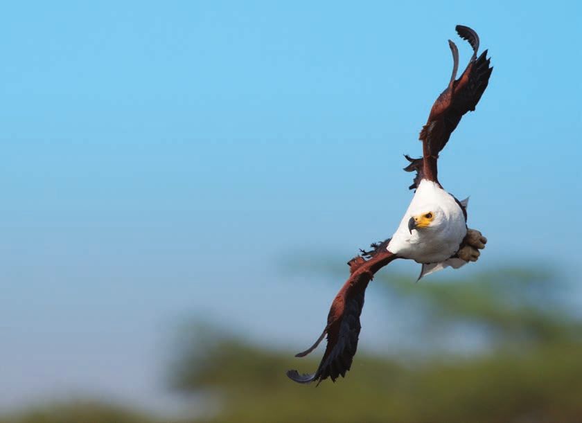
Esri
Resources
As notable raptor researcher Professor
Ian Newton put it, “An abundance and
diversity of raptors invariably signals a
Esri Technical Support
largely undisturbed ecosystem support- esri.com/support
ing an abundance of other wildlife.”
Esri Desktop Order Center and
For more information, contact Rob
Software Information
Davies at rob.davies@habitatinfo.com. t 800 447 9778 (usa only)
Esri Products
Acknowledgment esri.com/products
A word of thanks to Esri and its associates.
Whenever I have approached Esri for help Esri Store
esri.com/store
with my many and varied conservation
projects around the world, it has always ArcGIS for Developers
helped creatively. I guess the culture that developers.arcgis.com
has arisen from a company, originally Customer Care Portal
called Environmental Systems Research my.esri.com
Institute, and the people who built it
Esri US Regional Offices
have great empathy for the environment. esri.com/about-esri/usa
Thank you to Esri for helping raptors and
Esri Distributors
other wildlife. It is very much appreciated.
esri.com/distributors
The Global Raptor Impact Network
App is a free tool for conducting raptor About the Author
research that works offline and uploads Rob Davies moved from Wales to South
to an enterprise database when internet
connectivity is available. Africa in 1982. His PhD on Black Eagles in
the Karoo led him into GIS in 1986 with Copyright © 2021 Esri.
All rights reserved.
the mapping of flight paths and eagle ter-
Printed in the United States of America.
raptors and consequently, less capable ritories. Throughout his career in conser- @esri.com, 3D Analyst, ACORN, Address Coder, ADF, AML, ArcAtlas,
ArcCAD, ArcCatalog, ArcCOGO, ArcData, ArcDoc, ArcEdit, ArcEditor,
of signalling that something is wrong in vation in Africa and in Wales 2001, Davies ArcEurope, ArcExplorer, ArcExpress, ArcGIS, arcgis.com, ArcGlobe,
ArcGrid, ArcIMS, ARC/INFO, ArcInfo, ArcInfo Librarian, ArcLessons,
their habitats. has endeavoured to harness GIS tech- ArcLocation, ArcLogistics, ArcMap, ArcNetwork, ArcNews,
ArcObjects, ArcOpen, ArcPad, ArcPlot, ArcPress, ArcPy, ArcQuest,
nologies for improved biodiversity con- ArcReader, ArcScan, ArcScene, ArcSchool, ArcScripts, ArcSDE, ArcSdl,
The Role of Raptors in servation and human adaptation to cli- ArcSketch, ArcStorm, ArcSurvey, ArcTIN, ArcToolbox, ArcTools,
ArcUSA, ArcUser, ArcView, ArcVoyager, ArcWatch, ArcWeb, ArcWorld,
Protecting Ecosystems mate change. He has directed two NGOs, ArcXML, Atlas GIS, AtlasWare, Avenue, BAO, Business Analyst,
Business Analyst Online, BusinessMAP, CityEngine, Community,
Community Analyst, CommunityInfo, Community Maps, Companion,
The loss of vultures and other raptors worked with the Peace Parks Foundation, Database Integrator, DBI Kit, Drone2Map, EDN, Esri, esri.com,
Esri—Team GIS, Esri—The GIS Company, Esri—The GIS People, Esri—
from Africa may be far more consequen- and set up a biodiversity information The GIS Software Leader, Excalibur, FormEdit, GeoBIM, GeoCollector,
GeoEnrichment, GeoEvent, Geographic Design System, Geography
tial than the loss of elephants, rhinos, and centre in Wales. He established the Matters, Geography Network, geographynetwork.com, Geoloqi,
GeoPlanner, Geoportal, Geostatistical Analyst, Geotrigger, GIS by
other higher-profile species that mo- African Raptor Databank, which has now Esri, gis.com, GISData Server, GIS Day, gisday.com, GIS for Everyone,
Indoors, Insights, JTX, MapIT, Maplex, MapObjects, MapStudio,
nopolize popular attention and funding. developed into the Global Raptor Impact ModelBuilder, MOLE, MPS—Atlas, Network analyst, Ortho Maker,
PLTS, Rent-a-Tech, Scene Viewer, SDE, See What Others Can’t, SML,
Raptors are indicators of environmental Network. In addition to his mapping work, Sourcebook·America, SpatiaLABS, Spatial Analyst, Spatial Database
Engine, StoryMaps, Story Maps Basic, Story Maps Cascade, Story
health. They are highly effective as “ca- Davies illustrates wildlife and has recently Maps Crowdsource, Story Maps Journal, Story Maps Series, Story
Maps Shortlist, Story Maps Swipe and Spyglass, Story Maps Tour,
naries in the coal mine” that provide early published a field guide to African raptors. StreetMap, SURE, Tapestry, the ARC/INFO logo, the ArcGIS Explorer
logo, the ArcGIS logo, the ArcPad logo, the Esri globe logo, the
warning when vital earth support systems He now runs Habitat Info, a consultancy Esri Press logo, The Geographic Advantage, The Geographic
Approach, the GIS Day logo, the MapIT logo, The Science of Where,
are threatened. in West Wales. The World’s Leading Desktop GIS, Velocity, Water Writes, and Your
Personal Geographic Information System are trademarks, service
marks, or registered marks of Esri in the United States, the European
Community, or certain other jurisdictions.
Other companies and products or services mentioned herein may
be trademarks, service marks, or other registered marks of their
respective mark owners.
Learn more about the Global Raptor Impact
Network (GRIN) App at https://bit.ly/2KdfLop
and start collecting data.
70 au Winter 2021 esri.com/arcuser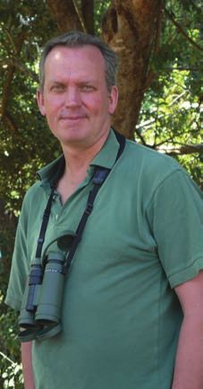
You can also read